
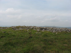
Prehistoric sites within 3km of SX 61500 66500
Guidance for walkers: The monuments featured in this database are archaeological treasures and need to be protected and preserved - please do not disturb any sites. Please check access and firing times before visiting sites, not all sites listed are on open access land. Firing ranges and boundaries of open access areas are marked on the OL28 OS Dartmoor Explorer map. Please stick to the country code and consider giving support to the numerous agencies that help to keep Dartmoor a fabulous natural and historic environment!
About the database listings: In all listings clicking on the photo or the site name will open a page for the site with a larger photo and further details from the database. The database now has over 6680 records covering nearly all publicly listed sites on Dartmoor including around 4800 round houses. This level of detail is of interest to archaeologists but tends to swamp listings of sites more likely to be of interest for walkers. For this reason, the listings default to around 550 core sites only. These are the stone circles, stone rows and the ring cairns listed by Turner. The default search radius is 2 km. The controls below the map can be used to start a new search by entering a 6- or 8-digit reference (without the prefix "SX"). The search radius can be specified and you can add incremental Display layers of detail on top of the core sites. If using a more detailed layer you will need to decrease the search radius to avoid getting hundreds of search results.
- Core sites Default listing of core sites consisting of stone circles & rows and some of the major ring cairns.
- Plus cairns adds approx. 1000 cairns and other minor sites not included in the core listings but excluding round houses.
- Plus round houses adds approx. 4800 round houses.
- Plus non-sites adds in the records for sites that no longer exist or are not prehistoric sites.
- Plus duplicates adds records excluded as duplicates. Those maybe duplicate records in external listings (e.g. the Historic Environment Records). For example, some sites have been identified as cairns in some listings and interpreted as round houses in other listings and both records appear.
These listings have incorporated, matched up and merged all of the records from all of the major archaeological listings including: Worth, Grinsell, Turner, Butler, Bill Radcliffe, Sandy Gerrard, Megalithic Portal, the National Monument Records and the Historic Environment Records. The author would like to thank Bill, Sandy, the lovely people both at Megalithic Portal (especially Anne Tate who did an amazing job to link listings) and at ACE Archaeology for collaborative work over the years to synchronise and correct listings across the various websites which now interlink. A culmination of years of work the final merger of cairn records took 3 months of cross referencing in 2017 the result being a snapshot of the records at that time. This data has in turn been refined since by field work and research. The round house data was supplied by Sandy Gerrard. Grid references are in order of accuracy: from Google Earth satellite, if visible and found, from a Garmin GPS reading, if visited by the author and from the literature otherwise. Individual site pages will state the source of the grid reference and provide satellite imagery. If a site listing lacks a photo it has not yet been visited by the author in which case the grid reference is from the literature.
Currently the database only includes sites which can be represented by a grid reference. Reaves are not included as they require GIS shape technology which is beyond the current capability of this system. To see the sources for the records, look at the tables on the resources menu. The database listings can also be viewed on a Google map and downloaded as GPS datasets for Garmin devices.
Corrections, or any feedback or suggestions are very welcome, email: info@dartmoorwalks.org.uk.
NOTE: Clicking on the icons for each monument in the map will give the name of the site. You can zoom in and out and drag the map around.
List of sites within 3km of SX 61500 66500
Drizzlecombe Round House
OS Map: SX 59345 67265
HER: MDV4033
ShortName: HT:Drizzleco16
Nearby sites: SX 59345 67265
Distance: 2.29km
Hook Lake S Round House
OS Map: SX 63820 64709
HER: MDV4319
ShortName: HT:Hook Lake13
Nearby sites: SX 63820 64709
Distance: 2.93km
Langcombe Foot Round House
OS Map: SX 60154 67180
HER: MDV5116
ShortName: HT:Langcombe7
Nearby sites: SX 60154 67180
Distance: 1.51km
Ranny Brook Round House
OS Map: SX 62077 63579
HER: MDV4273
ShortName: HT:Ranny Bro57
Nearby sites: SX 62077 63579
Distance: 2.98km
Upper Hentor Brook Round House
OS Map: SX 58986 65391
HER: MDV3482
ShortName: HT:Upper Hen35
Nearby sites: SX 58986 65391
Distance: 2.75km
Drizzlecombe Round House
OS Map: SX 59326 67159
HER: MDV4046
ShortName: HT:Drizzleco17
Nearby sites: SX 59326 67159
Distance: 2.27km
Hook Lake S Round House
OS Map: SX 63826 64786
HER: MDV4242
ShortName: HT:Hook Lake14
Nearby sites: SX 63826 64786
Distance: 2.89km
Langcombe Foot Round House
OS Map: SX 60128 67123
HER: MDV5116
ShortName: HT:Langcombe8
Nearby sites: SX 60128 67123
Distance: 1.51km
Ranny Brook Round House
OS Map: SX 62081 63657
HER: MDV4273
ShortName: HT:Ranny Bro58
Nearby sites: SX 62081 63657
Distance: 2.90km
Upper Hentor Brook Round House
OS Map: SX 58984 65264
HER: MDV48950
ShortName: HT:Upper Hen36
Nearby sites: SX 58984 65264
Distance: 2.80km
Drizzlecombe Round House
OS Map: SX 59315 67246
HER: MDV4033
ShortName: HT:Drizzleco18
Nearby sites: SX 59315 67246
Distance: 2.31km
Hook Lake S Round House
OS Map: SX 63845 64700
HER: MDV4320
ShortName: HT:Hook Lake15
Nearby sites: SX 63845 64700
Distance: 2.96km
Langcombe Foot Round House
OS Map: SX 60125 67138
HER: MDV5116
ShortName: HT:Langcombe9
Nearby sites: SX 60125 67138
Distance: 1.52km
Ranny Brook Round House
OS Map: SX 62076 63599
HER: MDV4273
ShortName: HT:Ranny Bro59
Nearby sites: SX 62076 63599
Distance: 2.96km
Upper Hentor Brook Round House
OS Map: SX 58987 65376
HER: MDV3482
ShortName: HT:Upper Hen37
Nearby sites: SX 58987 65376
Distance: 2.75km
Drizzlecombe Round House
OS Map: SX 59313 67284
HER: MDV4033
ShortName: HT:Drizzleco19
Nearby sites: SX 59313 67284
Distance: 2.32km
Hook Lake S Round House
OS Map: SX 63819 64719
HER: MDV4318
ShortName: HT:Hook Lake16
Nearby sites: SX 63819 64719
Distance: 2.92km
Langcombe Foot Round House
OS Map: SX 60116 67127
HER: MDV5116
ShortName: HT:Langcombe10
Nearby sites: SX 60116 67127
Distance: 1.52km
Ranny Brook Round House
OS Map: SX 62085 63733
HER: MDV50915
ShortName: HT:Ranny Bro60
Nearby sites: SX 62085 63733
Distance: 2.83km
Upper Hentor Brook Round House
OS Map: SX 58989 65260
HER: MDV48951
ShortName: HT:Upper Hen38
Nearby sites: SX 58989 65260
Distance: 2.80km
Drizzlecombe Round House
OS Map: SX 59302 67220
HER: MDV43605
ShortName: HT:Drizzleco20
Nearby sites: SX 59302 67220
Distance: 2.31km
Hook Lake S Round House
OS Map: SX 63844 64792
HER: MDV4242
ShortName: HT:Hook Lake17
Nearby sites: SX 63844 64792
Distance: 2.90km
Langcombe Foot Round House
OS Map: SX 60109 67147
HER: MDV5116
ShortName: HT:Langcombe11
Nearby sites: SX 60109 67147
Distance: 1.53km
Upper Hentor Brook Round House
OS Map: SX 58987 65173
HER: MDV48947
ShortName: HT:Upper Hen39
Nearby sites: SX 58987 65173
Distance: 2.84km
A Breton Special Reported Cist
OS Map: SX 59 66
HER: MDV-1
PMD: A Breton Special
ShortName: CT?A Breton 1
Notes: This is not possible to trace. Radcliffe notes: Could be any one of the cists in the area. The information is from Breton in OS map collection. NMR suggest SX 56 NE 44, 5909 6577? Possibly the 5947 6674 site?
Nearby sites: SX 59 66
Distance: 2.55km
Drizzlecombe Round House
OS Map: SX 59481 67088
HER: MDV25270
ShortName: HT:Drizzleco21
Nearby sites: SX 59481 67088
Distance: 2.10km
Hook Lake S Round House
OS Map: SX 63883 64746
HER: MDV4317
ShortName: HT:Hook Lake18
Nearby sites: SX 63883 64746
Distance: 2.96km
Langcombe Foot Round House
OS Map: SX 60161 67084
HER: MDV5116
ShortName: HT:Langcombe12
Nearby sites: SX 60161 67084
Distance: 1.46km
Upper Hentor Brook Round House
OS Map: SX 58998 65358
HER: MDV3482
ShortName: HT:Upper Hen40
Nearby sites: SX 58998 65358
Distance: 2.75km
Drizzlecombe Round House
OS Map: SX 59545 67143
HER: MDV55245
ShortName: HT:Drizzleco22
Nearby sites: SX 59545 67143
Distance: 2.06km
Upper Hentor Brook Round House
OS Map: SX 5908 6517
HER: MDV48949
ShortName: HT:Upper Hen41
Nearby sites: SX 5908 6517
Distance: 2.76km
Drizzlecombe Round House
OS Map: SX 59353 67179
HER: MDV4046
ShortName: HT:Drizzleco23
Nearby sites: SX 59353 67179
Distance: 2.25km
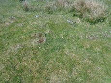
Langcombe Head 1 Reported Cairn
OS Map: SX 6199 6630
HER: MDV13173
ShortName: CN?Langcombe1
Butler map: 50.3.12
Grinsell: COR 24
Notes: Probing confirms that the mound is a peat stack.
Nearby sites: SX 6199 6630
Distance: 0.53km
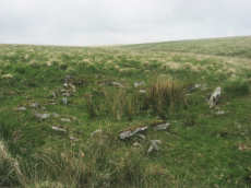
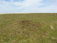
Shavercombe Head (9+ cairns) Reported Cairn
OS Map: SX 6065 6490
ShortName: CNxShavercom2
Butler map: 50.3
Notes: Nine circular mounds on high ground at Shavercombe Head. Each of these mounds looks like a barrow, but each is composed solely of peat and there are many other mounds in the vicinity suggesting that there is some form of natural or other agency causing this phenomena.
Nearby sites: SX 6065 6490
Distance: 1.81km
Great Gnats' Head 2 Reported Cist
OS Map: SX 6119 6803
HER: MDV5092
ShortName: CN:GreatGnats2
Butler map: 50.5.2
Grinsell: SHA 1a
Barrow Report: 20
Notes: "Round cairn adjacent to cist. Cairn lies 4m s of the cist and survives as a 4m diam and 0.2m high mound. This cairn was investigated in 1901 and found to cover a circular, carefully paved area lying on top of a large flat stone."
Nearby sites: SX 6119 6803
Distance: 1.56km
Great Gnats' Head 3 Cairn
OS Map: SX 6128 6805
HER: MDV57383
ShortName: CN:GreatGnats3
Butler map: 50.5.3
Notes: HER entry does not match the size of the cairn listed by Butler.
Nearby sites: SX 6128 6805
Distance: 1.57km
Deadman's Bottom (W) Reported Cairn
OS Map: SX 6070 6697
HER: MDV57422
ShortName: CN:Deadmans W
Butler map: 50.1
Grinsell: SHA 5
Turner: D27
Notes: Hut circle. Butler Circle 2 / 3
UPDATE 31/12/2022
The following 3 records have been merged into one with the first retained and the other two deleted, this corresponds with maintenance done on the HER (MDV48861 and MDV57422 have been deleted). The NGRs have been reset to match MDV57422.
1. SiteID=2587(was MDV48861) now set to HER=MDV57422
2. SiteID=4174 (was MDV57441) deleted
3. SiteID=4169 (was MDV57422) deleted
Nearby sites: SX 6070 6697
Distance: 0.93km
Deadman's Bottom (E) Cairn
Prehistoric Dartmoor Walks: Dartmoor Site: Guide to the Langcombe Brook & Deadman's Bottom Cists
OS Map: SX 60788 66893
HER: MDV5118
ShortName: CN Deadmans E
Butler map: 50.1
Grinsell: SHA 6
Turner: D28
Notes: Worth considered this to be a cairn. It was excavated and it was found to be paved with reddened earth showing great fires had been present. Butler Circle 1. Butler suggests it could just have been a hut circle and the fires the consequence of domestic activity. He points out the presence of a settlement wall. However it is also very close to a pair of cists and could be a cairn. We are listing as a cairn although Butler could of course be right. This "circle" can be clearly seen in the Google satellite images. Previously listed at SX 60798 66895 (Garmin reading?), presumed SX 60788 66893 from Google.
Nearby sites: SX 60788 66893
Distance: 0.81km
Deadman's Bottom 4 Reported Cairn
OS Map: SX 6061 6684
HER: MDV5131
ShortName: CN?Deadmans 4
Grinsell: SHA 9
Notes: Hut circle or cairn?
Nearby sites: SX 6061 6684
Distance: 0.95km
Deadman's Bottom 3 Reported Cairn
OS Map: SX 6059 6686
HER: MDV5130
ShortName: CN?Deadmans 3
Grinsell: SHA 9a
Notes: Hut circle or cairn?
Nearby sites: SX 6059 6686
Distance: 0.98km
Deadman's Bottom 2 Reported Cairn
OS Map: SX 6063 6683
HER: MDV20163
ShortName: CN?Deadmans 2
Grinsell: SHA 9b
Notes: Hut circle or cairn?
Nearby sites: SX 6063 6683
Distance: 0.93km
Little Gnats' Head Round House
OS Map: SX 60512 67320
HER: MDV55305
ShortName: HT:Little Gn1
Nearby sites: SX 60512 67320
Distance: 1.28km
Drizzlecombe 25(pos duplicate) Reported Cairn
OS Map: SX 5920 6699
HER: MDV55250
ShortName: CN:Drizzle 25
Nearby sites: SX 5920 6699
Distance: 2.35km
Hen Tor N.8 Reported Cairn
OS Map: SX 5949 6581
HER: MDV55456
ShortName: CN:Hen Tor N8
Notes: The author of PDW was unable to locate this site at SX 59490 65810 on 13/08/2017. Unable to confirm its existence or non-existence!
Nearby sites: SX 5949 6581
Distance: 2.13km
Hen Tor N.9 Cairn
OS Map: SX 59264 65848
HER: MDV55460
ShortName: CN Hen Tor N9
Nearby sites: SX 59264 65848
Distance: 2.33km
Hen Tor N.10 Reported Cairn
OS Map: SX 5931 6586
HER: MDV55465
ShortName: CN:Hen Tor N10
Notes: The author of PDW was unable to locate this site at SX 59310 65860 on 13/08/2017. Unable to confirm its existence or non-existence!
Nearby sites: SX 5931 6586
Distance: 2.28km
Deadman's Bottom 7 (pos duplicate) Reported Cairn
OS Map: SX 6071 6697
HER: MDV57423
ShortName: CN:Deadmans 7
Nearby sites: SX 6071 6697
Distance: 0.92km
Deadman's Bottom 8 (pos duplicate) Reported Cairn
OS Map: SX 6065 6691
HER: MDV57434
ShortName: CN:Deadmans 8
Nearby sites: SX 6065 6691
Distance: 0.94km
Deadman's Bottom 9 (pos duplicate) Reported Cairn
OS Map: SX 6065 6689
HER: MDV57437
ShortName: CN:Deadmans 9
Nearby sites: SX 6065 6689
Distance: 0.94km
Deadman's Bottom 10 (duplicate) Reported Cairn
OS Map: SX 6064 6683
HER: MDV57440
ShortName: CN:Deadmans 10
Nearby sites: SX 6064 6683
Distance: 0.92km
Foot of Giant's Basin (a) Cairn
OS Map: SX 59188 66945
HER: MDV55251
ShortName: CN Foot of G1
Butler map: 49.19.7-9a
Grinsell: SHE 33a
Notes: 1 of 3 small cairns at the foot of Giant's Basin.
Nearby sites: SX 59188 66945
Distance: 2.35km
Foot of Giant's Basin (b) Cairn
OS Map: SX 59189 66941
HER: MDV55251
ShortName: CN Foot of G3
Butler map: 49.19.7-9b
Grinsell: SHE 33b
Notes: 1 of 3 small cairns at the foot of Giant's Basin.
Nearby sites: SX 59189 66941
Distance: 2.35km
Foot of Giant's Basin (c) Cairn
OS Map: SX 59190 66935
HER: MDV55251
ShortName: CN Foot of G5
Butler map: 49.19.7-9c
Grinsell: SHE 33c
Notes: 1 of 3 small cairns at the foot of Giant's Basin.
Nearby sites: SX 59190 66935
Distance: 2.35km
Whittenknowles Rocks Round House
OS Map: SX 58645 67038
HER: MDV3995
ShortName: HT:Whittenkn1
Nearby sites: SX 58645 67038
Distance: 2.91km
Whittenknowles Rocks Round House
OS Map: SX 58602 66962
HER: MDV3995
ShortName: HT:Whittenkn2
Nearby sites: SX 58602 66962
Distance: 2.93km
Whittenknowles Rocks Round House
OS Map: SX 58613 67078
HER: MDV3995
ShortName: HT:Whittenkn3
Nearby sites: SX 58613 67078
Distance: 2.94km
Whittenknowles Rocks Round House
OS Map: SX 58620 67048
HER: MDV3995
ShortName: HT:Whittenkn4
Nearby sites: SX 58620 67048
Distance: 2.93km
Whittenknowles Rocks Round House
OS Map: SX 58633 67041
HER: MDV3995
ShortName: HT:Whittenkn6
Nearby sites: SX 58633 67041
Distance: 2.92km
Whittenknowles Rocks Round House
OS Map: SX 58642 67079
HER: MDV3995
ShortName: HT:Whittenkn7
Nearby sites: SX 58642 67079
Distance: 2.92km
Whittenknowles Rocks Round House
OS Map: SX 58587 67065
HER: MDV3995
ShortName: HT:Whittenkn9
Nearby sites: SX 58587 67065
Distance: 2.97km
Whittenknowles Rocks Round House
OS Map: SX 58662 67089
HER: MDV3995
ShortName: HT:Whittenkn12
Nearby sites: SX 58662 67089
Distance: 2.90km
Eastern Tor Round House
OS Map: SX 58604 66420
HER: MDV4023
ShortName: HT:Eastern T1
Nearby sites: SX 58604 66420
Distance: 2.90km
Eastern Tor Round House
OS Map: SX 58524 66497
HER: MDV4016
ShortName: HT:Eastern T2
Nearby sites: SX 58524 66497
Distance: 2.98km
Eastern Tor Round House
OS Map: SX 58554 66398
HER: MDV4023
ShortName: HT:Eastern T3
Nearby sites: SX 58554 66398
Distance: 2.95km
Whittenknowles Rocks Round House
OS Map: SX 58665 67085
HER: MDV3995
ShortName: HT:Whittenkn15
Nearby sites: SX 58665 67085
Distance: 2.89km
Eastern Tor Round House
OS Map: SX 58513 66370
HER: MDV4023
ShortName: HT:Eastern T4
Nearby sites: SX 58513 66370
Distance: 2.99km
Eastern Tor Round House
OS Map: SX 58546 66497
HER: MDV4016
ShortName: HT:Eastern T5
Nearby sites: SX 58546 66497
Distance: 2.95km
Eastern Tor Round House
OS Map: SX 58534 66380
HER: MDV4023
ShortName: HT:Eastern T6
Nearby sites: SX 58534 66380
Distance: 2.97km
Whittenknowles Rocks Round House
OS Map: SX 58553 67048
HER: MDV3995
ShortName: HT:Whittenkn18
Nearby sites: SX 58553 67048
Distance: 3.00km
Eastern Tor Round House
OS Map: SX 58548 66389
HER: MDV4023
ShortName: HT:Eastern T7
Nearby sites: SX 58548 66389
Distance: 2.95km
Eastern Tor Round House
OS Map: SX 58587 66430
HER: MDV4023
ShortName: HT:Eastern T8
Nearby sites: SX 58587 66430
Distance: 2.91km
Eastern Tor Round House
OS Map: SX 58586 66403
HER: MDV4023
ShortName: HT:Eastern T9
Nearby sites: SX 58586 66403
Distance: 2.92km
Whittenknowles Rocks Round House
OS Map: SX 58595 67061
HER: MDV3995
ShortName: HT:Whittenkn26
Nearby sites: SX 58595 67061
Distance: 2.96km
Knackersmill Gulf C, wall cairn 10 (55.3) Reported Cairn
OS Map: SX 637 650
HER: MDV-1
ShortName: CN?Knackersm1
Butler Vol 5: p.102 & Fig.60
Notes: Estimated grid ref from Butler. This is a structure embedded into a settlemnt enclosure wall. Could be a hut circle that has been filled in or converted to a cairn.
Nearby sites: SX 637 650
Distance: 2.66km
Whittenknowles Rocks Round House
OS Map: SX 58561 67047
HER: MDV3995
ShortName: HT:Whittenkn29
Nearby sites: SX 58561 67047
Distance: 2.99km
Whittenknowles Rocks Round House
OS Map: SX 58565 67013
HER: MDV3995
ShortName: HT:Whittenkn30
Nearby sites: SX 58565 67013
Distance: 2.98km
Whittenknowles Rocks Round House
OS Map: SX 58571 67035
HER: MDV3995
ShortName: HT:Whittenkn31
Nearby sites: SX 58571 67035
Distance: 2.98km
Whittenknowles Rocks Round House
OS Map: SX 58573 67021
HER: MDV3995
ShortName: HT:Whittenkn32
Nearby sites: SX 58573 67021
Distance: 2.97km
Whittenknowles Rocks Round House
OS Map: SX 58575 67093
HER: MDV3995
ShortName: HT:Whittenkn33
Nearby sites: SX 58575 67093
Distance: 2.98km
Erme Plains S Round House
OS Map: SX 63565 64867
HER: MDV4331
ShortName: HT:Erme Plai11
Nearby sites: SX 63565 64867
Distance: 2.63km
Whittenknowles Rocks Round House
OS Map: SX 58590 67022
HER: MDV3995
ShortName: HT:Whittenkn35
Nearby sites: SX 58590 67022
Distance: 2.96km
Crane Hill Reported Cairn
OS Map: SX 61882 68773
HER: MDV78136
ShortName: CN:Crane Hill
Nearby sites: SX 61882 68773
Distance: 2.30km
Little Gnat's Head Reported Cairn
OS Map: SX 60845 67193
HER: MDV102713
ShortName: CN:LittleGnats
Notes: "Circular ring bank on Little Gnat's Head, between the River Plym and Deadman's Bottom. Overgrown with grass and peat, there is a 0.5 metre gap on the south-west side. The location is a likely one for a cairn, but the feature more closely resembles a hut circle, especially with a possible entrance gap to the south-west."
Nearby sites: SX 60845 67193
Distance: 0.95km
Erme Plains S Round House
OS Map: SX 6359 6473
HER: MDV28119
ShortName: HT:Erme Plai20
Nearby sites: SX 6359 6473
Distance: 2.74km
Whittenknowles Rocks Round House
OS Map: SX 58673 67058
HER: MDV3995
ShortName: HT:Whittenkn45
Nearby sites: SX 58673 67058
Distance: 2.88km
Erme Plains S Round House
OS Map: SX 6362 6457
HER: MDV28118
ShortName: HT:Erme Plai24
Nearby sites: SX 6362 6457
Distance: 2.87km
Erme Pound Round House
OS Map: SX 63836 65662
HER: MDV5109
ShortName: HT:Erme Poun1
Nearby sites: SX 63836 65662
Distance: 2.48km
Erme Pound Round House
OS Map: SX 63821 65670
HER: MDV5109
ShortName: HT:Erme Poun2
Nearby sites: SX 63821 65670
Distance: 2.46km
Erme Pound Round House
OS Map: SX 63797 65661
HER: MDV5109
ShortName: HT:Erme Poun3
Nearby sites: SX 63797 65661
Distance: 2.45km
Erme Pound Round House
OS Map: SX 63758 65659
HER: MDV5109
ShortName: HT:Erme Poun4
Nearby sites: SX 63758 65659
Distance: 2.41km
Erme Pound Round House
OS Map: SX 63766 65656
HER: MDV5109
ShortName: HT:Erme Poun5
Nearby sites: SX 63766 65656
Distance: 2.42km
Knackersmill Gulf N. (duplicate) Reported Cist
OS Map: SX 6337 6559
HER: MDV28468
Megalithic Portal: 45759
ShortName: CT:Knackersm3
Butler Vol 5: p.180 & Fig.122
Notes: Duplicate of HER 13185, see notes on PMD on this.
Nearby sites: SX 6337 6559
Distance: 2.08km
Erme Pound Round House
OS Map: SX 63758 65667
HER: MDV5109
ShortName: HT:Erme Poun6
Nearby sites: SX 63758 65667
Distance: 2.41km
Erme Pound Round House
OS Map: SX 63839 65594
HER: MDV5109
ShortName: HT:Erme Poun7
Nearby sites: SX 63839 65594
Distance: 2.51km
Erme Pound Round House
OS Map: SX 63744 65679
HER: MDV5109
ShortName: HT:Erme Poun8
Nearby sites: SX 63744 65679
Distance: 2.39km
Erme Pound Round House
OS Map: SX 63844 65646
HER: MDV5109
ShortName: HT:Erme Poun9
Nearby sites: SX 63844 65646
Distance: 2.49km
Erme Pound Round House
OS Map: SX 63720 65692
HER: MDV5109
ShortName: HT:Erme Poun10
Nearby sites: SX 63720 65692
Distance: 2.36km
Erme Pound Round House
OS Map: SX 63732 65685
HER: MDV5109
ShortName: HT:Erme Poun11
Nearby sites: SX 63732 65685
Distance: 2.38km
Erme Pound Round House
OS Map: SX 63717 65681
HER: MDV5109
ShortName: HT:Erme Poun12
Nearby sites: SX 63717 65681
Distance: 2.36km
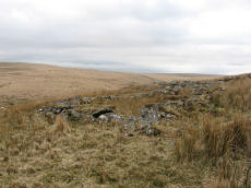
Drizzlecombe 23 Reported Cairn
OS Map: SX 59423 67331
HER: MDV103613
ShortName: CN Drizzle 23
Notes: This record has previously been listed as a "pos duplicate". However, there is a cairn at this location that matches no other records as can be seen in the photo. The HER NGR was SX 59418 67321. The item in the photo is at SX 59423 67331
Nearby sites: SX 59423 67331
Distance: 2.24km
Erme Pound Round House
OS Map: SX 63842 65585
HER: MDV5109
ShortName: HT:Erme Poun13
Nearby sites: SX 63842 65585
Distance: 2.51km
Erme Pound Round House
OS Map: SX 63840 65659
HER: MDV5109
ShortName: HT:Erme Poun14
Nearby sites: SX 63840 65659
Distance: 2.49km
Erme Pound Round House
OS Map: SX 63817 65629
HER: MDV5109
ShortName: HT:Erme Poun15
Nearby sites: SX 63817 65629
Distance: 2.48km
Erme Pound Round House
OS Map: SX 63761 65643
HER: MDV5109
ShortName: HT:Erme Poun16
Nearby sites: SX 63761 65643
Distance: 2.42km
Erme Pound Round House
OS Map: SX 63919 65646
HER: MDV5109
ShortName: HT:Erme Poun17
Nearby sites: SX 63919 65646
Distance: 2.57km
Erme Pound Round House
OS Map: SX 63922 65658
HER: MDV5109
ShortName: HT:Erme Poun18
Nearby sites: SX 63922 65658
Distance: 2.56km
Erme Pound Round House
OS Map: SX 63897 65630
HER: MDV5109
ShortName: HT:Erme Poun19
Nearby sites: SX 63897 65630
Distance: 2.55km
Erme Pound Round House
OS Map: SX 63937 65644
HER: MDV5109
ShortName: HT:Erme Poun20
Nearby sites: SX 63937 65644
Distance: 2.58km
Knackersmill Gulf Round House
OS Map: SX 6365 6502
HER: MDV13172
ShortName: HT:Knackersm1
Nearby sites: SX 6365 6502
Distance: 2.61km
Erme Pound Round House
OS Map: SX 63938 65651
HER: MDV5109
ShortName: HT:Erme Poun21
Nearby sites: SX 63938 65651
Distance: 2.58km
Knackersmill Gulf Round House
OS Map: SX 63579 64979
HER: MDV4236
ShortName: HT:Knackersm2
Nearby sites: SX 63579 64979
Distance: 2.58km
Green Hill Clearance Cairn
OS Map: SX 6365 6774
HER: MDV28465
ShortName: CN?GreenHill2
Grinsell: B:LYD 101b
Notes: Mound 30m S of LYD 101 period doubtful. A cairn was alleged on Green Hill but field evidence revealed a small mound measuring 7.8m by 7.5m and 0.4m high and concluded that it is the remains of peat workings.
Nearby sites: SX 6365 6774
Distance: 2.48km
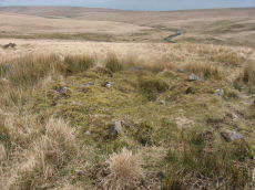
Drizzlecombe 24 Reported Cairn
OS Map: SX 59376 67356
HER: MDV103613
ShortName: CN Drizzle 24
Notes: There is a cairn at this location that matches no other records as can be seen in the photo. It is at the uphill end of a little known stone row.
Nearby sites: SX 59376 67356
Distance: 2.29km
Erme Pound Round House
OS Map: SX 63820 65665
HER: MDV5109
ShortName: HT:Erme Poun22
Nearby sites: SX 63820 65665
Distance: 2.47km
Knackersmill Gulf Round House
OS Map: SX 63632 64947
HER: MDV4236
ShortName: HT:Knackersm3
Nearby sites: SX 63632 64947
Distance: 2.64km
Erme Pound Round House
OS Map: SX 63830 65666
HER: MDV5109
ShortName: HT:Erme Poun23
Nearby sites: SX 63830 65666
Distance: 2.47km
Knackersmill Gulf Round House
OS Map: SX 63746 65077
HER: MDV13172
ShortName: HT:Knackersm4
Nearby sites: SX 63746 65077
Distance: 2.66km
Erme Pound Round House
OS Map: SX 63886 65560
HER: MDV5109
ShortName: HT:Erme Poun24
Nearby sites: SX 63886 65560
Distance: 2.56km
Knackersmill Gulf Round House
OS Map: SX 63585 64958
HER: MDV4236
ShortName: HT:Knackersm5
Nearby sites: SX 63585 64958
Distance: 2.59km
Erme Pound Round House
OS Map: SX 63874 65612
HER: MDV5109
ShortName: HT:Erme Poun25
Nearby sites: SX 63874 65612
Distance: 2.53km
Knackersmill Gulf Round House
OS Map: SX 63584 64991
HER: MDV4236
ShortName: HT:Knackersm6
Nearby sites: SX 63584 64991
Distance: 2.57km
Erme Pound Round House
OS Map: SX 63871 65561
HER: MDV5109
ShortName: HT:Erme Poun26
Nearby sites: SX 63871 65561
Distance: 2.55km
Knackersmill Gulf Round House
OS Map: SX 63692 65010
HER: MDV13172
ShortName: HT:Knackersm7
Nearby sites: SX 63692 65010
Distance: 2.65km
Deadman's Bottom 13 Reported Cist
OS Map: SX 608 668
HER: MDV5121
ShortName: CT:Deadmans 13
Notes: Duplicate: Record gives an account of the Deadman's Bottom North and South cists and the associated circles.
Nearby sites: SX 608 668
Distance: 0.76km
Erme Pound Round House
OS Map: SX 64030 65527
HER: MDV5111
ShortName: HT:Erme Poun27
Nearby sites: SX 64030 65527
Distance: 2.71km
Knackersmill Gulf Round House
OS Map: SX 63629 65080
HER: MDV13172
ShortName: HT:Knackersm8
Nearby sites: SX 63629 65080
Distance: 2.56km
Eylesbarrow Cairn
OS Map: SX 59971 68587
HER: MDV4014
ShortName: CN Eylesbarr1
Butler map: 47.15
Grinsell: SHE 3
Barrow Report: 12
Notes: Southern of the 2 large cairns. Butler had SHE 2 - typo!
Nearby sites: SX 59971 68587
Distance: 2.59km
Erme Pound Round House
OS Map: SX 63889 65631
HER: MDV5109
ShortName: HT:Erme Poun28
Nearby sites: SX 63889 65631
Distance: 2.54km
Knackersmill Gulf Round House
OS Map: SX 63630 65076
HER: MDV13172
ShortName: HT:Knackersm9
Nearby sites: SX 63630 65076
Distance: 2.56km
Eylesbarrow 1 Cairn
OS Map: SX 59958 68627
HER: MDV4031
ShortName: CN Eylesbarr3
Butler map: 47.15.1
Grinsell: WAL 33
Barrow Report: 12
Notes: Northern of the 2 large cairns
Nearby sites: SX 59958 68627
Distance: 2.63km
Eylesbarrow Round House
OS Map: SX 59320 68284
HER: MDV4035
ShortName: HT:Eylesbarr1
Nearby sites: SX 59320 68284
Distance: 2.82km
Knackersmill Gulf Round House
OS Map: SX 63696 65011
HER: MDV13172
ShortName: HT:Knackersm10
Nearby sites: SX 63696 65011
Distance: 2.65km
Eylesbarrow 2 Reported Cairn
OS Map: SX 5998 6858
ShortName: CN?Eylesbarr4
Butler map: 47.15.2
Notes: Butler: "Not unusually smaller cairns share the peaks withhe giants and two can be found east of th larger cairn (HER 4014) approcimately in line with the reave. Neither listed on HER.
Nearby sites: SX 5998 6858
Distance: 2.58km
Eylesbarrow Round House
OS Map: SX 59336 68279
HER: MDV4035
ShortName: HT:Eylesbarr2
Nearby sites: SX 59336 68279
Distance: 2.80km
Knackersmill Gulf Round House
OS Map: SX 63699 65011
HER: MDV13172
ShortName: HT:Knackersm11
Nearby sites: SX 63699 65011
Distance: 2.66km
Eylesbarrow 3 Reported Cairn
OS Map: SX 6005 6858
ShortName: CN?Eylesbarr5
Butler map: 47.15.3
Notes: Butler: "Not unusually smaller cairns share the peaks withhe giants and two can be found east of th larger cairn (HER 4014) approcimately in line with the reave. Neither listed on HER.
Nearby sites: SX 6005 6858
Distance: 2.54km
Eylesbarrow Round House
OS Map: SX 59334 68171
HER: MDV4035
ShortName: HT:Eylesbarr3
Nearby sites: SX 59334 68171
Distance: 2.74km
Eylesbarrow Round House
OS Map: SX 5936 6848
HER: MDV25105
ShortName: HT:Eylesbarr6
Nearby sites: SX 5936 6848
Distance: 2.92km
Lower Hartor Tor Round House
OS Map: SX 60218 67337
HER: MDV5117
ShortName: HT:Lower Har1
Nearby sites: SX 60218 67337
Distance: 1.53km
Eylesbarrow Round House
OS Map: SX 59281 68296
HER: MDV4035
ShortName: HT:Eylesbarr8
Nearby sites: SX 59281 68296
Distance: 2.85km
Lower Hartor Tor Round House
OS Map: SX 60268 67341
HER: MDV5117
ShortName: HT:Lower Har2
Nearby sites: SX 60268 67341
Distance: 1.49km
Lower Hartor Tor Round House
OS Map: SX 60238 67357
HER: MDV5117
ShortName: HT:Lower Har3
Nearby sites: SX 60238 67357
Distance: 1.53km
Lower Hartor Tor Round House
OS Map: SX 60247 67348
HER: MDV5117
ShortName: HT:Lower Har4
Nearby sites: SX 60247 67348
Distance: 1.51km
Yealm Steps Reported Cist
OS Map: SX 617 637
HER: MDV4367
PMD: Yealm Steps
ShortName: CT?Yealm Ste2
Notes: The County Sites and Monument Record notes a cist at Ranny Brook. This may be an outlier of the Ranny Brook settlement,
Nearby sites: SX 617 637
Distance: 2.81km
Eylesbarrow Round House
OS Map: SX 59302 68282
HER: MDV4035
ShortName: HT:Eylesbarr17
Nearby sites: SX 59302 68282
Distance: 2.83km
Hentor Warren (alleged) Reported Cist
OS Map: SX 5892 6578
HER: MDV3504
PMD: Hen Tor Meadow W.
ShortName: CT?HentorWarr
Notes: Alledged cist reported by Breton could not be found during field investigation. See als NMR record 438626 and Grinsell SHE 33a
Nearby sites: SX 5892 6578
Distance: 2.68km
Giants Basin Foot Reported Cist
OS Map: SX 59225 66944
HER: MDV3380
PMD: Drizzlecombe
ShortName: CT?Giants Ba1
Barrow Report: 12
Notes: To the east of the giants basin are two stones which stand parallel to each other, and resemble the two longer sides of a cist. Probably a duplicate of SHE 33a or SHE 33d.
UPDATE 31/12/2022. The HER gives an NGR of SX 5913 6699. This is to the *west* of the Giants Basin and Worth very clearly states to the east. We will arbitrarily assign an NGR which is slightly to the east. SX 59225 66944 - it is a guess of the reported location.
Nearby sites: SX 59225 66944
Distance: 2.32km
Plym Ford Reported Cist
OS Map: SX 6116 6851
HER: MDV5094
PMD: Plym Ford
ShortName: CT?Plym Ford1
Notes: Alledged cist - Breton. A cist was alleged at this location but could not be found on the ground
Nearby sites: SX 6116 6851
Distance: 2.04km
Ranny Brook Round House
OS Map: SX 62003 63608
HER: MDV4273
ShortName: HT:Ranny Bro1
Nearby sites: SX 62003 63608
Distance: 2.94km
Ranny Brook Round House
OS Map: SX 62053 63596
HER: MDV4273
ShortName: HT:Ranny Bro2
Nearby sites: SX 62053 63596
Distance: 2.96km
Hortonsford Bottom Reported Cairn
OS Map: SX 626 660
HER: MDV5088
PMD: Hortonsford Bottom
ShortName: CT?Hortonsfo1
Notes: Radcliffe: This is based on a rare mistake by RH Worth in Barrow Rreport 14. This is HER 4296
Nearby sites: SX 626 660
Distance: 1.21km
Lower Hentor Brook Round House
OS Map: SX 5859 6580
HER: MDV55398
ShortName: HT:Lower Hen21
Nearby sites: SX 5859 6580
Distance: 2.99km
Ranny Brook Round House
OS Map: SX 62048 63571
HER: MDV4273
ShortName: HT:Ranny Bro4
Nearby sites: SX 62048 63571
Distance: 2.98km
Shavercombe Round House
OS Map: SX 593 659
HER: MDV55463
ShortName: HT:Shavercom1
Nearby sites: SX 593 659
Distance: 2.28km
Ranny Brook Round House
OS Map: SX 62043 63571
HER: MDV4273
ShortName: HT:Ranny Bro5
Nearby sites: SX 62043 63571
Distance: 2.98km
Shavercombe Round House
OS Map: SX 59367 66034
HER: MDV55490
ShortName: HT:Shavercom2
Nearby sites: SX 59367 66034
Distance: 2.18km
Ranny Brook Round House
OS Map: SX 62044 63619
HER: MDV4273
ShortName: HT:Ranny Bro6
Nearby sites: SX 62044 63619
Distance: 2.93km
Shavercombe Round House
OS Map: SX 59362 66028
HER: MDV55489
ShortName: HT:Shavercom3
Nearby sites: SX 59362 66028
Distance: 2.19km
Ranny Brook Round House
OS Map: SX 62044 63630
HER: MDV4273
ShortName: HT Ranny Bro7
Nearby sites: SX 62044 63630
Distance: 2.92km
Shavercombe Round House
OS Map: SX 59337 66112
HER: MDV3347
ShortName: HT:Shavercom4
Nearby sites: SX 59337 66112
Distance: 2.20km
Shavercombe Round House
OS Map: SX 59320 66048
HER: MDV55485
ShortName: HT:Shavercom5
Nearby sites: SX 59320 66048
Distance: 2.23km
Ranny Brook Round House
OS Map: SX 62037 63727
HER: MDV43752
ShortName: HT:Ranny Bro9
Nearby sites: SX 62037 63727
Distance: 2.82km
Shavercombe Round House
OS Map: SX 59318 66019
HER: MDV3346
ShortName: HT:Shavercom6
Nearby sites: SX 59318 66019
Distance: 2.23km
Shavercombe Round House
OS Map: SX 59318 66111
HER: MDV3347
ShortName: HT:Shavercom7
Nearby sites: SX 59318 66111
Distance: 2.22km
Shavercombe Round House
OS Map: SX 59316 66039
HER: MDV55486
ShortName: HT:Shavercom8
Nearby sites: SX 59316 66039
Distance: 2.23km
Ranny Brook Round House
OS Map: SX 62011 63584
HER: MDV4273
ShortName: HT:Ranny Bro12
Nearby sites: SX 62011 63584
Distance: 2.96km
Shavercombe Round House
OS Map: SX 5937 6593
HER: MDV55467
ShortName: HT:Shavercom9
Nearby sites: SX 5937 6593
Distance: 2.20km
Ranny Brook Round House
OS Map: SX 62011 63589
HER: MDV4273
ShortName: HT:Ranny Bro13
Nearby sites: SX 62011 63589
Distance: 2.96km
Shavercombe Round House
OS Map: SX 59314 66022
HER: MDV55487
ShortName: HT:Shavercom10
Nearby sites: SX 59314 66022
Distance: 2.24km
Ranny Brook Round House
OS Map: SX 62057 63659
HER: MDV4273
ShortName: HT:Ranny Bro14
Nearby sites: SX 62057 63659
Distance: 2.90km
Shavercombe Round House
OS Map: SX 59197 66484
HER: MDV55470
ShortName: HT:Shavercom11
Nearby sites: SX 59197 66484
Distance: 2.30km
Langcombe Head 2 Cairn
OS Map: SX 6204 6630
HER: MDV13174
ShortName: CN:Langcombe2
Nearby sites: SX 6204 6630
Distance: 0.58km
Ranny Brook Round House
OS Map: SX 62005 63589
HER: MDV4273
ShortName: HT:Ranny Bro15
Nearby sites: SX 62005 63589
Distance: 2.95km
Shavercombe Round House
OS Map: SX 59282 66189
HER: MDV55478
ShortName: HT:Shavercom12
Nearby sites: SX 59282 66189
Distance: 2.24km
Great Gnats' Head 5 Cairn
OS Map: SX 616 680
HER: MDV13176
ShortName: CN:GreatGnats5
Nearby sites: SX 616 680
Distance: 1.50km
Shavercombe Round House
OS Map: SX 5927 6587
HER: MDV55461
ShortName: HT:Shavercom13
Nearby sites: SX 5927 6587
Distance: 2.32km
Hentor Brook 1 Reported Cairn
OS Map: SX 5894 6517
HER: MDV48946
ShortName: CNxHentor Br1
Butler map: 49.7
Notes: Hut circle
Nearby sites: SX 5894 6517
Distance: 2.88km
Great Gnats' Head 5 (duplicate) Reported Cairn
OS Map: SX 616 681
HER: MDV13178
ShortName: CN:GreatGnats6
Notes: Probably a duplicate of HER 13176
Nearby sites: SX 616 681
Distance: 1.60km
Ranny Brook Round House
OS Map: SX 61998 63582
HER: MDV4273
ShortName: HT:Ranny Bro17
Nearby sites: SX 61998 63582
Distance: 2.96km
Shavercombe Round House
OS Map: SX 5923 6634
HER: MDV55492
ShortName: HT:Shavercom14
Nearby sites: SX 5923 6634
Distance: 2.28km
Shavercombe Tor 1 Reported Cairn
OS Map: SX 5933 6615
HER: MDV3349
ShortName: CN:Shavercom3
Butler map: 49.8.1
Grinsell: SHA 22
Notes: NMR 4 ?
Nearby sites: SX 5933 6615
Distance: 2.20km
Shavercombe Round House
OS Map: SX 59217 66195
ShortName: HT:Shavercom15
Nearby sites: SX 59217 66195
Distance: 2.30km
Shavercombe Tor 2 Reported Cairn
OS Map: SX 5930 6614
HER: MDV3348
ShortName: CN:Shavercom4
Butler map: 49.8.2
Grinsell: SHA 21
Notes: NMR 3 ?
Nearby sites: SX 5930 6614
Distance: 2.23km
Ranny Brook Round House
OS Map: SX 61997 63577
HER: MDV4273
ShortName: HT:Ranny Bro19
Nearby sites: SX 61997 63577
Distance: 2.96km
Shavercombe Round House
OS Map: SX 59213 66202
ShortName: HT:Shavercom16
Nearby sites: SX 59213 66202
Distance: 2.31km
Shavercombe Tor 3 Cairn
OS Map: SX 5926 6613
HER: MDV55476
ShortName: CN:Shavercom5
Butler map: 49.8.3
Notes: NMR 2 ?
Nearby sites: SX 5926 6613
Distance: 2.27km
Ranny Brook Round House
OS Map: SX 61984 63540
HER: MDV4273
ShortName: HT:Ranny Bro20
Nearby sites: SX 61984 63540
Distance: 3.00km
Shavercombe Round House
OS Map: SX 59178 66150
HER: MDV55484
ShortName: HT:Shavercom17
Nearby sites: SX 59178 66150
Distance: 2.35km
Shavercombe Tor 4 Cairn
OS Map: SX 5924 6609
HER: MDV130770
ShortName: CN:Shavercom6
Butler map: 49.8.4
Notes: NMR 5 ?
Nearby sites: SX 5924 6609
Distance: 2.30km
Shavercombe Round House
OS Map: SX 59164 66134
HER: MDV55483
ShortName: HT:Shavercom18
Nearby sites: SX 59164 66134
Distance: 2.36km
Shavercombe Tor 5 Cairn
OS Map: SX 5927 6621
HER: MDV130768
ShortName: CN:Shavercom7
Butler map: 49.8.5
Nearby sites: SX 5927 6621
Distance: 2.25km
Shavercombe Round House
OS Map: SX 5931 6587
HER: MDV55463
ShortName: HT:Shavercom19
Nearby sites: SX 5931 6587
Distance: 2.28km
Shavercombe Tor 6 Reported Cairn
OS Map: SX 5923 6619
HER: MDV55491
ShortName: CN?Shavercom8
Butler map: 49.8.6
Notes: Hut circle or cairn? NMR 1? Probably HER 55480 - which refers toButler considerig it to be a cairn.
Nearby sites: SX 5923 6619
Distance: 2.29km
Shavercombe Round House
OS Map: SX 59170 66183
ShortName: HT:Shavercom20
Nearby sites: SX 59170 66183
Distance: 2.35km
Upper Hentor Brook Round House
OS Map: SX 59055 65135
HER: MDV3353
ShortName: HT:Upper Hen1
Nearby sites: SX 59055 65135
Distance: 2.80km
Whittenknowles Rocks Cairn
OS Map: SX 58712 67167
HER: MDV66369
ShortName: CN:Whittenkn1
Butler map: 49.11
Notes: The cairn survives as a 4m diameter mound standing up to 0.6m high. Stones protruding around the western and southern edges of the mound may represent a kerb which survives elsewhere as a buried feature.
Nearby sites: SX 58712 67167
Distance: 2.87km
Ranny Brook Round House
OS Map: SX 61963 63624
HER: MDV4273
ShortName: HT:Ranny Bro24
Nearby sites: SX 61963 63624
Distance: 2.91km
Upper Hentor Brook Round House
OS Map: SX 58996 65104
HER: MDV48955
ShortName: HT:Upper Hen2
Nearby sites: SX 58996 65104
Distance: 2.87km
Giant's Hill 1 Cairn
OS Map: SX 59631 66875
HER: MDV3342
ShortName: CN:Giant's H1
Butler map: 49.14.1
Grinsell: SHA 15
Nearby sites: SX 59631 66875
Distance: 1.91km
Upper Hentor Brook Round House
OS Map: SX 59066 65450
ShortName: HT:Upper Hen3
Nearby sites: SX 59066 65450
Distance: 2.65km
Giant's Hill 2 Cairn
OS Map: SX 59311 66696
HER: MDV3350
ShortName: CN:Giant's H2
Butler map: 49.14.2
Grinsell: SHA 14
Nearby sites: SX 59311 66696
Distance: 2.20km
Ranny Brook Round House
OS Map: SX 61947 63624
HER: MDV4273
ShortName: HT:Ranny Bro26
Nearby sites: SX 61947 63624
Distance: 2.91km
Upper Hentor Brook Round House
OS Map: SX 59007 65375
HER: MDV3482
ShortName: HT:Upper Hen4
Nearby sites: SX 59007 65375
Distance: 2.74km
Lower Hartor Tor Cairn
OS Map: SX 60174 67299
HER: MDV5082
ShortName: CN:Lower Har1
Butler map: 49.17
Grinsell: SHE 35
Nearby sites: SX 60174 67299
Distance: 1.55km
Upper Hentor Brook Round House
OS Map: SX 59079 65186
HER: MDV48953
ShortName: HT:Upper Hen5
Nearby sites: SX 59079 65186
Distance: 2.75km
Ranny Brook Round House
OS Map: SX 61940 63624
HER: MDV4273
ShortName: HT:Ranny Bro28
Nearby sites: SX 61940 63624
Distance: 2.91km
Upper Hentor Brook Round House
OS Map: SX 59106 65462
HER: MDV55450
ShortName: HT:Upper Hen6
Nearby sites: SX 59106 65462
Distance: 2.61km
Ranny Brook Round House
OS Map: SX 61937 63628
HER: MDV4273
ShortName: HT:Ranny Bro29
Nearby sites: SX 61937 63628
Distance: 2.91km
Upper Hentor Brook Round House
OS Map: SX 59081 65454
HER: MDV55448
ShortName: HT:Upper Hen7
Nearby sites: SX 59081 65454
Distance: 2.64km
Ranny Brook Round House
OS Map: SX 62012 63724
HER: MDV43753
ShortName: HT:Ranny Bro30
Nearby sites: SX 62012 63724
Distance: 2.82km
Upper Hentor Brook Round House
OS Map: SX 59000 65097
HER: MDV48955
ShortName: HT:Upper Hen8
Nearby sites: SX 59000 65097
Distance: 2.87km
Upper Hentor Brook Round House
OS Map: SX 59132 65335
HER: MDV55454
ShortName: HT:Upper Hen9
Nearby sites: SX 59132 65335
Distance: 2.64km
Ranny Brook Round House
OS Map: SX 62088 63598
HER: MDV4273
ShortName: HT:Ranny Bro32
Nearby sites: SX 62088 63598
Distance: 2.96km
Upper Hentor Brook Round House
OS Map: SX 59106 65386
HER: MDV55451
ShortName: HT:Upper Hen10
Nearby sites: SX 59106 65386
Distance: 2.64km
Upper Hentor Brook Round House
OS Map: SX 59007 65097
HER: MDV48955
ShortName: HT:Upper Hen11
Nearby sites: SX 59007 65097
Distance: 2.86km
Foot of Giant's Basin (a-c) Reported Cairn
OS Map: SX 5919 6693
ShortName: CN:Foot of G2
Butler map: 49.19.7-9
Notes: SHE 33a-c. 3 small cairns at the foot of Giant's Basin. Grinsell 33a-c SHE 33a-c. This is record has been separated out into component cairns, this record is therefore marked as a duplicate.
Nearby sites: SX 5919 6693
Distance: 2.35km
Ranny Brook Round House
OS Map: SX 62099 63645
HER: MDV4273
ShortName: HT:Ranny Bro34
Nearby sites: SX 62099 63645
Distance: 2.92km
Upper Hentor Brook Round House
OS Map: SX 59024 65374
HER: MDV3482
ShortName: HT:Upper Hen12
Nearby sites: SX 59024 65374
Distance: 2.72km
Ranny Brook Round House
OS Map: SX 62103 63599
HER: MDV4273
ShortName: HT:Ranny Bro35
Nearby sites: SX 62103 63599
Distance: 2.96km
Upper Hentor Brook Round House
OS Map: SX 59064 65528
HER: MDV3488
ShortName: HT:Upper Hen13
Nearby sites: SX 59064 65528
Distance: 2.62km
Ranny Brook Round House
OS Map: SX 62109 63646
HER: MDV4273
ShortName: HT:Ranny Bro36
Nearby sites: SX 62109 63646
Distance: 2.92km
Upper Hentor Brook Round House
OS Map: SX 59065 65569
HER: MDV55497
ShortName: HT:Upper Hen14
Nearby sites: SX 59065 65569
Distance: 2.61km
Drizzlecombe Settlement Reported Cist
OS Map: SX 59232 67271
HER: MDV-1
PMD: Drizzlecombe Settlement
ShortName: CT-Drizzle 26
Notes: A claimed possible cist that could just be a natural arrangement. "An arrangement of stones made up of a pair of long edge-set orthostatic slabs placed to the E and S of a large tilted slab. It is possible that this is a disturbed cist, comprising a displaced sidestone and two endstones but the two orthostats are not parallel and there is no clear central depression. the length between the endstones is 1.2m and the height of the tilted slab is 0.49m. NGR SX 5928 6727" (From Robertson,Jennifer 1991 The Archaeology of the Upper Plym Unpublished PhD Thesis p875). No HER record, the NMR (Sept 1999) gives NGR SX 5927 6727. The item in the photo is probably the site referred to and is located at SX 59232 67271
Nearby sites: SX 59232 67271
Distance: 2.40km
Upper Hentor Brook Round House
OS Map: SX 5906 6543
HER: MDV55449
ShortName: HT:Upper Hen15
Nearby sites: SX 5906 6543
Distance: 2.66km
Drizzlecombe 15 Cairn
OS Map: SX 59262 67208
HER: MDV3368
ShortName: CN Drizzle 15
Butler map: 49.19.15
Grinsell: SHE 26
Notes: Cairn or hut circle? Probable cairn - although only hut circles listed in this precise location on HER although there are also numerous cairns in the general area. The photo of this site matches well the diagram given by Butler on p.141 of Vol 3 of the Dartmoor Atlas of Antiquities with the four large slabs radiating out from the centre.
Nearby sites: SX 59262 67208
Distance: 2.35km
Giant's Hill Round House
OS Map: SX 598 670
HER: MDV56854
ShortName: HT:Giant's H1
Nearby sites: SX 598 670
Distance: 1.77km
Ranny Brook Round House
OS Map: SX 62089 63717
HER: MDV50916
ShortName: HT:Ranny Bro38
Nearby sites: SX 62089 63717
Distance: 2.84km
Upper Hentor Brook Round House
OS Map: SX 59046 65131
HER: MDV3353
ShortName: HT:Upper Hen16
Nearby sites: SX 59046 65131
Distance: 2.81km
Drizzlecombe 16 Reported Cairn
OS Map: SX 59277 67215
HER: MDV3369
ShortName: CN Drizzle 16
Butler map: 49.19.16
Notes: Possibly HER MDV3369 "A group of three cairns near two huts to the south-west of enclosure at Drizzlecombe. All the cairns have been dig into and some are hard to differentiate from the huts."
Nearby sites: SX 59277 67215
Distance: 2.34km
Penn Moor (N) Reported Cairn
OS Map: SX 6078 6500
HER: MDV5127
ShortName: CN?Penn Moor1
Grinsell: COR 25
Notes: Natural feature? innumerable amorphous mounds of natural formation lie adjacent to the position specified. None can be distinguished as a 'tumulus'
Nearby sites: SX 6078 6500
Distance: 1.66km
Giant's Hill Round House
OS Map: SX 59598 66799
HER: MDV3352
ShortName: HT:Giant's H2
Nearby sites: SX 59598 66799
Distance: 1.93km
Ranny Brook Round House
OS Map: SX 62056 63558
HER: MDV4273
ShortName: HT:Ranny Bro39
Nearby sites: SX 62056 63558
Distance: 2.99km
Upper Hentor Brook Round House
OS Map: SX 59056 65484
HER: MDV55447
ShortName: HT:Upper Hen17
Nearby sites: SX 59056 65484
Distance: 2.65km
Drizzlecombe 17 Cairn
OS Map: SX 59240 67188
HER: MDV3369
ShortName: CN Drizzle 17
Butler map: 49.19.17
Notes: "A group of three cairns near two huts to the south-west of enclosure at Drizzlecombe. All the cairns have been dig into and some are hard to differentiate from the huts."
Nearby sites: SX 59240 67188
Distance: 2.36km
Giant's Hill Round House
OS Map: SX 59526 66835
HER: MDV3352
ShortName: HT:Giant's H3
Nearby sites: SX 59526 66835
Distance: 2.00km
Ranny Brook Round House
OS Map: SX 62117 63637
HER: MDV4273
ShortName: HT:Ranny Bro40
Nearby sites: SX 62117 63637
Distance: 2.93km
Upper Hentor Brook Round House
OS Map: SX 59139 65341
HER: MDV55454
ShortName: HT:Upper Hen18
Nearby sites: SX 59139 65341
Distance: 2.63km
Drizzlecombe 18 Cairn
OS Map: SX 59376 67182
HER: MDV4032
ShortName: CN Drizzle 18
Butler map: 49.19.18
Grinsell: SHE 27
Notes: ?
Nearby sites: SX 59376 67182
Distance: 2.23km
Plym Head Reported Cist
OS Map: SX 6177 6839
HER: MDV5093
PMD: Plym Head
ShortName: CNxPlym Head1
Notes: A cairn was alleged at this location could no trace of it could be revealed during field investigation. NMR: "Capstone 5 feet 8 inches by 5 feet 14 stones. Prostrate stones in circle, one over 8 feet high, one over 6 feet high, one over 3 feet high. Oriented 22 1/2o east of north. This is a little doubtful, the tinners might have made it."
Nearby sites: SX 6177 6839
Distance: 1.91km
Giant's Hill Round House
OS Map: SX 59541 66822
HER: MDV3352
ShortName: HT:Giant's H4
Nearby sites: SX 59541 66822
Distance: 1.99km
Ranny Brook Round House
OS Map: SX 62024 63624
HER: MDV4273
ShortName: HT:Ranny Bro41
Nearby sites: SX 62024 63624
Distance: 2.92km
Upper Hentor Brook Round House
OS Map: SX 58997 65249
HER: MDV48954
ShortName: HT:Upper Hen19
Nearby sites: SX 58997 65249
Distance: 2.80km
Drizzlecombe 19 Reported Cairn
OS Map: SX 5956 6728
ShortName: CN?Drizzle 19
Butler map: 49.19.19
Notes: Butler: Identity of this "structure is uncertain, a circular stony bank surounding a slightly raised but uneven interior .. it also is likely tobe a badly damaged burial mound"
Nearby sites: SX 5956 6728
Distance: 2.09km
Eylesbarrow (reported cist) Reported Cairn
OS Map: SX 59733 68119
HER: MDV66398
PMD: Narrator Brookhead S
ShortName: CT?Eylesbarr2
Notes: Doubtful. SX 59406820. The site of a possible cist lies on the lower SW flank of Eylesbarrow some 400m W of Eylesbarrow Mine.The feature is marked by a single upright slab 1.1m long 0.2m wide and 0.3m high resembling a sidestone adjacent to a second slab 1.4m long and 0.9m wide perhaps representing the coverstone.Both stones are earthfast and are surrounded by a cluster of smaller stones which could represent the remains of a cairn. The area surrounding these stones has been disturbed by later tin extraction activity and it is also possible that they are products of this activity.
Nearby sites: SX 59733 68119
Distance: 2.40km
Drizzlecombe Round House
OS Map: SX 59483 67135
HER: MDV3444
ShortName: HT:Drizzleco1
Nearby sites: SX 59483 67135
Distance: 2.11km
Giant's Hill Round House
OS Map: SX 59531 66827
HER: MDV3352
ShortName: HT:Giant's H5
Nearby sites: SX 59531 66827
Distance: 2.00km
Upper Hentor Brook Round House
OS Map: SX 59059 65530
HER: MDV3488
ShortName: HT:Upper Hen20
Nearby sites: SX 59059 65530
Distance: 2.63km
Drizzlecombe 20 Reported Cist
OS Map: SX 59685 67315
HER: MDV4034
PMD: Drizzlecombe 20
ShortName: CN:Drizzle 20
Butler map: 49.19.20
Grinsell: SHE 31
Notes: A cairn situated on a south-facing slope below the crest of a ridge. It consists largely of small stones, partly heather-covered and has a diameter of 9.5 m and a height of 0.5 m; there is a depression of 0.6 m in the centre with a cavity which could be the site of a ruined cist.
Nearby sites: SX 59685 67315
Distance: 1.99km
Drizzlecombe Round House
OS Map: SX 59554 67157
HER: MDV55247
ShortName: HT:Drizzleco2
Nearby sites: SX 59554 67157
Distance: 2.05km
Giant's Hill Round House
OS Map: SX 59528 66820
HER: MDV3352
ShortName: HT:Giant's H6
Nearby sites: SX 59528 66820
Distance: 2.00km
Upper Hentor Brook Round House
OS Map: SX 59116 65315
HER: MDV3486
ShortName: HT:Upper Hen21
Nearby sites: SX 59116 65315
Distance: 2.66km
Drizzlecombe Round House
OS Map: SX 59198 66793
HER: MDV66638
ShortName: HT:Drizzleco3
Nearby sites: SX 59198 66793
Distance: 2.32km
Giant's Hill Round House
OS Map: SX 59467 66819
HER: MDV3352
ShortName: HT:Giant's H7
Nearby sites: SX 59467 66819
Distance: 2.06km
Upper Hentor Brook Round House
OS Map: SX 59060 65498
HER: MDV55446
ShortName: HT:Upper Hen22
Nearby sites: SX 59060 65498
Distance: 2.64km
Deadman's Bottom 5 (pos duplicate) Reported Cairn
OS Map: SX 6067 6696
HER: MDV22795
ShortName: CN:Deadmans 5
Notes: UPDATE 31/12/2022. This record was duplicated by HER record MDV57442 which has now been deleted (SiteID=4270, also deleted)
Nearby sites: SX 6067 6696
Distance: 0.95km
Drizzlecombe Round House
OS Map: SX 59368 67073
HER: MDV3337
ShortName: HT:Drizzleco4
Nearby sites: SX 59368 67073
Distance: 2.21km
Giant's Hill Round House
OS Map: SX 59468 66793
HER: MDV3352
ShortName: HT:Giant's H8
Nearby sites: SX 59468 66793
Distance: 2.05km
Hook Lake Round House
OS Map: SX 64014 65213
HER: MDV5149
ShortName: HT:Hook Lake1
Nearby sites: SX 64014 65213
Distance: 2.82km
Upper Hentor Brook Round House
OS Map: SX 59123 65311
HER: MDV3486
ShortName: HT:Upper Hen23
Nearby sites: SX 59123 65311
Distance: 2.66km
Drizzlecombe Round House
OS Map: SX 59384 67236
HER: MDV4033
ShortName: HT:Drizzleco5
Nearby sites: SX 59384 67236
Distance: 2.24km
Giant's Hill Round House
OS Map: SX 59544 66824
HER: MDV3352
ShortName: HT:Giant's H9
Nearby sites: SX 59544 66824
Distance: 1.98km
Hook Lake Round House
OS Map: SX 64069 65314
HER: MDV5146
ShortName: HT:Hook Lake2
Nearby sites: SX 64069 65314
Distance: 2.83km
Upper Hentor Brook Round House
OS Map: SX 5906 6516
HER: MDV3505
ShortName: HT:Upper Hen24
Nearby sites: SX 5906 6516
Distance: 2.78km
Drizzlecombe Round House
OS Map: SX 59389 67092
HER: MDV3337
ShortName: HT:Drizzleco6
Nearby sites: SX 59389 67092
Distance: 2.19km
Giant's Hill Round House
OS Map: SX 59525 66846
HER: MDV3352
ShortName: HT:Giant's H10
Nearby sites: SX 59525 66846
Distance: 2.01km
Hook Lake Round House
OS Map: SX 64021 65166
HER: MDV5151
ShortName: HT:Hook Lake3
Nearby sites: SX 64021 65166
Distance: 2.85km
Ranny Brook Round House
OS Map: SX 62112 63578
HER: MDV4273
ShortName: HT:Ranny Bro47
Nearby sites: SX 62112 63578
Distance: 2.99km
Upper Hentor Brook Round House
OS Map: SX 5906 6516
HER: MDV3353
ShortName: HT:Upper Hen25
Nearby sites: SX 5906 6516
Distance: 2.78km
Drizzlecombe Round House
OS Map: SX 59409 67108
HER: MDV25270
ShortName: HT:Drizzleco7
Nearby sites: SX 59409 67108
Distance: 2.18km
Giant's Hill Round House
OS Map: SX 59594 66796
HER: MDV3352
ShortName: HT:Giant's H11
Nearby sites: SX 59594 66796
Distance: 1.93km
Hook Lake Round House
OS Map: SX 64071 65119
HER: MDV5152
ShortName: HT:Hook Lake4
Nearby sites: SX 64071 65119
Distance: 2.92km
Upper Hentor Brook Round House
OS Map: SX 5906 6544
HER: MDV3484
ShortName: HT:Upper Hen26
Nearby sites: SX 5906 6544
Distance: 2.66km
Drizzlecombe Round House
OS Map: SX 59445 67093
HER: MDV25270
ShortName: HT:Drizzleco8
Nearby sites: SX 59445 67093
Distance: 2.14km
Giant's Hill Round House
OS Map: SX 59489 66842
HER: MDV3352
ShortName: HT:Giant's H12
Nearby sites: SX 59489 66842
Distance: 2.04km
Hook Lake Round House
OS Map: SX 64025 65210
HER: MDV5150
ShortName: HT:Hook Lake5
Nearby sites: SX 64025 65210
Distance: 2.84km
Ranny Brook Round House
OS Map: SX 62057 63591
HER: MDV4273
ShortName: HT:Ranny Bro49
Nearby sites: SX 62057 63591
Distance: 2.96km
Upper Hentor Brook Round House
OS Map: SX 59037 65139
HER: MDV3353
ShortName: HT:Upper Hen27
Nearby sites: SX 59037 65139
Distance: 2.81km
Drizzlecombe Round House
OS Map: SX 59220 66825
HER: MDV66638
ShortName: HT:Drizzleco9
Nearby sites: SX 59220 66825
Distance: 2.30km
Giant's Hill Round House
OS Map: SX 59567 66789
HER: MDV3352
ShortName: HT:Giant's H13
Nearby sites: SX 59567 66789
Distance: 1.95km
Hook Lake Round House
OS Map: SX 64119 65302
HER: MDV5147
The Stone Rows of GB: Hook Lake
ShortName: HT Hook Lake6
Barrow Report: 38
Notes: This hut circle is of great interest in as much as it lies in the path of the Hook Lake stone row. Indeed, one of the stones from the stone row is actually incorporated into the wall of the hut circle. The photo of this site shows two massive slabs of the hut circle on the left hand side of the photo. On the right hand side of the photo the Hook Lake stone row can be seen going down hill. For further coverage of this see the Stone Rows of Great Britain page linked from this record.
Nearby sites: SX 64119 65302
Distance: 2.88km
Ranny Brook Round House
OS Map: SX 62056 63552
HER: MDV4273
ShortName: HT:Ranny Bro50
Nearby sites: SX 62056 63552
Distance: 3.00km
Upper Hentor Brook Round House
OS Map: SX 59103 65380
HER: MDV55452
ShortName: HT:Upper Hen28
Nearby sites: SX 59103 65380
Distance: 2.65km
Drizzlecombe Round House
OS Map: SX 59230 66801
HER: MDV66638
ShortName: HT:Drizzleco10
Nearby sites: SX 59230 66801
Distance: 2.29km
Giant's Hill Round House
OS Map: SX 59487 66818
HER: MDV3352
ShortName: HT:Giant's H14
Nearby sites: SX 59487 66818
Distance: 2.04km
Hook Lake Round House
OS Map: SX 64057 65380
HER: MDV5135
ShortName: HT:Hook Lake7
Nearby sites: SX 64057 65380
Distance: 2.79km
Langcombe Brook Round House
OS Map: SX 60795 66892
HER: MDV5118
ShortName: HT:Langcombe1
Notes: This round house is also listed as a cairn. This record has been marked as a duplicate. The actual site maybe a cairn, a round house or both see Deadman's Bottom (E) Cairn SiteID=2588.
Nearby sites: SX 60795 66892
Distance: 0.81km
Ranny Brook Round House
OS Map: SX 62064 63653
HER: MDV4273
ShortName: HT:Ranny Bro51
Nearby sites: SX 62064 63653
Distance: 2.90km
Upper Hentor Brook Round House
OS Map: SX 58977 65379
HER: MDV3482
ShortName: HT:Upper Hen29
Nearby sites: SX 58977 65379
Distance: 2.76km
Drizzlecombe Round House
OS Map: SX 59547 67152
HER: MDV55246
ShortName: HT:Drizzleco11
Nearby sites: SX 59547 67152
Distance: 2.06km
Giant's Hill Round House
OS Map: SX 59517 66796
HER: MDV3352
ShortName: HT:Giant's H15
Nearby sites: SX 59517 66796
Distance: 2.00km
Hook Lake Round House
OS Map: SX 64063 65318
HER: MDV5146
ShortName: HT:Hook Lake8
Nearby sites: SX 64063 65318
Distance: 2.82km
Langcombe Brook Round House
OS Map: SX 60772 66901
HER: MDV57435
ShortName: HT:Langcombe2
Nearby sites: SX 60772 66901
Distance: 0.83km
Ranny Brook Round House
OS Map: SX 62085 63606
HER: MDV4273
ShortName: HT:Ranny Bro52
Nearby sites: SX 62085 63606
Distance: 2.95km
Upper Hentor Brook Round House
OS Map: SX 5897 6519
HER: MDV48945
ShortName: HT:Upper Hen30
Nearby sites: SX 5897 6519
Distance: 2.85km
Drizzlecombe Round House
OS Map: SX 59231 66794
HER: MDV66638
ShortName: HT:Drizzleco12
Nearby sites: SX 59231 66794
Distance: 2.29km
Giant's Hill Round House
OS Map: SX 59525 66851
HER: MDV3352
ShortName: HT:Giant's H16
Nearby sites: SX 59525 66851
Distance: 2.01km
Hook Lake Round House
OS Map: SX 64068 65241
HER: MDV5148
ShortName: HT:Hook Lake9
Nearby sites: SX 64068 65241
Distance: 2.86km
Langcombe Brook Round House
OS Map: SX 60605 66860
ShortName: HT:Langcombe3
Nearby sites: SX 60605 66860
Distance: 0.96km
Ranny Brook Round House
OS Map: SX 62069 63714
HER: MDV43754
ShortName: HT:Ranny Bro53
Nearby sites: SX 62069 63714
Distance: 2.84km
Upper Hentor Brook Round House
OS Map: SX 5895 6516
HER: MDV48946
ShortName: HT:Upper Hen31
Nearby sites: SX 5895 6516
Distance: 2.88km
Drizzlecombe Round House
OS Map: SX 59343 67236
HER: MDV4033
ShortName: HT:Drizzleco13
Nearby sites: SX 59343 67236
Distance: 2.28km
Giant's Hill Round House
OS Map: SX 59525 66840
HER: MDV3352
ShortName: HT:Giant's H17
Nearby sites: SX 59525 66840
Distance: 2.00km
Hook Lake Round House
OS Map: SX 64058 65335
HER: MDV5135
ShortName: HT:Hook Lake10
Nearby sites: SX 64058 65335
Distance: 2.81km
Langcombe Brook Round House
OS Map: SX 60603 66876
HER: MDV57432
ShortName: HT:Langcombe4
Nearby sites: SX 60603 66876
Distance: 0.97km
Upper Hentor Brook Round House
OS Map: SX 58945 65170
HER: MDV48952
ShortName: HT:Upper Hen32
Nearby sites: SX 58945 65170
Distance: 2.88km
Drizzlecombe Round House
OS Map: SX 59276 67218
HER: MDV3368
ShortName: HT:Drizzleco14
Nearby sites: SX 59276 67218
Distance: 2.34km
Hook Lake Round House
OS Map: SX 64074 65332
HER: MDV5135
ShortName: HT:Hook Lake11
Nearby sites: SX 64074 65332
Distance: 2.83km
Langcombe Brook Round House
OS Map: SX 60585 66873
HER: MDV57433
ShortName: HT:Langcombe5
Nearby sites: SX 60585 66873
Distance: 0.99km
Upper Hentor Brook Round House
OS Map: SX 59102 65373
HER: MDV55453
ShortName: HT:Upper Hen33
Nearby sites: SX 59102 65373
Distance: 2.65km
Drizzlecombe Round House
OS Map: SX 59349 67237
HER: MDV4033
ShortName: HT:Drizzleco15
Nearby sites: SX 59349 67237
Distance: 2.27km
Hook Lake Round House
OS Map: SX 64070 65346
HER: MDV5135
ShortName: HT:Hook Lake12
Nearby sites: SX 64070 65346
Distance: 2.82km
Langcombe Foot Round House
OS Map: SX 60147 67072
HER: MDV5116
ShortName: HT:Langcombe6
Nearby sites: SX 60147 67072
Distance: 1.47km
Ranny Brook Round House
OS Map: SX 62082 63625
HER: MDV4273
ShortName: HT:Ranny Bro56
Nearby sites: SX 62082 63625
Distance: 2.93km
Upper Hentor Brook Round House
OS Map: SX 5898 6535
HER: MDV3482
ShortName: HT:Upper Hen34
Nearby sites: SX 5898 6535
Distance: 2.77km
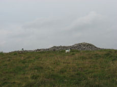
Brown Heath Enclosed Settlement
OS Map: SX 64080 65389
HER: MDV5135
Megalithic Portal: 14936
ShortName: ES Brown Heath
DPD page: 74
Barrow Report: 38
Notes: "A fine example of an enclosure. The walling consisting of very large stones reaching a height of one metre. It contains three hut circles and a number of courts situated mainly on its north and western sides. There is no obvious entrance." Lethbridge p. 74, diagram p.71. Hook Lake on Megalithic Portal.
Nearby sites: SX 64080 65389
Distance: 2.81km
Brown Heath (Hook Lake) Encircled Cairn and Cist
OS Map: SX 64114 65327
HER: MDV5137
Megalithic Portal: 52166
The Stone Rows of GB: Hook Lake
PMD: Hook Lake Stone row
Alternate name: Hook Lake stone row Encircled Cairn and Cist
ShortName: CT Hook Lake
Butler map: 55.8
DPD page: 74
Grinsell: HAR 3
Turner: F11
Barrow Report: 38
Notes: "A double stone row, on Brown Heath, circa 540 feet in length, direction of length N 10o E. At the north end is a stone circle, diameter 31 feet, surrounding a cairn which contains the remains of a cist." Ruined and possibly no longer visible. Butler Hook Lake stone row - Vol. 4. Map 55.8 (pp.78-9).
Nearby sites: SX 64114 65327
Distance: 2.87km
Brown Heath (Hook Lake) Stone Row
OS Map: SX 64112 65318
HER: MDV5136
Megalithic Portal: 1788
The Stone Rows of GB: Hook Lake
PMD: Brown Heath Stone Row
Alternate name: Hook Lake Stone Row
ShortName: SR Hook Lake
Butler map: 55.8
DPD page: 74
Barrow Report: 38
Notes: Worth: Brown Heath, Butler: Hook Lake. "On the southwest slopes of Brown Heath a double stone row 182.0m. long runs from a cairn circle at its northern and higher end to the east side of the enclosure (SX 66 NW 50) where it is overlaid by the enclosure wall. The point at which the southern end of the row ended is therefore not easily determined. The row does not point exactly to the centre of the cairn, but to about 2.0m. to the East. The eastern part of the row contains more stones than the western part, in which there are notable gaps. There are a few large stones, the largest being 1.0m. high and measuring 1.0m. x 0.7m., but most are relatively small, their average height being 0.5m". Lethbridge p.74, diagram p.71. See also: Sea Views at Hook Lake/
Nearby sites: SX 64112 65318
Distance: 2.87km
Calveslake Cist
Prehistoric Dartmoor Walks: Dartmoor Site: Guide to the Langcombe Brook & Deadman's Bottom Cists
OS Map: SX 60874 67551
HER: MDV5085
Megalithic Portal: 45660
PMD: Calveslake Tor
Alternate name: Calveslake Tor Cist
ShortName: CT Calveslak
Butler map: 50.4
DPD page: 43
Grinsell: SHA 3
Barrow Report: 12 19
Notes: "A perfect, well constructed cist at Calveslake. Length, 3ft 7inches; width at north end,1ft 7 1/2 inches; at south end, 1ft 9inches, depth to floor, 2ft 7inches. An irregular shaped cover-stone overhangs the eastern end of the cist. The barrow in which the cist stands has a diameter of 18 feet." Lethbridge Calves Lake cist p.42-43, diagram p.42. Butler Calveslake Tor - Vol. 3. Map 50.4 (diagram p.154).
Nearby sites: SX 60874 67551
Distance: 1.22km
Deadman's Bottom Embanked Cairn Circle
Prehistoric Dartmoor Walks: Dartmoor Site: Guide to the Langcombe Brook & Deadman's Bottom Cists
OS Map: SX 60711 67027
HER: MDV12420
Megalithic Portal: 3194
Alternate name: Deadman's Bottom 1 Embanked Cairn Circle
ShortName: CC Deadmans 1
Turner: B1
Notes: "Turner identifies this site as an embanked stone circle; an annular bank of earth and/or stones with an inner edge of orthostats. Internal diam 16m with bank 0.8m wide and 0.3m high. The bank has been pushed out on the sse side and the stones lean outward (turner)." Turner B1.
Nearby sites: SX 60711 67027
Distance: 0.95km
Deadman's Bottom, North Cist
Prehistoric Dartmoor Walks: Dartmoor Site: Guide to the Langcombe Brook & Deadman's Bottom Cists
OS Map: SX 60782 66900
HER: MDV5120
Megalithic Portal: 3194
PMD: Deadman's Bottom N 1
Alternate name: Langcombe Brook 2 Cist
ShortName: CT Deadmans N
Butler map: 50.3.2
DPD page: 44
Grinsell: SHA 7
Barrow Report: 12 19
Notes: "The remains of a cist lie on the northern slopes of Deadmans Bottom. The feature consists of a stone lined box, c.1m long and c. 0.4m wide, with a coverstone which has now slid to the north. The cist has collapsed in on itself. There is a turf covered stone spread to the south but little real evidence of an associated cairn." Lethbridge p.44 Langcombe Cist C - diagram p.43 Butler Langcombe Brook 2 (Cist 2) - Vol. 3. Map 50.3 (pp.148-54 general plan of Langcombe Brook cairns p.151, diagram of Deadmans Bottom cists p.149).
Nearby sites: SX 60782 66900
Distance: 0.82km
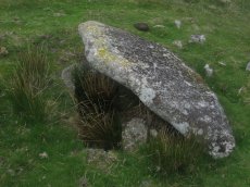
Deadman's Bottom, South Ring Setting Cairn and Cist
Prehistoric Dartmoor Walks: Dartmoor Site: Guide to the Langcombe Brook & Deadman's Bottom Cists
OS Map: SX 60788 66892
HER: MDV5119
Megalithic Portal: 3194
PMD: Deadman's Bottom N 2
Alternate name: Langcombe Brook 1 Ring Setting Cairn and Cist
ShortName: CT Deadmans S
Butler map: 50.3.1
DPD page: 45
Grinsell: SHA 8
Turner: D12
Barrow Report: 12 19
Notes: "Cairn consists of a stony mound, c 6.1m in diameter and c 0.5m high, contained by granite slabs some upright some fallen. The southern quadrant of the cairn has been disturbed. The remains of a very fine cist, box dimensions c. 0.8 x 0.7m internally, survives at its centre." One side slab and the cover-stone of the cist are missing although both could be slabs nearby. The cover-stone may be the large slab which lies to the south. Lethbridge p.45 Langcombe Cist D - diagram p.43 Dixon #7. Bar Rep. 19. Butler Langcombe Brook 1 (Cist 1) Vol. 3. Map 50.3 (pp.148-54 general plan of Langcombe Brook cairns p.151, diagram of Deadmans Bottom cists p.149).
Nearby sites: SX 60788 66892
Distance: 0.81km
Deadmans Bottom D Platform Cairn Circle and Cist
Prehistoric Dartmoor Walks: Dartmoor Site: Guide to the Langcombe Brook & Deadman's Bottom Cists
OS Map: SX 6096 6673
HER: MDV5086
Megalithic Portal: 45731
PMD: Deadman's Bottom S 10
Alternate name: Langcombe Brook 10 Platform Cairn Circle and Cist
ShortName: CT:Deadmans D
Butler map: 50.3.10
DPD page: 45
Grinsell: SHA 10
Turner: E44
Barrow Report: 53
Notes: "The cairn is 5m in diameter by 0.3m high with a retaining kerb on its northern side. The cist is 0.8m long b 0.7m wide." "Cist (listed as 'D' by Worth) found at Deadman's Bottom Langcombe, by Mr Button. Internal dimensions, length 3 feet 8 inches, width 2 feet. The stones are barely visible above grass level. The cover stone is missing." Lethbridge p.45 Langcombe Cist E - diagram p.43. Butler Langcombe Brook Cairn 10 - Vol. 3. Map 50.3 (pp.148-54 general plan of Langcombe Brook cairns p.151, diagram of Langcombe cists p.153).
Nearby sites: SX 6096 6673
Distance: 0.59km
Deadmans Bottom E Cist
Prehistoric Dartmoor Walks: Dartmoor Site: Guide to the Langcombe Brook & Deadman's Bottom Cists
OS Map: SX 60984 66714
HER: MDV5122
Megalithic Portal: 45732
PMD: Deadman's Bottom S 9
Alternate name: Langcombe Brook 9 Cist
ShortName: CT Deadmans E
Butler map: 50.3.9
DPD page: 45
Grinsell: SHA 11
Barrow Report: 53
Notes: "Cist (Listed as 'E' by Worth) found at Deadman's Bottom, Langcombe, by Mr. Button. Probable original dimensions, length 2ft 2 ins, width 1ft. 5ins. The stones barely show above the surface and the cover-stone is missing." ... "A well defined cairn 6.0m in diameter and 0.4m high with a cist in the top. This stone-lined cist measures 0.7m by 0.5m internally and 0.3 deep. Two of the side stones have fallen inwards." Lethbridge p.45 Langcombe Cist F - diagram p.43 Butler Langcombe Brook Cairn 9 - Vol. 3. Map 50.3 (pp.148-54 general plan of Langcombe Brook cairns p.151, diagram of Langcombe cists p.153).
Nearby sites: SX 60984 66714
Distance: 0.56km
Deadmans Bottom F Platform Cairn Circle and Cist
Prehistoric Dartmoor Walks: Dartmoor Site: Guide to the Langcombe Brook & Deadman's Bottom Cists
OS Map: SX 61201 66983
HER: MDV5125
Megalithic Portal: 45733
PMD: Deadman's Bottom E.
Alternate name: Langcombe Brook 11 Platform Cairn Circle and Cist
ShortName: CT Deadmans F
Butler map: 50.3.11
DPD page: 43
Grinsell: SHA 12
Barrow Report: 53
Notes: "Cist (Listed as 'F' by Worth) found at Deadman's Bottom, Langcombe, by Mr. Button. The cover-stone is still in position but the cist appears to have been rifled, the end and side-stones having been displaced at the north-east and southwest angles. Original length would appear to have been 2 feet 10 inches, and the width 1 foot 7 inches. The greatest length of the cover-stone is 4ft 9 inches and its greatest width 3 feet 1 1/2 inches." ... "A flat-topped cairn measuring 5.4m in diameter and standing a maximum of 0.4m high. A well-preserved cist 1.3m long, 0.6m wide and 0.15m deep is largely obscured by the coverstone". Lethbridge p.43 Langcombe Cist A (Upper Deadman's Bottom) - diagram p.43. nb. Not listed by Turner - assigned as "Platform Circle" type cairn due to description in NMR. Butler Langcombe Brook Cairn 11 - Vol. 3. Map 50.3 (pp.148-54 general plan of Langcombe Brook cairns p.151, diagram of Langcombe cists p.153).
Nearby sites: SX 61201 66983
Distance: 0.57km
Drizzlecombe Platform Cairn Circle
Prehistoric Dartmoor Walks: Dartmoor Site: Drizzlecombe Ceremonial Complex (Photos 1)
OS Map: SX 59135 67134
HER: MDV3374
Megalithic Portal: 16932
PMD: Drizzlecombe N 14
Alternate name: Drizzlecombe 14 Platform Cairn Circle
ShortName: PC Drizzle
Butler map: 49.19.14
Grinsell: SHE 25a
Turner: E35
Barrow Report: 34 56
Notes: "stone circle" marked on os 6" 1906. This site was almost totally excavated in 1914. Half an 11 foot diameter kerb circle and the slight remains of a cairn were found.3 flint flakes and a "well finished" scraper were found. The 34th Barrow Report includes a photo of the flints and the excavated and exposed kerb.
Nearby sites: SX 59135 67134
Distance: 2.45km
Drizzlecombe Enclosed Settlement
Prehistoric Dartmoor Walks: Dartmoor Site: Drizzlecombe Ceremonial Complex (Photos 1)
OS Map: SX 59341 67152
HER: MDV4046
Megalithic Portal: 10509
ShortName: ES Drizzle
Butler map: 49.19
DPD page: 39
Notes: "The drizzlecombe pound (diam (max 67m, min 64m), thic of wall (max 1.52m, min 1.37m), area 0.3ha) is not circular as there is a considerable length of straight wall on the sw. The wall is much ruined in parts. An inner lining of slabs is still visible on the nw side. Mean elevation of ground is 366m od ground slopes to sw with mean gradient of 1 in 7. A cairn lies a few yards outside the pound wall, two hut circles within the enclosure. The entrance is in the west wall". Lethbridge pp.38-42, diagram p.38.
Nearby sites: SX 59341 67152
Distance: 2.26km
Drizzlecombe Cist
Prehistoric Dartmoor Walks: Dartmoor Site: Drizzlecombe Ceremonial Complex (Photos 1)
OS Map: SX 59227 67478
HER: MDV3363
Megalithic Portal: 16934
PMD: Drizzlecombe N.
Alternate name: Drizzlecombe 21 Cist
ShortName: CT Drizzle
Butler map: 49.19.21
DPD page: 41
Grinsell: SHE 24
Barrow Report: 26 34
Notes: Butler Vol. 3. Map 49.19.21 (pp.135-142, general plan of Drizzlecombe complex p.135, diagram p.141 Cist 21). Lethbridge p.38-41, diagram p.38 Cist C(3)
Nearby sites: SX 59227 67478
Distance: 2.47km
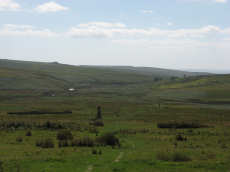
Drizzlecombe Ceremonial Complex
Prehistoric Dartmoor Walks: Dartmoor Site: Drizzlecombe Ceremonial Complex (Photos 1)
OS Map: SX 592 670
HER: MDV3376
Megalithic Portal: 1906
PMD: Drizzlecombe C
ShortName: CX Drizzle
Butler map: 49.19
DPD page: 38
Notes: Lethbridge pp.38-42. Diagram p.38. Ceremonial complex consisting of three stone rows headed by massive standing stones and also associated cairns and cists.
Nearby sites: SX 592 670
Distance: 2.35km
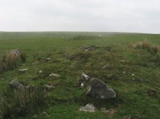
Drizzlecombe (Central) Encircled Cairn
Prehistoric Dartmoor Walks: Dartmoor Site: Drizzlecombe Ceremonial Complex (Photos 1)
OS Map: SX 59253 67081
HER: MDV14772
Megalithic Portal: 3206
PMD: Drizzlecombe B
Alternate name: Drizzlecombe stone row 3 Encircled Cairn
ShortName: EC Drizzle Ce
Butler map: 49.19.3
Grinsell: SHE 29
Turner: F13
Barrow Report: 56
Notes: Central in alignment of 3 cairns. Cairn heads the NW Drizzlecombe row. See diagram in coverage on Prehistoric Dartmoor Walks, marked as C3.
Nearby sites: SX 59253 67081
Distance: 2.32km
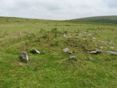
Drizzlecombe (W) Encircled Cairn
Prehistoric Dartmoor Walks: Dartmoor Site: Drizzlecombe Ceremonial Complex (Photos 1)
OS Map: SX 59236 67101
HER: MDV3329
Megalithic Portal: 10499
PMD: Drizzlecombe N Row
Alternate name: Drizzlecombe 4 Encircled Cairn
ShortName: EC Drizzle W
Butler map: 49.19.4
Grinsell: SHE 28
Turner: F24
Notes: Western most in alignment of 3 cairns. The other two cairns head Drizzlecombe rows. See diagram in coverage on Prehistoric Dartmoor Walks, marked as C4. Turner F24
Nearby sites: SX 59236 67101
Distance: 2.34km
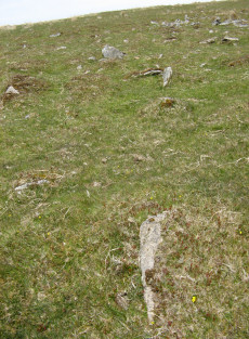
Drizzlecombe 4 Stone Row
Prehistoric Dartmoor Walks: Dartmoor Site: Drizzlecombe Ceremonial Complex (Photos 1)
OS Map: SX 59257 67256
Megalithic Portal: 1902
The Stone Rows of GB: Drizzlecombe 4
ShortName: SR Drizzle 4
Notes: See also Megalithic Portal: Standing Stone for a nearby small standing stone.
Nearby sites: SX 59257 67256
Distance: 2.37km
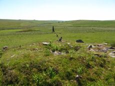
Drizzlecombe E. Encircled Cairn
Prehistoric Dartmoor Walks: Dartmoor Site: Drizzlecombe Ceremonial Complex (Photos 1)
OS Map: SX 59267 67065
HER: MDV4047
Megalithic Portal: 3207
PMD: Drizzlecombe C
Alternate name: Drizzlecombe stone row 2 Encircled Cairn
ShortName: EC Drizzle E
Butler map: 49.19.2
DPD page: 39
Grinsell: SHE 30
Turner: F7
Notes: Eastern most in alignment of 3 cairns. Cairn heads the NE Drizzlecombe row. See diagram in coverage on Prehistoric Dartmoor Walks, marked as C2. Lethbridge Row B. pp.38-42. Diagram p.38. See also 14780
Nearby sites: SX 59267 67065
Distance: 2.30km
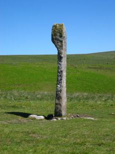
Drizzlecombe N.E. Standing Stone
Prehistoric Dartmoor Walks: Dartmoor Site: Drizzlecombe Ceremonial Complex (Photos 1)
OS Map: SX 59215 67005
HER: MDV3377
Megalithic Portal: 16928
PMD: Drizzlecombe Standing Stones
ShortName: SS Drizzle NE
Butler map: 49.19
Butler Vol 5: p.230
DPD page: 39
Notes: Largest standing stone on Dartmoor - terminal for Drizzlecombe stone row. It is 4.2m in height with a distinctive bulging profile at the top. Worth suggests it was probably dragged here from Higher Hartor Tor about 1km away. Re-erected in 1893. Lethbridge Row B. pp.38-42. Diagram p.38. Worth's Row 19/Row C. Used to be listed as HER 14781 perhaps now deleted as an HER duplicate record.
Nearby sites: SX 59215 67005
Distance: 2.34km
Drizzlecombe N.E. Stone Row
Prehistoric Dartmoor Walks: Dartmoor Site: Drizzlecombe Ceremonial Complex (Photos 1)
OS Map: SX 59258 67054
HER: MDV14776
Megalithic Portal: 536
The Stone Rows of GB: Drizzlecombe 2
PMD: Drizzlecombe C Stone Row
Alternate name: Drizzlecombe 2 Stone Row
ShortName: SR Drizzle NE
Butler map: 49.19.2
DPD page: 39
Notes: Butler Row 2, NMR Row 2, Worth Row C. Terminated by the tallest standing stone on Dartmoor. It is 4.2m in height with a distinctive bulging profile at the top the broad face is across the row unlike the other two Drizzlecombe rows. Interestingly this stone is photographed in Worth's Dartmoor prior to being re-erected. Worth suggests it was probably dragged here from Higher Hartor Tor about 1km away. This standing stone has 3 smaller cairns in close proximity. This is the shortest of the three rows at 83.2m but has larger slabs set further apart with the largest near the cairn. Lethbridge Row B. pp.38-42. Diagram p.38. See also: Sea Views at Drizzlecombe 2
Nearby sites: SX 59258 67054
Distance: 2.31km
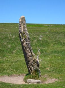
Drizzlecombe N.W. Standing Stone
Prehistoric Dartmoor Walks: Dartmoor Site: Drizzlecombe Ceremonial Complex (Photos 1)
OS Map: SX 59134 66988
Megalithic Portal: 16929
PMD: Drizzlecombe Standing Stones
ShortName: SS Drizzle NW
Butler map: 49.19
DPD page: 40
Notes: Terminal for Drizzlecombe NW stone row. Re-erected in 1893. Lethbridge Row C. pp.38-42. Diagram p.38. NB. This website had previously matched this site with the HER record 3377. That record now clearly refers to the NE stone - although that may not have previously been the case. There is no HER record for this site now. Worth's Row 18/Row B. Previously listed here with a grid referecne of SX 59200 67020 which is quite a bit out.
Nearby sites: SX 59134 66988
Distance: 2.42km
Drizzlecombe N.W. Stone Row
Prehistoric Dartmoor Walks: Dartmoor Site: Drizzlecombe Ceremonial Complex (Photos 1)
OS Map: SX 59243 67071
HER: MDV3376
Megalithic Portal: 1904
The Stone Rows of GB: Drizzlecombe 3
PMD: Drizzlecombe B Stone Row
Alternate name: Drizzlecombe 3 Stone Row
ShortName: SR Drizzle NW
Butler map: 49.19.3
DPD page: 40
Notes: Butler Row 3, NMR Row 1, Worth Row B. The NW and S terminal stones have their broad face parallel to the row. The NW row is single for half of its 149.5m length uphill then double for 47m before becoming single again for the last 28m to the cairn. This arrangement appears to be the original design. The other two stone rows are single throughout. The S row is exactly the same length as the NW row but with smaller stones. The average interval between the stones is almost identical and the orientation of the row is such that it gently curves southwards downhill bringing the lower part of the row parallel to the S row. This shift of 7 degrees in alignment of the NW row from top to bottom to line up with the S row would suggest it was constructed later to match the S row. The height of the terminating stones for S and NW rows are 3m and 2.3m respectively. Lethbridge Row C. pp.38-42. Diagram p.38. See also: Sea Views at Drizzlecombe 3
Nearby sites: SX 59243 67071
Distance: 2.33km
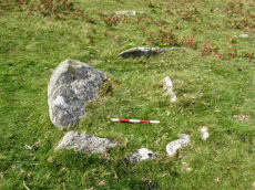
Drizzlecombe Row 4 Kerbed Reported Cairn
Prehistoric Dartmoor Walks: Dartmoor Site: Drizzlecombe Ceremonial Complex (Photos 1)
OS Map: SX 59278 67279
Megalithic Portal: 1902
The Stone Rows of GB: Drizzlecombe 4
ShortName: CN Driz Kerbed
Notes: This site is a possible kerbed cairn very close to Drizzlecombe Stone Row 4. This site was looked at by Sandy Gerrard, ACE Archaeology and the current author on 07/09/2019 whilst surveying the possible stone row 4.
Nearby sites: SX 59278 67279
Distance: 2.35km
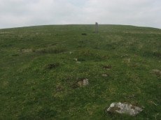
Drizzlecombe S Row Encircled Cairn
Prehistoric Dartmoor Walks: Dartmoor Site: Drizzlecombe Ceremonial Complex (Photos 1)
OS Map: SX 59170 66964
HER: MDV14779
Megalithic Portal: 16937
PMD: Drizzlecombe SW Row
Alternate name: Drizzlecombe stone row 1 Encircled Cairn
ShortName: EC Drizzle S
Butler map: 49.19.1
Grinsell: SHE 32
Notes: "Cairn lies at the north-east end of Row A (South Row)of the Drizzlecombe group. Cairn measures 6.7 metres in diameter, up to 0.8 metres high, with central hollow 2.3 metres by 1.5 metres by 0.25 metres deep." "Small number of edge stones around the periphery represent a kerb. Large flat stone, 1.7m by 1m by 0.3m thick, situated immediately s of the mound may be the displaced coverstone from a cist"
Nearby sites: SX 59170 66964
Distance: 2.38km
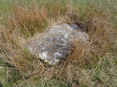
Drizzlecombe S Row Reported Cist
Prehistoric Dartmoor Walks: Dartmoor Site: Drizzlecombe Ceremonial Complex (Photos 1)
OS Map: SX 59169 66957
HER: MDV14779
PMD: Drizzlecombe SW Row
ShortName: CT-DrizzleSRow
Butler map: 49.19.1
Nearby sites: SX 59169 66957
Distance: 2.38km
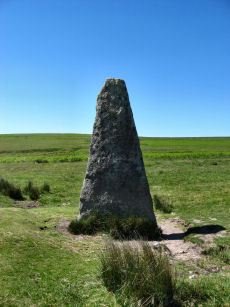
Drizzlecombe S. Standing Stone
Prehistoric Dartmoor Walks: Dartmoor Site: Drizzlecombe Ceremonial Complex (Photos 1)
OS Map: SX 59057 66868
HER: MDV14778
Megalithic Portal: 16927
PMD: Drizzlecombe Standing Stones
ShortName: SS Drizzle S
Butler map: 49.19
DPD page: 40
Notes: Terminal stone of the southern double row at Drizzlecombe. The standing stone at the southwest end measures 1.8 metres by 0.4 metres and is 3.2 metres high. Re-erected in 1893. Lethbridge Row A pp.38-42. Diagram p.38. Worth's Row 17/Row A.
Nearby sites: SX 59057 66868
Distance: 2.47km
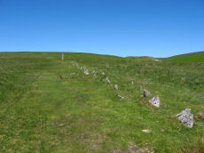
Drizzlecombe S. Stone Row
Prehistoric Dartmoor Walks: Dartmoor Site: Drizzlecombe Ceremonial Complex (Photos 1)
OS Map: SX 59161 66949
HER: MDV14777
Megalithic Portal: 1905
The Stone Rows of GB: Drizzlecombe 1
PMD: Drizzlecombe A Stone Row
Alternate name: Drizzlecombe 1 Stone Row
ShortName: SR Drizzle S
Butler map: 49.19.1
DPD page: 40
Notes: Butler Row 1, NMR Row 3, Worth Row A. See notes for Drizzlecombe B (N.W.) row. Lethbridge Row A pp.38-42. Diagram p.38. See also: Sea Views at Drizzlecombe 1
Nearby sites: SX 59161 66949
Distance: 2.38km
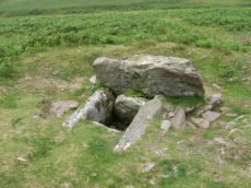
Drizzlecombe, North Cist
Prehistoric Dartmoor Walks: Dartmoor Site: Drizzlecombe Ceremonial Complex (Photos 1)
OS Map: SX 59156 67215
HER: MDV3339
Megalithic Portal: 534
PMD: Drizzlecombe N 13
Alternate name: Drizzlecombe 13 Cist
ShortName: CT Drizzle N
Butler map: 49.19.13
DPD page: 41
Grinsell: SHE 25
Barrow Report: 19
Notes: Butler Drizzlecombe - Vol. 3. Map 49.19.13 (pp.135-142, general plan of Drizzlecombe complex p.135, diagram p.140 Cairn 13). Lethbridge p.38-41, diagram p.38 Cist B(2)
Nearby sites: SX 59156 67215
Distance: 2.45km
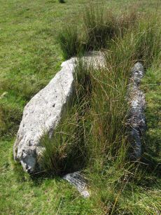
Drizzlecombe, South Cist
Prehistoric Dartmoor Walks: Dartmoor Site: Drizzlecombe Ceremonial Complex (Photos 1)
OS Map: SX 59033 66725
HER: MDV3340
Megalithic Portal: 16933
PMD: Drizzlecombe SW.
Alternate name: Drizzlecombe 22 Cist
ShortName: CT Drizzle S
Butler map: 49.19.22
DPD page: 41
Grinsell: SHE 34
Barrow Report: 19
Notes: Lethbridge p.38-41, diagram p.38 Cist A(1) Butler Drizzlecombe - Vol. 3. Map 49.19.22 (pp.135-142, general plan of Drizzlecombe complex p.135, diagram p.141 Cist 22).
Nearby sites: SX 59033 66725
Distance: 2.48km
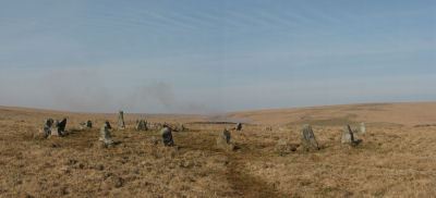
Erme Cairn Circle
Prehistoric Dartmoor Walks: Dartmoor Site: Upper Erme Stone Row & Cairn Circle
OS Map: SX 63517 64442
HER: MDV4310
Megalithic Portal: 533
Alternate name: Upper Erme stone row Cairn Circle
ShortName: CC The Dancers
Butler map: 55.7.1
DPD page: 71
Grinsell: COR 10
Turner: G16
Notes: An impressive cairn circle (often referred to as a stone circle) on Stall Moor which is also known as The Dancers, Kiss in the Ring or Stall Moor Circle. "Round barrow with retaining circle at south end of longest Dartmoor stone row. Diameter 16m, height of mound 0.3m." Lethbridge pp.70-71, diagram p.71
Nearby sites: SX 63517 64442
Distance: 2.88km
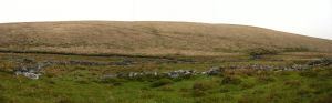
Erme Pound
Prehistoric Dartmoor Walks: Dartmoor Site: Upper Erme Stone Row & Cairn Circle
OS Map: SX 638 658
HER: MDV5110
Megalithic Portal: 14937
ShortName: PD Erme Pound
DPD page: 71
Notes: See also MDV5109
Nearby sites: SX 638 658
Distance: 2.40km
Erme Pound (Near) Cist
OS Map: SX 6392 6551
HER: MDV28585
Megalithic Portal: 45758
PMD: Erme Pound
ShortName: CT:Erme Pound
Grinsell: HAR 2
Turner: D29
Notes: "A prehistoric round cairn, 300 metres west of the River Erme in an area of intense peat cutting remains. The cairn has surviving elements of a kerb and a central hollow which may have contained a cist. This probable platform cairn has a diameter of 3.8 metres and is raised above ground by 0.5 metres. The flat-topped mound is surrounded by a closely fitting, though incomplete, kerb of upright slabs, where many of the survivors remain in situ. An elongated hollow across the centre of the cairn may represent a disturbed cist, and a displaced slab within the hollow is the remains of a capstone.". "Noted by Hankin in July 1976, perhaps in a small cairn diameter 3.7m and height 0.3m. It is now filled in and Grinsell failed to locate it, 'it seems never to have been planned if it ever existed.'" This cist was listed by Dixon in 1952 70th Barrow Report (T.D.A Vol 84) with Dixon #96. It is not listed in prior Barrow Reports - and appears towards end of Dixon's list, so presumably discovered/reported late 40s to 1952. Not listed by Butler (area covered in Vol. 4. Map 55). Not listed in Hankin's 'An archaeological check-list for Harford'.
Nearby sites: SX 6392 6551
Distance: 2.61km
Foot of NE Longstone (1) Reported Cairn
OS Map: SX 59206 67009
HER: MDV55243
Alternate name: Foot of Longstone 2 (1) Reported Cairn
ShortName: CN Foot of NE1
Butler map: 49.19.10
Notes: The HER has these entries for this group of 3 cairns MDV55243, MDV55249, MDV55250. Those entries have been assigned arbitrarily to our 3 records as it is difficult to match up. The grid references for this record is from a Garmin reading.
Nearby sites: SX 59206 67009
Distance: 2.35km
Foot of NE Longstone (2) Reported Cairn
OS Map: SX 59220 66999
HER: MDV55249
Alternate name: Foot of Longstone 2 (2) Reported Cairn
ShortName: CN Foot of NE2
Butler map: 49.19.11
Notes: The HER has these entries for this group of 3 cairns MDV55243, MDV55249, MDV55250. Those entries have been assigned arbitrarily to our 3 records as it is difficult to match up. The grid references for this record is from a Garmin reading.
Nearby sites: SX 59220 66999
Distance: 2.33km
Foot of NE Longstone (3) Reported Cairn
OS Map: SX 59204 67002
HER: MDV55250
Alternate name: Foot of Longstone 2 (3) Reported Cairn
ShortName: CN:Foot of NE3
Butler map: 49.19.12
Notes: Not listed in NMR But near this row 438619. The third of Butler's cairns at the foot of the NE standing stone. The grid reference is estimated from the plan given by Butler that shows 3 cairns around the menhir fig 49.18 p.135 Vol 3.
The HER has these entries for this group of 3 cairns MDV55243, MDV55249, MDV55250. Those entries have been assigned arbitrarily to our 3 records as it is difficult to match up.
Nearby sites: SX 59204 67002
Distance: 2.35km
Giant's Basin Cairn
Prehistoric Dartmoor Walks: Dartmoor Site: Drizzlecombe Ceremonial Complex (Photos 1)
OS Map: SX 59202 66945
HER: MDV3372
Megalithic Portal: 538
ShortName: CN GiantsBasin
Butler map: 49.19.5
DPD page: 40
Grinsell: SHE 33
Notes: The Giant's Basin is an impressive but heavily disturbed cairn lying adjacent to the Drizzlecombe Stone Rows. It measures approximately 22 metres in diameter, a maximum of 3 metres high and is partially turf-covered. An approximately 2.5 metre wide reed-covered slight depression around its circumference suggests a silted ditch. Much of the central part of the cairn has been removed to a depth of 1.65m and most of excavated material in the form of fist-sized stones and small boulders has been deposited around the rim of the mound. Lethbridge pp.38-42, diagram p.38.
Nearby sites: SX 59202 66945
Distance: 2.34km
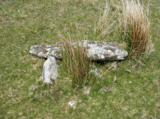
Giants Basin (near) Cist
OS Map: SX 59181 66953
HER: MDV3373
Megalithic Portal: 18464
PMD: Giants Basin Foot
Alternate name: Drizzlecombe 6 Cist
ShortName: CT GiantsBasin
Butler map: 49.19.6
Grinsell: SHE 33d
Barrow Report: 12
Notes: "The structure comprises a flat slab measuring 1.2m by 0.76m which rests at a slight angle on three upright slabs. These slabs, up to 0.4m high, form a 'z' shape on plan in what appears to be a slight hollow. This feature has been classified by some authorities as a cist although others reject this interpretation for either positional or structural reasons. The historical and archaeological tradition for the existence of a cist here is by no means certain. Known cists in the locality have invariably had their coverstones removed and are open. It is a scheduled ancient monument." The arrangement in the photo could well be natural.
Nearby sites: SX 59181 66953
Distance: 2.36km
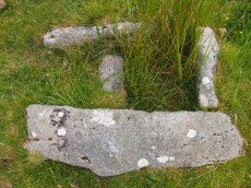
Giants Hill E Cist
OS Map: SX 59587 66717
HER: MDV70333
Megalithic Portal: 45812
ShortName: CT GiantsHillE
DPD page: 48
Notes: "A little further to the east on giant's hill another cist was photographed in 2004. A large flat stone c0.9m x c0.9m partly covered by vegetation is the capstone of a small square cist c0.56m x 0.56m. One of the side stones is missing. (lethbridge)." Lethbridge p.48 Giant's Hill unscheduled Cist diagram p.47.
Nearby sites: SX 59587 66717
Distance: 1.93km
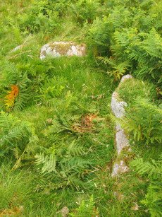
Giants Hill W Cist
OS Map: SX 59444 66753
HER: MDV55396
Megalithic Portal: 45813
PMD: Giants Hill
ShortName: CT GiantsHillW
DPD page: 48
Notes: "The cist is situated at the wsw end of the cairn, is 1.4m by 0.7m by 0.3m deep and is orientated ne-sw". Lethbridge p.48 Giant's Hill scheduled Cist diagram p.47.
Nearby sites: SX 59444 66753
Distance: 2.07km
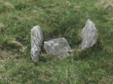
Great Gnat's Head Cist
OS Map: SX 61174 68034
HER: MDV5091
Megalithic Portal: 45675
PMD: Great Gnat's Head
Alternate name: Great Gnats' Head 1 Cist
ShortName: CT GreatGnats1
Butler map: 50.5.1
DPD page: 42
Grinsell: SHA 1
Barrow Report: 20
Notes: "Cist measures a maximum 1.0m long by 0.70m internally and 0.7m deep. Two side slabs and a fallen end slab are extant. There is no trace of a cover stone.". Lethbridge (near Abbot's Way cist) photo and diagram p.42 Butler Great Gnat's Head 1 - Vol. 3. Map 50.5 (diagram p.155).
Nearby sites: SX 61174 68034
Distance: 1.57km

Great Gnats Head Cairn
OS Map: SX 61657 67908
HER: MDV13177
Megalithic Portal: 45861
Alternate name: Great Gnats' Head Summit 4 Cairn
ShortName: CN GreatGnats4
Butler map: 50.5.4
Grinsell: SHA 2
Notes: "A Bronze Age summit cairn, now badly disturbed by a conical walkers cairn built in the SW quadrant. It measures 8.5m in diameter, the outer slope is 0.3m high and the interior is scooped to a depth of 0.3m -small boulders and upright slabs are visible. The conical cairn is 2.6m in diameter and 1.5m high." Butler Volume 3 Map 50.5.
Nearby sites: SX 61657 67908
Distance: 1.42km
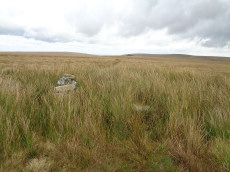
Green Hill Cairn
OS Map: SX 63665 67796
HER: MDV5106
Megalithic Portal: 2143
PMD: Green Hill
ShortName: CN GreenHill
Butler map: 55.7.4
DPD page: 72
Grinsell: LYD 101
Barrow Report: 14
Notes: "Cairn on the summit of Green Hill is the northern terminal of the stone row (SX 66 NW 20 but see also SX 66 NW 101 for cairn which may extend the row). Diameter 9m, height 0.7m. The possible remains of a central cist are indicated by a group of large stone slabs".
Nearby sites: SX 63665 67796
Distance: 2.52km
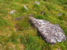
Grim's Grave (S) Platform Cairn Circle and Cist
Prehistoric Dartmoor Walks: Dartmoor Site: Guide to the Langcombe Brook & Deadman's Bottom Cists
OS Map: SX 61251 66313
HER: MDV5126
Megalithic Portal: 14929
PMD: Langcombe Brook S.
Alternate name: Langcombe Brook 4 Platform Cairn Circle and Cist
ShortName: CT GrimsGraveS
Butler map: 50.3.4
Butler Vol 5: p.160
DPD page: 46
Grinsell: SHA 18
Turner: E8
Barrow Report: 50
Notes: Lethbridge p.46 Langcombe Cist H - diagram p.43. Butler Langcombe Brook 4 (Cairn 4) - Vol. 3. Map 50.3 (pp.148-54 general plan of Langcombe Brook cairns p.151, diagram of Langcombe cists p.153).
Nearby sites: SX 61251 66313
Distance: 0.31km
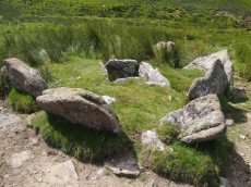
Grims Grave Ring Setting Cairn and Cist
Prehistoric Dartmoor Walks: Dartmoor Site: Guide to the Langcombe Brook & Deadman's Bottom Cists
OS Map: SX 61245 66422
HER: MDV5083
Megalithic Portal: 14930
PMD: Grim's Grave
ShortName: CT Grims Grave
Butler map: 50.3.3
DPD page: 46
Grinsell: SHA 13
Turner: D20
Barrow Report: 12 20 56
Notes: "A ring cairn set into the slope, c 4.5m in diameter, with a cist at its centre. The cairn consists of a stony, turf-covered mound contained by a ring of upright slabs, most leaning outwards, c 1m in height; the mound rises to c 0.4m at top of cist. The cist, box dimensions c 0.8m x 0.95m internally, is formed from edge-set slabs. One side slab is c 1.7m long, 0.9m wide and 0.2m thick. The monument survives in a very good condition though the cover-stone is missing - this is possibly the slab that now lies on the down-slope side." Lethbridge p.46 Langcombe Cist G (Grim's Grave) - diagram p.43. Butler Vol. 3. Map 50.3 Cairn 3 (pp.148-54 general plan of Langcombe Brook cairns p.151, diagram of Langcombe cists p.153, photo pp.94-96).
Nearby sites: SX 61245 66422
Distance: 0.27km
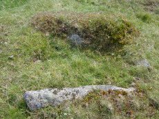
Hentor Cist
Prehistoric Dartmoor Walks: Dartmoor Site: Guide to the Hentor & Shavercombe Brook Cists
OS Map: SX 59252 65720
HER: MDV55317
Megalithic Portal: 45790
PMD: Hen Tor Warren 1
Alternate name: Hen Tor N.1 Cist
ShortName: CT Hen Tor N1
Butler map: 49.22.1
DPD page: 51
Notes: Butler Hen Tor 1 (Cairn 1) - Vol. 3. Map 49.22 (general plan of Hen Tor with diagram of cists pp.146-7). "A low earthen barrow or cairn with cist. The barrow is 4m by 3.5m and 0.6m high. The centrally placed cist is 1.2m by 0.75m. internally and 0.2m deep. Three side stones visible, with the cist aligned north-east/south-west, but no coverstone. The overall condition is fair". Lethbridge p.50-51 Shavercombe Cist F - diagram p.49.
Nearby sites: SX 59252 65720
Distance: 2.38km
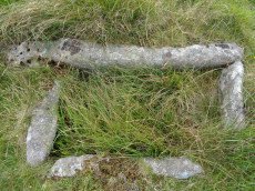
Hentor (Shavercombe C) Ring Setting Cairn and Cist
Prehistoric Dartmoor Walks: Dartmoor Site: Guide to the Hentor & Shavercombe Brook Cists
OS Map: SX 59606 65893
HER: MDV3503
Megalithic Portal: 45728
PMD: Hen Tor Warren 6
Alternate name: Hen Tor N.6 Ring Setting Cairn and Cist
ShortName: CT Hen Tor N6
Butler map: 49.22.6
DPD page: 49
Grinsell: SHA 27
Turner: D14
Barrow Report: 52 56
Notes: "The cairn is 5.2m in diameter and 0.7m high with the remains of a retaining circle. The cist is 1.1m by 0.6m and 0.6m deep with a stone floor; it is aligned north west/south east". Lethbridge p.49 Shavercombe Cist A - diagram 49. Butler Hen Tor 6 (Cairn 6) - Vol. 3. Map 49.22 (general plan of Hen Tor with diagram of cists pp.146-7).
Nearby sites: SX 59606 65893
Distance: 1.99km
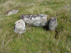
Hentor (Shavercombe) Platform Cairn Circle and Cist
Prehistoric Dartmoor Walks: Dartmoor Site: Guide to the Hentor & Shavercombe Brook Cists
OS Map: SX 59372 65801
HER: MDV3479
Megalithic Portal: 45661
PMD: Hen Tor Warren 2
Alternate name: Hen Tor N.2 Platform Cairn Circle and Cist
ShortName: CT Hen Tor N2
Butler map: 49.22.2
DPD page: 50
Grinsell: SHA 26
Turner: E48
Barrow Report: 20
Notes: "A cairn with circle and cist. The cairn is 5m in diameter and 0.4m high and contains at least six upright stones forming a circle that surrounds the centrally placed cist. The cist, in fair condition, is aligned north west/south east. A flat stone lying immediately south west of the cist may be the capstone." Lethbridge p.50-51 Shavercombe Cist E - diagram p.49. Shavercombe. Butler Hen Tor Cairn 2 - Vol. 3. Map 49.22 (general plan of Hen Tor with diagram of cists pp.146-7).
Nearby sites: SX 59372 65801
Distance: 2.24km

Hentor (Shavercombe) Cist
Prehistoric Dartmoor Walks: Dartmoor Site: Guide to the Hentor & Shavercombe Brook Cists
OS Map: SX 59825 65892
HER: MDV3491
Megalithic Portal: 45781
PMD: Shavercombe Brook
Alternate name: Hen Tor N.7 Cist
ShortName: CT Hen Tor N7
Butler map: 49.22.7
Grinsell: SHA 20
Notes: "The oval cairn is 7.5m by 6.5m and 0.9m high with some kerbing. An amorphous hollow occupies the centre of the mound and a single sidestone of the cist remains in situ". Butler Hen Tor 7 (Cairn 7)- Vol. 3. Map 49.22 (general plan of Hen Tor with diagram of cists pp.146-7).
Nearby sites: SX 59825 65892
Distance: 1.78km
Hentor A Cist
Prehistoric Dartmoor Walks: Dartmoor Site: Guide to the Hentor & Shavercombe Brook Cists
OS Map: SX 59708 65692
HER: MDV3511
Megalithic Portal: 45712
PMD: Hen Tor Warren 5
Alternate name: Hen Tor N.5 Cist
ShortName: CT:Hen Tor N5
Butler map: 49.22.5
DPD page: 50
Grinsell: SHA 30
Barrow Report: 52
Notes: The author was unable to locate this cist at SX 59708 65692 on 13/08/17. The HER has ngr SX 5971 6570. The site is clearly difficult to find. The area is dense in bracken and according to Lethbridge the cist is very badly damaged. It is unclear how accurate the grid reference is - although it is quite possible that the problem is simply that it is overgrown and difficult to see. A cist consisting of two sidestones, one of which has fallen outwards, and an irregular shaped coverstone. Lethbridge p.50 Shavercombe Cist D - diagram p.49. Butler Hen Tor 5 (Cairn 5) - Vol. 3. Map 49.22 (general plan of Hen Tor with diagram of cists pp.146-7).
Nearby sites: SX 59708 65692
Distance: 1.97km
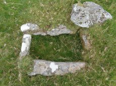
Hentor B Cist
Prehistoric Dartmoor Walks: Dartmoor Site: Guide to the Hentor & Shavercombe Brook Cists
OS Map: SX 59567 65806
HER: MDV3490
Megalithic Portal: 45727
PMD: Hen Tor Warren 3
Alternate name: Hen Tor N.3 Cist
ShortName: CT Hen Tor N3
Butler map: 49.22.3
DPD page: 49
Grinsell: SHA 28
Barrow Report: 52
Notes: "The cairn measures 4.7m in diameter and 0.5m high. The cist, aligned north west to south east, measures 0.8m by 0.4m and is 0.3m deep. A probable coverstone 2.0m to the north measures 0.9m by 0.7m". Lethbridge p.49 Shavercombe Cist B - diagram p.49. Butler Hen Tor 3 (Cairn 3) - Vol. 3. Map 49.22 (general plan of Hen Tor with diagram of cists pp.146-7).
Nearby sites: SX 59567 65806
Distance: 2.05km
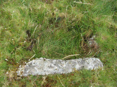
Hentor Farm Platform Cairn Circle and Cist
Prehistoric Dartmoor Walks: Dartmoor Site: Guide to the Hentor & Shavercombe Brook Cists
OS Map: SX 59089 65792
HER: MDV12744
Megalithic Portal: 45774
PMD: Hen Tor Meadow
ShortName: CT Hentor Farm
Grinsell: SHA 48
Turner: E45
Notes: "A slight cairn with retaining circle, enclosing a cist aligned SSE-NNW, near the junction of Shavercombe Lake and River Plym." Turner has "central cist". Not listed by Butler (relevant map Vol. 3. Map 49.22).
Nearby sites: SX 59089 65792
Distance: 2.51km
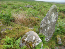
Hentor Warren Reported Cist
Prehistoric Dartmoor Walks: Dartmoor Site: Guide to the Hentor & Shavercombe Brook Cists
OS Map: SX 59003 65604
ShortName: CT-Hen Tor N9
Butler map: 49.22
Notes: Possible cist reported by Sam Goodwin. This site is close to the ruins of Hentor Warren House. The structure has the appearance of being a Bronze Age site but it is situated in close proximity to a jumble of remains from the historic period including buildings and walls. Site visited by the author and Sam on 16/06/2018.
Nearby sites: SX 59003 65604
Distance: 2.65km
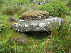
Hentor Warren Reported Cist
OS Map: SX 59023 65597
ShortName: CT-Hen Tor N10
Butler map: 49.22
Notes: Possible cist reported by Sam Goodwin. This site is close to the ruins of Hentor Warren House. The structure has the appearance of being a Bronze Age site but it is situated in close proximity to a jumble of remains from the historic period including buildings and walls. Site visited by the author and Sam on 16/06/2018. This particular slab has a cavity below it which is large enough for a dog to shelter in. On top of the slab is a thick layer which could represent remains of a cairn.
UPDATE 16/01/2019. This site is described as a "cooler" in Eric Hemery's High Dartmoor on p.21 photo 19. "A cupboard recess or chamber used for cool-storage of foodstuffs" (p.33). See also p.39 photo 39 and p.200 for "Mother Nicholl's Book -place" - another cupboard recess within the walls of Hentor Warren House.
Nearby sites: SX 59023 65597
Distance: 2.64km
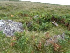
Hentor Warren (Shavercombe) Platform Cairn Circle and Cist
Prehistoric Dartmoor Walks: Dartmoor Site: Guide to the Hentor & Shavercombe Brook Cists
OS Map: SX 59632 65777
HER: MDV3492
Megalithic Portal: 45662
PMD: Hen Tor Warren 4
Alternate name: Hen Tor N.4 Platform Cairn Circle and Cist
ShortName: CT Hen Tor N4
Butler map: 49.22.4
DPD page: 50
Grinsell: SHA 29
Turner: E47
Barrow Report: 12 20
Notes: "On the slope north of Hen Tor at 395.0m OD is the remains of a cairn with a cist. The cairn measures 5.6m in diameter and 0.6m in height with a few stones of a cairn circle 3.2m in diameter remaining on the west side. The cist is 1.2m by 0.4m and 0.5m deep with a coverstone 1.6m by 1.1m at its maximum." Lethbridge p.50 Shavercombe Cist C - diagram p.49. Butler Hen Tor Cairn 4- Vol. 3. Map 49.22 (general plan of Hen Tor with diagram of cists pp.146-7).
Nearby sites: SX 59632 65777
Distance: 2.00km
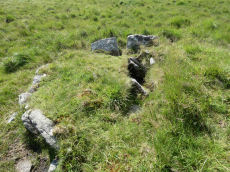
Knackersmill Gulf N. Cist
OS Map: SX 63390 65587
HER: MDV13185
Megalithic Portal: 45759
PMD: Stinger's Hill
ShortName: CT Stingers
Butler Vol 5: p.180 & Fig.122
DPD page: 73
Grinsell: COR 8
Notes: The NMR gives SX63376494 as the grid reference - this error is replicated in HER entry 28468. The author could not find a cist there. As PMD points out that is the location of Grinsell's CORNWOOD 9 cairn and not CORNWOOD 8. "A cist 1.20m. by 0.60m. with a close set retaining kerb circle 4.0m. in diameter is situated on Stinger's Hill opposite Erme Pound". Lethbridge Stingers Hill cist p.73. diagram p.71. Butler Map 55.7. (diagram Vol. 5. p.180). The author visited this site on 16/7/21 and the grid reference is confirmed as listed on this record.
Nearby sites: SX 63390 65587
Distance: 2.10km
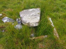
Langcombe (S) Platform Cairn Circle and Cist
Prehistoric Dartmoor Walks: Dartmoor Site: Guide to the Langcombe Brook & Deadman's Bottom Cists
OS Map: SX 60866 66155
HER: MDV5128
Megalithic Portal: 45729
PMD: Langcombe Brook 6
Alternate name: Langcombe Brook 6 Platform Cairn Circle and Cist
ShortName: CT Langcombe S
Butler map: 50.3.6
DPD page: 47
Grinsell: SHA 19
Turner: E23
Barrow Report: 50 52
Notes: "A cist, lying a little over 590 yds south west of Grim's Grave, within a flat topped cairn. Cist has two sides and the south end stone are in place and the cover stone rests in part over the cist". Lethbridge p.47 Langcombe Cist J - diagram p.43. Butler Langcombe Brook 6 (Cairn 6) - Vol. 3. Map 50.3 (pp.148-54 general plan of Langcombe Brook cairns p.151, diagram of Langcombe cists p.153).
Nearby sites: SX 60866 66155
Distance: 0.72km
Langcombe Brook 5 Cist
Prehistoric Dartmoor Walks: Dartmoor Site: Guide to the Langcombe Brook & Deadman's Bottom Cists
OS Map: SX 60878 66421
HER: MDV5129
Megalithic Portal: 45767
PMD: Langcombe Brook 5
ShortName: CT:Langcombe 5
Butler map: 50.3.5
DPD page: 46
Grinsell: SHA 17
Notes: "Two end stones and two side stones are in position but the coverstone is missing. The tops of the stones are at ground level Length of N side stone 1.4m, S side stone 1m, W end stone 0.6m, and E end stone 0.5m. Present depth of cist is 0.3m." Lethbridge p.46 Langcombe Cist I - diagram p.43. Butler Langcombe Brook 5 (Cairn 5) - Vol. 3. Map 50.3 (pp.148-54 general plan of Langcombe Brook cairns p.151, diagram of Langcombe cists p.153).
Nearby sites: SX 60878 66421
Distance: 0.63km
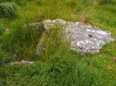
Langcombe Brook 7 Cist
Prehistoric Dartmoor Walks: Dartmoor Site: Guide to the Langcombe Brook & Deadman's Bottom Cists
OS Map: SX 60380 66921
HER: MDV5134
Megalithic Portal: 45765
PMD: Langcombe Brook 7
ShortName: CT Langcombe 7
Butler map: 50.3.7
DPD page: 47
Grinsell: SHA 16
Notes: "Two end stones and the western side stone are in an upright position while the eastern side stone leans inwards. Length of northern end stone 0.7m, southern end stone 0.7m, eastern side stone 1.2m and western side stone 1m. Present depth of cist 0.3m. There is a cover stone measuring 1.6m by 1m which rests on the eastern side stone and which partly covers the northern corner of the cist". Lethbridge p.47 Langcombe Cist K - diagram p.43 Butler Langcombe Brook 7 (Cairn 7) - Vol. 3. Map 50.3 (pp.148-54 general plan of Langcombe Brook cairns p.151, diagram of Langcombe cists p.153).
Nearby sites: SX 60380 66921
Distance: 1.20km
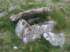
Plym Steps Ring Setting Cairn and Cist
Prehistoric Dartmoor Walks: Dartmoor Site: Guide to the Langcombe Brook & Deadman's Bottom Cists
OS Map: SX 60427 67110
HER: MDV5133
Megalithic Portal: 45659
PMD: Langcombe Brook 8
Alternate name: Langcombe Brook 8 Ring Setting Cairn and Cist
ShortName: CT Plym Steps
Butler map: 50.3.8
DPD page: 44
Grinsell: SHA 4
Turner: D22
Barrow Report: 19
Notes: Central cist. Butler Langcombe Brook 8 (Cairn 8)- Vol. 3. Map 50.3 (pp.148-54 general plan of Langcombe Brook cairns p.151, diagram of Langcombe cists p.153). Lethbridge p.44 Langcombe Cist B - diagram p.43
Nearby sites: SX 60427 67110
Distance: 1.23km
Ranny Brook (Yealm) Enclosed Settlement
OS Map: SX 62352 63670
HER: MDV43608
Megalithic Portal: 45574
ShortName: ES:Ranny Brook
Notes: An enclosure of earth and stone walling 0.5m wide by 0.4m high encompasses an oval area 18.0m by 16.0m. It lies on the South facing slope to the North of Ranny Brook. Scheduled: Devon 10853.
Nearby sites: SX 62352 63670
Distance: 2.96km
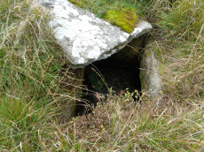
Redlake Foot (Brown Heath) Cist
OS Map: SX 63778 66069
HER: MDV5102
Megalithic Portal: 45760
PMD: Brown Heath
Alternate name: Brown Heath Cist
ShortName: CT Brown Heath
Butler map: 55.7.3
DPD page: 73
Grinsell: HAR 1
Barrow Report: 60 69 71
Notes: "A fine cist at Redlake Foot measuring internally, 0.7m. by 1.0m. and 1.0m. deep single slabs form the end-stones and the southern side-stone. The northern side is a slab resting on a horizontal 'post' type stone" Cover slab partly displaced from the sides. Lethbridge p.73, diagram p.71. Butler Brown Heath (Cairn 3) - Vol. 4. Map 55.7.3 (p.76-7 diagram p.76).
Nearby sites: SX 63778 66069
Distance: 2.32km
Shavercombe Enclosed Settlement
OS Map: SX 59366 66297
HER: MDV3344
Megalithic Portal: 45576
ShortName: ES:Shavercombe
Notes: "Shavercombe pound is not circular. There is no hut circle within the pound. It is one of two main enclosures in a scheduled area which also includes three isolated hut circles. The fence or wall consisted of granite with large stones in the bottom courses. There are many long stones like broad gateposts laid lengthwise along both faces of the wall and filled between in the centre with small stones. The upper part was probably similarly faced with smaller blocks."
Nearby sites: SX 59366 66297
Distance: 2.14km
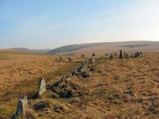
Stall Moor (Upper Erme) Stone Row
Prehistoric Dartmoor Walks: Dartmoor Site: Upper Erme Stone Row & Cairn Circle
OS Map: SX 63663 67796
HER: MDV4309
Megalithic Portal: 1464
The Stone Rows of GB: Upper Erme
PMD: Stall Moor Stone Row
Alternate name: Upper Erme Row Stone Row
ShortName: SR Stall Moor
Butler map: 55.7
DPD page: 71
Notes: Worth: Stall Moor. Butler: Upper Erme. The longest stone row on Dartmoor. "A single stone row running for approximately 3.1km from a cairn on Green Hill to a stone circle on Stall Moor". Lethbridge pp.71-72, diagram p.71
Nearby sites: SX 63663 67796
Distance: 2.52km
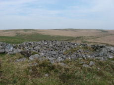
Upper Erme Cairn
OS Map: SX 63522 64958
HER: MDV4366
Megalithic Portal: 15210
Alternate name: Erme Plains Cairn
ShortName: CN Upper Erme
Butler map: 55.7.2
Grinsell: COR 9
Notes: "A round cairn, measuring 13.8 to 14.6m diameter and 1.0m high. It lies on a false crest, adjacent to a stone row, SX 66 NW 20, and just above the River Erme, at 380m above OD, is constructed of small boulders, and has a central hollow, 0.7m deep. In fair condition, though a small shelter has been built on its north side." The photo used here was taken in 2011 and attached to this record retrospectively in 2020 - identification is most probable but not 100% certain.
Nearby sites: SX 63522 64958
Distance: 2.54km
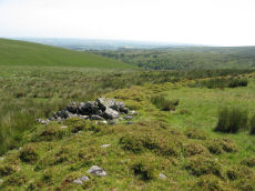
Yealm Steps Enclosed Settlement
OS Map: SX 62065 63607
HER: MDV4273
Megalithic Portal: 45575
ShortName: ES Yealm Steps
Notes: "A fine example of enclosure and hut circles. Extensive prehistoric settlement area. Two villages contiguous, the larger pound a development of the smaller. Pound walls and those of huts consist of stone and turf. At least 22 huts within the enclosure. To the north and south of the pounds are scatters of isolated huts generally much larger than the enclosed huts. On the south there are remains of fields or paddocks. Rough moorland."
Nearby sites: SX 62065 63607
Distance: 2.95km