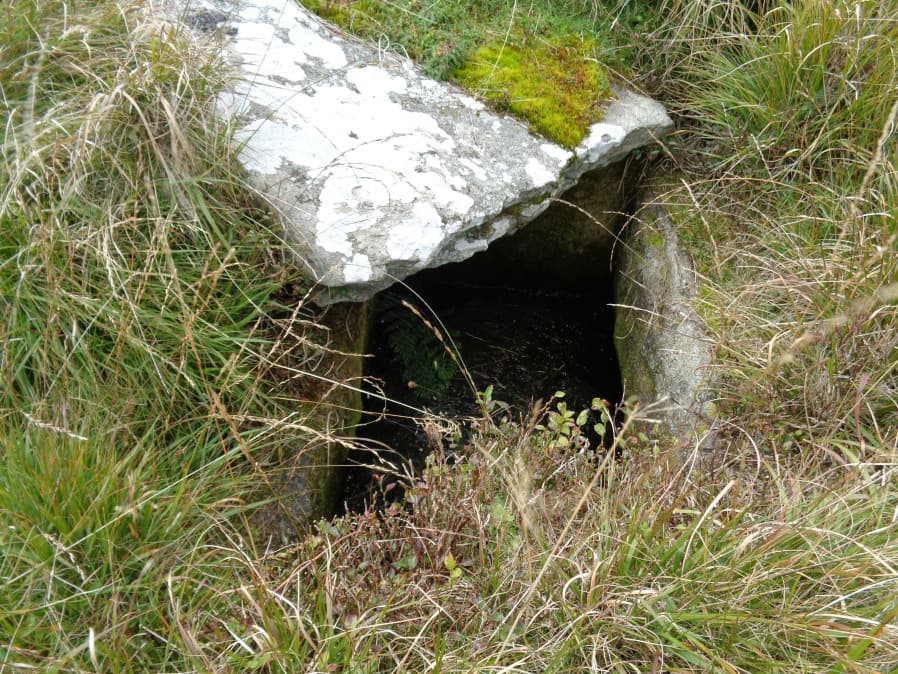
Redlake Foot (Brown Heath) Cist

Photo taken on 18-09-2017

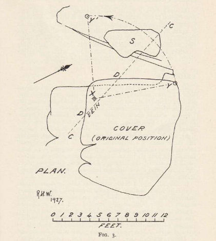
Plan by RHW. Barrow Report 60. TDA Vol.73 1941
Database entries
OS Map: SX 63778 66069
OS Source: Garmin
Butler OS: SX63776607
HER: MDV5102
Megalithic Portal: 45760
PMD: Brown Heath
Alternate name: Brown Heath
Short Name: CT Brown Heath
Butler map: 55.7.3
Dixon Cist #: 102
Grinsell: HARFORD 1
DPD page: 73
Exist: Yes
Record: Unique
Record Source: Butler
Hut Class: No
Cist Class: Yes
Cairn Class: Yes
Barrow Report: 60 69 71
Dimensions (m): 6.5 x 0.5 C
Lidar: SX 63778 66069
Guide Map: 51
Nearest Bus Stop: Cornwood Crossways (9.5 km) [Route: 59]
Nearby sites: SX 63778 66069
Notes
"A fine cist at Redlake Foot measuring internally, 0.7m. by 1.0m. and 1.0m. deep single slabs form the end-stones and the southern side-stone. The northern side is a slab resting on a horizontal 'post' type stone" Cover slab partly displaced from the sides. Lethbridge p.73, diagram p.71. Butler Brown Heath (Cairn 3) - Vol. 4. Map 55.7.3 (p.76-7 diagram p.76).References
These are selected references with an emphasis on out of copyright sources linked as PDFs. For more detailed references try any linked HER or PMD record above.
- Butler, Jeremy, Dartmoor Atlas of Antiquities, vol.4: The South-East, (1993)
- Dixon, C.E.B., Barrow Report 71, T.D.A. Vol.85 pp.176-177 (1953)
- Grinsell, L.V., Dartmoor Barrows, Devon Archaeological Society Proceedings No.36 (1978)
- Lethbridge, William D., Discover Preshistoric Dartmoor, (2015)
- Newman, Phil, The Upper Erme Valley Dartmoor National Park Devon An Archaeological Survey, Southwest Landscape Investigations (2018)
- Worth, R. Hansford, Barrow Report 21, T.D.A. Vol.34 pp.104- 146 (1902)
- Worth, R. Hansford, Barrow Report 60, T.D.A. Vol.73 pp.51-59 (1941)
- Worth, R. Hansford, Barrow Report 69, T.D.A. Vol.82 pp.45-48 (1950)