

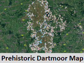
Suggested Prehistoric Dartmoor Walks
The following suggested walks are featured on this site. Click on the header or the picture on the left to go to the walk. Each walk includes an OS map of the route. The OS map includes a tool which enables panning in and out. The OS OpenSpace maps are not as detailed as the OS Leisure (OL28) Explorer Map for Dartmoor which should be used in conjunction with these maps. Many of the routes are lengthy which is a necessity if using public transport. Some of the routes can be adapted and shortened by the use of a car, check the OS Leisure map or walking guide books for suitable parking. There are many good B&Bs and campsites around the moor and wild camping is permitted. If new to walking on the moors then try the shorter walks first.
Walking on Dartmoor can be very enjoyable but this can be spoilt if you are not sufficiently prepared. Ensure you have suitable walking boots, clothing and plenty of food and water. The OS Leisure map and a compass are essential and water proofs are advisable as the weather can change suddenly on the moors. The unexpected can happen on long walks so let someone know where you are going in case there is a problem as there will be no mobile phone reception on large parts of the moor. Allow at least 1 hour for every 3km (less than 2 miles) or at least 4 hours for 10Km. The 20km walks can be done in around 8 hours but ensure there is plenty of time left to get that last bus home! Enjoy!
UPDATE SUMMER 2024
Many of these walks were based on the 82 Transmoor Bus service that was discontinued in 2015. As of May 2024 there is a new "transmoor" bus service (171/172) that will allow 5 hour walks from the central moor. There is also now a very reliable train service to Okehampton and the useful 118 bus down to Tavistock. On summer Saturdays there is also the Haytor Hoppa bus. Many of these walks are possible once again or can be adapted and for that reason they have been retained here even if some are no longer possible - especially the longer 8 hour walks involving the old Tansmoor bus.
Details of public transport can be found on The Guide to Public Transport page.
If venturing onto the firing ranges on the northern moor then check firing times, see: Dartmoor firing times.
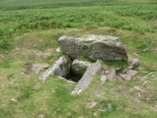
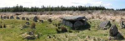
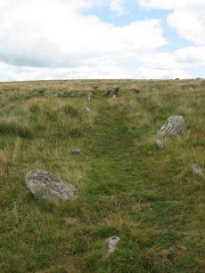
Burrator 1: Down Tor Stone Row and Cairn Circle
ROUTE: Short walk. Start Sharpitor Car Park Sharpitor Car Park. Distance 11km.
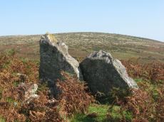
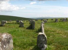
SITES OF INTEREST: Hart Tor Double Stone Row & Cairn Circle, Down Tor Stone Row and Cairn Circle.
PUBLIC TRANSPORT: Stagecoach 98 bus from Yelverton to Sharpitor car park (just beyond Dousland/Burrator Inn). Alternatively start from Princetown using the Country Bus 171 and adapt walk. Originally based on discontinued 82 Transmoor bus
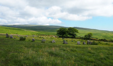
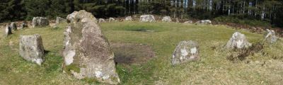
Burrator 2: Yellowmead and Drizzlecombe
ROUTE: Long walk. Start Burrator Inn. Finish Sharpitor Car Park. Distance 17km.
SITES OF INTEREST: Yellowmead 4-circle Cairn. Drizzlecombe Complex.
PUBLIC TRANSPORT: Stagecoach 98 bus from Yelverton to Sharpitor car park (just beyond Dousland/Burrator Inn) but would require fast walking. Probably better to start from Princetown using the Country Bus 171 and adapt walk. Originally based on discontinued 82 Transmoor bus.
Burrator 3: Ringmoor, Brisworthy Circle and Legis Pound
ROUTE: Long walk. Start Burrator Inn. Marchant's Cross. Ringmoor Down. Legis Tor. Great Trowlesworthy Tor. Ditsworthy Warren House. Drizzlecombe. Deancombe, Burrator. Finish Sharpitor Car park. Distance 20km.
SITES OF INTEREST: Ringmoor Down Cairn Circle. Brisworthy Stone Circle. Legis Tor Settlements. Trowlesworthy Settlements, Row and Cairn Circle. Drizzlecombe.
PUBLIC TRANSPORT: Walk originally based on the discontinued Transmoor Bus Service. Walk could be done as a south-north walk using the Plymouth Citibus 59 to Lee Moor and getting the Stagecoach 98 (Sharpitor or Dousland) or Country Bus 171 (Princetown) home.
Ivybridge 1: East Erme - Butterdon Hill, Piles Hill & Corringdon Ball
ROUTE: Easy medium length walk. Start Ivybridge Train Station. Stowford Bridge. Butterdon Hill, Piles Hill, Glasscombe Corner, Corringdon Ball. Finish Ivybridge Train Station. Distance 16km.
SITES OF INTEREST: Rows, Cairns & Chambered Tomb; Butterdon Hill, Piles Hill, Glasscombe Corner & Corringdon Ball
PUBLIC TRANSPORT: Daily train to and from Ivybridge.
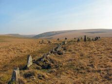
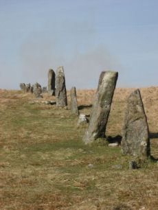
Ivybridge 2: West Erme - Burford, Stalldown and Erme Rows and Cairns
ROUTE: Long walk. Start Ivybridge Train station. Burford Down (optional), Stalldown, Erme Circle. Finish Ivybridge Train station. Distance 28km
SITES OF INTEREST: Burford, Stalldown and Erme Stone Rows and Cairns
PUBLIC TRANSPORT: Daily train to and from Ivybridge.
Ivybridge 3: The Neolithic tombs of Cuckoo Ball & Corringdon Ball
ROUTE: Easy medium length walk. Start Ivybridge Train Station. Davey Cross. Butterdon Hill, Piles Hill, Glasscombe Corner, corringdon Ball, Butter Brook reservoir. Finish Ivybridge Train Station. Distance 15km.
SITES OF INTEREST: Cuckoo Ball & Corringdon Ball Chambered Tombs, Butterdon Hill Long Cairn, stone rows on Piles Hill, Glasscombe Corner, Butterdon Hill & Butter Brook. Butter Brook settlements & standing stone.
PUBLIC TRANSPORT: Daily train to and from Ivybridge.
Moretonhampstead 1: Mardon Down Stone Circle & Cairns
ROUTE: Short walk. Start Moretonhampstead. Mardon Down. Clifford Bridge. Finish Steps Bridge. Distance 10km.
SITES OF INTEREST: Mardon Down Stone Circle & Cairns
PUBLIC TRANSPORT: Exeter to Moretonhampstead via Dunsford (Country Bus 359) runs Monday to Saturday. The last bus from Moretonhampstead to Exeter leaves at 16.15 to return to Exeter. This still leaves plenty of time for this walk.
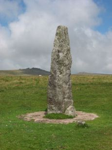
Moretonhampstead 2: Butterdon Hill (nr Moretonhampstead) Standing Stone
ROUTE: Short walk. Start Moretonhampstead. Butterdon Hill. Cranbrook. Fingle Bridge. Clifford Bridge. Finish Steps Bridge. Distance 15km. Allow 4.5 hours minimum.
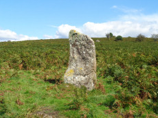
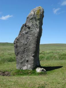
SITES OF INTEREST: Butterdon Hill (nr Moretonhampstead) Standing Stone
PUBLIC TRANSPORT: Exeter to Moretonhampstead via Dunsford (Country Bus 359) runs Monday to Saturday. The last bus from Moretonhampstead leaves at 16.15 to return to Exeter. This still leaves plenty of time for this walk.
Okehampton: Belstone and Cosdon Hill
ROUTE: Long Hilly walk. Start Okehampton. Follow East Okement to Belstone Common. Over Belstone Tor and on to Little Hound Tor. Round Cosdon Hill to South Zeal and Sticklepath. Distance 16km.
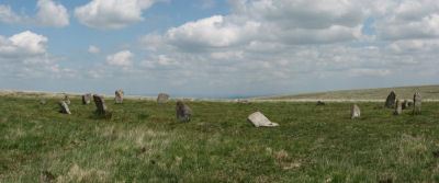
SITES OF INTEREST: Belstone Nine Maidens Cairn Circle. Little Hound Tor Stone Circle. Cosdon Hill Triple Stone Row
PUBLIC TRANSPORT: Dartmoor Line train Exeter to Okehampton.
Postbridge 1: Multiple sites on Lakehead Hill
ROUTE: Easy walk. Start Postbridge, over Lakehead Hill and Bellever Tor to Dunnabridge Pound - return to Postbridge via Laughter Tor. Distance 11km.
SITES OF INTEREST: Lakehead Hill - settlements and numerous cists, cairn circles and stones rows. Bellever settlements. Dunnabridge Pound. Laughter Tor - standing stone, stone row and settlements
PUBLIC TRANSPORT: Country Bus 171. Originally based on discontinued 82 Transmoor bus.
Postbridge 2: Soussons Circle, Cator Pound, Challacombe
ROUTE: Easy walk. Start Postbridge. Path through Pizwell. Cator Common. Soussons Down. Vitifer Mine. Challacombe Down. Finish Warren House Inn. Distance 12km.
SITES OF INTEREST: Pizwell Medieval Village, Soussons Cairn Circle, Cator Pound, Challacombe Triple Stone Row
PUBLIC TRANSPORT: Country Bus 171. Originally based on discontinued 82 Transmoor bus.
Princetown 1: Merrivale Complex & Walkhampton Settlements
ROUTE: Easy walk. Start Princetown. Finish Princetown. Distance 11km.
SITES OF INTEREST: Merrivale Complex & Walkhampton Settlements
PUBLIC TRANSPORT: Country Bus 171 or Stagecoach 98. Originally based on discontinued 82 Transmoor bus.
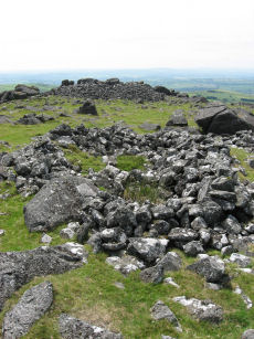
Princetown 2: White Tor Fort & Langstone Moor Circle & Settlements
ROUTE: Long walk. Start Princetown (for Merrivale). Finish Princetown. Distance 21km.
SITES OF INTEREST: White Tor Fort; Langstone Moor Menhir, Stone Row and Stone Circle. Langstone Moor Settlements
PUBLIC TRANSPORT: Country Bus 171 or Stagecoach 98 but walk may have to be shortened. Walk originally based on the discontinued Transmoor Bus Service.
FIRING RANGE NOTICES: Langstone Moor is within the Merrivale Firing Range. Check Dartmoor Training Area Firing Notice for the Firing Programme before walking this route.
Sharpitor 1: Sharpitor area Stone Rows and Cists
ROUTE: Short walk. Start Sharpitor Car Park. Finish Sharpitor Car Park. Distance 10km.
SITES OF INTEREST: Sharpitor Stone Rows, Hart Tor Stone Row, Peek Hill Cist, Raddick Hill Cist, Ingra Cist, Black Tor Stone Row
PUBLIC TRANSPORT: Walk originally based on the discontinued Transmoor Bus Service. Probably now possible starting from Plymouth to Yelverton or starting from Tavistock.
Warren House Inn 1: Fernworthy and Grey Wethers
ROUTE: Easy walk. Start Warren House Inn. Hurston Ridge to Fernworthy reservoir. Fernworthy Forest to Grey Wethers. Finish Postbridge. Distance 13km.
SITES OF INTEREST: Hurston Ridge Double Stone Row, Fernworthy Stone Circle, Grey Wethers Double Stone Circle
PUBLIC TRANSPORT: Country Bus 171. Walk originally based on the discontinued Transmoor Bus Service.
Warren House Inn 2: Kestor, Shovel Down & Scorhill Stone Circle
ROUTE: Long walk. Start Warren House Inn. Fernworthy reservoir. Thornworthy Tor. Middle Tor and Kestor. Batworthy Corner. Scorhill Down. Shovel Down. Fernworthy. Finish Warren House Inn. Distance 17km.
SITES OF INTEREST: Shovel Down Ceremonial complex, Round Pound and Kestor Settlements, Scorhill Stone Circle
PUBLIC TRANSPORT: Country Bus 171 but walk may need to be shortened. Alternatively use the Stagecoach 173 bus to or from Chagford. Walk originally based on the discontinued Transmoor Bus Service.
Page last updated 28/03/2024