
Deadman's Bottom, South Ring Setting Cairn and Cist
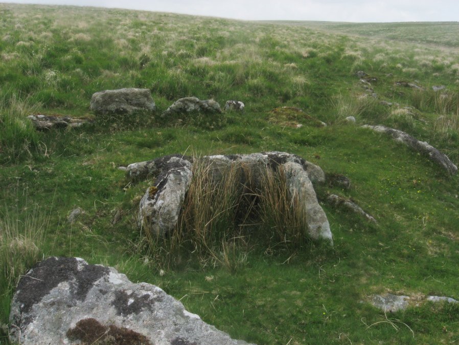
Photo taken on 04-06-2016
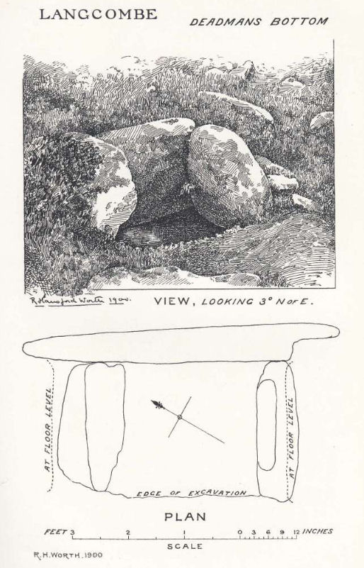
Plan by RHW. Barrow Report 19. TDA Vol.32 1900
Database entries
PDW coverage: Dartmoor Site: Guide to the Langcombe Brook & Deadman's Bottom Cists
OS Map: SX 60788 66892
OS Source: Garmin
Butler OS: SX60786688
HER: MDV5119
Megalithic Portal: 3194
PMD: Deadman's Bottom N 2
Alternate name: Langcombe Brook 1
Short Name: CT Deadmans S
Butler map: 50.3.1
Dixon Cist #: 7
Grinsell: SHAUGH PRIOR 8
Turner: D12
DPD page: 45
Exist: Yes
Record: Unique
Record Source: Butler
Hut Class: No
Cist Class: Yes
Cairn Class: Yes
Barrow Report: 12 19
Dimensions (m): 5.0 x 0.2 C
Lidar: SX 60788 66892
Guide Map: 50
Nearest Bus Stop: Lee Moor Clearview (7.9 km) [Route: 59]
Nearby sites: SX 60788 66892
Notes
"Cairn consists of a stony mound, c 6.1m in diameter and c 0.5m high, contained by granite slabs some upright some fallen. The southern quadrant of the cairn has been disturbed. The remains of a very fine cist, box dimensions c. 0.8 x 0.7m internally, survives at its centre." One side slab and the cover-stone of the cist are missing although both could be slabs nearby. The cover-stone may be the large slab which lies to the south. Lethbridge p.45 Langcombe Cist D - diagram p.43 Dixon #7. Bar Rep. 19. Butler Langcombe Brook 1 (Cist 1) Vol. 3. Map 50.3 (pp.148-54 general plan of Langcombe Brook cairns p.151, diagram of Deadmans Bottom cists p.149).References
These are selected references with an emphasis on out of copyright sources linked as PDFs. For more detailed references try any linked HER or PMD record above.
- Butler, Jeremy, Dartmoor Atlas of Antiquities, vol.3: The South-West, (1994)
- Grinsell, L.V., Dartmoor Barrows, Devon Archaeological Society Proceedings No.36 (1978)
- Lethbridge, William D., Discover Preshistoric Dartmoor, (2015)
- Turner, J.R., Ring Cairns, stone circles and related monuments on Dartmoor, D.A.S.P. No.48 pp.27-86 (1990)
- Worth, R. Hansford, The Erme, Yealm and Torry part 1, T.P.I. Vol.11 part 1 pp.173-183 (1892)
- Worth, R. Hansford, Barrow Report 19, T.D.A. Vol.32 pp.46-54 (1900)
- Worth, R.N., Barrow Report 12, T.D.A. Vol.22 pp.49-52 (1890)