
Deadmans Bottom E Cist
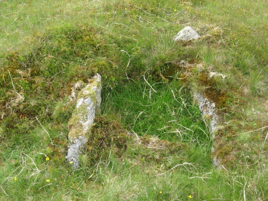
Photo taken on 04-06-2016
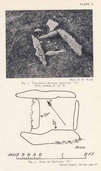
Plan by RHW. Barrow Report 53. TDA Vol.66 1934
Database entries
PDW coverage: Dartmoor Site: Guide to the Langcombe Brook & Deadman's Bottom Cists
OS Map: SX 60984 66714
OS Source: Garmin
Butler OS: SX60996669
HER: MDV5122
Megalithic Portal: 45732
PMD: Deadman's Bottom S 9
Alternate name: Langcombe Brook 9
Short Name: CT Deadmans E
Butler map: 50.3.9
Dixon Cist #: 56
Grinsell: SHAUGH PRIOR 11
DPD page: 45
Exist: Yes
Record: Unique
Record Source: Butler
Hut Class: No
Cist Class: Yes
Cairn Class: Yes
Barrow Report: 53
Dimensions (m): 5.0 x 0.3 C
Lidar: SX 60984 66714
Guide Map: 50
Nearest Bus Stop: Lee Moor Clearview (7.9 km) [Route: 59]
Nearby sites: SX 60984 66714
Notes
"Cist (Listed as 'E' by Worth) found at Deadman's Bottom, Langcombe, by Mr. Button. Probable original dimensions, length 2ft 2 ins, width 1ft. 5ins. The stones barely show above the surface and the cover-stone is missing." ... "A well defined cairn 6.0m in diameter and 0.4m high with a cist in the top. This stone-lined cist measures 0.7m by 0.5m internally and 0.3 deep. Two of the side stones have fallen inwards." Lethbridge p.45 Langcombe Cist F - diagram p.43 Butler Langcombe Brook Cairn 9 - Vol. 3. Map 50.3 (pp.148-54 general plan of Langcombe Brook cairns p.151, diagram of Langcombe cists p.153).References
These are selected references with an emphasis on out of copyright sources linked as PDFs. For more detailed references try any linked HER or PMD record above.
- Butler, Jeremy, Dartmoor Atlas of Antiquities, vol.3: The South-West, (1994)
- Grinsell, L.V., Dartmoor Barrows, Devon Archaeological Society Proceedings No.36 (1978)
- Lethbridge, William D., Discover Preshistoric Dartmoor, (2015)
- Worth, R. Hansford, Barrow Report 53, T.D.A. Vol.66 pp.39-42 (1934)