
Hentor Cist
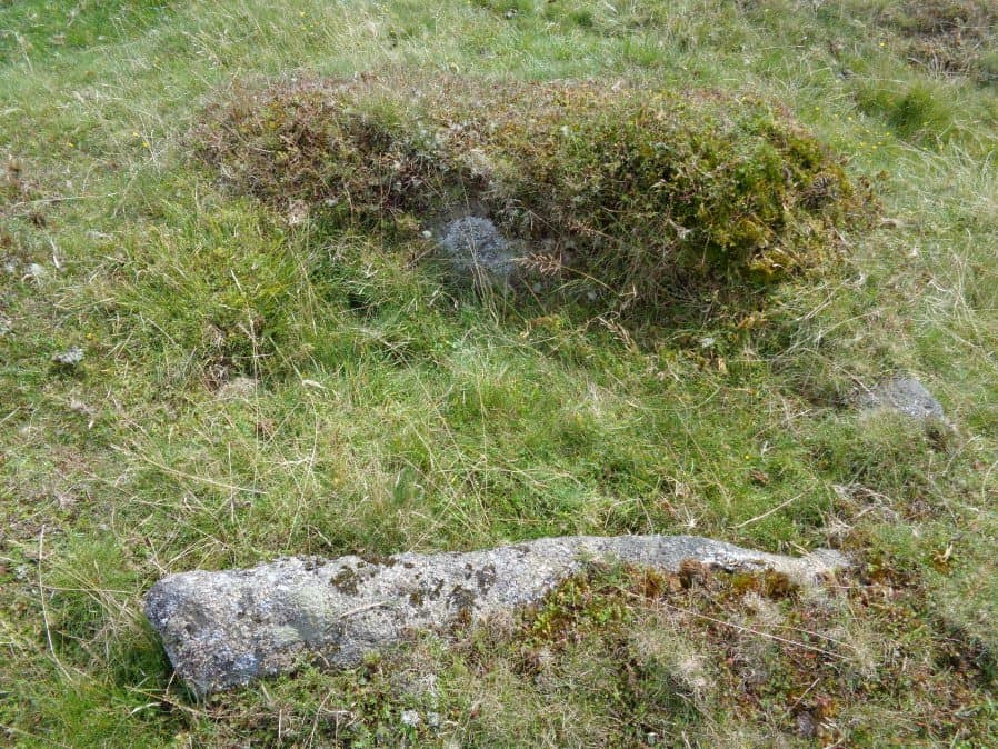
Photo taken on 13-08-2017
Database entries
PDW coverage: Dartmoor Site: Guide to the Hentor & Shavercombe Brook Cists
OS Map: SX 59252 65720
OS Source: Garmin
Butler OS: SX59256571
HER: MDV55317
Megalithic Portal: 45790
PMD: Hen Tor Warren 1
Alternate name: Hen Tor N.1
Short Name: CT Hen Tor N 1
Butler map: 49.22.1
Dixon Cist #: 131
DPD page: 51
Exist: Yes
Record: Unique
Record Source: Butler
Hut Class: No
Cist Class: Yes
Cairn Class: Yes
Dimensions (m): 3.5 x 0.4 C
Lidar: SX 59252 65720
Guide Map: 49
Nearest Bus Stop: Lee Moor Clearview (5.6 km) [Route: 59]
Nearby sites: SX 59252 65720
Notes
Butler Hen Tor 1 (Cairn 1) - Vol. 3. Map 49.22 (general plan of Hen Tor with diagram of cists pp.146-7). "A low earthen barrow or cairn with cist. The barrow is 4m by 3.5m and 0.6m high. The centrally placed cist is 1.2m by 0.75m. internally and 0.2m deep. Three side stones visible, with the cist aligned north-east/south-west, but no coverstone. The overall condition is fair". Lethbridge p.50-51 Shavercombe Cist F - diagram p.49.References
These are selected references with an emphasis on out of copyright sources linked as PDFs. For more detailed references try any linked HER or PMD record above.
- Butler, Jeremy, Dartmoor Atlas of Antiquities, vol.3: The South-West, (1994)
- Lethbridge, William D., Discover Preshistoric Dartmoor, (2015)