
Knackersmill Gulf N. Cist
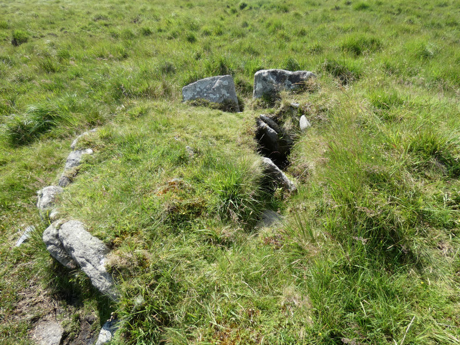
Photo taken on 16-07-2021
Database entries
OS Map: SX 63390 65587
OS Source: Garmin
HER: MDV13185
Megalithic Portal: 45759
PMD: Stinger's Hill
Alternate name: Knackersmill Gulf N.
Short Name: CT Stingers
Butler Vol 5: p.180 & Fig.122
Dixon Cist #: 104
Grinsell: CORNWOOD 8
DPD page: 73
Exist: Yes
Record: Unique
Record Source: Butler
Hut Class: No
Cist Class: Yes
Cairn Class: Yes
Dimensions (m): 4 x 0.6
Lidar: SX 63390 65587
Guide Map: 51
Nearest Bus Stop: Cornwood Crossways (8.7 km) [Route: 59]
Nearby sites: SX 63390 65587
Notes
The NMR gives SX63376494 as the grid reference - this error is replicated in HER entry 28468. The author could not find a cist there. As PMD points out that is the location of Grinsell's CORNWOOD 9 cairn and not CORNWOOD 8. "A cist 1.20m. by 0.60m. with a close set retaining kerb circle 4.0m. in diameter is situated on Stinger's Hill opposite Erme Pound". Lethbridge Stingers Hill cist p.73. diagram p.71. Butler Map 55.7. (diagram Vol. 5. p.180). The author visited this site on 16/7/21 and the grid reference is confirmed as listed on this record.References
These are selected references with an emphasis on out of copyright sources linked as PDFs. For more detailed references try any linked HER or PMD record above.
- Butler, Jeremy, Dartmoor Atlas of Antiquities, vol.5: The Second Millennium B.C., (1997)
- Grinsell, L.V., Dartmoor Barrows, Devon Archaeological Society Proceedings No.36 (1978)
- Lethbridge, William D., Discover Preshistoric Dartmoor, (2015)
- Newman, Phil, The Upper Erme Valley Dartmoor National Park Devon An Archaeological Survey, Southwest Landscape Investigations (2018)