
Guide to the Stone Rows of Dartmoor
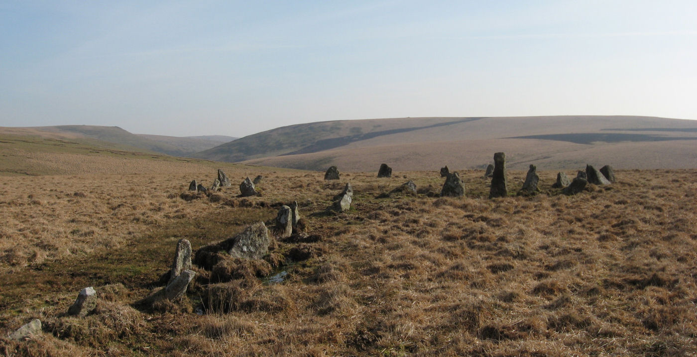
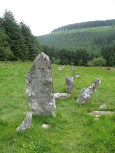
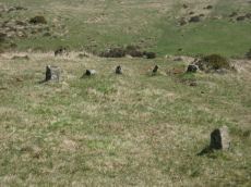
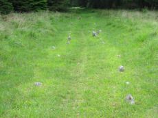
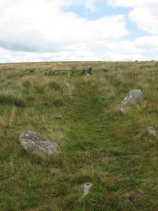
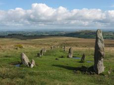
Photo: The Dancers Cairn Circle and Stall Moor (Upper Erme) Stone Row
Perhaps the most distinctive and enigmatic of the prehistoric monuments on Dartmoor are the stone rows. Dartmoor has the largest concentrations of stone rows of any area in Britain. There are over seventy stone rows known on Dartmoor today (see listing below) although there were probably once considerably more. A small number of the rows recorded by antiquarians in the nineteenth century have disappeared either through destruction at the hands of road and newtake wall builders whilst others may have simply receded into the peat1.
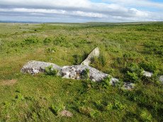
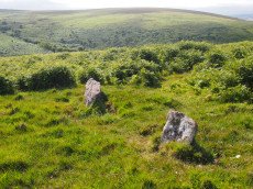
The stone rows consist of one or more roughly straight lines of standing stones many of which include structures such as cairn circles or large standing stones at either or both ends. The rows consist of a wide variety of size stones and a wide variety of lengths.
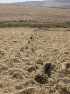
The single rows are typically 40 to 200 m in length2 although there are four rows on the southern moor which are over 0.5 km in length (Burford Down, Stall Moor (Upper Erme), Stalldown and Butterdon Hill). Curiously these four rows are all very roughly north-south in orientation. The longest is the Stall Moor stone row which stretches for 3.1 km from The Dancers (Upper Erme) cairn circle over rough terrain with stones going up and down gullies all the way to a cairn on Green Hill.
There are many double and a few triple stone rows on Dartmoor. These rows are typically between 100m and 200m in length. Particularly fine examples of double rows include Merrivale, Hurston Ridge and the Assycombe stone rows. The Cosdon and Challacombe rows are the most impressive of the triple stone rows. At Corringdon Ball there is an odd complex variously described as a seven-fold stone row or a combination of two triple stone rows consisting of very small stones.
The double stone rows have often been referred to as stone avenues suggesting that they may have had some kind of ritual processional purpose. However whilst some have an average spacing of around 3.0m between the rows many have spacing less than 0.5m, some as narrow as 0.2m which is too narrow for a ritual pathway. The spacing of the stones within a row is very irregular as is the spacing in-between rows3. A good example is the Assycombe double stone row which has a distance between the rows that fluctuates wildly between 1.0m and 1.6m.
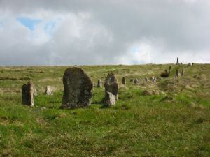
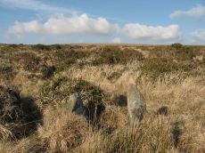
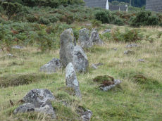
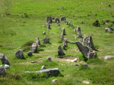
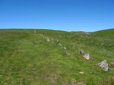
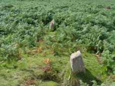
Hurston Ridge Stone Row
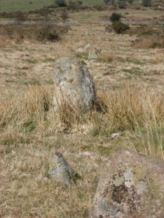
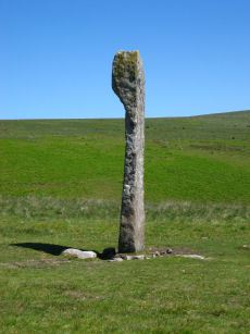
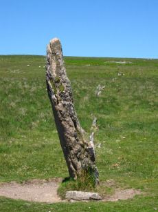
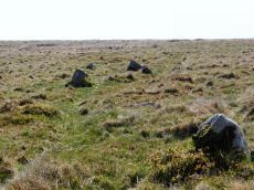
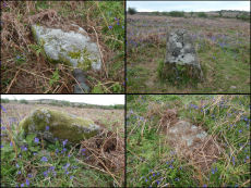
The stones of the rows vary in size with the majority consisting of stones less than 1m high for most of their length. Many of the rows consist of very small stones but often there will be a large terminal standing stone. The most impressive of these are the Drizzlecombe stone rows one of which has a terminal standing stone 4.2m high. Other notable examples include the Langstone Moor stone row, the Laughter Tor double stone row and the Shovel Down Longstone stone row. According to an account by Wilkinson in 1859 the Hart Tor double stone row was “terminated by a large monolith, now fallen, measuring about 25 feet long by 2 feet and 3 inches”, sadly this massive stone has long disappeared. A small number of the double rows have transverse blocking stones at the lower end, a good example being the Hurston Ridge row.
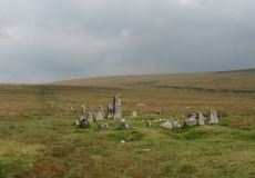
Cairns are also commonly associated as terminal features of the stone rows typically at the upper end. Fine examples include the Down Tor, Trowlesworthy East, Hart Tor and Ringmoor stone rows. In the case of single rows there is often a cairn at one end followed by a row of small stones ended by a large terminal stone a good example being the Drizzlecombe stone rows. Some of the rows have cairns and cists alongside them and in the case of one of the Merrivale double rows there is a large cairn actually within the row about midway along its length. A few of the rows form part of a ceremonial complex with other associated monuments such as stone circles, cists, cairns and standing stones such as at Merrivale, Fernworthy, Shovel Down and Drizzlecombe.
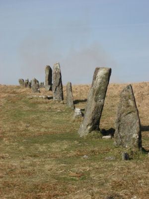
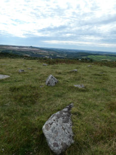
Perhaps the most impressive stone row still standing is the megalithic in proportion Stalldown stone row (see photo). This consists of massive blocks with mostly 1m to 1.5m high with four over 2m. The fallen stones of the Piles Hill stone row suggest it would have been even more striking with over 30 stones being between 2m and 3m in length. In 2004 a new stone row was discovered on Cut Hill which consists of massive fallen slabs over 2m in length. The Cut Hill row is the only row to have solid dating evidence, carbon dating of the peat surrounding the recumbent stones suggests a date “around the second half of the fourth millennium BC”.4 It is thought that most of the cairn circles and cists date to the early Bronze Age which would suggest a similar date for most of the stone rows but clearly the Cut Hill example is earlier dating back into the Neolithic. This suggests that the stone rows may have been constructed over a prolonged period of time through the late Neolithic and the early Bronze Age. It could be that the more megalithic in proportion rows are earlier but without firm evidence this is mere speculation. The association of many rows with cairns suggests that most of the stone rows are related to burial customs although care is needed when generalising to all stone rows as they are so varied in form. Also Emmett suggests it could be possible that these monuments could have had multiple phases of construction with cairns added later. To understand the stone rows better it is necessary to consider the environment at the time of construction.
Dartmoor Stone Rows in Context
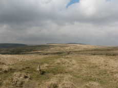
The first thing that should be considered is the environment in which these structures were erected. Today it is largely open moorland but in the Mesolithic these upland areas were largely forested. The first farmers started to change the environment and a process of deforestation started to take place. Initially Mesolithic clearances would have started to cause forest recession on higher ground. Later there would have been clearings on lower land with otherwise continuous forest. Much of Dartmoor would have been forested at the time these monuments started to be erected.
Until recently the only stone row on Dartmoor to undergo a detailed archaeological dig was the Cholwich Town stone row which was excavated in 1961 prior to being buried underneath waste from the china clay works. The pollen evidence suggested it was constructed in a clearing of grassland or heath land within a forest of alder, oak and hazel.
The Cholwich Town example suggests that many of the stone rows would not have been constructed on open moorland as we see it today, instead they were constructed on the forest margins when the valley slopes and bottoms were still forested. The altitude and location of the stone rows, around the altitude of the then forest margins, is similar to those of the cairn circles but notably different to the location of the hut circles which came later largely on lower ground in the valleys. Emmett suggests that the clear implication “is that the rows are earlier than the ubiquitous, valley sited, later Bronze Age settlements, and roughly contemporary with the elusive earlier Bronze Age settlements, at a time when Dartmoor was still largely forested”.4 The recent dating of the Cut Hill stone row fits this general picture of the rows belonging to a period before the later Bronze Age settlement remains that can be seen today. In fact in this particular case the row, which is at a higher altitude than any other, is much earlier than previously thought for rows dating as it does to much earlier in the Neolithic.
There was a major study of 71 Dartmoor stone rows carried out by Emmett in 1979 (Stone rows: the traditional view reconsidered, D.A.S.P. No. 37 pp. 94-114). The orientation of the rows was largely random depending on the slopes they were sited on as the rows tend to gently ascend slopes. There was a very slight bias in the data to alignments in the NE quadrant but Emmett suggested this merely reflected a preponderance of rows in southern and eastern Dartmoor (there are very few in north-west Dartmoor). Giving a precise orientation was also impossible because many of them are not straight with bends and curves along the length. According to Butler a closer inspection of row orientation does also bring out a possible tendency towards orientation towards the cardinal points for some of the rows5.
The vast bulk of the rows have cairns at one end or sometimes at both ends. Emmett pointed out that it was impossible to say without excavations whether or not the cairns and the rows at each site were constructed at the same time. However, it seems likely that they were, which would suggest they are burial monuments. Claims for astronomical or solstice alignments for the vast majority of rows does not fit with their orientations and rough construction. The spacing of the stones within a row is very variable and for double and treble rows the spacing between the rows is very variable and the rows are generally “wriggly” with random kinks and curves along their length. According to Emmett:
“The obvious conclusion is that the exact stone position was irrelevant ... The general random nature of stone placing throughout, leads to the conclusion that rows were not precisely designed monuments, but structures built for an overall impression”.
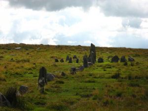
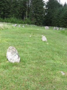
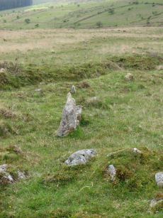
Down Tor Cairn Cirlce and Stone Row
There has long been speculation that Dartmoor stone rows have an astronomical purpose. The evidence for most of the rows does not support such a theory. The astronomer Lockyer made claims in 1906 that Merrivale and a number of other sites had astronomical purposes. R.H. Worth was rather scathing about such suggestions. In the case of Trowlesworthy, which Lockyer claimed pointed to Arcturus in 2100 BC, Worth simply pointed out that one end of the row was not visible from the other as it went over a hill - so it could not possibly be used for such a purpose6. Jack Walker's book Dartmoor Sun has beautiful pictures of the stones of the Down Tor stone row at the summer and winter solstices casting their shadows along the line of the row7. It is of course not impossible that this is by design but a simpler explanation is that with over 70 stone rows with widely variant orientations it is not surprising that one may have by chance the right orientation for this to happen. There is no credibility to claims that Dartmoor stone rows have an astronomical purpose.
In contrast to the stone rows the cists do have a very obvious alignment as first noted by Worth8. About 94% of them have the long axis within the NW/SE quadrants skewed by about 5 degrees on average. It would appear that some rough orientation towards the sun was a factor in the orientation of cists. According to Butler this pattern is not repeated on Bodmin Moor where the orientation of cists “is too variable to be significant”. Clearly burial customs and monument construction had a local character in the prehistoric. It is interesting to note that there are very few stone rows on Exmoor in North Devon instead there are curious arrangements of very small stones in rectangular structures known as stone settings. There are a small number of stone rows elsewhere in North Devon and some on Bodmin Moor but they appear to be quite different to the Dartmoor rows. The greatest concentration of stone rows in the British Isles outside of Dartmoor are to be found on the upland fringes in counties Derry, Fermanagh and Tyrone in Northern Ireland. There are also sites consisting of very small stones known as stone fans in NE Scotland which apparently have similarities with the Corringdon Ball stone rows.
The Exploration and Restoration of Dartmoor Stone Rows
One of the earliest accounts of a “stone avenue” on Dartmoor appears in Richard Polwhele's 1793 book Historical Views of Devonshire. This was actually written by Rev. John Swete and is a description of a supposed “druid way” near Spinsters Rock. Whilst there are still some “conical pillars” near Spinsters Rock these remains may no longer exist although a dig on Shilstone Common by Tyler in 1930 probably rediscovered cairn circles associated with these old reports. Polwhele in his descriptions of monuments in Devon, and his contemporary Borlase in his writings on Cornwall, attributed monuments and natural features such as rock basins as being the temples and places of worship of the Druids. This tradition of association of prehistoric monuments to the Druids was continued by Samuel Rowe in his classic 1848 work A Perambulation of Dartmoor. This was based on an earlier article Antiquarian Investigations in the Forest of Dartmoor, Devon published in 1830 in the Transactions of the Plymouth Institute. He introduces his paper by saying that the remoteness of Dartmoor has prevented the destruction of ancient remains but they are at risk, he stated:
“In these districts, therefore, the antiquary naturally looks for the vestiges of this people and their times; and as many of the most interesting relics are in hourly danger of spoliation, the notices in the following paper have been collected and published, with the hope that some may escape impending destruction, and that others may be preserved from that oblivion which appears to endanger the very memory of their existence”.9
These sentiments were reflected later in the concerns of the Dartmoor Preservation Society and the activities of the Dartmoor Exploration Committee. In the early nineteenth century stones from monuments were being plundered by road builders and there was an active campaign to make land productive for agriculture and as a consequence stones were being utilised for new buildings and new-take walls. This was also a period of industrial development on Dartmoor with leats, tramways associated with mining and railways starting to be built.
Rowe's 1830 article was one of the first to give descriptions of stone rows on Dartmoor. He gives accounts of Merrivale, Black Tor (Hart Tor), Challacombe, Watern Hill (Hurston Ridge - later claimed as being discovered by George French and the Dartmoor Exploration Committee) and the Shovel Down stone rows. A Perambulation of Dartmoor was majorly revised in a third edition in 1895 by Rowe's nephew J. Brooking Rowe although he rejected the Druid views of Samuel Rowe. R. N. Worth felt it necessary in 1880 to put the issue to rest by penning the rather scathing article Were There Druids in Devon? which pointed out that the theories of Polwhele and Borlase had no basis in fact.10
From the mid-nineteenth century there was a flourishing of interest in Dartmoor antiquities. Authors such as Ormerod revisited earlier accounts and made new observations. The Egyptologist Gardener Wilkinson wrote a major article on British Remains on Dartmoor in 1862. Spence Bate carried out an excavation of the terminal cairn of the Penn Beacon row and W. C. Lukis made plans of many sites on Dartmoor in 1879. In 1892 Richard Nichols Worth, father of Richard Hansford Worth, started the first in a series of five articles in the Transactions of the Devonshire Association on The Stone Rows of Dartmoor11. The first of these documented the 27 known stone rows at the time but the pace of discovery of new rows was illustrated by the inclusion of a last minute footnote from Robert Burnard about the discovery of the Assycombe stone row. This was the golden age of exploration and each annual report included descriptions of newly discovered stone rows. After R. N. Worth's death his son R. H. Worth continued the reports until 1911 and a total of 62 stone rows were listed in his collated writings on the subject in Worth's Dartmoor first published in 1953. To this day new stone rows are still periodically discovered such as the Cut Hill row in 2004 and the Tottiford row in 2009.
A number of the stone rows were restored by the Dartmoor Exploration Committee (notably by Sabine Baring-Gould, Robert Burnard and R. H. Worth). There has been much criticism of these restorations. There are many accounts in the reports to the Devonshire Association which give a sense of why it was considered so important to intervene to protect the sites. For example the report of the restoration of the Cosdon Row makes it clear that the Dartmoor Exploration committee were deeply concerned that failure to intervene would lead to the potential destruction of the site, see Extract from the Third Report of the Dartmoor Exploration Committee. R.H. Worth was very critical of some of the restorations, notably at Ringmoor Down and on the summit of Lakehead Hill due to a lack of accuracy in the restorations, but he was himself actively involved in the restorations as an act of preservation from further despoliation. Whatever criticisms we may have of the restorations we should be grateful that the process of destruction of sites was largely ended by the efforts of the restorers.
The following is a list of some of the more significant excavations and restorations of Dartmoor stone rows or associated cairns and menhirs:
- Merrivale B Cairn excavated (row no. 28). My Bray. 1802. The cairn midway along this double row was excavated by Mr Bray in 180212. There were no finds.
- Penn Beacon Cairn excavated (row no. 9). Spence Bate. 1872. The cairn at the north end of the row, approximately 52 feet in diameter and 6 foot high, was excavated and a cist was discovered. Fragments of a wide mouthed jar were found and a slate implement, thought to be used for fashioning clay vessels13.
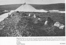
- Drizzlecombe terminal menhirs re-erected (row nos. 17, 18, 19). Baring-Gould, Robert Burnard, R.H. Worth and William Gray. 1893. The site was first described in detail by Worth in 1889. At this time the rows were well preserved but the terminal menhirs were found lying flat. The terminal stones were re-erected in 1893 in their original sockets.14
- Langstone Moor Menhir re-erected (row no. 30). D.E.C (?). 1893. The large terminal menhir was restored in its original socket.15
- Challacombe Down Stone Row restored (row no. 46). Baring-Gould, Robert Burnard. 1893. A few stones were re-erected within the rows by Burnard and Baring-Gould in 1893.16 One of these is set incorrectly across the middle row near its downhill end. Another 14 stones were re-erected where they were found outside of the rows near this which has created the rather strange arrangement towards the bottom of the hill as can be seen today. Worth comments that despite an attempt to "to re-erect these in the places 'they should have been' ... nothing coherent came out of that".17
- Laughter Tor Menhir re-erected (row no. 50). Robert Burnard. 1893. The standing stone was re-erected in 1893 and again in 1911 and the cairn was excavated in 1903 - it contained "a great quantity of charcoal and peat ashes".18
- Assycombe Stone Row blocking stone re-erected (row no. 43). Baring-Gould. 1894. The blocking stone at the west end of the row was re-erected and possibly other stones, Butler suggests the menhir near the cairn at the eastern end had been re-erected due to the presence of packing stones.19
- Hurston Ridge Stone Row restoration (row no. 44). Baring-Gould and Robert Burnard. 1894. A number of the stones were restored to their original sockets. A broken hand axe was discovered in the pit in which one of the stones had stood near to the menhir next to the cairn.20
- Hingston Hill (Down Tor) Stone Row restored (row 20). Baring-Gould, Rev. W. Gray and Robert Burnard. 1894. The westernmost stone (largest near the cairn circle) and an unknown number of others, were re-erected in their original sockets.21
- Lakehead Hill 4 (E or Summit) Stone Row and Cairn restored (row no. 51). Robert Burnard and Sabine Baring-Gould. 1895. The remains were discovered and restored in 1895.22 The reconstruction was undoubtedly flawed, as Worth points out, the stone row begins within the retaining circle and it is peculiarly one of the only curved stone rows on Dartmoor.23 The height and overall appearance of the cist is also doubtful. Despite Worth's criticisms, Hemery concludes: "My own feeling is one of profound thankfulness to the restorers that the monument survives at all".24
- Cosdon Hill Stone Row restored (row no. 33). R.H. Worth and Sabine Baring-Gould. 1896. Stones were re-erected and the cairn was partially excavated. Two cists were found in the cairn one of which was intact but the other had been robbed of the cover stone and two side stones.25
- Stalldown Stone Row restored (row no. 7). Sabine Baring-Gould. 1897. The row was in a ruinous state with most of the stones lying flat when it was restored by Baring-Gould in 1897.26 The restoration claimed to only use the original sockets for the stones but Worth claims that the row would not have originally aligned to the small circle of stones making the cairn just over the crest of the hill heading south.27
- Ringmoor Down Stone Row and Cairn Circle restored (row no. 16). Baring-Gould. 1909 (?). Most of the stones in the first 300m. were not standing before restoration. The 7 stones closest to the cairn were restored where they were found and are out of alignment to the west with a long gap before the next stones. Only one of the cairn circle stones was still standing when restored and another four were lying in position with six socket holes visible. According to Butler, R.H. Worth was partially involved in the restoration of the row but disowned Baring-Gould's work on the circle which included importing stones from up to half a kilometre away to reconstruct the circle. 28 29 30
- Yellowmead Four-fold Circle restored (row no. 66). Rev. Hugh Breton. 1921. A group of four concentric stone circles of which the innermost one is considered to be a cairn circle. Three stones were standing in 1921 when all the fallen stones were raised during restoration. There also appears to have been a stone row leading away from the stone circles. According to Butler all but 3 stones were re-erected in a restoration job that R.H. Worth described as being 'very faithfully done'. In 2008 Kayt Armstrong and a team from Bournemouth University carried out a geophysics survey of the site which was followed up with shallow ground truthing excavations. This investgation concluded that the site consisted of a central cairn with four concentric rings which appeared to have been very accurately reconstructed, there was also evidence that tended to confirm the presence of one stone row. 31
- Cholwich Town Stone Row and Cairn Circle excavated (row no. 10). George Eogan. 1961. Excavated prior to being covered by china clay waste. The sockets of many missing stones were found, also a pit 8ft. in diameter in the centre of the circle. Pollen analysis suggested the row was originally in a clearing of a wooded area.
- Cut Hill Stone row dating (row no. 88). Greeves and Fyfe. 2007. The row was discovered in April 2004. In 2007 a ninth buried stone was discovered and peat samples were carbon dated suggesting a date of around 3,500BC.
- Tottiford Stone Rows excavation (row no. 89). Time Team. 2011. The Tottiford monuments (stone circle, rows and cairns) were discovered in 2009 when water levels at the reservoir were low. The Time Team carried out an excavation of the site including the single and double rows. No dating evidence was found for the rows.
Bibliography & references
1Butler points out that a number of monuments have disappeared under the peat and that this is likely to happen soon to the remaining sections of the Holne Moor triple row and the east end of the Cosdon rows. Butler (1997) p. 18.
2 Emmett (1979)
3 Emmett (1979)
4 Fyfe, Ralph M. & Greeves, Tom (2010)
5 Butler (1997) pp.239-243
6 Stone Rows and Astronomical Theory reproduced as Appendix IV in Worth (1971) pp.452-457
7 Walker (2005)
8 Worth R. H. (1971) pp.176-180
9 Rowe (1830) p.180
10 Were There Druids in Devon? T.D.A. Vol. 12, Worth R.N. (1880)
11 For a full listing of The Stone Rows of Dartmoor articles in the T.D.A and the reports of the Dartmoor Exploration Committee, see the listing of : Articles
12 An account of this is reproduced in Mrs Bray's The Borders of the Tamar and the Tavy, vol.1, (1844)
13 Bate (1872)
14 See Twelfth Report of the Barrow Committee (1890) and Transactions of the Plymouth Institute Vol. X 1889-1990
, and The Stone Rows of Dartmoor - Part 1, T.D.A. Vol. 24. The restoration of the menhirs is described in The Stone Rows of Dartmoor - Part 2, T.D.A. Vol. 25 (1893).
15 See Second Report of the Dartmoor Exploration Committee T.D.A. Vol. 27, (1895)
16 See Second Report of the Dartmoor Exploration Committee T.D.A. Vol. 27, (1895)
17 Worth R. H. (1971) p.226
18 See Twenty-Second Report of the Barrow Committee T.D.A Vol. 35 (1903)
19 Baring-Gould's field notes clearly refer to the blocking stone down hill being prone, see The Stone Rows of Dartmoor - Part 1 T.D.A. Vol. 24 p.389 (1892). Butler states the terminal stone at the other end was also restored, see Butler Vol. 2 p.166 (1991)
20 See The Stone Rows of Dartmoor - Part 3, T.D.A. Vol. 26 (1894)
21 See The Stone Rows of Dartmoor - Part 3, T.D.A. Vol. 26 (1894) and for a detailed account of the restoration see Burnard's Dartmoor Pictorial Records (originally published in 1894) pp. 68-70
22 See Third Report of the Dartmoor Exploration Committee, T.D.A. Vol. 28 (1896)
23 Worth R. H. (1971) pp.229-230
24Hemery (1983) p483
25 See Extract from the Third report of the Dartmoor Exploration Committee, T.D.A. Vol. 28 (1896)
26 See Fourth Report of the Dartmoor Exploration Committee, T.D.A. Vol. 29 (1897)
27 Worth R. H. (1971) pp.206-7
28 The date of this restoration is typically referred to as being 1909 but may have been a subsequent summer. The Twenty-ninth Report of the Barrow Committee, T.D.A. Vol. 42 (1910) states that Brisworthy stone circle had been restored but the work on the row is not mentioned although it is stated that it had been included on the OS map. Breton (1911) refers to restoring the Brisworthy stone circle alongside R.H. Worth in the summer of 1909 and then later in reference to Ringmoor writes "we hope all these remains will be restored during the coming summer".
29 Worth R. H. (1971) pp.209, the original plan before restoration can be seen in T.D.A. Vol 73 p.234
30 Butler Vol 3 (1994) pp.142-3
31 See Katy Armstrong's thesis Archaeological geophysical prospection in peatland environments (2010) pp.206-241. See also, Armstrong, K, 2009b. Archaeological excavations at Yellowmead Stone Circles, Dartmoor Matters, The Dartmoor Preservation Association, Spring 2009, pp.10-11 and Armstrong, K, 2009c. Yellowmead stone circles, Sheepstor, Dartmoor Magazine. 94, pp.35-6.
Baring-Gould, S, A Book of Dartmoor, (1900), (Halgrove reprint 2002)
Bate, C Spence, Researches into Some Antient Tumuli on Dartmoor, T.D.A. Vol. 5 pp.549-58 (1872)
Bray, Anna Eliza, The Borders of the Tamar and the Tavy, vol.1, (1844)
Breton, Henry Hugh, Beautiful Dartmoor And Its Interesting Antiquities, (1911, republished in 1990)
Burnard, Robert, Dartmoor Pictorial Records, (1986)
Butler, Jeremy, Dartmoor Atlas of Antiquities, vol.2: The North, (1991)
Butler, Jeremy, Dartmoor Atlas of Antiquities, vol.3: The South-West, (1994)
Butler, Jeremy Dartmoor Atlas of Antiquities: Vol. 5. - The Second Millennium B.C. (Devon Books, 1997)
Emmett, D.D. Stone rows: the traditional view reconsidered, D.A.S.P. No. 37 pp. 94-114 (1979)
Fyfe, Ralph M. & Greeves, Tom The date and context of a stone row: Cut Hill, Dartmoor, south-west England Antiquity Vol 84, No. 323 pp55-70. (2010). See also Cut Hill, Dartmoor (phase 3), Stone row chronology and landscape change.
Lukis, W.C,
Report on the Prehistoric Monuments of Devon and Cornwall and Report on the Monuments of Dartmoor, Proceeding of the Society of Antiquaries Vol. 8 (1881)
Newman, Phil The Field Archaeology of Dartmoor (English Heritage, 2011)
Hemery, Eric. High Dartmoor (Robert Hale, 1983)
Rowe, Samuel, Antiquarian Investigations in the Forest of Dartmoor, Devon, Transactions of the Plymouth Institute Vol. 1, pp.179- 212 (1830)
Rowe, Samuel, A Perambulation of Dartmoor (3rd Edition), (1896)
Walker, Jack, Dartmoor Sun, (2005)
Wilkinson J. Gardner, British Remains on Dartmoor, Journal Brit. Arch. Assoc. xviii. pp.22-53, 111-133. (1862)
Worth, R.H. Worth's Dartmoor (David & Charles, 1971)
Worth, R. N., The Stone Rows of Dartmoor - Parts 1-5 (1880)
Worth, R. N., Were There Druids in Devon?, Transactions of the Devonshire Association Vol. 12, pp.228- 242 (1880)
Introduction
There are 76 stone rows listed by Butler ( Vol. 5 pp.213-14) and with one exception (see note on Shoveldown) they are all listed below with links to their location on the OS map, to their National Monument Records (NMR) and to any coverage on this website. Please note that external links open in a new page. Some of these rows were reliably reported in the past but on the National Monument Record are described as no longer in existence or otherwise untraceable (e.g. destroyed by quarrying or sunken in the peat or in the case of the Soussons Down Triple Stone row destroyed by plunder and afforestation). Worth listed 62 stones rows as republished in Worth's Dartmoor. This listing was increased to 71 rows by Emmett in his 1979 study although Emmett mentions "42 sites, some with rows of doubtful authenticity which are excluded". Since Butler's list a stone row on Cut Hill has been discovered. The Time Team dig at Tottiford Reservoir discovered two more stone rows which are included once in the listings. These 2 additional inclusions, less one Shoveldown row, brings the total of rows to 77.
Doubtful rows
There are numerous alignments of stones in existence today or reported to have once existed which have been described as stone rows or as possible stone rows. It is likely that many of these are in fact remains of reaves or walls or other structures from the historic period and some are just geological features. Some of these are discussed by Butler (Vol. 5 pp 214-19). Emmett refers to 42 sites of "doubtful authenticity" which he excluded from his study.
Prehistoric Monuments of Dartmoor list of Stone Rows
Academics and researchers will find the very comprehensive listing of 117 sites on Bill Radcliffe's Prehistoric Monuments of Dartmoor (PMD) website very useful. Each entry has a link to any related NMR and HER (Historical Environment Record) records along with useful bibliography and other details. The listing has a useful interface which gives listings by OS grid squares. It covers doubtful rows and those rows once reported by early explorers but now lost, destroyed, or otherwise untraceable.
The listing below covers most of the confirmed stone rows that can be seen today although it should be emphasised that some are insignificant and potentially very difficult to find!
Each record has a link to corresponding NMR, HER (the Heritage Gateway Historic Environment Record) and PMD records, a link to the location on the Ordnance Survey map, a photo (if available) and a link to relevant coverage on Prehistoric Dartmoor Walks and a link giving a listing of nearby sites. The author would like to thank Bill Radcliffe for the helpful correspondence whilst checking records. See also: Database and Web Search Tools
Note on nomenclature
The naming and numbering systems for stone rows used by different authors and authorities are not consistent. The listings by Worth are perhaps best well known so aspects of Worth's nomenclature will be used in these listings. Where there are 2 or more rows in the same location they maybe referred to using letters A,B,C ...or by numbers 1,2,3 ... where possible we use compass bearings as there can be no ambiguity with these e.g. N, E or S.E etc sometimes combined with Worth's lettering.
Note on Shoveldown
Different sources report different numbers of stone rows on Shovel Down. These vary from 5 to 10 rows. Worth describes 3 double rows (NMR Rows A,B,C) and one single row with an additional double row south of the Longstone. He speculates on whether the double row heading south from the Longstone to the Three Boys might be a continuation of the double row to the north of the Longstone with the Longstone in the middle. Butler treats these as two separate rows. The most recent update to the NMR record suggests that they are one and the same row (NMR Row E-F). The NMR records also mention accounts which suggest a total of up to 10 rows but later accounts suggest that there is one long single row broken into several sections (NMR Row D-G-H-F) which give the appearance of separate rows. This leaves a total of 4 double rows and one single row. Unfortunately, the NMR, Butler and Worth all use different systems for labelling the Shoveldown rows. Worth confusingly uses two letters per double row so there is a row A (presumably A & B) then a row C (C & D) etc. We will adopt the labelling used in the NMRs.
- NMR Row A = Butler Rows 3 = Worth Row E - double row (No special feature marks either end.)
- NMR Row B = Butler Rows 2 = Worth Row A - double row (South end of row ends in Fourfold circle.)
- NMR Row C = Butler Rows 4 = Worth Row C - double row (Terminates at southern end in a cairn.)
- NMR Row D-G-H-J = Butler Row 1 = Worth Row H - single row
- NMR Row E-F = Butler Rows 5 & 6 = Worth Row G - double row (Longstone at centre)
A table of these rows without photos and additional notes is available: Table of Dartmoor Stone Rows
Default listing is alphabetical by Site Name. Click here to order instead by: Site Name, OS, Worth Number
Assycombe Stone Row
Prehistoric Dartmoor Walks: Dartmoor Site: Assycombe Double Stone Row
OS Map: SX 66095 82641
HER: MDV6537
Megalithic Portal: 1738
The Stone Rows of GB: Assycombe Stone Row
PMD: Assycombe Stone Row
Short Name: SR Assycombe
Butler map: 35.19
DPD: 135
Dimensions (m): 125
Notes: "Bronze Age stone row and cairn, Assycombe. The double stone row is 120m long terminating in the cairn at the North-East end. The South-West end is blocked by a stone 2.0m high, re-erected there by Baring-Gould. The cairn is 8.4m in diameter and 0.6m high. Scheduled." Also from Burnard's 1892 field notes: The row, which starts from a ruined cairn, consists of 84 standing stones, and extends 800 feet E. and W., running in two rows down the hill towards Assycombe. It terminates towards the W. in a stone lying prone, 5' 9" long. 2'' wide. The avenue is from 5' to 6' wide, inner measurement. The stones composing the row are 18" high, and down to 6". Breton p.67-68.
Nearest Bus Stop (Minor): Warren House Inn (2.2 km) [Route: 171(20/07/26 to 19/09/26)]
Nearest Bus Stop (Major): Postbridge Post Office (4.0 km) [Route: 98,171(20/07/26 to 19/09/26)]
Nearby sites: SX 66095 82641
Black Tor (Avon) Stone Row
OS Map: SX 67730 63494
HER: MDV28589
Megalithic Portal: 1772
The Stone Rows of GB: Black Tor Avon Stone Row
PMD: Black Tor Avon Stone Row
Short Name: SR BlackTor 1
Butler map: 57.25
DPD: 85
Dimensions (m): 56
Notes: "A stone row running north west - south east seen on the plateau west of Black Tor". The stones are very hidden and difficult to see. The row is headed at the NW end by two small cairns. Lethbridge suggests remains of cist in one of them, diagram p.85. See also HER 5752, SX 66 SE 89 and SX 66 SE 33. NB. There is also a possible second row about 200 metres away SiteID=1320
Nearest Bus Stop: South Brent Pool Park (4.3 km) [Route: 38]
Nearby sites: SX 67730 63494
Black Tor (Avon) 2 Stone Row
OS Map: SX 675 635
HER: MDV5752
The Stone Rows of GB: Black Tor Avon Stone Row
PMD: Black Tor Avon Stone Row
Short Name: SR:BlackTor 2
Butler map: 57.25
Notes: HER: A stone row is alleged at this location by Worth (1932-33) but has not been located since, either by Worth, or during field investigation.. Masson Phillips: In August 1932 author was present at a field meeting led by R.H. Worth who pointed out a single stone row, more or less east to west with a low barrow at each end, he had discovered near the summit of Black Tor in the Avon Valley. Worth later contacted Quinnell to say he had been unable to locate it on a second visit. Quinnell also failed to locate it again, despite searching on at least six occasions 'had it not been that I and some 20 persons saw it in 1932 I would doubt its existence'. See also: HER MDV28589
Nearest Bus Stop: South Brent Pool Park (4.5 km) [Route: 38]
Nearby sites: SX 675 635
Black Tor (Stanlake) Stone Row
Prehistoric Dartmoor Walks: Dartmoor Walk: Sharpitor area Stone Rows and Cists
OS Map: SX 56988 71381
HER: MDV4994
Megalithic Portal: 1771
The Stone Rows of GB: Black Tor Stanlake
PMD: Black Tor Stanlake Stone Row
Short Name: SR Stanlake
Butler map: 45.14
DPD: 24
Dimensions (m): 295
Notes: "A Bronze Age Stone Row lies just inside, and is partly buried by, a substantial field boundary. The row extends from SX57217155 to SX57007137, some 294m long and includes at least 57 visible stones. Its north-eastern end is denoted by a substantial blocking stone and its lower south-western end by three funerary cairns. The row can be seen as three distinct parts forming the whole. The northern part includes 39 stones, the central group of 8 stones is separated from the northern row by a 66.2m wide gap whilst the southern group is on a slightly different alignment to the others. The row is unusual in that the blocking stone is at the upper end and a cairn lies at the lower end." Lethbridge diagram and photo p.24.
Nearest Bus Stop: Princetown Dartmoor Visitor Centre (3.0 km) [Route: 98,171(20/07/26 to 19/09/26)]
Nearby sites: SX 56988 71381
Blackaton Brook Reported Stone Row
OS Map: SX 648 908
HER: No record
Short Name: SR:Blackaton
Notes: Breton p.53 To the N. of it [Breton is referring to the Cosdon Triple row] are clitters of rocks, a short distance to the S, a swamp in which a feeder of the Blackaton Brook rises. On its E. slopes are the remains of a stone row. The feeder referred to is the Cheriton Comb which passes a boggy area. This would place the row at approximately SX 648 908. There is no known stone row at this point and this author is unaware of other accounts. This section of the Blackaton Brook has been greatly disturbed by stream workings.
Nearest Bus Stop (Minor): Throwleigh Cross (2.1 km) [Route: 670]
Nearest Bus Stop (Major): Ramsley (2.4 km) [Route: 670,671,6A]
Nearby sites: SX 648 908
Brent Fore Hill Stone Row
Prehistoric Dartmoor Walks: Dartmoor Walk: The Neolithic tombs of Cuckoo Ball & Corringdon Ball
OS Map: SX 66848 61345
HER: MDV5765
Megalithic Portal: 1777
The Stone Rows of GB: Brent Fore Hill
PMD: Brent Fore Hill Stone Row
Short Name: SR Brent Fore
Butler map: 56.10
DPD: 83
Barrow Report: 66
Dimensions (m): 120
Notes: "The remains of a stone row and cairn on Brent Fore Hill. The row is crossed by two leats, one of which is now disused. The cairn is visible as a low mound of turf-covered stones of 13.5 metres in diameter and 0.3 metres high". Lethbridge East Glaze Brook stone row p.83. See also: Sea Views at Brent Fore Hill
Nearest Bus Stop: South Brent Pool Park (3.6 km) [Route: 38]
Nearby sites: SX 66848 61345
Brown Heath (Hook Lake) Stone Row
OS Map: SX 64112 65318
HER: MDV5136
Megalithic Portal: 1788
The Stone Rows of GB: Hook Lake
PMD: Brown Heath Stone Row
Alternate name: Hook Lake Stone Row
Short Name: SR Hook Lake
Butler map: 55.8
DPD: 74
Barrow Report: 38
Dimensions (m): 227
Notes: Worth: Brown Heath, Butler: Hook Lake. "On the southwest slopes of Brown Heath a double stone row 182.0m. long runs from a cairn circle at its northern and higher end to the east side of the enclosure (SX 66 NW 50) where it is overlaid by the enclosure wall. The point at which the southern end of the row ended is therefore not easily determined. The row does not point exactly to the centre of the cairn, but to about 2.0m. to the East. The eastern part of the row contains more stones than the western part, in which there are notable gaps. There are a few large stones, the largest being 1.0m. high and measuring 1.0m. x 0.7m., but most are relatively small, their average height being 0.5m". Lethbridge p.74, diagram p.71. See also: Sea Views at Hook Lake/
Nearest Bus Stop: Cornwood Crossways (6.8 km) [Route: 59]
Nearby sites: SX 64112 65318
Burford Down Stone Row
Prehistoric Dartmoor Walks: Dartmoor Site: Burford Down stone row and cairns
OS Map: SX 63695 60165
HER: MDV4333
Megalithic Portal: 1463
The Stone Rows of GB: Burford Down
PMD: Burford Down Stone Row
Short Name: SR BurfordDown
Butler map: 54.17
DPD: 70
Barrow Report: 14 40
Dimensions (m): 508
Notes: "This single stone row on a slight north slope extends from a crest at 260m OD to a col at 255m OD. It can be traced from its south terminal, marked by a cairn, at SX 63706017 for 336m, bearing 1o, to a possible blocking stone at SX 63706051 and of different character for a further 120m to SX63706062. The recumbent stone, considered ... to be the north terminal lies yet a further 47m distant at SX 63706067." See also: Sea Views at Burford Down
Nearest Bus Stop: Cornwood Crossways (3.3 km) [Route: 59]
Nearby sites: SX 63695 60165
Butter Brook N Stone Row
Prehistoric Dartmoor Walks: Dartmoor Walk: The Neolithic tombs of Cuckoo Ball & Corringdon Ball
OS Map: SX 652 599
HER: MDV13166
Megalithic Portal: 1970
The Stone Rows of GB: Butterbrook 2
PMD: Butter Brook 2 Stone Row
Alternate name: Butter Brook 1 Stone Row
Short Name: SR:Butter Br N
Butler map: 53.11
DPD: 78
Dimensions (m): 25.6
Notes: Continued notes from Butter Brook S. "At 73 metres from the terminal there is a single orthostat 0.5 metre high, standing 3.25 metres off centre south from the projection of the rows, at the edge of a small clitter of broken stones. A third row, irregularly spaced and not showing much above ground, meets the double section of the rows at an angle of about 10o on the north-west side, extending westward to about level with the terminal. Visual projection east-ward along the third row appears to be in line with the orthostat". Lethbridge 78 Rows 4/5 diagram p.77. Formerly listed as Butter Brook 2.
Nearest Bus Stop: Ivybridge BP Garage (Stop B) (4.1 km) [Route: 38]
Nearby sites: SX 652 599
Butter Brook S Stone Row
Prehistoric Dartmoor Walks: Dartmoor Walk: The Neolithic tombs of Cuckoo Ball & Corringdon Ball
OS Map: SX 651 599
HER: MDV13166
Megalithic Portal: 1971
The Stone Rows of GB: Butterbrook 1
PMD: Butter Brook 1 Stone Row
Alternate name: Butter Brook 2 Stone Row
Short Name: SR Butter Br S
Butler map: 53.11
DPD: 78
Dimensions (m): 198
Notes: "A stone row about 42 metres long is situated on south sloping ground at SX 65145995, just north of the marshy Butterbrook valley. It is aligned south south west/north north east, and terminates at the south end in a hollow-centred ring of turf and stones of 2.5 metres diameter east/west, 3.2 metres north/south. The first stone in the row is 10.35 metres from the centre of the terminal, thereafter the spacing becomes about 3 metres. The maximum height of the stones is 0.67 metre. The row becomes double for about 12.5 metres (four to five pairs of stones), with a distance of 0.4 to 0.5 metre between rows, after which only the second row appears to continue." Lethbridge p.78 Rows 4/5 diagram p.77. Formerly listed as Butter Brook 1
Nearest Bus Stop: Ivybridge BP Garage (Stop B) (4.0 km) [Route: 38]
Nearby sites: SX 651 599
Butterdon East Stone Row
OS Map: SX 65870 59203
HER: MDV2888
The Stone Rows of GB: Butterdon East
PMD: Butterdon E. Stone Row
Alternate name: Butterdon E. Stone Row
Short Name: SR ButterdonE
Butler map: 53.8
Butler Vol 5: p.218 & Fig.150
Dimensions (m): 55
Notes: There are two massive slabs with one small slab forming an alignment. It is unclear whether these were originally standing but it is thought they could have been placed in their current locations. This would make for a very spectacular stone row and one that would be quite unique on Dartmoor. However, there are stone rows consisting of two huge slabs and a small central slab in other parts of the country. The grid reference given here and the photo is of the central stone.
Nearest Bus Stop: Ivybridge BP Garage (Stop B) (3.8 km) [Route: 38]
Nearby sites: SX 65870 59203
Butterdon Hill Stone Row
Prehistoric Dartmoor Walks: Dartmoor Walk: The Erme East stone rows
OS Map: SX 65629 58814
HER: MDV2988
Megalithic Portal: 556
The Stone Rows of GB: Butterdon Hill
PMD: Butterdon Stone Row
Alternate name: Butterdon Hill Row Stone Row
Short Name: SR Butterdon
Butler map: 53.8
DPD: 77
Dimensions (m): 1973
Notes: "The northern part of the Butterdon stone row has been surveyed from Hangershell Rocks cairn at SX 65645941 to Hobajons Cross at SX 65506045." and "For the 1050m of this part the majority of the several hundred stones are from 0.1m to 0.4m high and form an irregular line. There is a gap of 70.0m on the north side of Hangershell but otherwise the row is fairly continuous. The area is not entirely free of natural surface stones and while some can be immediately discounted occasionally there is a short double or triple row where all the stones are alike and these which formed the original row cannot now be determined. Barely two dozen stones are 0.5m high or higher, Hobajons Cross at 1.2m being the highest. It is possible that this was at some stage a terminal stone since it appears to have cup marks on the south face and the extension onwards, to the Longstone, is on an entirely different alignment." Lethbridge Row 1 diagram p.77.
Nearest Bus Stop: Ivybridge BP Garage (Stop B) (3.3 km) [Route: 38]
Nearby sites: SX 65629 58814
Cantrell Stone Row
Prehistoric Dartmoor Walks: Dartmoor Site: Cuckoo Ball Chambered Tomb
OS Map: SX 65688 57135
HER: MDV2889
Megalithic Portal: 1798
The Stone Rows of GB: Cantrell
PMD: Cantrell Stone Row
Short Name: SR Cantrell
Butler map: 53.12
DPD: 80
Dimensions (m): 48
Notes: "A double stone row, with a cairn at the north-east end, lies near the moor gate at Cantrell, Ugborough Moor. The southern row consists of nine stones, one of which is almost buried and one has fallen. The length of the row from the centre of the cairn is 153 feet and the alignment is N44o 20' E. The rows are from 7 to 12 feet apart and the stones are about 5 feet 6 inches apart, centre to centre. The cairn has a diameter of 22 feet and encloses what may be the remains of a cist".
Nearest Bus Stop: Ivybridge BP Garage (Stop B) (2.2 km) [Route: 38]
Nearby sites: SX 65688 57135
Challacombe Down Stone Row
Prehistoric Dartmoor Walks: Dartmoor Site: Challacombe Down Triple Stone Row
OS Map: SX 69016 80718
HER: MDV6600
Megalithic Portal: 1819
The Stone Rows of GB: Challacombe Down
PMD: Challacombe Stone Row
Short Name: SR Challacombe
Butler map: 24.3
Butler Vol 5: p.239 & Fig.169
DPD: 126
Dimensions (m): 145.
Notes: "Bronze Age triple stone row well marked and wider apart at the north, drawing nearer to the south where they meet a blocking stone of unusual size. The stones have suffered little in their restoration except that a stone in the middle row was turned to form a blocking stone for that row. The loose stones scattered to the west of the north end have been suggested to form a stone circle and additional rows but may be stones excavated from the north end of the stone row." Breton p.41-42
Nearest Bus Stop (Minor): Warren House Inn (1.6 km) [Route: 171(20/07/26 to 19/09/26)]
Nearest Bus Stop (Major): Postbridge Post Office (4.7 km) [Route: 98,171(20/07/26 to 19/09/26)]
Nearby sites: SX 69016 80718
Cholwich Town Stone Row
OS Map: SX 585 623
HER: MDV2438
Megalithic Portal: 1824
The Stone Rows of GB: Cholwichtown
PMD: Cholwich Town Stone Row
Alternate name: Cholwichtown stone row Stone Row
Short Name: SRxCholwich
Butler map: 48.7
Dimensions (m): 217
Notes: "This ring and stone row is now covered by china clay waste. A stone row and circle on top of a low ridge, between Tory Brook and a tributary of the Yealm, near Cholwich Town. The row, extending over 700ft, consisted of uprights 2-3ft. high and 3ft. apart, the circle, at the northern end of the row, was 15ft. in diameter with seven upright stones. The site was excavated in 1961, and the sockets of many missing stones were found, also a pit 8ft. in diameter in the centre of the circle." Pollen analysis suggested the row was originally in a clearing of a wooded area.
Nearest Bus Stop: Lee Moor Clearview (1.3 km) [Route: 59]
Nearby sites: SX 585 623
Collard Tor E. Stone Row
OS Map: SX 55849 62035
HER: MDV14792
Megalithic Portal: 1842
The Stone Rows of GB: Collard Tor East
PMD: Collard Tor E Stone Row
Alternate name: Collard Tor E Stone Row
Short Name: SR CollardTorE
Butler map: 48.6.2
DPD: 57
Dimensions (m): 65
Notes: Butler Collard Tor 1. "Two stone rows each headed by a cairn lie on a gentle clitter-covered south-facing hillslope between 239m and 259m above OD. The rows which are oriented approximately north-south, diverge from their northern ends and are from 17m to 19 apart; a field bank interrupts the course of the east row.
Nearest Bus Stop: Wotter Methodist Church (0.2 km) [Route: 59]
Nearby sites: SX 55849 62035
Collard Tor W. Stone Row
OS Map: SX 55833 62045
HER: MDV2583
Megalithic Portal: 1843
The Stone Rows of GB: Collard Tor West
PMD: Collard Tor W Stone Row
Alternate name: Collard Tor W Stone Row
Short Name: SR CollardTorW
Butler map: 48.6.1
DPD: 57
Dimensions (m): 83.5
Notes: Butler Collard Tor 2. Described in entry for Collard Tor E. Lethbridge pp.55-7, diagram p.55.
Nearest Bus Stop: Wotter Methodist Church (0.2 km) [Route: 59]
Nearby sites: SX 55833 62045
Conies Down Stone Row
OS Map: SX 58591 79076
HER: MDV4592
Megalithic Portal: 1846
The Stone Rows of GB: Conies Down
PMD: Conies Down Stone Row
Short Name: SR ConiesDown
Butler map: 30.11
DPD: 107
Dimensions (m): 172.
Notes: "The Conies Down stone row is oriented a few degrees west of north-south and is 145m long. Originally a double alignment of stones, only three pairs of upright stones now survive. There are a total of 17 upright and 15 recumbent stones. The average gap between stones is 10m and between the pairs the gap is some 1.4m wide". Lethbridge diagram p.107.
Nearest Bus Stop: Two Bridges Hotel (4.7 km) [Route: 98,171(20/07/26 to 19/09/26)]
Nearby sites: SX 58591 79076
Corringdon Ball B Reported Stone Row
OS Map: SX 665 611
HER: MDV14802
The Stone Rows of GB: Corringdon Ball South
PMD: Corringdon Ball B Stone Row
Short Name: SR:CorringdonB
Notes: Group B consists of at least three multiple stone rows, parallel to Row A. The 1990 resurvey of the site showed this group of rows actually extends as far as Row A - nearly 200 metres and (along with C - see MDV5658), may in fact be a group of seven approximately parallel rows. Location of polygon is approximate.
Nearest Bus Stop: South Brent Pool Park (3.9 km) [Route: 38]
Nearby sites: SX 665 611
Corringdon Ball C Reported Stone Row
OS Map: SX 665 611
HER: MDV5658
The Stone Rows of GB: Corringdon Ball South
PMD: Corringdon Ball C Stone Row
Short Name: SR:CorringdonC
Notes: HER: Group C consists of at least three multiple stone rows, parallel to to rows in Group B. The 1990 resurvey of the site showed this group of rows extends roughly as far as Row A and Group B - nearly 200 metres. Along with B - see MDV14802), may in fact be a group of seven approximately parallel rows set south-east of the single row A. Location of polygon is approximate.
Nearest Bus Stop: South Brent Pool Park (3.9 km) [Route: 38]
Nearby sites: SX 665 611
Corringdon Ball N. Stone Row
Prehistoric Dartmoor Walks: Dartmoor Site: Corringdon Ball Chambered Tomb & Stone Rows
OS Map: SX 66661 61206
HER: MDV5656
Megalithic Portal: 1856
The Stone Rows of GB: Corringdon Ball North
PMD: Corringdon Ball A Stone Row
Alternate name: Corringdon Ball North Stone Row
Short Name: SR CorringdonN
Butler map: 56.8.2
DPD: 82
Barrow Report: 66
Dimensions (m): 132
Notes: "A single stone row, length 157 metres, spacing 1.0 metres, starting on the east with a cairn, diameter 6.7 metres, previously opened. The first stone of the row lies 18 metres west of the cairn's centre; there has been considerable robbery for the benefit of modern stone walls. The row clearly extends for 157 metres from the centre of the cairn, but with long intervals between the last stones. The stones are small, the highest being 635 millimetres." See also entry for Corringdon Ball Row B. p.82
Nearest Bus Stop: South Brent Pool Park (3.8 km) [Route: 38]
Nearby sites: SX 66661 61206
Corringdon Ball S. Stone Row
Prehistoric Dartmoor Walks: Dartmoor Site: Corringdon Ball Chambered Tomb & Stone Rows
OS Map: SX 66684 61205
HER: MDV5655
Megalithic Portal: 1857
The Stone Rows of GB: Corringdon Ball South
PMD: Corringdon Ball B Stone Row
Alternate name: Corringdon Ball South Stone Row
Short Name: SR CorringdonS
Butler map: 56.8.1
DPD: 82
Barrow Report: 66
Dimensions (m): 178
Notes: "Corringdon ball stone rows. Six or seven rows of small stones approximately 75m long, terminating at the east end in a small semi-circular stone setting of five stones, none more than 500mm high, and the alignments are irregular - they run along the contours. Situated on the open moor between the east and west glaze brooks. A complicated set of stones which can only be aligned into rows by exact survey. The direction of the rows is approximately south west". Described by R H Worth as two triple rows B & C. See also HER 14802 (Corringdon Ball B).
Nearest Bus Stop: South Brent Pool Park (3.7 km) [Route: 38]
Nearby sites: SX 66684 61205
Cosdon Stone Row
Prehistoric Dartmoor Walks: Dartmoor Site: Cosdon Hill Triple Stone Row
OS Map: SX 64317 91600
HER: MDV6886
Megalithic Portal: 1858
The Stone Rows of GB: Cosdon
PMD: Cosdon Stone Row
Short Name: SR Cosdon
Butler map: 40.6
DPD: 152
Dimensions (m): 146
Notes: "A triple stone row lies near the summit of Cosdon Hill and is 447 feet in length measured from the centre of the circled cairn which stands at the west end. At 225 feet from the west end there is a slight change in direction and the rows turn somewhat northward. This change of direction may be said to divide the row into western and an eastern section. Overall width, western part is 8 feet 10 inches, eastern part 10 feet 8 inches. The cairn is 26 feet in diameter and contains the remains of two cists; the retaining circle is very irregular. There is no formal feature to mark the termination of the rows at their eastern end"
Nearest Bus Stop: Ramsley (1.7 km) [Route: 670,671,6A]
Nearby sites: SX 64317 91600
Cox Tor Stone Row
OS Map: SX 5307 7618
HER: MDV12802
Megalithic Portal: 1840
PMD: Cox Tor
Short Name: SRxCoxTor
Butler map: 31.1
Notes: Stone row reported by R.N. Worth in 1894 and referred to by R.H. Worth in 1953. The row is no longer visible. The NMR states: "R.N. Worth mentions, like Crossing, one stone row, while R.H.Worth notes one or more rows. These cannot be traced, and the depth of peat on the grassy plateau is so little that if the row/rows were obvious with slight shrinkage they should still be reasonably visible. Spaced stones abound, particularly towards the northern end and numerous fictitious rows of four of five stones can be deduced but nothing acceptable from any of the cairns."
Nearest Bus Stop: Tavistock Higher Longford (2.0 km) [Route: 98,171(20/07/26 to 19/09/26)]
Nearby sites: SX 5307 7618
Cripdon Down Reported Stone Row
OS Map: SX 73362 80749
HER: MDV130912
PMD: Cripdon Down
Short Name: SR Cripdon
Notes: HER: Hemery (1983) records a stone row here, estimated at SX 735 808. Stone row, Cripdon Down. North-west of the hut circles depicted on the Ordnance Survey map (SX 78 SW 17) and west of the Cripdon Down summit pile is a single stone row, 120 yards long passing over the crest of the Down. At the northern end is a very large fallen slab (destroyed cist?). The lower, southern end has stones of a greater size than the majority, one 7 feet long could have former a blocking stone. The stones are evenly spaced and not generally large.
Nearest Bus Stop (Minor): Manaton Bus Shelter (1.7 km) [Route: 271,671]
Nearest Bus Stop (Major): Lustleigh Eastwrey Barton Hotel (5.2 km) [Route: 178,171(20/07/26 to 19/09/26)]
Nearby sites: SX 73362 80749
Cut Hill Stone Row
OS Map: SX 59871 82756
HER: MDV69604
Megalithic Portal: 25916
The Stone Rows of GB: Cut Hill
PMD: Cut Hill Stone Row
Short Name: SR Cut Hill
DPD: 130
Dimensions (m): 215
Notes: Discovered in 2004. Prehistoric stone row of 6-7 large granite slabs near the summit of Cut Hill. All the slabs are recumbent with one buried. The row is thought to date back earlier than 3,500BC. For more information, see: Cut Hill, Dartmoor (phase 3), Stone row chronology and landscape change, HER MDV69604 and Legendary Dartmoor
Nearest Bus Stop: Postbridge Post Office (6.2 km) [Route: 98,171(20/07/26 to 19/09/26)]
Nearby sites: SX 59871 82756
Drizzlecombe 4 Stone Row
Prehistoric Dartmoor Walks: Dartmoor Site: Drizzlecombe Ceremonial Complex (Photos 1)
OS Map: SX 59257 67256
HER: No record
Megalithic Portal: 1902
The Stone Rows of GB: Drizzlecombe 4
Short Name: SR Drizzle 4
Notes: See also Megalithic Portal: Standing Stone for a nearby small standing stone.
Nearest Bus Stop: Meavy Primary School (4.8 km) [Route: 56]
Nearby sites: SX 59257 67256
Drizzlecombe N.E. Stone Row
Prehistoric Dartmoor Walks: Dartmoor Site: Drizzlecombe Ceremonial Complex (Photos 1)
OS Map: SX 59258 67054
HER: MDV14776
Megalithic Portal: 536
The Stone Rows of GB: Drizzlecombe 2
PMD: Drizzlecombe C Stone Row
Alternate name: Drizzlecombe 2 Stone Row
Short Name: SR Drizzle NE
Butler map: 49.19.2
DPD: 39
Dimensions (m): 83.2
Notes: Butler Row 2, NMR Row 2, Worth Row C. Terminated by the tallest standing stone on Dartmoor. It is 4.2m in height with a distinctive bulging profile at the top the broad face is across the row unlike the other two Drizzlecombe rows. Interestingly this stone is photographed in Worth's Dartmoor prior to being re-erected. Worth suggests it was probably dragged here from Higher Hartor Tor about 1km away. This standing stone has 3 smaller cairns in close proximity. This is the shortest of the three rows at 83.2m but has larger slabs set further apart with the largest near the cairn. Lethbridge Row B. pp.38-42. Diagram p.38. See also: Sea Views at Drizzlecombe 2
Nearest Bus Stop: Meavy Primary School (4.8 km) [Route: 56]
Nearby sites: SX 59258 67054
Drizzlecombe N.W. Stone Row
Prehistoric Dartmoor Walks: Dartmoor Site: Drizzlecombe Ceremonial Complex (Photos 1)
OS Map: SX 59243 67071
HER: MDV3376
Megalithic Portal: 1904
The Stone Rows of GB: Drizzlecombe 3
PMD: Drizzlecombe B Stone Row
Alternate name: Drizzlecombe 3 Stone Row
Short Name: SR Drizzle NW
Butler map: 49.19.3
DPD: 40
Dimensions (m): 149.
Notes: Butler Row 3, NMR Row 1, Worth Row B. The NW and S terminal stones have their broad face parallel to the row. The NW row is single for half of its 149.5m length uphill then double for 47m before becoming single again for the last 28m to the cairn. This arrangement appears to be the original design. The other two stone rows are single throughout. The S row is exactly the same length as the NW row but with smaller stones. The average interval between the stones is almost identical and the orientation of the row is such that it gently curves southwards downhill bringing the lower part of the row parallel to the S row. This shift of 7 degrees in alignment of the NW row from top to bottom to line up with the S row would suggest it was constructed later to match the S row. The height of the terminating stones for S and NW rows are 3m and 2.3m respectively.
Nearest Bus Stop: Meavy Primary School (4.8 km) [Route: 56]
Nearby sites: SX 59243 67071
Drizzlecombe S. Stone Row
Prehistoric Dartmoor Walks: Dartmoor Site: Drizzlecombe Ceremonial Complex (Photos 1)
OS Map: SX 59161 66949
HER: MDV14777
Megalithic Portal: 1905
The Stone Rows of GB: Drizzlecombe 1
PMD: Drizzlecombe A Stone Row
Alternate name: Drizzlecombe 1 Stone Row
Short Name: SR Drizzle S
Butler map: 49.19.1
DPD: 40
Dimensions (m): 149.
Notes: Butler Row 1, NMR Row 3, Worth Row A. See notes for Drizzlecombe B (N.W.) row. Lethbridge Row A pp.38-42. Diagram p.38. See also: Sea Views at Drizzlecombe 1
Nearest Bus Stop: Meavy Primary School (4.7 km) [Route: 56]
Nearby sites: SX 59161 66949
Fernworthy N. Stone Row
Prehistoric Dartmoor Walks: Dartmoor Site: Fernworthy Ceremonial Complex
OS Map: SX 65538 84336
HER: MDV6562
Megalithic Portal: 1933
The Stone Rows of GB: Fernworthy 1
PMD: Fernworthy B Stone Row
Alternate name: Fernworthy 1 Stone Row
Short Name: SR Fernwthy N
Butler map: 35.15.1
DPD: 138
Dimensions (m): 101
Notes: Butler Row 1. "To the N of Fernworthy stone circle is a double stone row. At its N end are the disturbed remains of a barrow. The row survives well for 125m although beyond this (to the N) it has been heavily disturbed by forestry activity as far as the barrow. The plan of 1898, made prior to afforestation, shows the N end of the double row as already `buried or lost'. The surviving part of the double row contains paired, low stones 0.8m to 1.4m apart, averaging 0.3m high, although many are flush with the ground. The tallest stones are at the S end. The alignment of the row is tangential to the circle (SX 68 SE 56). The barrow at the N end of the row measures 6m in diameter, although it is very amorphous due to tree planting. there is a large proportion of stone in the centre of the low mound, as well as some amorphous scarping and one large upright slab." DNP Post 8D. Breton p.67.
Nearest Bus Stop (Minor): Warren House Inn (3.9 km) [Route: 171(20/07/26 to 19/09/26)]
Nearest Bus Stop (Major): Postbridge Post Office (5.5 km) [Route: 98,171(20/07/26 to 19/09/26)]
Nearby sites: SX 65538 84336
Fernworthy S.E. Stone Row
Prehistoric Dartmoor Walks: Dartmoor Site: Fernworthy Ceremonial Complex
OS Map: SX 6549 8407
HER: MDV6556
Megalithic Portal: 10484
The Stone Rows of GB: Fernworthy 2
PMD: Fernworthy C Stone Row
Alternate name: Fernworthy 2 Stone Row
Short Name: SR Fernwthy SE
Butler map: 35.15.2
DPD: 138
Dimensions (m): 20.5
Notes: Butler Row 2. "Centred at SX 65518404 is a cairn. 45m to the N at SX 65508409 is a barrow containing the remains of a cist. Between the two are the very fragmented remains of an alleged double stone row running N to S parallel to another row (SX 68 SE 59) which leads towards Fernworthy Stone Circle. The row, barrow and cairn have all been comprehensively damaged by afforestation and the digging of the adjacent drainage channels. Seven stones survive of an alignment but there is little evidence that it was a double row. The barrow at the N end of the row measures up to 6m in diameter and is 0.4m high, although its shape is obscured by drainage channels. The cist in the centre is represented by two stones set at right angles, 0.4m tall internally. The cairn at the S end of the row measures 7.3m N to S by 8.5m and is 0.5m high. There is a large amount of surface stone on and around it." DNP Post 5D.
Nearest Bus Stop (Minor): Warren House Inn (3.7 km) [Route: 171(20/07/26 to 19/09/26)]
Nearest Bus Stop (Major): Postbridge Post Office (5.3 km) [Route: 98,171(20/07/26 to 19/09/26)]
Nearby sites: SX 6549 8407
Fernworthy S.W. Stone Row
Prehistoric Dartmoor Walks: Dartmoor Site: Fernworthy Ceremonial Complex
OS Map: SX 65479 84105
HER: MDV14886
Megalithic Portal: 1934
The Stone Rows of GB: Fernworthy 3
PMD: Fernworthy A Stone Row
Alternate name: Fernworthy 3 Stone Row
Short Name: SR Fernwthy SW
Butler map: 35.15.3
DPD: 138
Dimensions (m): 31
Notes: Butler Row 3. "A disturbed double stone row is centred SX 65488408. It is 21m long and is oriented N to S. At the N end is a cairn (SX 68 SE 58) offset slightly W of the alignment of the row. Beyond this to the N is Fernworthy Stone Circle (SX 68 SE 56). The S end of the row is not very well preserved. The plan of 1898 depicts it terminating at a stone in the face of a wall, although the wall has since been removed. The stones in the row average 0.5m to 0.6m tall and lie in an area of amorphous modern earthworks up to 0.3m deep." DNP Post 1D. Breton p.67.
Nearest Bus Stop (Minor): Warren House Inn (3.7 km) [Route: 171(20/07/26 to 19/09/26)]
Nearest Bus Stop (Major): Postbridge Post Office (5.3 km) [Route: 98,171(20/07/26 to 19/09/26)]
Nearby sites: SX 65479 84105
Glasscombe Ball N. Stone Row
Prehistoric Dartmoor Walks: Dartmoor Walk: The Erme East stone rows
OS Map: SX 65733 60429
HER: MDV5659
Megalithic Portal: 1952
The Stone Rows of GB: Glasscombe Ball North
PMD: Glasscombe Ball Stone Row
Alternate name: Glasscombe Ball N Stone Row
Short Name: SR GlassBall N
Butler map: 56.13
DPD: 78
Dimensions (m): 84.5
Notes: "A single stone row on the northern verge of Glasscombe Ball lies a little west of north from the row near Spurrell's Cross (SX 65 NE 16) and about a third of a mile from it" ... "A stone row extending between two cairns. The north-east cairn is 0.6m high and is now elongated north-west to south-east to 6.0m. by 4.0m, and is turf-covered. The south-west cairn, 4.0m. in diameter and 0.8m. high is of close-packed stones and turf-covered." Lethbridge p.78, diagram p.77 Row 2
Nearest Bus Stop: South Brent Pool Park (4.5 km) [Route: 38]
Nearby sites: SX 65733 60429
Glasscombe Corner Stone Row
Prehistoric Dartmoor Walks: Dartmoor Walk: The Erme East stone rows
OS Map: SX 65997 60748
HER: MDV5661
Megalithic Portal: 3254
The Stone Rows of GB: Glasscombe Corner
PMD: Glasscombe Corner Stone Row
Short Name: SR Glasscombe
Butler map: 56.12
Butler Vol 5: p.229 & Fig.162
DPD: 81
Dimensions (m): 173
Notes: "A stone row partly double and partly single ending on the remains of a cairn circle. The length of the double row is 111.0m. and of the single row 61.0m, the total length to the centre of the cairn circle being 177.0m". Lethbridge Avon Valley stone row pp.81-82, diagram p.81.
Nearest Bus Stop: South Brent Pool Park (4.3 km) [Route: 38]
Nearby sites: SX 65997 60748

Grimslake Cist Reported Stone Row
OS Map: SX 70412 81154
HER: MDV8744
The Stone Rows of GB: Grimslake Cist
PMD: Grimslake Cist Stone Row
Short Name: SR Grimslake
Butler map: 20.16
Notes: The author visited this site on 21/06/24 and concluded there was no stone row but took a photo of some stones near the cairn and cist that are roughly linear but not convincing for a stone row. The Stone Rows of Great Britain website reached the same conclusion but with far more detail. This is not in my view a stone row. This site is now listed as "reported stone row" instead of a "stone row".
Nearest Bus Stop (Minor): Warren House Inn (3.0 km) [Route: 171(20/07/26 to 19/09/26)]
Nearest Bus Stop (Major): Postbridge Post Office (6.1 km) [Route: 98,171(20/07/26 to 19/09/26)]
Nearby sites: SX 70412 81154
Hameldown N.E. Stone Row
OS Map: SX 71481 80095
HER: MDV18865
Megalithic Portal: 6333472
The Stone Rows of GB: Hameldown
PMD: Berry Pound Stone Row
Alternate name: Hamel Down Stone Row
Short Name: SR Hamel NE
Butler map: 20.3
Dimensions (m): 217
Notes: Fleming (1983): stone row sse of berry pound. There is a cairn at the west end at sx71488010. The minimum length of the row is 217 m: it may be longer. It is largely destroyed: 5 upright stones, one leaning, one uprooted, and three stoneholes are still visible. Orientation 270 degrees. In one place there is evidence that it was a double row.
Nearest Bus Stop (Minor): Swallerton Gate (2.6 km) [Route: 271]
Nearest Bus Stop (Major): Postbridge Bellever (6.6 km) [Route: 98]
Nearby sites: SX 71481 80095
Harrowthorn Plantation Reported Stone Row
OS Map: SX 6252 6171
HER: MDV13236
Short Name: SR:Harrow
Notes: HER: Supposed stone row (not an antiquity) ... Worth states they were moved to make a carriageway in 19th century: These were stones removed to one side of the track to allow a carriage to pass during the 19th century at the order of Lord Blatchford. The writer is very much mistaken in thinking this is a stone row
Nearest Bus Stop: Cornwood Crossways (2.9 km) [Route: 59]
Nearby sites: SX 6252 6171
Hart Tor (Duplicate) Reported Stone Row
OS Map: SX 68 63
HER: MDV132249
Short Name: SRxHart_Dup
Notes: This HER record has confused Black Tor, South Brent with Black Tor near Hart Tor. The description is of the Hart Tor stone rows. See p.190 of Third Edition of Rowe, the narrative is about the Devonport Leat and the Crazywell pool before moving on to the rows at Black Tor i.e. the Hart Tor rows. HER: A stone row was alleged at Black Tor (1882) but there was no trace of the monument during field investigation (1950). 4th barrow Report:STONE ROW, BLACK TOR: Nearly a furlong from the Tor in the glen below, on the eastern bank of the stream, are a pair of avenues which are only 40 feet apart and run parallel to each other east and west. They are formed of stones 2.5 feet high and each is terminated at the eastern end by a circle 36 feet in diameter consisting, of 15 stones enclosing a cairn. Between the northern avenue and the stream is a cairn while another, very imperfect, will be observed at end of southern avenue (citing Row's Perambulation, Second Edition, pp.205-6).
Nearest Bus Stop: South Brent Pool Park (3.8 km) [Route: 38]
Nearby sites: SX 68 63
Hart Tor North Stone Row
Prehistoric Dartmoor Walks: Dartmoor Site: Hart Tor Stone Row & Cairn Circle
OS Map: SX 57708 71708
HER: MDV4896
Megalithic Portal: 1973
The Stone Rows of GB: Hart Tor North
PMD: Harter N Stone Row
Short Name: SR Hart Tor N
Butler map: 46.5.1
DPD: 25
Dimensions (m): 126
Notes: Butler Row 1. There are two cairns close by on the lower slopes of Hart Tor. One has an associated single stone row and the other has an associated double stone row - they diverge at an angle of 18 degrees.
Nearest Bus Stop: Princetown Dartmoor Visitor Centre (2.2 km) [Route: 98,171(20/07/26 to 19/09/26)]
Nearby sites: SX 57708 71708
Hart Tor South Stone Row
Prehistoric Dartmoor Walks: Dartmoor Site: Hart Tor Stone Row & Cairn Circle
OS Map: SX 57720 71698
HER: MDV4895
Megalithic Portal: 1974
The Stone Rows of GB: Hart Tor South
PMD: Harter S Stone Row
Short Name: SR Hart Tor S
Butler map: 46.5.1
DPD: 25
Dimensions (m): 56.4
Notes: Butler Row 2. The single row consists of 16 stones and is 56.4m long, although Gerrard suggests it was probably once much longer. The single row leads to a cairn which does not have a retaining circle. The cairn which has been robbed measures 7.4m in diameter and up to 0.75m high. For early description of both rows and the now missing menhir, see: Wilkinson J. Gardner, British Remains on Dartmoor, Journal Brit. Arch. Assoc. xviii. pp.22-53 (1862). Detailed survey of site in Hart Tor Stone Rows & Cairns, Meavy Valley Archaeology. Site Report No.9 - Sandy Gerrard (1999).
Nearest Bus Stop: Princetown Dartmoor Visitor Centre (2.2 km) [Route: 98,171(20/07/26 to 19/09/26)]
Nearby sites: SX 57720 71698
Hayne Down Stone Row
OS Map: SX 74022 79974
HER: MDV130870
Short Name: SR Hayne Down
Notes: Cunis, E, 2021, (HER Correspondence). (04/03/2021) Possible cairn(s) and small stone row identified on Hayne Down. William Crossing mentions a cist 'near the southern group of summit rocks’ (reported by Butler in Vol. One) but cairn not mentioned therefore this may be a separate feature.
One stone standing prominently, another 2-3 noted in a linear arrangement from what looks like a round cairn at the north-western end. Grid Ref: SX74022 79974.
Nearest Bus Stop (Minor): Swallerton Gate (0.9 km) [Route: 271]
Nearest Bus Stop (Major): Lustleigh Bishops Stone (4.8 km) [Route: 178]
Nearby sites: SX 74022 79974

Higher White Tor Stone Row
OS Map: SX 61917 78362
HER: MDV5834
Megalithic Portal: 2192
The Stone Rows of GB: Higher White Tor
PMD: Higher White Tor Stone Row
Short Name: SR HigherWhite
Butler map: 29.16
DPD: 110
Dimensions (m): 95.4
Notes: "A Late Neolithic stone alignment on Higher White Tor, surviving as two parallel rows of stones aligned roughly north-south. The alignment is 95.4 metres long and contains twelve upright stones and 24 recumbent ones." Lethbridge diagram and photo p.110. Site visited 28/05/2025 by the author. The main photo above gives a more realistic picture than the more "artistic" second photo.
Nearest Bus Stop (Minor): Powder Mills (2.0 km) [Route: 171(20/07/26 to 19/09/26)]
Nearest Bus Stop (Major): Postbridge Post Office (2.9 km) [Route: 98,171(20/07/26 to 19/09/26)]
Nearby sites: SX 61917 78362
Hingston Hill (Down Tor) Stone Row
Prehistoric Dartmoor Walks: Dartmoor Site: Down Tor Stone Row and Cairn Circle
OS Map: SX 58697 69267
HER: MDV3502
Megalithic Portal: 1901
The Stone Rows of GB: Hingston Hill
PMD: Down Tor Stone Row
Alternate name: Hingston Hill Stone Row
Short Name: SR Down Tor
Butler map: 47.12
DPD: 28
Barrow Report: 66
Dimensions (m): 351
Notes: "A stone alignment and cairn, situated on a saddle 620 metres east of Down Tor. The alignment is orientated east-north-east to west-south-west, running for 316 metres and containing at least 174 stones, with the tallest at either end."
Nearest Bus Stop: Princetown Dartmoor Visitor Centre (4.3 km) [Route: 98,171(20/07/26 to 19/09/26)]
Nearby sites: SX 58697 69267
Holne Moor Stone Row
OS Map: SX 67431 71042
HER: MDV12983
Megalithic Portal: 1981
The Stone Rows of GB: Holne Moor
PMD: Holne Moor Stone Row
Short Name: SR Holne Moor
Butler map: 60.25
DPD: 90
Dimensions (m): 147.
Notes: "A standing stone and triple stone row lying in a secluded position, across the head of a shallow, north facing valley. It measures 147 metres long with rows on average 1.5 m apart. The stones, fifty three of which were located, have a maximum height of 0.2 m and are spaced about 1.1 m apart, each opposite the stone of the adjacent row. There is also a possible former standing stone which is now recumbent." See also MDV129985
Nearest Bus Stop: Postbridge Bellever (6.6 km) [Route: 98]
Nearby sites: SX 67431 71042
Holne Ridge Stone Row
OS Map: SX 66741 71080
HER: MDV61453
Megalithic Portal: 27341
The Stone Rows of GB: Holne Ridge
PMD: Holne Ridge Stone Row
Alternate name: Holne Ridge North Stone Row
Short Name: SR Holne Ridge
Butler map: 60.26
DPD: 90
Dimensions (m): 28
Notes: "One or two cairns and a short probably unfinished stone row lie in the north west facing hollow above Horse Ford on the O Brook. The cairn described by Authority 2 lies at the south end of the site with the surviving stones of the stone row to the north. As so few stones survive the exact form and extent of the rows is impossible to determine but there may have been as many as three parallel rows approximately 1.0 metre apart. Overlying or abutting the east row at SX 6672 7109 is a low turf covered mound 3.0 metes in diameter and 0.4 metres high. It is not clear whether this feature forms part of the monument or if it is associated with the shallow turf cuttings to the east."
Nearest Bus Stop: Postbridge Bellever (6.4 km) [Route: 98]
Nearby sites: SX 66741 71080
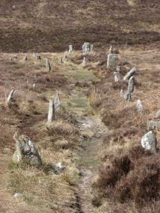
Hurston Ridge Stone Row
Prehistoric Dartmoor Walks: Dartmoor Site: Hurston Ridge Double Stone Row
OS Map: SX 67260 82437
HER: MDV6541
Megalithic Portal: 8345
The Stone Rows of GB: Hurston Ridge
PMD: Hurston Ridge Stone Row
Short Name: SR Hurston
Butler map: 25.9
Butler Vol 5: p.228 & Fig.161
DPD: 136
Dimensions (m): 143
Notes: .Worth: Watern Hill. "A stone alignment which includes two parallel lines of upright stones leading downslope for 143 metres from a round cairn. The lower end of the alignment is denoted by a blocking stone. Midway along the alignment a length of later enclosure walling crosses the row. The cairn at the upper end of the alignment measures 5.9 metres in diameter and stands up to a height of 0.6 metres. A large slab denoting the north eastern edge of the cairn may represent a second blocking stone of the associated alignment." A number of the stones were restored to their original sockets in 1894. A broken hand axe was discovered in the pit in which one of the stones had stood near to the menhir next to the cairn. First observed by Mr. George French of Postbridge.
Nearest Bus Stop (Minor): Warren House Inn (1.5 km) [Route: 171(20/07/26 to 19/09/26)]
Nearest Bus Stop (Major): Postbridge Post Office (4.4 km) [Route: 98,171(20/07/26 to 19/09/26)]
Nearby sites: SX 67260 82437
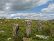
Joan Ford's Newtake Stone Row
OS Map: SX 63183 71987
HER: MDV6375
Megalithic Portal: 1985
The Stone Rows of GB: Joan Fords Newtake
PMD: Joan Ford's Newtake
Alternate name: Joan Ford's Newtake Stone Row
Short Name: SR Joan Fords
Notes: Stone Rows of Great Britain states: A probable single stone row measuring 7.27m long, including at least three large-sized upright orthostats and two recumbent slabs situated on a gentle south east facing slope. The stones stand up to between 1.55m and 1.23m high, arranged in height order with the tallest at the east. The row is orientated ENE to NSW and has restricted views of several skyline cairns and surrounding landscape. Breton (p.19) ... just above the river are 3 large monoliths in a row; do they form the end of a stone row, or are they part of a vanished linhay? Both the late Mr. Robert Burnard and Mr. R. Hansford Worth told me they did not know what they are, and neither do I. All we can say is the stones are there.
Nearest Bus Stop: Two Bridges Hotel (3.8 km) [Route: 98,171(20/07/26 to 19/09/26)]
Nearby sites: SX 63183 71987
Kennon Hill Reported Stone Row
OS Map: SX 64246 88657
HER: MDV130499
Short Name: SR:KennonHill
Notes: Hemery, E., 1983, High Dartmoor, 796-797 When referring to Sandy Road, Hemery records that in crossing the south foot of Kennon between Rewelake Pit and Sandy Ford, it passes below the ruins of a possible stone circle. Spencer (Maps) has marked this as 'Kennon Circle six stones standing' and, running north-eastward from it, 'stone row one hundred yards'. The circle is decribed as 'completely unphotogenic', appears to have had a diameter of approximately sixty feet and now has only one standing stone. Not able to confirm the stone row. Cunis, E, 2020, Possible stone circle and row, Kennon (14/12/2020) Features recorded during site visit with archaeologist from Dartmoor National Park Authority. Photographs of the features included. Possible stone circle and row recorded. In a very ruinous condition with vegetation covering the majority of the stone row. Circle SX 64201 88735, Row SX 64246 88657.. NB. Grid reference for row confirmed by Emma and corrected.
Nearest Bus Stop (Minor): Wonson Telephone Box (3.2 km) [Route: 670]
Nearest Bus Stop (Major): Ramsley (4.6 km) [Route: 670,671,6A]
Nearby sites: SX 64246 88657
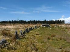
Lakehead Hill 4 (E of Summit) Stone Row
Prehistoric Dartmoor Walks: Dartmoor Site: Lakehead Hill
OS Map: SX 64498 77603
HER: MDV5870
Megalithic Portal: 2009
The Stone Rows of GB: Lakehead Hill East
PMD: Lakehead Great Cairn Stone Row
Alternate name: Lakehead Hill E Stone Row
Short Name: SR Lakehead E
Butler map: 27.19.4
DPD: 116
Dimensions (m): 12
Notes: HER: A stone alignment and a cairn with cist lying on a gentle slope near the summit of Lakehead Hill. The stone alignment survives as a single row of at least 11 stones leading westward towards the cairn and cist. The cairn measures 6.7 metres in diameter and is defined by several edge set stones, which in turn surround a large restored cist formed by five substantial upright slabs supporting a capstone measuring 2.2 metre long by 1.55 metres wide and 0.3 metres thick. Lethbridge diagram p.114 and photos p.116.
Nearest Bus Stop: Postbridge Bellever (1.0 km) [Route: 98]
Nearby sites: SX 64498 77603
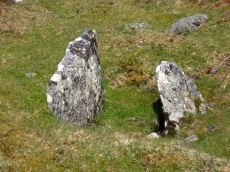
Lakehead Hill S.E. Stone Row
Prehistoric Dartmoor Walks: Dartmoor Site: Lakehead Hill
OS Map: SX 64701 77409
HER: MDV5875
Megalithic Portal: 44544
The Stone Rows of GB: Lakehead Hill 2
PMD: Lakehead Hill 2 Stone Row
Alternate name: Lakehead Hill 2 Stone Row
Short Name: SR Lakehead SE
Butler map: 27.19.7
Butler Vol 5: p.184 & Fig.127
DPD: 118
Barrow Report: 54
Notes: R.N. Worth The cist was examined in 1895/6 but nothing was found. It was surrounded by a double retaining circle and a stone row lead from it north west, of which ten stones remained, but these had sunk into the bog leaving only their tops showing. SRGB states: This description makes it clear that this is unlikely to be a stone row since a row composed of small stones would not have survived the ditch digging involved in the building of the hedge. It is much more likely that they represented stones exposed in the side of the ditch. HER also has: The stone row which falls in an afforested area could not be identified and has probably been destroyed
Nearest Bus Stop: Postbridge Bellever (0.8 km) [Route: 98]
Nearby sites: SX 64701 77409
Lakehead Hill S.W. Stone Row
Prehistoric Dartmoor Walks: Dartmoor Site: Lakehead Hill
OS Map: SX 6418 7730
HER: MDV5844
Megalithic Portal: 45595
PMD: Lakehead Hill 6 Stone Row
Short Name: SRxLakehead SW
Butler map: 27.19.1
Notes: HER: Alleged Stone row recorded in 1946 but covered by a forestry plantation in 1979. At that time, 3 stones were visible, but it was uncertain whether they were part of the stone row. It may have been destroyed or covered by humus. Butler: Worth records a stone row on the south-west side of Lakehead Hill but this area has been overplanted and nothing can now be seen. The row was about 123 metres long orientated to the north-east and without any associated cairn.
Nearest Bus Stop: Postbridge Bellever (1.3 km) [Route: 98]
Nearby sites: SX 6418 7730
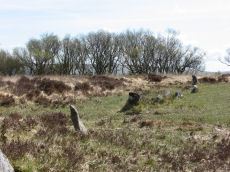
Lakehead Hill Summit Stone Row
Prehistoric Dartmoor Walks: Dartmoor Site: Lakehead Hill
OS Map: SX 64367 77656
HER: MDV5930
Megalithic Portal: 2010
The Stone Rows of GB: Lakehead Hill Summit
PMD: Lakehead Hill 3 Stone Row
Alternate name: Lakehead Hill summit Stone Row
Short Name: SR LakeheadSum
Butler map: 27.19.3
DPD: 115
Dimensions (m): 19.9
Notes: HER: A stone alignment lying on a gentle slope near the summit of Lakehead Hill. It includes a 22 metre long, single row of at least 12 stones standing up to 0.75 metres high, aligned east to west.. Lethbridge diagram p.114 and photo bottom p.115.
Nearest Bus Stop: Postbridge Bellever (1.2 km) [Route: 98]
Nearby sites: SX 64367 77656
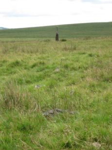
Langstone Moor Stone Row
Prehistoric Dartmoor Walks: Dartmoor Site: Langstone Moor Stone Circle, Stone Row & Settlements
OS Map: SX 55022 78851
HER: MDV4223
Megalithic Portal: 2016
The Stone Rows of GB: Langstone Moor
PMD: Langstone Moor I Stone Row
Short Name: SR Langstone
Butler map: 30.12
DPD: 14
Dimensions (m): 118
Notes: "A single stone row stands on Launceston (Langstone). Moor circa 330 feet in length, probably longer when complete. There are now only 18 stones, the largest of which stands only 18 inches above ground. At the north end are the remains of a barrow, now reduced to little more than a rubble ring. At the south end is the standing stone known as the 'Langstone', from which the moor probably takes its name. The stone was re-erected in 1893 and stands to a height of 9 feet 3 inches." Lethbridge p14, diagram p13. Breton (p.17): The Langstone was formerly the end of a stone row, composed of quite small stones, running in a direction N. and S. from a pool that occupies the site of a destroyed cairn.
Nearest Bus Stop: Merrivale Dartmoor Inn (3.7 km) [Route: 98,171(20/07/26 to 19/09/26)]
Nearby sites: SX 55022 78851
Langstone Moor 2 Stone Row
OS Map: SX 54945 78842
HER: MDV4107
PMD: Langstone Moor 2
Alternate name: Langstone Moor II Stone Row
Short Name: SR:Langstone 2
Butler map: 30.12
Notes: "Reave running from north - south on the eastern slopes of Whittor close to the Langstone Stone Row." Breton (p.17): Nearly parallel to it, and 60 yds away was another row.
Nearest Bus Stop: Merrivale Dartmoor Inn (3.7 km) [Route: 98,171(20/07/26 to 19/09/26)]
Nearby sites: SX 54945 78842
Langstone Moor 3 Stone Row
OS Map: SX 551 788
HER: No record
The Stone Rows of GB: Langstone Moor 3
PMD: Langstone Moor 3
Alternate name: Langstone Moor III Stone Row
Short Name: SR:Langstone 3
Butler map: 30.12
Notes: R.N. Worth Still further from the Launceston row to the eastward there are a few stones in line just above the surface, which may be the remnants of another. NB. This record and quote originates from the Bill Radcliffe PMD entry.
Nearest Bus Stop: Merrivale Dartmoor Inn (3.6 km) [Route: 98,171(20/07/26 to 19/09/26)]
Nearby sites: SX 551 788
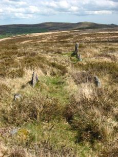
Laughter Tor E. Stone Row
Prehistoric Dartmoor Walks: Dartmoor Site: Laughter Tor Stone Row
OS Map: SX 65222 75393
HER: MDV53417
Megalithic Portal: 2017
The Stone Rows of GB: Laughter Tor 1
PMD: Laugh Tor I Stone Row
Alternate name: Laughter Tor 1 Stone Row
Short Name: SR Laugh Tor E
Butler map: 28.12.1
DPD: 122
Dimensions (m): 164
Notes: Butler Laughter 1. Double row interrupted by a new-take wall. row is robbed near wall. "Bronze Age standing stone 2.65 metres high, 0.7 metres wide and 0.52 metres thick, set into a small cairn. About 18 metres to the south east is a double stone row orientated north west to south east and consisting of at least 23 upright stones and a further 9 displaced ones averaging about 1.7 metres apart. The standing stone was re-erected in 1893 and again in 1911 and the cairn was excavated in 1903". Lethbridge pp.121-122. Breton p.41.
Nearest Bus Stop: Postbridge Bellever (2.0 km) [Route: 98]
Nearby sites: SX 65222 75393
Laughter Tor W. Stone Row
Prehistoric Dartmoor Walks: Dartmoor Site: Laughter Tor Stone Row
OS Map: SX 65207 75389
HER: MDV6002
Megalithic Portal: 52739
The Stone Rows of GB: Laughter Tor 2
PMD: Laugh Tor II Stone Row
Alternate name: Laughter Tor 2 Stone Row
Short Name: SR Laugh Tor W
Butler map: 28.12.2
Butler Vol 5: p.215 & Fig.149
DPD: 122
Dimensions (m): 8.2
Notes: Butler Laughter 2. "A double stone row at about 395m OD cuts across the gentle SW projecting spur of Laughter Tor in an area of heather and rough grass some 12m WSW of the standing stone 'Laughter Man'. The stones, although all relatively small in size, form two good slightly curving rows oriented about 295 degs. and 0.7m to 1.2m apart, consisting of thirteen stones extending from SX 6519075381 some 15m ESE to SX 6520475375. Now visible are six stones in each row with a single stone at the NW end. Originally there may have been at least ten in each row at intervals of about 1.2m". Lethbridge pp.121-122.
Nearest Bus Stop: Postbridge Bellever (2.0 km) [Route: 98]
Nearby sites: SX 65207 75389
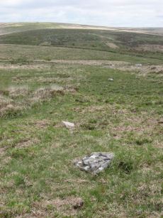
Leeden Tor Stone Row
Prehistoric Dartmoor Walks: Dartmoor Walk: Sharpitor area Stone Rows and Cists
OS Map: SX 56522 71474
HER: MDV50223
Megalithic Portal: 2020
The Stone Rows of GB: Leeden Tor
PMD: Leeden Tor Stone Row
Short Name: SR Leeden Tor
Butler map: 45.15
DPD: 23
Dimensions (m): 165
Notes: "BA cairn and stone row. The scrappy remains of a single stone row now 165m long descend from a badly battered cairn on the south-east slopes of Leeden Tor. The cairn is about 6m across with a large central pit and partial retaining circle. At least 14 stones remain in a line, four only still earthfast and the rest either flat or buried. Stone pits record the loss of some of the stones". Lethbridge p23, diagram p.24. See also: Sea Views at Leeden Tor
Nearest Bus Stop: Princetown Dartmoor Visitor Centre (3.2 km) [Route: 98,171(20/07/26 to 19/09/26)]
Nearby sites: SX 56522 71474
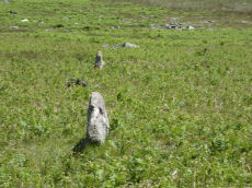
Little Links Tor Stone Row
OS Map: SX 54234 87486
HER: MDV51434
The Stone Rows of GB: Little Links Tor
PMD: Little Links Tor
Short Name: SR LittleLinks
Dimensions (m): 74
Notes: Formerly listed at SX 54160 87470. Visited on 20 June 2022 and correct location is SX 54234 87486.
Nearest Bus Stop: Fox and Hounds Hotel (1.9 km) [Route: 118]
Nearby sites: SX 54234 87486
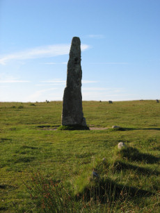
Merrivale (Menhir 1) Stone Row
Prehistoric Dartmoor Walks: Dartmoor Site: Merrivale Ceremonial Complex [Photo Set 1]
OS Map: SX 55361 74592
HER: MDV53397
Megalithic Portal: 3388
The Stone Rows of GB: Merrivale 4
PMD: Merrivale Menhir I Stone Row
Alternate name: Merrivale 4 Stone Row
Short Name: SR Mer Menhir
Butler map: 44.8.4
DPD: 17
Dimensions (m): 2.97
Notes: Butler Row 4. Prehistoric Monuments of Dartmoor website Menhir 1. "Stone row 4 is now a trivial affair [Butler] of 3 small slabs aligned towards a squarish block near the base of the standing stone. This area has suffered some damage over the past century. There were 5 stones in 1895, the missing one presumably accounted for by the pit which has appeared between the upper stones. This may well be the site of the cairn, C4, at the head of the rows recorded by Rowe but not included in the plans of Lukis or Worth. Nor is there much surviving from the circle of slabs around the menhir depicted in Bray's plan and recorded by Spence Bate in 1871, or the nearby cist which he excavated, C5. The Exploration Committee excavated at both ends of the row but no more socket holes were found and they concluded that this short alignment was complete." Lethbridge pp.16-18, diagram p.16.
Nearest Bus Stop: Merrivale Dartmoor Inn (0.8 km) [Route: 98,171(20/07/26 to 19/09/26)]
Nearby sites: SX 55361 74592
Merrivale 5 Stone Row
OS Map: SX 55354 74592
HER: MDV53398
The Stone Rows of GB: Merrivale 5
PMD: Merrivale Menhir II
Short Name: SR:Merrivale 5
Butler map: 44.8
Dimensions (m): 5.6
Notes: HER: Possible stone alignment lying to the south-west of the standing stone at Merrivale. Stones are small and identification uncertain. Gerrard: Cluster of small earthfast upright granite slabs. This feature lies within 9.0 meters west of the standing stone (PRN 53395) and includes a number of stones protruding through the turf, the largest of which stands up to 0.35 meters high. The precise nature of the feature associated with these stones is uncertain because most of it survives as a buried feature, but they may represent the site of a second cairn identified in this area by Rowe or may represent part of a stone alignment. Butler: A small slab can be seen approximately 5.5m from the standing stone which seems to have been deliberately set and Butler makes reference to the 'tops of several more which can be seen in one or two lines' between that and the standing stone, although he does not plot these stones on his plan.
Nearest Bus Stop: Merrivale Dartmoor Inn (0.8 km) [Route: 98,171(20/07/26 to 19/09/26)]
Nearby sites: SX 55354 74592
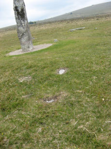
Merrivale 6 Stone Row
OS Map: SX 55344 74590
HER: No record
The Stone Rows of GB: Merrivale 6
Short Name: SR Merrivale 6
Butler map: 44.8
Dimensions (m): 6.4
Notes: Gerrard: A probable single stone row measuring at least 6.4m long, including small-sized stones situated on a gentle south facing slope with extensive views towards Bodmin Moor. The row is orientated east to west and a restricted view of the sea may be of significance.
Nearest Bus Stop: Merrivale Dartmoor Inn (0.7 km) [Route: 98,171(20/07/26 to 19/09/26)]
Nearby sites: SX 55344 74590
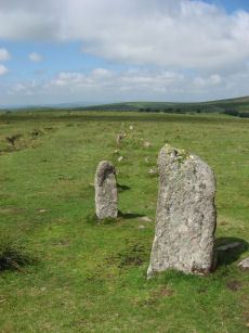
Merrivale A Stone Row
Prehistoric Dartmoor Walks: Dartmoor Site: Merrivale Ceremonial Complex [Photo Set 1]
OS Map: SX 55541 74809
HER: MDV14797
Megalithic Portal: 2044
The Stone Rows of GB: Merrivale 1
PMD: Merrivale A Stone Row
Alternate name: Merrivale 1 Stone Row
Short Name: SR MerrivaleA
Butler map: 44.8.1
DPD: 16
Dimensions (m): 183
Notes: Worth Merrivale A. Butler Merrivale 1. "Two Bronze Age double stone rows and associated cairns are located on open moorland. The rows are oriented roughly east to west and are almost parallel, being 25 metres between centres at their eastern ends increasing to 32 metres at the west. A leat still used to convey water to Hillside Stables separates the two monuments and flows to within 2 metres of the northern row. A single row (see SX 57 SE 115) runs roughly south-west from a small cairn at SX 55397476, some 4.75 metres south of the south row." Lethbridge pp.16-18, diagram p.16.
Nearest Bus Stop: Merrivale Dartmoor Inn (0.8 km) [Route: 98,171(20/07/26 to 19/09/26)]
Nearby sites: SX 55541 74809
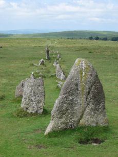
Merrivale B Stone Row
Prehistoric Dartmoor Walks: Dartmoor Site: Merrivale Ceremonial Complex [Photo Set 1]
OS Map: SX 55567 74788
HER: MDV14795
Megalithic Portal: 117
The Stone Rows of GB: Merrivale 2
PMD: Merrivale B Stone Row
Alternate name: Merrivale 2 Stone Row
Short Name: SR MerrivaleB
Butler map: 44.8.2
DPD: 16
Dimensions (m): 263.
Notes: Butler Merrivale 2. Worth Merrivale B. For description see Merrivale A. Lethbridge pp.16-18, diagram p.16.
Nearest Bus Stop: Merrivale Dartmoor Inn (0.8 km) [Route: 98,171(20/07/26 to 19/09/26)]
Nearby sites: SX 55567 74788
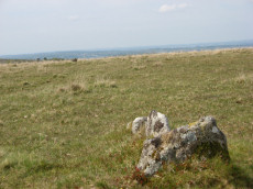
Merrivale C Stone Row
Prehistoric Dartmoor Walks: Dartmoor Site: Merrivale Ceremonial Complex [Photo Set 1]
OS Map: SX 55394 74761
HER: MDV5001
Megalithic Portal: 3391
The Stone Rows of GB: Merrivale 3
PMD: Merrivale C Stone Row
Alternate name: Merrivale 3 Stone Row
Short Name: SR MerrivaleC
Butler map: 44.8.3
DPD: 17
Dimensions (m): 60
Notes: "A stone row and a small cairn lie to the south of the double stone rows in close-cropped moorland turf. The cairn located at the northern end and slightly off-centre to the row, measures 3.2m across and up to 0.5m high. An 0.3m deep central pit opens out on the southern side."
Nearest Bus Stop: Merrivale Dartmoor Inn (0.7 km) [Route: 98,171(20/07/26 to 19/09/26)]
Nearby sites: SX 55394 74761
Oke Tor Reported Stone Row
OS Map: SX 61202 90099
HER: MDV4375
PMD: Oke Tor
Short Name: SR?OkeTor
Notes: Dubious. A stone row on the western slopes of oke tor. The stone row runs a little north of west and south of east directly downhill towards the river(east okement). It is single, and runs between two large stone slabs which probably once formed part of cists, and at the further end two large stones lying prone within 2m of each other. One of the two slabs is set amidst other stones which may have formed a circle. Between the slabs is a fallen stone.(worth). Grinsell gives ngr 610-902 for apparently the same site. The cist is contained in the remains of a cairn. Not found. NB. This record is duplicated here as a reported stone row. It is also duplicated on the HER. See also: Oke Tor Reported Cist Butler Vol 2 p.206.
Nearest Bus Stop (Minor): Belstone Car Park (3.8 km) [Route: 670]
Nearest Bus Stop (Major): Ramsley (4.8 km) [Route: 670,671,6A]
Nearby sites: SX 61202 90099
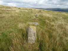
Penn Beacon S. Stone Row
OS Map: SX 59947 62553
HER: MDV2400
Megalithic Portal: 2076
The Stone Rows of GB: Penn Beacon South
PMD: Penn Beacon Stone Row
Alternate name: Penn Beacon S Stone Row
Short Name: SR Penn Beac S
Butler map: 52.14
DPD: 62
Dimensions (m): 32.5
Notes: "A single stone row, sixty-six feet long, the largest stone being about 2 1/2 feet high. This row is no more than a remnant". Lethbridge p.62 Penn stone row - diagram p.59.
Nearest Bus Stop: Lee Moor Clearview (2.8 km) [Route: 59]
Nearby sites: SX 59947 62553

Penn Beacon S.W. Stone Row
OS Map: SX 59523 62471
HER: MDV2399
Megalithic Portal: 2077
The Stone Rows of GB: Penn Beacon South West
PMD: Penn Beacon Cairn Stone Row
Alternate name: Penn Beacon SW Stone Row
Short Name: SR PennBeac SW
Butler map: 52.14.1
DPD: 61
Dimensions (m): 5.8
Notes: "A short double stone row 24ft. long and nearly 2ft. wide consisting of two pairs of stones on the southern slope of Penn Beacon. To the north end of the row there is a cairn approximately 52 feet in diameter and 6 foot high. It was excavated in 1872, a cist was discovered, though the capstone had collapsed at one end. Fragments of a wide mouthed jar were found and a slate implement, thought to be used for fashioning clay vessels". Lethbridge p.61 Penn Moor south double stone row and cairn - diagram p.59. See also: Bate's 1872 Report
Nearest Bus Stop: Lee Moor Clearview (2.3 km) [Route: 59]
Nearby sites: SX 59523 62471
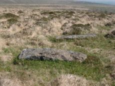
Piles Hill Stone Row
Prehistoric Dartmoor Walks: Dartmoor Site: Piles Hill Double Stone Row & Cairns
OS Map: SX 65016 61113
HER: MDV5662
Megalithic Portal: 2080
The Stone Rows of GB: Piles Hill
PMD: Piles Hill Stone Row
Short Name: SR Piles Hill
Butler map: 54.19
DPD: 74
Dimensions (m): 865
Notes: "The double stone row formed by 139 stones, 7 of which lean; the others are either stumps with drill marks, cleanly snapped off stones, or recumbent posts, whole or split by drilling. Some 30 stones exceed 2.0m. in length with a maximum of 3.0m. A few take the form of slabs or boulders but the majority are of post-type up to 0.6m. square in section, with an angled top created by a single 'chamfer'. The rows in the main alignment are from 21.0m. to 30.0m. apart and within them the gaps between stones vary from 3.0m. to 30.0m. At each end the rows are close, 12.0m. to 17.0m. apart with fewer large gaps between stones". Lethbridge pp.74-6, diagram p.74.
Nearest Bus Stop: Cornwood Crossways (4.8 km) [Route: 59]
Nearby sites: SX 65016 61113
Ramsley Stone Row
OS Map: SX 652 930
HER: MDV6950
PMD: Ramsley Stone Row
Short Name: SRxRamsley
Notes: "There is evidence for the former existence of stone rows at Ramsley above South Zeal. They were destroyed some 25 years ago by works in connection with the Ramsley Mine and only a few of the smaller and less important stones remain. Mr George French, working at Ramsley at the time, recollects their existence." Destroyed site, might have been field wall. Grid reference given is that of the vicinity of the Ramsley cairn.
Nearest Bus Stop: South Zeal The Croft (0.2 km) [Route: 178]
Nearby sites: SX 652 930
Ringhill Stones Reported Stone Row
OS Map: SX 6473 7947
HER: MDV5856
Megalithic Portal: 2101
Short Name: SRxRinghill
Notes: Breton p.34: Ringhill Stones stand in a field E. of the farm. The two large ones are 15ft. apart. The largest is nearly 5ft. high They were formerly part of stone rows which have been destroyed. 203 yds N.E. of the stones close to the Stannon Brook is the site of a blowing house; just beyond is a stone hedge, built into it is a mould stone.. HER: standing stones. Only two of the five standing stones could be found, it appears that the remainder were destroyed during the construction of an occupational road to Hartyland. These stones are of very weathered appearance, suggestive of great antiquity. See also entry on Megalithic Portal.
Nearest Bus Stop: Postbridge Post Office (0.6 km) [Route: 98,171(20/07/26 to 19/09/26)]
Nearby sites: SX 6473 7947
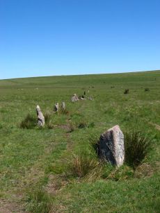
Ringmoor Down Stone Row
Prehistoric Dartmoor Walks: Dartmoor Site: Ringmoor Stone Row & Cairn Circle
OS Map: SX 56330 65808
HER: MDV3986
Megalithic Portal: 2102
The Stone Rows of GB: Ringmoor Down
PMD: Ringmoor Down Stone Row
Short Name: SR Ringmoor
Butler map: 49.20
DPD: 34
Dimensions (m): 369
Notes: "A stone row, 1740 feet long, mainly single but double in parts. At its southern end is a cairn circle with a diameter of 40ft. 6ins. In 1909 the circle was restored and five of the present stones were introduced from elsewhere. Prior to restoration one stone was standing, four had fallen and the presumed sites of six other stones were represented by pits. A 4ft long fallen stone terminated the stone row at its northern end". Lethbridge p.34-36, diagram p.34 site 3. See also: Sea Views at Ringmoor Down`
Nearest Bus Stop: Meavy Primary School (2.3 km) [Route: 56]
Nearby sites: SX 56330 65808
Round Hill E Reported Stone Row
OS Map: SX 6121 7439
HER: MDV6220
PMD: Roundhill E.
Short Name: SR:RoundHill E
Notes: Record originates with Prowse. HER: Stone alignment east of Round Hill later identified as a prehistoric field boundary
Nearest Bus Stop: Two Bridges Hotel (0.7 km) [Route: 98,171(20/07/26 to 19/09/26)]
Nearby sites: SX 6121 7439

Scorhill Reported Stone Row
Prehistoric Dartmoor Walks: Dartmoor Site: Scorhill Stone Circle
OS Map: SX 65485 87207
HER: MDV130497
Megalithic Portal: 25238
PMD: Scorhill Stone Row
Short Name: SR Scorhill
Butler map: 38.8
Butler Vol 5: p.172 & Fig.112
DPD: 146
Dimensions (m): 5
Notes: N. Teign. Claimed by Butler.See also Butler Vol 5 p. 249 fig. 175. Possible stone row near long cairn south-east of the Scorhill stone circle recorded by Butler (1991), although Gerrard was not convinced during Monument Protection Programme visit in 1998 and was not included in scheduling. Site visit in 2021 recorded potential row.. Visited by author on 06/02/2025 and the feature can be seen but currently looks like stones that may have been disturbed, tumbled, from the cairn that happen to form a short linear features. Changed entry from stone row to reported stone row as I'm inclined to agree with Gerrard.
Nearest Bus Stop (Minor): Wonson Telephone Box (3.0 km) [Route: 670]
Nearest Bus Stop (Major): Chagford The Square (4.6 km) [Route: 173,178,671]
Nearby sites: SX 65485 87207
Scorhill N Reported Stone Row
OS Map: SX 6574 8782
HER: MDV6189
Megalithic Portal: 25238
Short Name: SR:ScorhillN
Notes: HER: (1950) Stone row. SX 65628794 to SX 65748782. (09/07/1974) There is no alignment of stones in this area of moorland which can be considered other than natural. It is doubtful if the alleged stone row was ever seen by Crawford. The information most probably came from H H Breton, an unreliable correspondent of c 1925.
Nearest Bus Stop (Minor): Wonson Telephone Box (2.6 km) [Route: 670]
Nearest Bus Stop (Major): Chagford The Square (4.6 km) [Route: 173,178,671]
Nearby sites: SX 6574 8782
Sharp Tor North East Stone Row
OS Map: SX 6500 6188
HER: MDV13486
The Stone Rows of GB: Sharp Tor North East
PMD: Sharp Tor NE. Stone Row
Alternate name: Sharp Tor NE Stone Row
Short Name: SR:Sharp Tor N
Dimensions (m): 12.5
Notes: HER: "Circle of seven stones, measuring around 8.0 metres in diameter, with a possible stone alignment of three stones leading north-east from the circle." See also linked entry on SRGB which states "Dense vegetation made it difficult to be certain that there was a stone row row at this location."
Nearest Bus Stop: Cornwood Crossways (5.1 km) [Route: 59]
Nearby sites: SX 6500 6188
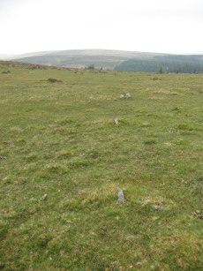
Sharpitor E. Stone Row
Prehistoric Dartmoor Walks: Dartmoor Walk: Sharpitor area Stone Rows and Cists
OS Map: SX 56171 70819
HER: MDV4991
Megalithic Portal: 2117
The Stone Rows of GB: Sharpitor North East
PMD: Sharpitor E Stone Row
Alternate name: Sharpitor NE Stone Row
Short Name: SR Sharp NE
Butler map: 45.13
DPD: 21
Dimensions (m): 27.5
Notes: Described by Worth as "Sharpitor, foot of eastern slope". Listed by Butler as Sharpitor N.E. (which can be confused with another alleged row). "A stone row, with a cairn at the west end at SX 56147078, extends almost due west for 26.0m. to SX 56167078. The cairn, mutilated and amorphous, is now approximately 6.7m in diameter and 0.3m. high at its maximum. There are nine stones in the row, including three pairs, with an additional stone which seems to be displaced, all between 0.1m. and 0.3m. high. The east end of the row is terminated by a reave (SX 67 SE 91) which has cut across and evidently destroyed any westward extension." Lethbridge pp.20-22.
Nearest Bus Stop: Walkhampton Memorial (3.1 km) [Route: 55,56]
Nearby sites: SX 56171 70819
Sharpitor N.W. 1 Stone Row
Prehistoric Dartmoor Walks: Dartmoor Walk: Sharpitor area Stone Rows and Cists
OS Map: SX 55665 70617
HER: MDV3762
Megalithic Portal: 2118
The Stone Rows of GB: Sharpitor North West 1
PMD: Sharpitor Summit N Stone Row
Alternate name: Sharpitor NW 1 Stone Row
Short Name: SR Sharp NW1
Butler map: 45.12.1
DPD: 21
Barrow Report: 66
Dimensions (m): 113
Notes: "The double stone row is in poor shape. Both terminals have survived fixing its length at 113m from the blocking stone to the centre of the cairn. The cairn (4.5 x 0.3) has lost its retaining circle and has been dug into in the centre. The other end of the row is well defined by a pair of larger slabs in the line of the rows followed by a central cross-set blocking stone 1.2m long that has been tipped backwards and is partly overgrown. The stones seemed to have increased in size nearer the cairn. Unusually the highest point on the ground is not at the cairn end but near the centre of the rows as they cross the summit of the ridge".
Nearest Bus Stop: Walkhampton Memorial (2.5 km) [Route: 55,56]
Nearby sites: SX 55665 70617

Sharpitor N.W. 2 Stone Row
Prehistoric Dartmoor Walks: Dartmoor Walk: Sharpitor area Stone Rows and Cists
OS Map: SX 55687 70600
HER: MDV3761
Megalithic Portal: 2119
The Stone Rows of GB: Sharpitor North West 2
PMD: Sharpitor Summit S Stone Row
Alternate name: Sharpitor NW 2 Stone Row
Short Name: SR Sharp NW2
Butler map: 45.12.2
DPD: 21
Dimensions (m): 133
Notes: "A BA single stone row oriented NE - SW at a very slight angle to the north-east end of the adjacent double stone row. The large scale survey dated 1980 shows a total of thirty stones whilst in 1994 it was reported that only about 10 stones can be identified with certainty and half of these are either buried or just showing."
Nearest Bus Stop: Walkhampton Memorial (2.5 km) [Route: 55,56]
Nearby sites: SX 55687 70600
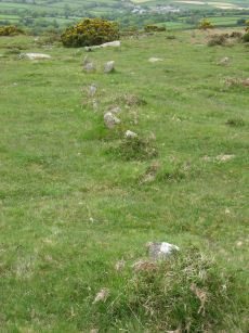
Sharpitor W. (Peek Hill) Stone Row
Prehistoric Dartmoor Walks: Dartmoor Walk: Sharpitor area Stone Rows and Cists
OS Map: SX 55058 70748
HER: MDV12831
Megalithic Portal: 2120
The Stone Rows of GB: Sharpitor West
PMD: Sharpitor W Stone Row
Alternate name: Sharpitor W Stone Row
Short Name: SR Sharpitor W
Butler map: 45.11
DPD: 20
Dimensions (m): 132
Notes: Butler: Sharpitor W, Worth: Peek Hill. Near Horseyeat Farm. "BA stone row and cairn. The 132m long row has 47 upright stones and the low cairn is 8.4m in diameter. Both monuments lie under dense bracken cover; gorse vegetation has obscured part of the row". Lethbridge pp.19-20, diagram p.19, photo p.20 Horseyeat Farm stone row. See also: Sea Views at Sharpitor West
Nearest Bus Stop: Walkhampton Memorial (2.0 km) [Route: 55,56]
Nearby sites: SX 55058 70748
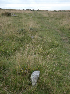
Shaugh Moor Stone Row
OS Map: SX 55422 63435
HER: MDV2434
Megalithic Portal: 2121
The Stone Rows of GB: Shaugh Moor
PMD: Shaugh Moor Stone Row
Alternate name: Shaugh Moor row Stone Row
Short Name: SR ShaughMoor
Butler map: 48.5
DPD: 55
Dimensions (m): 179
Notes: "A single stone row 587 feet long, the spacing of the stones varies between 3 feet and 5 feet, centre to centre. At the Southwest end there is a retaining circle 50 feet in diameter. The stones of the row are very small and sunk into the peat, making them hard to find. A stone row 164m long aligned SW-NE over the brow and down the south side of the valley. The terminals are not intervisible. It is composed of small stones, normally between 35 and 10cm high, the tallest (65cms) being at the apparent northern terminal. Where the stones have been removed their original positions can be identified from depressions in the turf". Lethbridge p.54-55, diagram p.55. See also: Sea Views at Shaugh Moor
Nearest Bus Stop: Shaugh Prior White Thorn Inn (1.3 km) [Route: 59]
Nearby sites: SX 55422 63435
Shell Top S.W. Stone Row
OS Map: SX 59473 63142
HER: MDV48897
Megalithic Portal: 36955
The Stone Rows of GB: Shell Top South West
PMD: Shell Top Stone Row
Alternate name: Shell Top SW Stone Row
Short Name: SR:ShellTopSW
Butler map: 51.9
DPD: 60
Dimensions (m): 73.5
Notes: Not listed in NMR. Discovered by Lethbridge in 1992. Butler Vol. 3 Map 51.9. Oval cairn at the higher end. Orientated just west of north and 73.5 m from the cairn is a massive fallen longstone 2.7 m long which is probably the terminal stone of the row. There are 31 of 47 original stones visible in the row, all but a few either flat or leaning. Lethbridge p.59-61 diagram p.59, 61.
Nearest Bus Stop: Lee Moor Clearview (2.6 km) [Route: 59]
Nearby sites: SX 59473 63142
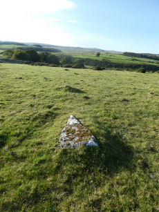
Sherberton Stone Row
OS Map: SX 63948 73349
HER: MDV6426
Megalithic Portal: 6333470
The Stone Rows of GB: Sherberton Row
PMD: Sherberton Stone Row
Alternate name: Sherberton Row Stone Row
Short Name: SR Sherberton
Butler Vol 5: p.211 & Fig.148
DPD: 100
Dimensions (m): 117
Notes: The Sherberton double row was discovered in 1997. It is an unimpressive double row of small stones a short distance north-west of the Sherberton Circle. For a plan see Butler Vol. 5 p. 210-12. Lethbridge pp.99-100, diagram p.99 and p.100.
Nearest Bus Stop (Minor): Powder Mills (3.4 km) [Route: 171(20/07/26 to 19/09/26)]
Nearest Bus Stop (Major): Two Bridges Hotel (3.5 km) [Route: 98,171(20/07/26 to 19/09/26)]
Nearby sites: SX 63948 73349
Sherberton Common Reported Stone Row
OS Map: SX 69148 73346
HER: MDV6426
The Stone Rows of GB: Sherberton Common
PMD: Sherberton Common
Short Name: SR:SherberCom
Butler map: 11.6
Butler Vol 5: p.214
Dimensions (m): 68.6
Notes: Sandy Gerrard (see link to SRGB): According R.N. Worth this is a double stone row that measured 68.6m long situated on a gently sloping south facing slope. According to him the row was destroyed in 1897 shortly after its discovery. The rows were described as being between 8 and 9 feet apart and included some contiguous stones. Jeremy Butler suggested that it was a passage similar to one surviving at Fernworthy Reservoir but he was unable to identify the site of the feature described by Worth (Butler, J., 1997, 214). Fresh fieldwork has identified the structure, which survives comparatively well and is clearly a passageway leading to a robbed roundhouse from a length of prehistoric rubble walling. The structure has only been partly robbed and several stones remain together with the original 1897 stone robbing pits.
Nearest Bus Stop (Minor): Widecombe in the Moor Car Park (4.5 km) [Route: 271]
Nearest Bus Stop (Major): Postbridge Bellever (5.4 km) [Route: 98]
Nearby sites: SX 69148 73346
Shoveldown 1 Stone Row
Prehistoric Dartmoor Walks: Dartmoor Site: Shovel Down Ceremonial Complex
OS Map: SX 66049 85707
HER: MDV6181
Megalithic Portal: 2128
The Stone Rows of GB: Shoveldown 1
PMD: Shovel Down H-K Stone Row
Short Name: SR ShovelRow 1
Butler map: 36.7.1
DPD: 139
Dimensions (m): 540
Notes: Worth Row G, Butler Row 1. This row is considered to be one long partially robbed row. Previously listed here as Shoveldown D-G-H-J now Shoveldown 1 after Butler and Gerrard.
Nearest Bus Stop (Minor): Wonson Telephone Box (4.1 km) [Route: 670]
Nearest Bus Stop (Major): Chagford The Square (4.4 km) [Route: 173,178,671]
Nearby sites: SX 66049 85707
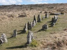
Shoveldown 2 Stone Row
Prehistoric Dartmoor Walks: Dartmoor Site: Shovel Down Ceremonial Complex
OS Map: SX 65955 86026
HER: MDV6171
Megalithic Portal: 2129
The Stone Rows of GB: Shoveldown 2
PMD: Shovel Down A-B Stone Row
Short Name: SR ShovelRow 2
Butler map: 36.7.2
DPD: 139
Dimensions (m): 182
Notes: Worth Row A. Butler Rows 2.('B' SX 65968615 to SX 65968601) Double row to the east. Length 596 ft. Rows 3 ft 6in apart. Row is near Batworthy enclosure and has been much robbed; now just 12 pairs of stones and 15 single. Spacing of stones along the rows is around 6 ft. Two fallen stones next to the circle are much the largest in the row; one is 11 ft 6in, in length. and the other 7ft 4 in. The southern end of the row terminates in the Fourfold Circle (SX 68 NE 17). Lethbridge 139-145, diagram p.139.
Previously listed here as Shoveldown B now Shoveldown 2 after Butler and Gerrard.
Nearest Bus Stop (Minor): Wonson Telephone Box (3.8 km) [Route: 670]
Nearest Bus Stop (Major): Chagford The Square (4.4 km) [Route: 173,178,671]
Nearby sites: SX 65955 86026

Shoveldown 3 Stone Row
Prehistoric Dartmoor Walks: Dartmoor Site: Shovel Down Ceremonial Complex
OS Map: SX 65932 86073
HER: MDV6168
Megalithic Portal: 2130
The Stone Rows of GB: Shoveldown 3
PMD: Shovel Down D-E Stone Row
Short Name: SR ShovelRow 3
Butler map: 36.7.3
DPD: 139
Dimensions (m): 155
Notes: Worth Row E, Butler Rows 3. ('A' SX 65898616 to SX 65938605). Double row to the west of row B. Length 476 ft. Rows just over 4 ft apart but distance varies considerably along length. No special feature marks either end. Much robbed and single now along much of its length. Lethbridge 139-145, diagram p.139.
Previously listed here as Shoveldown A now Shoveldown 3 after Butler and Gerrard. Photo included here previously (taken in 2010) had misidentified Shoveldown 4 for this row.
Nearest Bus Stop (Minor): Wonson Telephone Box (3.8 km) [Route: 670]
Nearest Bus Stop (Major): Chagford The Square (4.4 km) [Route: 173,178,671]
Nearby sites: SX 65932 86073

Shoveldown 4 Stone Row
Prehistoric Dartmoor Walks: Dartmoor Site: Shovel Down Ceremonial Complex
OS Map: SX 65998 85903
HER: MDV14875
Megalithic Portal: 2127
The Stone Rows of GB: Shoveldown 4
PMD: Shovel Down C-F Stone Row
Short Name: SR ShovelRow 4
Butler map: 36.7.4
DPD: 139
Dimensions (m): 118
Notes: Worth Row C, Butler Rows 4. "('C' SX 65948601 to SX 65998590) A double row, 380 feet long, with an average distance of five feet between the rows. Most of the pairs of stones are complete and the southern end terminates in a barrow (SX 68 NE 34). No special feature marks the northern end."
Nearest Bus Stop (Minor): Wonson Telephone Box (3.9 km) [Route: 670]
Nearest Bus Stop (Major): Chagford The Square (4.4 km) [Route: 173,178,671]
Nearby sites: SX 65998 85903
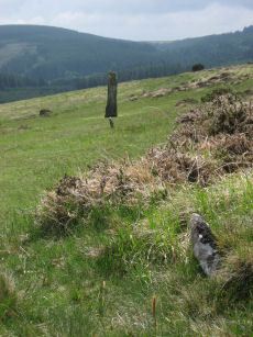
Shoveldown 5 Stone Row
Prehistoric Dartmoor Walks: Dartmoor Site: Shovel Down Ceremonial Complex
OS Map: SX 66017 85840
HER: MDV6179
Megalithic Portal: 2126
The Stone Rows of GB: Shoveldown 5
PMD: Shovel Down G Stone Row
Short Name: SR ShovelRow 5
Butler map: 36.7.5
DPD: 139
Dimensions (m): 148
Notes: Worth Row G, Butler Rows 5 & 6 ('E')SX 66028581 to SX 66028567) A double row, 485 feet long with 3 1/4 feet between the rows which run almost due north and south, and terminates in a standing stone known as the Longstone (SX 68 NE 39). Fairly complete at the northern end but more ragged towards the south.
Nearest Bus Stop (Minor): Wonson Telephone Box (4.0 km) [Route: 670]
Nearest Bus Stop (Major): Chagford The Square (4.4 km) [Route: 173,178,671]
Nearby sites: SX 66017 85840
Shoveldown 6 Stone Row
OS Map: SX 66024 85681
HER: MDV6148
The Stone Rows of GB: Shoveldown 6
PMD: Shovel Down South
Short Name: SR:ShovelRow 6
Butler map: 36.7.6
Dimensions (m): 170
Notes: Previously listed here as Shoveldown Longstone to Three Boys Stone Row now Shoveldown 6 after Butler and Gerrard.
Nearest Bus Stop (Minor): Wonson Telephone Box (4.1 km) [Route: 670]
Nearest Bus Stop (Major): Chagford The Square (4.5 km) [Route: 173,178,671]
Nearby sites: SX 66024 85681
Shoveldown D Reported Stone Row
Prehistoric Dartmoor Walks: Dartmoor Site: Shovel Down Ceremonial Complex
OS Map: SX 66040 85680
HER: MDV6145
Megalithic Portal: 2128
The Stone Rows of GB: Shoveldown 1
PMD: Shovel Down H-K Stone Row
Short Name: SR:ShovelRow D
Butler map: 36.7.1
DPD: 139
Notes: Worth Row D, Butler Row 1. This row is considered to be one long partially robbed row - previously listed as four separate rows.
Nearest Bus Stop (Minor): Wonson Telephone Box (4.1 km) [Route: 670]
Nearest Bus Stop (Major): Chagford The Square (4.4 km) [Route: 173,178,671]
Nearby sites: SX 66040 85680
Shoveldown H Reported Stone Row
Prehistoric Dartmoor Walks: Dartmoor Site: Shovel Down Ceremonial Complex
OS Map: SX 65990 85950
HER: MDV14881
Megalithic Portal: 2128
The Stone Rows of GB: Shoveldown 1
PMD: Shovel Down H-K Stone Row
Short Name: SR:ShovelRow H
Butler map: 36.7.1
DPD: 139
Notes: Worth Row H, Butler Row 1. This row is considered to be one long partially robbed row - previously listed as four separate rows.
Nearest Bus Stop (Minor): Wonson Telephone Box (3.9 km) [Route: 670]
Nearest Bus Stop (Major): Chagford The Square (4.4 km) [Route: 173,178,671]
Nearby sites: SX 65990 85950
Shoveldown J Reported Stone Row
Prehistoric Dartmoor Walks: Dartmoor Site: Shovel Down Ceremonial Complex
OS Map: SX 65980 86030
HER: MDV14882
Megalithic Portal: 2128
The Stone Rows of GB: Shoveldown 1
PMD: Shovel Down H-K Stone Row
Short Name: SR:ShovelRow J
Butler map: 36.7.1
DPD: 139
Notes: Worth Row D, Butler Row 1. This row is considered to be one long partially robbed row - previously listed as four separate rows.
Nearest Bus Stop (Minor): Wonson Telephone Box (3.8 km) [Route: 670]
Nearest Bus Stop (Major): Chagford The Square (4.4 km) [Route: 173,178,671]
Nearby sites: SX 65980 86030
Soussons Down (Red Barrows) Stone Row
Prehistoric Dartmoor Walks: Dartmoor Site: Soussons Cairn Circle
OS Map: SX 6767 7998
HER: MDV6015
Megalithic Portal: 2136
The Stone Rows of GB: Soussons Down
PMD: Red Barrows Stone Row
Alternate name: Soussons Down Stone Row
Short Name: SR Red Barrows
Butler map: 24.2
Dimensions (m): 62
Notes: Triple row destroyed in 1946 Butler Vol. 5 p38, Vol. 2 Map 24.2 p.19. The row was associated with a cairn about 300m north of the four Red Barrow cairn group (SX 67 NE 3). Butler mentions that some of the stones of the row remained and these were observed and reported to Sandy Gerrard by Chris Jenkins.
Nearest Bus Stop (Minor): Warren House Inn (1.0 km) [Route: 171(20/07/26 to 19/09/26)]
Nearest Bus Stop (Major): Postbridge Post Office (3.1 km) [Route: 98,171(20/07/26 to 19/09/26)]
Nearby sites: SX 6767 7998
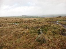
Spurrell's Cross Stone Row
Prehistoric Dartmoor Walks: Dartmoor Walk: The Erme East stone rows
OS Map: SX 65860 59862
HER: MDV2890
Megalithic Portal: 2137
The Stone Rows of GB: Spurrells Cross
PMD: Spurrells Cross Stone Row
Alternate name: Spurrell's Cross Stone Row
Short Name: SR Spurrells X
Butler map: 53.10
DPD: 78
Dimensions (m): 119
Notes: "The row has apparently been double, but since only seven stones still stand, which together with six sunken stones form the fixed points now determinable, it is difficult to ascertain the original spacing. The lines were probably about 3 feet 6 inches apart and the spacing between the stones about 3 feet. The length of the row is 370 feet as measured from the centre of the cairn and the direction of length is N 20o W. The largest standing stone is 2 feet in height. The cairn, at the south end of the row is 50 feet in diameter with only two stones remaining of the retaining circle". Lethbridge p.78, diagram p.77 Row 3. The photo here is most probably not of the row. The row runs parallel to Butterdon row and does not orientate on Spurrel's Cross.
Nearest Bus Stop: Ivybridge BP Garage (Stop B) (4.3 km) [Route: 38]
Nearby sites: SX 65860 59862
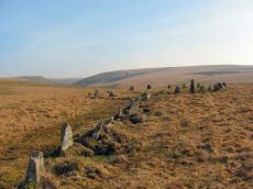
Stall Moor (Upper Erme) Stone Row
Prehistoric Dartmoor Walks: Dartmoor Site: Upper Erme Stone Row & Cairn Circle
OS Map: SX 63663 67796
HER: MDV4309
Megalithic Portal: 1464
The Stone Rows of GB: Upper Erme
PMD: Stall Moor Stone Row
Alternate name: Upper Erme Row Stone Row
Short Name: SR Stall Moor
Butler map: 55.7
DPD: 71
Dimensions (m): 3386
Notes: Worth: Stall Moor. Butler: Upper Erme. The longest stone row on Dartmoor. "A single stone row running for approximately 3.1km from a cairn on Green Hill to a stone circle on Stall Moor". Lethbridge pp.71-72, diagram p.71
Nearest Bus Stop: Princetown Dartmoor Visitor Centre (7.4 km) [Route: 98,171(20/07/26 to 19/09/26)]
Nearby sites: SX 63663 67796
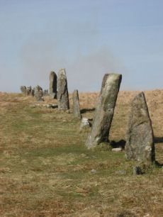
Stalldown Stone Row
Prehistoric Dartmoor Walks: Dartmoor Site: Stalldown Stone Row
OS Map: SX 63223 62558
HER: MDV4277
Megalithic Portal: 531
The Stone Rows of GB: Stalldown
PMD: Staldon Stone Row
Alternate name: Stalldon Row Stone Row
Short Name: SR Stalldown
Butler map: 54.18
Butler Vol 5: p.20 & Fig.2
DPD: 67
Dimensions (m): 859
Notes: "Bronze Age stone row and cairn circle on stall down. The stone row runs north -south for about 850m ow which 500m has been restored. It is associated with three cairns (one either side) and a cairn circle. The stones are mostly 1m to 1.5m high with four over 2m". Lethbridge pp.67-68
Nearest Bus Stop: Cornwood Crossways (4.0 km) [Route: 59]
Nearby sites: SX 63223 62558
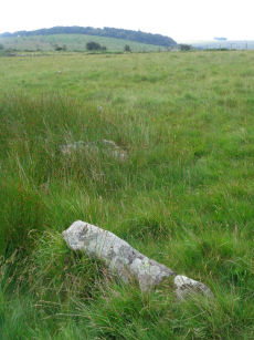
Stalldown South East Stone Row
OS Map: SX 63746 61059
HER: No record
The Stone Rows of GB: Stalldown South East
PMD: Stalldown SE1
Alternate name: Stalldown SE1 Stone Row
Short Name: SR StalldownSE
Butler map: 54.4
Dimensions (m): 21
Notes: The Stone Rows of Great Britain states: "This line of seven stones seems to be artificial and certainly looks like a stone row. The proximity of a number of small cairns further enhances this interpretation as does the visual relationship with Plymouth Sound. The stones however lies between two reaves (prehistoric boundary banks) and close to other boundaries. The possibility of this feature being an unfinished or partly robbed field boundary cannot therefore be wholly discounted." The author visited this site on 16/07/2021 and logged the location of 6 of the 7 stones of this row (must have missed one): SX 63748 61049, SX 63750 61056, SX 63751 61058, SX 63750 61060, SX 63751 61063, SX 63751 61065.
Nearest Bus Stop: Cornwood Crossways (3.6 km) [Route: 59]
Nearby sites: SX 63746 61059

Stannon Newtake Stone Row
OS Map: SX 65348 81091
HER: MDV54555
Megalithic Portal: 2144
The Stone Rows of GB: Stannon Newtake
PMD: Stannon Newtake Stone Row
Short Name: SR Stannon New
Butler map: 35.21
Dimensions (m): 18
Notes: HER: A group of four edge set stones standing up to 1 metre high, situated to the southeast of the cairn, represent the remains of a stone alignment. Possible extension of the White Ridge Stone Row. "Standing stones, possibly a stone row. Forty-six feet S. of the cairn (SX 68 SE 23) are two standing stones, two and a half feet high, their broad planes facing the monument. These, and two others in line, suggest the remains of a stone row, destroyed for materials for an ancient hedge. If a row, it does not point to the centre of the cairn."
Nearest Bus Stop (Minor): Warren House Inn (2.1 km) [Route: 171(20/07/26 to 19/09/26)]
Nearest Bus Stop (Major): Postbridge Post Office (2.3 km) [Route: 98,171(20/07/26 to 19/09/26)]
Nearby sites: SX 65348 81091

Thornworthy Reported Stone Row
OS Map: SX 66375 85001
HER: MDV6666
Short Name: SR Thornworthy
Notes: HER: A series of large stones set into a prominent field bank of a field system. It was alleged to be a stone row but this is thought unlikely. OS(1978): (SX 664850 to SX 663849) 'Stone Row' (NR) (1971 OS map).(10/02/1978) This recent publication entry (not on OS 25" 1904 or OS 6" 1961) is not a stone row but refers to some large stones set at irregular intervals along the course of a prominent field bank of a field system oriented on Thornworthy Tor (SX 68 NE146). The author located this feature on 03/03/2025 with Steve Szypko and we concluded this is regular stones in a reave, most probably prehistoric, but not a stone row.
Nearest Bus Stop (Minor): Warren House Inn (4.2 km) [Route: 171(20/07/26 to 19/09/26)]
Nearest Bus Stop (Major): Chagford The Square (4.5 km) [Route: 173,178,671]
Nearby sites: SX 66375 85001
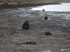
Tottiford Reservoir 1 Stone Row
OS Map: SX 81137 83093
HER: MDV102540
Megalithic Portal: 24205
The Stone Rows of GB: Tottiford Reservoir 1
PMD: Tottiford Reservoir Stone Rows
Short Name: SR Tottiford 1
Dimensions (m): 147
Notes: "This stone row was initially noticed in late 2009, when the reservoir was only 6% full. This double stone row is aligned roughly north-west - south-east and is at least 54 meters in length. The size and form of the stones used varies considerably but the two rows are consistently 1.2 meters apart. The row leads directly to (or away from) the naturally occurring mound south-east of the stone circle." This row will be normally covered by the Tottiford Reservoir. The stones of the row were exposed for a short period following the drought of August 2022. From the northenern end the author took a photo at SX 81135 83102 (6/9/22). It was too muddy to get any closer and the grid reference of SX 81137 83093 is inferred and used for this entry. Max Piper visited the day before and got as close as SX 81129 83102 which is consistent with the inferred actual location.
Nearest Bus Stop: Lustleigh Turn (2.4 km) [Route: 178]
Nearby sites: SX 81137 83093
Tottiford Reservoir 2 Stone Row
OS Map: SX 81104 83202
HER: MDV102542
The Stone Rows of GB: Tottiford Reservoir 2
PMD: Tottiford Reservoir
Alternate name: Tottiford Reservoir II Stone Row
Short Name: SR Tottiford 2
Dimensions (m): 60
Notes: Excavated during the Time Team dig in 2011. This row will be normally covered by the Tottiford Reservoir. The stones of the row were exposed for a short period following the drought of August 2022. See Wessex Archaeology report Tottiford Reservoir: Archaeological Evaluation and Assessment of Results. See also Legendary Dartmoor - Time Team at Tottiford. The NGR used here is the eastern end from Max Piper (visit 05/09/22). Max recorded SX 81104 83202 for eastern end and SX 81077 83202 for western end. The author vistied on 06/09/22 and obtained SX 81117 83210 for the eastern end. The listing uses Max's NGR.
Nearest Bus Stop: Lustleigh Turn (2.4 km) [Route: 178]
Nearby sites: SX 81104 83202
Treeland Brake Stone Row
OS Map: SX 6741 6158
HER: MDV5827
Megalithic Portal: 6333473
The Stone Rows of GB: Treeland Brake
PMD: Treeland Brake Stone Row
Short Name: SRxTreeland Bk
Butler map: 56.11
Notes: Notes from the NMR record: "Treeland Brake Stone Row. The only record of the row is a photograph taken by Mr HG Hurrell in the late 1950s. Mr Hurrell remembers about five erect stones and about five fallen, aligned north-east to south-west. The row has been destroyed by agricultural activity by 1977. (Photograph is in the possession of S & M Register)." Also: "A colour print taken by Mr Hurrell from approximately SX 67206130 shows the stones aligned to a field corner at SX 67296147. Approximate centre of row, SX 67276141; the area is now under pasture."
Nearest Bus Stop: South Brent Pool Park (3.2 km) [Route: 38]
Nearby sites: SX 6741 6158
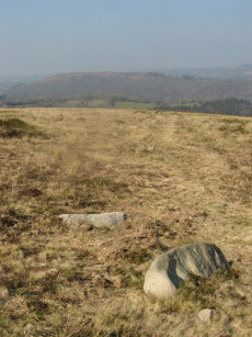
Trendlebere Down Stone Row
OS Map: SX 76600 79239
HER: MDV8076
Megalithic Portal: 2171
The Stone Rows of GB: Trendlebere Down
PMD: Trendlebeare Down Stone Row
Short Name: SR Trendlebere
Butler map: 2.7
DPD: 151
Dimensions (m): 119
Notes: "A stone row 100ft. to the north of the Haytor-Manaton road." 18 stones of the stone row can be identified of which 9 are fallen and 9 upright stones. The fallen stones vary in length between 3'4" and 4'6"; the upright ones between 6" and 2'4".
Nearest Bus Stop (Minor): Manaton Becky Falls (1.1 km) [Route: 271,671]
Nearest Bus Stop (Major): Lustleigh Bishops Stone (3.0 km) [Route: 178]
Nearby sites: SX 76600 79239
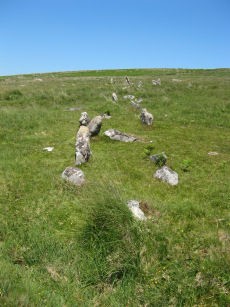
Trowlesworthy E. Stone Row
Prehistoric Dartmoor Walks: Dartmoor Site: Trowlesworthy, Settlements, Stone Row & Cairn Circle
OS Map: SX 57646 63972
HER: MDV2421
Megalithic Portal: 3516
The Stone Rows of GB: Trowlesworthy 1
PMD: Trowlesworthy E Stone Row
Alternate name: Trowlesworthy 1 Stone Row
Short Name: SR Trowles E
Butler map: 51.8.1
Butler Vol 5: p.229 & Fig.163
DPD: 57
Dimensions (m): 127.
Notes: Butler Trowlesworthy 1. "A Bronze Age stone alignment comprising a double stone row consisting of 99 upright and 8 recumbent stones running south-south-west from a possible stone circle near the foot of the south flank of Little Trowlesworthy Tor. The surviving length of the row is about 129 metres, it is bisected by a leat. The better preserved element of the row is down the slope from the leat. The circle comprises 8 main orthostat stones in a "kidney-shaped" plan. The south-west orthostat in the ring is surrounded by a number of smaller stones". Lethbridge p.57-8, diagram p.58. See also, Legendary Dartmoor: The Pulpit and Sea Views at Trowlesworthy 1
Nearest Bus Stop: Lee Moor Clearview (2.1 km) [Route: 59]
Nearby sites: SX 57646 63972
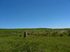
Trowlesworthy W. Stone Row
Prehistoric Dartmoor Walks: Dartmoor Site: Trowlesworthy, Settlements, Stone Row & Cairn Circle
OS Map: SX 57536 63978
HER: MDV2415
Megalithic Portal: 2176
The Stone Rows of GB: Trowlesworthy 2
PMD: Trowlesworthy W Stone Row
Alternate name: Trowlesworthy 2 Stone Row
Short Name: SR Trowles W
Butler map: 51.8.2
DPD: 58
Dimensions (m): 82
Notes: Butler Trowlesworthy 2. "A single stone row consisting of 35 upright and 13 recumbent stones running in an E to W line from the site of a possible ring cairn at the foot of the SW flank of Little Trowlesworthy Tor. The cairn at the head of the row is marked by a circle containing one upright and eight fallen small slabs and boulders. Within these is a slightly raised area, perhaps the remains of a cairn." Lethbridge p.57-8, diagram p.58.
Nearest Bus Stop: Lee Moor Clearview (2.1 km) [Route: 59]
Nearby sites: SX 57536 63978
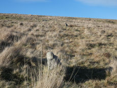
West Mill Tor Reported Stone Row
OS Map: SX 5878 9078
HER: MDV11812
Short Name: SR:West Mill
Notes: HER: A double stone row thought to be of prehistoric date comprises 35 surviving stones, of which 7 are recumbent. The original arrangement may have included 64 stones. They now stand at a distance of 9m between rows as slabs set on edge and in line averaging 0.15m thick, 0.5m long and 0.4m high. A sinuous double row of set stones lies across the summit area of a moorland ridge. Its origins and function are obscure but it may be associated with military activity, possibly a trackway.
Nearest Bus Stop: Okehampton Railway Station (3.7 km) [Route: 118,306,6A]
Nearby sites: SX 5878 9078
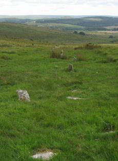
White Ridge Stone Row
OS Map: SX 65420 81661
HER: MDV6642
Megalithic Portal: 4145
The Stone Rows of GB: White Ridge
PMD: White Ridge Stone Row
Short Name: SR White Ridge
Butler map: 35.20
DPD: 125
Dimensions (m): 582
Notes: "A double stone row, 620 ft in length from the centre of a cairn at the north end, running nearly due south and slightly downhill. Well preserved at the north end for a short distance but becoming more dilapidated as it approaches the newtake wall at the south end". Lethbridge diagram p.124 and photo top p.125. Breton p.45 sadly robbed to build the wall, but the upper part is still a good specimen of the double avenue. It is 260 yds. long; there are three stones on the S. side of the wall.
Nearest Bus Stop (Minor): Warren House Inn (2.2 km) [Route: 171(20/07/26 to 19/09/26)]
Nearest Bus Stop (Major): Postbridge Post Office (2.9 km) [Route: 98,171(20/07/26 to 19/09/26)]
Nearby sites: SX 65420 81661
Whitehorse Hill Reported Stone Row
OS Map: SX 62208 84938
HER: MDV130871
Short Name: SR:Whitehorse
Notes: Hemery, E., 1983, High Dartmoor, 779-780 (Monograph). Hemery notes set stones representing ?stone circle and single ?row south at the end of the Sand Path; more stones southward may be part of same alignment. Possible identification of a retaining-circle. Possible extension of alignment in the form of spaced, fallen stones, to a point beyond a military range-pole. Inconclusive (much interference by turf-cutters) but may be candidate at approximately 1,840 feet above sea level to qualify as the highest placed on Dartmoor.
Nearest Bus Stop: Postbridge Post Office (6.6 km) [Route: 98,171(20/07/26 to 19/09/26)]
Nearby sites: SX 62208 84938
Yar Tor Stone Row
OS Map: SX 68177 73857
HER: MDV6459
Megalithic Portal: 2199
The Stone Rows of GB: Yar Tor
PMD: Yar Tor Stone Row
Short Name: SR Yar Tor
Butler map: 14.11
DPD: 122
Barrow Report: 56
Dimensions (m): 250
Notes: "The remains of a probable triple stone row with a cairn and cist at its south end and a barrow at its north. The row comprises stones set 2m apart and standing to a height of 0.3m. Some are concealed beneath the turf. The cairn measures 11m in diameter and 0.3m high with a central cist surrounded by a kerb. The barrow is 6m in diameter and 1m high".
Nearest Bus Stop: Postbridge Bellever (4.4 km) [Route: 98]
Nearby sites: SX 68177 73857

Yardworthy Stone Row
OS Map: SX 67605 84395
HER: MDV61337
Megalithic Portal: 6333471
The Stone Rows of GB: Yardworthy
PMD: Yardworthy
Short Name: SR Yardworthy
Dimensions (m): 9
Notes: Quinnell quoted on HER: Stone row in Yardworthy Newtake, an area of rough pasture that has since undergone some stone clearance. Apparently the remains of a double row it starts 3.0 metres from a low barrow at SX67608438 and extends to the north-east for 7.0 metres. The north-west side consists of four stones, 2.0 to 2.5 metres apart. The south-eastern side about 1.4 metres distant has only one stone and two turf humps which may conceal others. Visible stones are barely 0.1 metres high. Immediately beyond the north-east end is a hollow or stone pit about 4.0 by 2.0 metres diameter. This, and clearance in the area may have destroyed any continuation.
Nearest Bus Stop (Minor): Warren House Inn (3.4 km) [Route: 171(20/07/26 to 19/09/26)]
Nearest Bus Stop (Major): Chagford The Square (4.0 km) [Route: 173,178,671]
Nearby sites: SX 67605 84395
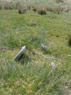
Yellowmead Stone Row
Prehistoric Dartmoor Walks: Dartmoor Site: Yellowmead 4-fold Cairn Circle
OS Map: SX 57482 67842
HER: MDV80769
Megalithic Portal: 2202
The Stone Rows of GB: Yellowmead Down
PMD: Yellowmead Stone Row
Alternate name: Yellowmead Down Stone Row
Short Name: SR Yellowmead
Butler map: 47.14
DPD: 31
Barrow Report: 41 56
Dimensions (m): 28.4
Notes: "A group of four concentric stone circles of which the innermost one is considered to be a cairn circle. Three stones were standing in 1921 when all the fallen stones were raised during restoration. There also appears to have been a stone row leading away from the stone circles." and "The double row as planned by Worth except that one stone is now missing. It is 6.9m long with mostly small line slabs, set on edge. They are about 0.3m long and 0.3m high, the intervals between stones and between the rows being 0.8m". Breton, see Megalithic circles on Yellowmead Down, Sheepstor (Heart of Dartmoor pp.89-91).
Nearest Bus Stop: Meavy Primary School (3.1 km) [Route: 56]
Nearby sites: SX 57482 67842