
Ringmoor Down Stone Row
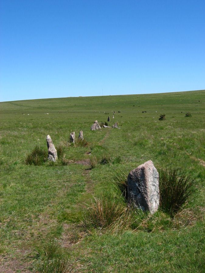
Photo taken on 17-06-2010
Database entries
PDW coverage: Dartmoor Site: Ringmoor Stone Row & Cairn Circle
OS Map: SX 56330 65808
OS Source: SRGB
HER: MDV3986
Megalithic Portal: 2102
The Stone Rows of GB: Ringmoor Down
PMD: Ringmoor Down Stone Row
Alternate name: Ringmoor Down
Short Name: SR Ringmoor
Butler map: 49.20
DPD page: 34
Exist: Yes
Record: Unique
Record Source: PDW
Hut Class: No
Dimensions (m): 369
Lidar: SX 56330 65808
Guide Map: 47
Nearest Bus Stop: Meavy Primary School (3.0 km) [Route: 56]
Nearby sites: SX 56330 65808
Notes
"A stone row, 1740 feet long, mainly single but double in parts. At its southern end is a cairn circle with a diameter of 40ft. 6ins. In 1909 the circle was restored and five of the present stones were introduced from elsewhere. Prior to restoration one stone was standing, four had fallen and the presumed sites of six other stones were represented by pits. A 4ft long fallen stone terminated the stone row at its northern end". Lethbridge p.34-36, diagram p.34 site 3. See also: Sea Views at Ringmoor Down`References
These are selected references with an emphasis on out of copyright sources linked as PDFs. For more detailed references try any linked HER or PMD record above.
- Brailsford, J. W, Bronze Age Stone Monuments of Dartmoor, Antiquity Volume 12, Number 48 pp.444-63 (1938)
- Breton, Henry Hugh, Beautiful Dartmoor And Its Interesting Antiquities, (1990)
- Butler, Jeremy, Dartmoor Atlas of Antiquities, vol.3: The South-West, (1994)
- Emmett, D.D., Stone rows: the traditional view reconsidered, D.A.S.P. No.37 pp.94-114 (1979)
- Grinsell, L.V., Grinsell, Folklore of Prehistoric Sites in England, (1976)
- Lethbridge, William D., Discover Preshistoric Dartmoor, (2015)
- Newman, Phil, Ringmoor Down Premier Archaeological Landscape - A new survey , Southwest Landscape Investigations (2022)
- Worth, R. Hansford, Retaining circles associated with stone rows Dartmoor, T.D.A. Vol.73 pp.227-38 (1941)
- Worth, R. Hansford, The Stone Rows of Dartmoor Part 1, T.D.A. Vol.78 pp.285-316 (1946)
- Worth, R.N., The Stone Rows of Dartmoor - Part 4, T.D.A. Vol.27 pp.437-442 (1895)