
Trowlesworthy W. Stone Row
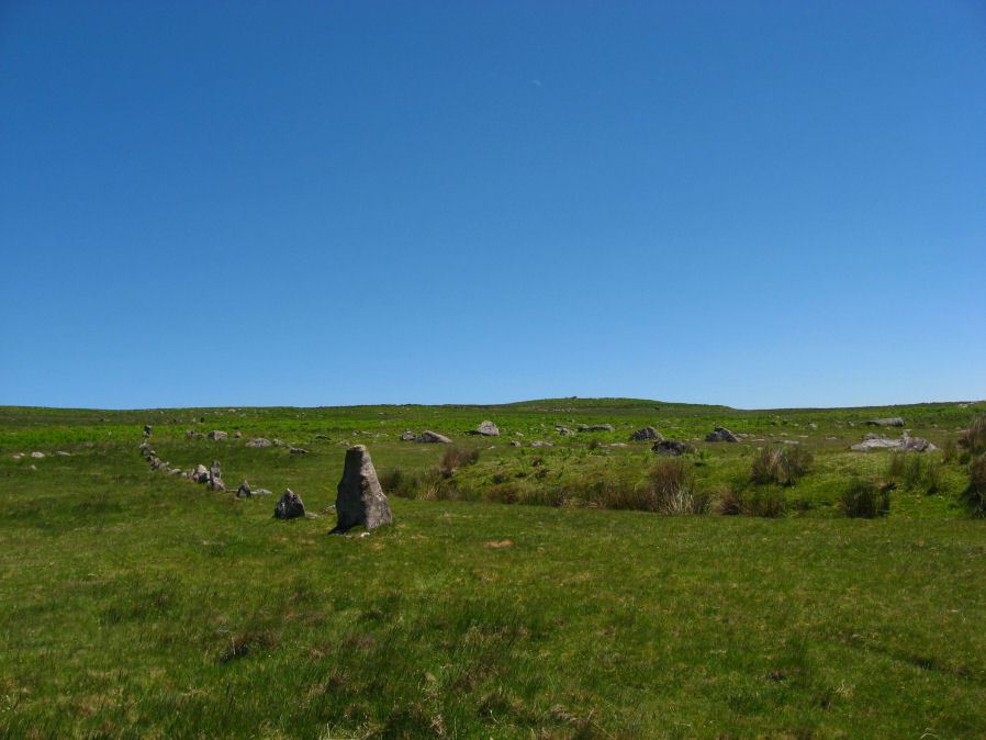
Photo taken on 17-06-2010
Database entries
PDW coverage: Dartmoor Site: Trowlesworthy, Settlements, Stone Row & Cairn Circle
OS Map: SX 57536 63978
OS Source: SRGB
HER: MDV2415
Megalithic Portal: 2176
The Stone Rows of GB: Trowlesworthy 2
PMD: Trowlesworthy W Stone Row
Alternate name: Trowlesworthy 2
Short Name: SR Trowles W
Butler map: 51.8.2
DPD page: 58
Exist: Yes
Record: Unique
Record Source: PDW
Hut Class: No
Dimensions (m): 82
Lidar: SX 57536 63978
Guide Map: 53
Nearest Bus Stop: Lee Moor Clearview (2.7 km) [Route: 59]
Nearby sites: SX 57536 63978
Notes
Butler Trowlesworthy 2. "A single stone row consisting of 35 upright and 13 recumbent stones running in an E to W line from the site of a possible ring cairn at the foot of the SW flank of Little Trowlesworthy Tor. The cairn at the head of the row is marked by a circle containing one upright and eight fallen small slabs and boulders. Within these is a slightly raised area, perhaps the remains of a cairn." Lethbridge p.57-8, diagram p.58.References
These are selected references with an emphasis on out of copyright sources linked as PDFs. For more detailed references try any linked HER or PMD record above.
- Bate, C Spence, On the Prehistoric Antiquities of Dartmoor, T.D.A. Vol.4 pp.491-516 (1871)
- Brailsford, J. W, Bronze Age Stone Monuments of Dartmoor, Antiquity Volume 12, Number 48 pp.444-63 (1938)
- Butler, Jeremy, Dartmoor Atlas of Antiquities, vol.3: The South-West, (1994)
- Coppard, Rev. W. J., The Prevention of the Destruction of the Trowlesworthy Row, The Archaeological Journal, Vol.17 p.70 (1860)
- Emmett, D.D., Stone rows: the traditional view reconsidered, D.A.S.P. No.37 pp.94-114 (1979)
- Gerrard, Sandy, English Heritage Book of Dartmoor: Landscapes Through Time, (1997)
- Lethbridge, William D., Discover Preshistoric Dartmoor, (2015)
- Lukis, W.C, Report on the Monuments of Dartmoor, Proceeding of the Society of Antiquaries Vol.8 (1881)
- Rowe, Samuel, A Perambulation of Dartmoor (3rd Edition), (1896)
- Worth, R. Hansford, The Moorland Plym, T.P.I. Vol.10 Part 3 p.294 (1890)
- Worth, R. Hansford, Retaining circles associated with stone rows Dartmoor, T.D.A. Vol.73 pp.227-38 (1941)
- Worth, R. Hansford, The Stone Rows of Dartmoor Part 1, T.D.A. Vol.78 pp.285-316 (1946)
- Worth, R.N., The Stone Rows of Dartmoor - Part 1, T.D.A. Vol.24 pp.387-417 (1892)