
Holne Moor Stone Row
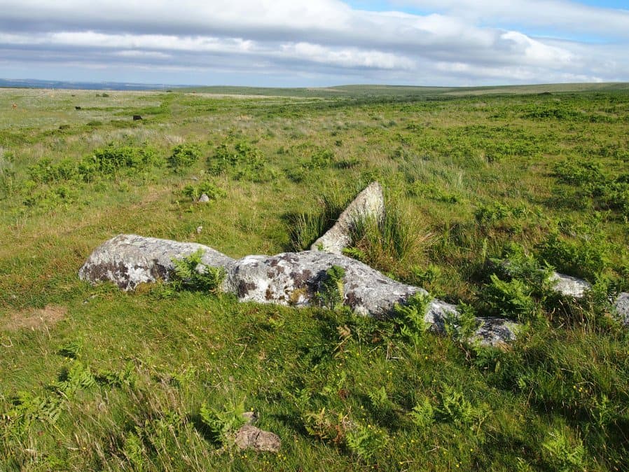
Photo taken on 15-07-2016
Database entries
OS Map: SX 67431 71042
OS Source: SRGB
HER: MDV12983
Megalithic Portal: 1981
The Stone Rows of GB: Holne Moor
PMD: Holne Moor Stone Row
Alternate name: Holne Moor
Short Name: SR Holne Moor
Butler map: 60.25
DPD page: 90
Exist: Yes
Record: Unique
Record Source: PDW
Hut Class: No
Dimensions (m): 147.
Lidar: SX 67431 71042
Guide Map: 40
Nearest Bus Stop: Postbridge Bellever (8.6 km) [Route: 98]
Nearby sites: SX 67431 71042
Notes
"A standing stone and triple stone row lying in a secluded position, across the head of a shallow, north facing valley. It measures 147 metres long with rows on average 1.5 m apart. The stones, fifty three of which were located, have a maximum height of 0.2 m and are spaced about 1.1 m apart, each opposite the stone of the adjacent row. There is also a possible former standing stone which is now recumbent." See also MDV129985References
These are selected references with an emphasis on out of copyright sources linked as PDFs. For more detailed references try any linked HER or PMD record above.
- Butler, Jeremy, Dartmoor Atlas of Antiquities, vol.4: The South-East, (1993)
- Gerrard, Sandy, English Heritage Book of Dartmoor: Landscapes Through Time, (1997)
- Lethbridge, William D., Discover Preshistoric Dartmoor, (2015)
- Newman, Phil, A Triple Stone Row on Holne Moor, Southwest Landscape Investigations (2024)
- Newman, Phil; Probert, S. A. J, Holne Moor, Dartmoor, Devonshire. A Landscape Survey, Royal Commission on the Historical Monuments of England (1997)