Database entries
OS Map: SX 81137 83093
OS Source: Garmin
HER: MDV102540
Megalithic Portal: 24205
The Stone Rows of GB: Tottiford Reservoir 1
PMD: Tottiford Reservoir Stone Rows
Alternate name: Tottiford Reservoir 1
Short Name: SR Tottiford 1
Exist: Yes
Record: Unique
Record Source: PDW
Hut Class: No
Dimensions (m): 147
Lidar: SX 81137 83093
Guide Map: 60
Nearest Bus Stop: Lustleigh Turn (3.1 km) [Route: 178]
Nearby sites: SX 81137 83093
Notes
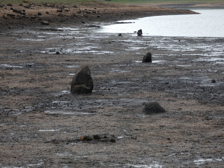
"This stone row was initially noticed in late 2009, when the reservoir was only 6% full. This double stone row is aligned roughly north-west - south-east and is at least 54 meters in length. The size and form of the stones used varies considerably but the two rows are consistently 1.2 meters apart. The row leads directly to (or away from) the naturally occurring mound south-east of the stone circle." This row will be normally covered by the Tottiford Reservoir. The stones of the row were exposed for a short period following the drought of August 2022. From the northenern end the author took a photo at SX 81135 83102 (6/9/22). It was too muddy to get any closer and the grid reference of SX 81137 83093 is inferred and used for this entry. Max Piper visited the day before and got as close as SX 81129 83102 which is consistent with the inferred actual location.