
Trowlesworthy E. Stone Row
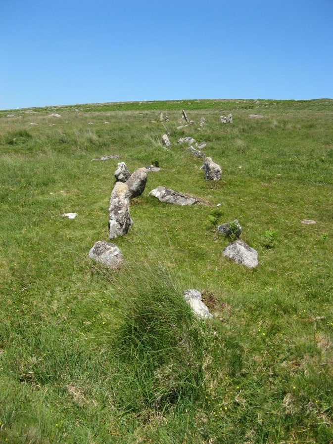
Photo taken on 27-06-2018
Database entries
PDW coverage: Dartmoor Site: Trowlesworthy, Settlements, Stone Row & Cairn Circle
OS Map: SX 57646 63972
OS Source: SRGB
HER: MDV2421
Megalithic Portal: 3516
The Stone Rows of GB: Trowlesworthy 1
PMD: Trowlesworthy E Stone Row
Alternate name: Trowlesworthy 1
Short Name: SR Trowles E
Butler map: 51.8.1
Butler Vol 5: p.229 & Fig.163
DPD page: 57
Exist: Yes
Record: Unique
Record Source: PDW
Hut Class: No
Dimensions (m): 127.
Lidar: SX 57646 63972
Guide Map: 53
Nearest Bus Stop: Lee Moor Clearview (2.7 km) [Route: 59]
Nearby sites: SX 57646 63972
Notes
Butler Trowlesworthy 1. "A Bronze Age stone alignment comprising a double stone row consisting of 99 upright and 8 recumbent stones running south-south-west from a possible stone circle near the foot of the south flank of Little Trowlesworthy Tor. The surviving length of the row is about 129 metres, it is bisected by a leat. The better preserved element of the row is down the slope from the leat. The circle comprises 8 main orthostat stones in a "kidney-shaped" plan. The south-west orthostat in the ring is surrounded by a number of smaller stones". Lethbridge p.57-8, diagram p.58. See also, Legendary Dartmoor: The Pulpit and Sea Views at Trowlesworthy 1References
These are selected references with an emphasis on out of copyright sources linked as PDFs. For more detailed references try any linked HER or PMD record above.
- Bate, C Spence, On the Prehistoric Antiquities of Dartmoor, T.D.A. Vol.4 pp.491-516 (1871)
- Brailsford, J. W, Bronze Age Stone Monuments of Dartmoor, Antiquity Volume 12, Number 48 pp.444-63 (1938)
- Butler, Jeremy, Dartmoor Atlas of Antiquities, vol.3: The South-West, (1994)
- Butler, Jeremy, Dartmoor Atlas of Antiquities, vol.5: The Second Millennium B.C., (1997)
- Coppard, Rev. W. J., The Prevention of the Destruction of the Trowlesworthy Row, The Archaeological Journal, Vol.17 p.70 (1860)
- Emmett, D.D., Stone rows: the traditional view reconsidered, D.A.S.P. No.37 pp.94-114 (1979)
- Gerrard, Sandy, English Heritage Book of Dartmoor: Landscapes Through Time, (1997)
- Lethbridge, William D., Discover Preshistoric Dartmoor, (2015)
- Lukis, W.C, Report on the Monuments of Dartmoor, Proceeding of the Society of Antiquaries Vol.8 (1881)
- Rowe, Samuel, A Perambulation of Dartmoor (3rd Edition), (1896)
- Wilkinson J. Gardner, British Remains on Dartmoor, Journal Brit. Arch. Assoc. xviii. pp.22-53, 111-133. (1862)
- Worth, R. Hansford, The Moorland Plym, T.P.I. Vol.10 Part 3 p.294 (1890)
- Worth, R. Hansford, Retaining circles associated with stone rows Dartmoor, T.D.A. Vol.73 pp.227-38 (1941)
- Worth, R. Hansford, The Stone Rows of Dartmoor Part 1, T.D.A. Vol.78 pp.285-316 (1946)
- Worth, R.N., The Stone Rows of Dartmoor - Part 1, T.D.A. Vol.24 pp.387-417 (1892)