
Stalldown Stone Row
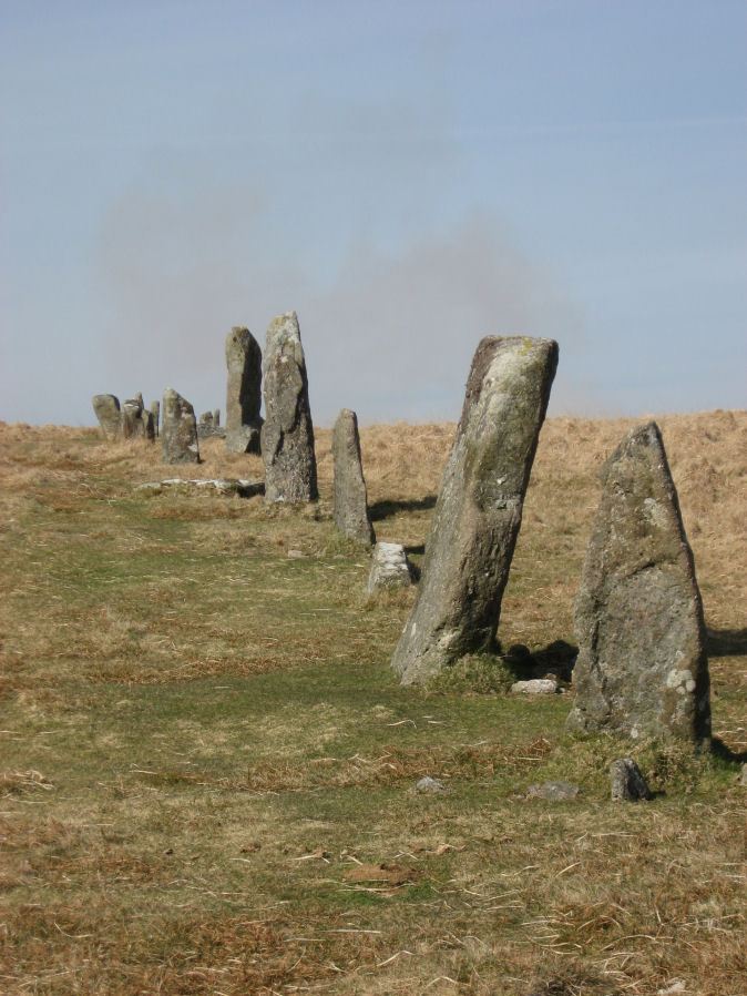
Photo taken on 19-03-2011
Database entries
PDW coverage: Dartmoor Site: Stalldown Stone Row
OS Map: SX 63223 62558
OS Source: SRGB
HER: MDV4277
Megalithic Portal: 531
The Stone Rows of GB: Stalldown
PMD: Staldon Stone Row
Alternate name: Stalldon Row
Short Name: SR Stalldown
Butler map: 54.18
Butler Vol 5: p.20 & Fig.2
DPD page: 67
Exist: Yes
Record: Unique
Record Source: PDW
Hut Class: No
Dimensions (m): 859
Lidar: SX 63223 62558
Guide Map: 56
Nearest Bus Stop: Cornwood Crossways (5.2 km) [Route: 59]
Nearby sites: SX 63223 62558
Notes
"Bronze Age stone row and cairn circle on stall down. The stone row runs north -south for about 850m ow which 500m has been restored. It is associated with three cairns (one either side) and a cairn circle. The stones are mostly 1m to 1.5m high with four over 2m". Lethbridge pp.67-68References
These are selected references with an emphasis on out of copyright sources linked as PDFs. For more detailed references try any linked HER or PMD record above.
- Baring-Gould, Sabine, Fourth Report of the Dartmoor Exploration Committee, T.D.A. Vol.29 pp.145-65 (1897)
- Brailsford, J. W, Bronze Age Stone Monuments of Dartmoor, Antiquity Volume 12, Number 48 pp.444-63 (1938)
- Butler, Jeremy, Dartmoor Atlas of Antiquities, vol.4: The South-East, (1993)
- Butler, Jeremy, Dartmoor Atlas of Antiquities, vol.5: The Second Millennium B.C., (1997)
- Davidson, C. & Seabrook, R., Stone rings on south-east Dartmoor, D.A.S.P. No.31 (1973)
- Emmett, D.D., Stone rows: the traditional view reconsidered, D.A.S.P. No.37 pp.94-114 (1979)
- Gerrard, Sandy, English Heritage Book of Dartmoor: Landscapes Through Time, (1997)
- Lethbridge, William D., Discover Preshistoric Dartmoor, (2015)
- Newman, Phil, The Upper Erme Valley Dartmoor National Park Devon An Archaeological Survey, Southwest Landscape Investigations (2018)
- Worth, R. Hansford, Retaining circles associated with stone rows Dartmoor, T.D.A. Vol.73 pp.227-38 (1941)
- Worth, R. Hansford, The Stone Rows of Dartmoor Part 1, T.D.A. Vol.78 pp.285-316 (1946)