
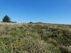
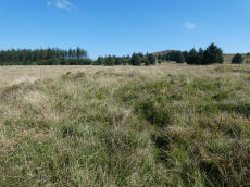
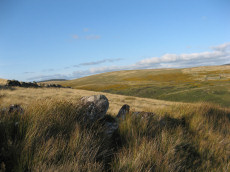
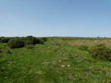
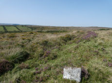
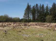
Prehistoric sites within 5km of SX 65513 77361
Guidance for walkers: The monuments featured in this database are archaeological treasures and need to be protected and preserved - please do not disturb any sites. Please check access and firing times before visiting sites, not all sites listed are on open access land. Firing ranges and boundaries of open access areas are marked on the OL28 OS Dartmoor Explorer map. Please stick to the country code and consider giving support to the numerous agencies that help to keep Dartmoor a fabulous natural and historic environment!
About the database listings: In all listings clicking on the photo or the site name will open a page for the site with a larger photo and further details from the database. The database now has over 6680 records covering nearly all publicly listed sites on Dartmoor including around 4800 round houses. This level of detail is of interest to archaeologists but tends to swamp listings of sites more likely to be of interest for walkers. For this reason, the listings default to around 550 core sites only. These are the stone circles, stone rows and the ring cairns listed by Turner. The default search radius is 2 km. The controls below the map can be used to start a new search by entering a 6- or 8-digit reference (without the prefix "SX"). The search radius can be specified and you can add incremental Display layers of detail on top of the core sites. If using a more detailed layer you will need to decrease the search radius to avoid getting hundreds of search results.
- Core sites Default listing of core sites consisting of stone circles & rows and some of the major ring cairns.
- Plus cairns adds approx. 1000 cairns and other minor sites not included in the core listings but excluding round houses.
- Plus round houses adds approx. 4800 round houses.
- Plus non-sites adds in the records for sites that no longer exist or are not prehistoric sites.
- Plus duplicates adds records excluded as duplicates. Those maybe duplicate records in external listings (e.g. the Historic Environment Records). For example, some sites have been identified as cairns in some listings and interpreted as round houses in other listings and both records appear.
These listings have incorporated, matched up and merged all of the records from all of the major archaeological listings including: Worth, Grinsell, Turner, Butler, Bill Radcliffe, Sandy Gerrard, Megalithic Portal, the National Monument Records and the Historic Environment Records. The author would like to thank Bill, Sandy, the lovely people both at Megalithic Portal (especially Anne Tate who did an amazing job to link listings) and at ACE Archaeology for collaborative work over the years to synchronise and correct listings across the various websites which now interlink. A culmination of years of work the final merger of cairn records took 3 months of cross referencing in 2017 the result being a snapshot of the records at that time. This data has in turn been refined since by field work and research. The round house data was supplied by Sandy Gerrard. Grid references are in order of accuracy: from Google Earth satellite, if visible and found, from a Garmin GPS reading, if visited by the author and from the literature otherwise. Individual site pages will state the source of the grid reference and provide satellite imagery. If a site listing lacks a photo it has not yet been visited by the author in which case the grid reference is from the literature.
Currently the database only includes sites which can be represented by a grid reference. Reaves are not included as they require GIS shape technology which is beyond the current capability of this system. To see the sources for the records, look at the tables on the resources menu. The database listings can also be viewed on a Google map and downloaded as GPS datasets for Garmin devices.
Corrections, or any feedback or suggestions are very welcome, email: info@dartmoorwalks.org.uk.
NOTE: Clicking on the icons for each monument in the map will give the name of the site. You can zoom in and out and drag the map around.
List of sites within 5km of SX 65513 77361
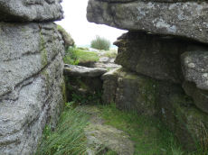
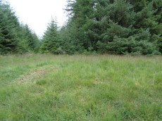
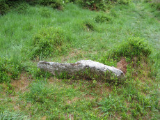
Bellever Rock Shelter
OS Map: SX 644 765
HER: MDV5941
ShortName: RS Bellever
Notes: Natural crevice in Bellever Tor forming a possibly built up Rock Shelter as reported by Robert Burnard (1914). Date of shelter not known for certain but signs of ancient habitation and numerous flints found.
Nearby sites: SX 644 765
Distance: 1.41km
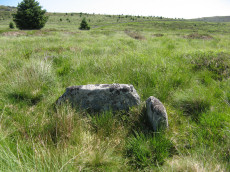
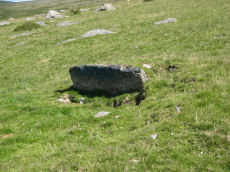
Littaford Tor E Cist
OS Map: SX 61846 76717
PMD: Littaford Tor E.
ShortName: CT Littaford 1
Notes: Radcliffe: "Long axis approx W-E . Stones visible on N ,E and S sides and some stone could be felt under grass on W side. Approx. 1m x 0.5m x 0.5m depth internally. No obvious sign of cairn mound. No obvious stonecutting in vicinity. TAP Greeves (pers. comm.) "
Nearby sites: SX 61846 76717
Distance: 3.72km

Riddon Ridge S. Cist
OS Map: SX 66780 76269
HER: MDV5986
PMD: RHR Stone
ShortName: CT Riddon 4
Butler map: 18.2.9
Grinsell: LYD 67
Notes: Known as the RHR stone. HER: A turf-covered cairn situated near the crest of the south-eastern slope of Riddon Ridge. It measures 8.4m north to south by 10.0m and stands to a maximum 0.9m high. There is no obvious trace of a kerb. Much stone is visible protruding through the turf and an amorphous hollow is situated slightly west of centre. A recumbent slab inscribed with the letters 'RHR' lies in the latter. The hollow possibly marks the site of an unrecorded excavation or it is the result of erosion around the originally upright inscribed stone..
Nearby sites: SX 66780 76269
Distance: 1.67km
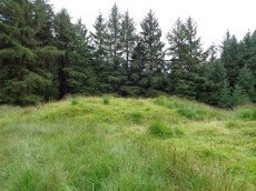
Grendon Farm (Hill W of) Cairn Circle
OS Map: SX 6805 7835
HER: MDV6008
ShortName: CN:GrendonFarm
Grinsell: WID 1a
Notes: HER: Cairn located on highest point of hill west of Grendon Farm, measuring 12 metres in diameter, composed of small stones overgrown with gorse and heather. Disturbed on the eastern side.
Nearby sites: SX 6805 7835
Distance: 2.72km

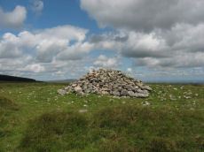
Corndon Tor 1 Cairn
OS Map: SX 68588 74227
HER: MDV6387
Megalithic Portal: 22982
ShortName: CN CorndonTor
Butler map: 15.4.1
Barrow Report: 56 62
Notes: HER: Cairn on the summit of Corndon Tor, to the north of the main outcrop, comprising a large stony mound, constructed from moorstone with a truncated cone profile and no turf cover. Remains of a possible second cairn are located to the south on the outcrop.
Nearby sites: SX 68588 74227
Distance: 4.39km

Yar Tor N.E.1 Cairn
OS Map: SX 68014 74182
HER: MDV14377
ShortName: CN Yar Tor N 1
Butler map: 14.11
Grinsell: WID 19
Notes: HER: Barrow north-east of Yar Tor on Corndon Down; located at the northern end of the stone row. Within area of Dartmeet parallel reave system and later prehistoric fields / enclosures. The north cairn comprises vegetation covered mound of earth, slightly ovoid in shape, 6 metres by 6.3 metres by 1 metres high.
Nearby sites: SX 68014 74182
Distance: 4.04km

Corndon Down 1 Cairn
OS Map: SX 68678 74766
HER: MDV6385
ShortName: CN CorndonDn 1
Butler map: 15.5.1
Grinsell: WID 17
Barrow Report: 56 62
Notes: HER: Large stone cairn; one of a pair approximately 530m north of Corndon Tor. The eastern cairn comprises a stony mound standing to over 2m high with a flattish top surface which has been badly disturbed by recent building of shelters. One very pronounced example is in centre of the cairn and appears recent. A reave, part of the Dartmeet system, touches the cairn tangentially on the west side but is not covered by it.
Nearby sites: SX 68678 74766
Distance: 4.09km

Corndon Down 2 Cairn
OS Map: SX 68579 74731
HER: MDV6386
ShortName: CN CorndonDn 2
Butler map: 15.5.2
Grinsell: WID 16
Barrow Report: 56 62
Notes: HER: Large stone cairn; one of a pair approximately 530m north of Corndon Tor. A mound of loose stone over 2m high in places. Upper surface extensively disturbed and undulating caused by interference, including recent shelter building.
Nearby sites: SX 68579 74731
Distance: 4.04km
Hamel Down W. Cairn
OS Map: SX 6997 7904
HER: MDV5991
ShortName: CN:Hamel W
Butler map: 20.
Notes: HER: A circular mound situated on the moderate western slope of Hameldown, measuring 13 metres in diameter. It lies within an abandoned field and may be connected with field clearance, although its regularity and size, if not its position are more convincing as a prehistoric burial mound.
Nearby sites: SX 6997 7904
Distance: 4.76km
Red Barrows 2 Cairn
Prehistoric Dartmoor Walks: Dartmoor Site: Soussons Cairn Circle
OS Map: SX 67709 79666
HER: MDV6006
ShortName: CN RedBar 2
Butler map: 24.2.2
Grinsell: MAN 6
Barrow Report: 56
Notes: HER: One of a row of four barrows on Soussons Down known as 'The Red Barrows' of 13.7 metres in diameter by 1.2 metres high. Excavated by the Dartmoor Exploration Committee in 1902. Fragments of burnt bone and wood charcoal found in central pit, with further bone, wood charcoal in paved area. Two indeterminate fragments of bronze also found, and a flint arrowhead.
Nearby sites: SX 67709 79666
Distance: 3.18km
Red Barrows 3 Cairn
Prehistoric Dartmoor Walks: Dartmoor Site: Soussons Cairn Circle
OS Map: SX 67694 79690
HER: MDV6005
ShortName: CN RedBar 3
Butler map: 24.2.3
Grinsell: MAN 7
Notes: HER: One of a row of four barrows on Soussons Down known as 'The Red Barrows'. It is a substantial mound of 21.0 metres diameter by 1.3 metres high and appears to be undamaged. Two edge set stones on the south eastern side of the mound may represent the remains of a kerb which survives elsewhere as a buried feature
Nearby sites: SX 67694 79690
Distance: 3.19km
Red Barrows 4 Cairn
Prehistoric Dartmoor Walks: Dartmoor Site: Soussons Cairn Circle
OS Map: SX 67695 79705
HER: MDV6004
ShortName: CN RedBar 4
Butler map: 24.2.4
Grinsell: MAN 8
Notes: HER: Northern of a row of four barrows on Soussons Down known as 'The Red Barrows' survives as flat topped 10 metres diameter mound standing up to 0.5 metres high
Nearby sites: SX 67695 79705
Distance: 3.20km

Soussons Plantation N.1 Cairn
Prehistoric Dartmoor Walks: Dartmoor Site: Soussons Cairn Circle
OS Map: SX 67673 79963
HER: MDV6015
The Stone Rows of GB: Soussons Down
ShortName: CN Soussons N1
Butler map: 24.2.5
Butler Vol 5: p.38 & Fig.15
Grinsell: MAN 4
Notes: Cairn at north end of the Red Barrows stone row.
Nearby sites: SX 67673 79963
Distance: 3.38km

Rowtor Brook 1 Cairn
OS Map: SX 62786 78626
HER: MDV5837
ShortName: CN RowtorBr 1
Butler map: 27.17.1
Grinsell: LYD 44
Notes: HER: The eastern of a pair of cairns, measures 9.4 metres diameter and 1.1 metre high. Was excavated around 1900 by the Dartmoor Exploration Committee and has a central depression 2.8 metres across 1.0 metre deep. This work revealed a pit filled with wood charcoal, which 'probably originally contained burnt bones'.
Nearby sites: SX 62786 78626
Distance: 3.01km

Rowtor Brook 2 Cairn
OS Map: SX 62702 78664
HER: MDV5836
ShortName: CN RowtorBr 2
Butler map: 27.17.2
Grinsell: LYD 43
Notes: HER: The western of a pair of cairns. Composed of medium-size stones, measuring 9.6 metres east to west and 8.2 metres north to south and standing 0.8 metres high. Has a central depression 3.0 metres, 0.3 metres deep; spoil from it has produced a slight widening of the eastern arc, with two piles of removed stones adjacent.
Nearby sites: SX 62702 78664
Distance: 3.10km
Cocks Lake Cairn
OS Map: SX 6540 7476
HER: MDV54389
ShortName: CN?Cocks Lake
Butler map: 28.6
Barrow Report: 22
Notes: Butler: " A stony mound on the edge of the leat ... is probably a prehistoric cairn. It has been dug into and the stones scattered outwards from a central pit, but there is no sign of a cist. Possibly this is the ruined cairn that Burnard 'examined in Brimpts newtake but without result'" (Barrow Report 22).
Nearby sites: SX 6540 7476
Distance: 2.60km
Bellever Tor 5 Cairn Circle
OS Map: SX 63859 75989
ShortName: CN Bellever 5
Butler map: 27.20.5
Notes: This record used to link to HER record MDV 5889 but that is clearly Bellever Tor 4 (ring cairn). This site is mentioned within that HER entry but it is a separate monument. Arguably it needs its own record. NB. Butler cairns 4 and 5 had previously been transposed in the listings here. The original records for both have been retained and the Butler number corrected and the grid references corrected. This was previously listed as Butler cairn 4 and is now listed correctly as cairn 5. See also: Dartmoor Explorations: Antiquities of Black Newtake and Environs
Nearby sites: SX 63859 75989
Distance: 2.15km
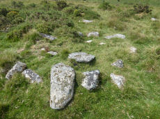
Laughter Tor Stone Row Cairn
OS Map: SX 6522 7538
HER: MDV66340
ShortName: CN:Laughter 1
Butler map: 28.12
Grinsell: LYD 68a
Barrow Report: 22
Notes: HER: Cairn at west end of Laughter Tor stone row of 5.5 metres diameter by 0.2 metres high. This cairn may be original or the result of restoration work when the standing stone was re-erected.
Nearby sites: SX 6522 7538
Distance: 2.00km

White Ridge S.W. Cairn
OS Map: SX 6414 8160
HER: MDV6770
ShortName: CN WhiteRid SW
Butler map: 35.11
Grinsell: LYD 19
Notes: Round cairn lying immediately west of an enclosed stone hut circle settlement in Great Stannon newtake (SX64158160). Diameter 7.2 metres, height 0. 9 metres. Kerb. Robbed. Central pit 2.2 metres by 0.8 metres by 0.1 metres deep. Grass covered mound with some edge set stones on the west side which may represent the remnants of a kerb. The orientation of the central pit is 123 degrees. Large number of stones protruding from the mound, many of which have quartz in them.
Nearby sites: SX 6414 8160
Distance: 4.49km
Broad Down N.E. Cairn
OS Map: SX 63700 81010
HER: MDV6774
ShortName: CN BroadDn 1
Butler map: 35.13
Grinsell: LYD 18
Notes: HER: Cairn in north-east corcner of Broad Down visible as a stony turf-covered mound 6.5 metres by 6.3 metres with a maximum height of 0.8 metres with a central hollow
Nearby sites: SX 63700 81010
Distance: 4.08km
White Ridge Stone Row Cairn
OS Map: SX 6541 8165
HER: MDV6639
ShortName: CN WhiteRid 1
Butler map: 35.20
Grinsell: LYD 27
Notes: HER: Remains of a badly damaged cairn of up to 10 metres across by 0.3 metres high at the north end of the stone row to the south-east of White Ridge. It is composed of stone and soil but no kerb slabs are visible
Nearby sites: SX 6541 8165
Distance: 4.29km

Stannon Newtake W. Cairn
OS Map: SX 6533 8108
HER: MDV6657
ShortName: CN Stannon 2
Butler map: 35.21.2
Grinsell: LYD 28
Barrow Report: 15
Notes: Cairn a short distance to the north of the northernmost coaxial field boundary. The cairn survives as a 6.5m diameter mound up to 0.6m high. A central hollow is the result of excavation in 1896 which revealed a pit containing charcoal, burnt bone and a flint flake. A group of four edge set stones up to 1m high to the southeast are the remains of a stone alignment.
Nearby sites: SX 6533 8108
Distance: 3.72km

Corndon Tor 2 Cairn
OS Map: SX 68601 74158
HER: MDV16727
ShortName: CN CorndonTor2
Butler map: 15.4.2
Grinsell: WID 18
Barrow Report: 56 62
Notes: HER: On the main outcrop of Corndon Tor is a possible tor cairn (south of MDV6387). Stones piled around the base of the outcrop may be remains of cairn which has been much disturbed and is now very spread and fragmentary The cairn overlies a reave which runs up to the tor, a shelter has been built against the tor very recently using stone from the cairn. Maximum diameter 27.2m.
The Google satellite imagery shows that this feature has the clear appearance of a tor cairn.
Nearby sites: SX 68601 74158
Distance: 4.45km

Hurston Ridge Cairn
OS Map: SX 67003 81844
HER: MDV6609
ShortName: CN Hurston
Butler map: 25.10
Grinsell: LYD 30
Notes: Hurston ridge; pillaged cairn (diam 8m) examined in 1900. Yielded large portion of broken urn (circumference 1.12m), resting mouth down on flat stone covering pit filled with wood charcoal. The urn was partly protected by a leaning stone kept in position by trigger stones. Highly ornamented. Dark, friable pottery containing little clay. No surrounding stone circle (worth).
Nearby sites: SX 67003 81844
Distance: 4.72km
Assycombe Hill S.1 Cairn
OS Map: SX 6625 8116
HER: MDV61310
ShortName: CN:AssycombS1
Butler map: 26.4.1
Butler Vol 5: p.199
Notes: NMR 916309 clearly refers to Butler's Assycombe Hill S.1 & S.2. The entry refers to Butler's coverage Vol 2 p. 26. It is clear from Butler that the NGR is SX 662 812. This is clear both from the listingat the end of Vol2 as well as from where they are marked on Butler's Map 26. The text states "The proximity of these two cairns on te summit of the ridge 400 m to the suth-west suggests these may have been the burial mounds of the community" i.e the Assycombe Hill South settlement. However, the NGR given in the NMR is SX 662802 which is 1 km to the south! This error has resulted in duplicate entries for the HER which has this pair of cairns at both locations. HER 54601 & 54602 are duplicates (with incorrect NGRs) of 61309 & 61310.
Nearby sites: SX 6625 8116
Distance: 3.87km
Assycombe Hill S.2 Cairn
OS Map: SX 6624 8118
HER: MDV61309
ShortName: CN:AssycombS2
Butler map: 26.4.2
Butler Vol 5: p.218 & Fig.152
Notes: NMR 916309 clearly refers to Butler's Assycombe Hill S.1 & S.2. The entry refers to Butler's coverage Vol 2 p. 26. It is clear from Butler that the NGR is SX 662 812. This is clear both from the listingat the end of Vol2 as well as from where they are marked on Butler's Map 26. The text states "The proximity of these two cairns on te summit of the ridge 400 m to the suth-west suggests these may have been the burial mounds of the community" i.e the Assycombe Hill South settlement. However, the NGR given in the NMR is SX 662802 which is 1 km to the south! This error has resulted in duplicate entries for the HER which has this pair of cairns at both locations. HER 54601 & 54602 are duplicates (with incorrect NGRs) of 61309 & 61310.
Nearby sites: SX 6624 8118
Distance: 3.89km
Stannon Bottom Cairn
OS Map: SX 6539 8060
HER: MDV6677
ShortName: CN?Stannon 5
Grinsell: LYD 30a
Notes: Three cairns noted on the edge of a hut circle settlement on Merripit Hill. Unclear whether these are ritual or clearance cairns as they may have been hut circles that have been covered with loose stone.
Nearby sites: SX 6539 8060
Distance: 3.24km
Braddon Lake 1 Cairn
OS Map: SX 63490 79624
HER: MDV20242
ShortName: CN:Braddon 1
Nearby sites: SX 63490 79624
Distance: 3.04km

White Ridge 2 Cairn
OS Map: SX 65027 82187
HER: MDV20915
ShortName: CN WhiteRid 2
Notes: HER: The monument includes a round cairn lying on the summit of White Ridge situated within Great Stannon Newtake. The cairn lies in a very prominent position and commands extensive views over much of Dartmoor. The mound measures 15.8 metres in diameter and stands up to 0.7 metres high. A number of edge set stones on the southern edge of the mound may represent a kerb, which survives elsewhere as a buried feature. Three pits in the mound suggest robbing or partial early excavation.
Nearby sites: SX 65027 82187
Distance: 4.85km
Bellever Tor 12 Cairn
OS Map: SX 6453 7686
HER: MDV52765
ShortName: CN:Bellever12
Notes: "Low flat-topped cairn situated immediately outside the eastern edge of a settlement and field system on the gently sloping northern flank of Bellever Tor. The heather and moss covered mound measures 3.6 metres in diameter with a maximum height of 0.35 metres. It is probably sepulchral in origin and appears to be undisturbed."
Nearby sites: SX 6453 7686
Distance: 1.10km
Stannon Newtake b Cairn
OS Map: SX 65193 81487
HER: MDV15378
PMD: Stannon Newtake b
ShortName: CN:Stannon 4
Notes: (greeves + robinson) prehistoric long cairn 16m long, 6.50m width (max), 1m high (highest at ne end). Small rectangular depression in ne end and stone slab set on edge at sw end. Composed mostly of small stone, covered with gorse and is disturbed by track at sw end. The author attempted to find this feature on 18/07/2025 and the area is covered with very dense and high gorse making it extremely difficult to access or see any potential features. Is the grid reference wrong? Looking at Lidar data the HER grid reference of SX 6518 8149 is close. It can clearly be seen on lidar at SX 65193 81487 which is 13 metres from the HER grid reference. The gird reference has been updated on this record to the Lidar feature. A screengrab of the lidar data imagery is included here with the feature highlighted.
Nearby sites: SX 65193 81487
Distance: 4.14km
Lakehead Hill 14 Cairn
OS Map: SX 6496 7847
HER: MDV52768
ShortName: CN:Lakehead 14
Notes: HER: Two low stoney cairns situated in open moorland on the gently sloping north-eastern flank of Lakehead Hill 500m south of Postbridge.
Nearby sites: SX 6496 7847
Distance: 1.24km
Crockern Tor 2 Cairn
OS Map: SX 61262 75987
HER: MDV52777
ShortName: CN CrockernNW2
Nearby sites: SX 61262 75987
Distance: 4.47km
Littaford Tor 3 Cairn
OS Map: SX 61849 77048
HER: MDV52779
ShortName: CN Littaford3
Nearby sites: SX 61849 77048
Distance: 3.68km
Stennen Hill 3 Cairn
OS Map: SX 62265 78280
HER: MDV52785
ShortName: CN Stennen 3
Nearby sites: SX 62265 78280
Distance: 3.38km
Braddon Lake 2 Cairn
OS Map: SX 6360 7981
HER: MDV52812
ShortName: CN:Braddon 2
Nearby sites: SX 6360 7981
Distance: 3.11km
Lakehead Hill 15 Cairn
OS Map: SX 6494 7850
HER: MDV52769
ShortName: CN:Lakehead 15
Notes: HER: Denuded mound, probably barrow located on open moorland on Lakehead Hill. The flat-topped mound measures 8.5m ns by 5.0m with a maximum height of 0.35m. There is no stone apparent in the construction of this feature and though partially obscured by long grass it appears to be undisturbed.
Nearby sites: SX 6494 7850
Distance: 1.28km
Broad Down Cairn
OS Map: SX 6327 8007
HER: MDV54679
ShortName: CN:BroadDn 2
Nearby sites: SX 6327 8007
Distance: 3.52km
Winney's Down Cairn
OS Map: SX 6362 8182
HER: MDV59463
Alternate name: Winney's Down Cairn
ShortName: CN:Winneys 1
Nearby sites: SX 6362 8182
Distance: 4.84km
Merripit Hill 1 Cairn
OS Map: SX 66359 79926
HER: MDV103610
ShortName: CN:Merripit 1
Nearby sites: SX 66359 79926
Distance: 2.70km

Rowter Cairn
OS Map: SX 62346 79968
HER: MDV106844
ShortName: CN Rowter
Nearby sites: SX 62346 79968
Distance: 4.10km
Yar Tor E.1 Clearance Cairn
OS Map: SX 6815 7384
HER: MDV21514
ShortName: CN?Yar Tor E 1
Butler map: 14.11.1
Grinsell: WID 21a
Notes: HER 21514 includes two possibe cairs, maybe clearance cairns. WID 21a and WID 21b
Nearby sites: SX 6815 7384
Distance: 4.40km
Yar Tor E.2 Clearance Cairn
OS Map: SX 6815 7383
HER: MDV21514
ShortName: CN?Yar Tor E 2
Butler map: 14.11.2
Grinsell: WID 21b
Notes: HER 21514 includes two possibe cairs, maybe clearance cairns. WID 21a and WID 21b
Nearby sites: SX 6815 7383
Distance: 4.41km
Lower Cator Clearance Cairn
OS Map: SX 68420 75800
HER: MDV26442
ShortName: CN?Lower Cator
Butler map: 17.2
Notes: Round House reused as a clearance cairn. Butler. A cairn, with a trench across the centre, lies at the middle of a field between these huts, trimmed to a pear shape by ploughing around the edges.
HER quoting Butler: Lower Cator Prehistoric setlement includes this hut circle with a diameter of circa 6 metres with its lower half filled with clearance stones. a few slabs surround this hut. Other details: Map 17, Site 2.
Nearby sites: SX 68420 75800
Distance: 3.30km
Yar Tor (SE of) Clearance Cairn
OS Map: SX 6815 7381
HER: MDV21514
ShortName: CN?Yar Tor SE
Grinsell: WID 21c
Nearby sites: SX 6815 7381
Distance: 4.42km
Kings Oven Reported Cist
OS Map: SX 67477 81336
HER: MDV121913
PMD: King's Oven
ShortName: CT?KingsOven 1
Butler map: 26.1.2
Notes: In the wall of King's Oven enclosure. Butler gives NGR for CHA 6a by mistake.
Nearby sites: SX 67477 81336
Distance: 4.43km
Roundy Park, gate south of Reported Cist
OS Map: SX 6396 7948
HER: MDV71274
ShortName: CT?Roundy Pk 2
Notes: Possible cist near a gate in the fence.
Nearby sites: SX 6396 7948
Distance: 2.63km
Lade Hill Reported Cist
OS Map: SX 63340 81841
PMD: Lade Hill
ShortName: CT?Lade Hill1
Notes: Via Radcliffe: "A good candidate for a damaged cist. There is one long slab still in situ which is orientated 120/300 degrees. Other stones are rather jumbled and some look shattered, so I believe at some time it must have received a hit or near miss from an artillery piece - there are quite a few old shell holes on this hillside." (Information from TAP Greeves). No NMR or HER records.
Nearby sites: SX 63340 81841
Distance: 4.98km
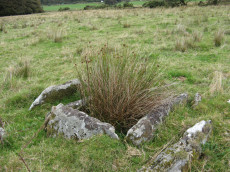
Stannon Newtake a Reported Cist
OS Map: SX 6492 8123
HER: MDV19547
PMD: Stannon Newtake a
ShortName: CN:Stannon 3
Notes: Four upright slabs form a crude semi-circle on a small shelf of an otherwise steep, e-facing and clitter strewn hillside, above stannon brook. The semi-circle described by the slabs is 3m in diam with a max height of 0.7m. It does not form a recognisable archaeological feature and seems more like random assemblage of natural slabs
Nearby sites: SX 6492 8123
Distance: 3.91km
Riddon Ridge S.E. Reported Cist
OS Map: SX 6695 7635
PMD: Riddon Ridge 1
ShortName: CT:Riddon 3
Butler map: 18.2.8
Grinsell: LYD 67a
Barrow Report: 33
Notes: Butler: A few small set stones show around the edge of another [cairn] at 8 (5 x 0.4m) It appears to be untouched, too small to attract the attention of casual diggers. It is, however, approximately in the position of the cairn excavated by R. Burnard in 1914, who may have carefully replaced the stones he removed. His cairn was more compact before excavation (3.7 x 0.8) so if it is the same his restoration has allowed considerable spread. To his surprise, Burnard was not the first to investigate it, but he was still able to recover part of a pot, a flint, pieces of quartz and some charcoal contained within a stone-lined pit at the centre.. See Barrow Report 33. No specific HER entry but mentioned on MDV129868.
Nearby sites: SX 6695 7635
Distance: 1.76km
Higher White Tor (site of) Reported Cist
OS Map: SX 622 786
HER: MDV5969
PMD: Whiten Tor - Stennen Hill
ShortName: CT?H White Tor
Grinsell: LYD 50c
Notes: "This site was apparently excavated in 1827, when human hair was found (Grinsell cites Bray), but this site has not been located since this time - site / location not confirmed."
"The cist on east side of Great Whiten Tor, Postbridge" (Higher White Tor at SX 619785) was examined and revealed faint indications of bone ash contained in a pit 1foot 10inches diameter and 1foot 4inches deep. The pit was covered by a flat stone nearly 2 feet square. The coverstone of the cist had been removed to one side. Cannot be located today."
NB Grinsell suggests SX624780 as the grid reference
Nearby sites: SX 622 786
Distance: 3.54km
Sherwell Reported Cairn
OS Map: SX 6838 7455
ShortName: CN?Sherwell
Butler map: 15.1
Notes: Butler: "A small cairn lies within a neighbouring field, obviously trenched with the stones thrown downhill". Not listed on NMR or HER.
Nearby sites: SX 6838 7455
Distance: 4.02km
Riddon Ridge summit Reported Cairn
OS Map: SX 6633 7663
HER: MDV19985
ShortName: CN:Riddon 1
Butler map: 18.1.23
Grinsell: LYD 67b
Notes: HER: cairn discovered. Ridge siting. Diameter 4.5m, height 0.3m.
Nearby sites: SX 6633 7663
Distance: 1.10km
Riddon Ridge N. Reported Cairn
OS Map: SX 66140 77230
HER: MDV132303
ShortName: CN Riddon N
Butler map: 18.1.24
Notes: The remains of a disturbed turf-covered cairn. The monument measures 10.5 by 8.5 metres and stands to a height of 0.75 metres. The cairn shows signs of disturbance as a shallow hollow slightly west of centre and a possible spoil heap lies nearby.
UPDATE: 28/12/24. This entry had previously been linked incorrectly to details of a round house a little distance away - photo and grid reference was incorrect. Now linked to correct HER entry.
Nearby sites: SX 66140 77230
Distance: 0.64km

Water Hill 2 Reported Cairn
OS Map: SX 67155 81314
HER: MDV6675
ShortName: CN?WaterHill 2
Butler map: 26.5.2
Notes: Doubtful "a heather covered mound slightly to the n of the large cairn on the summit of water hill. It measures 5.1m in diam and up to 0.6m high with one recumbent granite boulder visible on its s side. It is apparently composed of earth and stone". This record formerly linked to MDV54619 which has presumably been deleted as a duplicate.
Visited by author on a few occasions and not recorded due to doubt about identification. The raised area in the photo is the only possible candidate for Butler's satellite cairn.
Nearby sites: SX 67155 81314
Distance: 4.28km
Bellever Tor 7 Reported Cairn
OS Map: SX 63866 75782
HER: MDV5951
ShortName: CN-Bellever 7
Butler map: 27.20.7
Grinsell: LYD 63
Turner: A40
Barrow Report: 57
Notes: Probably a hut circle
Nearby sites: SX 63866 75782
Distance: 2.28km
Littaford Tor 2 Reported Cairn
OS Map: SX 61430 76490
HER: MDV52778
ShortName: CN Littaford 2
Butler map: 29.1
Notes: A large granite slab lies the W side and a boulder is exposed just N of the centre. These may be part of a distroyed cist, but the boulder is very irregular and looks like a natural stone in situ around which the cairn may have been built.
Nearby sites: SX 61430 76490
Distance: 4.17km
Swincombe Ford Newtake 2 Reported Cairn
OS Map: SX 6331 7307
HER: MDV130278
ShortName: CN?Swincombe 2
Butler map: 63.5.2
Notes: Butler: "A short distance to the north is a smaller oval mound ... possibly a second burial cairn". Not listed on NMR or HER.
Nearby sites: SX 6331 7307
Distance: 4.82km

Riddon Corner Reported Cairn
OS Map: SX 6714 7636
HER: MDV64234
ShortName: CN?Riddon 2
Butler map: 18.2.7
Notes: Butler: The cairn at 7 (8.0 x 1.0 m), 5 m from the field wall and close to a reave, is probably prehistoric. A slight depression in its flat suface suggests it has been dug and a track cutting across the eastern edge has also caused some slight damage. A pile of stones in a similiar relationship to the next reave to the south is more likely to be clearance from the field.
HER entry: A turf-covered mound measuring 8.2 by 7.2 by 0.7 metres high. The mound bears some indications of disturbance. It is uncertain whether it is a barrow or the result of more recent field clearance.. Possibly visible on Lidar.
Nearby sites: SX 6714 7636
Distance: 1.91km
Round Hill E.2 Reported Cairn
OS Map: SX 6161 7441
HER: MDV18229
ShortName: CN:RoundHillE2
Notes: HER quoting Quinnell: [i]The earthwork noted by Greeves (1982) is at SX 61607440 on a triangular patch of moorland, effectively isolated by a silted stream course on the W and S and tin workings to the E, with the West Dart to the N.
Nearby sites: SX 6161 7441
Distance: 4.89km
Muddilake Reported Cairn
OS Map: SX 62775 75096
HER: MDV5895
ShortName: CN?Muddilake 1
Grinsell: LYD 106
Turner: A38
Barrow Report: 58
Notes: Hut Circle - listed by Butler as a cairn. This is the second cairn that Worth mentions in Barrow Report 58. "A cairn, 4 feet in diameter, but so robbed as to be reducedto little more than a marginal ring".
Nearby sites: SX 62775 75096
Distance: 3.55km
Higher White Tor Reported Cairn
OS Map: SX 6163 7825
HER: MDV5957
ShortName: CN?HigherWhite
Grinsell: LYD 41b
Notes: natural? round barrow between longford tor and higher white tor. A very large barrow 1.3m high with a diameter of 30m under gorse and heather. No sign of ditch or kerb exist and there is no indication of an earlier disturbance. The monument is in a classic position commanding a fine view of the cherry brook valley.
Nearby sites: SX 6163 7825
Distance: 3.98km
Stennen Hill 8 Reported Cairn
OS Map: SX 6257 7788
HER: MDV13520
ShortName: CNxStennen 8
Grinsell: LYD 48
Barrow Report: 57
Notes: Hut Circle NMR B. Barrow report 57: "Fifty-four feet from the centre of the last describedkistvaen, on a bearing S.3t'W., lies the centre of a retainingcircle of 16 feet 6 inches internal diameter, the lar5;est stoneof which is 7 feet by 6 inches on plan, and stands 3 feet inheight. There are but slight traces of the mound, and thereis no indication of a kistvaen." This is a duplicate of the record for the round house site 6512. NB. Worth & Grinsell name this Stennen Hill No.2 (It is Butler 9)
Nearby sites: SX 6257 7788
Distance: 2.99km
Stennen Hill 7 Reported Cairn
OS Map: SX 62525 77877
HER: MDV5848
ShortName: CN Stennen 7
Grinsell: LYD 50
Notes: Hut Circle NMR A. There are disturbed remains here within a prehistoric settlement. It seems likely these remains are of a round house. Breton p.34-35.
Nearby sites: SX 62525 77877
Distance: 3.03km
Stennen Hill 5 Reported Cairn
OS Map: SX 62402 77797
HER: MDV5849
ShortName: CN Stennen 5
Grinsell: LYD 50a
Notes: Hut circle. There are disturbed remains here within a prehistoric settlement. It seems likely these remains are of a round house.
Nearby sites: SX 62402 77797
Distance: 3.14km
Stennen Hill 6 Reported Cairn
OS Map: SX 62431 77794
HER: MDV5850
ShortName: CN Stennen 6
Grinsell: LYD 50b
Notes: Hut circle
Nearby sites: SX 62431 77794
Distance: 3.11km
Rowden Down Reported Cairn
OS Map: SX 6993 7602
HER: MDV12961
ShortName: CN?Rowden Dn
Grinsell: WID 23
Notes: Hut circle or ring cairn
Nearby sites: SX 6993 7602
Distance: 4.62km
Muddilake (N) Reported Cairn
OS Map: SX 62761 75202
HER: MDV48858
ShortName: CN?Muddilake 2
Turner: A37
Notes: Probable remains of a hut circle; this feature has previously been identified as a cairn. One of several associated with settlement site north of Muddilake Brook. Probably the second hut circle on NMR entry 442677
Nearby sites: SX 62761 75202
Distance: 3.50km
Stennen Hill 4 Reported Cairn
OS Map: SX 62404 78661
HER: MDV52786
ShortName: CN?Stennen 4
Nearby sites: SX 62404 78661
Distance: 3.37km
Corndon Down 3 Cairnfield Master
OS Map: SX 6879 7521
HER: MDV130667
ShortName: CN:CorndonDn 3
Notes: HER: Thirty-nine clearance cairns amid medieval fields on the east lower slopes of Corndon Down. The cairns comprise stony turf-covered, circular or elliptical heaps of between 2m and 5m across and up to 0.8m high. The majority of the cairns lie within a large abandoned newtake field (centred SX 6879 7521) which appears never to have been cultivated. The remainder are within smaller fields just to the east, one of which contains cultivation ridges.
Nearby sites: SX 6879 7521
Distance: 3.92km
Yar Tor Tor Enclosure
OS Map: SX 67849 74046
HER: MDV128748
ShortName: EN Yar Tor
Butler map: 14.8
Notes: HER quoting Newman: A Tor enclosure of uncertain date on the northern outcrop of Yar Tor. This enclosure is situated in a natural avenue between two outcrops with vertical faces on the north and south sides which has been blocked off at the western and eastern ends by artificial stone walls.
Nearby sites: SX 67849 74046
Distance: 4.06km
Crockern Tor 3 Reported Cist
OS Map: SX 61204 75824
ShortName: CT CrockernNW3
Notes: Possible cist reported by Nigel Rendle to Bill Radcliffe in 2008 NE of Crockern Farm. Bill comments Feb 2025 we were doubtful of it, as it is close to the path to Wistman's Wood, so how can it have been missed? But it looks good to me.. The author visited 25/09/2025 with Steve Szypko and these were my notes: there is an upright stone that looks like a possible displaced capstone and some other stones that could form a cist. This arrangement in itself is unconvincing but there is also a rectangular hole consistent with a cist. It is perhaps an unlikely but possible cist. NB. The grid reference has now been updated.
Nearby sites: SX 61204 75824
Distance: 4.57km
Arch Tor Platform Cairn Circle
OS Map: SX 63168 77843
HER: MDV21510
Megalithic Portal: 45618
Alternate name: Arch Tor 1 Platform Cairn Circle
ShortName: PC Arch Tor 1
Butler map: 27.6
Turner: E11
Notes: "A round cairn which survives as an 8.7 metre diameter mound standing up to 0.9 metres high. Large edge set stones on the north western edge of the mound may suggest the presence of a kerb which survives elsewhere as a buried feature."
Nearby sites: SX 63168 77843
Distance: 2.39km
Archerton Settlement
OS Map: SX 641 788
HER: MDV5931
Megalithic Portal: 42727
ShortName: ST:Archerton
Notes: An oval pound now planted with trees. Rowe noted remains of banks and a hut within the enclosure. Prowse mentions traceable sub-division banks with distinct evidence of nine hut circles and a further one, ten yards diameter, "close outside on the east". See: T.D.A. Vol. 23 pp.311-12
Nearby sites: SX 641 788
Distance: 2.02km
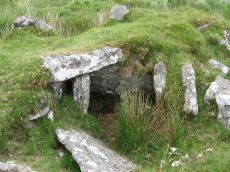
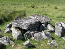
Archerton S.W. (Rowtor Brook) Ring Setting Cairn and Cist
OS Map: SX 62752 78808
HER: MDV5838
Megalithic Portal: 37604
PMD: Hollowcombe Bottom
Alternate name: Rowtor Brook 3 Ring Setting Cairn and Cist
ShortName: CT RowtorBr 3
Butler map: 27.17.3
Butler Vol 5: p.55 & Fig.33
DPD page: 112
Grinsell: LYD 42
Turner: D24
Barrow Report: 57
Notes: Breton: on N. side of wall is a kistvaen, around which is a triple circle, a very unusual feature..
HER: The cist lies within three concentric circles of stones at 10, 15 and 24 feet diameters, the inner ring being of large stones, the middle ring of smaller stones and the outer ring of even smaller stones. The cist measures internally 0.8m by 0.6m and 0.9m deep. Half of its capstone lies across its north end.
For more information see: Lethbridge Hollowcombe Bottom, diagram and photo p.112. Butler Rowtor Brook 3 - Vol. 2. Map 27.17 (diagram Vol. 5. p.55). Breton p.35
Nearby sites: SX 62752 78808
Distance: 3.12km
Archerton Tennis Ground Platform Cairn Circle and Cist
OS Map: SX 63852 78872
HER: MDV5839
Megalithic Portal: 37599
PMD: Archerton Tennis Court
Alternate name: Archerton Platform Cairn Circle and Cist
ShortName: CT Arch Tennis
Butler map: 27.18
DPD page: 114
Grinsell: LYD 45
Turner: E49
Barrow Report: 57
Notes: Lethbridge diagram p.112, photo top p.114. Butler Archerton - Vol. 2. Map 27.18. Breton p.37 Its four sides are complete, the capstone is partially buried; it stands on a slight mound and has been enclosed by a circle of small stones which are nearly buried under the turf.
Nearby sites: SX 63852 78872
Distance: 2.25km
Bellever Settlement
OS Map: SX 646 767
HER: MDV5919
Megalithic Portal: 23723
ShortName: ST:Bellever
Notes: Hut circle at Bellever excavated in recent years. See also A dig in Devon reveals how life was lived 3,500 years ago: from cookery to DIY and Bellever's bustling Bronze Age uncovered
Nearby sites: SX 646 767
Distance: 1.13km
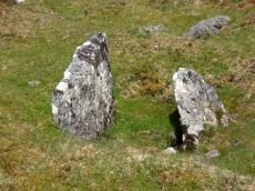
Bellever Tor (SW) Encircled Cairn
OS Map: SX 64144 76275
HER: MDV5885
Megalithic Portal: 3056
Alternate name: Bellever Tor 2 Encircled Cairn
ShortName: EC:Bellever 2
Butler map: 27.20.2
Grinsell: LYD 59a
Turner: F18
Notes: cairn, it does not appear to have been excavated, although there is a slight disturbance at the top centre where large granite stones are bared. At the north west extreme are two stones, the positions of which indicate this being part of the retaining circle, no others remain. Height 0.8m, diameter 5.0m. Turner F18. See also: Dartmoor Explorations: Antiquities of Black Newtake and Environs. NGR taken from Dartmoor Explorations (Steve Grigg).
Nearby sites: SX 64144 76275
Distance: 1.75km
Bellever Tor 1 (W) (Newtake) Platform Cairn Circle and Cist
Prehistoric Dartmoor Walks: Dartmoor Site: Lakehead Hill
OS Map: SX 64089 76472
HER: MDV5884
Megalithic Portal: 34876
PMD: Bellever Tor W.
Alternate name: Bellever Tor 1 Platform Cairn Circle and Cist
ShortName: CT Bellever 1
Butler map: 27.20.1
DPD page: 119
Grinsell: LYD 59
Turner: E26
Barrow Report: 54 56
Notes: Further coverage see the Lakehead Hill page. Lethbridge diagram p.119 (uppermost cist) and photo top p.119. Dixon #62. Bar Rep 54. Butler Bellever Tor (Cairn 1) - Vol. 2. Map 27.20.1 (diagram pp.52-3).
Nearby sites: SX 64089 76472
Distance: 1.68km
Bellever Tor N. Enclosed Settlement
OS Map: SX 64485 76808
HER: MDV27672
Megalithic Portal: 24263
ShortName: ES BelleverTor
Notes: The photo was taken at SX 64510 76849.
Nearby sites: SX 64485 76808
Distance: 1.17km
Black Newtake (b) Stone Ring Cairn Circle
Prehistoric Dartmoor Walks: Dartmoor Site: Lakehead Hill
OS Map: SX 63863 76038
HER: MDV5889
Megalithic Portal: 45841
Alternate name: Bellever Tor 4 Stone Ring Cairn Circle
ShortName: RC Bellever 4
Butler map: 27.20.4
DPD page: 119
Grinsell: LYD 61
Turner: A50
Barrow Report: 57
Notes: "Cairn visible as unbroken circular bank 11.5 metres in external diameter with a bank 2.4 to 3.7 metres wide by 0.75 metres high enclosing a flat platform circa 6 metres diameter and 0.5 metres above ground surface. Some small stones appear in the north and east margins, and several larger stones are visible on the platform." Lethbridge diagram p.119 (Cairn near Cist 1) - no photo.
Nearby sites: SX 63863 76038
Distance: 2.11km
Black Newtake (C) No. 3 Ring Setting Cairn and Cist
Prehistoric Dartmoor Walks: Dartmoor Site: Lakehead Hill
OS Map: SX 63893 75869
HER: MDV5890
Megalithic Portal: 34908
PMD: Black Newtake Central
Alternate name: Bellever Tor 6 Ring Setting Cairn and Cist
ShortName: CT Bellever 6
Butler map: 27.20.6
DPD page: 120
Grinsell: LYD 62
Turner: D4
Barrow Report: 57
Notes: Further coverage on Lakehead Hill page. Lethbridge diagram p.119 Cist 2 and photo top p.120. Butler Bellever Tor - Vol. 2. Map 27.20.6 (Cairn 6 diagram pp.52-3).
Nearby sites: SX 63893 75869
Distance: 2.20km
Black Newtake (E) No. 5 Ring Setting Cairn and Cist
Prehistoric Dartmoor Walks: Dartmoor Site: Lakehead Hill
OS Map: SX 63853 75734
HER: MDV5950
Megalithic Portal: 45744
PMD: Black Newtake S.
Alternate name: Bellever Tor 8 Ring Setting Cairn and Cist
ShortName: CT Bellever 8
Butler map: 27.20.8
Grinsell: LYD 64
Turner: D7
Barrow Report: 57
Notes: "Turf and gorse covered cairn. Approximately 6 metres in diameter with a maximum height of 0.35 metres. A depression in the top possibly marks the site of a cist with one large leaning or recumbent stone detectable under the turf at the east end" "Small orthostatic circle, diameter 6.5 metres, with central cist. Only one stone remains. Part of group with similar thin rectangular slabs, now eroded". Further coverage on Lakehead Hill page. Butler Bellever Tor - Vol. 2. Map 27.20.8 (Cairn 8 diagram pp.52-3). See also: Dartmoor Explorations: Antiquities of Black Newtake and Environs
Nearby sites: SX 63853 75734
Distance: 2.32km
Black Newtake (N) No. 1 Ring Setting Cairn and Cist
Prehistoric Dartmoor Walks: Dartmoor Site: Lakehead Hill
OS Map: SX 63919 76067
HER: MDV5888
Megalithic Portal: 45738
PMD: Black Newtake N.
Alternate name: Bellever Tor 3 Ring Setting Cairn and Cist
ShortName: CT Bellever 3
Butler map: 27.20.3
DPD page: 119
Grinsell: LYD 60
Turner: D5
Barrow Report: 57
Notes: Further coverage on Lakehead Hill page. Lethbridge Cist 1 diagram p.119 and photo top p.119. Butler Bellever Tor (Cairn 3) - Vol. 2. Map 27.20.3 (diagram pp.52-3). Site revisited 04/09/23 and the site is very overgrown unlike in 2010. The exact location by Garmin is SX 63919 76067 now used on this record. See also: Dartmoor Explorations: Antiquities of Black Newtake and Environs
Nearby sites: SX 63919 76067
Distance: 2.05km
Broadun Enclosed Settlement
OS Map: SX 6354 7993
HER: MDV5946
Megalithic Portal: 26043
ShortName: ES:Broadun
Notes: "An enclosed settlement, maximum dimensions 300m NE/SW by 250m NW/SE, giving an area of 6ha. Enclosure cut through on SE by a leat, but wall still visible. Inside are 36 huts, and a further 3 outside. Condition of huts mainly poor. Average internal diameter is 3.7m: the largest is 13m by 10.5m, the smallest 2.5m. The enclosure wall appears contemporary with or later than the huts. The interior of the enclosure appears to have been cleared." See also HER entry 6800
Nearby sites: SX 6354 7993
Distance: 3.24km
Broadun Ring Enclosed Settlement
OS Map: SX 63704 80192
HER: MDV6746
Megalithic Portal: 26048
ShortName: ES BroadunRing
Notes: Breton p.38
Nearby sites: SX 63704 80192
Distance: 3.36km
Cator Pound
Prehistoric Dartmoor Walks: Dartmoor Site: Cator Pound
OS Map: SX 6730 7765
HER: MDV6009
Megalithic Portal: 34961
ShortName: PD Cator Pound
Notes: HER: Cator pound, widecombe. In his survey of widecombe made about 1750, dean milles describes 'a very considerable circle of stones on the n part of the western down on a farm called cator and on an eminence called whitehill'; he gives the diameter as 58 paces and says it consisted 'chiefly of large stones mowst of which rise about 4 feet above ye ground. This circle consists now of about 30 stones but there are spaces where several more stood, half the number are fallen; the rest are either erect or on their sides'.
Nearby sites: SX 6730 7765
Distance: 1.81km
Cator Common Embanked Cairn Circle
Prehistoric Dartmoor Walks: Dartmoor Site: Cator Pound
OS Map: SX 67426 78001
HER: MDV5978
Megalithic Portal: 52173
ShortName: CC CatorCommon
Butler map: 18.4
Grinsell: WID 1
Turner: B3
Notes: HER: Cairn, hollow towards centre. Retaining circle of c.28 upright slabs, mostly turned inwards. Diameter 18.0m, height 0.6m. Breton p.41
Nearby sites: SX 67426 78001
Distance: 2.02km

Cator Common Platform Cairn Circle and Cist
OS Map: SX 67118 77510
HER: MDV5987
Megalithic Portal: 45793
PMD: Pizwell Bridge
Alternate name: Pizwell Bridge Platform Cairn Circle and Cist
ShortName: CT Pizwell 1
Butler map: 18.5
Butler Vol 5: p.171 & Fig.110
Grinsell: WID 2
Turner: E10
Notes: "Pizwell Bridge cairn of circa 5m diameter by 0.5m high is to be found about 10m below the road in an unusual position near the base of the hill. Three retaining slabs form an arc around one side with another just under the turf. The top of a slab near the centre with a pit alongside might be one side of a cist. ". Butler Pizwell Bridge Vol. 1. Map 18.5 (diagram Vol 5. p.171). Possible central cist.
Nearby sites: SX 67118 77510
Distance: 1.61km
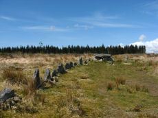
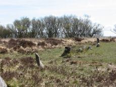
Challacombe Down Stone Row
Prehistoric Dartmoor Walks: Dartmoor Site: Challacombe Down Triple Stone Row
OS Map: SX 69016 80718
HER: MDV6600
Megalithic Portal: 1819
The Stone Rows of GB: Challacombe Down
PMD: Challacombe Stone Row
ShortName: SR Challacombe
Butler map: 24.3
Butler Vol 5: p.239 & Fig.169
DPD page: 126
Notes: "Bronze Age triple stone row well marked and wider apart at the north, drawing nearer to the south where they meet a blocking stone of unusual size. The stones have suffered little in their restoration except that a stone in the middle row was turned to form a blocking stone for that row. The loose stones scattered to the west of the north end have been suggested to form a stone circle and additional rows but may be stones excavated from the north end of the stone row." Breton p.41-42
Nearby sites: SX 69016 80718
Distance: 4.85km
Challacombe Down Standing Stone
Prehistoric Dartmoor Walks: Dartmoor Site: Challacombe Down Triple Stone Row
OS Map: SX 69021 80723
HER: MDV6600
Megalithic Portal: 10092
PMD: Challacombe Stone Row
ShortName: SS Challacombe
Butler map: 24.3
DPD page: 126
Notes: The largest and most prominent blocking stone of the Dartmoor rows is to be found at the Challacombe triple row. Worth states that it is over 5 feet in width at the base and over 6 feet in height. Butler (Vol. 2) states that the terminal pillar is today 0.5m shorter than when it was measured in 1893.
Nearby sites: SX 69021 80723
Distance: 4.86km
Challacombe Down Cairn Circle
Prehistoric Dartmoor Walks: Dartmoor Site: Challacombe Down Triple Stone Row
OS Map: SX 6898 8084
HER: MDV49462
Megalithic Portal: 1819
PMD: Challacombe Down Stone Row
ShortName: CC Challacombe
Butler map: 24.3
Butler Vol 5: p.239 & Fig.169
Turner: G20
Notes: Dubious site - the current arrangement relates to stones placed during restoration of the stone row. See Worth (1953) p. 226 on how "nothing coherent" came of attempts to re-erect stones scattered to the west of the north end of the row which gave the appearance of a stone circle.
Nearby sites: SX 6898 8084
Distance: 4.91km
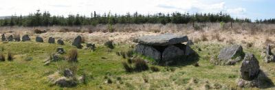
Chittaford Down Platform Cairn Circle and Cist
OS Map: SX 63687 79463
HER: MDV5932
Megalithic Portal: 52177
PMD: Chittaford Down
Alternate name: Chittaford Down 3 Platform Cairn Circle and Cist
ShortName: CT Chittaford3
Butler map: 27.18.3
Butler Vol 5: p.160 & Fig.100
DPD page: 112
Grinsell: LYD 39
Turner: E28
Barrow Report: 57
Notes: "A cist about 350 yards north of Archerton House. It has an irregular shape no coverstone and stands in the centre of a 14ft. diameter ruined cairn. There are traces of an enclosing ring of stones. Excavation in 1900 recovered wood charcoal and a worked flint flake from a small pit within the cist. Under the eastern side stone an archer's polished stone wrist guard was found". Lethbridge diagram and photo bottom p.112. Butler Chittaford Down 3 - Vol. 2. Map 27.18 (diagram Vol. 5. p.160).
Nearby sites: SX 63687 79463
Distance: 2.78km
Chittaford Down Platform Cairn Circle
OS Map: SX 63502 79203
HER: MDV5832
Megalithic Portal: 42726
PMD: Archerton
Alternate name: Chittaford Down 1 Platform Cairn Circle
ShortName: PC Chittaford1
Butler map: 27.18.1
Butler Vol 5: p.170 & Fig.109
Grinsell: LYD 38
Turner: E14
Notes: "Remains of a cairn, visible as a turf covered stony mound. The NE quadrant is robbed out but around the rest of the periphery are parts of a kerb of small boulders, some set on edge, giving a diameter of 6.5m NW-SE. Maximum height 0.6m in the SW quadrant, but elsewhere the interior is badly robbed." Butler says there is a possible end slab of a cist.
Nearby sites: SX 63502 79203
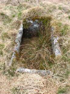
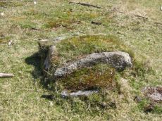
Distance: 2.73km
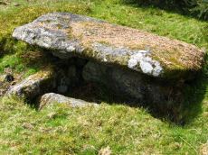
Crockern Tor Cist
OS Map: SX 61414 76055
HER: MDV57569
Megalithic Portal: 45816
PMD: Crockern Tor
Alternate name: Crockern Tor 1 Cist
ShortName: CT CrockernNW1
Butler Vol 5: p.32 & Fig.11
DPD page: 110
Notes: "Remains of a small cairn with cist on a moderate W slope in open grassland at SX 61407604 overlooking the West Dart in Crockern Newtake. It has been robbed heavily, leaving only one cist slab and fragments of the cairn material. The slab is restangular in side view and in section, firmly embedded on edge, measuring 1.2m long 0.48m high and 0.15m thick. It is aligned NW to SE." Butler Vol 5 p. 32. Lethbridge diagram and photo p.110.
Nearby sites: SX 61414 76055
Distance: 4.30km
Dunnabridge Pound
Prehistoric Dartmoor Walks: Dartmoor Site: Dunnabridge Pound
OS Map: SX 6462 7465
HER: MDV6272
Megalithic Portal: 10635
PMD: Dunnabridge Pound
ShortName: PD Dunnabridge
Notes: Dunnabridge Pound probably has its origins in the prehistoric period as evidenced by the slight traces of hut circles within it. The pound underwent reconstruction in the medieval period and was used in the drifts to hold cattle found illegally pasturing on the moors.
Nearby sites: SX 6462 7465
Distance: 2.85km
Dunnabridge Common Platform Cairn Circle and Cist
Prehistoric Dartmoor Walks: Dartmoor Site: Lakehead Hill
OS Map: SX 63585 75470
HER: MDV5952
Megalithic Portal: 37603
PMD: Smith Hill
Alternate name: Bellever Tor 9 Platform Cairn Circle and Cist
ShortName: CT Bellever 9
Butler map: 27.20.9
DPD page: 120
Grinsell: LYD 65
Turner: E37
Barrow Report: 58
Notes: Lethbridge Cist 3 diagram p.119 and photo bottom p.120. Butler Bellever Tor (Cairn 9) - Vol. 2. Map 27.20.9 (diagram p52-3). See also: Dartmoor Explorations: Antiquities of Black Newtake and Environs
Nearby sites: SX 63585 75470
Distance: 2.70km
Dunnabridge Pound Farm Newtake Cist
Prehistoric Dartmoor Walks: Dartmoor Site: Lakehead Hill
OS Map: SX 64086 75691
HER: MDV5891
Megalithic Portal: 45751
PMD: Dunnabridge Newtake
Alternate name: Bellever Tor 10 Cist
ShortName: CT Bellever10
Butler map: 27.20.10
Butler Vol 5: p.60 & Fig.39
DPD page: 121
Grinsell: LYD 66
Barrow Report: 59
Notes: Only one side of this cist remains. Further coverage on Lakehead Hill page. Lethbridge Cist 4 diagram p.119 and photo top p.121. Butler Bellever Tor - Vol. 2. Map 27.20.10 (Cairn 10 diagram pp.52-3). See also: Dartmoor Explorations: Antiquities of Black Newtake and Environs
Nearby sites: SX 64086 75691
Distance: 2.20km

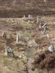
Higher White Tor Stone Row
OS Map: SX 61917 78362
HER: MDV5834
Megalithic Portal: 2192
The Stone Rows of GB: Higher White Tor
PMD: Higher White Tor Stone Row
ShortName: SR HigherWhite
Butler map: 29.16
DPD page: 110
Notes: "A Late Neolithic stone alignment on Higher White Tor, surviving as two parallel rows of stones aligned roughly north-south. The alignment is 95.4 metres long and contains twelve upright stones and 24 recumbent ones." Lethbridge diagram and photo p.110. Site visited 28/05/2025 by the author. The main photo above gives a more realistic picture than the more "artistic" second photo.
Nearby sites: SX 61917 78362
Distance: 3.73km
Huccaby Rings Inner Enclosed Settlement
OS Map: SX 6582 7381
HER: MDV6405
Megalithic Portal: 4616
ShortName: ES HuccabyInn
Notes: "Huccaby Ring a circular banked enclosure south-east of Huccaby Tor; smaller than Outer Huccaby Ring that lies to the north-west of the Tor. A Bronze Age enclosure visible as a turf covered stoney bank measuring 3.5 metres wide and stading to a maximum height of 0.7 metres. There is no obvious sign of an entrance."
Nearby sites: SX 6582 7381
Distance: 3.56km
Huccaby Rings Outer Enclosed Settlement
OS Map: SX 65553 74441
HER: MDV6397
Megalithic Portal: 4614
ShortName: ES HuccabyOut
Notes: "Outer Huccaby Ring earthwork; a sub-rectangular banked enclosure. The bank is grassed over rubble. There is a probable entrance on the south-west side. A hillslope enclosure in rough moorland measuring 105 metres east-west and 95 metres north-south with a bank of small stones averaging 0.6 metres high. It is of prehistoric date with later additions." In more recent years the formerly grass covered site has become gorse and heather covered as can be seen in the photo of the northern section. In 2022-2024 work has been done by the Dartmoor Preservation Association to clear the gorse from the bank.
Nearby sites: SX 65553 74441
Distance: 2.92km
King's Oven (Water Hill) Cairn
OS Map: SX 67158 81299
HER: MDV6674
Megalithic Portal: 34690
PMD: Water Hill Possible Chambered Cairn
Alternate name: Water Hill 1 Cairn
ShortName: CN WaterHill 1
Butler map: 26.5.1
Butler Vol 5: p.156 & Fig.95
Grinsell: CHA 6
Notes: Situated at SX 67158129 on the rounded summit of Water Hill is the remains of a substantial round cairn 18.0 metres in diameter and up to 1.4 metres high in the east and 0.9 metres in the west. The whole of the central area of the cairn has been robbed to construct a superimposed modern boundary cairn 4.0 metres in diam and 2.1 metres high. This has given a 'dished' appearance to the cairn proper. Several large slabs averaging 0.8 metres by 0.7 metres scattered around the base of the boundary cairn may be the remains of a destroyed cist.
Nearby sites: SX 67158 81299
Distance: 4.27km
Kraps Ring Enclosed Settlement
OS Map: SX 64444 78157
HER: MDV5861
Megalithic Portal: 11477
ShortName: ES:KrapsRing
Notes: HER: A large sub-circular enclosure of 120 metres by 113 metres containing at least nine hut circles, almost entirely surrounded by the mature conifers in Bellever Plantation. There are two hut circles associated with the enclosure outside the pound wall on the south-western side.
Nearby sites: SX 64444 78157
Distance: 1.33km
Lakehead Hill Platform Cairn Circle
Prehistoric Dartmoor Walks: Dartmoor Site: Lakehead Hill
OS Map: SX 64358 77773
HER: MDV5869
Megalithic Portal: 1057
Alternate name: Lakehead Hill 1 Platform Cairn Circle
ShortName: PC Lakehead 1
Butler map: 27.19.1
DPD page: 114
Grinsell: LYD 53
Turner: E16
Barrow Report: 55
Notes: HER: A ring cairn lying on a gentle slope near the summit of Lakehead Hill. The cairn survives as a 6 metre diameter circle of upright slabs standing up to 0.4 metres high surrounding a slightly raised area. In the centre of the circle is a small 0.15 metre high mound. Lethbridge diagram p.114 and photo bottom p.114.
Nearby sites: SX 64358 77773
Distance: 1.23km
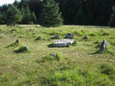
Lakehead Hill Cairn Circle
Prehistoric Dartmoor Walks: Dartmoor Site: Lakehead Hill
OS Map: SX 64351 77493
HER: MDV52762
Megalithic Portal: 24365
Alternate name: Lakehead Hill 5 Cairn Circle
ShortName: CC Lakehead 5
Butler map: 27.19.5
DPD page: 117
Grinsell: LYD 55
Turner: G24
Barrow Report: 54
Notes: Butler Cairn 5. Tuner lists this as G24 Stone Circle. However, it is clear from its size and location near other Ring Settings that it is in fact better described as a Ring Setting despite having no visible internal structure. In these listings we will leave it as a cairn circle. HER: A ring cairn lying on a gentle slope near the summit of Lakehead Hill. The cairn is defined by a circle of edge set stones which measure 7.8 metres in diameter and stand up to 0.9 metres high.
Nearby sites: SX 64351 77493
Distance: 1.17km
Lakehead Hill 2 Cist
Prehistoric Dartmoor Walks: Dartmoor Site: Lakehead Hill
OS Map: SX 64261 77701
HER: MDV5841
Megalithic Portal: 4612
PMD: Lakehead Hill NW.
ShortName: CT Lakehead 2
Butler map: 27.19.2
DPD page: 115
Grinsell: LYD 52
Barrow Report: 17 55
Notes: HER: The remains of a cairn on Lakehead Hill. It includes an 8 metre diameter and 0.1 metre high mound containing a north west to south east orientated cist measuring 0.9 metres long by 0.55 metres wide. The cist is now backfilled and protrudes 0.4 metres high above the present land surface. Part excavation of the cist in 1898 by the Dartmoor Exploration Committee, revealed flint knives and scrapers together with pottery fragments and charcoal. Scheduled. Further coverage on Lakehead Hill page. Lethbridge diagram p.114 and photos top p.115. Butler Lakehead Hill (Cairn 2 diagrams pp.48-52).
Nearby sites: SX 64261 77701
Distance: 1.30km
Lakehead Hill 4 (E of Summit) Stone Row
Prehistoric Dartmoor Walks: Dartmoor Site: Lakehead Hill
OS Map: SX 64498 77603
HER: MDV5870
Megalithic Portal: 2009
The Stone Rows of GB: Lakehead Hill East
PMD: Lakehead Great Cairn Stone Row
Alternate name: Lakehead Hill E Stone Row
ShortName: SR Lakehead E
Butler map: 27.19.4
DPD page: 116
Notes: HER: A stone alignment and a cairn with cist lying on a gentle slope near the summit of Lakehead Hill. The stone alignment survives as a single row of at least 11 stones leading westward towards the cairn and cist. The cairn measures 6.7 metres in diameter and is defined by several edge set stones, which in turn surround a large restored cist formed by five substantial upright slabs supporting a capstone measuring 2.2 metre long by 1.55 metres wide and 0.3 metres thick. Lethbridge diagram p.114 and photos p.116.
Nearby sites: SX 64498 77603
Distance: 1.04km
Lakehead Hill 4 (E or Summit) Ring Setting Cairn and Cist
Prehistoric Dartmoor Walks: Dartmoor Site: Lakehead Hill
OS Map: SX 64499 77611
HER: MDV5870
Megalithic Portal: 2009
PMD: Lakehead Hill Summit
Alternate name: Lakehead Hill 4 Ring Setting Cairn and Cist
ShortName: CT Lakehead 4
Butler map: 27.19.4
Butler Vol 5: p.59 & Fig.37
DPD page: 116
Grinsell: LYD 54
Turner: D6
Notes: A single stone row of at least 11 stones leading westward towards the cairn and cist. HER: The cairn measures 6.7 metres in diameter and is defined by several edge set stones, which in turn surround a large restored cist formed by five substantial upright slabs supporting a capstone measuring 2.2 metre long by 1.55 metres wide and 0.3 metres thick. Further coverage on Lakehead Hill page. Lethbridge diagram p.114 and photo top p.116. Butler Lakehead Hill (Cairn 4) - Vol. 2. Map 27.19.4 (diagrams pp.48-52). Breton p.35-36
Nearby sites: SX 64499 77611
Distance: 1.04km
Lakehead Hill 6 (Newtake) Ring Setting Cairn and Cist
Prehistoric Dartmoor Walks: Dartmoor Site: Lakehead Hill
OS Map: SX 64363 77475
HER: MDV5842
Megalithic Portal: 24365
PMD: Lakehead Hill Central
Alternate name: Lakehead Hill 6 Ring Setting Cairn and Cist
ShortName: CT Lakehead 6
Butler map: 27.19.6
DPD page: 117
Grinsell: LYD 56
Turner: D10
Barrow Report: 54 56
Notes: Further coverage on Lakehead Hill page. Lethbridge diagram p.114 and photo bottom p.117. Dixon #64. Bar Rep 54. Butler Lakehead Hill (Cairn 6) - Vol. 2. Map 27.19.6 (diagrams pp.48-52). HER: On a gentle slope near the summit of Lakehead Hill is a ring cairn and cist. The cairn measures 6.9 metres in diameter and contains a central cist. The cist protrudes 0.4 metres above the surrounding ground surface and is covered by a capstone measuring 1.7 metres long, 1.28 metres wide and 0.15 metre thick. DEC Report 3: A second small kistvaen within a circle exists on the west side of Lake Head Hill, and was examined, but nothing was found in it. The circle about it is tolerably complete and the stone chest has lost only one of the side-stones ; but it is very small. Apparently a small stone row led from it. Near the kistvaen is a circle of stones enclosing a cairn, but no kistvaen. From the circle perhaps a stone row led away east, but only three stones remain in line.
Nearby sites: SX 64363 77475
Distance: 1.16km
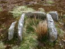
Lakehead Hill 7 (Newtake) Cist
Prehistoric Dartmoor Walks: Dartmoor Site: Lakehead Hill
OS Map: SX 64720 77395
HER: MDV5875
Megalithic Portal: 11137
PMD: Lakehead Hill E.
Alternate name: Lakehead Hill 7 Cist
ShortName: CT Lakehead 7
Butler map: 27.19.7
Butler Vol 5: p.184 & Fig.127
DPD page: 118
Grinsell: LYD 57
Barrow Report: 54
Notes: Butler Lakehead Hill (Cairn 7) - Vol. 2. Map 27.19.7 (diagrams pp.48-52).Further coverage on Lakehead Hill page. Lethbridge diagram p.114 and photo top p.118.
Nearby sites: SX 64720 77395
Distance: 0.79km
Lakehead Hill 8 Cist
Prehistoric Dartmoor Walks: Dartmoor Site: Lakehead Hill
OS Map: SX 64717 77178
HER: MDV5879
Megalithic Portal: 24377
PMD: Lakehead Hill SE.
ShortName: CT Lakehead 8
Butler map: 27.19.8
Butler Vol 5: p.61 & Fig.41
DPD page: 118
Grinsell: LYD 58
Barrow Report: 33 55
Notes: HER: Southern of two cists to east of trackway on south side of Lakehead Hill. The cist, which lies in a small cairn 4.5 metres diameter, is orientated north-north-west to south-south-east. Only three sides of the cist survive; the cap stone has also gone. It was excavated in 1914 when a pit containing charcoal was found.. Further coverage on Lakehead Hill page. Lethbridge diagram p.114 and photo bottom p.118. Butler Lakehead Hill (Cairn 8) - Vol. 2. Map 27.19.8 (diagrams pp.48-52). Discovered by Mr. George French of Postbridge.
Nearby sites: SX 64717 77178
Distance: 0.82km
Lakehead Hill S.E. Stone Row
Prehistoric Dartmoor Walks: Dartmoor Site: Lakehead Hill
OS Map: SX 64701 77409
HER: MDV5875
Megalithic Portal: 44544
The Stone Rows of GB: Lakehead Hill 2
PMD: Lakehead Hill 2 Stone Row
Alternate name: Lakehead Hill 2 Stone Row
ShortName: SR Lakehead SE
Butler map: 27.19.7
Butler Vol 5: p.184 & Fig.127
DPD page: 118
Barrow Report: 54
Notes: R.N. Worth The cist was examined in 1895/6 but nothing was found. It was surrounded by a double retaining circle and a stone row lead from it north west, of which ten stones remained, but these had sunk into the bog leaving only their tops showing. SRGB states: This description makes it clear that this is unlikely to be a stone row since a row composed of small stones would not have survived the ditch digging involved in the building of the hedge. It is much more likely that they represented stones exposed in the side of the ditch. HER also has: The stone row which falls in an afforested area could not be identified and has probably been destroyed
Nearby sites: SX 64701 77409
Distance: 0.81km
Lakehead Hill S.W. Stone Row
Prehistoric Dartmoor Walks: Dartmoor Site: Lakehead Hill
OS Map: SX 6418 7730
HER: MDV5844
Megalithic Portal: 45595
PMD: Lakehead Hill 6 Stone Row
ShortName: SRxLakehead SW
Butler map: 27.19.1
Notes: HER: Alleged Stone row recorded in 1946 but covered by a forestry plantation in 1979. At that time, 3 stones were visible, but it was uncertain whether they were part of the stone row. It may have been destroyed or covered by humus. Butler: Worth records a stone row on the south-west side of Lakehead Hill but this area has been overplanted and nothing can now be seen. The row was about 123 metres long orientated to the north-east and without any associated cairn.
Nearby sites: SX 6418 7730
Distance: 1.33km
Lakehead Hill Summit Stone Row
Prehistoric Dartmoor Walks: Dartmoor Site: Lakehead Hill
OS Map: SX 64367 77656
HER: MDV5930
Megalithic Portal: 2010
The Stone Rows of GB: Lakehead Hill Summit
PMD: Lakehead Hill 3 Stone Row
Alternate name: Lakehead Hill summit Stone Row
ShortName: SR LakeheadSum
Butler map: 27.19.3
DPD page: 115
Notes: HER: A stone alignment lying on a gentle slope near the summit of Lakehead Hill. It includes a 22 metre long, single row of at least 12 stones standing up to 0.75 metres high, aligned east to west.. Lethbridge diagram p.114 and photo bottom p.115.
Nearby sites: SX 64367 77656
Distance: 1.18km
Lakehead Newtake Cist
Prehistoric Dartmoor Walks: Dartmoor Site: Lakehead Hill
OS Map: SX 64677 78385
HER: MDV5955
Megalithic Portal: 45734
PMD: Lakehead Hill NE.
Alternate name: Lakehead Hill 9 Cist
ShortName: CT Lakehead 9
Butler map: 27.19.9
Butler Vol 5: p.60 & Fig.40
Grinsell: LYD 51
Barrow Report: 55
Notes: HER: Remains of a cist. It consists of a single sidestone, partly buried and aligned NW/SE, measuring 1.3m by 0.2m and 0.3m high. There was no sign of a surrounding cairn or trace of a retaining circle seen in 1979, both probably destroyed by afforestation. Considered but not recommended for scheduling. Butler Lakehead Hill - Vol. 2. Map 27.19.9 (diagrams pp.48-52). Further coverage on Lakehead Hill page.
Nearby sites: SX 64677 78385
Distance: 1.32km
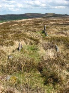
Laughter Tor E. Stone Row
Prehistoric Dartmoor Walks: Dartmoor Site: Laughter Tor Stone Row
OS Map: SX 65222 75393
HER: MDV53417
Megalithic Portal: 2017
The Stone Rows of GB: Laughter Tor 1
PMD: Laugh Tor I Stone Row
Alternate name: Laughter Tor 1 Stone Row
ShortName: SR Laugh Tor E
Butler map: 28.12.1
DPD page: 122
Notes: Butler Laughter 1. Double row interrupted by a new-take wall. row is robbed near wall. "Bronze Age standing stone 2.65 metres high, 0.7 metres wide and 0.52 metres thick, set into a small cairn. About 18 metres to the south east is a double stone row orientated north west to south east and consisting of at least 23 upright stones and a further 9 displaced ones averaging about 1.7 metres apart. The standing stone was re-erected in 1893 and again in 1911 and the cairn was excavated in 1903". Lethbridge pp.121-122. Breton p.41.
Nearby sites: SX 65222 75393
Distance: 1.99km
Laughter Tor W. Stone Row
Prehistoric Dartmoor Walks: Dartmoor Site: Laughter Tor Stone Row
OS Map: SX 65207 75389
HER: MDV6002
Megalithic Portal: 52739
The Stone Rows of GB: Laughter Tor 2
PMD: Laugh Tor II Stone Row
Alternate name: Laughter Tor 2 Stone Row
ShortName: SR Laugh Tor W
Butler map: 28.12.2
Butler Vol 5: p.215 & Fig.149
DPD page: 122
Notes: Butler Laughter 2. "A double stone row at about 395m OD cuts across the gentle SW projecting spur of Laughter Tor in an area of heather and rough grass some 12m WSW of the standing stone 'Laughter Man'. The stones, although all relatively small in size, form two good slightly curving rows oriented about 295 degs. and 0.7m to 1.2m apart, consisting of thirteen stones extending from SX 6519075381 some 15m ESE to SX 6520475375. Now visible are six stones in each row with a single stone at the NW end. Originally there may have been at least ten in each row at intervals of about 1.2m". Lethbridge pp.121-122.
Nearby sites: SX 65207 75389
Distance: 2.00km
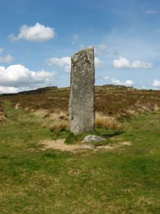
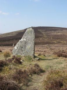
Laughtor Man Standing Stone
Prehistoric Dartmoor Walks: Dartmoor Site: Laughter Tor Stone Row
OS Map: SX 65223 75389
HER: MDV6001
Megalithic Portal: 2017
PMD: Laugh Tor Man
ShortName: SS Laughtor
Butler map: 28.12
Butler Vol 5: p.215 & Fig.149
DPD page: 122
Notes: The longstone is 2.4 m high and was found prostrate on a cairn which was excavated by Burnard. The cairn contained "a great quantity of charcoal and peat ashes". The longstone was restored in 1903. A double stone row heads to the longstone. Breton p.41 a huge menhir I found in June 1913, lying on the ground. It was then 16 ft long, but 4 ft. had been broken off. It was re-erected by the late Rev S. Baring Gould, with the Duchy appliances, and he told me that they could not join the two pieces, so he erected it as it now stands; it is 8.5 ft high, 2ft 6in wide and 1.5 ft thick. The stone row runs E. 720 ft.. See also, Legendary Dartmoor: The Prehistoric Complex of Laughter Tor
Nearby sites: SX 65223 75389
Distance: 1.99km
Muddilake Newtake Reported Cist
OS Map: SX 62654 75194
HER: MDV5893
Megalithic Portal: 45745
PMD: Muddilake Newtake
ShortName: CT:Muddilake
Grinsell: LYD 105
Turner: A21
Barrow Report: 58
Notes: NMR states "A hut circle, not a cairn circle". This is almost certainly not a cist. "The measurements do not conform to those of Prowse but nothing else can be seen in the vicinity. It is most unlikely that these stones represent the remains of a cist, but are a natural occurrence." (see also duplicate HER record 5894 and SiteID=2547). This "cist" entry was listed by Dixon, however, it seems a dubious entry. This is not listed by Butler, the relevant map is Vol. 2. Map 29.9.
Nearby sites: SX 62654 75194
Distance: 3.59km
Muddy Lakes Newtake Reported Cairn
OS Map: SX 6258 7518
HER: MDV5894
Megalithic Portal: 45745
Alternate name: Muddilake West Reported Cairn
ShortName: CT?Muddilake 3
Barrow Report: 58
Notes: Hut circle or cairn? Grinsell states "Traces of cairn with central slab, probably side-slab of cist. Diameter 6.0 meters, height is slight." Other observers say "no trace of cist". This is a duplicate of record 382 (HER 5893). Dixon #82. Bar Rep. 58 (TDA 71. 1939 illustration p.69).
Nearby sites: SX 6258 7518
Distance: 3.66km
Red Barrows Cairn
Prehistoric Dartmoor Walks: Dartmoor Site: Soussons Cairn Circle
OS Map: SX 67718 79650
HER: MDV6007
Megalithic Portal: 34986
PMD: Red Barrows
Alternate name: Red Barrows 1 Cairn
ShortName: CN RedBar 1
Butler map: 24.2.1
Grinsell: MAN 5
Notes: Four Bronze Age round barrows between 10 and 20 meters in diameter and 0.5 to 2.2 meters high. One barrow was excavated in 1902, finds included pottery and flints. See also HER records, 6004, 6005, 6006, 6007.
Nearby sites: SX 67718 79650
Distance: 3.18km
Ringhill Stones Reported Stone Row
OS Map: SX 6473 7947
HER: MDV5856
Megalithic Portal: 2101
ShortName: SRxRinghill
Notes: Breton p.34: Ringhill Stones stand in a field E. of the farm. The two large ones are 15ft. apart. The largest is nearly 5ft. high They were formerly part of stone rows which have been destroyed. 203 yds N.E. of the stones close to the Stannon Brook is the site of a blowing house; just beyond is a stone hedge, built into it is a mould stone.. HER: standing stones. Only two of the five standing stones could be found, it appears that the remainder were destroyed during the construction of an occupational road to Hartyland. These stones are of very weathered appearance, suggestive of great antiquity. See also entry on Megalithic Portal.
Nearby sites: SX 6473 7947
Distance: 2.25km
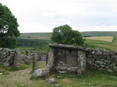
Roundy Park, Postbridge Cist
OS Map: SX 63920 79669
HER: MDV5935
Megalithic Portal: 26041
PMD: Roundy Park
Alternate name: Roundy Park Cist
ShortName: CT Roundy Pk 1
Butler map: 27.4
Butler Vol 5: p.22 & Fig.3
DPD page: 113
Grinsell: LYD 40
Barrow Report: 21
Notes: One of the largest cists on Dartmoor. Discovered in August 1893 by Robert Burnard, who was responsible for the restoration of the grave. Lethbrdige diagram p.112, photo p.113. Butler Vol. 2. Map 27.4 (diagram of location p.41, diagram of site Vol. 5 p.22). Breton p.37
Nearby sites: SX 63920 79669
Distance: 2.80km
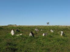
Sherberton Stone Circle
OS Map: SX 63946 73187
HER: MDV6290
Megalithic Portal: 1252
PMD: Sherberton Stone Circle
ShortName: SC Sherberton
DPD page: 101
Turner: G5
Notes: Remains of a 97 ft diameter stone circle with a stone wall passing through its western side. "Nine of the original stones are still standing, plus one larger stone which is incorporated in the remains of the old wall which bisects the western extremity of the circle. This stone appears to have been removed from the original circumference, and its height is 1.4m. The remaining nine stones range in height from 0.3m to 0.75m. The original circle appears to have been c. 30m across, although no stones appear to the west of the old wall. The length of the 2 fallen stones at the southern end is 2.6m and 2.4m".
Nearby sites: SX 63946 73187
Distance: 4.46km
Sherberton Stone Row
OS Map: SX 63948 73349
HER: MDV6426
Megalithic Portal: 6333470
The Stone Rows of GB: Sherberton Row
PMD: Sherberton Stone Row
Alternate name: Sherberton Row Stone Row
ShortName: SR Sherberton
Butler Vol 5: p.211 & Fig.148
DPD page: 100
Notes: The Sherberton double row was discovered in 1997. It is an unimpressive double row of small stones a short distance north-west of the Sherberton Circle. For a plan see Butler Vol. 5 p. 210-12. Lethbridge pp.99-100, diagram p.99 and p.100.
Nearby sites: SX 63948 73349
Distance: 4.31km
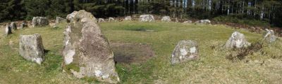
Soussons Common Ring Setting Cairn and Cist
Prehistoric Dartmoor Walks: Dartmoor Site: Soussons Cairn Circle
OS Map: SX 67516 78700
HER: MDV6013
Megalithic Portal: 1266
PMD: Soussons Plantation
Alternate name: Soussons Plantation S. Ring Setting Cairn and Cist
ShortName: CT Soussons Cm
Butler map: 24.2.6
DPD page: 124
Grinsell: MAN 9
Turner: D2
Barrow Report: 22 23 45 56
Notes: "A 28 feet diameter cairn circle with a central cist (plan). The tallest stone in the cairn circle is about 2 feet high." "This cist measures at least 1.3 metres long by 0.5 metres wide and when excavated in 1903 two coils of human hair were found". Lethbridge p.124. Butler Soussons Plantation S - Vol. 2. Map 24.2.6 (diagrams pp. 18-20). Breton p.41.
Nearby sites: SX 67516 78700
Distance: 2.41km
Soussons Down (Red Barrows) Stone Row
Prehistoric Dartmoor Walks: Dartmoor Site: Soussons Cairn Circle
OS Map: SX 6767 7998
HER: MDV6015
Megalithic Portal: 2136
The Stone Rows of GB: Soussons Down
PMD: Red Barrows Stone Row
Alternate name: Soussons Down Stone Row
ShortName: SR Red Barrows
Butler map: 24.2
Notes: Triple row destroyed in 1946 Butler Vol. 5 p38, Vol. 2 Map 24.2 p.19. The row was associated with a cairn about 300m north of the four Red Barrow cairn group (SX 67 NE 3). Butler mentions that some of the stones of the row remained and these were observed and reported to Sandy Gerrard by Chris Jenkins.
Nearby sites: SX 6767 7998
Distance: 3.39km
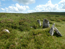
Stannon Little Newtake Ring Setting Cairn and Cist
OS Map: SX 65464 81068
HER: MDV6616
Megalithic Portal: 37598
PMD: Stannon Newtake
Alternate name: Stannon Newtake E. Ring Setting Cairn and Cist
ShortName: CT Stannon 1
Butler map: 35.21.1
DPD page: 124
Grinsell: LYD 29
Turner: D16
Barrow Report: 57
Notes: "Cairn survives as a 4.5 metre diameter mound up to 0.5 metres high. The western edge is denoted by a kerb of edge set slabs up to 1.15 metres high. The eastern edge is beneath a later boundary bank. A cist in the centre is a rectangular pit 1.2 metres by 0.5 metres denoted by edge set slabs". Butler Stannon Newtake E. - Vol. 2. Map 35.21 (diagram p.168). Visited again by the author 18/07/2025 and quite overgrown - the outer kerb can be seen but the cist is covered by vegetation. Breton p.45.
Nearby sites: SX 65464 81068
Distance: 3.71km

Stannon Newtake Stone Row
OS Map: SX 65348 81091
HER: MDV54555
Megalithic Portal: 2144
The Stone Rows of GB: Stannon Newtake
PMD: Stannon Newtake Stone Row
ShortName: SR Stannon New
Butler map: 35.21
Notes: HER: A group of four edge set stones standing up to 1 metre high, situated to the southeast of the cairn, represent the remains of a stone alignment. Possible extension of the White Ridge Stone Row. "Standing stones, possibly a stone row. Forty-six feet S. of the cairn (SX 68 SE 23) are two standing stones, two and a half feet high, their broad planes facing the monument. These, and two others in line, suggest the remains of a stone row, destroyed for materials for an ancient hedge. If a row, it does not point to the centre of the cairn."
Nearby sites: SX 65348 81091
Distance: 3.73km
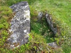
Stennen Hill No. 1 Platform Cairn Circle and Cist
OS Map: SX 62573 77905
HER: MDV5846
Megalithic Portal: 45736
PMD: Powder Mills W.
Alternate name: Stennen Hill 1 Platform Cairn Circle and Cist
ShortName: CT Stennen 1
Butler map: 29.11.1
Butler Vol 5: p.199 & Fig.142
DPD page: 111
Grinsell: LYD 47
Turner: E13
Barrow Report: 57
Notes: "Cist lies approximately in the centre of a subcircular cairn measuring 7 by 6.5m the longer axis and cist aligned nne to ssw. It is stony but almost turf-covered with 2 large kerbstones, including burnards `menhir' remaining in situ in the nw. The cist is flush with the cairn top, which is flattish and stands only 0.2m high on the nw but up to 0.7m high on the se, downhill side. This may be the cairn's original form; built into the slope as a flat platform with the cist visible (nmr citing pattison)". See also HER. Lethbridge photo top p.111. Butler Stennen Hill 1 - Vol. 2. Map 29.11 (diagram Vol. 5. p.199). NB. Worth & Grinsell name this Stennen Hill No. 1. Breton p.34.
Nearby sites: SX 62573 77905
Distance: 2.99km
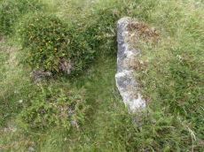
Stennen Hill No. 3 Cist
OS Map: SX 62615 77838
HER: MDV5847
Megalithic Portal: 45737
PMD: Powder Mills E.
Alternate name: Stennen Hill 2 Cist
ShortName: CT Stennen 2
Butler map: 29.11.2
Butler Vol 5: p.200 & Fig.143
DPD page: 111
Grinsell: LYD 49
Barrow Report: 57
Notes: "cist is oriented nw. - se. And is open with the south west side stone and the end stone buried beneath the turf. Internal dimensions 1.3m by 0.85m depth 0.5m. The mound, which is slight with a height of 0.3m is much disturbed. Judging by the remains of the retaining circle of which six stones can be seen the diameter of the mound was 4.5m. Condition of the cist is fair, of mound poor." Only one large stone remains in the mound of a cairn. Lethbridge photo top p.111. Butler Stennen Hill 2 - Vol. 2. Map 29.11 (diagram Vol. 5. p.200). NB. Worth & Grinsell name this Stennen Hill No. 3 (It is Butler 2). Breton p.34.
Nearby sites: SX 62615 77838
Distance: 2.94km
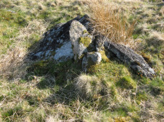
Swincombe Ford Newtake 1 Cist
OS Map: SX 63330 72988
HER: MDV54431
Megalithic Portal: 42665
PMD: Swincombe Ford Newtake
ShortName: CT Swincombe 1
Butler map: 63.5.1
DPD page: 99
Notes: Butler Vol. 4. Map 63.5 (diagram p.215). "A robbed cist within a cairn on a gently sloping NE-facing moorland hillside. A stoney cairn 6.0m N-S by 5.5m E-W and 0.3m high contains the cist, approximately 0.8m wide, 0.3m deep and of indeterminate length and orientation. The capstone, 1.4m by 1.3m largely obscures the cist, with only the ?NE end stone being visible." Lethbridge diagram p.99 photo top of p.99.
Nearby sites: SX 63330 72988
Distance: 4.89km
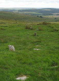
White Ridge Stone Row
OS Map: SX 65420 81661
HER: MDV6642
Megalithic Portal: 4145
The Stone Rows of GB: White Ridge
PMD: White Ridge Stone Row
ShortName: SR White Ridge
Butler map: 35.20
DPD page: 125
Notes: "A double stone row, 620 ft in length from the centre of a cairn at the north end, running nearly due south and slightly downhill. Well preserved at the north end for a short distance but becoming more dilapidated as it approaches the newtake wall at the south end". Lethbridge diagram p.124 and photo top p.125. Breton p.45 sadly robbed to build the wall, but the upper part is still a good specimen of the double avenue. It is 260 yds. long; there are three stones on the S. side of the wall.
Nearby sites: SX 65420 81661
Distance: 4.30km
Wistman's wood Settlement
OS Map: SX 6125 7750
HER: MDV5933
Megalithic Portal: 42854
Alternate name: Wistman's wood Settlement
ShortName: ST:Wistmans
Nearby sites: SX 6125 7750
Distance: 4.27km
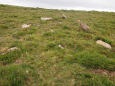
Yar Tor Stone Row
OS Map: SX 68177 73857
HER: MDV6459
Megalithic Portal: 2199
The Stone Rows of GB: Yar Tor
PMD: Yar Tor Stone Row
ShortName: SR Yar Tor
Butler map: 14.11
DPD page: 122
Barrow Report: 56
Notes: "The remains of a probable triple stone row with a cairn and cist at its south end and a barrow at its north. The row comprises stones set 2m apart and standing to a height of 0.3m. Some are concealed beneath the turf. The cairn measures 11m in diameter and 0.3m high with a central cist surrounded by a kerb. The barrow is 6m in diameter and 1m high".
Nearby sites: SX 68177 73857
Distance: 4.40km

Yar Tor (Money Pit) Platform Cairn Circle and Cist
OS Map: SX 68181 73865
HER: MDV6460
Megalithic Portal: 1369
PMD: Money Pit
Alternate name: Money Pit Platform Cairn Circle and Cist
ShortName: CT Money Pit
Butler map: 14.11
Butler Vol 5: p.23 & Fig.4
DPD page: 122
Grinsell: WID 21
Turner: E51
Barrow Report: 56 62
Notes: "The south cairn is a very spread and slight earthwork with a centrally placed cist. Only the north and west side slabs of the cist remain in situ though a misplaced slab lies to one side of the chamber. Eleven slabs forming a kerb of approximately 3m surrounding the cist remain in situ. Several additional stones survive, protruding just above the surface of the flattened cairn, which are likely to be evidence of an outer circle with a diameter of approximately 11m". Lethbridge diagram p.122 and photo bottom p.122. Butler Money Pit - Vol. 1. Map 14.11 (photo on p.92, diagram pp.125-6).
Nearby sites: SX 68181 73865
Distance: 4.40km
Yar Tor Prehistoric Homestead Round House
OS Map: SX 674 734
HER: MDV26473
Megalithic Portal: 22983
ShortName: HC:YarTor
Notes: HER: Two incomplete conjoined enclosures on the south-west slope of Yar Tor, near Dartmeet, of probable Medieval date.
Nearby sites: SX 674 734
Distance: 4.39km

Yar Tor Summit Cairn
OS Map: SX 67865 73943
HER: MDV6434
Megalithic Portal: 11065
Alternate name: Yar Tor summit Cairn
ShortName: CN Yar Tor Sum
Butler map: 14.8
Grinsell: WID 20
Barrow Report: 56
Notes: "Large cairn (approximately 18.0 metres) built on the summit of Yar Tor; the stones have been rearranged to form a shelter. This cairn is aligned with a reave; part of the Dartmeet parallel reave system."
Nearby sites: SX 67865 73943
Distance: 4.15km