
Corndon Down 1 Cairn
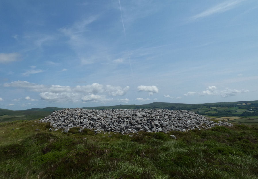
Photo taken on 17-06-2025
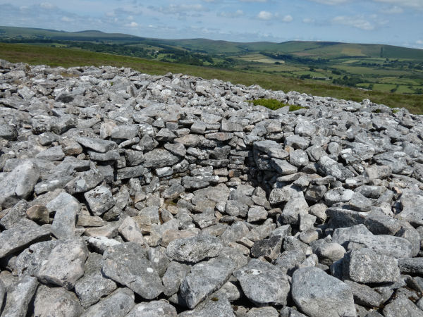
Shelter near centre [17/06/2025]
Database entries
OS Map: SX 68678 74766
OS Source: Google
Butler OS: SX68657477
HER: MDV6385
Alternate name: Corndon Down 1
Short Name: CN CorndonDn 1
Butler map: 15.5.1
Grinsell: WIDECOMBE IN THE MOOR 17
Exist: Yes
Record: Unique
Record Source: Butler
Hut Class: No
Cairn Class: Yes
Barrow Report: 56 62
Dimensions (m): 21.0 x 2.5
Lidar: SX 68678 74766
Guide Map: 36
Nearest Bus Stop (Minor): Widecombe in the Moor Car Park (5.1 km) [Route: 271]
Nearest Bus Stop (Major): Postbridge Bellever (4.1 km) [Route: 98]
Nearby sites: SX 68678 74766
Notes
HER: Large stone cairn; one of a pair approximately 530m north of Corndon Tor. The eastern cairn comprises a stony mound standing to over 2m high with a flattish top surface which has been badly disturbed by recent building of shelters. One very pronounced example is in centre of the cairn and appears recent. A reave, part of the Dartmeet system, touches the cairn tangentially on the west side but is not covered by it.References
These are selected references with an emphasis on out of copyright sources linked as PDFs. For more detailed references try any linked HER or PMD record above.
- Butler, Jeremy, Dartmoor Atlas of Antiquities, vol.1: The East, (1991)
- Grinsell, L.V., Dartmoor Barrows, Devon Archaeological Society Proceedings No.36 (1978)
- Worth, R. Hansford, Barrow Report 56, T.D.A. Vol.69 pp.75-109 (1937)
- Worth, R. Hansford, Barrow Report 62, T.D.A. Vol.75 pp.53-55 (1943)