
Lakehead Hill Platform Cairn Circle
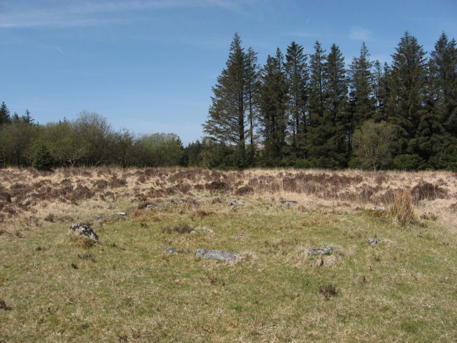
Photo taken on 15-05-2010
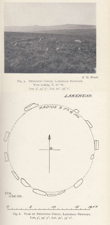
Plan by RHW. Barrow Report 55. TDA Vol.68 1936
Database entries
PDW coverage: Dartmoor Site: Lakehead Hill
OS Map: SX 64358 77773
OS Source: Garmin
Butler OS: SX64347777
HER: MDV5869
Megalithic Portal: 1057
Alternate name: Lakehead Hill 1
Short Name: PC Lakehead 1
Butler map: 27.19.1
Grinsell: LYDFORD 53
Turner: E16
DPD page: 114
Exist: Yes
Record: Unique
Record Source: Butler
Hut Class: No
Cairn Class: Yes
Barrow Report: 55
Dimensions (m): 6.0
Lidar: SX 64358 77773
Guide Map: 28
Nearest Bus Stop: Postbridge Post Office (1.6 km) [Route: 98,171(20/07/26 to 19/09/26)]
Nearby sites: SX 64358 77773
Notes
HER: A ring cairn lying on a gentle slope near the summit of Lakehead Hill. The cairn survives as a 6 metre diameter circle of upright slabs standing up to 0.4 metres high surrounding a slightly raised area. In the centre of the circle is a small 0.15 metre high mound. Lethbridge diagram p.114 and photo bottom p.114.References
These are selected references with an emphasis on out of copyright sources linked as PDFs. For more detailed references try any linked HER or PMD record above.
- Brailsford, J. W, Bronze Age Stone Monuments of Dartmoor, Antiquity Volume 12, Number 48 pp.444-63 (1938)
- Butler, Jeremy, Dartmoor Atlas of Antiquities, vol.2: The North, (1991)
- Grinsell, L.V., Dartmoor Barrows, Devon Archaeological Society Proceedings No.36 (1978)
- Lethbridge, William D., Discover Preshistoric Dartmoor, (2015)
- Turner, J.R., Ring Cairns, stone circles and related monuments on Dartmoor, D.A.S.P. No.48 pp.27-86 (1990)
- Worth, R. Hansford, Barrow Report 55, T.D.A. Vol.68 pp.49-50 (1936)