
King's Oven (Water Hill) Cairn
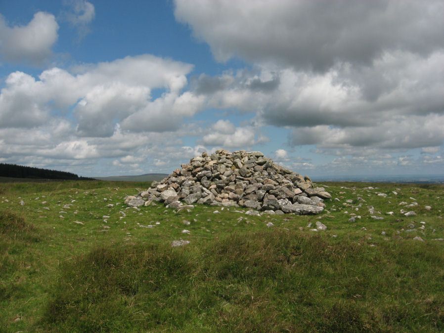
Photo taken on 25-07-2015
Database entries
OS Map: SX 67158 81299
OS Source: Google
Butler OS: SX67158128
HER: MDV6674
Megalithic Portal: 34690
PMD: Water Hill Possible Chambered Cairn
Alternate name: Water Hill 1
Short Name: CN WaterHill 1
Butler map: 26.5.1
Butler Vol 5: p.156 & Fig.95
Grinsell: CHAGFORD 6
Exist: Yes
Record: Unique
Record Source: Butler
Hut Class: No
Cist Class: Maybe
Cairn Class: Yes
Dimensions (m): 18.0 x 1.3
Lidar: SX 67158 81299
Guide Map: 27
Nearest Bus Stop (Minor): Warren House Inn (0.5 km) [Route: 171(20/07/26 to 19/09/26)]
Nearest Bus Stop (Major): Postbridge Post Office (3.4 km) [Route: 98,171(20/07/26 to 19/09/26)]
Nearby sites: SX 67158 81299
Notes
Situated at SX 67158129 on the rounded summit of Water Hill is the remains of a substantial round cairn 18.0 metres in diameter and up to 1.4 metres high in the east and 0.9 metres in the west. The whole of the central area of the cairn has been robbed to construct a superimposed modern boundary cairn 4.0 metres in diam and 2.1 metres high. This has given a 'dished' appearance to the cairn proper. Several large slabs averaging 0.8 metres by 0.7 metres scattered around the base of the boundary cairn may be the remains of a destroyed cist.The southern flat topped cairn measures 18 metres in diameter and 1.5 metres in height and is surmounted by a modern stone pile. A large slab situated to the south of this pile may have been part of a cist.
References
These are selected references with an emphasis on out of copyright sources linked as PDFs. For more detailed references try any linked HER or PMD record above.
- Bray, Anna Eliza, The Borders of the Tamar and the Tavy, vol.1, (1836)
- Butler, Jeremy, Dartmoor Atlas of Antiquities, vol.2: The North, (1991)
- Butler, Jeremy, Dartmoor Atlas of Antiquities, vol.5: The Second Millennium B.C., (1997)
- Grinsell, L.V., Dartmoor Barrows, Devon Archaeological Society Proceedings No.36 (1978)
- Page, John Lloyd Warden, An Exploration of Dartmoor and its Antiquities, with some account of its borders, (1889)
- Rowe, Samuel, A Perambulation of Dartmoor (3rd Edition), (1896)