
Stennen Hill No. 3 Cist
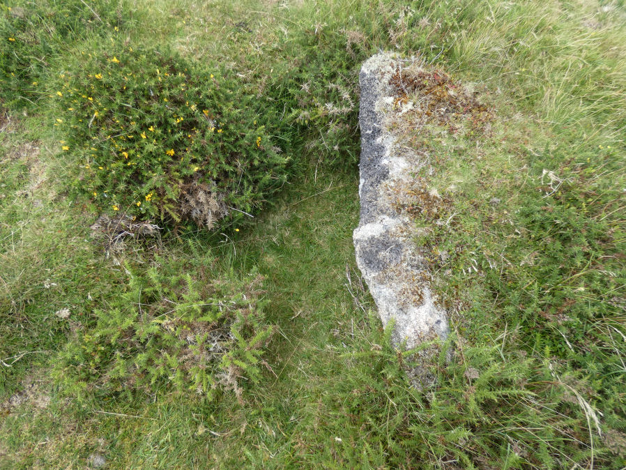
Photo taken on 21-07-2023
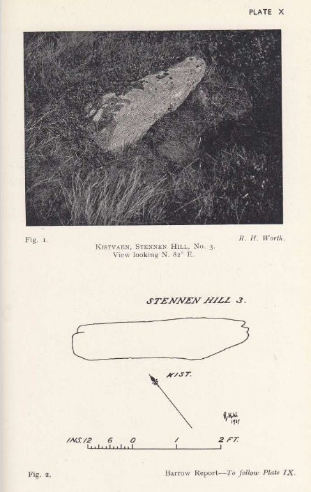
Plan by RHW. Barrow Report 57. TDA Vol.70 1938
Database entries
OS Map: SX 62615 77838
OS Source: Garmin
Butler OS: SX62627781
HER: MDV5847
Megalithic Portal: 45737
PMD: Powder Mills E.
Alternate name: Stennen Hill 2
Short Name: CT Stennen 2
Butler map: 29.11.2
Butler Vol 5: p.200 & Fig.143
Dixon Cist #: 77
Grinsell: LYDFORD 49
DPD page: 111
Exist: Yes
Record: Unique
Record Source: Butler
Hut Class: No
Cist Class: Yes
Cairn Class: Yes
Barrow Report: 57
Dimensions (m): 5.0 x 0.3 C
Lidar: SX 62615 77838
Guide Map: 28
Nearest Bus Stop (Minor): Powder Mills (1.7 km) [Route: 171(20/07/26 to 19/09/26)]
Nearest Bus Stop (Major): Postbridge Post Office (2.4 km) [Route: 98,171(20/07/26 to 19/09/26)]
Nearby sites: SX 62615 77838
Notes
"cist is oriented nw. - se. And is open with the south west side stone and the end stone buried beneath the turf. Internal dimensions 1.3m by 0.85m depth 0.5m. The mound, which is slight with a height of 0.3m is much disturbed. Judging by the remains of the retaining circle of which six stones can be seen the diameter of the mound was 4.5m. Condition of the cist is fair, of mound poor." Only one large stone remains in the mound of a cairn. Lethbridge photo top p.111. Butler Stennen Hill 2 - Vol. 2. Map 29.11 (diagram Vol. 5. p.200). NB. Worth & Grinsell name this Stennen Hill No. 3 (It is Butler 2). Breton p.34.References
These are selected references with an emphasis on out of copyright sources linked as PDFs. For more detailed references try any linked HER or PMD record above.
- Breton, Henry Hugh, The Heart of Dartmoor, (1926)
- Butler, Jeremy, Dartmoor Atlas of Antiquities, vol.2: The North, (1991)
- Butler, Jeremy, Dartmoor Atlas of Antiquities, vol.5: The Second Millennium B.C., (1997)
- Grinsell, L.V., Dartmoor Barrows, Devon Archaeological Society Proceedings No.36 (1978)
- Lethbridge, William D., Discover Preshistoric Dartmoor, (2015)
- Worth, R. Hansford, Barrow Report 57, T.D.A. Vol.70 pp.59-62 (1938)