
Corndon Down 2 Cairn
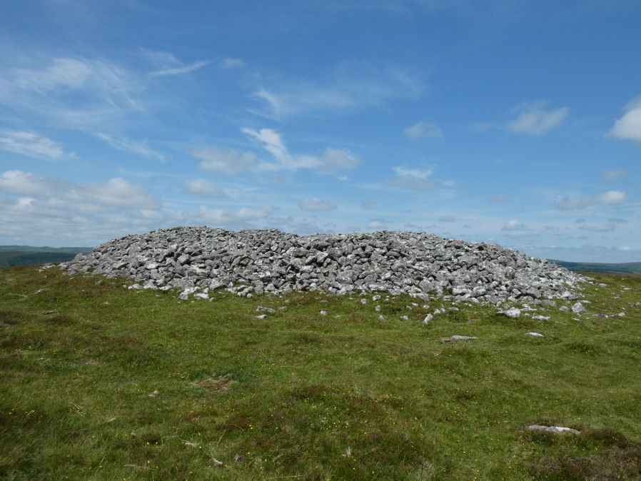
Photo taken on 17-06-2025
Database entries
OS Map: SX 68579 74731
OS Source: Google
Butler OS: SX68567472
HER: MDV6386
Alternate name: Corndon Down 2
Short Name: CN:CorndonDn 2
Butler map: 15.5.2
Grinsell: WIDECOMBE IN THE MOOR 16
Exist: Yes
Record: Unique
Record Source: Butler
Hut Class: No
Cairn Class: Yes
Barrow Report: 56 62
Dimensions (m): 25
Lidar: SX 68579 74731
Guide Map: 36
Nearest Bus Stop: Dartmeet Badgers Holt (2.6 km) [Route: 172]
Nearby sites: SX 68579 74731
Notes
HER: Large stone cairn; one of a pair approximately 530m north of Corndon Tor. A mound of loose stone over 2m high in places. Upper surface extensively disturbed and undulating caused by interference, including recent shelter building.References
These are selected references with an emphasis on out of copyright sources linked as PDFs. For more detailed references try any linked HER or PMD record above.
- Butler, Jeremy, Dartmoor Atlas of Antiquities, vol.1: The East, (1991)
- Grinsell, L.V., Dartmoor Barrows, Devon Archaeological Society Proceedings No.36 (1978)
- Worth, R. Hansford, Barrow Report 56, T.D.A. Vol.69 pp.75-109 (1937)
- Worth, R. Hansford, Barrow Report 62, T.D.A. Vol.75 pp.53-55 (1943)