
Bellever Rock Shelter
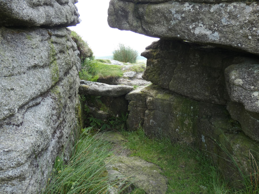
Photo taken on 02-07-2025
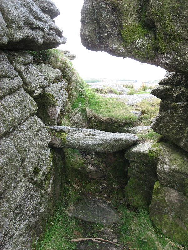
Photo 15/05/2010
Database entries
OS Map: SX 644 765
OS Source: HER
HER: MDV5941
Alternate name: Bellever
Short Name: RS Bellever
Exist: Yes
Record: Unique
Record Source: HER
Hut Class: No
Lidar: SX 644 765
Guide Map: 35
Nearest Bus Stop: Postbridge Bellever (1.8 km) [Route: 98]
Nearby sites: SX 644 765
Notes
Natural crevice in Bellever Tor forming a possibly built up Rock Shelter as reported by Robert Burnard (1914). Date of shelter not known for certain but signs of ancient habitation and numerous flints found.ROCK SHELTER ON BELLAFORD TOR
On 24 October, 1913, a Postbridge resident, whilst watching the Harrier Hunt on that day, observed some flint flakes under a boulder near the summit of the tor.
This was reported to the writer, who proceeded next day with Mr. George French and the finder of the flakes to the site, a narrow cleft between two large boulders. This cleft points north-west, is ten feet long, and varies in width from three feet at the entrance (south-east) to four feet four inches. On excavation, the rock floor of the shelter was found to be two and a half feet under the grass surface, with the foundation-stones of a wall which evidently closed the north-west end.
Near this wall was a large fire or cooking-ho1e occupying a natural depression in the rock floor. This was full of peat, charcoal, and ashes.
A flint flake lay on the floor between the fire hole and the wall, and no less than sixty-six examples were found on a ledge of rock which ran under the boulder on the south side of the shelter.
This ledge formed a useful seat near the fire hole, or could have served as a shelf. The entrance was protected by a large boulder with a passage on each side.
The shelter was easily roofed in with "vags" or thatch of heather or rushes providing plenty of head room.
The earth thrown out during the excavation was composed of granite grit mixed with black soil - the latter probably derived from the roof.
No wood charcoal was observed - nor were any potsherds found.
The cooking or fire hole and flint flakes indicate prehistory. In the absence of sherds it cannot be confidently assumed that the rock-shelter goes back to so remote a time. On the other hand, it is difficult to account for the flakes and attending circumstances, unless we have in this shelter a varying instance of occupation by the hut-circle folk.
The site can easily be found by ascending the tor as far as the plateau near the summit (often used as a picnic site on Bellaford Tor Hunt day), when it lies between this and a sheer drop of several feet, on the north-west slope of the tor right opposite Powder Mills.
The flints are mainly large thin flakes, mostly derived from the chalk - many show the bulb of percussion - a few only have secondary working.
The best examples are a skin scraper - a notched scraper and a borer of cherty flint. ROBERT BURNARD
References
These are selected references with an emphasis on out of copyright sources linked as PDFs. For more detailed references try any linked HER or PMD record above.
- Burnard, Robert, Scientific Memoranda Report 27: Restoration of Hurston Ridge Stone row and Laughter Tor Menhir, T.D.A. Vol.46 p.70-72 (1914)