
Archerton S.W. (Rowtor Brook) Ring Setting Cairn and Cist
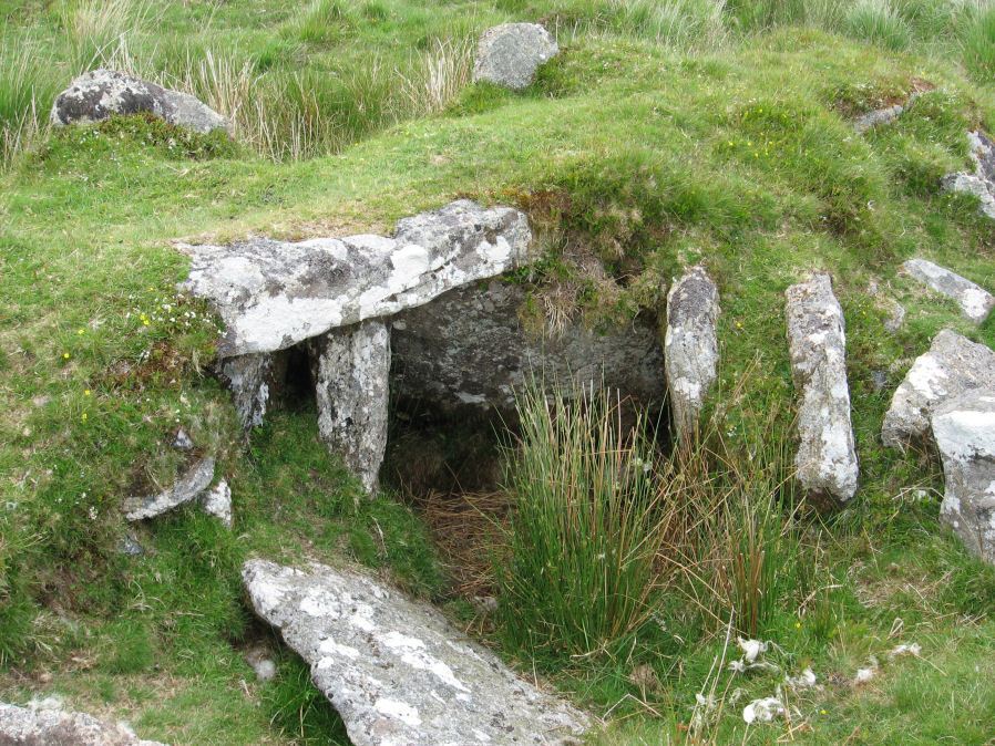
Photo taken on 27-06-2015
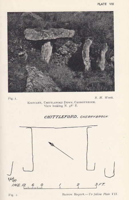
Plan by RHW. Barrow Report 57. TDA Vol.70 1938
Database entries
OS Map: SX 62752 78808
OS Source: Google
Butler OS: SX62767880
HER: MDV5838
Megalithic Portal: 37604
PMD: Hollowcombe Bottom
Alternate name: Rowtor Brook 3
Short Name: CT RowtorBr 3
Butler map: 27.17.3
Butler Vol 5: p.55 & Fig.33
Dixon Cist #: 75
Grinsell: LYDFORD 42
Turner: D24
DPD page: 112
Exist: Yes
Record: Unique
Record Source: Butler
Hut Class: No
Cist Class: Yes
Cairn Class: Yes
Barrow Report: 57
Dimensions (m): 7.0 x 1.0 C
Lidar: SX 62752 78808
Guide Map: 28
Nearest Bus Stop: Postbridge Post Office (2.6 km) [Route: 98,171(20/07/26 to 19/09/26)]
Nearby sites: SX 62752 78808
Notes
Breton: on N. side of wall is a kistvaen, around which is a triple circle, a very unusual feature..HER: The cist lies within three concentric circles of stones at 10, 15 and 24 feet diameters, the inner ring being of large stones, the middle ring of smaller stones and the outer ring of even smaller stones. The cist measures internally 0.8m by 0.6m and 0.9m deep. Half of its capstone lies across its north end.
For more information see: Lethbridge Hollowcombe Bottom, diagram and photo p.112. Butler Rowtor Brook 3 - Vol. 2. Map 27.17 (diagram Vol. 5. p.55). Breton p.35
References
These are selected references with an emphasis on out of copyright sources linked as PDFs. For more detailed references try any linked HER or PMD record above.
- Baring-Gould, Sabine, Seventh Report of the Dartmoor Exploration Committee, T.D.A. Vol.33 pp.130-138 (1901)
- Breton, Henry Hugh, The Heart of Dartmoor, (1926)
- Burnard, Robert, Notes on Dartmoor Kistvaens, T.D.A. Vol.22 pp.200-207 (1890)
- Butler, Jeremy, Dartmoor Atlas of Antiquities, vol.2: The North, (1991)
- Butler, Jeremy, Dartmoor Atlas of Antiquities, vol.5: The Second Millennium B.C., (1997)
- Grinsell, L.V., Dartmoor Barrows, Devon Archaeological Society Proceedings No.36 (1978)
- Lethbridge, William D., Discover Preshistoric Dartmoor, (2015)
- Prowse, Arthur B., The Ancient Metropolis of Dartmoor, T.D.A. Vol.23 pp.307-14 (1891)
- Turner, J.R., Ring Cairns, stone circles and related monuments on Dartmoor, D.A.S.P. No.48 pp.27-86 (1990)
- Worth, R. Hansford, Barrow Report 21, T.D.A. Vol.34 pp.104- 146 (1902)
- Worth, R. Hansford, Barrow Report 57, T.D.A. Vol.70 pp.59-62 (1938)