
The Turner Classification of Cairns
Turner used the following clasifications for stone circles and cairns:
Listing of Turner Cairns: A Stone Rings
Willings Walls Warren Stone Ring Cairn Circle
OS Map: SX 5818 6517
HER: MDV3438
Megalithic Portal: 1358
PMD: Willings Walls Warren Stone Circle
Alternate name: Willings Walls 5 Stone Ring Cairn Circle
Short Name: RC:Willings 5
Turner: A1
Dimensions (m): 41
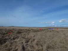
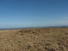
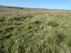
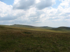
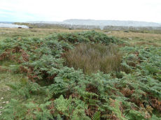
Notes: "Willings walls warren, lee moor. Unusual stone circle. Two kists nearby. Plan. A reave interferes with the circumference of the circle. Four groups of stones are in the circle. No trace of barrow within the circle; and no evidence to show that the stones were ever cists (worth)." A 40m diameter circle consisting of 5 groups of stones. It touches and is incorporated into the Willings Walls Reave. Lethbridge p.52-3 Willingswalls Stone Circle - diagram p52.
Nearest Bus Stop: Lee Moor Clearview (3.4 km) [Route: 59]
Nearby sites: SX 5818 6517
Ringmoor Down Stone Ring Cairn Circle
OS Map: SX 56113 65922
HER: MDV19760
Megalithic Portal: 34142
Alternate name: Ringmoor Down 4 Stone Ring Cairn Circle
Short Name: CC Ringmoor 4
Butler map: 49.21.4
Turner: A2
Dimensions (m): 35.0 x 0.1
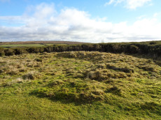
Notes: HER: A low, disturbed circular earthwork on the upper ridge of Ringmoor Down is a probable ring cairn. The bank is low and spread being up to 4.6m wide by 0.1m high and forms a slightly irregular circle with an internal diameter of between 28 and 30m and overall diameter of 37m. Two lines of tin prospecting pits which traverse the monument, of probable medieval or post medieval date, have caused some damage on the southern arc of the bank and its interior.
Nearest Bus Stop: Meavy Primary School (2.1 km) [Route: 56]
Nearby sites: SX 56113 65922
Stonetor Hill Stone Ring Cairn Circle
OS Map: SX 6520 8536
HER: MDV48856
Megalithic Portal: 3478
Alternate name: Stonetor Hill 4 Stone Ring Cairn Circle
Short Name: RC:Stonetor 4
Turner: A3
DPD: 133
Dimensions (m): 25
Notes: Possible pound? "The feature consists of a sub-circular earthern bank 25m in diameter and up to 0.4m in height. It is best preserved on the North side where the bank is well defined, flat topped and has a plan width of about 4.0m On the South side the bank has been spread and flattened but still survives to 0.5m in height as a prominent outward-facing scarp, where the natural ground surface falls away from the enclsure. There is no entrance through the bank."
Nearest Bus Stop (Minor): Wonson Telephone Box (4.7 km) [Route: 670]
Nearest Bus Stop (Major): Warren House Inn (4.9 km) [Route: 171]
Nearby sites: SX 6520 8536
Stalldown Stone Ring Cairn Circle
Prehistoric Dartmoor Walks: Dartmoor Site: Stalldown Stone Row [Photo Set 2]
OS Map: SX 63529 62310
HER: MDV4301
Megalithic Portal: 45819
Alternate name: Stalldown Summit 6 Stone Ring Cairn Circle
Short Name: RC Staldon 6
Butler map: 54.18.6
Turner: A4
Dimensions (m): 29.0 x 0.3
Notes: A circular turf-covered stone ring on the summit of Stalldown Barrow hill. It is 25.5m in diameter, comprising a bank of small stones, 2.0m to 3.0m wide and 0.2m to 0.7m high. There is a 5.0m gap in the south-west but no evidence of disturbance to the interior or of a surrounding ditch. Not far to the east is Hillson's House. Butler Cairn 6 (Vol 3 54.18).
Nearest Bus Stop: Cornwood Crossways (4.1 km) [Route: 59]
Nearby sites: SX 63529 62310

South Teignhead / White Ridge Stone Ring Cairn Circle
OS Map: SX 64168 82656
HER: MDV6771
Megalithic Portal: 35830
PMD: Teignhead Henge
Alternate name: South Teignhead Pound Stone Ring Cairn Circle
Short Name: RC White Ridge
Butler map: 35.18
Turner: A5
Dimensions (m): 21
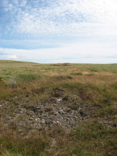
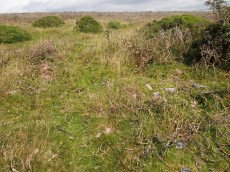
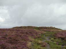
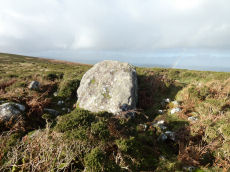
Notes: A small circular 'pound' about 0.5km SE of Grey Wethers. It measures 75ft (N-S) by 66ft; the bank composed of small stone and earth is 6-8ft wide and 3ft high. An entrance on the W has one door jamb standing. Turner listed this as a ring cairn A5 but also suggested it as a possible henge monument.
The author revisited this site with Steve Szypko on 16/05/25. It is hard to find so the photo has been annotated with a red highlight to bring out the feature, Steve stands to the side giving scale.
Nearest Bus Stop: Warren House Inn (3.7 km) [Route: 171]
Nearby sites: SX 64168 82656
Cosdon Beacon East Stone Ring Cairn Circle
Prehistoric Dartmoor Walks: Dartmoor Site: Cosdon Hill Triple Stone Row
OS Map: SX 63663 91492
HER: MDV6928
Megalithic Portal: 10325
Alternate name: Cosdon Beacon 2 Stone Ring Cairn Circle
Short Name: RC Cosdon 2
Butler map: 40.7.2
Grinsell: ST 4
Turner: A6
DPD: 152
Dimensions (m): c.25.0 x 0.6
Notes: Located 25m to east of Cosdon Beacon. A near circular bank 1.6m wide of double slab construction and about 21m across. Turner A6 (diagram p.59). NMR Cairn A. Butler Cosdon Beacon 2 Vol. 2. Map 40.7.2. (diagram of Cosdon Summit cairns on p.207).
Nearest Bus Stop: Ramsley (2.1 km) [Route: 670,671,6A]
Nearby sites: SX 63663 91492
Haytor Down Stone Ring Cairn Circle
OS Map: SX 7670 7811
HER: MDV48849
Megalithic Portal: 45820
Alternate name: Haytor Down N.1 Stone Ring Cairn Circle
Short Name: RC:Haytor N1
Butler map: 2.6.1
Butler Vol 5: p.190 & Fig.132
Turner: A7
Dimensions (m): 17
Notes: "Ring cairn on Haytor Down. Stone ring 21.0 meters internal diameter, with bank 1.5 meters wide and 0.4 meters high. Modern entrance." One of group of 4 cairns - see Butler for diagram in Vol 1 and 5.
Nearest Bus Stop (Minor): Haytor Vale Moorlands House (0.8 km) [Route: 193,271]
Nearest Bus Stop (Major): Lustleigh Bishops Stone (3.9 km) [Route: 178]
Nearby sites: SX 7670 7811
White Hill S.W.1 Stone Ring Cairn Circle
OS Map: SX 52941 83690
HER: MDV21078
Megalithic Portal: 45821
Short Name: RC WhiteHiSW 1
Butler map: 32.22.1
Grinsell: PET 1
Turner: A8
Dimensions (m): 19.0 x 0.3
Notes: "Ring cairn 460 metres south-west of White Hill summit, forming part of the White Hill round cairn cemetery. This monument includes a ring cairn situated on a gentle west-facing slope overlooking Willsworthy Army Camp. The earthwork appears as a raised internal platform measuring 15m in diameter surrounded by a circular bank 3.5m wide and 0.5m high. A shallow hollow in the centre of the internal area suggests robbing or partial early excavation. This cairn forms part of the White Hill round cairn cemetery." NMR A. Cairn is part of an alignment of cairns, see photo.
Butler Cairns 1-6: SX52948369, SX53008367, SX53058366, SX53098365, SX53148365, SX53158366
Nearest Bus Stop: Dartmoor Inn (1.7 km) [Route: 118]
Nearby sites: SX 52941 83690
Gripper's Hill Stone Ring Cairn Circle
OS Map: SX 68650 65503
HER: MDV5224
Megalithic Portal: 45822
Alternate name: Gripper's Hill Summit 1 Stone Ring Cairn Circle
Short Name: RC Grippers 1
Butler map: 57.31.1
Grinsell: DEA 4
Turner: A9
Dimensions (m): 11.0 x 0.7
Notes: "Ring cairn on Gripper's Hill; stone ring 14.0 metres in diameter internally, with bank 1.2 meters wide and 0.3 meters high." NMR A
Nearest Bus Stop: Buckfast Higher Mill Lane (5.5 km) [Route: 88]
Nearby sites: SX 68650 65503
Mardon Down (E) Stone Ring Cairn Circle
Prehistoric Dartmoor Walks: Dartmoor Site: Mardon Down Stone Circle & Cairns
OS Map: SX 76894 87602
HER: MDV12771
Megalithic Portal: 45824
Short Name: RC Mardon East
Butler Vol 5: p.147 & Fig.89
Turner: A10
DPD: 149
Dimensions (m): 13.3
Notes: HER: Earthwork lying 150 metres east of the summit ridge, probably a robbed cairn or enclosure, comprising a curving stony bank forming the outline suggestive of an approximate circle. Badly damaged on the north and north-east sides and mostly effaced on the west by a path.
Nearest Bus Stop: Moretonhampstead Court Street Car Park (2.3 km) [Route: 171,173]
Nearby sites: SX 76894 87602
White Hill N Stone Ring Cairn Circle
OS Map: SX 53443 83898
HER: MDV3211
Megalithic Portal: 45826
Alternate name: White Hill S.E.1 Stone Ring Cairn Circle
Short Name: CN:WhiteHiSE 1
Butler map: 32.22.9
Grinsell: PET 9
Turner: A11
Dimensions (m): 16.0 x 0.1
Notes: NMR A - there are 2 more?! "Ring cairn 80 metres north-east of White Hill summit, forming part of the White Hill round cairn cemetery. Barrow A (diameter 15.0 metres, height 0.25 metres)."
Nearest Bus Stop: Dartmoor Inn (1.8 km) [Route: 118]
Nearby sites: SX 53443 83898
Holne Moor Stone Ring Cairn Circle
OS Map: SX 66919 70785
HER: MDV6474
Megalithic Portal: 27342
Alternate name: Holne Ridge N.9 Stone Ring Cairn Circle
Short Name: RC HolneRidg 9
Butler map: 60.26.9
Grinsell: HOL 5
Turner: A12
Dimensions (m): 22.0 x 0.8
Notes: "One of four cairns 310 metres south of Horn's Cross forming part of a cairn cemetery on Holne Ridge. Ring cairn measuring 19.9 metres in diameter, height 0.9 metres. Has a 4 metre wide bank standing up to 0.9 metres high surrounding an 11.9 metre diameter internal area. A stone on the inner face of the east side of the cairn has been cut by tear and feather."
Nearest Bus Stop: Dartmeet Badgers Holt (2.4 km) [Route: 172]
Nearby sites: SX 66919 70785
Buckland Ridge (S) Stone Ring Cairn Circle
OS Map: SX 7357 7324
HER: MDV30630
Megalithic Portal: 45827
Alternate name: Buckland Common 5 Stone Ring Cairn Circle
Short Name: RC:BucklandRid
Butler map: 10.9
Turner: A13
Dimensions (m): 19.0
Notes: Linear arrangement of mounds incorporated into boundary. Could be prehistoric cairns. Turner A13. No NMR record. "Robbed cairn. Stone ring is 13m inside diameter bank 1.80m wide and 50cms high, much of the bank on the eastern side has been destroyed. The central area has been disturbed, modern stone wall running north to south through the eastern section of the stone ring."
Nearest Bus Stop: Poundsgate Tavistock Inn (3.3 km) [Route: 172]
Nearby sites: SX 7357 7324
Corn Ridge Stone Ring Cairn Circle
OS Map: SX 55138 89153
HER: MDV3172
Megalithic Portal: 52276
Alternate name: Branscombe's Loaf 2 Stone Ring Cairn Circle
Short Name: RC Branscomb 2
Butler map: 43.12.2
Grinsell: BRI 10
Turner: A14
Dimensions (m): 14.5 x 0.3
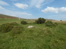
Notes: This ring cairn can just about be seen in the photograph that accompanies this record, it is a bit difficult to capture in a photograph. It is a bit of an indistinct circular bank. It is perhaps easier to see in the Google Earth satellite imagery - which can help to then make sense of the photograph. One of 4 cairns on Corn Ridge - see Turner "Ring Cairns, Stone Circles and Related Monuments on Dartmoor" DASP No. 48 p59 for diagram of the 4 cairns.
Nearest Bus Stop: Sourton Windard Terrace (2.1 km) [Route: 118]
Nearby sites: SX 55138 89153
Holne Moor (N) Stone Ring Cairn Circle
OS Map: SX 6809 7162
HER: MDV26266
Megalithic Portal: 45830
Short Name: RC:HolneMoor N
Turner: A16
Dimensions (m): 9.5
Notes: "Possible cairn in corner of a field." "Stone ring 9.5m diam internally, with bank 1.2m wide and 0.4m high. Joined on w side by reave (turner)." No NMR record.
Nearest Bus Stop: Dartmeet Badgers Holt (1.8 km) [Route: 172]
Nearby sites: SX 6809 7162
Tor Royal (newtake) Stone Ring Cairn Circle
OS Map: SX 62974 72262
HER: MDV18388
Megalithic Portal: 45831
Alternate name: Joan Ford's Newtake N.3 Stone Ring Cairn Circle
Short Name: RC JoanFd N3
Butler map: 63.3
Turner: A18
Dimensions (m): 11.0 x 0.3
Notes: "Disturbed ring cairn consisting of a stone ring 8.0 meters in diameter internally with bank 1.0 meter wide and 0.2 meters high." This feature was previously listed here at SX 62939 72246 but that is the location of the nearby cairn to the east of this ring cairn. This record has been updated with SX 62974 72262 from a visit on 04/09/23.
Nearest Bus Stop: Two Bridges Hotel (3.4 km) [Route: 98,171,172]
Nearby sites: SX 62974 72262
Tynacombe Stone Ring Cairn Circle
OS Map: SX 7037 6328
HER: MDV13638
Megalithic Portal: 45832
Short Name: RC:Tynacombe
Turner: A20
Dimensions (m): 7.5
Notes: "Ring cairn. Thynacombe stone ring 7.5 meters in diameter internally, with bank 1.5 meters wide and 0.2 meters high, damaged on the east side."
Nearest Bus Stop: South Brent Pool Park (3.4 km) [Route: 38]
Nearby sites: SX 7037 6328
Langstone Moor Stone Ring Cairn Circle
Prehistoric Dartmoor Walks: Dartmoor Site: Langstone Moor Stone Circle, Stone Row & Settlements
OS Map: SX 54843 77922
HER: MDV48862
Megalithic Portal: 45833
Short Name: RC Langstone
Turner: A22
Dimensions (m): 6.9
Notes: HER: A semi-circular bank, possibly the remains of a ring cairn.1.4 to 2m wide, 0.4m high. Composed of small + medium sized stones now largely turf-covered. It fades at each end of a near-perfect semi-circle of 14.9m internal diam. There is a low stone pile, 0.2m high, in se quadrant.
The author visited this site on 25/06/2018. A semi circular group of periglacial mounds can indeed be seen. The author on that occasion concluded that what appears to be a ring cairn is in fact simply the natural arrangement of the mounds. Re-visited on 13/08/2025 and the appearance looked very much like a ring cairn. This feature is also listed by some authors Mortar Emplacement 12
Nearest Bus Stop: Merrivale Dartmoor Inn (2.7 km) [Route: 98,171,172]
Nearby sites: SX 54843 77922
Willings Walls Reave Stone Ring Cairn Circle
OS Map: SX 5822 6520
HER: MDV56777
Megalithic Portal: 45834
Alternate name: Willings Walls 1 Stone Ring Cairn Circle
Short Name: RC:Willings 1
Butler map: 51.6.1
Turner: A23
Dimensions (m): 5.0 x 3.0 x 0.3
Notes: "Ring cairn willings walls reave. Stone ring with internal diam 6.8m, bank 1.5m wide and 0.5m high. Just outside a break in the reave"
Nearest Bus Stop: Lee Moor Clearview (3.5 km) [Route: 59]
Nearby sites: SX 5822 6520
White Tor Stone Ring Cairn Circle
OS Map: SX 54597 78701
HER: MDV4164
Megalithic Portal: 35804
Alternate name: White Tor E.1 Stone Ring Cairn Circle
Short Name: RC White E1
Butler map: 31.22.1
Grinsell: PET 24
Turner: A26
Dimensions (m): 7.8 x 0.2
Notes: See also duplicate 439800. Turner A26. Butler White Tor E.1. "Round cairn 340 metres east of White Tor summit. This monument includes a round cairn situated on a gentle south-east facing slope overlooking the valley of the River Walkham. The cairn mound measures 6m in diameter and stands up to 0.4m high. A hollow in the centre of the mound measuring 3m in diameter and 0.3m deep is the result of a partial excavation carried out by the Dartmoor Exploration Committee in 1899. This work recovered a perforated stone. A kerb of small stones defines the outer edge of the mound."
Nearest Bus Stop: Merrivale Dartmoor Inn (3.5 km) [Route: 98,171,172]
Nearby sites: SX 54597 78701
Weatherdon Hill Stone Ring Cairn Circle
OS Map: SX 6516 5889
HER: MDV13165
Megalithic Portal: 45835
Alternate name: Wetherdon Hill 20 Stone Ring Cairn Circle
Short Name: RC:Wetherdon20
Butler map: 53.9.20
Grinsell: HAR 14a
Turner: A28
Dimensions (m): 6.0
Notes: "Weatherdon hill (4): diameter approx.5.6m ht. Approx 0.15m. Alt. C.335-340m." "Mr. L. V. Grinsell noted a small cairn-circle or ring-cairn a short distance south of cairn 2 on weatherdon hill."
Nearest Bus Stop: Ivybridge BP Garage (Stop B) (3.1 km) [Route: 38]
Nearby sites: SX 6516 5889
Wigford Down Stone Ring Cairn Circle
OS Map: SX 5469 6505
HER: MDV48904
Megalithic Portal: 3536
Alternate name: Wigford Down 9 Stone Ring Cairn Circle
Short Name: RC:Wigford 9
Butler map: 48.1.9
Grinsell: MEA 3a
Turner: A31
Dimensions (m): 6.0 x 0.3
Notes: "Ring cairn, wigford down. Internal diam 2.7m, with bank 1m wide and 0.2m high. Smallest ring cairn (diam) on dartmoor. Turner suggests a link between the construction of this, small, ring cairn, with the larger cairn sx56nw/11 to its nw."
Nearest Bus Stop: Shaugh Prior White Thorn Inn (2.0 km) [Route: 59]
Nearby sites: SX 5469 6505
Holne Lee Stone Ring Cairn Circle
OS Map: SX 68656 69919
HER: MDV5199
Megalithic Portal: 45836
Alternate name: Holne Lee 7 Stone Ring Cairn Circle
Short Name: RC Holne Lee 7
Butler map: 58.11.7
Grinsell: HOL 17
Turner: A32
Dimensions (m): 18.0 x 0.8
Notes: HER: One of two cairns of probable Bronze Age date on Holne Lee. Cairn is 21 metres in diameter and is constructed of small boulders, and consists of a platform 14 metres diameter and about 0.2m high, with a perimeter rim average thickness 3.5m and 0.5m high. There is a gap, 4.3m wide, facing north north-east.
Nearest Bus Stop: Poundsgate Tavistock Inn (2.9 km) [Route: 172]
Nearby sites: SX 68656 69919
Sourton Common Stone Ring Cairn Circle
OS Map: SX 54418 88858
HER: MDV4674
Megalithic Portal: 10023
Alternate name: Corn Ridge W.1 Stone Ring Cairn Circle
Short Name: RC CornRg W1
Butler map: 43.8.1
Grinsell: BRI 3
Turner: A33
Dimensions (m): 21.0 x 0.3
Notes: "Ring cairn surviving as a circular bank 4m wide and 0.7m high surrounding an internal area measuring 12m in diam. Four small hollows in the ring bank suggest partial early excavation or robbing" NMR B.
Nearest Bus Stop: Sourton Windard Terrace (1.7 km) [Route: 118]
Nearby sites: SX 54418 88858
Ring of Bells Stone Ring Cairn Circle
OS Map: SX 5214 8287
HER: MDV3221
Megalithic Portal: 45837
Short Name: RC:RingofBells
Grinsell: MAR 2
Turner: A34
Dimensions (m): 17 x 0.3
Notes: "Ring cairn with entrance. Stone ring 13m internal diam, with bank 1.5m wide and 0.3m high.3m wide entrance on ese side. Flag pole has been sited here"
Nearest Bus Stop: Lydford Gorge Lower Entr (2.0 km) [Route: 118]
Nearby sites: SX 5214 8287
Horns Cross Stone Ring Cairn Circle
OS Map: SX 66921 71125
HER: MDV6475
Megalithic Portal: 27342
Alternate name: Holne Ridge N.6 Stone Ring Cairn Circle
Short Name: RC:HolneRidg 6
Butler map: 60.26.6
Grinsell: HOL 3
Turner: A35
DPD: 90
Dimensions (m): 15.5 x 0.3
Notes: "Remains of cairn; one of eight cairns forming part of a cairn cemetery on Holne Ridge. Truncated cairn, or ring cairn, gap in north-east. Diameter 14 metres, height 0.3 metres."
Nearest Bus Stop: Dartmeet Badgers Holt (2.1 km) [Route: 172]
Nearby sites: SX 66921 71125
Mardon Down Stone Ring Cairn Circle
Prehistoric Dartmoor Walks: Dartmoor Site: Mardon Down Stone Circle & Cairns
OS Map: SX 76729 87264
HER: MDV19003
Megalithic Portal: 22313
PMD: Mardon Down Cairn 1
Alternate name: Mardon Down 2 Stone Ring Cairn Circle
Short Name: RC Mardon 2
Turner: A36
DPD: 149
Dimensions (m): 12
Notes: "Stone ring with central cairn. Outer ring measures 12.0 metres in diameter with bank 1.5 metres wide and 0.3 metres high. Central cairn 5.0 metres in diameter and 0.4 metres high with disturbance on its western side. Outer ring has 2.5 metre wide entrance on the east."
Nearest Bus Stop: Moretonhampstead Court Street Car Park (2.0 km) [Route: 171,173]
Nearby sites: SX 76729 87264
Whitchurch Common (N) Stone Ring Cairn Circle
OS Map: SX 53020 75005
HER: MDV4115
Megalithic Portal: 3535
Alternate name: Whitchurch Common N. Stone Ring Cairn Circle
Short Name: RC Whitchurch1
Turner: A41
Dimensions (m): 5.5
Notes: Hut Circle or ring cairn? "Ring cairn with entrance. Stone ring 5.5m internal diam, with bank 1.5m wide and 0.4m high.2.5m wide entrance on ssw side" " A hut with an internal diam of 5.8m and walling 1.5m wide and 0.4m high; there is an entrance gap in the sw. This is evidently grinsell's cairn and worth's barrow.(broadly it is on the n slope of barn hill as stated by worth, but locally on the sw slope). While the structure might in isolation be construed as a cairn, the lack of any internal stone, the consistently smooth angle of the inner face of the wall and the presence of other huts and a field system militate against the worth and grinsell classifications"
Nearest Bus Stop: Tavistock Higher Longford (1.4 km) [Route: 98,171,172]
Nearby sites: SX 53020 75005
Ball Gate Stone Ring Cairn Circle
Prehistoric Dartmoor Walks: Dartmoor Walk: The Erme East stone rows
OS Map: SX 66996 61306
HER: MDV7739
Megalithic Portal: 45839
PMD: Corringdon Ball Gate cairn
Alternate name: Corringdon Ball N. Stone Ring Cairn Circle
Short Name: RC Ball Gate
Butler map: 56.10
Grinsell: BRE 9
Turner: A43
Barrow Report: 28 66
Dimensions (m): 24.0 x 0.4
Notes: "A very vague circle 21m diameter, which may be the remains of a mutilated cairn. Vis=-/4/1977 (ancient monuments) possibly rather damaged on one side. Vis=23/6/1973 (grinsell, l. V. ). Site of cairn almost levelled probably for material to build the adjoining wall. Shown on OS 6" as 'cairn circle'. Diameter 21m, height 0.4m. Vis=28/7/1977 (os) there is a gap in the rim on the southeast, probably for carts taking away the stone".
Nearest Bus Stop: South Brent Pool Park (3.5 km) [Route: 38]
Nearby sites: SX 66996 61306
Shell Top Stone Ring Cairn Circle
OS Map: SX 59835 63835
HER: MDV12790
Megalithic Portal: 1250
Alternate name: Shell Top Summit 3 Stone Ring Cairn Circle
Short Name: RC:ShellTopSu3
Butler map: 51.10.3
Grinsell: COR 1a
Turner: A44
Dimensions (m): 20.0 x 0.2
Notes: "A stone ring 20.5m overall diameter, comprising small, heather covered stones, 0.8m wide and 0.2m high. It lies on the broad level summit of shell top at 475m above sea level. There is a wide 3m wide gap on the north side and the interior is slightly domed, about 0.4m high, possibly a natural rise since it is off-centre. The term 'stone circle' is rather a mis-nomer since only half a dozen stones protrude from the turf and in appearance it is simply a low circular bank."
Nearest Bus Stop: Lee Moor Clearview (3.2 km) [Route: 59]
Nearby sites: SX 59835 63835
Saddlesborough Stone Ring Cairn Circle
OS Map: SX 5587 6321
HER: MDV2433
Megalithic Portal: 45840
Alternate name: Saddlesborough Summit Stone Ring Cairn Circle
Short Name: RC Saddlesboro
Butler map: 48.3
Turner: A45
Dimensions (m): 19.0 x 0.3
Notes: "Stone ring with an annular bank. The interior is part infilled with small stones and boulders to 0.3 meters or less below the bank top. This cairn measures 15.5 meters in diameter, with a bank 1.3 meters wide and 0.4 meters high. The interior has been dug into. Situated on a level summit."
The two entries SiteID=545 and SiteID=1472 are probably correct but the area is disturbed by tin workings and further confirmation is required that the correct features have been identified in the field (in terms of photos - visit 12 Sep 2022). Grid references not updated due to doubt about ID.
Nearest Bus Stop: Wotter Methodist Church (1.3 km) [Route: 59]
Nearby sites: SX 5587 6321
Broad Barrow Stone Ring Cairn Circle
OS Map: SX 70577 79908
HER: MDV20787
Megalithic Portal: 16630
Alternate name: Broad Burrow Stone Ring Cairn Circle
Short Name: RC BroadBarrow
Butler map: 20.9
Butler Vol 5: p.166 & Fig.106
Grinsell: MAN 10
Turner: A46
Dimensions (m): 38 x 2.6
Notes: "Infilled ring cairn. Stone ring 14 metres diameter internally with bank 2.5 metres wide and 0.4 metres high. Infilled to 0.25 metres below bank top." Butler Volume 1 Map 20.9.
Nearest Bus Stop: Warren House Inn (3.3 km) [Route: 171]
Nearby sites: SX 70577 79908
Cox Tor (NW) Stone Ring Cairn Circle
OS Map: SX 53024 76424
HER: MDV4128
Megalithic Portal: 32104
Alternate name: Cox Tor N.5 Stone Ring Cairn Circle
Short Name: RC CoxTor 5
Butler map: 31.1.5
Grinsell: PET 35
Turner: A48
Dimensions (m): 17.0 x 0.8
Notes: Breton p.16 Two very curious ring cairns; one has a diameter of 55ft and the other 27ft.
Nearest Bus Stop: Tavistock Higher Longford (2.1 km) [Route: 98,171,172]
Nearby sites: SX 53024 76424
Black Newtake (b) Stone Ring Cairn Circle
Prehistoric Dartmoor Walks: Dartmoor Site: Lakehead Hill
OS Map: SX 63863 76038
HER: MDV5889
Megalithic Portal: 45841
Alternate name: Bellever Tor 4 Stone Ring Cairn Circle
Short Name: RC Bellever 4
Butler map: 27.20.4
Grinsell: LYD 61
Turner: A50
DPD: 119
Barrow Report: 57
Dimensions (m): 6.0 x 1.0
Notes: "Cairn visible as unbroken circular bank 11.5 metres in external diameter with a bank 2.4 to 3.7 metres wide by 0.75 metres high enclosing a flat platform circa 6 metres diameter and 0.5 metres above ground surface. Some small stones appear in the north and east margins, and several larger stones are visible on the platform." Lethbridge diagram p.119 (Cairn near Cist 1) - no photo.
NB. Butler cairns 4 and 5 had previously been transposed in the listings here. The original records for both have been retained and the Butler number corrected and the grid references corrected. This was previously listed as Butler cairn 5 and is now correctly identiifed as Cairn 4. See also: Dartmoor Explorations: Antiquities of Black Newtake and Environs
Nearest Bus Stop: Powder Mills (1.1 km) [Route: 171]
Nearby sites: SX 63863 76038
Cox Tor (NE) Stone Ring Cairn Circle
OS Map: SX 53047 76430
HER: MDV4127
Megalithic Portal: 32104
Alternate name: Cox Tor N.6 Stone Ring Cairn Circle
Short Name: RC CoxTor 6
Butler map: 31.1.6
Grinsell: PET 36
Turner: A51
Dimensions (m): 10.0 x 0.7
Notes: "Narrow ridge of north-south outcropping rock measuring 10 metres in diameter, surrounded by circular stoney bank 4 metres wide, 0.8 metres high. 1890 excavation showed it to consist of an outer bank with central infill of loose stones and earth. No trace of burials or artefacts." "Cox Tor. Smaller of two adjacent cairns. Lies 12.5 metres south-east of larger one (see related record). Similar in shape, though smaller; diameter 8.23 metres. Construction of centre was loose, much earth being mingled with the stone. Nothing found and no pit in the "calm". (Baring-Gould - fifth report of the DEC) Breton p.16 Two very curious ring cairns; one has a diameter of 55ft and the other 27ft.
Nearest Bus Stop: Tavistock Higher Longford (2.1 km) [Route: 98,171,172]
Nearby sites: SX 53047 76430
Piles Hill Stone Ring Cairn Circle
OS Map: SX 65334 60849
HER: MDV5763
Megalithic Portal: 10030
Alternate name: Piles Hill Summit Stone Ring Cairn Circle
Short Name: RC:Piles Hill
Butler map: 54.19
Butler Vol 5: p.162 & Fig.103
Grinsell: HAR 12
Turner: A53
Dimensions (m): 30.0 x 1.2
Notes: Bell cairn of Wessex type. "Cairn on piles hill. An unusual monument, the equivalent of a bell barrow in stone. Cairn (diam 17.8m, heig 1.37m), berm(widt 3.05m), stone circle (diam 2.1m, heig 457mm)vis=12/4/1950 (os). Cairn with bell disc features. Slight hollow in the centre of the tump (mound), otherwise in good condition. No distinct outer bank could be found, but the berm and central tump were quite evident."
Nearest Bus Stop: South Brent Pool Park (5.0 km) [Route: 38]
Nearby sites: SX 65334 60849
Knatta Barrow Stone Ring Cairn Circle
OS Map: SX 65970 64212
HER: MDV5717
Megalithic Portal: 45842
Short Name: RC:Knatta Bar
Butler map: 57.29
Butler Vol 5: p.160 & Fig.102
Grinsell: BRE 2
Turner: A54
Dimensions (m): 14.0 x 0.7
Notes: "This large cairn (24m diameter, 1.7m height) composed of loose granite boulders. It is unusual among summit cairns in having a well defined outer bank about 1m wide and 0.5m high. This is partly turf covered but where eroded can be seen to be built of loose stone like the central cairn which touches it. It shows best on the north and east sides, while on the south west side it tends to merge into the body of the cairn."
Nearest Bus Stop: South Brent Pool Park (6.0 km) [Route: 38]
Nearby sites: SX 65970 64212
Harbourne Head A Stone Ring Cairn Circle
OS Map: SX 69119 65039
HER: MDV5802
Megalithic Portal: 42628
Alternate name: Parnell's Hill 1 Stone Ring Cairn Circle
Short Name: RC Harbourne A
Butler map: 57.31.6
Grinsell: DEA 8
Turner: A55
Dimensions (m): 24.0 x 1.2
Notes: "One of a pair of cairns on Gripper's Hill." " A ring cairn, Harbourne Head consisting of a stone ring 17.0 metres in diameter internally, with bank 1.8 metres wide and 0.4 metres high. Cairn contains a central mound, 12.0 metres in diameter, 0.8 metres high. This type of cairn is referred to as a Dartmoor version of the Wessex bell barrows."
Nearest Bus Stop: Buckfast Higher Mill Lane (5.2 km) [Route: 88]
Nearby sites: SX 69119 65039
Branscombe's Loaf Stone Ring Cairn Circle
OS Map: SX 55305 89126
HER: MDV48863
Megalithic Portal: 45843
Alternate name: Branscombe's Loaf Stone Ring Cairn Circle
Short Name: RC Branscomb 6
Turner: A57
Dimensions (m): 18.5
Notes: One of 4 cairns on Corn Ridge - see Turner "Ring Cairns, Stone Circles and Related Monuments on Dartmoor" DASP No. 48 p59 for diagram of the 4 cairns. This one is a "tor cairn" - a circular bank enclosing a rocky outcrop. The circle can be seen clearly on Google Earth satellite imagery.
Nearest Bus Stop: Sourton Windard Terrace (2.2 km) [Route: 118]
Nearby sites: SX 55305 89126

Pupers Rock Stone Ring Cairn Circle
OS Map: SX 67281 67376
HER: MDV5219
Megalithic Portal: 45845
Alternate name: Pupers Hill Summit Stone Ring Cairn Circle
Short Name: RC:Pupers Rock
Butler map: 58.9
Grinsell: DEA 1
Turner: A58
DPD: 89
Dimensions (m): 27.0 x 1.0
Notes: HER: A natural outcrop some 10.0m across and 2.0m high, encompassed by a mass of small stones. Most are piled to the west of the outcrop but overall they form a cairn 16.0m in diameter and 1.0m high. On the southern side the precise perimeter is difficult to determine since a spread of stone on the surface extends for a further 8.0 metres. This site is on the local list of Nationally Important Dartmoor sites.. Turner: Ring cairn incorporating a large flat-topped granite outcrop. The stone ring measures 17 meters in diameter internally with 2.5 meter wide bank 0.6 meters high. There are the remains of a stone circle, around 1.0 meter high within the outcrop.
Nearest Bus Stop: Poundsgate Tavistock Inn (5.7 km) [Route: 172]
Nearby sites: SX 67281 67376
Cox Tor Stone Ring Cairn Circle
OS Map: SX 53060 76190
HER: MDV4151
Megalithic Portal: 32104
Alternate name: Cox Tor Summit Stone Ring Cairn Circle
Short Name: RC CoxTor 3
Butler map: 31.1.3
Grinsell: PET 37a
Turner: A59
Dimensions (m): 17
Notes: "Cox tor, ring cairn. The outcrop of granite on the summit is surrounded by an ancient wall, enclosing a space of about 21m in diameter, built of small stones. Pillaged and part used in erection of the cairn for the 1887 jubilee."
NB. The NMR listings had two entries for this feature. The entry SiteID=3229 referred to NMR entry SX 57 NW 132 (Monument Number 919075) which was a duplicate. As the NMR listings are no longer public our entry SiteID=3229 has been deleted.
Nearest Bus Stop: Tavistock Higher Longford (2.0 km) [Route: 98,171,172]
Nearby sites: SX 53060 76190

Inner Pupers Stone Ring Cairn Circle
OS Map: SX 67566 67421
HER: MDV13205
Megalithic Portal: 45847
PMD: Inner Pupers
Short Name: RC InnerPupers
Butler map: 58.9
Grinsell: BUC 6
Turner: A60
DPD: 89
Dimensions (m): 21.5 x 1.0
Notes: HER: The rock outcrop known as Inner Pupers is encompassed by a cairn of 13.0 meters overall diameter. It takes the shape of a platform 0.4 meters high around the rock, with a rim 1.5 meters wide and a further 0.4 meters high. Of small stones, with further 'natural' slabs protrude through. NB. This feature is very visible on Google Satellite.
Nearest Bus Stop: Poundsgate Tavistock Inn (5.5 km) [Route: 172]
Nearby sites: SX 67566 67421
Easdon Hill Stone Ring Cairn Circle
OS Map: SX 73358 82318
HER: MDV8767
Megalithic Portal: 45848
PMD: Easdon Tor
Short Name: RC:Easdon Hill
Butler map: 22.3
Grinsell: MAN 1
Turner: A61
Dimensions (m): 15.5
Notes: HER: A cairn with a large centrally placed rock which is possibly the capstone of a kist. Robbers have excavated around and about this giving a rock strewn central hollow to the cairn. There is no encircling ditch. The capstone is approximately square. Touching its base at the east is a triangular shaped orthostat. The cairn is situated on the very summit of a hill.. HER referring to Turner: Turner identifies this site as a ring cairn. Internal diameter 6 metres, with bank 2.5 metres wide and 1 metre high ... Encircles a natural boulder, 2.8 metres wide, 1.6 metres thick and up to 2.5 metres high. Reave on north-western side.
Nearest Bus Stop (Minor): Manaton Bus Shelter (2.0 km) [Route: 271,671]
Nearest Bus Stop (Major): Batworthy Miniature Pony Centre (2.9 km) [Route: 171]
Nearby sites: SX 73358 82318
High Willhays (N) Stone Ring Cairn Circle
OS Map: SX 58020 89440
HER: MDV20152
Megalithic Portal: 45849
Short Name: RC:HighWill N
Grinsell: OKE 5
Turner: A64
Dimensions (m): 22
Notes: "A revetted mound adjoins the south side of one of the granite outcrops at High Willhays. Measuring 19 metres east to west by 18 metres overall it stands around 0.8 metres high. The sides of the mound are formed by coursed granite slabs and boulders and the top is largely flat though a hollow has formed in the southern half."
Nearest Bus Stop: Sourton Windard Terrace (4.7 km) [Route: 118]
Nearby sites: SX 58020 89440
High Willhays Stone Ring Cairn Circle
OS Map: SX 58032 89224
HER: MDV21296
Megalithic Portal: 36417
Short Name: RC HighWill
Butler map: 42.2
Turner: A65
Dimensions (m): 10 x 0.6
Notes: "Higher willhayes ring cairn. Irregular segment of stone ring set against rock outcrop.10m wide n-s and 5.5m radius to outcrop, with bank 1m wide and 0.2m high. Also contains segment of stone setting 7.5m wide n-s, 2.5m radius to outcrop"
Nearest Bus Stop: Sourton Windard Terrace (4.8 km) [Route: 118]
Nearby sites: SX 58032 89224
Corn Ridge Rock Stone Ring Cairn Circle
OS Map: SX 55219 89145
HER: MDV48864
Megalithic Portal: 45850
Alternate name: Branscombe's Loaf 3 Stone Ring Cairn Circle
Short Name: RC Branscomb 3
Butler map: 43.12.3
Turner: A66
Dimensions (m): c.10.0
Notes: "Tor cairn on summit of Corn Ridge. Two banks of small to medium stones associated with large outcrop. Outer bank survives as 12 metres long, 1.2 metres wide, 0.3 metres high curving rubble spread following s + w edges of the outcrop. Inner ring measures 1.3m wide, 0.3m high and corresponds with the n edge of the outcrop, but also extends over the rock itself, which stands 3m high. Area enclosed by ring banks measures 15m ns by 12m ew" One of 4 cairns on Corn Ridge - see Turner "Ring Cairns, Stone Circles and Related Monuments on Dartmoor" DASP No. 48 p59 for diagram of the 4 cairns.
Nearest Bus Stop: Sourton Windard Terrace (2.1 km) [Route: 118]
Nearby sites: SX 55219 89145
Wigford Down (S) Stone Ring Cairn Circle
OS Map: SX 54702 64962
HER: MDV2367
Megalithic Portal: 3536
PMD: Wigford Down Summit
Alternate name: Wigford Down 5 Stone Ring Cairn Circle
Short Name: RC Wigford 5
Butler map: 48.1.5
Grinsell: MEA 7b
Turner: B9
Barrow Report: 62
Dimensions (m): 7.62
Notes: "One of two cairn circles, both in a raised platform. Ring of large stones. Cist cover in centre. Diam 7.62m.". This site could also be a hut circle - it is unclear whether the large slab is a cist cover or not. See Butler Vol 3 p.97 fig. 48.1.2 Wigford Down 4 in Barrow Report 62. NMR A.
Nearest Bus Stop: Shaugh Prior White Thorn Inn (1.9 km) [Route: 59]
Nearby sites: SX 54702 64962
Page last updated 12/07/15