
Wigford Down (S) Stone Ring Cairn Circle
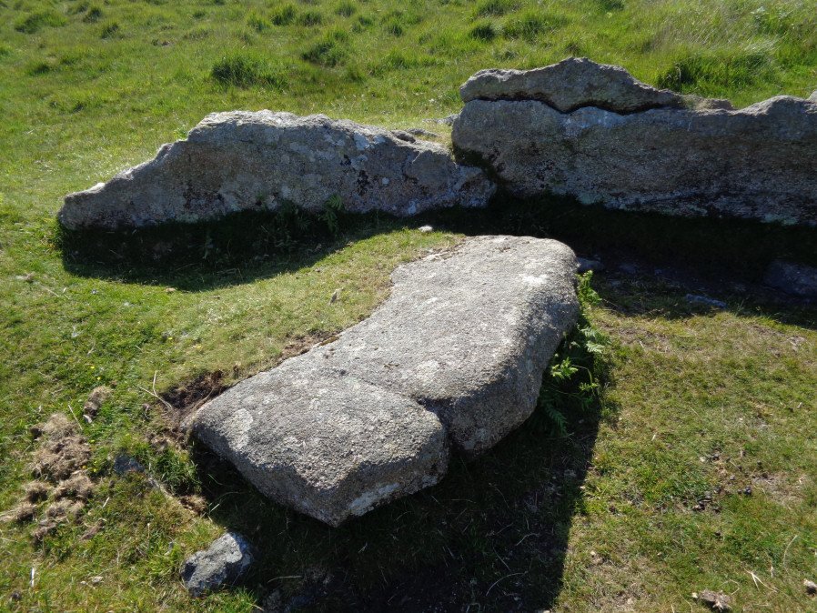
Photo taken on 18-06-2017
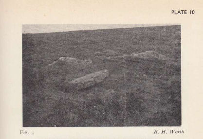
Photo by RHW. Barrow Report 62. TDA Vol.75 1943
Database entries
OS Map: SX 54702 64962
OS Source: Garmin
Butler OS: SX54706495
HER: MDV2367
Megalithic Portal: 3536
PMD: Wigford Down Summit
Alternate name: Wigford Down 5
Short Name: RC Wigford 5
Butler map: 48.1.5
Grinsell: MEAVY 7b
Turner: B9
Exist: Yes
Record: Unique
Record Source: Butler
Hut Class: Maybe
Cist Class: Maybe
Cairn Class: Yes
Barrow Report: 62
Dimensions (m): 7.62
Lidar: SX 54702 64962
Guide Map: 46
Nearest Bus Stop: Shaugh Prior White Thorn Inn (2.5 km) [Route: 59]
Nearby sites: SX 54702 64962
Notes
"One of two cairn circles, both in a raised platform. Ring of large stones. Cist cover in centre. Diam 7.62m.". This site could also be a hut circle - it is unclear whether the large slab is a cist cover or not. See Butler Vol 3 p.97 fig. 48.1.2 Wigford Down 4 in Barrow Report 62. NMR A.References
These are selected references with an emphasis on out of copyright sources linked as PDFs. For more detailed references try any linked HER or PMD record above.
- Breton, Henry Hugh, The Forest of Dartmoor, (1990)
- Fox, Aileen, Celtic Fields and Farms on Dartmoor in Light of Recent Excavations at Kestor, Proceedings of the Prehistoric Society Vol. 20. pp.87-102 (1954)
- Grinsell, L.V., Dartmoor Barrows, Devon Archaeological Society Proceedings No.36 (1978)
- Turner, J.R., Ring Cairns, stone circles and related monuments on Dartmoor, D.A.S.P. No.48 pp.27-86 (1990)
- Worth, R. Hansford, The Moorland Plym, T.P.I. Vol.10 Part 3 p.294 (1890)
- Worth, R. Hansford, Barrow Report 62, T.D.A. Vol.75 pp.53-55 (1943)