
Ringmoor Down Stone Ring Cairn Circle
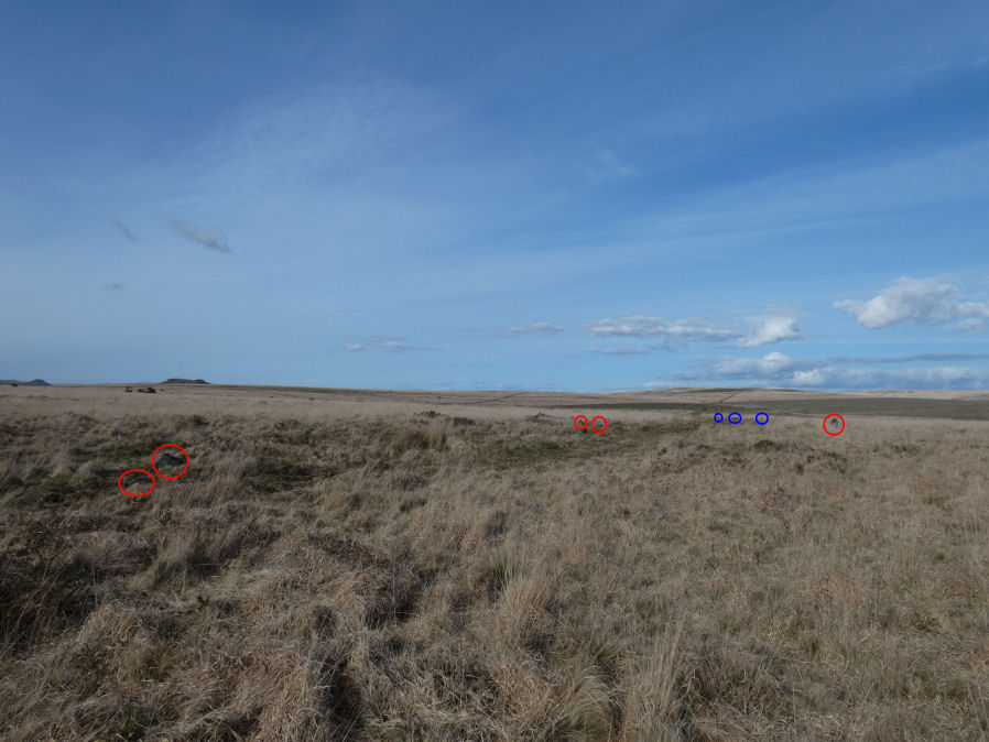
Photo taken on 15-04-2023
Database entries
OS Map: SX 56113 65922
OS Source: Garmin
Butler OS: SX56106590
HER: MDV19760
Megalithic Portal: 34142
Alternate name: Ringmoor Down 4
Short Name: CC Ringmoor 4
Butler map: 49.21.4
Turner: A2
Exist: Yes
Record: Unique
Record Source: Butler
Hut Class: No
Dimensions (m): 35.0 x 0.1
Lidar: SX 56113 65922
Guide Map: 47
Nearest Bus Stop: Meavy Primary School (2.7 km) [Route: 56]
Nearby sites: SX 56113 65922
Notes
HER: A low, disturbed circular earthwork on the upper ridge of Ringmoor Down is a probable ring cairn. The bank is low and spread being up to 4.6m wide by 0.1m high and forms a slightly irregular circle with an internal diameter of between 28 and 30m and overall diameter of 37m. Two lines of tin prospecting pits which traverse the monument, of probable medieval or post medieval date, have caused some damage on the southern arc of the bank and its interior.Butler, 1994: barely visible circular enclosure .. its position on the ridge suggesting a large ring cairn rather than a domestic enclosure. The flat interior 35 m across, disturbed by a line of tinners' pits, is surrounded by a low bank no more than 0.1 m high supporting a few earthfast slabs
Turner, 1990: Stone ring 31.5 metres in diameter internally, with bank 0.7 metres wide and 0.15 metres high. A few upright stones still remain in the bank.
Newman, P. + Probert, S., 2005: This feature is now largely obscured by dense Molinia. Only a 35m section of slightly curving bank is visible between SX 5612 6591 and SX 5613 6588. None of the stones noted by the Ordnance Survey (1979) are in situ, there being just two clusters of three stones each. It seems unlikely that this could represent an embanked stone circle it seems more likely to be an ephemeral part of the surrounding medieval field system.
The current author has failed to find this feature on multiple occasions. Most recently on 9th April 2023. A follow up visit on 15th April 2023 has led to the conclusion that this site is perhaps better considered to be an enclosure or part of the surrounding medieval field system as suggested by Newman + Probert.
In the photo it is very difficult to make out the stones due to the long Molinia grass so I have ringed them in red. There are in fact two groups of three stones but I have ringed what I can see in the photo. The one furthest to the right is actually my rucksack sat on top of one stone that would not be visible otherwise. The stones circled in blue a little way in the distance are from the nearby Ringmoor Down Cairn Circle (also dubious as most stones not earthfast).
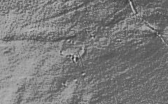
Butler himself debates whether the low bank represents an enclosure or a ring cairn. Lidar data available to a more modern perspective suggests not a circular feature but a rectangular enclosure.
The following extract from Lidar shows that along with 3 of the tinners pits below.
To conclude in our view this is not a ring cairn. This record is being retained as this is a reported ring cairn that is part of both the Butler and Turner listings. However, the CairnClass classification has been changed from yes to No.
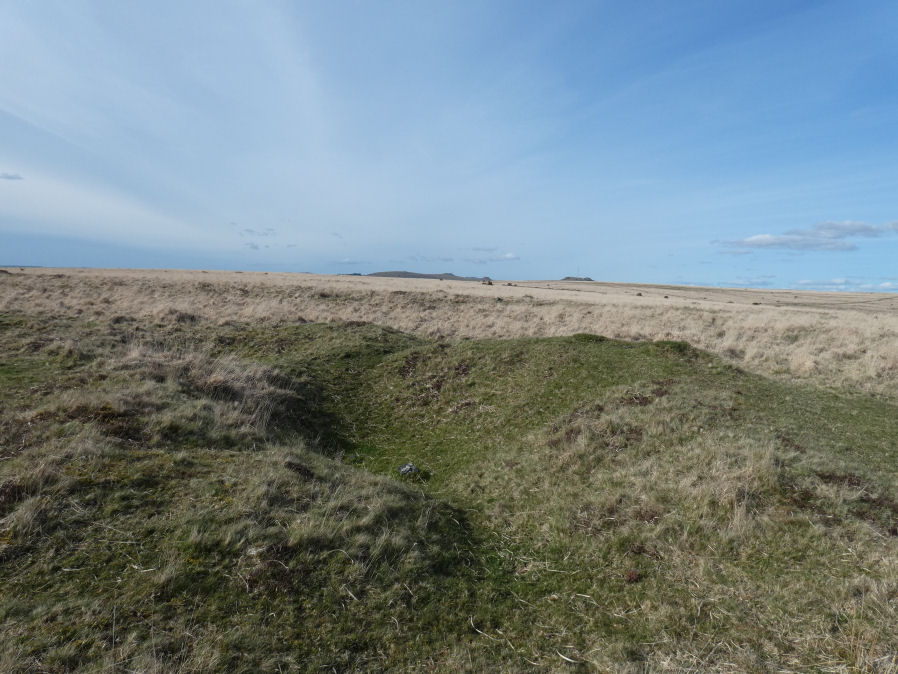
The photo below taken on 15-04-2023 shows one of the tinners pits at SX 56118 65903.
References
These are selected references with an emphasis on out of copyright sources linked as PDFs. For more detailed references try any linked HER or PMD record above.
- Butler, Jeremy, Dartmoor Atlas of Antiquities, vol.3: The South-West, (1994)
- Newman, Phil, Ringmoor Down Premier Archaeological Landscape - A new survey , Southwest Landscape Investigations (2022)
- Turner, J.R., Ring Cairns, stone circles and related monuments on Dartmoor, D.A.S.P. No.48 pp.27-86 (1990)