
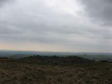
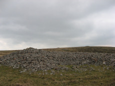
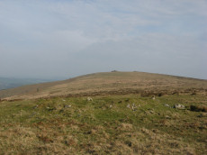
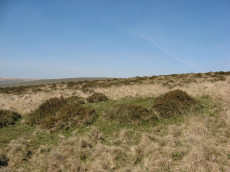
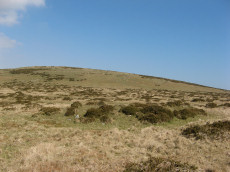
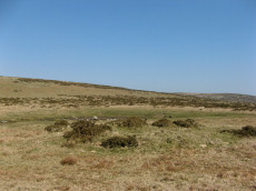
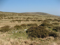
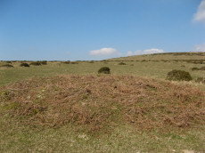
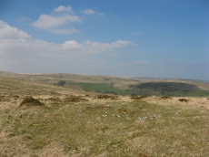
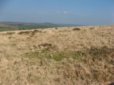
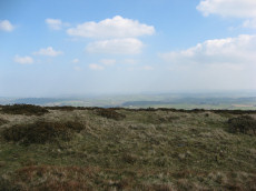
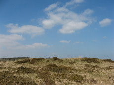
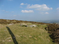
Prehistoric sites within 5km of SX 63728 56106
Guidance for walkers: The monuments featured in this database are archaeological treasures and need to be protected and preserved - please do not disturb any sites. Please check access and firing times before visiting sites, not all sites listed are on open access land. Firing ranges and boundaries of open access areas are marked on the OL28 OS Dartmoor Explorer map. Please stick to the country code and consider giving support to the numerous agencies that help to keep Dartmoor a fabulous natural and historic environment!
About the database listings: In all listings clicking on the photo or the site name will open a page for the site with a larger photo and further details from the database. The database now has over 6680 records covering nearly all publicly listed sites on Dartmoor including around 4800 round houses. This level of detail is of interest to archaeologists but tends to swamp listings of sites more likely to be of interest for walkers. For this reason, the listings default to around 550 core sites only. These are the stone circles, stone rows and the ring cairns listed by Turner. The default search radius is 2 km. The controls below the map can be used to start a new search by entering a 6- or 8-digit reference (without the prefix "SX"). The search radius can be specified and you can add incremental Display layers of detail on top of the core sites. If using a more detailed layer you will need to decrease the search radius to avoid getting hundreds of search results.
- Core sites Default listing of core sites consisting of stone circles & rows and some of the major ring cairns.
- Plus cairns adds approx. 1000 cairns and other minor sites not included in the core listings but excluding round houses.
- Plus round houses adds approx. 4800 round houses.
- Plus non-sites adds in the records for sites that no longer exist or are not prehistoric sites.
- Plus duplicates adds records excluded as duplicates. Those maybe duplicate records in external listings (e.g. the Historic Environment Records). For example, some sites have been identified as cairns in some listings and interpreted as round houses in other listings and both records appear.
These listings have incorporated, matched up and merged all of the records from all of the major archaeological listings including: Worth, Grinsell, Turner, Butler, Bill Radcliffe, Sandy Gerrard, Megalithic Portal, the National Monument Records and the Historic Environment Records. The author would like to thank Bill, Sandy, the lovely people both at Megalithic Portal (especially Anne Tate who did an amazing job to link listings) and at ACE Archaeology for collaborative work over the years to synchronise and correct listings across the various websites which now interlink. A culmination of years of work the final merger of cairn records took 3 months of cross referencing in 2017 the result being a snapshot of the records at that time. This data has in turn been refined since by field work and research. The round house data was supplied by Sandy Gerrard. Grid references are in order of accuracy: from Google Earth satellite, if visible and found, from a Garmin GPS reading, if visited by the author and from the literature otherwise. Individual site pages will state the source of the grid reference and provide satellite imagery. If a site listing lacks a photo it has not yet been visited by the author in which case the grid reference is from the literature.
Currently the database only includes sites which can be represented by a grid reference. Reaves are not included as they require GIS shape technology which is beyond the current capability of this system. To see the sources for the records, look at the tables on the resources menu. The database listings can also be viewed on a Google map and downloaded as GPS datasets for Garmin devices.
Corrections, or any feedback or suggestions are very welcome, email: info@dartmoorwalks.org.uk.
NOTE: Clicking on the icons for each monument in the map will give the name of the site. You can zoom in and out and drag the map around.
List of sites within 5km of SX 63728 56106
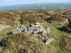
Western Beacon 19 Cist
OS Map: SX 65576 58524
HER: MDV132347
ShortName: CT:WesternB19
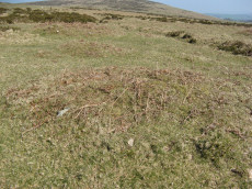
Notes: HER: Small stony mound west of cairn MDV3137, 1.7 metres diameter, 0.3 metres high, with upright stones in centre, 0.6 metres by 0.4 metress by 0.1 metres high, may be remains of a cist and low mound.
Nearby sites: SX 65576 58524
Distance: 3.03km
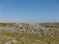
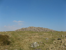
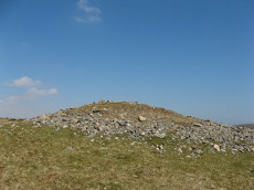
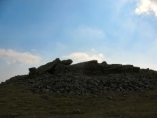
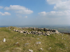
Butterdon Hill Summit 6 Cairn
OS Map: SX 65533 58671
HER: MDV2915
ShortName: CN Butterdon 6
Butler map: 53.9.6
Grinsell: HAR 18
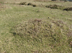
Notes: Large cairn. "One of a group of four cairns on Butterdon Hill. Badly damaged, especially around the perimeter. Cairn consists of a mound of stone, earth and turf base, possibly with a berm and ditch. Diameter 25 metres, height approximately 2.5 metres"
Nearby sites: SX 65533 58671
Distance: 3.14km
Butterdon Hill S.E.10 Cairn
OS Map: SX 65629 58529
HER: MDV2896
ShortName: CN Butterdon10
Butler map: 53.9.10
Grinsell: UGB 21
Notes: "Cairn consisting of a mound of stones upon a stone, earth and turf base, possibly with a berm and ditch. Diameter 15m, height approx 1.8m"
Nearby sites: SX 65629 58529
Distance: 3.08km
Butterdon Hill S.W.11 Cairn
OS Map: SX 65449 58602
HER: MDV3137
ShortName: CN Butterdon11
Butler map: 53.9.11
Grinsell: HAR 19
Notes: "Round cairn on butterdon hill ... situated on slope, in poor condition. Diameter 14.5m. Height varies 1.7m - 0.1m. ... Cairn covered by modern circular enclosure of granite boulders (included in height). Diameter 16m, height 1.8m."
Nearby sites: SX 65449 58602
Distance: 3.03km
Butterdon Hill N.W.12 Cairn
OS Map: SX 65401 58822
HER: MDV3134
ShortName: CN Butterdon12
Butler map: 53.9.12
Grinsell: HAR 15
Notes: "Mutilated cairn. Diameter 17m, height 1.5m. Siting hillspur ... On the western slope of butterdon hill. A scattered pile of stones, of medium size. Probably many have been removed. The east side of the cairn is quite flattened, this being the higher side of the slope, but the western side, on lower ground, gives the impression of a cairn some 0.6m - 0.9m high. The edge is too scattered to permit the accurate measurement of the diameter. Approx diameter 15m, height 0.6m - 0.9m."
Nearby sites: SX 65401 58822
Distance: 3.19km
Wetherdon Hill 18 Cairn
OS Map: SX 65052 58863
HER: MDV3135
ShortName: CN Wetherdon18
Butler map: 53.9.18
Grinsell: HAR 13
Notes: "Large cairn consisting of a mound of loosely packed stones on a base of stone and earth, the circumference of which projects beyond the stones. It is 20m in diameter, 1.6m high and has an outer ditch"
Nearby sites: SX 65052 58863
Distance: 3.06km
Wetherdon Hill 19 Cairn
OS Map: SX 65165 58922
HER: MDV3136
ShortName: CN Wetherdon19
Butler map: 53.9.19
Grinsell: HAR 14
Notes: "Cairn consisting of a mound of stones built upon a base of stone and earth, the circumference of which projects beyond the stones. Diameter 20m, height 1.5m"
Nearby sites: SX 65165 58922
Distance: 3.16km
Butterdon Hill N.1 Cairn
OS Map: SX 65824 59761
HER: MDV2902
ShortName: CN:ButterdonN1
Butler map: 53.10.1
Grinsell: UGB 13
Nearby sites: SX 65824 59761
Distance: 4.21km
Butterdon Hill N.2 Cairn
OS Map: SX 65996 59834
HER: MDV2901
ShortName: CN ButterdonN2
Butler map: 53.10.2
Grinsell: UGB 14
Nearby sites: SX 65996 59834
Distance: 4.36km
Butterdon Hill N.3 Cairn
OS Map: SX 65726 59701
HER: MDV2904
ShortName: CN:ButterdonN3
Butler map: 53.10.3
Grinsell: UGB 13a
Nearby sites: SX 65726 59701
Distance: 4.11km
Piles Hill S.W.8 Cairn
OS Map: SX 64568 59769
HER: MDV42373
ShortName: CN PilesSW 8
Butler map: 53.11.8
Notes: This area has very many patches of gorse that look like they could conceal a mound but could just be vegetation. This makes identifying claimed cairns very difficult. The photo maybe of this cairn. It is very close to what appears to be a mound on Lidar data at SX 64564 59766. Garmin location is SX 64568 59769 which matches well. The HER location is given as SX 64570 59758.
Nearby sites: SX 64568 59769
Distance: 3.76km
Piles Hill S.W.12 Cairn
OS Map: SX 64914 60068
HER: MDV130016
ShortName: CN PilesHil112
Butler map: 53.11.12
Grinsell: HAR 24
Notes: Sited on a hill slope at the juncion of two reaves. This area has very many patches of gorse that look like they could conceal a mound but could just be vegetation. This makes identifying claimed cairns very difficult. The author looked for this cairn on 20/04/2019 and found this. The mound is long and thin and consistent with a fragmentary section of a reave rather than a cairn.
Nearby sites: SX 64914 60068
Distance: 4.14km
Piles Hill S.W.16 Cairn
OS Map: SX 64522 60293
HER: MDV4305
ShortName: CN PilesHill16
Butler map: 53.11.16
Grinsell: HAR 7
Barrow Report: 36
Nearby sites: SX 64522 60293
Distance: 4.26km
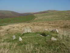
Cantrell stone rows Cairn
OS Map: SX 65722 57176
HER: MDV33471
PMD: Cantrell
ShortName: CN Cantrell
Butler map: 53.12
Grinsell: UGB 24
Notes: cairn at ne end of row worth no 62. Cairn 7m diameter: 0.6m high (am7). Vis=22/6/1973 (grinsell). Cairn with possible end-slab of cist in central hollow, giving orientation sse/nnw.
Nearby sites: SX 65722 57176
Distance: 2.26km
Western Beacon 2 Cairn
OS Map: SX 65449 57732
HER: MDV3126
ShortName: CN WesternB 2
Butler map: 53.13.2
Grinsell: UGB 22
Notes: "Cairn is hollow in centre, otherwise in fair condition. Diameter 16.0m, height 1.7m."
Nearby sites: SX 65449 57732
Distance: 2.37km
Western Beacon 3 Cairn
OS Map: SX 65470 57664
HER: MDV25001
ShortName: CN WesternB 3
Butler map: 53.13.3
Notes: "One of a group of three closely spaced cairns on the south-western brow of Western Beacon. Small cairn close to other cairns."
Nearby sites: SX 65470 57664
Distance: 2.34km
Western Beacon 4 Cairn
OS Map: SX 65454 57646
HER: MDV25000
ShortName: CN WesternB 4
Butler map: 53.13.4
Notes: "Group of three closely spaced cairns on the south-western brow of Western Beacon."
Nearby sites: SX 65454 57646
Distance: 2.31km
Western Beacon 5 Cairn
OS Map: SX 65407 57632
HER: MDV3123
ShortName: CN WesternB 5
Butler map: 53.13.5
Grinsell: HAR 23
Notes: "Cairn consisting of stone and earth base surmounted by a mound of stones measuring 25m in diameter and 1.8m high. Visitors have moved stones around to form shelters "
Nearby sites: SX 65407 57632
Distance: 2.27km
Western Beacon 6 Cairn
OS Map: SX 65443 57624
HER: MDV3125
ShortName: CN WesternB 6
Butler map: 53.13.6
Grinsell: UGB 23
Notes: "Group of three closely spaced cairns on the south-western brow of Western Beacon. Cairn is in good condition. Diam 17.0m, 1.7m high."
Nearby sites: SX 65443 57624
Distance: 2.29km
Western Beacon 9 Cairn
OS Map: SX 65384 58124
HER: MDV3130
ShortName: CN WesternB 9
Butler map: 53.14.9
Grinsell: HAR 21
Notes: "Between western beacon and butterdon hill about 105m west of black pool. On flat, grassy ground that has been almost completely cleared of stones. A grass covered mound of stones, with hollow centre. Oval shape with longer diameter. Diameter e-w 16.50m, n-s 12.2m. Height 0.6m."
Nearby sites: SX 65384 58124
Distance: 2.61km
Western Beacon 10 Cairn
OS Map: SX 65487 58105
HER: MDV3129
ShortName: CN WesternB10
Butler map: 53.14.10
Grinsell: HAR 22
Nearby sites: SX 65487 58105
Distance: 2.66km
Western Beacon 12 Cairn
OS Map: SX 65584 58062
HER: MDV2894
ShortName: CN WesternB12
Butler map: 53.14.12
Grinsell: UGB 21a
Nearby sites: SX 65584 58062
Distance: 2.70km
Western Beacon 13 Cairn
OS Map: SX 65713 58036
HER: MDV2905
ShortName: CN WesternB13
Butler map: 53.14.13
Grinsell: UGB 21b
Notes: NMR refers to Grinsell "216" - typo for 21b?
Nearby sites: SX 65713 58036
Distance: 2.77km
Western Beacon 14 Cairn
OS Map: SX 65719 58027
HER: MDV24997
ShortName: CN WesternB14
Butler map: 53.14.14
Notes: No matching entry on NMR or HER
Nearby sites: SX 65719 58027
Distance: 2.77km
Western Beacon 15 Cairn
OS Map: SX 65727 58032
HER: MDV24997
ShortName: CN WesternB15
Butler map: 53.14.15
Notes: ?
Nearby sites: SX 65727 58032
Distance: 2.78km
Western Beacon 16 Cairn
OS Map: SX 65732 58041
HER: MDV24997
ShortName: CN WesternB16
Butler map: 53.14.16
Notes: Possible hut circle near 2 cairns
Nearby sites: SX 65732 58041
Distance: 2.79km
Western Beacon 17 Cairn
OS Map: SX 65757 58028
HER: MDV129932
ShortName: CN WesternB17
Butler map: 53.14.17
Notes: No matching entry on NMR or HER
Nearby sites: SX 65757 58028
Distance: 2.79km
Beacon Plains 1 Cairn
OS Map: SX 66310 59477
HER: MDV2893
ShortName: CN BeaconPl 1
Butler map: 53.16.1
Grinsell: UGB 17a
Notes: HER: Cairn situated on Beacon Plain, north-west of Ugborough Beacon 50 metres south-west of another cairn (MDV2892). It is built of stone and earth, now turf-covered and is 13 metres in diameter and 0.7 metres high. A ditch and retaining kerb can be traced around the mound, the centre of which is hollow with the remains of a small building.
Butler has incorrect NGR: 66225945 cf. 66375947 (Grinsell UGB 17a) NGR corrected
Nearby sites: SX 66310 59477
Distance: 4.25km
Beacon Plains 2 Cairn
OS Map: SX 66389 59465
HER: MDV2892
ShortName: CN BeaconPl 2
Butler map: 53.16.2
Grinsell: UGB 17b
Notes: This should be approx. 50m distant from Beacon Plains 1. The slight mound with a change of vegetation in the photo might be this cairn (visited by author 30/03/2019). The co-ords given here are from this object. The HER co-ords are SX 66374 59469, the object in the photo is at SX 66389 59465. NB. The author revisited this on 22/04/2019. A more thorough search was done to try to pinpoint this cairn and nothing was found. This included looking up to 50 metres both west and east of the cairn (Beacon Plains 1) that can be easily located (the two are according to Butler separated by about 50 metres on an east to west line). The patch with a change of vegetation is an unconvincing site but it can't be ruled out!
Nearby sites: SX 66389 59465
Distance: 4.29km
Ugborough Beacon 1 Cairn
OS Map: SX 66756 59113
HER: MDV3121
ShortName: CN Ugborough 1
Butler map: 53.16.3
Grinsell: UGB 17
Notes: HER: Cairn on the summit of Ugborough Beacon, incorporates part of a granite outcrop in its structure. It consists of a rock and earth base surmounted by a mound of stones built up around the outcrop. It is 22 metres in diameter and 1.5 metres high. Visitors have repositioned some of the stones of the mound to form shelters.
Nearby sites: SX 66756 59113
Distance: 4.27km
Ugborough Beacon 2 Cairn
OS Map: SX 66741 58926
HER: MDV2900
ShortName: CN Ugborough 2
Butler map: 53.16.4
Grinsell: UGB 18
Nearby sites: SX 66741 58926
Distance: 4.13km
Ugborough Beacon 3 Cairn
OS Map: SX 66716 58789
HER: MDV3105
ShortName: CN Ugborough 3
Butler map: 53.16.5
Grinsell: UGB 19
Nearby sites: SX 66716 58789
Distance: 4.02km
Glasscombe Ball N.1 Cairn
OS Map: SX 65783 60473
HER: MDV5660
ShortName: CN GlassBallN1
Butler map: 56.13
Grinsell: UGB 8
Notes: ne cairn with row
Nearby sites: SX 65783 60473
Distance: 4.83km
Glasscombe Ball N.2 Cairn
OS Map: SX 65724 60426
HER: MDV129007
ShortName: CN GlassBallN2
Butler map: 56.13
Grinsell: UGB 8a
Notes: sw cairn with row
Nearby sites: SX 65724 60426
Distance: 4.76km
Glas Barrow Cairn
OS Map: SX 65981 60272
HER: MDV5665
ShortName: CN GlasBarrow
Butler map: 56.13
Grinsell: UGB 10
Nearby sites: SX 65981 60272
Distance: 4.74km
Ugborough Beacon 5 Cairn
OS Map: SX 66731 58689
HER: MDV132364
ShortName: CN Ugborough 5
Butler map: 53.16.7
Notes: Butler: "Yet another cairn lies 75 m downhill on the edge of one of the numerous stone pits spread over this part of the hillside. Several large slabs lie within the central hollow where the structured interior distinguishes it from the surrounding waste heaps".
Nearby sites: SX 66731 58689
Distance: 3.96km
Glasscombe Ball N.3 Cairn
OS Map: SX 65930 60452
HER: MDV28480
ShortName: CN:GlassBallN3
Grinsell: UGB 9
Notes: cairn sited on ridge
Nearby sites: SX 65930 60452
Distance: 4.87km
Piles Hill Cairn
OS Map: SX 654 605
HER: MDV132368
ShortName: MDV132368
Notes: HER: Small cairn in Butterdon Hill to Piles Hill stone row. Turf-covered stony mound of 4 metres by 3 metres and 0.4 metres high. It marks the change of orientation at the north end of the row
Nearby sites: SX 654 605
Distance: 4.70km
Butterdon Hill N.5 Cairn
OS Map: SX 656 592
HER: MDV132369
ShortName: CN:ButterdonN5
Notes: HER: Small cairn with a possible cist in Butterdon Hill to Piles Hill stone row. Low turf-covered mound of 1.7 metres diameter by 0.4 metres high with a large stone in centre which could be a capstone of a cist or a fallen upright of the stone row
Nearby sites: SX 656 592
Distance: 3.62km
HenlakeDown Cairn
OS Map: SX 6306 5720
HER: MDV28581
ShortName: CN:HenlakeDo1
Notes: Cairn on summit of henlake down. Vis=6/5/1986 (griffith + robinson). A low cairn visible on the summit se of the trig point. Diameter circa 7m, height 0.15m. Appears to be a heavily robbed cairn of small stone; could be a less heavily robbed ring cairn, but rather small for this.
Nearby sites: SX 6306 5720
Distance: 1.28km
Butterdon Hill W. Long Cairn
OS Map: SX 654 586
HER: MDV132345
ShortName: CN:Butterdon W
Notes: HER: Possible long cairn on the west side of Butterdon Hill. Trapezoidal mound, oriented west to east of 15 metres by 5 metres and 0.5 to 0.6 metres high tapering to west end and with side ditches 0.9 metres wide by 0.4 metres deep. Upright stones at the east end suggest a forecourt or collapsed chambe
Nearby sites: SX 654 586
Distance: 3.00km
Addicombe 3 Clearance Cairn
OS Map: SX 64754 58424
HER: MDV13093
ShortName: CN Addicombe3
Butler map: 53.1.3
Notes: "A hollow centred cairn, small stones showing in the wall like perimeter which spreads out on the outer side. The west side has almost disappeared. The walls are covered with turf and bracken. May be a doubtful site; result of land clearance?"
Nearby sites: SX 64754 58424
Distance: 2.53km
Piles Hill S.W.6 Clearance Cairn
OS Map: SX 6459 5969
HER: MDV130033
ShortName: CN?PilesSW 6
Butler map: 53.11.6
Notes: Butler describes as cairn. However, possibly a clearance cairn associated withthe `Bulllaven Reave'. This area has very many patches of gorse that look like they could conceal a mound but could just be vegetation. This makes identifying claimed cairns very difficult. The author looked for this cairn on 20/04/2019 and was unable to find it. Lidar data points to a possible mound at SX 64614 59684 which is close to Butler's location of SX 6459 5969 but this could not be found.
Nearby sites: SX 6459 5969
Distance: 3.69km
Piles Hill S.W.7 Clearance Cairn
OS Map: SX 6461 5957
HER: MDV130034
ShortName: CN?PilesSW 7
Butler map: 53.11.7
Notes: Butler describes as cairn. However, possibly a clearance cairn associated withthe 'Bulllaven Reave'. This area has very many patches of gorse that look like they could conceal a mound but could just be vegetation. This makes identifying claimed cairns very difficult. The author looked for this cairn on 20/04/2019 and was unable to find it. However, Lidar data indicates the possibility of a mound at SX 64615 59588 which is very close to this grid reference - but this could not be found.
Nearby sites: SX 6461 5957
Distance: 3.57km
Piles Hill S.W.4 Clearance Cairn
OS Map: SX 64697 59781
HER: MDV130031
ShortName: CN-PilesSW 4
Butler map: 53.11.4
Notes: Butler describes as cairn. However, possibly a clearance cairn associated with the Bulllaven Reave. This area has very many patches of gorse that look like they could conceal a mound but could just be vegetation. This makes identifying claimed cairns very difficult. The Butler cairns 53.11.4 and 53.11.5 have NGRs given by Butler as SX 6468 5975 and SX 6465 5974 respectively. Possible matches to these sites on Lidar data are mounds a few metres away to the north-east at SX 64679 59766 and SX 64692 59773. These two mounds could be found and have the locations of SX 64684 59771 and SX 64697 59781 as taken on a Garmin on 20/04/2019. The sites in the photos correspond to this.
Nearby sites: SX 64697 59781
Distance: 3.80km
Piles Hill S.W.5 Clearance Cairn
OS Map: SX 64684 59771
HER: MDV130032
ShortName: CN-PilesSW 5
Butler map: 53.11.5
Notes: Butler describes as cairn. However, possibly a clearance cairn associated with the Bulllaven Reave. This area has very many patches of gorse that look like they could conceal a mound but could just be vegetation. This makes identifying claimed cairns very difficult. The Butler cairns 53.11.4 and 53.11.5 have NGRs given by Butler as SX 6468 5975 and SX 6465 5974 respectively. Possible matches to these sites on Lidar data are mounds a few metres away to the north-east at SX 64679 59766 and SX 64692 59773. These two mounds could be found and have the locations of SX 64684 59771 and SX 64697 59781 as taken on a Garmin on 20/04/2019. The sites in the photos correspond to this.
Nearby sites: SX 64684 59771
Distance: 3.79km
Piles Hill S.W.10 Clearance Cairn
OS Map: SX 6497 6001
HER: MDV13483
ShortName: CN?PilesHill10
Butler map: 53.11.10
Notes: Butler describes as cairn. However, possibly a clearance cairn associated withthe `Bulllaven Reave'. This area has very many patches of gorse that look like they could conceal a mound but could just be vegetation. This makes identifying claimed cairns very difficult. The author looked for this cairn on 20/04/2019 and was unable to find it.
Nearby sites: SX 6497 6001
Distance: 4.10km
Piles Hill S.W.11 Clearance Cairn
OS Map: SX 6513 6004
HER: MDV27912
ShortName: CN?PilesHill11
Butler map: 53.11.11
Notes: Butler describes as cairn. However, possibly a clearance cairn associated withthe `Bulllaven Reave'. This area has very many patches of gorse that look like they could conceal a mound but could just be vegetation. This makes identifying claimed cairns very difficult. The author looked for this cairn on 20/04/2019 and was unable to find it.
Nearby sites: SX 6513 6004
Distance: 4.18km
Piles Hill S.W.13 Clearance Cairn
OS Map: SX 6456 5991
HER: MDV130028
ShortName: CN:PilesSW13
Butler map: 53.11.13
Notes: Butler describes as cairn. However, possibly a clearance cairn associated withthe `Bulllaven Reave'.
Nearby sites: SX 6456 5991
Distance: 3.89km
Piles Hill S.W.17 Clearance Cairn
OS Map: SX 6461 6010
HER: MDV130029
ShortName: CN?PilesHill17
Butler map: 53.11.17
Notes: Butler describes as cairn. However, possibly a clearance cairn associated with the Bulllaven Reave.
Nearby sites: SX 6461 6010
Distance: 4.09km
Piles Hill S.W.18 Clearance Cairn
OS Map: SX 6467 6004
HER: MDV130030
ShortName: CN?PilesHill18
Butler map: 53.11.18
Notes: Butler describes as cairn. However, possibly a clearance cairn associated with the 'Bulllaven Reave'.
Nearby sites: SX 6467 6004
Distance: 4.05km
Glasscombe Ball S.2 Clearance Cairn
OS Map: SX 65837 60192
ShortName: CN-GlassBallS2
Notes: Cairn west of the Butterdon Hill stone row; 5 metres in diameter. May be medieval or later feature, rather than prehistoric. See also site 1768 which has a very simimilar appearance and is 100 m due east of this cairn. The HER grid reference closely matches the location in this record. Butler lists one such cairn which he refers to as beign closr to the stone row - so probably the other one.
Nearby sites: SX 65837 60192
Distance: 4.60km
Glasscombe Ball S.1 Clearance Cairn
OS Map: SX 65937 60181
HER: MDV103623
ShortName: CN-GlassBallS1
Butler map: 56.13
Notes: Cairn west of the Butterdon Hill stone row; approx 5 metres in diameter. About 11m north of the row. May be medieval or later feature, rather than prehistoric. See also site 1764 which has a very similar appearance and is 100 m due west of this.
The HER (103623) grid reference closely matches the location of the other cairn in this pair so probably refers to that (as does the NMR record SX 66 SE 106). Butler lists only one such cairn which he refers to as being close to the stone row which fits the location of this cairn.
Nearby sites: SX 65937 60181
Distance: 4.64km
Piles Hill S.W.15 Clearance Cairn
OS Map: SX 6479 5951
HER: MDV130346
ShortName: CN:PilesSW15
Notes: HER: Irregular pear-shaped mound, 7.4m x 4.3m and 0.3m high, formed of small stones lying atop the peat. More of the stone lies close by the mound. The mound is not a burial cairn, but is probably a post-Mediaeval feature.
Nearby sites: SX 6479 5951
Distance: 3.57km
Yadsworthy Waste Clearance Cairn
OS Map: SX 637 610
HER: MDV123437
ShortName: CN:Yadsworthy
Notes: HER: At least eight post medieval clearance cairns, to the south of a prehistoric enclosure, north of Yadsworthy Waste. The mounds are stony and turf covered, approximately circular. The largest has a diameter of 3.2 metres, but most are lower than 0.3 metres high.
Nearby sites: SX 637 610
Distance: 4.89km
Glasscombe Ball N.4 Reported Cist
OS Map: SX 65825 60577
HER: MDV5676
ShortName: CT-GlassBallN4
Grinsell: UGB 9a
Notes: A group of stones, probably the remains of a cist, were found by Mr. Carpenter on Piles Hill, 600 yards west of Glasscombe Corner. ... This cairn may have a prehistoric origin but the impression is that of a collection for some recent purpose.
Nearby sites: SX 65825 60577
Distance: 4.94km
Addicombe 5 Reported Cairn
OS Map: SX 64943 58109
ShortName: CN Addicombe5
Notes: The author was looking for Addicombe 1 and encountered this which looks like a very dilapidated cairn that is much larger. There are no records of it. There are a number of mounds in the vicinity which are the result of the construction of the Red Lake tramway but this is quite a bit downhill from there and seems unlikely to be one of those. The Addicombe 1 cairn is around 3 metres across. This is considerably larger,more like 12 metres (estimate from memory - not a measurement). The area is covered in Butler Map 53.1
Nearby sites: SX 64943 58109
Distance: 2.34km
Piles Hill S.W.2 Reported Cist
OS Map: SX 64812 59675
HER: MDV13091
PMD: Butter Brook
ShortName: CN PilesSW 2
Butler map: 53.11.2
Grinsell: HAR 25
Notes: This cairn may also have headed a stone row but only one slab remains. At the centre of the cairn there is a flat slab which was probably the cover of a cist [Butler]. This area has very many patches of gorse that look like they could conceal a mound but could just be vegetation. This makes identifying claimed cairns very difficult. A mound could be identified on Lidar at SX 64810 59670 - this fits closely with both Butler's location and with the Garmin location of the object in the photo.
Nearby sites: SX 64812 59675
Distance: 3.73km
Addicombe 1 Reported Cairn
OS Map: SX 64970 58110
ShortName: CN Addicombe1
Butler map: 53.1.1
Notes: Butler cairn 53.1.1. This is not listed on the NMR or HER records. There is clearly a mound at this location. Whether it is prehistoric or from the historic period is not clear.
Nearby sites: SX 64970 58110
Distance: 2.36km
Addicombe 2 Reported Cairn
OS Map: SX 64970 58460
HER: MDV128275
ShortName: CN:Addicombe2
Butler map: 53.1.2
Notes: Butler quoted on HER: 'Cairn 2' 50 metres to the north-east of Enclosures 'C' and 'D' with a dimeter of 5 metres by 0.3 metres high with the interior thrown out to the east.
Nearby sites: SX 64970 58460
Distance: 2.66km
Butter Brook homestead Reported Cairn
OS Map: SX 65146 59125
HER: MDV128295
ShortName: CN-ButterHome
Butler map: 53.4
Notes: Butler: Possibly associated with the homestead is a small cairn dug into from the north-east side, sited almost on the skyline 200 m to the south. Butler gives location as SX 6515 5913. The item in the photo might be the cairn referred to but the author is uncertain. It is at SX 65146 59125.
Nearby sites: SX 65146 59125
Distance: 3.34km
Addicombe 4 Reported Cairn
OS Map: SX 6495 5855
HER: MDV25322
ShortName: CN:Addicombe4
Notes: HER: Possible cairn visible on aerial image at SX 6495 5855. Not shown on Ordnance Survey 1954 10,560 maps. Visible on 1946 RAF photograph.
Nearby sites: SX 6495 5855
Distance: 2.73km
Butterdon Hill Summit 7-9 Reported Cairn
OS Map: SX 65540 58653
ShortName: CN-Butter 7-9
Butler map: 53.9.7-9
Notes: Butler: "Two tiny cairns ... are sited close to [Butterdon Hill Summit 6] and the triangulation pyramid stands on a particularly stony patch which maybe the remains of a third".
Nearby sites: SX 65540 58653
Distance: 3.13km

Butterdon Hill W.13-17 Reported Cairn
OS Map: SX 65116 58671
HER: MDV13164
ShortName: CN Butter13-17
Butler map: 53.9.13-17
Notes: This record currently relates to a group of five small cairns listed by Butler Map 9.13-17 (SX65155865). The HER/NMR lists one cairn at SX65125869 "A group of granite stones on a low oval mound of earth and stone, 7m x 4m, direction of length ene-wsw (c.50deg. E. Of true n. ). The lower sw part is a group of stones, max. Ht.1.0m, which have the appearance of being man-placed. The remainder of the site is a low mound standing less than 0.5m high, which merges into the hillside at the higher ne end." This might be the cairn in the photograph - but this requires confirmation. The NGR given by this record relates to the item in the photo.
Nearby sites: SX 65116 58671
Distance: 2.92km
Butter Brook 1 stone row Reported Cairn
OS Map: SX 65157 59942
HER: MDV130037
ShortName: CN Butter Br1
Butler map: 53.11.1
Notes: HER: Cairn '1' (Butler) at the south end of the stone row on Lower Piles. Small cairn in Butterdon Hill to Piles Hill stone row. Turf-covered stony mound of 4 metres by 0.4 metres high marks a change of orientation of north end of row
Nearby sites: SX 65157 59942
Distance: 4.09km
Piles Hill S.W.3 Reported Cairn
OS Map: SX 648 595
HER: MDV13094
ShortName: CN:PilesSW 3
Butler map: 53.11.3
Notes: We have the following which might refer to the same cairn but it is hard to tell. 1)Butler 53.11.3 Piles Hill SW (SX64785963) size 10.0 x 0.4 2) HER MDV13094 (SX64805950) size 7 x 0.25. NOTE. Butler also listed this as being Grinsell Harford 25 (SX64885966) size 12 x 0.3 but that we have listed as another site. This area has very many patches of gorse that look like they could conceal a mound but could just be vegetation. This makes identifying claimed cairns very difficult. The author looked for this cairn on 20/04/2019 and was unable to find it.
Nearby sites: SX 648 595
Distance: 3.56km
Western Beacon 7 Reported Cairn
OS Map: SX 65402 57570
HER: MDV28485
ShortName: CN-WesternB 7
Butler map: 53.13.7
Grinsell: UGB 23a
Notes: Cairn, or stoneheap from industrial workings measuring 24m in diameter x 3m high.
Nearby sites: SX 65402 57570
Distance: 2.22km
Western Beacon 8 Reported Cairn
OS Map: SX 65121 58192
HER: MDV3133
ShortName: CN WesternB 8
Butler map: 53.14.8
Grinsell: HAR 20
Notes: "Turf covered cairn, practically round, badly mutilated with small hummocks in centre. Diameter 14.0m, height 1.0m. Lies south of enclosed hut circle settlement."
Nearby sites: SX 65121 58192
Distance: 2.51km
Lud Brook Reported Cairn
OS Map: SX 66014 58548
ShortName: CN Lud Brook
Butler map: 53.15
Notes: A small cairn just in front of the Butterdon Hill neolithic long cairn which can be seen behind it. Butler: "Five metres from and in line with the lower end of the latter is a conventional round cairn, also dug into".
Nearby sites: SX 66014 58548
Distance: 3.35km
Cornwood 2 Reported Cairn
OS Map: SX 6245 5824
HER: MDV27665
ShortName: CN?Cornwood 2
Notes: stony cairn with axis approx ne-sw. Approx 7m x 3m x 0.6m high, neatly constructed, but possibly not prehistoric (worksheet).
Nearby sites: SX 6245 5824
Distance: 2.49km
Harford Moor Gate (north of) Reported Cairn
OS Map: SX 6435 5985
HER: MDV16515
ShortName: CN?Harford M2
Notes: A previously unrecorded doubtful small cairn. A partly turf-covered heap of small stones, 3m diameter, 0.3m high
Nearby sites: SX 6435 5985
Distance: 3.80km
Cornwood 1 Crop Mark
OS Map: SX 6221 5881
HER: MDV28579
ShortName: CN:Cornwood 1
Notes: 'cairn' visible and recorded on (rchm app 1985).
Nearby sites: SX 6221 5881
Distance: 3.10km
Beacon Plain A Standing Stone
Prehistoric Dartmoor Walks: Dartmoor Walk: The Neolithic tombs of Cuckoo Ball & Corringdon Ball
OS Map: SX 65838 59189
HER: MDV2888
Megalithic Portal: 44532
The Stone Rows of GB: Butterdon East
PMD: Beacon Plain
ShortName: SS Beacon Pl A
Butler map: 53.8
Butler Vol 5: p.216 & Fig.150
DPD page: 79
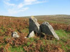
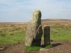
Notes: "One of two large granite blocks situated some 500 meters east of Hangershell Rocks. May be fallen standing stones or stones brought to the site but never erected. This western stone lies 55 meters from the other and tapers towards its northern end. Between the two are traces of two other stones, and the fact that they form a straight line lends weight to the argument that they are fallen menhirs. This western stone was excavated in august 1968, and groups of small stones were found at the broad end and along the w side as if to receive the stone when it was erected." For more on that see coverage on the SRGB and on PMD. See also HER record MDV2883 and also Butterdon East Stone Row and Beacon Plain B Standing Stone.
Nearby sites: SX 65838 59189
Distance: 3.74km
Beacon Plain B Standing Stone
Prehistoric Dartmoor Walks: Dartmoor Walk: The Neolithic tombs of Cuckoo Ball & Corringdon Ball
OS Map: SX 65886 59210
HER: MDV2883
Megalithic Portal: 44532
The Stone Rows of GB: Butterdon East
PMD: Beacon Plain
ShortName: SS Beacon Pl B
Butler map: 53.8
Butler Vol 5: p.216 & Fig.150
DPD page: 79
Notes: "There are two possible menhirs, on Beacon Plain, 500 yards east of Hangershell Rock. The more easterly stone measures 18 feet 4 inches in length. The other stone lies 57 yards away on a bearing 26 degrees south of west. It is 18 feet in length, 5 feet 6 inches wide at one end, and tapers to a blunt point. The stones are completely isolated on a grass moor, and have none of the characteristics of surface boulders. If they were menhirs they are the largest known on Dartmoor." There are suggestions these two stones are ends of a short stone row with a smaller stone in between. For more on that see coverage on the SRGB and on PMD. See also HER record MDV2888 and also Butterdon East Stone Row and Beacon Plain A Standing Stone.
Nearby sites: SX 65886 59210
Distance: 3.78km

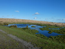
Black Pool (Western Beacon) Ancient Pool
OS Map: SX 65501 58131
HER: MDV127193
ShortName: PO Black Pool
Notes: "One of over 40 such 'sacred' pools identified on Dartmoor that are thought to have potentially been designed during the prehistoric period. Livestock watering pond, 30 metres by 20 metres and 0.6 metres deep. Pool has been modified by peat cutting."
Nearby sites: SX 65501 58131
Distance: 2.69km
Burford Down Stone Row
Prehistoric Dartmoor Walks: Dartmoor Site: Burford Down stone row and cairns
OS Map: SX 63695 60165
HER: MDV4333
Megalithic Portal: 1463
The Stone Rows of GB: Burford Down
PMD: Burford Down Stone Row
ShortName: SR BurfordDown
Butler map: 54.17
DPD page: 70
Barrow Report: 14 40
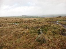
Notes: "This single stone row on a slight north slope extends from a crest at 260m OD to a col at 255m OD. It can be traced from its south terminal, marked by a cairn, at SX 63706017 for 336m, bearing 1o, to a possible blocking stone at SX 63706051 and of different character for a further 120m to SX63706062. The recumbent stone, considered ... to be the north terminal lies yet a further 47m distant at SX 63706067." See also: Sea Views at Burford Down
Nearby sites: SX 63695 60165
Distance: 4.06km
Burford Down Standing Stone
Prehistoric Dartmoor Walks: Dartmoor Site: Burford Down stone row and cairns
OS Map: SX 63703 60687
HER: MDV4333
Megalithic Portal: 1463
PMD: Burford Down Stone Row
ShortName: SS BurfordDown
Butler map: 54.17
DPD page: 70
Notes: "The alleged blocking stone noted by Parsons measures 2.7m by 1.0m and has been split by drilling." TDA Vol. 85 (1953) pp. 145-147 (Hamlyn Parsons).
Nearby sites: SX 63703 60687
Distance: 4.58km
Burford Down Encircled Cairn
Prehistoric Dartmoor Walks: Dartmoor Site: Burford Down stone row and cairns
OS Map: SX 63704 60178
HER: MDV4257
Megalithic Portal: 719
PMD: Burford Down Stone Row
Alternate name: Burford Down stone row Encircled Cairn
ShortName: EC BurfordDown
Butler map: 54.17
DPD page: 70
Grinsell: HAR 5
Turner: F10
Barrow Report: 14 40
Notes: "The south terminal cairn, 9.0m diameter and 0.6m high, has a central depression, about 2.5m diameter and 0.4m deep, and is edged by 3 upright and 2 fallen orthostats, average 0.7m by 0.2m and up to 0.9m high, the remains of a retaining circle or peristalith."
Nearby sites: SX 63704 60178
Distance: 4.07km
Burford Down (Tristis Rock) Platform Cairn Circle and Cist
Prehistoric Dartmoor Walks: Dartmoor Site: Burford Down stone row and cairns
OS Map: SX 6378 6016
HER: MDV4258
Megalithic Portal: 45689
PMD: Tristis Rock
Alternate name: Tristis Rock Platform Cairn Circle and Cist
ShortName: CT TristisRock
Butler map: 54.17
DPD page: 70
Grinsell: HAR 6
Turner: E22
Barrow Report: 14 40
Notes: "Retaining circle of a barrow, internal diameter between 16 and 17 feet and consisting of twelve stones which enclose the remaining south side stone of a cist. The overall length of the side stone is 4 feet 6 inches, the internal length of the cist would not have been more than 3 feet". Butler Tristis Rock - Vol. 4. Map 54.17 (p.60 diagram of Tristis Rock cairn p.59).
Nearby sites: SX 6378 6016
Distance: 4.05km
Butter Brook Standing Stone
Prehistoric Dartmoor Walks: Dartmoor Walk: The Neolithic tombs of Cuckoo Ball & Corringdon Ball
OS Map: SX 64747 59301
HER: MDV13095
Megalithic Portal: 45565
PMD: Butterbrook Standing Stone
ShortName: SS ButterBrook
Notes: The stone is easy to approach from the dry ground to the south but just beyond the stone to the north is marshland. A standing-stone, possibly prehistoric, near Butter Brook (near Harford) is 2.03m long and has a standing height of 1.77m. The stone is located towards the north of the eastern side of the plantation around Butterbrook reservoir. [Entry no. 70 in An archaeological check-list for Harford, Devon Archaeological Society/DCRA publications no. 11 (1982)]
Nearby sites: SX 64747 59301
Distance: 3.35km
Butter Brook N Stone Row
Prehistoric Dartmoor Walks: Dartmoor Walk: The Neolithic tombs of Cuckoo Ball & Corringdon Ball
OS Map: SX 652 599
HER: MDV13166
Megalithic Portal: 1970
The Stone Rows of GB: Butterbrook 2
PMD: Butter Brook 2 Stone Row
Alternate name: Butter Brook 1 Stone Row
ShortName: SR:Butter Br N
Butler map: 53.11
DPD page: 78
Notes: Continued notes from Butter Brook S. "At 73 metres from the terminal there is a single orthostat 0.5 metre high, standing 3.25 metres off centre south from the projection of the rows, at the edge of a small clitter of broken stones. A third row, irregularly spaced and not showing much above ground, meets the double section of the rows at an angle of about 10o on the north-west side, extending westward to about level with the terminal. Visual projection east-ward along the third row appears to be in line with the orthostat". Lethbridge 78 Rows 4/5 diagram p.77. Formerly listed as Butter Brook 2.
Nearby sites: SX 652 599
Distance: 4.07km
Butter Brook S Stone Row
Prehistoric Dartmoor Walks: Dartmoor Walk: The Neolithic tombs of Cuckoo Ball & Corringdon Ball
OS Map: SX 651 599
HER: MDV13166
Megalithic Portal: 1971
The Stone Rows of GB: Butterbrook 1
PMD: Butter Brook 1 Stone Row
Alternate name: Butter Brook 2 Stone Row
ShortName: SR Butter Br S
Butler map: 53.11
DPD page: 78
Notes: "A stone row about 42 metres long is situated on south sloping ground at SX 65145995, just north of the marshy Butterbrook valley. It is aligned south south west/north north east, and terminates at the south end in a hollow-centred ring of turf and stones of 2.5 metres diameter east/west, 3.2 metres north/south. The first stone in the row is 10.35 metres from the centre of the terminal, thereafter the spacing becomes about 3 metres. The maximum height of the stones is 0.67 metre. The row becomes double for about 12.5 metres (four to five pairs of stones), with a distance of 0.4 to 0.5 metre between rows, after which only the second row appears to continue." Lethbridge p.78 Rows 4/5 diagram p.77. Formerly listed as Butter Brook 1
Nearby sites: SX 651 599
Distance: 4.03km

Butterdon (ENE) Ancient Pool
OS Map: SX 65733 58969
HER: MDV127203
ShortName: PO Butterdon
Notes: "A pool east-north-east of Butterdon. One of over 40 such 'sacred' pools identified on Dartmoor that are thought to have potentially been designed during the prehistoric period. Lies near group of features including a stone row and cairns. Sub-rectangular shallow pit 15 metres by 19 metres and 0.4 metres deep. The edges show the remains of peat cutting"
Nearby sites: SX 65733 58969
Distance: 3.50km
Butterdon East Stone Row
OS Map: SX 65870 59203
HER: MDV2888
The Stone Rows of GB: Butterdon East
PMD: Butterdon E. Stone Row
Alternate name: Butterdon E. Stone Row
ShortName: SR ButterdonE
Butler map: 53.8
Butler Vol 5: p.218 & Fig.150
Notes: There are two massive slabs with one small slab forming an alignment. It is unclear whether these were originally standing but it is thought they could have been placed in their current locations. This would make for a very spectacular stone row and one that would be quite unique on Dartmoor. However, there are stone rows consisting of two huge slabs and a small central slab in other parts of the country. The grid reference given here and the photo is of the central stone.
Nearby sites: SX 65870 59203
Distance: 3.77km
Butterdon Hill Stone Row
Prehistoric Dartmoor Walks: Dartmoor Walk: The Erme East stone rows
OS Map: SX 65629 58814
HER: MDV2988
Megalithic Portal: 556
The Stone Rows of GB: Butterdon Hill
PMD: Butterdon Stone Row
Alternate name: Butterdon Hill Row Stone Row
ShortName: SR Butterdon
Butler map: 53.8
DPD page: 77
Notes: "The northern part of the Butterdon stone row has been surveyed from Hangershell Rocks cairn at SX 65645941 to Hobajons Cross at SX 65506045." and "For the 1050m of this part the majority of the several hundred stones are from 0.1m to 0.4m high and form an irregular line. There is a gap of 70.0m on the north side of Hangershell but otherwise the row is fairly continuous. The area is not entirely free of natural surface stones and while some can be immediately discounted occasionally there is a short double or triple row where all the stones are alike and these which formed the original row cannot now be determined. Barely two dozen stones are 0.5m high or higher, Hobajons Cross at 1.2m being the highest. It is possible that this was at some stage a terminal stone since it appears to have cup marks on the south face and the extension onwards, to the Longstone, is on an entirely different alignment." Lethbridge Row 1 diagram p.77.
Nearby sites: SX 65629 58814
Distance: 3.31km
Butterdon Hill Cist
Prehistoric Dartmoor Walks: Dartmoor Walk: The Erme East stone rows
OS Map: SX 65781 59341
HER: MDV2887
Megalithic Portal: 45752
PMD: Butterdon Hill
Alternate name: Butterdon Ridge N.E. Cist
ShortName: CT Butterdon 3
Butler map: 53.8.3
Butler Vol 5: p.59 & Fig.38
DPD page: 79
Grinsell: UGB 16
Barrow Report: 61
Notes: "The western side stone and the two end stones are still standing, but the other side stone and the cover stone are missing. The cist measures 23 inches by 15 inches"... "no sign whatever of a mound, and the cist may have been freestanding". Lethbridge p.79 East of Hangershell Rock diagram p.77. Butler Butterdon Ridge N.E. - Vol. 4. Map 53.8.3 (p.25 general plan of Butterdon rows and cairns p.24).
Nearby sites: SX 65781 59341
Distance: 3.83km
Butterdon Hill Encircled Cairn
Prehistoric Dartmoor Walks: Dartmoor Walk: The Erme East stone rows
OS Map: SX 65634 58816
HER: MDV2897
Megalithic Portal: 722
PMD: Butterdon Row
Alternate name: Butterdon Hill stone row Encircled Cairn
ShortName: EC Butterdon 1
Butler map: 53.8.1
DPD page: 78
Grinsell: HAR 16
Turner: F8
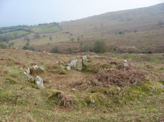
Notes: A low cairn within a retaining circle of stones is situated at SX65635881, at the south end of the Butterdon stone row (SX 65 NE 17), with which it is associated. The circle is 11 metres in diameter, and consists of twelve stones, all now recumbent, although when Worth wrote in 1941, one was erect and three were leaning. Some of the stones are unusually large. The cairn is 9 metres in diameter by 0.3 metre high, with a hollow in the centre. Radcliffe reports: Mike Brown says the row "terminates in a small kistvaen" at its southern end. Hemery says the cist "has been removed". Lethbridge p.78 Row 1 diagram p.77.
Nearby sites: SX 65634 58816
Distance: 3.31km
Butterdon Hill Cairn
OS Map: SX 65601 58766
HER: MDV2895
Megalithic Portal: 10002
Alternate name: Butterdon Hill Summit 5 Cairn
ShortName: CN Butterdon 5
Butler map: 53.9.5
Butler Vol 5: p.160
Grinsell: HAR 17
Notes: "The northernmost of several cairns near the summit of Butterdon Hill lies approximately 200 feet south-south-east (sic) from the retaining circle at the end of the stone row (SX 65 NE 17). There are clear remains of a marginal wall on the eastern circumference of this cairn; whether it is an original feature is not known but there is no apparent reason why it should have been added later. A large cairn, 27 metres in diameter, 3.3 metres high. The barrow has an apparent berm, but this may not have been an original characteristic."
Nearby sites: SX 65601 58766
Distance: 3.25km
Butterdon Hill Chambered Tomb
Prehistoric Dartmoor Walks: Dartmoor Walk: The Neolithic tombs of Cuckoo Ball & Corringdon Ball
OS Map: SX 66012 58573
HER: MDV2886
Megalithic Portal: 31698
PMD: Butterdon Long Cairn
Alternate name: Butterdon Hill chambered cairn Chambered Tomb
ShortName: NT Butterdon
Butler map: 53.15
Butler Vol 5: p.155
Grinsell: A:UGB 2
Notes: "The mound is situated on a slight south-east slope at 1050 ft O.D. It is 25 metres long, orientated north-south, is 16.0 metres wide and 0.9 metre high at the north end and 10.0 metres wide and 0.7 metre high at the south end. There are no visible side ditches. The construction is of earth and small stones but extensive pillaging and/or excavation has exposed a number of large upright and some displaced stones. The mound is certainly a long barrow."
Nearby sites: SX 66012 58573
Distance: 3.36km
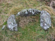
Butterdon South Cist
OS Map: SX 65576 58524
HER: MDV125710
PMD: Butterdon South
ShortName: CT Butterdon S
Notes: Found by Dave Parks (author of Prehistoric Dartmoor Walks) on 30/03/2019 and confirmed as a probable cist by Nigel Stainer a few days later.
Nearby sites: SX 65576 58524
Distance: 3.04km
Cantrell Stone Row
Prehistoric Dartmoor Walks: Dartmoor Site: Cuckoo Ball Chambered Tomb
OS Map: SX 65688 57135
HER: MDV2889
Megalithic Portal: 1798
The Stone Rows of GB: Cantrell
PMD: Cantrell Stone Row
ShortName: SR Cantrell
Butler map: 53.12
DPD page: 80
Notes: "A double stone row, with a cairn at the north-east end, lies near the moor gate at Cantrell, Ugborough Moor. The southern row consists of nine stones, one of which is almost buried and one has fallen. The length of the row from the centre of the cairn is 153 feet and the alignment is N44o 20' E. The rows are from 7 to 12 feet apart and the stones are about 5 feet 6 inches apart, centre to centre. The cairn has a diameter of 22 feet and encloses what may be the remains of a cist".
Nearby sites: SX 65688 57135
Distance: 2.21km
Cuckoo Ball Chambered Tomb
Prehistoric Dartmoor Walks: Dartmoor Site: Cuckoo Ball Chambered Tomb
OS Map: SX 65963 58195
HER: MDV2885
Megalithic Portal: 31700
PMD: Cuckoo Ball Chambered Cairn
Alternate name: Cuckoo Ball chambered cairn Chambered Tomb
ShortName: NT Cuckoo Ball
Butler map: 53.15
Butler Vol 5: p.155
DPD page: 80
Grinsell: A:UGB 1
Barrow Report: 30 56
Notes: "The remains of a long cairn and burial chamber on a hill-slope at Cuckoo Ball. The cairn, which was probably robbed for newtake walls to the west and north, is 23 metres long by 12 metres wide, aligned north/south, and is 0.7 metre high at the north. The burial chamber is at the north end."
Nearby sites: SX 65963 58195
Distance: 3.06km
Eastern beacon (S) Platform Cairn Circle
OS Map: SX 66755 58770
HER: MDV3106
Megalithic Portal: 17583
Alternate name: Ugborough Beacon 4 Platform Cairn Circle
ShortName: PC Ugborough 4
Butler map: 53.16.6
Grinsell: UGB 20
Turner: E52
Barrow Report: 62
Notes: Flat top turf-covered cairn. 20.5m. diameter, 1.7m. high. Possible remains of retaining circle. Large hollow in centre
Nearby sites: SX 66755 58770
Distance: 4.03km
Glasscombe Ball N. Stone Row
Prehistoric Dartmoor Walks: Dartmoor Walk: The Erme East stone rows
OS Map: SX 65733 60429
HER: MDV5659
Megalithic Portal: 1952
The Stone Rows of GB: Glasscombe Ball North
PMD: Glasscombe Ball Stone Row
Alternate name: Glasscombe Ball N Stone Row
ShortName: SR GlassBall N
Butler map: 56.13
DPD page: 78
Notes: "A single stone row on the northern verge of Glasscombe Ball lies a little west of north from the row near Spurrell's Cross (SX 65 NE 16) and about a third of a mile from it" ... "A stone row extending between two cairns. The north-east cairn is 0.6m high and is now elongated north-west to south-east to 6.0m. by 4.0m, and is turf-covered. The south-west cairn, 4.0m. in diameter and 0.8m. high is of close-packed stones and turf-covered." Lethbridge p.78, diagram p.77 Row 2
Nearby sites: SX 65733 60429
Distance: 4.77km
Hangershell Ancient Pool
OS Map: SX 65824 59588
HER: MDV127209
ShortName: PO:Hangershell
Notes: "A pool, one of over 40 such 'sacred' pools identified on Dartmoor that are thought to have potentially been designed during the prehistoric period. Lies near a prehistoric cairn. Sub-rectangular shallow pit of 12 metres by 16 metres and 0. 5 metres deep. Drained to west and east edges which show the remains of peat cutting"
Nearby sites: SX 65824 59588
Distance: 4.06km
Hangershell Rock (East of) Cairn
OS Map: SX 65662 59404
HER: MDV3124
Megalithic Portal: 4615
Alternate name: Butterdon Ridge N. Cairn
ShortName: CN Butterdon 2
Butler map: 53.8.2
Grinsell: UGB 15
Barrow Report: 61
Notes: East of hangershell rock large cairn with hollow centre. Diameter 17m, height 1.2m.
Nearby sites: SX 65662 59404
Distance: 3.82km
Harford Gate Encircled Cairn
Prehistoric Dartmoor Walks: Dartmoor Walk: The Neolithic tombs of Cuckoo Ball & Corringdon Ball
OS Map: SX 64494 59677
HER: MDV13092
Megalithic Portal: 3281
Alternate name: Piles Hill S.W.9 Encircled Cairn
ShortName: EC HarfordGate
Butler map: 53.11.9
Grinsell: HAR 26
Turner: F3
Notes: "This cairn occupies a prominent position on the brow of a hill and is one of two north-west of Harford Moor Gate. Measures 13 metres in diameter and 0.3 metres in height, it is turf-covered and has a retaining kerb." Visited by the author 20/04/19. Garmin gives location as SX 64495 59682 but a Lidar source gives location as SX 64494 59677 - which matches closely the HER NGR.
Nearby sites: SX 64494 59677
Distance: 3.65km
Harford Moor Settlement
Prehistoric Dartmoor Walks: Dartmoor Walk: The Neolithic tombs of Cuckoo Ball & Corringdon Ball
OS Map: SX 6445 5931
HER: MDV2849
Megalithic Portal: 23440
ShortName: ST HarfordMoor
Notes: On the western side of Harford Moor reservoir.
Nearby sites: SX 6445 5931
Distance: 3.28km
Lower Piles Enclosed Settlement
Prehistoric Dartmoor Walks: Dartmoor Walk: The Neolithic tombs of Cuckoo Ball & Corringdon Ball
OS Map: SX 64396 60528
HER: MDV4354
Megalithic Portal: 45580
ShortName: ES:Lower Piles
Notes: "Within the newtake known as lower piles. A group of seven huts near the south east corner of the enclosed land. All now composed of fairly small stones the walls appearing as thick banks of stone and turf, not high, but spreading to a width of 1.8m or more. The diameters vary from c 9.20 to c 12.20m outside measurements. Only one hut has a well defined entrance, this is on the south east side of the circle."
Nearby sites: SX 64396 60528
Distance: 4.47km
Lower Piles Ring Setting Cairn and Cist
Prehistoric Dartmoor Walks: Dartmoor Walk: The Neolithic tombs of Cuckoo Ball & Corringdon Ball
OS Map: SX 64540 60262
HER: MDV4256
Megalithic Portal: 1108
PMD: Lower Piles
Alternate name: Piles Hill S.W.15 Ring Setting Cairn and Cist
ShortName: CT Lower Piles
Butler map: 53.11.15
DPD page: 76
Grinsell: HAR 8
Turner: D13
Barrow Report: 36 62
Notes: "A cist with a retaining circle, diameter 14 to 15 feet, of which seven stones still remain, lies about 150 yds south of the south east angle of Lower Piles enclosure. The cist measures 3 feet 7 inches in length by 1 foot 4 inches wide at the south-eastern end and 2 feet wide at the north western. The present depth is from 2 feet 9 inches to 3 feet. The cover-stone and the north-western end-stone are missing." Letchfield diagram p.76. Barrow Report 36 says "To the south-east, in the direction of the length of the kistvaen, stands a single large stone, about 100 feet distant; to the north-west, with its centre 110 feet away from the centre of the kistvaen, there is a small cairn of 20 feet diameter; this also is in the line of the length of the kistvaen." The stone is at SX 64518 60236 Butler Piles Hill S.W. - Vol. 4. Map 53.11.15 (p.33 diagram of cist & plan of cairns on Piles Hill p.30).
Nearby sites: SX 64540 60262
Distance: 4.23km
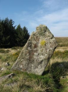
Piles Hill Standing Stone
Prehistoric Dartmoor Walks: Dartmoor Site: Piles Hill Double Stone Row & Cairns
OS Map: SX 65433 60746
HER: MDV5653
Megalithic Portal: 10003
PMD: Piles Hill Standing Stone
ShortName: SS Piles Hill
Butler map: 53.8
DPD page: 77
Notes: The fallen menhir on Piles Hill: "The 'Longstone' is a block of very coarse-grained pinkish granite. It is now 2.5m long and of rough rectangular section tapering from a base formerly about 0.4m. by 0.7m. which has been squared and snapped by drilling. The stone lies in a northwest to southeast direction. To its northeast side there is a boundary stone erected in 1803 and shaped by drilling. It is of identical stone and appears to have been fashioned from the 'Longstone' which would therefore have originally been some 4.5m long." Lethbridge p.77
Nearby sites: SX 65433 60746
Distance: 4.94km
Scad Brook Enclosed Settlement
OS Map: SX 66681 59973
HER: MDV2913
Megalithic Portal: 45573
ShortName: ES Scad Brook
DPD page: 81
Notes: Sub-circular enclosure approximately 1.25 hectares in area containing eleven hut circles ranging from 3.5 metres to 10 metres in diameter, with entrances facing south-east and many of the walls standing up to a metre high. The most complete hut has been excavated and re-instated with walls faced with orthostats and an entrance with jambs. Lethbridge p.81
Nearby sites: SX 66681 59973
Distance: 4.87km
Spurrell's Cross Stone Row
Prehistoric Dartmoor Walks: Dartmoor Walk: The Erme East stone rows
OS Map: SX 65860 59862
HER: MDV2890
Megalithic Portal: 2137
The Stone Rows of GB: Spurrells Cross
PMD: Spurrells Cross Stone Row
Alternate name: Spurrell's Cross Stone Row
ShortName: SR Spurrells X
Butler map: 53.10
DPD page: 78
Notes: "The row has apparently been double, but since only seven stones still stand, which together with six sunken stones form the fixed points now determinable, it is difficult to ascertain the original spacing. The lines were probably about 3 feet 6 inches apart and the spacing between the stones about 3 feet. The length of the row is 370 feet as measured from the centre of the cairn and the direction of length is N 20o W. The largest standing stone is 2 feet in height. The cairn, at the south end of the row is 50 feet in diameter with only two stones remaining of the retaining circle". Lethbridge p.78, diagram p.77 Row 3. The photo here is most probably not of the row. The row runs parallel to Butterdon row and does not orientate on Spurrel's Cross.
Nearby sites: SX 65860 59862
Distance: 4.32km
Spurrells Ancient Pool
OS Map: SX 65810 60059
HER: MDV127224
ShortName: PO:Spurrells
Notes: "A pool measuring around 18m. One of over 40 such 'sacred' pools identified on Dartmoor that are thought to have potentially been designed during the prehistoric period. Lies to the north of a stone row. Livestock watering pond modified by peat cutting of 25 metres by 16 metres and 0.4 metres deep. The edges show the remains of peat cutting"
Nearby sites: SX 65810 60059
Distance: 4.47km
Spurrells Cross Encircled Cairn
Prehistoric Dartmoor Walks: Dartmoor Walk: The Erme East stone rows
OS Map: SX 65858 59864
HER: MDV2891
Megalithic Portal: 1273
PMD: Spurrell's Cross Stone Row
Alternate name: Spurrell's cross stone row Encircled Cairn
ShortName: EC:Spurrells X
Butler map: 53.10
Grinsell: UGB 12
Turner: F9
Barrow Report: 56
Notes: Cairn at SX 65855985, 12 metres in diameter by 0.4 metres high, with two stones of retaining circle, from which double stone row descends to north north west. This cairn is located about 125 metres from Spurrells Cross.
Nearby sites: SX 65858 59864
Distance: 4.32km
Stalldown South East Stone Row
OS Map: SX 63746 61059
The Stone Rows of GB: Stalldown South East
PMD: Stalldown SE1
Alternate name: Stalldown SE1 Stone Row
ShortName: SR StalldownSE
Butler map: 54.4
Notes: The Stone Rows of Great Britain states: "This line of seven stones seems to be artificial and certainly looks like a stone row. The proximity of a number of small cairns further enhances this interpretation as does the visual relationship with Plymouth Sound. The stones however lies between two reaves (prehistoric boundary banks) and close to other boundaries. The possibility of this feature being an unfinished or partly robbed field boundary cannot therefore be wholly discounted." The author visited this site on 16/07/2021 and logged the location of 6 of the 7 stones of this row (must have missed one): SX 63748 61049, SX 63750 61056, SX 63751 61058, SX 63750 61060, SX 63751 61063, SX 63751 61065.
Nearby sites: SX 63746 61059
Distance: 4.95km
Ugborough Parish Church Enclosed Settlement
OS Map: SX 6775 5575
HER: MDV28486
Megalithic Portal: 17582
ShortName: ES:UgboroughCh
Notes: Church built within Prehistoric Earthwork
Nearby sites: SX 6775 5575
Distance: 4.04km
Weatherdon Hill Stone Ring Cairn Circle
OS Map: SX 6516 5889
HER: MDV13165
Megalithic Portal: 45835
Alternate name: Wetherdon Hill 20 Stone Ring Cairn Circle
ShortName: RC:Wetherdon20
Butler map: 53.9.20
Grinsell: HAR 14a
Turner: A28
Notes: "Weatherdon hill (4): diameter approx.5.6m ht. Approx 0.15m. Alt. C.335-340m." "Mr. L. V. Grinsell noted a small cairn-circle or ring-cairn a short distance south of cairn 2 on weatherdon hill."
Nearby sites: SX 6516 5889
Distance: 3.13km

Weatherdon Hill Ancient Pool
OS Map: SX 65619 58948
HER: MDV127227
Alternate name: Wetherdon Hill Ancient Pool
ShortName: PO Wetherdon
Notes: "A pool, one of over 40 such 'sacred' pools identified on Dartmoor that are thought to have potentially been designed during the prehistoric period. Lies adjacent to the Butterdon Hill stone row. Sub-rectangular shallow pit of 11 metres by 15 metres and 0.5 metres deep. Part of disused peat cutting in the area to the south end of the stone row."
Nearby sites: SX 65619 58948
Distance: 3.41km
Western Beacon (East of) Cairn
OS Map: SX 65594 57673
Alternate name: Western Beacon 20 Cairn
ShortName: CN WesternB20
Turner: A30
Notes: Ring Cairn east of Western Beacon. UPDATE 01/01/2023: there is no HER entry for this ring cairn. It has been renamed in this listing to include "East of" since listing as Western Beacon (as it appears in Turner's list) is confusing. Alt-Name set to cairn 20. Turner gives SX 6556 5769 as the grid reference.
Nearby sites: SX 65594 57673
Distance: 2.44km