
Piles Hill Standing Stone
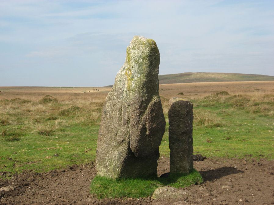
Photo taken on 30-09-2011
Database entries
PDW coverage: Dartmoor Site: Piles Hill Double Stone Row & Cairns
OS Map: SX 65433 60746
OS Source: Garmin
HER: MDV5653
Megalithic Portal: 10003
PMD: Piles Hill Standing Stone
Alternate name: Piles Hill
Short Name: SS Piles Hill
Butler map: 53.8
DPD page: 77
Exist: Yes
Record: Unique
Record Source: PDW
Hut Class: No
Dimensions (m): 2.5
Lidar: SX 65433 60746
Guide Map: 57
Nearest Bus Stop: South Brent Pool Park (6.2 km) [Route: 38]
Nearby sites: SX 65433 60746
Notes
The fallen menhir on Piles Hill: "The 'Longstone' is a block of very coarse-grained pinkish granite. It is now 2.5m long and of rough rectangular section tapering from a base formerly about 0.4m. by 0.7m. which has been squared and snapped by drilling. The stone lies in a northwest to southeast direction. To its northeast side there is a boundary stone erected in 1803 and shaped by drilling. It is of identical stone and appears to have been fashioned from the 'Longstone' which would therefore have originally been some 4.5m long." Lethbridge p.77References
These are selected references with an emphasis on out of copyright sources linked as PDFs. For more detailed references try any linked HER or PMD record above.
- Butler, Jeremy, Dartmoor Atlas of Antiquities, vol.4: The South-East, (1993)
- Laskey, John and Andrews, John, Three Days Excursion on Dartmoor, Gentlemans Magazine Library, English Topology Part 3 (1893)
- Lethbridge, William D., Discover Preshistoric Dartmoor, (2015)
- Worth, R. Hansford, The Dartmoor Menhirs, T.D.A. Vol.72 pp.191-200 (1940)
- Worth, R. Hansford, Dartmoor: 1788-1808, T.D.A. Vol.73 pp.203-226 (1941)
- Worth, R. Hansford, The Stone Rows of Dartmoor Part 1, T.D.A. Vol.78 pp.285-316 (1946)