
Butterdon Hill Cairn
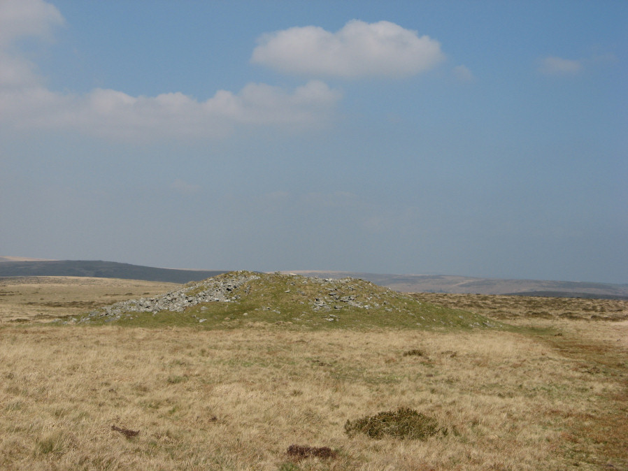
Photo taken on 30-03-2019
Database entries
OS Map: SX 65601 58766
OS Source: Google
Butler OS: SX65595876
HER: MDV2895
Megalithic Portal: 10002
Alternate name: Butterdon Hill Summit 5
Short Name: CN Butterdon 5
Butler map: 53.9.5
Butler Vol 5: p.160
Grinsell: HARFORD 17
Exist: Yes
Record: Unique
Record Source: Butler
Hut Class: No
Cairn Class: Yes
Dimensions (m): 30.0 x 4.0
Lidar: SX 65601 58766
Guide Map: 58
Nearest Bus Stop: Ivybridge BP Garage (Stop B) (4.3 km) [Route: 38]
Nearby sites: SX 65601 58766
Notes
"The northernmost of several cairns near the summit of Butterdon Hill lies approximately 200 feet south-south-east (sic) from the retaining circle at the end of the stone row (SX 65 NE 17). There are clear remains of a marginal wall on the eastern circumference of this cairn; whether it is an original feature is not known but there is no apparent reason why it should have been added later. A large cairn, 27 metres in diameter, 3.3 metres high. The barrow has an apparent berm, but this may not have been an original characteristic."References
These are selected references with an emphasis on out of copyright sources linked as PDFs. For more detailed references try any linked HER or PMD record above.
- Butler, Jeremy, Dartmoor Atlas of Antiquities, vol.4: The South-East, (1993)
- Butler, Jeremy, Dartmoor Atlas of Antiquities, vol.5: The Second Millennium B.C., (1997)
- Grinsell, L.V., Dartmoor Barrows, Devon Archaeological Society Proceedings No.36 (1978)
- Hankin, C. F., Archaeological checklist of Ugborough parish, D.A.S.P. No.33 (1975)