
Ugborough Beacon 1 Cairn
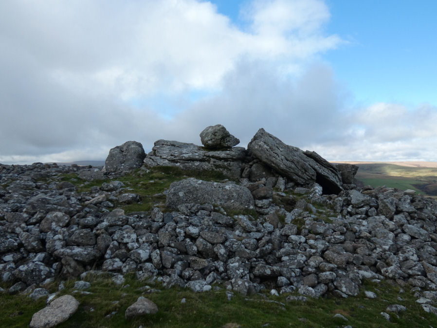
Photo taken on 08-10-2025
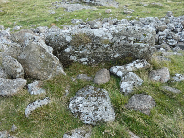
Photo 08/10/25 detail of ring.
Database entries
OS Map: SX 66756 59113
OS Source: Google
Butler OS: SX66745910
HER: MDV3121
Alternate name: Ugborough Beacon 1
Short Name: CN Ugborough 1
Butler map: 53.16.3
Grinsell: UGBOROUGH 17
Exist: Yes
Record: Unique
Record Source: Butler
Hut Class: No
Cairn Class: Yes
Dimensions (m): 24.0 x1.5
Lidar: SX 66756 59113
Guide Map: 58
Nearest Bus Stop: South Brent Pool Park (4.5 km) [Route: 38]
Nearby sites: SX 66756 59113
Notes
HER: Cairn on the summit of Ugborough Beacon, incorporates part of a granite outcrop in its structure. It consists of a rock and earth base surmounted by a mound of stones built up around the outcrop. It is 22 metres in diameter and 1.5 metres high. Visitors have repositioned some of the stones of the mound to form shelters.References
These are selected references with an emphasis on out of copyright sources linked as PDFs. For more detailed references try any linked HER or PMD record above.
- Butler, Jeremy, Dartmoor Atlas of Antiquities, vol.4: The South-East, (1993)
- Crossing, William, Guide to Dartmoor, (2001)
- Grinsell, L.V., Dartmoor Barrows, Devon Archaeological Society Proceedings No.36 (1978)
- Laskey, John and Andrews, John, Three Days Excursion on Dartmoor, Gentlemans Magazine Library, English Topology Part 3 (1893)
- Worth, R. Hansford, Barrow Report 21, T.D.A. Vol.34 pp.104- 146 (1902)
- Worth, R. Hansford, Dartmoor: 1788-1808, T.D.A. Vol.73 pp.203-226 (1941)