
Beacon Plains 2 Cairn
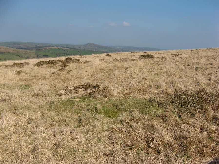
Photo taken on 30-03-2019
Database entries
OS Map: SX 66389 59465
OS Source: Garmin
Butler OS: SX66305945
HER: MDV2892
Alternate name: Beacon Plains 2
Short Name: CN BeaconPl 2
Butler map: 53.16.2
Grinsell: UGBOROUGH 17b
Exist: Maybe
Record: Unique
Record Source: Butler
Hut Class: No
Cairn Class: Maybe
Dimensions (m): 12.0 x 0.5
Lidar: SX 66389 59465
Guide Map: 58
Nearest Bus Stop: South Brent Pool Park (4.9 km) [Route: 38]
Nearby sites: SX 66389 59465
Notes
This should be approx. 50m distant from Beacon Plains 1. The slight mound with a change of vegetation in the photo might be this cairn (visited by author 30/03/2019). The co-ords given here are from this object. The HER co-ords are SX 66374 59469, the object in the photo is at SX 66389 59465. NB. The author revisited this on 22/04/2019. A more thorough search was done to try to pinpoint this cairn and nothing was found. This included looking up to 50 metres both west and east of the cairn (Beacon Plains 1) that can be easily located (the two are according to Butler separated by about 50 metres on an east to west line). The patch with a change of vegetation is an unconvincing site but it can't be ruled out!References
These are selected references with an emphasis on out of copyright sources linked as PDFs. For more detailed references try any linked HER or PMD record above.
- Butler, Jeremy, Dartmoor Atlas of Antiquities, vol.4: The South-East, (1993)
- Grinsell, L.V., Dartmoor Barrows, Devon Archaeological Society Proceedings No.36 (1978)