
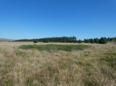
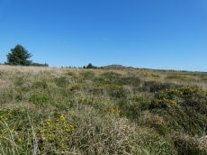
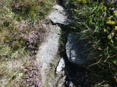
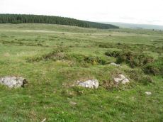
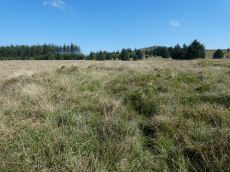
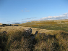
Prehistoric sites within 3km of SX 65400 78000
Guidance for walkers: The monuments featured in this database are archaeological treasures and need to be protected and preserved - please do not disturb any sites. Please check access and firing times before visiting sites, not all sites listed are on open access land. Firing ranges and boundaries of open access areas are marked on the OL28 OS Dartmoor Explorer map. Please stick to the country code and consider giving support to the numerous agencies that help to keep Dartmoor a fabulous natural and historic environment!
About the database listings: In all listings clicking on the photo or the site name will open a page for the site with a larger photo and further details from the database. The database now has over 6680 records covering nearly all publicly listed sites on Dartmoor including around 4800 round houses. This level of detail is of interest to archaeologists but tends to swamp listings of sites more likely to be of interest for walkers. For this reason, the listings default to around 550 core sites only. These are the stone circles, stone rows and the ring cairns listed by Turner. The default search radius is 2 km. The controls below the map can be used to start a new search by entering a 6- or 8-digit reference (without the prefix "SX"). The search radius can be specified and you can add incremental Display layers of detail on top of the core sites. If using a more detailed layer you will need to decrease the search radius to avoid getting hundreds of search results.
- Core sites Default listing of core sites consisting of stone circles & rows and some of the major ring cairns.
- Plus cairns adds approx. 1000 cairns and other minor sites not included in the core listings but excluding round houses.
- Plus round houses adds approx. 4800 round houses.
- Plus non-sites adds in the records for sites that no longer exist or are not prehistoric sites.
- Plus duplicates adds records excluded as duplicates. Those maybe duplicate records in external listings (e.g. the Historic Environment Records). For example, some sites have been identified as cairns in some listings and interpreted as round houses in other listings and both records appear.
These listings have incorporated, matched up and merged all of the records from all of the major archaeological listings including: Worth, Grinsell, Turner, Butler, Bill Radcliffe, Sandy Gerrard, Megalithic Portal, the National Monument Records and the Historic Environment Records. The author would like to thank Bill, Sandy, the lovely people both at Megalithic Portal (especially Anne Tate who did an amazing job to link listings) and at ACE Archaeology for collaborative work over the years to synchronise and correct listings across the various websites which now interlink. A culmination of years of work the final merger of cairn records took 3 months of cross referencing in 2017 the result being a snapshot of the records at that time. This data has in turn been refined since by field work and research. The round house data was supplied by Sandy Gerrard. Grid references are in order of accuracy: from Google Earth satellite, if visible and found, from a Garmin GPS reading, if visited by the author and from the literature otherwise. Individual site pages will state the source of the grid reference and provide satellite imagery. If a site listing lacks a photo it has not yet been visited by the author in which case the grid reference is from the literature.
Currently the database only includes sites which can be represented by a grid reference. Reaves are not included as they require GIS shape technology which is beyond the current capability of this system. To see the sources for the records, look at the tables on the resources menu. The database listings can also be viewed on a Google map and downloaded as GPS datasets for Garmin devices.
Corrections, or any feedback or suggestions are very welcome, email: info@dartmoorwalks.org.uk.
NOTE: Clicking on the icons for each monument in the map will give the name of the site. You can zoom in and out and drag the map around.
List of sites within 3km of SX 65400 78000
Bellever Tor N Round House
OS Map: SX 6486 7675
HER: MDV52774
ShortName: HT:Bellever 3
Nearby sites: SX 6486 7675
Distance: 1.36km
Bellever Tor N Round House
OS Map: SX 6474 7677
HER: MDV5917
ShortName: HT:Bellever 4
Nearby sites: SX 6474 7677
Distance: 1.40km
Riddon Ridge Reported Cist
OS Map: SX 6674 7658
HER: MDV26459
PMD: Riddon Ridge 2
ShortName: CN?Riddon Ri8
Grinsell: LYD 67c
Turner: A25
Notes: Hut circle or cairn? Radcliffe: "Grinsell lists this as a cist in his Table III with GR 6664 7657, but does not mention this in his List B. His grid reference differs from that of Turner, who does not mention a cist. SMR ref is 666 765. There is a hut circle near these grid references."
Nearby sites: SX 6674 7658
Distance: 1.95km
Bellever Tor N Round House
OS Map: SX 64616 76827
HER: MDV50111
ShortName: HT:Bellever 5
Nearby sites: SX 64616 76827
Distance: 1.41km
Bellever Tor 10 Reported Cairn
OS Map: SX 6417 7609
HER: MDV27221
ShortName: CN?Bellever 10
Nearby sites: SX 6417 7609
Distance: 2.27km
Bellever Tor N Round House
OS Map: SX 6479 7678
HER: MDV5918
ShortName: HT:Bellever 6
Nearby sites: SX 6479 7678
Distance: 1.36km
Lakehead Hill 15 Crop Mark
OS Map: SX 6448 7732
HER: MDV27258
ShortName: CN?Lakehead 15
Notes: Aerial Photograph
Nearby sites: SX 6448 7732
Distance: 1.14km
Bellever Tor N Round House
OS Map: SX 64805 76745
HER: MDV108181
ShortName: HT:Bellever 7
Nearby sites: SX 64805 76745
Distance: 1.39km
Stannon Bottom Cairn
OS Map: SX 6539 8060
HER: MDV6677
ShortName: CN?Stannon B1
Grinsell: LYD 30a
Notes: Three cairns noted on the edge of a hut circle settlement on Merripit Hill. Unclear whether these are ritual or clearance cairns as they may have been hut circles that have been covered with loose stone.
Nearby sites: SX 6539 8060
Distance: 2.60km
Bellever Tor N Round House
OS Map: SX 64813 76913
HER: MDV5880
ShortName: HT:Bellever 8
Nearby sites: SX 64813 76913
Distance: 1.24km
Bellever Tor N Round House
OS Map: SX 64657 76895
HER: MDV50113
ShortName: HT:Bellever 9
Nearby sites: SX 64657 76895
Distance: 1.33km
Bellever Tor N Round House
OS Map: SX 64475 76820
HER: MDV5883
ShortName: HT:Bellever 10
Nearby sites: SX 64475 76820
Distance: 1.50km
Bellever Tor N Round House
OS Map: SX 64894 76954
HER: MDV50116
ShortName: HT:Bellever 11
Nearby sites: SX 64894 76954
Distance: 1.16km
Pizwell Bridge (duplicate) Reported Cairn
OS Map: SX 672 775
HER: MDV53010
ShortName: CT?Pizwell B2
Notes: Probably duplicate of HER 5987
Nearby sites: SX 672 775
Distance: 1.87km
Bellever Tor N Round House
OS Map: SX 64876 76754
HER: MDV52774
ShortName: HT:Bellever 12
Nearby sites: SX 64876 76754
Distance: 1.35km
Stennen Hill 9 Reported Cairn
OS Map: SX 6257 7788
HER: MDV13520
ShortName: CNxStennen 9
Grinsell: LYD 48
Barrow Report: 57
Notes: Hut Circle NMR B. Barrow report 57: "Fifty-four feet from the centre of the last describedkistvaen, on a bearing S.3t'W., lies the centre of a retainingcircle of 16 feet 6 inches internal diameter, the lar5;est stoneof which is 7 feet by 6 inches on plan, and stands 3 feet inheight. There are but slight traces of the mound, and thereis no indication of a kistvaen." This is a duplicate of the record for the round house site 6512. NB. Worth & Grinsell name this Stennen Hill No.2 (It is Butler 9)
Nearby sites: SX 6257 7788
Distance: 2.83km
Bellever Tor N Round House
OS Map: SX 6488 7695
HER: MDV50115
ShortName: HT:Bellever 13
Nearby sites: SX 6488 7695
Distance: 1.17km
Bellever Tor N Round House
OS Map: SX 64395 76837
HER: MDV27672
ShortName: HT:Bellever 14
Nearby sites: SX 64395 76837
Distance: 1.54km
Stennen Hill 8 Reported Cairn
OS Map: SX 62525 77877
HER: MDV5848
ShortName: CN Stennen 8
Grinsell: LYD 50
Notes: Hut Circle NMR A. There are disturbed remains here within a prehistoric settlement. It seems likely these remains are of a round house.
Nearby sites: SX 62525 77877
Distance: 2.88km
Bellever Tor N Round House
OS Map: SX 6425 7690
HER: MDV27673
ShortName: HT:Bellever 15
Nearby sites: SX 6425 7690
Distance: 1.59km
Bellever Tor N Round House
OS Map: SX 64429 76738
HER: MDV27672
ShortName: HT:Bellever 16
Nearby sites: SX 64429 76738
Distance: 1.59km
Stennen Hill 6 Reported Cairn
OS Map: SX 62431 77794
HER: MDV5850
ShortName: CN Stennen 6
Grinsell: LYD 50b
Notes: Hut circle
Nearby sites: SX 62431 77794
Distance: 2.98km
Bellever Tor N Round House
OS Map: SX 6487 7675
HER: MDV52774
ShortName: HT:Bellever 17
Nearby sites: SX 6487 7675
Distance: 1.36km
Bellever Tor N Round House
OS Map: SX 64863 76759
HER: MDV52774
ShortName: HT:Bellever 18
Nearby sites: SX 64863 76759
Distance: 1.35km
Riddon Ridge (E Slope) Reported Cairn
OS Map: SX 668 766
HER: MDV-1
ShortName: CN?Riddon Ri6
Grinsell: LYD 67ai
Notes: Many hut circles in this area. Also could possibly be duplicate of NMR 442461. See LYD 67a
Nearby sites: SX 668 766
Distance: 1.98km
Bellever Tor N Round House
OS Map: SX 64479 76805
HER: MDV5882
ShortName: HT:Bellever 19
Nearby sites: SX 64479 76805
Distance: 1.51km
Laughter Tor Reported Cairn
OS Map: SX 6538 7532
HER: MDV-1
ShortName: CNxLaughter 1
Grinsell: LYD 68b
Notes: There is no evidence of a cairn at the W end of the alignment
Nearby sites: SX 6538 7532
Distance: 2.68km
Bellever Tor N Round House
OS Map: SX 6449 7674
HER: MDV5923
ShortName: HT:Bellever 20
Nearby sites: SX 6449 7674
Distance: 1.55km
Bellever Tor NE Round House
OS Map: SX 65008 76608
HER: MDV5999
ShortName: HT:Bellever 21
Nearby sites: SX 65008 76608
Distance: 1.45km
Bellever Tor S Round House
OS Map: SX 64118 75953
HER: MDV52775
ShortName: HT:Bellever 22
Nearby sites: SX 64118 75953
Distance: 2.42km
Dunnabridge Round House
OS Map: SX 63932 75633
HER: MDV5892
ShortName: HT:Dunnabrid1
Nearby sites: SX 63932 75633
Distance: 2.79km
Dunnabridge Round House
OS Map: SX 63910 75626
HER: MDV5892
ShortName: HT:Dunnabrid2
Nearby sites: SX 63910 75626
Distance: 2.80km
Dunnabridge Round House
OS Map: SX 63889 75631
HER: MDV5892
ShortName: HT:Dunnabrid3
Nearby sites: SX 63889 75631
Distance: 2.81km
Riddon Brake Round House
OS Map: SX 6669 7774
HER: MDV5984
ShortName: HT:Riddon Br1
Nearby sites: SX 6669 7774
Distance: 1.32km
Riddon Ridge Round House
OS Map: SX 66598 76630
HER: MDV27674
ShortName: HT:Riddon Ri1
Nearby sites: SX 66598 76630
Distance: 1.82km
Riddon Ridge Round House
OS Map: SX 6701 7602
HER: MDV64229
ShortName: HT:Riddon Ri2
Nearby sites: SX 6701 7602
Distance: 2.55km
Riddon Ridge Round House
OS Map: SX 66126 76451
ShortName: HT:Riddon Ri3
Nearby sites: SX 66126 76451
Distance: 1.71km
Riddon Ridge Round House
OS Map: SX 6614 7695
HER: MDV26462
ShortName: HT:Riddon Ri4
Nearby sites: SX 6614 7695
Distance: 1.28km
Riddon Ridge Round House
OS Map: SX 6620 7633
HER: MDV64224
ShortName: HT:Riddon Ri5
Nearby sites: SX 6620 7633
Distance: 1.85km
Riddon Ridge Round House
OS Map: SX 6627 7632
HER: MDV64225
ShortName: HT:Riddon Ri6
Nearby sites: SX 6627 7632
Distance: 1.89km
Riddon Ridge Round House
OS Map: SX 6611 7650
ShortName: HT:Riddon Ri7
Nearby sites: SX 6611 7650
Distance: 1.66km
Merripit Hill Round House
OS Map: SX 6588 8014
HER: MDV6678
ShortName: HT:Merripit 1
Nearby sites: SX 6588 8014
Distance: 2.19km
Riddon Ridge Round House
OS Map: SX 6659 7655
HER: MDV5985
ShortName: HT:Riddon Ri8
Nearby sites: SX 6659 7655
Distance: 1.88km
Merripit Hill Round House
OS Map: SX 66246 80225
HER: MDV6678
ShortName: HT:Merripit 2
Nearby sites: SX 66246 80225
Distance: 2.38km
Riddon Ridge Round House
OS Map: SX 6611 7653
HER: MDV64223
ShortName: HT:Riddon Ri9
Nearby sites: SX 6611 7653
Distance: 1.63km
Hill W of Grendon Farm Cairn Circle
OS Map: SX 6805 7835
HER: MDV6008
ShortName: CN:Hill W of1
Grinsell: WID 1a
Notes: The remains of a ring cairn are visible as overgrown small stones.
Nearby sites: SX 6805 7835
Distance: 2.67km
Riddon Ridge Round House
OS Map: SX 667 769
HER: MDV6089
ShortName: HT:Riddon Ri10
Nearby sites: SX 667 769
Distance: 1.70km
Riddon Ridge Round House
OS Map: SX 6671 7647
HER: MDV26459
ShortName: HT:Riddon Ri11
Nearby sites: SX 6671 7647
Distance: 2.01km
Riddon Ridge Round House
OS Map: SX 6676 7635
HER: MDV64227
ShortName: HT:Riddon Ri12
Nearby sites: SX 6676 7635
Distance: 2.14km
Riddon Ridge Round House
OS Map: SX 6691 7650
HER: MDV64226
ShortName: HT:Riddon Ri13
Nearby sites: SX 6691 7650
Distance: 2.13km
Riddon Ridge Round House
OS Map: SX 6697 7639
HER: MDV26458
ShortName: HT:Riddon Ri14
Nearby sites: SX 6697 7639
Distance: 2.25km
Riddon Ridge Round House
OS Map: SX 6640 7625
ShortName: HT:Riddon Ri15
Nearby sites: SX 6640 7625
Distance: 2.02km
Riddon Ridge Round House
OS Map: SX 6605 7671
HER: MDV64222
ShortName: HT:Riddon Ri16
Nearby sites: SX 6605 7671
Distance: 1.44km
Bellever Tor N.2 Cairn
OS Map: SX 6453 7686
HER: MDV52765
ShortName: CN:Bellever N2
Notes: "Low flat-topped cairn situated immediately outside the eastern edge of a settlement and field system on the gently sloping northern flank of Bellever Tor. The heather and moss covered mound measures 3.6 metres in diameter with a maximum height of 0.35 metres. It is probably sepulchral in origin and appears to be undisturbed."
Nearby sites: SX 6453 7686
Distance: 1.43km
Riddon Ridge Round House
OS Map: SX 6577 7694
HER: MDV64214
ShortName: HT:Riddon Ri17
Nearby sites: SX 6577 7694
Distance: 1.12km
Riddon Ridge summit Reported Cairn
OS Map: SX 6633 7663
HER: MDV19985
ShortName: CN:Riddon Ri1
Butler map: 18.1.23
Grinsell: LYD 67b
Nearby sites: SX 6633 7663
Distance: 1.66km
Lakehead Hill 14 Cairn
OS Map: SX 6496 7847
HER: MDV52768
ShortName: CN:Lakehead 14
Nearby sites: SX 6496 7847
Distance: 0.64km
Riddon Ridge Round House
OS Map: SX 6579 7699
HER: MDV64213
ShortName: HT:Riddon Ri18
Nearby sites: SX 6579 7699
Distance: 1.08km
Riddon Ridge N. Reported Cairn
OS Map: SX 66060 76860
HER: MDV64234
ShortName: CN Riddon Ri5
Butler map: 18.1.24
Notes: Listed by Butler as a cairn. This site is in an area of hut circles and is perhaps more likely a hut circle.
Nearby sites: SX 66060 76860
Distance: 1.32km
Riddon Ridge Round House
OS Map: SX 6581 7700
HER: MDV64212
ShortName: HT:Riddon Ri19
Nearby sites: SX 6581 7700
Distance: 1.08km
Riddon Corner Reported Cairn
OS Map: SX 6714 7636
ShortName: CN?Riddon Co1
Butler map: 18.2.7
Notes: "The cairn at 7 (8.0 x 1.0 m), 5 m from the field wall and close to a reave, is probably prehistoric. A slight depression in its flat suface suggests it has been dug and a track cutting across the eastern edge has also caused some slight damage. A pile of stones in a similiar relationship to the next reave to the south is more likely to be clearance from the field." Possibly visible on Lidar.
Nearby sites: SX 6714 7636
Distance: 2.39km
Riddon Ridge Round House
OS Map: SX 6596 7695
HER: MDV64215
ShortName: HT:Riddon Ri20
Nearby sites: SX 6596 7695
Distance: 1.19km
Riddon Ridge S.E. Reported Cist
OS Map: SX 6695 7635
HER: MDV129868
PMD: Riddon Ridge 1
ShortName: CT:Riddon Ri2
Butler map: 18.2.8
Grinsell: LYD 67a
Barrow Report: 33
Notes: HER suggests possibly located SX 668764. Locality only as not found. There is confusing ground evidence for the presence of a cairn in this area. There are several low, possibly stoney mounds but all are rather amorphous and resemble natural features. It is not possible to determine which is the feature examined by Burnard or that described by Butler (1991 136-137). LYD 67a? Possibly described in Barrow Report 33.
Nearby sites: SX 6695 7635
Distance: 2.26km
Riddon Ridge Round House
OS Map: SX 6599 7680
HER: MDV64221
ShortName: HT:Riddon Ri21
Nearby sites: SX 6599 7680
Distance: 1.34km
Riddon Ridge S. Cist
OS Map: SX 66780 76269
HER: MDV5986
PMD: RHR Stone
ShortName: CT:Riddon Ri3
Butler map: 18.2.9
Grinsell: LYD 67
Notes: (burnard) small cairn, previously rifled. On excavation, bottom and part of side wall of a small vase and a few sherd fragments found, in centre of a stone-lined receptacle. Stones of the cairn around the pit were packed at an inward angle, thus backing up the wall of the cavity. Much wood charcoal, one flint flake and a few pieces of spar found.
Nearby sites: SX 66780 76269
Distance: 2.21km
Riddon Ridge Round House
OS Map: SX 66115 76440
ShortName: HT:Riddon Ri22
Nearby sites: SX 66115 76440
Distance: 1.72km
Riddon Ridge E. Reported Cairn
OS Map: SX 6702 7722
ShortName: CNxRiddon Ri4
Butler map: 18.2.10
Notes: The mound appears to be a spoil heap of stones removed from short stretches of this reave.
Nearby sites: SX 6702 7722
Distance: 1.80km
Arch Tor 2 Reported Cairn
OS Map: SX 6361 7837
HER: MDV52787
ShortName: CN?Arch Tor 2
Notes: three small cairns
Nearby sites: SX 6361 7837
Distance: 1.83km
Riddon Ridge Round House
OS Map: SX 6605 7681
HER: MDV64219
ShortName: HT:Riddon Ri23
Nearby sites: SX 6605 7681
Distance: 1.36km
Braddon Lake 2 Cairn
OS Map: SX 6360 7981
HER: MDV52812
ShortName: CN:Braddon L2
Nearby sites: SX 6360 7981
Distance: 2.55km
Riddon Ridge Round House
OS Map: SX 6680 7634
HER: MDV64228
ShortName: HT:Riddon Ri24
Nearby sites: SX 6680 7634
Distance: 2.17km
Riddon Ridge Round House
OS Map: SX 6606 7692
HER: MDV64216
ShortName: HT:Riddon Ri25
Nearby sites: SX 6606 7692
Distance: 1.27km
Riddon Ridge Round House
OS Map: SX 6608 7688
HER: MDV64217
ShortName: HT:Riddon Ri26
Nearby sites: SX 6608 7688
Distance: 1.31km
Riddon Ridge Round House
OS Map: SX 6607 7646
HER: MDV5996
ShortName: HT:Riddon Ri27
Nearby sites: SX 6607 7646
Distance: 1.68km
Riddon Ridge Round House
OS Map: SX 66087 76490
ShortName: HT:Riddon Ri28
Nearby sites: SX 66087 76490
Distance: 1.66km
Assycombe Hill S.2 (duplicate) Reported Cairn
OS Map: SX 6627 8016
ShortName: CN:Assycombe6
Notes: NMR 916309 clearly refers to Butler's Assycombe Hill S.1 & S.2. The entry refers to Butler's coverage Vol 2 p. 26. It is clear from Butler that the NGR is SX 662 812. This is clear both from the listingat the end of Vol2 as well as from where they are marked on Butler's Map 26. The text states "The proximity of these two cairns on te summit of the ridge 400 m to the suth-west suggests these may have been the burial mounds of the community" i.e the Assycombe Hill South settlement. However, the NGR given in the NMR is SX 662802 which is 1 km to the south! This error has resulted in duplicate entries for the HER which has this pair of cairns at both locations. HER 54601 & 54602 are duplicates (with incorrect NGRs) of 61309 & 61310.
UPDATE 31/12/2022. HER record 54601 has been deleted. This duplicate record will be left in place - as it explains the duplication.
Nearby sites: SX 6627 8016
Distance: 2.33km
Riddon Ridge Round House
OS Map: SX 6610 7682
HER: MDV5983
ShortName: HT Riddon Ri29
Nearby sites: SX 6610 7682
Distance: 1.37km
Assycombe Hill S.1 (duplicate) Reported Cairn
OS Map: SX 6627 8016
ShortName: CN:Assycombe4
Notes: NMR 916309 clearly refers to Butler's Assycombe Hill S.1 & S.2. The entry refers to Butler's coverage Vol 2 p. 26. It is clear from Butler that the NGR is SX 662 812. This is clear both from the listingat the end of Vol2 as well as from where they are marked on Butler's Map 26. The text states "The proximity of these two cairns on te summit of the ridge 400 m to the suth-west suggests these may have been the burial mounds of the community" i.e the Assycombe Hill South settlement. However, the NGR given in the NMR is SX 662802 which is 1 km to the south! This error has resulted in duplicate entries for the HER which has this pair of cairns at both locations. HER 54601 & 54602 are duplicates (with incorrect NGRs) of 61309 & 61310.
UPDATE 31/12/2022. HER record 54602 has been deleted. This duplicate record will be left in place - as it explains the duplication.
Nearby sites: SX 6627 8016
Distance: 2.33km
Riddon Ridge Round House
OS Map: SX 6611 7689
HER: MDV64218
ShortName: HT:Riddon Ri30
Nearby sites: SX 6611 7689
Distance: 1.32km
Riddon Ridge Round House
OS Map: SX 6602 7679
HER: MDV64220
ShortName: HT:Riddon Ri31
Nearby sites: SX 6602 7679
Distance: 1.36km
Broad Down Cairn
OS Map: SX 6327 8007
HER: MDV54679
ShortName: CN:BroadDown2
Nearby sites: SX 6327 8007
Distance: 2.97km
Laughter Hole S Round House
OS Map: SX 66135 75425
HER: MDV26175
ShortName: HT:Laughter 1
Nearby sites: SX 66135 75425
Distance: 2.68km
Laughter Hole S Round House
OS Map: SX 66120 75245
HER: MDV66344
ShortName: HT:Laughter 2
Nearby sites: SX 66120 75245
Distance: 2.85km
Laughter Hole S Round House
OS Map: SX 6573 7513
HER: MDV66346
ShortName: HT:Laughter 3
Nearby sites: SX 6573 7513
Distance: 2.89km
Laughter Hole S Round House
OS Map: SX 6583 7562
HER: MDV26179
ShortName: HT:Laughter 4
Nearby sites: SX 6583 7562
Distance: 2.42km
Laughter Hole S Round House
OS Map: SX 66092 75257
HER: MDV66343
ShortName: HT:Laughter 5
Nearby sites: SX 66092 75257
Distance: 2.83km
Laughter Hole S Round House
OS Map: SX 66105 75455
HER: MDV26157
ShortName: HT:Laughter 6
Nearby sites: SX 66105 75455
Distance: 2.64km
Laughter Hole S Round House
OS Map: SX 66115 75485
HER: MDV26175
ShortName: HT:Laughter 7
Nearby sites: SX 66115 75485
Distance: 2.61km
Laughter Tor Round House
OS Map: SX 65289 75770
HER: MDV66339
ShortName: HT:Laughter 9
Nearby sites: SX 65289 75770
Distance: 2.23km
Black Newtake Round House
OS Map: SX 6395 7616
HER: MDV28594
ShortName: HT:Black New1
Nearby sites: SX 6395 7616
Distance: 2.34km
Laughter Tor E Round House
OS Map: SX 65504 75645
HER: MDV6020
ShortName: HT:Laughter 10
Nearby sites: SX 65504 75645
Distance: 2.36km
Black Newtake Round House
OS Map: SX 63718 76306
HER: MDV5886
ShortName: HT:Black New2
Nearby sites: SX 63718 76306
Distance: 2.39km
Laughter Tor E Round House
OS Map: SX 6551 7565
HER: MDV6020
ShortName: HT:Laughter 11
Nearby sites: SX 6551 7565
Distance: 2.35km
Black Newtake Round House
OS Map: SX 63708 76307
HER: MDV5886
ShortName: HT:Black New3
Nearby sites: SX 63708 76307
Distance: 2.39km
Laughter Tor E Round House
OS Map: SX 65554 75655
HER: MDV6020
ShortName: HT:Laughter 12
Nearby sites: SX 65554 75655
Distance: 2.35km
Black Newtake Round House
OS Map: SX 63857 75783
HER: MDV27670
ShortName: HT:Black New4
Nearby sites: SX 63857 75783
Distance: 2.70km
Laughter Tor E Round House
OS Map: SX 65559 75659
HER: MDV6020
ShortName: HT:Laughter 13
Nearby sites: SX 65559 75659
Distance: 2.35km
Laughter Tor E Round House
OS Map: SX 6550 7564
HER: MDV6020
ShortName: HT:Laughter 14
Nearby sites: SX 6550 7564
Distance: 2.36km
Stannon Round House
OS Map: SX 6534 8048
HER: MDV19553
ShortName: HT:Stannon1
Nearby sites: SX 6534 8048
Distance: 2.48km
Laughter Tor N Round House
OS Map: SX 6524 7583
HER: MDV66338
ShortName: HT:Laughter 15
Nearby sites: SX 6524 7583
Distance: 2.18km
Stannon Hill Round House
OS Map: SX 6542 8014
HER: MDV27760
ShortName: HT:Stannon H1
Nearby sites: SX 6542 8014
Distance: 2.14km
Laughter Tor N Round House
OS Map: SX 6502 7608
HER: MDV6011
ShortName: HT:Laughter 16
Nearby sites: SX 6502 7608
Distance: 1.96km
Stannon Tor S Round House
OS Map: SX 6457 8056
HER: MDV27275
ShortName: HT:Stannon T1
Nearby sites: SX 6457 8056
Distance: 2.69km
Laughter Tor N Round House
OS Map: SX 6506 7609
HER: MDV5998
ShortName: HT:Laughter 17
Nearby sites: SX 6506 7609
Distance: 1.94km
Laughter Tor N Round House
OS Map: SX 65064 76116
ShortName: HT:Laughter 18
Nearby sites: SX 65064 76116
Distance: 1.91km
Red Barrows 2 Cairn
OS Map: SX 67709 79666
HER: MDV6006
ShortName: CN Red Barro2
Butler map: 24.2.2
Grinsell: MAN 6
Barrow Report: 56
Nearby sites: SX 67709 79666
Distance: 2.85km
Laughter Tor N Round House
OS Map: SX 65115 76035
HER: MDV26449
ShortName: HT:Laughter 19
Nearby sites: SX 65115 76035
Distance: 1.99km
Red Barrows 3 Cairn
OS Map: SX 67694 79690
HER: MDV6005
ShortName: CN Red Barro3
Butler map: 24.2.3
Grinsell: MAN 7
Nearby sites: SX 67694 79690
Distance: 2.85km
Riddon Ridge 7 Reported Cairn
OS Map: SX 6674 7658
HER: MDV16536
ShortName: CNxRiddon Ri7
Turner: D1
Notes: Hut Circle
Nearby sites: SX 6674 7658
Distance: 1.95km
Laughter Tor N Round House
OS Map: SX 65145 76025
HER: MDV26449
ShortName: HT:Laughter 20
Nearby sites: SX 65145 76025
Distance: 1.99km
Red Barrows 4 Cairn
OS Map: SX 67695 79705
HER: MDV6004
ShortName: CN Red Barro4
Butler map: 24.2.4
Grinsell: MAN 8
Nearby sites: SX 67695 79705
Distance: 2.86km
Laughter Tor N Round House
OS Map: SX 652 762
HER: MDV6012
ShortName: HT:Laughter 21
Nearby sites: SX 652 762
Distance: 1.81km
Laughter Tor N Round House
OS Map: SX 65227 75954
HER: MDV6081
ShortName: HT:Laughter 22
Nearby sites: SX 65227 75954
Distance: 2.05km
Laughter Tor N Round House
OS Map: SX 65255 76285
HER: MDV26451
ShortName: HT:Laughter 23
Nearby sites: SX 65255 76285
Distance: 1.72km
Laughter Tor N Round House
OS Map: SX 6527 7637
HER: MDV26450
ShortName: HT:Laughter 24
Nearby sites: SX 6527 7637
Distance: 1.64km
Laughter Tor N Round House
OS Map: SX 65275 76265
HER: MDV26451
ShortName: HT:Laughter 25
Nearby sites: SX 65275 76265
Distance: 1.74km
Laughter Tor N Round House
OS Map: SX 6558 7659
HER: MDV26452
ShortName: HT:Laughter 26
Nearby sites: SX 6558 7659
Distance: 1.42km
Laughter Tor N Round House
OS Map: SX 65243 75961
HER: MDV6082
ShortName: HT:Laughter 27
Nearby sites: SX 65243 75961
Distance: 2.05km
Laughter Tor SW Round House
OS Map: SX 6490 7528
HER: MDV66368
ShortName: HT:Laughter 28
Nearby sites: SX 6490 7528
Distance: 2.77km
Laughter Tor W Round House
OS Map: SX 65028 75775
HER: MDV66335
ShortName: HT:Laughter 29
Nearby sites: SX 65028 75775
Distance: 2.26km
Laughter Tor W Round House
OS Map: SX 65006 75775
HER: MDV66336
ShortName: HT:Laughter 30
Nearby sites: SX 65006 75775
Distance: 2.26km
Higher Cherrybrook Round House
OS Map: SX 6359 7707
HER: MDV27226
ShortName: HT:Higher Ch1
Nearby sites: SX 6359 7707
Distance: 2.03km
Laughter Tor W Round House
OS Map: SX 6477 7580
HER: MDV27255
ShortName: HT:Laughter 31
Nearby sites: SX 6477 7580
Distance: 2.29km
Higher Cherrybrook Round House
OS Map: SX 6356 7738
HER: MDV5973
ShortName: HT:Higher Ch2
Nearby sites: SX 6356 7738
Distance: 1.94km
Rowtor Brook 1 Cairn
OS Map: SX 62786 78626
HER: MDV5837
ShortName: CN:Rowtor Br1
Butler map: 27.17.1
Grinsell: LYD 44
Nearby sites: SX 62786 78626
Distance: 2.69km
Rowtor Brook 2 Cairn
OS Map: SX 62702 78664
HER: MDV5836
ShortName: CN:Rowtor Br2
Butler map: 27.17.2
Grinsell: LYD 43
Nearby sites: SX 62702 78664
Distance: 2.78km
Chittaford Down 2 Reported Cist
OS Map: SX 6354 7921
HER: MDV19983
ShortName: CT?Chittafor2
Butler map: 27.18.2
Grinsell: LYD 38a
Notes: Reported by Prowse as cist 1891 - cist no longer visible
Nearby sites: SX 6354 7921
Distance: 2.22km
Higher White Tor SE Round House
OS Map: SX 62515 77665
HER: MDV60331
ShortName: HT:Higher Wh2
Nearby sites: SX 62515 77665
Distance: 2.90km
Lakehead Hill 10 Reported Cairn
OS Map: SX 6504 7826
HER: MDV5921
ShortName: CN?Lakehead 10
Butler map: 27.19.10
Grinsell: LYD 51a
Barrow Report: 55
Notes: There is no ground evidence to suggest the presence of the cairn noted by Worth.
Nearby sites: SX 6504 7826
Distance: 0.44km
Higher White Tor SE Round House
OS Map: SX 62525 77675
HER: MDV27215
ShortName: HT:Higher Wh3
Nearby sites: SX 62525 77675
Distance: 2.89km
Lakehead Hill 11 Reported Cairn
OS Map: SX 6477 7740
HER: MDV112862
ShortName: CNxLakehead 11
Butler map: 27.19.11
Grinsell: LYD 57a
Notes: Probably destroyed by afforestation
Nearby sites: SX 6477 7740
Distance: 0.87km
Higher White Tor SE Round House
OS Map: SX 62525 77655
HER: MDV60332
ShortName: HT:Higher Wh4
Nearby sites: SX 62525 77655
Distance: 2.90km
Lakehead Hill 12 Reported Cairn
OS Map: SX 6477 7740
HER: MDV112862
ShortName: CNxLakehead 12
Butler map: 27.19.12
Grinsell: LYD 57b
Notes: Probably destroyed by afforestation
Nearby sites: SX 6477 7740
Distance: 0.87km
Higher White Tor SE Round House
OS Map: SX 62555 77885
HER: MDV13520
ShortName: HT:Higher Wh5
Nearby sites: SX 62555 77885
Distance: 2.85km
Lakehead Hill 13 Reported Cairn
OS Map: SX 6477 7740
HER: MDV112862
ShortName: CNxLakehead 13
Butler map: 27.19.13
Grinsell: LYD 57c
Notes: Probably destroyed by afforestation
Nearby sites: SX 6477 7740
Distance: 0.87km
Lakehead Hill S Round House
Prehistoric Dartmoor Walks: Dartmoor Site: Lakehead Hill
OS Map: SX 64593 77299
HER: MDV5876
Megalithic Portal: 24378
ShortName: HT Lakehead 3
Notes: Lakehead Hill South Hut Circle
Nearby sites: SX 64593 77299
Distance: 1.07km
Higher White Tor SE Round House
OS Map: SX 62485 77625
HER: MDV60334
ShortName: HT:Higher Wh7
Nearby sites: SX 62485 77625
Distance: 2.94km
Higher White Tor SE Round House
OS Map: SX 62515 77685
HER: MDV60329
ShortName: HT:Higher Wh8
Nearby sites: SX 62515 77685
Distance: 2.90km
Higher White Tor SE Round House
OS Map: SX 62505 77665
HER: MDV60333
ShortName: HT:Higher Wh9
Nearby sites: SX 62505 77665
Distance: 2.91km
Bellever Tor 5 Cairn Circle
OS Map: SX 63859 75989
ShortName: CN Bellever 5
Butler map: 27.20.5
Notes: This record used to link to HER record MDV 5889 but that is clearly Bellever Tor 4 (ring cairn). This site is mentioned within that listing but it is a seprate monument with no HER record. It needs its own record. NB. Butler cairns 4 and 5 had previously been transposed in the listings here. The original records for both have been retained and the Butler number corrected and the grid references corrected. This was previously listed as Butler cairn 4 and is now listed correctly as cairn 5. See also: Dartmoor Explorations: Antiquities of Black Newtake and Environs
Nearby sites: SX 63859 75989
Distance: 2.53km
Higher White Tor SE Round House
OS Map: SX 62421 77792
HER: MDV27666
ShortName: HT:Higher Wh10
Nearby sites: SX 62421 77792
Distance: 2.99km
Higher White Tor SE Round House
OS Map: SX 6241 7782
HER: MDV27666
ShortName: HT:Higher Wh11
Nearby sites: SX 6241 7782
Distance: 3.00km
Higher White Tor SE Round House
OS Map: SX 62418 77845
HER: MDV27666
ShortName: HT:Higher Wh12
Nearby sites: SX 62418 77845
Distance: 2.99km
Bellever Tor 7 Reported Cairn
OS Map: SX 63866 75782
HER: MDV5951
ShortName: CN-Bellever 7
Butler map: 27.20.7
Grinsell: LYD 63
Turner: A40
Barrow Report: 57
Notes: Probably a hut circle
Nearby sites: SX 63866 75782
Distance: 2.70km
Higher White Tor SE Round House
OS Map: SX 62515 77875
HER: MDV5848
ShortName: HT:Higher Wh13
Nearby sites: SX 62515 77875
Distance: 2.89km
Laughter Tor Stone Row Cairn
OS Map: SX 6522 7538
HER: MDV66340
ShortName: CN:Laughter 5
Butler map: 28.12
Grinsell: LYD 68a
Barrow Report: 22
Nearby sites: SX 6522 7538
Distance: 2.63km
Laughter Tor S. (8) Reported Cairn
Prehistoric Dartmoor Walks: Dartmoor Site: Laughter Tor Stone Row
OS Map: SX 653 755
HER: MDV6083
ShortName: CN?Laughter 4
Butler map: 28.12
Barrow Report: 22 56
Notes: 8 small cairns recorded by Burnard in 1903 - one contained almost a wheelbarrow full of charcoal. These can no longer be located.
Nearby sites: SX 653 755
Distance: 2.50km
Bellever Rock Shelter
OS Map: SX 644 765
HER: MDV5941
ShortName: RS Bellever
Notes: "Bellever tor. Flint flakes found under a boulder near the summit of the tor. Narrow cleft between two large boulders investigated. On excavation the rock floor of the shelter was found to be 762mm under the grass surface, with the foundation stones of a wall which closed the north west end. Near this wall was a large fire or cooking hole, full of peat, charcoal and ashes, occupying a natural depression in the floor. Flint flake was found on the floor and 66 others on a ledge of rock which ran under the boulder on the south side of the shelter. Entrance protected by a large boulder with a passage on each side. Easily roofed in with thatch of heather or rushes. Earth found on floor was composed of granite grit mixed with black soil, probably from the roof. No wood charcoal or potsherds found. The flints are mainly large thin flakes mostly from chalk, many show the bulb of percussion, a few only have secondary working. Best examples are a skin scraper, a notched scraper and a borer of cherty flint."
Nearby sites: SX 644 765
Distance: 1.80km
Arch Tor Round House
OS Map: SX 6345 7795
HER: MDV57555
ShortName: HT:Arch Tor1
Nearby sites: SX 6345 7795
Distance: 1.95km
Arch Tor Round House
OS Map: SX 6326 7784
HER: MDV60263
ShortName: HT:Arch Tor2
Nearby sites: SX 6326 7784
Distance: 2.15km
Arch Tor Round House
OS Map: SX 6326 7781
HER: MDV60264
ShortName: HT:Arch Tor3
Nearby sites: SX 6326 7781
Distance: 2.15km
Arch Tor Round House
OS Map: SX 6326 7780
HER: MDV57554
ShortName: HT:Arch Tor4
Nearby sites: SX 6326 7780
Distance: 2.15km
Arch Tor Round House
OS Map: SX 6332 7784
HER: MDV60266
ShortName: HT:Arch Tor5
Nearby sites: SX 6332 7784
Distance: 2.09km
Arch Tor Round House
OS Map: SX 6342 7786
HER: MDV60268
ShortName: HT:Arch Tor6
Nearby sites: SX 6342 7786
Distance: 1.98km
Arch Tor Round House
OS Map: SX 6344 7786
HER: MDV60267
ShortName: HT:Arch Tor7
Nearby sites: SX 6344 7786
Distance: 1.96km
Arch Tor Round House
OS Map: SX 6346 7796
HER: MDV60270
ShortName: HT:Arch Tor8
Nearby sites: SX 6346 7796
Distance: 1.94km
Arch Tor Round House
OS Map: SX 6357 7809
HER: MDV60273
ShortName: HT:Arch Tor9
Nearby sites: SX 6357 7809
Distance: 1.83km
Arch Tor Round House
OS Map: SX 6354 7814
HER: MDV60274
ShortName: HT:Arch Tor10
Nearby sites: SX 6354 7814
Distance: 1.87km
Arch Tor Round House
OS Map: SX 6342 7784
HER: MDV60269
ShortName: HT:Arch Tor11
Nearby sites: SX 6342 7784
Distance: 1.99km
Arch Tor Round House
OS Map: SX 6356 7816
HER: MDV60275
ShortName: HT:Arch Tor12
Nearby sites: SX 6356 7816
Distance: 1.85km
Chittaford Down Round House
OS Map: SX 643 798
HER: MDV5943
ShortName: HT:Chittafor1
Notes: This entry was originally assigned SX 63000 79000 but the HER record has SX 643 798 - this has now been corrected.
Nearby sites: SX 643 798
Distance: 1.49km
Arch Tor Round House
OS Map: SX 6353 7806
HER: MDV60272
ShortName: HT:Arch Tor13
Nearby sites: SX 6353 7806
Distance: 1.87km
Chittaford Down Round House
OS Map: SX 63702 79408
HER: MDV12753
ShortName: HT:Chittafor2
Nearby sites: SX 63702 79408
Distance: 2.21km
Arch Tor Round House
OS Map: SX 6350 7803
HER: MDV60271
ShortName: HT:Arch Tor14
Nearby sites: SX 6350 7803
Distance: 1.90km
Chittaford Down Round House
OS Map: SX 6350 7936
HER: MDV20060
ShortName: HT:Chittafor3
Nearby sites: SX 6350 7936
Distance: 2.34km
Merripit Hill Cairn
OS Map: SX 66359 79926
HER: MDV103610
ShortName: CN:Merripit
Nearby sites: SX 66359 79926
Distance: 2.15km
Merripit Hill Clearance Cairn
OS Map: SX 6575 8044
HER: MDV19555
ShortName: CN?Merripit
Grinsell: B:LYD 30b
Notes: On the summit of Merripit Hill is a prominent mound representing an infilled mine shaft enclosed by debris
Nearby sites: SX 6575 8044
Distance: 2.46km
Lower Broadun Round House
OS Map: SX 63856 80115
HER: MDV6805
ShortName: HT:Lower Bro1
Nearby sites: SX 63856 80115
Distance: 2.62km
Lower Broadun Round House
OS Map: SX 63859 80080
HER: MDV6805
ShortName: HT:Lower Bro2
Nearby sites: SX 63859 80080
Distance: 2.59km
Lower Broadun Round House
OS Map: SX 63870 80113
HER: MDV6805
ShortName: HT:Lower Bro3
Nearby sites: SX 63870 80113
Distance: 2.61km
Kraps Ring Round House
OS Map: SX 64389 78070
HER: MDV52760
ShortName: HT:Kraps Rin1
Nearby sites: SX 64389 78070
Distance: 1.01km
Kraps Ring Round House
OS Map: SX 64371 78100
HER: MDV5929
ShortName: HT:Kraps Rin2
Nearby sites: SX 64371 78100
Distance: 1.03km
Kraps Ring Round House
OS Map: SX 64404 78132
HER: MDV5861
ShortName: HT:Kraps Rin3
Nearby sites: SX 64404 78132
Distance: 1.00km
Kraps Ring Round House
OS Map: SX 64408 78143
HER: MDV5861
ShortName: HT:Kraps Rin4
Nearby sites: SX 64408 78143
Distance: 1.00km
Kraps Ring Round House
OS Map: SX 64418 78120
HER: MDV5861
ShortName: HT:Kraps Rin5
Nearby sites: SX 64418 78120
Distance: 0.99km
Kraps Ring Round House
OS Map: SX 64425 78104
HER: MDV5861
ShortName: HT:Kraps Rin6
Nearby sites: SX 64425 78104
Distance: 0.98km
Kraps Ring Round House
OS Map: SX 64431 78174
HER: MDV5861
ShortName: HT:Kraps Rin7
Nearby sites: SX 64431 78174
Distance: 0.98km
Broadun Round House
OS Map: SX 63565 79925
HER: MDV5946
ShortName: HT:Broadun 1
Nearby sites: SX 63565 79925
Distance: 2.66km
Kraps Ring Round House
OS Map: SX 64431 78143
HER: MDV5861
ShortName: HT:Kraps Rin8
Nearby sites: SX 64431 78143
Distance: 0.98km
Broadun Round House
OS Map: SX 63508 79991
HER: MDV5946
ShortName: HT:Broadun 2
Nearby sites: SX 63508 79991
Distance: 2.75km
Kraps Ring Round House
OS Map: SX 64433 78132
HER: MDV5861
ShortName: HT:Kraps Rin9
Nearby sites: SX 64433 78132
Distance: 0.98km
Broadun Round House
OS Map: SX 63513 80031
HER: MDV5946
ShortName: HT:Broadun 3
Nearby sites: SX 63513 80031
Distance: 2.77km
Kraps Ring Round House
OS Map: SX 64436 78122
HER: MDV5861
ShortName: HT:Kraps Rin10
Nearby sites: SX 64436 78122
Distance: 0.97km
Broadun Round House
OS Map: SX 63515 79949
HER: MDV5946
ShortName: HT:Broadun 4
Nearby sites: SX 63515 79949
Distance: 2.71km
Kraps Ring Round House
OS Map: SX 64470 78098
HER: MDV5861
ShortName: HT:Kraps Rin11
Nearby sites: SX 64470 78098
Distance: 0.94km
Broadun Round House
OS Map: SX 63526 80038
HER: MDV5946
ShortName: HT:Broadun 5
Nearby sites: SX 63526 80038
Distance: 2.77km
Kraps Ring Round House
OS Map: SX 64486 78110
HER: MDV5861
ShortName: HT:Kraps Rin12
Nearby sites: SX 64486 78110
Distance: 0.92km
Broadun Round House
OS Map: SX 63524 79954
HER: MDV5946
ShortName: HT:Broadun 6
Nearby sites: SX 63524 79954
Distance: 2.71km
Kraps Ring Round House
OS Map: SX 64439 78154
HER: MDV5861
ShortName: HT:Kraps Rin13
Nearby sites: SX 64439 78154
Distance: 0.97km
Broadun Round House
OS Map: SX 63538 79980
HER: MDV5946
ShortName: HT:Broadun 7
Nearby sites: SX 63538 79980
Distance: 2.72km
Broadun Round House
OS Map: SX 63527 79931
HER: MDV5946
ShortName: HT:Broadun 8
Nearby sites: SX 63527 79931
Distance: 2.69km
Broadun Round House
OS Map: SX 63536 79943
HER: MDV5946
ShortName: HT:Broadun 9
Nearby sites: SX 63536 79943
Distance: 2.69km
Broadun Round House
OS Map: SX 6354 7988
HER: MDV5946
ShortName: HT:Broadun 10
Nearby sites: SX 6354 7988
Distance: 2.64km
Broadun Round House
OS Map: SX 63542 79934
HER: MDV5946
ShortName: HT:Broadun 11
Nearby sites: SX 63542 79934
Distance: 2.68km
Broadun Round House
OS Map: SX 63548 79946
HER: MDV5946
ShortName: HT:Broadun 12
Nearby sites: SX 63548 79946
Distance: 2.69km
Broadun Round House
OS Map: SX 6355 7999
HER: MDV5946
ShortName: HT:Broadun 13
Nearby sites: SX 6355 7999
Distance: 2.72km
Broadun Round House
OS Map: SX 63548 79894
HER: MDV5946
ShortName: HT:Broadun 14
Nearby sites: SX 63548 79894
Distance: 2.65km
Broadun Round House
OS Map: SX 63505 79996
HER: MDV5946
ShortName: HT:Broadun 15
Nearby sites: SX 63505 79996
Distance: 2.75km
Broadun Round House
OS Map: SX 63590 79972
HER: MDV5946
ShortName: HT:Broadun 16
Nearby sites: SX 63590 79972
Distance: 2.68km
Broadun Round House
OS Map: SX 63672 79907
HER: MDV5946
ShortName: HT:Broadun 17
Nearby sites: SX 63672 79907
Distance: 2.57km
Broadun Round House
OS Map: SX 63669 79881
HER: MDV5946
ShortName: HT:Broadun 18
Nearby sites: SX 63669 79881
Distance: 2.56km
Broadun Round House
OS Map: SX 63642 79836
HER: MDV5946
ShortName: HT:Broadun 19
Nearby sites: SX 63642 79836
Distance: 2.54km
Broadun Round House
OS Map: SX 63626 79975
HER: MDV5946
ShortName: HT:Broadun 20
Nearby sites: SX 63626 79975
Distance: 2.65km
Broadun Round House
OS Map: SX 63616 79965
HER: MDV5946
ShortName: HT:Broadun 21
Nearby sites: SX 63616 79965
Distance: 2.65km
Broadun Round House
OS Map: SX 63551 79978
HER: MDV5946
ShortName: HT:Broadun 22
Nearby sites: SX 63551 79978
Distance: 2.71km
Broadun Round House
OS Map: SX 63590 79907
HER: MDV5946
ShortName: HT:Broadun 23
Nearby sites: SX 63590 79907
Distance: 2.63km
Broadun Round House
OS Map: SX 63557 79909
HER: MDV5946
ShortName: HT:Broadun 24
Nearby sites: SX 63557 79909
Distance: 2.65km
Broadun Round House
OS Map: SX 63586 79921
HER: MDV5946
ShortName: HT:Broadun 25
Nearby sites: SX 63586 79921
Distance: 2.64km
Broadun Round House
OS Map: SX 63583 79860
HER: MDV5946
ShortName: HT:Broadun 26
Nearby sites: SX 63583 79860
Distance: 2.60km
Broadun Round House
OS Map: SX 63584 79942
HER: MDV5946
ShortName: HT:Broadun 27
Nearby sites: SX 63584 79942
Distance: 2.66km
Roundy Park, gate south of Reported Cist
OS Map: SX 6396 7948
HER: MDV71274
ShortName: CT?Roundy Pa2
Notes: Possible cist near a gate in the fence.
Nearby sites: SX 6396 7948
Distance: 2.06km
Broadun Round House
OS Map: SX 63574 79901
HER: MDV5946
ShortName: HT:Broadun 28
Nearby sites: SX 63574 79901
Distance: 2.64km
Bellever Tor (site of) Reported Cist
OS Map: SX 64330 76764
HER: MDV5953
PMD: Bellever Settlement
ShortName: CT-Bellever 11
Notes: Two parallel boulders, a natural occurence, protrude from the long grass in the vicinity of Worth's reference but no cist could be identified.
Nearby sites: SX 64330 76764
Distance: 1.63km
Broadun Round House
OS Map: SX 63572 79931
HER: MDV5946
ShortName: HT:Broadun 29
Nearby sites: SX 63572 79931
Distance: 2.66km
Broadun Round House
OS Map: SX 63527 80038
HER: MDV5946
ShortName: HT:Broadun 30
Nearby sites: SX 63527 80038
Distance: 2.77km
Broadun Round House
OS Map: SX 63596 79940
HER: MDV5946
ShortName: HT:Broadun 31
Nearby sites: SX 63596 79940
Distance: 2.65km
Broadun Round House
OS Map: SX 63465 80012
HER: MDV5946
ShortName: HT:Broadun 32
Nearby sites: SX 63465 80012
Distance: 2.79km
Broadun Round House
OS Map: SX 63504 79973
HER: MDV5946
ShortName: HT:Broadun 33
Nearby sites: SX 63504 79973
Distance: 2.74km
Broadun Round House
OS Map: SX 63531 80014
HER: MDV5946
ShortName: HT:Broadun 34
Nearby sites: SX 63531 80014
Distance: 2.75km
Broadun Round House
OS Map: SX 63502 79993
HER: MDV5946
ShortName: HT:Broadun 35
Nearby sites: SX 63502 79993
Distance: 2.75km
Broadun Round House
OS Map: SX 63491 79981
HER: MDV5946
ShortName: HT:Broadun 36
Nearby sites: SX 63491 79981
Distance: 2.75km
Broadun Round House
OS Map: SX 63498 79915
HER: MDV5946
ShortName: HT:Broadun 37
Nearby sites: SX 63498 79915
Distance: 2.70km
Broadun Round House
OS Map: SX 63470 79944
HER: MDV5946
ShortName: HT:Broadun 38
Nearby sites: SX 63470 79944
Distance: 2.74km
Broadun Round House
OS Map: SX 63494 79930
HER: MDV5946
ShortName: HT:Broadun 39
Nearby sites: SX 63494 79930
Distance: 2.71km
Lakehed Hill (site of) Reported Cist
OS Map: SX 6439 7728
HER: MDV5877
PMD: Lych Way
ShortName: CT?Lakehed H1
Grinsell: LYD 58a
Notes: Depicted on historic maps, this has not been located in modern times.
Nearby sites: SX 6439 7728
Distance: 1.24km
Broadun Round House
OS Map: SX 63458 79957
HER: MDV5946
ShortName: HT:Broadun 40
Nearby sites: SX 63458 79957
Distance: 2.76km
Broadun Round House
OS Map: SX 63455 80001
HER: MDV5946
ShortName: HT:Broadun 41
Nearby sites: SX 63455 80001
Distance: 2.79km
Lakehead Hill 16 (site of) Reported Cist
OS Map: SX 645 778
HER: MDV61774
PMD: Lakehead Hill
ShortName: CNxLakehead 16
Notes: Under the huge roots of a recently fallen tree, with a semicircle of spaced stones, a central slab and a capstone entwined in the roots. The finder no longer believes this to be a cist. The compiler could find nothing that meets the description.
Nearby sites: SX 645 778
Distance: 0.92km
Broadun Round House
OS Map: SX 63449 79986
HER: MDV5946
ShortName: HT:Broadun 42
Nearby sites: SX 63449 79986
Distance: 2.78km
Broadun Round House
OS Map: SX 63433 79984
HER: MDV5946
ShortName: HT:Broadun 43
Nearby sites: SX 63433 79984
Distance: 2.79km
Broadun Round House
OS Map: SX 63502 79943
HER: MDV5946
ShortName: HT:Broadun 44
Nearby sites: SX 63502 79943
Distance: 2.72km
Broadun Round House
OS Map: SX 63504 80009
HER: MDV5946
ShortName: HT:Broadun 45
Nearby sites: SX 63504 80009
Distance: 2.76km
Broadun Round House
OS Map: SX 63470 79917
HER: MDV5946
ShortName: HT:Broadun 46
Nearby sites: SX 63470 79917
Distance: 2.72km
Broadun Ring Round House
OS Map: SX 63689 80171
HER: MDV6746
ShortName: HT:Broadun R1
Nearby sites: SX 63689 80171
Distance: 2.76km
Broadun Ring Round House
OS Map: SX 63702 80224
HER: MDV6746
ShortName: HT:Broadun R2
Nearby sites: SX 63702 80224
Distance: 2.80km
Broadun Ring Round House
OS Map: SX 63692 80211
HER: MDV6746
ShortName: HT:Broadun R3
Nearby sites: SX 63692 80211
Distance: 2.79km
Broadun Ring Round House
OS Map: SX 63696 80226
HER: MDV6746
ShortName: HT:Broadun R4
Nearby sites: SX 63696 80226
Distance: 2.80km
Braddon Lake 1 Cairn
OS Map: SX 63490 79624
HER: MDV20242
ShortName: CN:Braddon L1
Nearby sites: SX 63490 79624
Distance: 2.51km
Broadun Ring Round House
OS Map: SX 63704 80193
HER: MDV6746
ShortName: HT:Broadun R5
Nearby sites: SX 63704 80193
Distance: 2.77km
Broadun Ring Round House
OS Map: SX 63707 80227
HER: MDV6746
ShortName: HT:Broadun R6
Nearby sites: SX 63707 80227
Distance: 2.80km
Hartland Tor W Reported Cairn
OS Map: SX 6395 7988
HER: MDV20473
ShortName: CNxHartland 2
Nearby sites: SX 6395 7988
Distance: 2.37km
Broadun Ring Round House
OS Map: SX 63709 80133
HER: MDV6746
ShortName: HT:Broadun R7
Nearby sites: SX 63709 80133
Distance: 2.72km
Broadun Ring Round House
OS Map: SX 63728 80241
HER: MDV6746
ShortName: HT:Broadun R8
Nearby sites: SX 63728 80241
Distance: 2.80km
Broadun Ring Round House
OS Map: SX 63705 80229
HER: MDV6746
ShortName: HT:Broadun R9
Nearby sites: SX 63705 80229
Distance: 2.80km
Broadun Ring Round House
OS Map: SX 63720 80137
HER: MDV6746
ShortName: HT:Broadun R10
Nearby sites: SX 63720 80137
Distance: 2.72km
Broadun Ring Round House
OS Map: SX 63723 80225
HER: MDV6746
ShortName: HT:Broadun R11
Nearby sites: SX 63723 80225
Distance: 2.79km
Broadun Ring Round House
OS Map: SX 63732 80239
HER: MDV6746
ShortName: HT:Broadun R12
Nearby sites: SX 63732 80239
Distance: 2.79km
Broadun Ring Round House
OS Map: SX 63723 80141
HER: MDV6746
ShortName: HT:Broadun R13
Nearby sites: SX 63723 80141
Distance: 2.72km
Broadun Ring Round House
OS Map: SX 63725 80144
HER: MDV6746
ShortName: HT:Broadun R14
Nearby sites: SX 63725 80144
Distance: 2.72km
Broadun Ring Round House
OS Map: SX 63699 80207
HER: MDV6746
ShortName: HT:Broadun R15
Nearby sites: SX 63699 80207
Distance: 2.79km
Broadun Ring Round House
OS Map: SX 63726 80149
HER: MDV6746
ShortName: HT:Broadun R16
Nearby sites: SX 63726 80149
Distance: 2.72km
Hartland Tor E Round House
OS Map: SX 64340 80078
HER: MDV6801
ShortName: HT:Hartland 1
Nearby sites: SX 64340 80078
Distance: 2.33km
Hartland Tor E Round House
OS Map: SX 64349 80087
HER: MDV6801
ShortName: HT:Hartland 2
Nearby sites: SX 64349 80087
Distance: 2.34km
Hartland Tor E Round House
OS Map: SX 64292 80162
HER: MDV6801
ShortName: HT:Hartland 3
Nearby sites: SX 64292 80162
Distance: 2.43km
Lakehead Hill NE Round House
OS Map: SX 64968 78332
HER: MDV5967
ShortName: HT:Lakehead 1
Nearby sites: SX 64968 78332
Distance: 0.54km
Hartland Tor E Round House
OS Map: SX 64363 80041
HER: MDV54681
ShortName: HT:Hartland 4
Nearby sites: SX 64363 80041
Distance: 2.29km
Lakehead Hill NE Round House
OS Map: SX 65011 78260
HER: MDV5922
ShortName: HT:Lakehead 2
Nearby sites: SX 65011 78260
Distance: 0.47km
Hartland Tor SE Round House
OS Map: SX 64384 79842
HER: MDV12754
ShortName: HT:Hartland 5
Nearby sites: SX 64384 79842
Distance: 2.10km
Lakehead Hill S Round House
OS Map: SX 64593 77299
HER: MDV5876
Megalithic Portal: 24378
ShortName: HT:Lakehead 3
Notes: This record is a duplicate of the pre-existing record 626. THis has been marked as a duplicate and 626 has been retained. 626 was originally listed as Lakehead Hill South Settlement - but it is a lone Hut Circle
Nearby sites: SX 64593 77299
Distance: 1.07km
Roundy Park Round House
OS Map: SX 63941 79599
HER: MDV5936
ShortName: HT:Roundy Pa1
Nearby sites: SX 63941 79599
Distance: 2.16km
Bellever N Round House
OS Map: SX 6544 7774
HER: MDV53025
ShortName: HT:Bellever 1
Nearby sites: SX 6544 7774
Distance: 0.26km
Roundy Park Round House
OS Map: SX 63936 79607
HER: MDV5936
ShortName: HT:Roundy Pa2
Nearby sites: SX 63936 79607
Distance: 2.17km
Bellever Tor N Round House
OS Map: SX 64627 76883
HER: MDV50112
ShortName: HT:Bellever 2
Nearby sites: SX 64627 76883
Distance: 1.36km
Roundy Park Round House
OS Map: SX 64005 79628
HER: MDV5936
ShortName: HT:Roundy Pa3
Nearby sites: SX 64005 79628
Distance: 2.14km
Arch Tor Platform Cairn Circle
OS Map: SX 63168 77843
HER: MDV21510
Megalithic Portal: 45618
ShortName: PC Arch Tor
Butler map: 27.6
Turner: E11
Notes: "A round cairn which survives as an 8.7 metre diameter mound standing up to 0.9 metres high. Large edge set stones on the north western edge of the mound may suggest the presence of a kerb which survives elsewhere as a buried feature."
Nearby sites: SX 63168 77843
Distance: 2.24km
Archerton Settlement
OS Map: SX 641 788
HER: MDV5931
Megalithic Portal: 42727
ShortName: ST:Archerton
Notes: An oval pound now planted with trees. Rowe noted remains of banks and a hut within the enclosure. Prowse mentions traceable sub-division banks with distinct evidence of nine hut circles and a further one, ten yards diameter, "close outside on the east". See: T.D.A. Vol. 23 pp.311-12
Nearby sites: SX 641 788
Distance: 1.53km
Archerton S.W. (Rowtor Brook) Ring Setting Cairn and Cist
OS Map: SX 62752 78808
HER: MDV5838
Megalithic Portal: 37604
PMD: Hollowcombe Bottom
Alternate name: Rowtor Brook 3 Ring Setting Cairn and Cist
ShortName: CT ArchertonSW
Butler map: 27.17.3
Butler Vol 5: p.55 & Fig.33
DPD page: 112
Grinsell: LYD 42
Turner: D24
Barrow Report: 57
Notes: "The cist lies within three concentric circles of stones at 10, 15 and 24 feet diameters, the inner ring being of large stones, the middle ring of smaller stones and the outer ring of even smaller stones. The cist measures internally 0.8m by 0.6m and 0.9m deep. Half of its capstone lies across its north end." For more information see: Prowse TDA 1891 and HER record. Lethbridge Hollowcombe Bottom, diagram and photo p.112. Butler Rowtor Brook 3 - Vol. 2. Map 27.17 (diagram Vol. 5. p.55).
Nearby sites: SX 62752 78808
Distance: 2.77km
Archerton Tennis Ground Platform Cairn Circle and Cist
OS Map: SX 63852 78872
HER: MDV5839
Megalithic Portal: 37599
PMD: Archerton Tennis Court
Alternate name: Archerton Platform Cairn Circle and Cist
ShortName: CT Arch Tennis
Butler map: 27.18
DPD page: 114
Grinsell: LYD 45
Turner: E49
Barrow Report: 57
Notes: Lethbridge diagram p.112, photo top p.114. Butler Archerton - Vol. 2. Map 27.18.
Nearby sites: SX 63852 78872
Distance: 1.78km
Bellever Settlement
OS Map: SX 646 767
HER: MDV5919
Megalithic Portal: 23723
ShortName: ST:Bellever
Notes: Hut circle at Bellever excavated in recent years. See also A dig in Devon reveals how life was lived 3,500 years ago: from cookery to DIY and Bellever's bustling Bronze Age uncovered
Nearby sites: SX 646 767
Distance: 1.53km
Bellever Tor (SW) Encircled Cairn
OS Map: SX 6414 7627
HER: MDV5885
Megalithic Portal: 3056
Alternate name: Bellever Tor 2 Encircled Cairn
ShortName: EC:Bellever SW
Butler map: 27.20.2
Grinsell: LYD 59a
Turner: F18
Notes: "cairn, it does not appear to have been excavated, although there is a slight disturbance at the top centre where large granite stones are bared. At the north west extreme are two stones, the positions of which indicate this being part of the retaining circle, no others remain. Height 0.8m, diameter 5.0m." Turner F18. See also: Dartmoor Explorations: Antiquities of Black Newtake and Environs
Nearby sites: SX 6414 7627
Distance: 2.14km
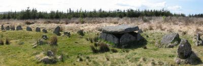
Bellever Tor 1 (W) (Newtake) Platform Cairn Circle and Cist
Prehistoric Dartmoor Walks: Dartmoor Site: Lakehead Hill
OS Map: SX 64089 76472
HER: MDV5884
Megalithic Portal: 34876
PMD: Bellever Tor W.
Alternate name: Bellever Tor 1 Platform Cairn Circle and Cist
ShortName: CT Bellever 1
Butler map: 27.20.1
DPD page: 119
Grinsell: LYD 59
Turner: E26
Barrow Report: 54 56
Notes: Further coverage see the Lakehead Hill page. Lethbridge diagram p.119 (uppermost cist) and photo top p.119. Dixon #62. Bar Rep 54. Butler Bellever Tor (Cairn 1) - Vol. 2. Map 27.20.1 (diagram pp.52-3).
Nearby sites: SX 64089 76472
Distance: 2.01km
Bellever Tor N. Enclosed Settlement
OS Map: SX 64485 76808
HER: MDV27672
Megalithic Portal: 24263
ShortName: ES BelleverTor
Notes: The photo was taken at SX 64510 76849.
Nearby sites: SX 64485 76808
Distance: 1.50km
Black Newtake (b) Stone Ring Cairn Circle
Prehistoric Dartmoor Walks: Dartmoor Site: Lakehead Hill
OS Map: SX 63863 76038
HER: MDV5889
Megalithic Portal: 45841
Alternate name: Bellever Tor 4 Stone Ring Cairn Circle
ShortName: RC BlackNew b
Butler map: 27.20.4
DPD page: 119
Grinsell: LYD 61
Turner: A50
Barrow Report: 57
Notes: "Cairn visible as unbroken circular bank 11.5 metres in external diameter with a bank 2.4 to 3.7 metres wide by 0.75 metres high enclosing a flat platform circa 6 metres diameter and 0.5 metres above ground surface. Some small stones appear in the north and east margins, and several larger stones are visible on the platform." Lethbridge diagram p.119 (Cairn near Cist 1) - no photo.
NB. Butler cairns 4 and 5 had previously been transposed in the listings here. The original records for both have been retained and the Butler number corrected and the grid references corrected. This was previously listed as Butler cairn 5 and is now correctly identiifed as Cairn 4. See also: Dartmoor Explorations: Antiquities of Black Newtake and Environs
Nearby sites: SX 63863 76038
Distance: 2.49km
Black Newtake (C) No. 3 Ring Setting Cairn and Cist
Prehistoric Dartmoor Walks: Dartmoor Site: Lakehead Hill
OS Map: SX 63893 75869
HER: MDV5890
Megalithic Portal: 34908
PMD: Black Newtake Central
Alternate name: Bellever Tor 6 Ring Setting Cairn and Cist
ShortName: CT BlackNew C3
Butler map: 27.20.6
DPD page: 120
Grinsell: LYD 62
Turner: D4
Barrow Report: 57
Notes: Further coverage on Lakehead Hill page. Lethbridge diagram p.119 Cist 2 and photo top p.120. Butler Bellever Tor - Vol. 2. Map 27.20.6 (Cairn 6 diagram pp.52-3).
Nearby sites: SX 63893 75869
Distance: 2.61km
Black Newtake (E) No. 5 Ring Setting Cairn and Cist
Prehistoric Dartmoor Walks: Dartmoor Site: Lakehead Hill
OS Map: SX 63853 75734
HER: MDV5950
Megalithic Portal: 45744
PMD: Black Newtake S.
Alternate name: Bellever Tor 8 Ring Setting Cairn and Cist
ShortName: CT BlackNew E5
Butler map: 27.20.8
Grinsell: LYD 64
Turner: D7
Barrow Report: 57
Notes: "Turf and gorse covered cairn. Approximately 6 metres in diameter with a maximum height of 0.35 metres. A depression in the top possibly marks the site of a cist with one large leaning or recumbent stone detectable under the turf at the east end" "Small orthostatic circle, diameter 6.5 metres, with central cist. Only one stone remains. Part of group with similar thin rectangular slabs, now eroded". Further coverage on Lakehead Hill page. Butler Bellever Tor - Vol. 2. Map 27.20.8 (Cairn 8 diagram pp.52-3). See also: Dartmoor Explorations: Antiquities of Black Newtake and Environs
Nearby sites: SX 63853 75734
Distance: 2.74km
Black Newtake (N) No. 1 Ring Setting Cairn and Cist
Prehistoric Dartmoor Walks: Dartmoor Site: Lakehead Hill
OS Map: SX 63919 76067
HER: MDV5888
Megalithic Portal: 45738
PMD: Black Newtake N.
Alternate name: Bellever Tor 3 Ring Setting Cairn and Cist
ShortName: CT BlackNew N1
Butler map: 27.20.3
DPD page: 119
Grinsell: LYD 60
Turner: D5
Barrow Report: 57
Notes: Further coverage on Lakehead Hill page. Lethbridge Cist 1 diagram p.119 and photo top p.119. Butler Bellever Tor (Cairn 3) - Vol. 2. Map 27.20.3 (diagram pp.52-3). Site revisited 04/09/23 and the site is very overgrown unlike in 2010. The exact location by Garmin is SX 63919 76067 now used on this record. See also: Dartmoor Explorations: Antiquities of Black Newtake and Environs
Nearby sites: SX 63919 76067
Distance: 2.44km
Broadun Enclosed Settlement
OS Map: SX 6354 7993
HER: MDV5946
Megalithic Portal: 26043
ShortName: ES:Broadun
Notes: "An enclosed settlement, maximum dimensions 300m NE/SW by 250m NW/SE, giving an area of 6ha. Enclosure cut through on SE by a leat, but wall still visible. Inside are 36 huts, and a further 3 outside. Condition of huts mainly poor. Average internal diameter is 3.7m: the largest is 13m by 10.5m, the smallest 2.5m. The enclosure wall appears contemporary with or later than the huts. The interior of the enclosure appears to have been cleared." See also HER entry 6800
Nearby sites: SX 6354 7993
Distance: 2.68km
Broadun Ring Enclosed Settlement
OS Map: SX 63704 80192
HER: MDV6746
Megalithic Portal: 26048
ShortName: ES BroadunRing
Nearby sites: SX 63704 80192
Distance: 2.77km
Cator Pound
Prehistoric Dartmoor Walks: Dartmoor Site: Cator Pound
OS Map: SX 6730 7765
HER: MDV6009
Megalithic Portal: 34961
ShortName: PD Cator Pound
Notes: The photo here is of the drove road to Cator pound. The pound is a very substantial prehistoric structure.
Nearby sites: SX 6730 7765
Distance: 1.93km
Cator Common Embanked Cairn Circle
Prehistoric Dartmoor Walks: Dartmoor Site: Cator Pound
OS Map: SX 67426 78001
HER: MDV5978
Megalithic Portal: 52173
ShortName: CC CatorCommon
Butler map: 18.4
Grinsell: WID 1
Turner: B3
Notes: "Cairn, to the south-west of (a) - (SX 67 NE45), 15 ft. diameter and 3 ft high; comprised of small stones overgrown with gorse and heather on unenclosed moorland."
Nearby sites: SX 67426 78001
Distance: 2.03km
Cator Common Platform Cairn Circle and Cist
OS Map: SX 67112 77513
HER: MDV5987
Megalithic Portal: 45793
PMD: Pizwell Bridge
Alternate name: Pizwell Bridge Platform Cairn Circle and Cist
ShortName: CT:CatorCommon
Butler map: 18.5
Butler Vol 5: p.171 & Fig.110
Grinsell: WID 2
Turner: E10
Notes: "Pizwell Bridge cairn of circa 5m diameter by 0.5m high is to be found about 10m below the road in an unusual position near the base of the hill. Three retaining slabs form an arc around one side with another just under the turf. The top of a slab near the centre with a pit alongside might be one side of a cist. ". Butler Pizwell Bridge Vol. 1. Map 18.5 (diagram Vol 5. p.171). Possible central cist.
Nearby sites: SX 67112 77513
Distance: 1.78km
Chittaford Down Platform Cairn Circle
OS Map: SX 63502 79203
HER: MDV5832
Megalithic Portal: 42726
PMD: Archerton
Alternate name: Chittaford Down 1 Platform Cairn Circle
ShortName: PC Chittaford
Butler map: 27.18.1
Butler Vol 5: p.170 & Fig.109
Grinsell: LYD 38
Turner: E14
Notes: "Remains of a cairn, visible as a turf covered stony mound. The NE quadrant is robbed out but around the rest of the periphery are parts of a kerb of small boulders, some set on edge, giving a diameter of 6.5m NW-SE. Maximum height 0.6m in the SW quadrant, but elsewhere the interior is badly robbed." Butler says there is a possible end slab of a cist.
Nearby sites: SX 63502 79203
Distance: 2.25km
Chittaford Down Platform Cairn Circle and Cist
OS Map: SX 63687 79463
HER: MDV5932
Megalithic Portal: 52177
PMD: Chittaford Down
Alternate name: Chittaford Down 3 Platform Cairn Circle and Cist
ShortName: CT Chittaford
Butler map: 27.18.3
Butler Vol 5: p.160 & Fig.100
DPD page: 112
Grinsell: LYD 39
Turner: E28
Barrow Report: 57
Notes: "A cist about 350 yards north of Archerton House. It has an irregular shape no coverstone and stands in the centre of a 14ft. diameter ruined cairn. There are traces of an enclosing ring of stones. Excavation in 1900 recovered wood charcoal and a worked flint flake from a small pit within the cist. Under the eastern side stone an archer's polished stone wrist guard was found". Lethbridge diagram and photo bottom p.112. Butler Chittaford Down 3 - Vol. 2. Map 27.18 (diagram Vol. 5. p.160).
Nearby sites: SX 63687 79463
Distance: 2.25km
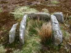
Dunnabridge Pound Farm Newtake Cist
Prehistoric Dartmoor Walks: Dartmoor Site: Lakehead Hill
OS Map: SX 64086 75691
HER: MDV5891
Megalithic Portal: 45751
PMD: Dunnabridge Newtake
Alternate name: Bellever Tor 10 Cist
ShortName: CT DunPound Fm
Butler map: 27.20.10
Butler Vol 5: p.60 & Fig.39
DPD page: 121
Grinsell: LYD 66
Barrow Report: 59
Notes: Only one side of this cist remains. Further coverage on Lakehead Hill page. Lethbridge Cist 4 diagram p.119 and photo top p.121. Butler Bellever Tor - Vol. 2. Map 27.20.10 (Cairn 10 diagram pp.52-3). See also: Dartmoor Explorations: Antiquities of Black Newtake and Environs
Nearby sites: SX 64086 75691
Distance: 2.66km
Kraps Ring Enclosed Settlement
OS Map: SX 64444 78157
HER: MDV5861
Megalithic Portal: 11477
ShortName: ES:KrapsRing
Nearby sites: SX 64444 78157
Distance: 0.97km
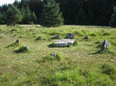
Lakehead Hill Cairn Circle
Prehistoric Dartmoor Walks: Dartmoor Site: Lakehead Hill
OS Map: SX 64351 77493
HER: MDV52762
Megalithic Portal: 24365
Alternate name: Lakehead Hill 5 Cairn Circle
ShortName: CC Lakehead 5
Butler map: 27.19.5
DPD page: 117
Grinsell: LYD 55
Turner: G24
Barrow Report: 54
Notes: Butler Cairn 5. Tuner lists this as G24 Stone Circle. However, it is clear from its size and location near other Ring Settings that it is in fact better described as a Ring Setting despite having no visible internal structure. In these listings we will leave it as a cairn circle. "The cairn is defined by a circle of edge set stones which measure 7.8 metres in diameter and stand up to 0.9 metres high." Lethbridge diagram p.114 and photo top p.117.
Nearby sites: SX 64351 77493
Distance: 1.17km
Lakehead Hill Platform Cairn Circle
Prehistoric Dartmoor Walks: Dartmoor Site: Lakehead Hill
OS Map: SX 64358 77773
HER: MDV5869
Megalithic Portal: 1057
Alternate name: Lakehead Hill 1 Platform Cairn Circle
ShortName: PC Lakehead 1
Butler map: 27.19.1
DPD page: 114
Grinsell: LYD 53
Turner: E16
Barrow Report: 55
Notes: "Ring cairn.(diam 5.95m, n. End stone heig 0.45m, widt 1.0m, thic 0.2m) marked on os 6in map. Included in 1955 spooner/dixon report: (lakehead bellever laughter), site no.10. Site no.10a in bellever plantation, lakehead (with sketch map) in dnp field report (dnp)." Lethbridge diagram p.114 and photo bottom p.114.
Nearby sites: SX 64358 77773
Distance: 1.07km
Lakehead Hill 2 Cist
Prehistoric Dartmoor Walks: Dartmoor Site: Lakehead Hill
OS Map: SX 64261 77701
HER: MDV5841
Megalithic Portal: 4612
PMD: Lakehead Hill NW.
ShortName: CT Lakehead 2
Butler map: 27.19.2
DPD page: 115
Grinsell: LYD 52
Barrow Report: 17 55
Notes: Further coverage on Lakehead Hill page. Lethbridge diagram p.114 and photos top p.115. See Seventeenth Barrow report. Butler Lakehead Hill (Cairn 2) - Vol. 2. Map 27.19.2 (diagrams pp.48-52).
Nearby sites: SX 64261 77701
Distance: 1.18km
Lakehead Hill 4 (E of Summit) Stone Row
Prehistoric Dartmoor Walks: Dartmoor Site: Lakehead Hill
OS Map: SX 64498 77603
HER: MDV5870
Megalithic Portal: 2009
The Stone Rows of GB: Lakehead Hill East
PMD: Lakehead Great Cairn Stone Row
Alternate name: Lakehead Hill E Stone Row
ShortName: SR Lakehead 4E
Butler map: 27.19.4
DPD page: 116
Notes: "A stone alignment and a cairn with cist lying on a gentle slope near the summit of Lakehead Hill. The stone alignment survives as a single row of at least 11 stones leading westward towards the cairn and cist. The cairn measures 6.7 metres in diameter and is defined by several edge set stones, which in turn surround a large restored cist formed by five substantial upright slabs supporting a capstone measuring 2.2 metre long by 1.55 metres wide and 0.3 metres thick." (E. Dart). Lethbridge diagram p.114 and photos p.116.
Nearby sites: SX 64498 77603
Distance: 0.99km
Lakehead Hill 4 (E or Summit) Ring Setting Cairn and Cist
Prehistoric Dartmoor Walks: Dartmoor Site: Lakehead Hill
OS Map: SX 64499 77611
HER: MDV5870
Megalithic Portal: 2009
PMD: Lakehead Hill Summit
Alternate name: Lakehead Hill 4 Ring Setting Cairn and Cist
ShortName: CT Lakehead 4
Butler map: 27.19.4
Butler Vol 5: p.59 & Fig.37
DPD page: 116
Grinsell: LYD 54
Turner: D6
Notes: A single stone row of at least 11 stones leading westward towards the cairn and cist. "The cairn measures 6.7 metres in diameter and is defined by several edge set stones, which in turn surround a large restored cist formed by five substantial upright slabs supporting a capstone measuring 2.2 metre long by 1.55 metres wide and 0.3 metres thick." Further coverage on Lakehead Hill page. Lethbridge diagram p.114 and photo top p.116. Butler Lakehead Hill (Cairn 4) - Vol. 2. Map 27.19.4 (diagrams pp.48-52).
Nearby sites: SX 64499 77611
Distance: 0.98km
Lakehead Hill 6 (Newtake) Ring Setting Cairn and Cist
Prehistoric Dartmoor Walks: Dartmoor Site: Lakehead Hill
OS Map: SX 64363 77475
HER: MDV5842
Megalithic Portal: 24365
PMD: Lakehead Hill Central
Alternate name: Lakehead Hill 6 Ring Setting Cairn and Cist
ShortName: CT Lakehead 6
Butler map: 27.19.6
DPD page: 117
Grinsell: LYD 56
Turner: D10
Barrow Report: 54 56
Notes: Further coverage on Lakehead Hill page. Lethbridge diagram p.114 and photo bottom p.117. Dixon #64. Bar Rep 54. Butler Lakehead Hill (Cairn 6) - Vol. 2. Map 27.19.6 (diagrams pp.48-52).
Nearby sites: SX 64363 77475
Distance: 1.16km
Lakehead Hill 7 (Newtake) Cist
Prehistoric Dartmoor Walks: Dartmoor Site: Lakehead Hill
OS Map: SX 64720 77395
HER: MDV5875
Megalithic Portal: 11137
PMD: Lakehead Hill E.
Alternate name: Lakehead Hill 7 Cist
ShortName: CT LakeNew 7
Butler map: 27.19.7
Butler Vol 5: p.184 & Fig.127
DPD page: 118
Grinsell: LYD 57
Barrow Report: 54
Notes: Butler Lakehead Hill (Cairn 7) - Vol. 2. Map 27.19.7 (diagrams pp.48-52).Further coverage on Lakehead Hill page. Lethbridge diagram p.114 and photo top p.118.
Nearby sites: SX 64720 77395
Distance: 0.91km
Lakehead Hill 8 Cist
Prehistoric Dartmoor Walks: Dartmoor Site: Lakehead Hill
OS Map: SX 64717 77178
HER: MDV5879
Megalithic Portal: 24377
PMD: Lakehead Hill SE.
ShortName: CT Lakehead 8
Butler map: 27.19.8
Butler Vol 5: p.61 & Fig.41
DPD page: 118
Grinsell: LYD 58
Barrow Report: 33 55
Notes: Further coverage on Lakehead Hill page. Lethbridge diagram p.114 and photo bottom p.118.Butler Lakehead Hill (Cairn 8) - Vol. 2. Map 27.19.8 (diagrams pp.48-52).
Nearby sites: SX 64717 77178
Distance: 1.07km
Lakehead Hill S.E. Stone Row
Prehistoric Dartmoor Walks: Dartmoor Site: Lakehead Hill
OS Map: SX 64701 77409
HER: MDV5875
Megalithic Portal: 44544
The Stone Rows of GB: Lakehead Hill 2
PMD: Lakehead Hill 2 Stone Row
Alternate name: Lakehead Hill 2 Stone Row
ShortName: SR Lakehead SE
Butler map: 27.19.7
Butler Vol 5: p.184 & Fig.127
DPD page: 118
Barrow Report: 54
Notes: "The cist was examined in 1895/6 but nothing was found. It was surrounded by a double retaining circle and a stone row lead from it north west, of which ten stones remained, but these had sunk into the bog leaving only their tops showing". SRGB states: "This description makes it clear that this is unlikely to be a stone row since a row composed of small stones would not have survived the ditch digging involved in the building of the hedge. It is much more likely that they represented stones exposed in the side of the ditch." HER also has: "The stone row which falls in an afforested area could not be identified and has probably been destroyed."(1979) (E. Dart).
Nearby sites: SX 64701 77409
Distance: 0.92km
Lakehead Hill S.W. Stone Row
Prehistoric Dartmoor Walks: Dartmoor Site: Lakehead Hill
OS Map: SX 6418 7730
HER: MDV5844
Megalithic Portal: 45595
PMD: Lakehead Hill 6 Stone Row
ShortName: SRxLakehead SW
Butler map: 27.19.1
Notes: "Alleged Stone row recorded in 1946 but covered by a forestry plantation in 1979. At that time, 3 stones were visible, but it was uncertain whether they were part of the stone row. It may have been destroyed or covered by humus." (River: Dart/Cherry Brook)
Nearby sites: SX 6418 7730
Distance: 1.41km
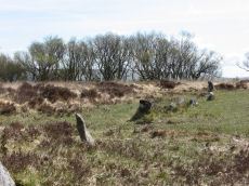
Lakehead Hill Summit Stone Row
Prehistoric Dartmoor Walks: Dartmoor Site: Lakehead Hill
OS Map: SX 64367 77656
HER: MDV5930
Megalithic Portal: 2010
The Stone Rows of GB: Lakehead Hill Summit
PMD: Lakehead Hill 3 Stone Row
Alternate name: Lakehead Hill summit Stone Row
ShortName: SR LakeheadSum
Butler map: 27.19.3
DPD page: 115
Notes: "A stone alignment lying on a gentle slope near the summit of Lakehead Hill. It includes a 22 metre long, single row of at least 12 stones standing up to 0.75 metres high, aligned east to west." (E. Dart). Lethbridge diagram p.114 and photo bottom p.115.
Nearby sites: SX 64367 77656
Distance: 1.09km
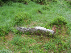
Lakehead Newtake Cist
Prehistoric Dartmoor Walks: Dartmoor Site: Lakehead Hill
OS Map: SX 64677 78385
HER: MDV5955
Megalithic Portal: 45734
PMD: Lakehead Hill NE.
Alternate name: Lakehead Hill 9 Cist
ShortName: CT Lakehead 9
Butler map: 27.19.9
Butler Vol 5: p.60 & Fig.40
Grinsell: LYD 51
Barrow Report: 55
Notes: Butler Lakehead Hill - Vol. 2. Map 27.19.9 (diagrams pp.48-52). Further coverage on Lakehead Hill page.
Nearby sites: SX 64677 78385
Distance: 0.82km
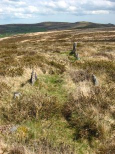
Laughter Tor E. Stone Row
Prehistoric Dartmoor Walks: Dartmoor Site: Laughter Tor Stone Row
OS Map: SX 65222 75393
HER: MDV53417
Megalithic Portal: 2017
The Stone Rows of GB: Laughter Tor 1
PMD: Laugh Tor I Stone Row
Alternate name: Laughter Tor 1 Stone Row
ShortName: SR Laugh Tor E
Butler map: 28.12.1
DPD page: 122
Notes: Butler Laughter 1. Double row interrupted by a new-take wall. row is robbed near wall. "Bronze Age standing stone 2.65 metres high, 0.7 metres wide and 0.52 metres thick, set into a small cairn. About 18 metres to the south east is a double stone row orientated north west to south east and consisting of at least 23 upright stones and a further 9 displaced ones averaging about 1.7 metres apart. The standing stone was re-erected in 1893 and again in 1911 and the cairn was excavated in 1903". Lethbridge pp.121-122.
Nearby sites: SX 65222 75393
Distance: 2.61km
Laughter Tor W. Stone Row
Prehistoric Dartmoor Walks: Dartmoor Site: Laughter Tor Stone Row
OS Map: SX 65207 75389
HER: MDV6002
Megalithic Portal: 52739
The Stone Rows of GB: Laughter Tor 2
PMD: Laugh Tor II Stone Row
Alternate name: Laughter Tor 2 Stone Row
ShortName: SR Laugh Tor W
Butler map: 28.12.2
Butler Vol 5: p.215 & Fig.149
DPD page: 122
Notes: Butler Laughter 2. "A double stone row at about 395m OD cuts across the gentle SW projecting spur of Laughter Tor in an area of heather and rough grass some 12m WSW of the standing stone 'Laughter Man'. The stones, although all relatively small in size, form two good slightly curving rows oriented about 295 degs. and 0.7m to 1.2m apart, consisting of thirteen stones extending from SX 6519075381 some 15m ESE to SX 6520475375. Now visible are six stones in each row with a single stone at the NW end. Originally there may have been at least ten in each row at intervals of about 1.2m". Lethbridge pp.121-122.
Nearby sites: SX 65207 75389
Distance: 2.62km
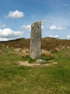
Laughtor Man Standing Stone
Prehistoric Dartmoor Walks: Dartmoor Site: Laughter Tor Stone Row
OS Map: SX 65223 75389
HER: MDV6001
Megalithic Portal: 2017
PMD: Laugh Tor Man
ShortName: SS Laughtor
Butler map: 28.12
Butler Vol 5: p.215 & Fig.149
DPD page: 122
Notes: The longstone is 2.4 m high and was found prostrate on a cairn which was excavated by Burnard. The cairn contained "a great quantity of charcoal and peat ashes". The longstone was restored in 1903. A double stone row heads to the longstone. See also, Legendary Dartmoor: The Prehistoric Complex of Laughter Tor
Nearby sites: SX 65223 75389
Distance: 2.62km
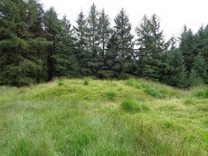
Red Barrows Cairn
Prehistoric Dartmoor Walks: Dartmoor Site: Soussons Cairn Circle
OS Map: SX 67718 79650
HER: MDV6007
Megalithic Portal: 34986
PMD: Red Barrows
Alternate name: Red Barrows 1 Cairn
ShortName: CN RedBarrows
Butler map: 24.2.1
Grinsell: MAN 5
Notes: Four Bronze Age round barrows between 10 and 20 meters in diameter and 0.5 to 2.2 meters high. One barrow was excavated in 1902, finds included pottery and flints. See also HER records, 6004, 6005, 6006, 6007.
Nearby sites: SX 67718 79650
Distance: 2.85km
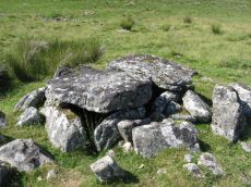
Roundy Park, Postbridge Cist
OS Map: SX 63920 79669
HER: MDV5935
Megalithic Portal: 26041
PMD: Roundy Park
Alternate name: Roundy Park Cist
ShortName: CT Roundy Park
Butler map: 27.4
Butler Vol 5: p.22 & Fig.3
DPD page: 113
Grinsell: LYD 40
Barrow Report: 21
Notes: One of the largest cists on Dartmoor. Discovered in August 1893 by Robert Burnard, who was responsible for the restoration of the grave. Lethbrdige diagram p.112, photo p.113. Butler Vol. 2. Map 27.4 (diagram of location p.41, diagram of site Vol. 5 p.22)
Nearby sites: SX 63920 79669
Distance: 2.23km
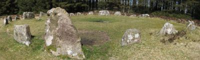
Soussons Common Ring Setting Cairn and Cist
Prehistoric Dartmoor Walks: Dartmoor Site: Soussons Cairn Circle
OS Map: SX 67516 78700
HER: MDV6013
Megalithic Portal: 1266
PMD: Soussons Plantation
Alternate name: Soussons Plantation S. Ring Setting Cairn and Cist
ShortName: CT Soussons Cm
Butler map: 24.2.6
DPD page: 124
Grinsell: MAN 9
Turner: D2
Barrow Report: 22 23 45 56
Notes: "A 28 feet diameter cairn circle with a central cist (plan). The tallest stone in the cairn circle is about 2 feet high." "This cist measures at least 1.3 metres long by 0.5 metres wide and when excavated in 1903 two coils of human hair were found" (Plan by RHW. Barrow Report 23. 1904). Lethbridge p.124. Butler Soussons Plantation S - Vol. 2. Map 24.2.6 (diagrams pp. 18-20). See also HER record MDV6013.
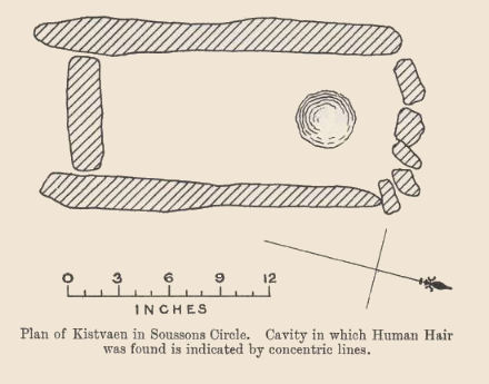
Nearby sites: SX 67516 78700
Distance: 2.23km
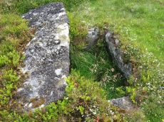
Stennen Hill No. 1 Platform Cairn Circle and Cist
OS Map: SX 62573 77905
HER: MDV5846
Megalithic Portal: 45736
PMD: Powder Mills W.
Alternate name: Stennen Hill 1 Platform Cairn Circle and Cist
ShortName: CT Stennen 1
Butler map: 29.11.1
Butler Vol 5: p.199 & Fig.142
DPD page: 111
Grinsell: LYD 47
Turner: E13
Barrow Report: 57
Notes: "Cist lies approximately in the centre of a subcircular cairn measuring 7 by 6.5m the longer axis and cist aligned nne to ssw. It is stony but almost turf-covered with 2 large kerbstones, including burnards `menhir' remaining in situ in the nw. The cist is flush with the cairn top, which is flattish and stands only 0.2m high on the nw but up to 0.7m high on the se, downhill side. This may be the cairn's original form; built into the slope as a flat platform with the cist visible (nmr citing pattison)". See also HER. Lethbridge photo top p.111. Butler Stennen Hill 1 - Vol. 2. Map 29.11 (diagram Vol. 5. p.199). NB. Worth & Grinsell name this Stennen Hill No. 1
Nearby sites: SX 62573 77905
Distance: 2.83km
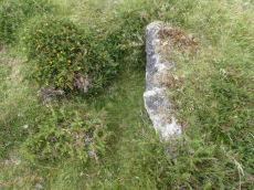
Stennen Hill No. 3 Cist
OS Map: SX 62615 77838
HER: MDV5847
Megalithic Portal: 45737
PMD: Powder Mills E.
Alternate name: Stennen Hill 2 Cist
ShortName: CT Stennen 2
Butler map: 29.11.2
Butler Vol 5: p.200 & Fig.143
DPD page: 111
Grinsell: LYD 49
Barrow Report: 57
Notes: "cist is oriented nw. - se. And is open with the south west side stone and the end stone buried beneath the turf. Internal dimensions 1.3m by 0.85m depth 0.5m. The mound, which is slight with a height of 0.3m is much disturbed. Judging by the remains of the retaining circle of which six stones can be seen the diameter of the mound was 4.5m. Condition of the cist is fair, of mound poor." Only one large stone remains in the mound of a cairn. Lethbridge photo top p.111. Butler Stennen Hill 2 - Vol. 2. Map 29.11 (diagram Vol. 5. p.200). NB. Worth & Grinsell name this Stennen Hill No. 3 (It is Butler 2)
Nearby sites: SX 62615 77838
Distance: 2.79km