
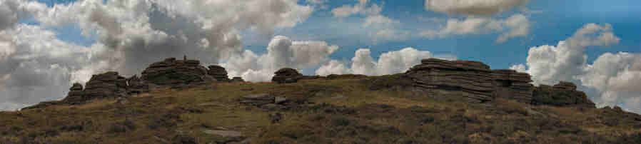
Lakehead Hill Cairn Circles, Cists and Settlements
This site is featured on the Postbridge: multiple sites on Lakehead Hill near Bellever walk (SX64387765). The main photos here were taken on a 0.5km stretch up Lakehead Hill towards Bellever Tor. A few additional photos were taken of cairns on the south western slope of Bellever. The area includes multiple cairn circles, cists, a stone row and settlements (Butler Vol. 2, Map 27). The remains that can be found today are quite impressive but once this locality had a much richer array of prehistoric sites. Many sites, some in their entirety, were robbed out for newtake walls.
Forestation
Another source of great archaeological loss was the forestation of the area in the 1930s and 1940s. An extensive area of Bellever and Laughter Hole was acquired by the Forestry Commission in 1930 and by 1938 the eastern slopes of Bellever Tor and Lakehead Hill had been planted and the western slopes of Bellever and Lakehead followed between 1940 and 1943 [Rouse]. The forestation policy resulted in "considerable disquiet" [Gill] and it was "a step that Hansford Worth strenuously opposed" [Hemery]. Butler comments:
The greatest single disaster to befall the archaeological heritage on the moor was the forestation of Bellever and Lakehead Hill from 1930 onwards, rivalled only by the similar treatment of the South Teign valley around Fernworthy. No attempt was made to preserve more than a handful of antiquities, or even to record those that were to be overplanted. These included a number of enclosed settlements along with cairns and stone rows, many of which are unlikely ever to be relocated. Some boundary walls of the former have re-emerged in a sadly mutilated state and, as trees have been felled their position marked by orange top posts.
Only one prehistoric settlement has survived moderately intact on Lakehead Hill, though two more were recorded nearby prior to forestation. Others very likely occupied the eastern slopes in the area now covered by the Bellever Farm enclosures. [Butler Vol. 2. p43]
In the clearing up Lakehead Hill are 8 cairns, cists and stone rows. The Dartmoor Exploration Committee noted some prehistoric sites in the Lakehead area which can no longer be located. There was a cairn with a double circle and a stone row that headed north-west which has disappeared since been observed in 1895. Butler mentions a stone row observed by Worth (listed as 14.) "but this area has been overplanted and nothing now can be seen of it". [Butler Vol. 2. p43]. Also some of the hut circles to the north east of Bellever Tor were planted over. One of these was recently excavated (see below) following damage by a falling tree.
Kraps Ring
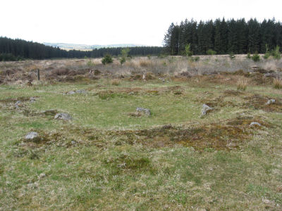
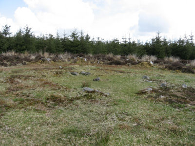
Kraps Ring [Butler Map 27.7] is the circular area about 120m across at the northern tip of the clearing on Lakehead Hill. The enclosure wall would have been massive; the width of the remains of the collapsed wall being up to 3m in places although Butler suggests it would have been 2m prior to its collapse. There were 15 huts within the ring when it was surveyed in 1891 by Prowse [Butler p44]. Kraps Ring was examined by the Dartmoor Exploration Committee in 1895 and of the hut circles within it was found that "all except one had been dug over for stones" and "owing to the disturbed character of these circles their further examination was abandoned" (See: Second Report of the Dartmoor Exploration Committee TDA Vol. 27)
Cairns, Cists & Stone Rows on Lakehead hill
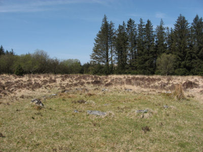
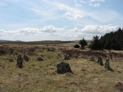
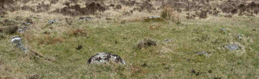
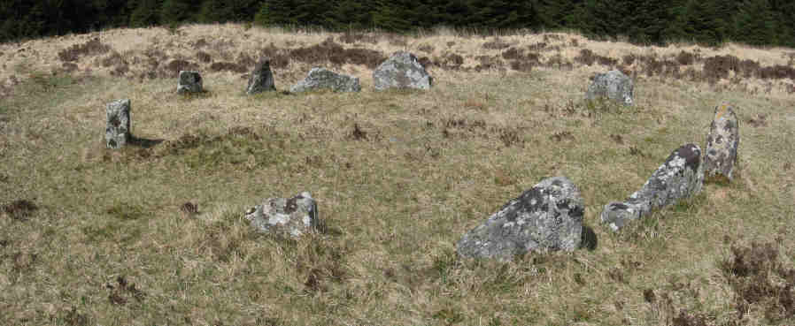
A short way southwards up the hill from Kraps Ring can be found cairn 1 which has a clear retaining circle of diameter 6m formed by 13 kerb stones. The cairn has long gone and there is no longer any noticeable mound.
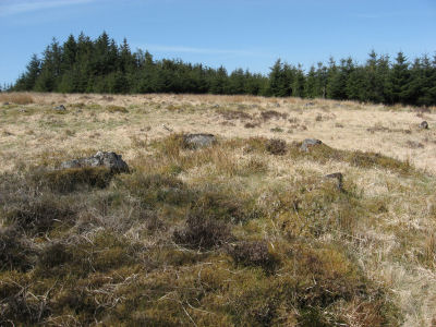
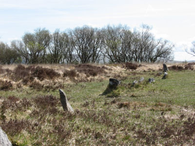
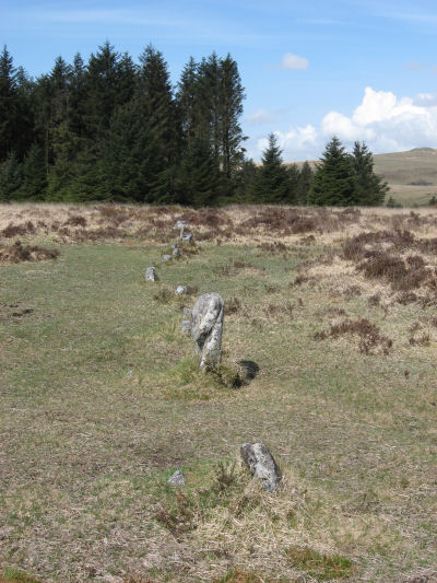
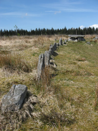
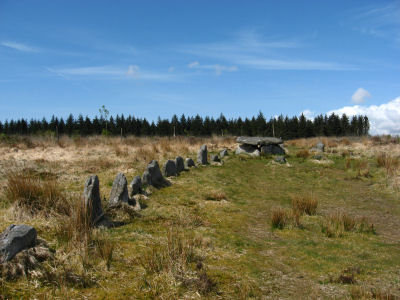
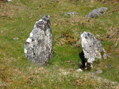
Around 200m further up towards the crest of the hill is stone row 3 (using Butler's numbering). This consists of 12 stones with space for 3 or 4 more. Butler observes: "The irregular spacing and remarkably poor alignment suggests that the stones may have been re-erected out of position by some unknown antiquary in the past. If a cairn once terminated the row it had been completely removed before the monument was first recorded and no trace now remains" [Butler Vol. 2. p51].
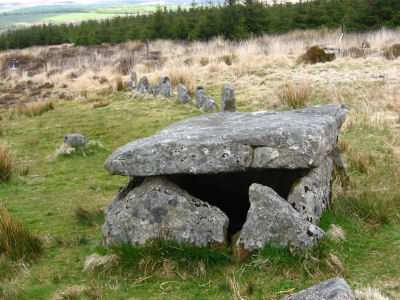
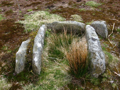
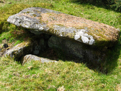
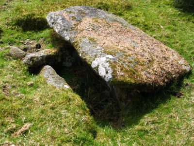
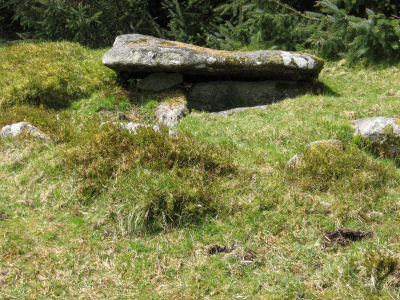
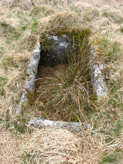
To the right just within the plantation, about 200m west of the stone row 3 is cairn 2. This consists of a cist with four sides remaining at the centre of a slight mound. This cist was investigated by Robert Burnard in 1898 (see report below). The cist had already been robbed but towards the edge of the cist the soil had not been disturbed and 3 flint knives, 3 flint scrapers and the remains of two urns were found. The larger urn would have held the cremation remains. The rim of one of the urns had an irregular pattern of short incised strokes forming angles and broken lines which would have covered the whole urn. These flints and urns indicate that it was a Beaker burial [Petit p94] that dates the site to the Neolithic or early Bronze Age.
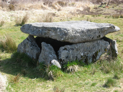
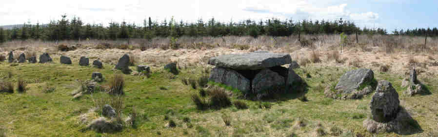
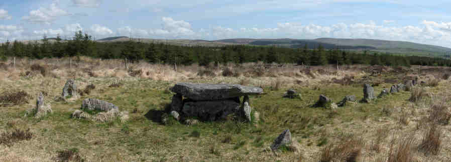
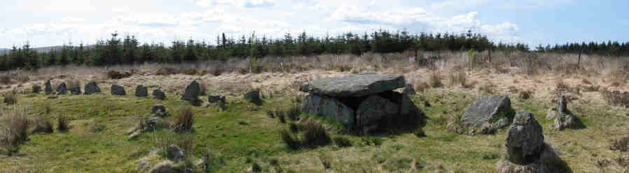
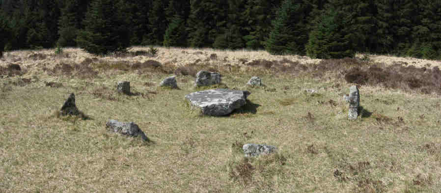
Returning to the stone row and then a similar distance to the left (east) is cairn 4. This was discovered in 1895 as a "moss-covered heap of stones; whatever had been there was then a total constructive loss" [Worth p229]. The remains were restored by Robert Burnard and Sabine Baring-Gould in 1895. The reconstruction was undoubtedly flawed, as Worth points out, the stone row begins within the retaining circle and it is peculiarly one of the only curved stone rows on Dartmoor. The height and overall appearance of the cist is also doubtful. Despite Worth's criticisms, Hemery concludes: "My own feeling is one of profound thankfulness to the restorers that the monument survives at all" [Hemery p484]. Indeed, the same could be said for many of the restored sites on Dartmoor, it is easy to criticise the lack of archaeological precision, but many of them were saved by the restorers. It is interesting to see one of Burnard's old photographs of this site shortly after it was restored and before it was surrounded by conifers (source TDA Vol. 28 p. 182.).
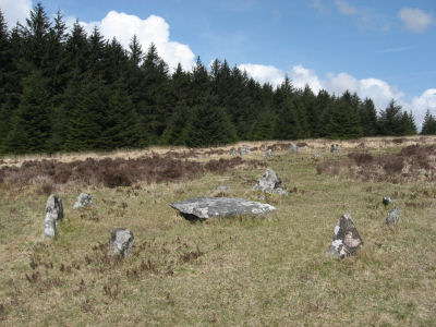
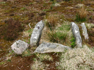
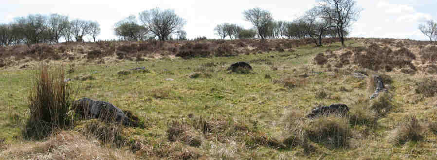
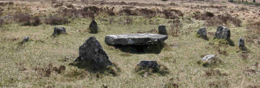
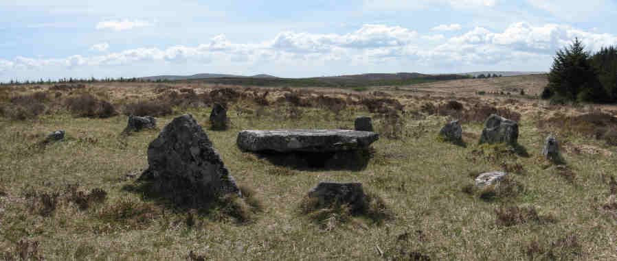
Returning to the stone row and continuing southwards for about 200m downhill, are the well preserved circles of cairn 5 and cairn 6. Cairn 5 is 6.8m in diameter and consists of 10 slabs with spaces for a few more. It encloses an almost flat area with no central cist remaining. About 40m to the south-east are 3 or 4 slabs that could be the remains of a stone row [Butler Vol2 p51]. The second circle, Cairn 6, lies a little further to the south-east. It too has 10 slabs with a large central cist slab. This was excavated by the Dartmoor Exploration Committee in 1896 but nothing was found. The diameter of Cairn 6 is 5.6m, it may also have once had a short stone row heading south-east.
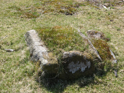
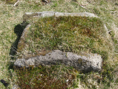
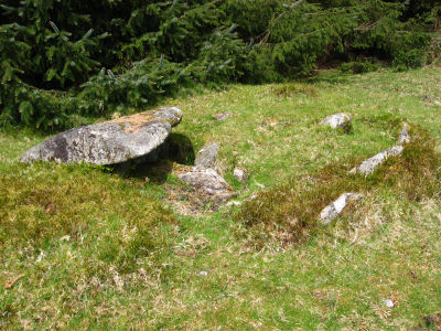
Further south, heading towards Bellever, there is the Lichway - a track that runs east to west. Turning left (east) along the Lichway after a few meters there is a hut circle on the left just to the edge of the plantation. About 100m further along the Lichway is another track that heads north back towards Postbridge. About 200m along this track on the right (east) is a clearing in the plantation which contains Cairn 7. This appears to have been a very large cairn but it is so badly damaged that it is difficult to be certain; "the stones and earth have been scattered in all directions exposing two sides of an exceptionally large cist in a hollow now well off centre". [Butler Vol. 2. p51]
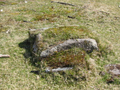
Returning back towards Bellever and then around 120m beyond the Lichway is the remains of Cairn 8 which is a cist with three side slabs as re-erected by Burnard in 1914. The excavation of the cist revealed some charcoal in the infill. [Butler Vol. 2. p51]
Settlements near Bellever Tor
On the northern slopes of Bellever Tor is a settlement of the rosette type [Butler Vol. 2, Map 27.9]. The largest hut lies at the hub of the structure with small enclosures encircling it which get progressively larger as they spiral around. This structure is easy to see on the northern slope of Bellever. There is also another settlement to the north east of the tor on the edge of the plantation.
Further to the east are around 8 hut circles that are deep within the plantation. One of these was excavated following a tree being blown over during a storm in 2007 (SX64867675). The excavation revealed post holes, a paved floor and sherds of pottery most of which were of a type known as Trevisker Ware. An analysis of one pot fragment revealed that it is made of gabbroic clay from the Lizard Peninsula in Cornwall. Pieces of charcoal were recovered which were carbon dated and revealed that the round house was lived in during the middle Bronze Age. One curious feature was a cairn erected on the site following its abandonment. [See Bellever excavations 2011 and Guardian: Unearthing bronze-age Dartmoor]
Excavations of a roundhouse at Bellever have provided evidence for at least three phases of use of the site, including two occupation phases and the re-use of the location for a small cairn. The date of the second phase is constrained by the recovery of sherds of Trevisker ware, indicating a mid-late Bronze Age date. [...] Radiocarbon dating of charcoal and macrofossils from two postholes and two stakeholes broadly confirms the pottery chronology. The site was occupied in the latter half of the second millennium BC, around 1610-1400 calibrated BC, and probably no longer in use by 1420-1260 calibrated BC. Pollen analytical work has demonstrated that the local contemporary environment of the site is an open, improved grassland, with little evidence of woodland cover. Following the ultimate abandonment of the site, the local environment shows a gradual shift to open heath communities. [Historic Environment Record for Bellever]
Bellever Tor Cairn & Black Newtake Cairns
To the west of Bellever Tor near the edge of the plantation (SX64077646) is Cairn 1 which is the best preserved of the Bellever Tor Cairns [Butler Vol. 2, map 27.20 p52]. This cairn was first recorded in 1890 by which point it had already had been rifled and the cover slab removed revealing 3 side slabs of the cist below. At the time it was recorded it was reported that the retaining circle was in fair condition and an excavation resulted in "nothing found". Today only 3 slabs of the circle remain visible above the turf although others may remain buried.
Further south following the plantation edge around is the Black Newtake area which includes a number of cairns. This area is very overgrown and apart from some mounds it is difficult to locate the cairns. However, the cist (SX63917606) of cairn 3 is quite easy to locate just beyond the wall of the Black Newtake enclosure. The cist has four prominent side slabs. According to Butler there are four remaining slabs of the retaining circle in pairs on opposite sides although these may be difficult to see as it is very overgrown. For more detail on the Black Newtake cairns and very useful coverage generally of the Bellever area it is worth looking at the Legendary Dartmoor page linked below.
Bibliography & references
Burnard, Robert. 1898. Report & Transactions of the Devonshire Association Vol. 30 pp.77-78.
Butler, J. Dartmoor Atlas of Antiquities: Vol. 2. - The North (Devon Books, 1991)
Butler, J. Dartmoor Atlas of Antiquities: Vol. 5. - The Second Millennium B.C. (Devon Books, 1997)
Crossing, William. 1912. Guide to Dartmoor (Peninsula Press, 2001) p.469
Gill, Crispin 1912. Dartmoor A New Study (David & Charles, 1977) p.269
Hemery, Eric. High Dartmoor (Robert Hale, 1983) p483
Pettit, Paul. Prehistoric Dartmoor (David & Charles, 1974)
Rouse, G.D. Forestry Commission Guide: The New Forests of Dartmoor (HMSO, 1972)
Worth, R.H. Worth's Dartmoor (David & Charles, 1971)
External Links
Legendary Dartmoor: Prehistoric Bellever
Dartmoor National Park Authority: Archaeologists begin new dig at Bellever
Flints found in Cairn 2
Extract from seventeenth report of the Barrow Committee
The following report by Robert Burnard describes the finds he made in Cairn 2. It is taken from Report & Transactions of the Devonshire Association Vol. 30 (1898) pp.77-78.
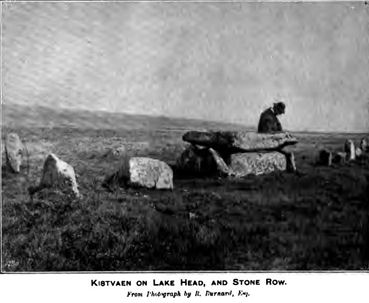
Exploration of a kistvaen on Lake Head Hill, Postbridge.
There is a small kistvaen on that part of Lake Head Hill which is included in sheet 99 S.W. 6-inch survey. It is not shown in any of the sheets hitherto published, but will be included in future editions. The accompanying plan illustrates construction and conveys dimensions. This small kist stands like a box, with about half its height showing above the surface of the ground. Its extreme depth is 2 feet. The cover-stone has been removed. No trace of a surrounding circle is visible, but there are slight remains of the once existing barrow. It had been opened at some unknown period, but as there seemed to be a good deal of undisturbed soil immediately contiguous to the inside walls, I determined to clear it out and subject the interior to a close search.
The result was very gratifying, for no less than three flint knives and three scrapers of the same material were found packed in close against the S.S.E end stone of the kist. The scrapers are apparently quite unused, and are very fine specimens. One of the knives by its shape suggests the idea of a spear-head. It may however be safer to include it in the knife class.
In addition to these implements about thirty small pot-sherds were found representing two vessels, one evidently being a large urn, and the other a small food vase. The pottery is of the usual type, and the vessels were hand-made.
The small specimen was considerably ornamented, judging from a portion of the rim which is herein illustrated.
Some wood charcoal was found, but no trace of bones or bone-ash.
When originally rifled the kist was not entirely cleared out around the sides, so that the flint implements were not discovered.
The urns were probably broken up, leaving some of the sherds in the bottom of the kist.
The small heap of debris which either came from the interior of the kist or formed part of the barrow was carefully examined, but nothing was found.
The large urn evidently held the cremated remains, and the small example the offering of food. The interment indicates the late Neolithic and early Bronze Age - the same period as the hut circles which have been explored by the Dartmoor Exploration Committee.
Robert Burnard (1898)
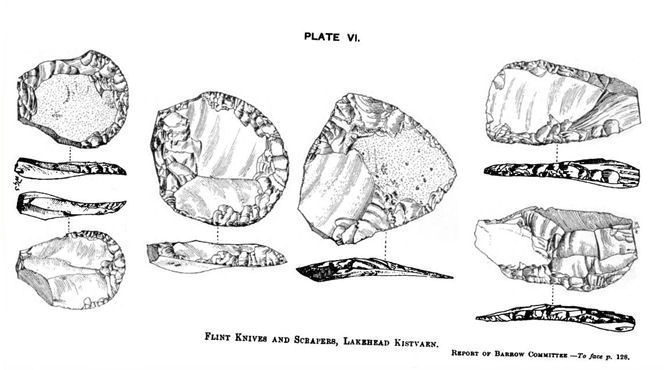
NOTE: The drawing of the knives and flints is reproduced from Report & Transactions of the Devonshire Association Vol. 34 (1902) p128.
Guide to sites on Lakehead Hill
The numerous sites are easy to find and are marked on the OL28 Dartmoor OS Map. The sites around Bellever have Dartmoor National Park (DNP) marker posts. The table below gives a guide to the sites using the number system used by Butler in section 19 on Map 27. The table also includes the DNP markers and a link to their location on the OS map via streetmap.co.uk. The first of the photos below the table is of a hut circle in Kraps Rings the subsequent photos can be identified from the table.
| Photo |  |
 |
 |  |
 |
 |
 |
 |
 |
| Description | Cairn Circle | Cist | Stone Row | Stone Row Cairn Circle Cist | Cairn Circle | Cairn Circle Cist | Hut Circle | Cairn Circle | Cist |
| DNP | 10A | 9A | 11A | 14A 15A |
12A | 13A | 17A | 16A | 18A |
| Butler | 1 | 2 | 3 | 4 | 5 | 6 | - | 7 | 8 |
| NMR | SX 67 NW 31 | SX 67 NW 11 | SX 67 NW 64 | SX 67 NW 32 | SX 67 NW 33 | SX 67 NW 34 | SX 67 NW 36 | SX 67 NW 35 | SX 67 NW 38 |
| Map Link | 64357777 | 64267770 | 64387765 | 64537760 | 64357750 | 64367748 | 64607730 | 64707740 | 64717717 |
| PDW SiteID | 292 | 366 | 152 | 368 | 274 | 364 | 626 | 363 | 337 |
The photos on this page were taken on the 15th May 2010.
See also: Guide to Dartmoor Stone Rows
Cairns, Cists & Stone Rows on Lakehead Hill
Bellever Tor & Settlements
Page last updated 9/12/11