
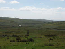
Prehistoric sites within 2km of SX 57680 67140
Guidance for walkers: The monuments featured in this database are archaeological treasures and need to be protected and preserved - please do not disturb any sites. Please check access and firing times before visiting sites, not all sites listed are on open access land. Firing ranges and boundaries of open access areas are marked on the OL28 OS Dartmoor Explorer map. Please stick to the country code and consider giving support to the numerous agencies that help to keep Dartmoor a fabulous natural and historic environment!
About the database listings: In all listings clicking on the photo or the site name will open a page for the site with a larger photo and further details from the database. The database now has over 6680 records covering nearly all publicly listed sites on Dartmoor including around 4800 round houses. This level of detail is of interest to archaeologists but tends to swamp listings of sites more likely to be of interest for walkers. For this reason, the listings default to around 550 core sites only. These are the stone circles, stone rows and the ring cairns listed by Turner. The default search radius is 2 km. The controls below the map can be used to start a new search by entering a 6- or 8-digit reference (without the prefix "SX"). The search radius can be specified and you can add incremental Display layers of detail on top of the core sites. If using a more detailed layer you will need to decrease the search radius to avoid getting hundreds of search results.
- Core sites Default listing of core sites consisting of stone circles & rows and some of the major ring cairns.
- Plus cairns adds approx. 1000 cairns and other minor sites not included in the core listings but excluding round houses.
- Plus round houses adds approx. 4800 round houses.
- Plus non-sites adds in the records for sites that no longer exist or are not prehistoric sites.
- Plus duplicates adds records excluded as duplicates. Those maybe duplicate records in external listings (e.g. the Historic Environment Records). For example, some sites have been identified as cairns in some listings and interpreted as round houses in other listings and both records appear.
These listings have incorporated, matched up and merged all of the records from all of the major archaeological listings including: Worth, Grinsell, Turner, Butler, Bill Radcliffe, Sandy Gerrard, Megalithic Portal, the National Monument Records and the Historic Environment Records. The author would like to thank Bill, Sandy, the lovely people both at Megalithic Portal (especially Anne Tate who did an amazing job to link listings) and at ACE Archaeology for collaborative work over the years to synchronise and correct listings across the various websites which now interlink. A culmination of years of work the final merger of cairn records took 3 months of cross referencing in 2017 the result being a snapshot of the records at that time. This data has in turn been refined since by field work and research. The round house data was supplied by Sandy Gerrard. Grid references are in order of accuracy: from Google Earth satellite, if visible and found, from a Garmin GPS reading, if visited by the author and from the literature otherwise. Individual site pages will state the source of the grid reference and provide satellite imagery. If a site listing lacks a photo it has not yet been visited by the author in which case the grid reference is from the literature.
Currently the database only includes sites which can be represented by a grid reference. Reaves are not included as they require GIS shape technology which is beyond the current capability of this system. To see the sources for the records, look at the tables on the resources menu. The database listings can also be viewed on a Google map and downloaded as GPS datasets for Garmin devices.
Corrections, or any feedback or suggestions are very welcome, email: info@dartmoorwalks.org.uk.
NOTE: Clicking on the icons for each monument in the map will give the name of the site. You can zoom in and out and drag the map around.
List of sites within 2km of SX 57680 67140
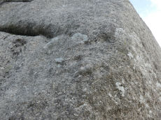
Cuckoo Rock Cup Stone
OS Map: SX 58463 68712
HER: MDV133689
Megalithic Portal: 58581
ShortName: CS Cuckoo Rock
Notes: "There appear to be eight circular cupmarks on the south-west corner of Cuckoo Rock in the Deancombe valley; apparently in pairs. Three pairs are arranged horizontally with a smaller pair just above them arranged vertically. Six of the marks measure approximately 5cm diameter by 2cm deep. The remaining two marks measure approximately 2cm diameter by 1cm deep. The carver likely stood on a boulder situated below to mark the rock. Reported to archaeologist at Dartmoor National Park authority who has visited the site (21/11/2022) and agrees with potential interpretation."
Nearby sites: SX 58463 68712
Distance: 1.76km
Ditsworthy Circle Ring Setting Cairn and Cist
OS Map: SX 58342 65726
HER: MDV42211
Megalithic Portal: 45797
PMD: Ditsworthy Circle
ShortName: CT Ditsworthy
Butler map: 49.6
Grinsell: B:SHE 36
Notes: nb. Not listed by Turner - assigned as "Ring Setting" type cairn due to description in NMR. Butler Vol. 3. Map 49.6. Remains of a ring cairn with three hollows visible within the circle of stones. Two of these probably represent the sites of the two cists recorded by Breton who referred to this cairn as the 'Ditsworthy Circle'. Nothing can be seen of the cists today.
Nearby sites: SX 58342 65726
Distance: 1.56km
Drizzlecombe Platform Cairn Circle
Prehistoric Dartmoor Walks: Dartmoor Site: Drizzlecombe Ceremonial Complex (Photos 1)
OS Map: SX 59135 67134
HER: MDV3374
Megalithic Portal: 16932
PMD: Drizzlecombe N 14
Alternate name: Drizzlecombe 14 Platform Cairn Circle
ShortName: PC Drizzle 14
Butler map: 49.19.14
Grinsell: SHE 25a
Turner: E35
Barrow Report: 34 56
Notes: "stone circle" marked on os 6" 1906. This site was almost totally excavated in 1914. Half an 11 foot diameter kerb circle and the slight remains of a cairn were found.3 flint flakes and a "well finished" scraper were found. The 34th Barrow Report includes a photo of the flints and the excavated and exposed kerb.
Nearby sites: SX 59135 67134
Distance: 1.46km
Drizzlecombe Enclosed Settlement
Prehistoric Dartmoor Walks: Dartmoor Site: Drizzlecombe Ceremonial Complex (Photos 1)
OS Map: SX 59341 67152
HER: MDV4046
Megalithic Portal: 10509
ShortName: ES Drizzle
Butler map: 49.19
DPD page: 39
Notes: "The drizzlecombe pound (diam (max 67m, min 64m), thic of wall (max 1.52m, min 1.37m), area 0.3ha) is not circular as there is a considerable length of straight wall on the sw. The wall is much ruined in parts. An inner lining of slabs is still visible on the nw side. Mean elevation of ground is 366m od ground slopes to sw with mean gradient of 1 in 7. A cairn lies a few yards outside the pound wall, two hut circles within the enclosure. The entrance is in the west wall". Lethbridge pp.38-42, diagram p.38.
Nearby sites: SX 59341 67152
Distance: 1.66km
Drizzlecombe Cist
Prehistoric Dartmoor Walks: Dartmoor Site: Drizzlecombe Ceremonial Complex (Photos 1)
OS Map: SX 59227 67478
HER: MDV3363
Megalithic Portal: 16934
PMD: Drizzlecombe N.
Alternate name: Drizzlecombe 21 Cist
ShortName: CT Drizzle 21
Butler map: 49.19.21
DPD page: 41
Grinsell: SHE 24
Barrow Report: 26 34
Notes: Butler Vol. 3. Map 49.19.21 (pp.135-142, general plan of Drizzlecombe complex p.135, diagram p.141 Cist 21). Lethbridge p.38-41, diagram p.38 Cist C(3)
Nearby sites: SX 59227 67478
Distance: 1.58km
Drizzlecombe Ceremonial Complex
Prehistoric Dartmoor Walks: Dartmoor Site: Drizzlecombe Ceremonial Complex (Photos 1)
OS Map: SX 592 670
HER: MDV3376
Megalithic Portal: 1906
PMD: Drizzlecombe C
ShortName: CX Drizzle
Butler map: 49.19
DPD page: 38
Notes: Lethbridge pp.38-42. Diagram p.38. Ceremonial complex consisting of three stone rows headed by massive standing stones and also associated cairns and cists.
Nearby sites: SX 592 670
Distance: 1.53km
Drizzlecombe (Central) Encircled Cairn
Prehistoric Dartmoor Walks: Dartmoor Site: Drizzlecombe Ceremonial Complex (Photos 1)
OS Map: SX 59253 67081
HER: MDV14772
Megalithic Portal: 3206
PMD: Drizzlecombe B
Alternate name: Drizzlecombe stone row 3 Encircled Cairn
ShortName: EC Drizzle Ce
Butler map: 49.19.3
Grinsell: SHE 29
Turner: F13
Barrow Report: 56
Notes: Central in alignment of 3 cairns. Cairn heads the NW Drizzlecombe row. See diagram in coverage on Prehistoric Dartmoor Walks, marked as C3.
Nearby sites: SX 59253 67081
Distance: 1.57km
Drizzlecombe (W) Encircled Cairn
Prehistoric Dartmoor Walks: Dartmoor Site: Drizzlecombe Ceremonial Complex (Photos 1)
OS Map: SX 59236 67101
HER: MDV3329
Megalithic Portal: 10499
PMD: Drizzlecombe N Row
Alternate name: Drizzlecombe 4 Encircled Cairn
ShortName: EC Drizzle W
Butler map: 49.19.4
Grinsell: SHE 28
Turner: F24
Notes: Western most in alignment of 3 cairns. The other two cairns head Drizzlecombe rows. See diagram in coverage on Prehistoric Dartmoor Walks, marked as C4. Turner F24
Nearby sites: SX 59236 67101
Distance: 1.56km
Drizzlecombe E. Encircled Cairn
Prehistoric Dartmoor Walks: Dartmoor Site: Drizzlecombe Ceremonial Complex (Photos 1)
OS Map: SX 59267 67065
HER: MDV4047
Megalithic Portal: 3207
PMD: Drizzlecombe C
Alternate name: Drizzlecombe stone row 2 Encircled Cairn
ShortName: EC Drizzle E
Butler map: 49.19.2
DPD page: 39
Grinsell: SHE 30
Turner: F7
Notes: Eastern most in alignment of 3 cairns. Cairn heads the NE Drizzlecombe row. See diagram in coverage on Prehistoric Dartmoor Walks, marked as C2. Lethbridge Row B. pp.38-42. Diagram p.38. See also 14780
Nearby sites: SX 59267 67065
Distance: 1.59km
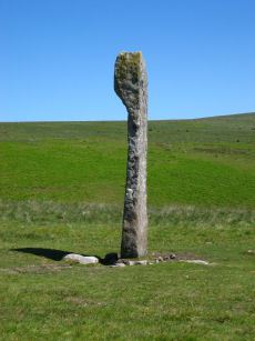
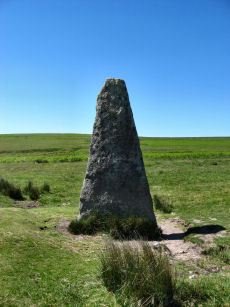
Drizzlecombe N.E. Standing Stone
Prehistoric Dartmoor Walks: Dartmoor Site: Drizzlecombe Ceremonial Complex (Photos 1)
OS Map: SX 59215 67005
HER: MDV3377
Megalithic Portal: 16928
PMD: Drizzlecombe Standing Stones
ShortName: SS Drizzle NE
Butler map: 49.19
Butler Vol 5: p.230
DPD page: 39
Notes: Largest standing stone on Dartmoor - terminal for Drizzlecombe stone row. It is 4.2m in height with a distinctive bulging profile at the top. Worth suggests it was probably dragged here from Higher Hartor Tor about 1km away. Re-erected in 1893. Lethbridge Row B. pp.38-42. Diagram p.38. Worth's Row 19/Row C. Used to be listed as HER 14781 perhaps now deleted as an HER duplicate record.
Nearby sites: SX 59215 67005
Distance: 1.54km
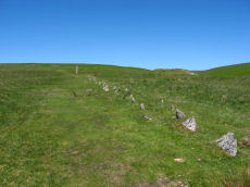
Drizzlecombe N.E. Stone Row
Prehistoric Dartmoor Walks: Dartmoor Site: Drizzlecombe Ceremonial Complex (Photos 1)
OS Map: SX 59258 67054
HER: MDV14776
Megalithic Portal: 536
The Stone Rows of GB: Drizzlecombe 2
PMD: Drizzlecombe C Stone Row
Alternate name: Drizzlecombe 2 Stone Row
ShortName: SR Drizzle NE
Butler map: 49.19.2
DPD page: 39
Notes: Butler Row 2, NMR Row 2, Worth Row C. Terminated by the tallest standing stone on Dartmoor. It is 4.2m in height with a distinctive bulging profile at the top the broad face is across the row unlike the other two Drizzlecombe rows. Interestingly this stone is photographed in Worth's Dartmoor prior to being re-erected. Worth suggests it was probably dragged here from Higher Hartor Tor about 1km away. This standing stone has 3 smaller cairns in close proximity. This is the shortest of the three rows at 83.2m but has larger slabs set further apart with the largest near the cairn. Lethbridge Row B. pp.38-42. Diagram p.38. See also: Sea Views at Drizzlecombe 2
Nearby sites: SX 59258 67054
Distance: 1.58km
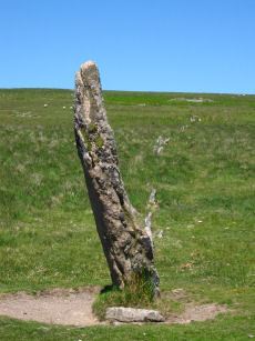
Drizzlecombe N.W. Standing Stone
Prehistoric Dartmoor Walks: Dartmoor Site: Drizzlecombe Ceremonial Complex (Photos 1)
OS Map: SX 59134 66988
Megalithic Portal: 16929
PMD: Drizzlecombe Standing Stones
ShortName: SS Drizzle NW
Butler map: 49.19
DPD page: 40
Notes: Terminal for Drizzlecombe NW stone row. Re-erected in 1893. Lethbridge Row C. pp.38-42. Diagram p.38. NB. This website had previously matched this site with the HER record 3377. That record now clearly refers to the NE stone - although that may not have previously been the case. There is no HER record for this site now. Worth's Row 18/Row B. Previously listed here with a grid referecne of SX 59200 67020 which is quite a bit out.
Nearby sites: SX 59134 66988
Distance: 1.46km
Drizzlecombe N.W. Stone Row
Prehistoric Dartmoor Walks: Dartmoor Site: Drizzlecombe Ceremonial Complex (Photos 1)
OS Map: SX 59243 67071
HER: MDV3376
Megalithic Portal: 1904
The Stone Rows of GB: Drizzlecombe 3
PMD: Drizzlecombe B Stone Row
Alternate name: Drizzlecombe 3 Stone Row
ShortName: SR Drizzle NW
Butler map: 49.19.3
DPD page: 40
Notes: Butler Row 3, NMR Row 1, Worth Row B. The NW and S terminal stones have their broad face parallel to the row. The NW row is single for half of its 149.5m length uphill then double for 47m before becoming single again for the last 28m to the cairn. This arrangement appears to be the original design. The other two stone rows are single throughout. The S row is exactly the same length as the NW row but with smaller stones. The average interval between the stones is almost identical and the orientation of the row is such that it gently curves southwards downhill bringing the lower part of the row parallel to the S row. This shift of 7 degrees in alignment of the NW row from top to bottom to line up with the S row would suggest it was constructed later to match the S row. The height of the terminating stones for S and NW rows are 3m and 2.3m respectively.
Nearby sites: SX 59243 67071
Distance: 1.56km
Drizzlecombe S Row Encircled Cairn
Prehistoric Dartmoor Walks: Dartmoor Site: Drizzlecombe Ceremonial Complex (Photos 1)
OS Map: SX 59170 66964
HER: MDV14779
Megalithic Portal: 16937
PMD: Drizzlecombe SW Row
Alternate name: Drizzlecombe stone row 1 Encircled Cairn
ShortName: EC Drizzle S
Butler map: 49.19.1
Grinsell: SHE 32
Notes: "Cairn lies at the north-east end of Row A (South Row)of the Drizzlecombe group. Cairn measures 6.7 metres in diameter, up to 0.8 metres high, with central hollow 2.3 metres by 1.5 metres by 0.25 metres deep." "Small number of edge stones around the periphery represent a kerb. Large flat stone, 1.7m by 1m by 0.3m thick, situated immediately s of the mound may be the displaced coverstone from a cist"
Nearby sites: SX 59170 66964
Distance: 1.50km
Drizzlecombe S. Standing Stone
Prehistoric Dartmoor Walks: Dartmoor Site: Drizzlecombe Ceremonial Complex (Photos 1)
OS Map: SX 59057 66868
HER: MDV14778
Megalithic Portal: 16927
PMD: Drizzlecombe Standing Stones
ShortName: SS Drizzle S
Butler map: 49.19
DPD page: 40
Notes: Terminal stone of the southern double row at Drizzlecombe. The standing stone at the southwest end measures 1.8 metres by 0.4 metres and is 3.2 metres high. Re-erected in 1893. Lethbridge Row A pp.38-42. Diagram p.38. Worth's Row 17/Row A.
Nearby sites: SX 59057 66868
Distance: 1.40km
Drizzlecombe S. Stone Row
Prehistoric Dartmoor Walks: Dartmoor Site: Drizzlecombe Ceremonial Complex (Photos 1)
OS Map: SX 59161 66949
HER: MDV14777
Megalithic Portal: 1905
The Stone Rows of GB: Drizzlecombe 1
PMD: Drizzlecombe A Stone Row
Alternate name: Drizzlecombe 1 Stone Row
ShortName: SR Drizzle S
Butler map: 49.19.1
DPD page: 40
Notes: Butler Row 1, NMR Row 3, Worth Row A. See notes for Drizzlecombe B (N.W.) row. Lethbridge Row A pp.38-42. Diagram p.38. See also: Sea Views at Drizzlecombe 1
Nearby sites: SX 59161 66949
Distance: 1.49km
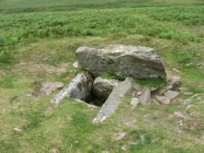
Drizzlecombe, North Cist
Prehistoric Dartmoor Walks: Dartmoor Site: Drizzlecombe Ceremonial Complex (Photos 1)
OS Map: SX 59156 67215
HER: MDV3339
Megalithic Portal: 534
PMD: Drizzlecombe N 13
Alternate name: Drizzlecombe 13 Cist
ShortName: CT Drizzle 13
Butler map: 49.19.13
DPD page: 41
Grinsell: SHE 25
Barrow Report: 19
Notes: Butler Drizzlecombe - Vol. 3. Map 49.19.13 (pp.135-142, general plan of Drizzlecombe complex p.135, diagram p.140 Cairn 13). Lethbridge p.38-41, diagram p.38 Cist B(2)
Nearby sites: SX 59156 67215
Distance: 1.48km
Drizzlecombe, South Cist
Prehistoric Dartmoor Walks: Dartmoor Site: Drizzlecombe Ceremonial Complex (Photos 1)
OS Map: SX 59033 66725
HER: MDV3340
Megalithic Portal: 16933
PMD: Drizzlecombe SW.
Alternate name: Drizzlecombe 22 Cist
ShortName: CT Drizzle 22
Butler map: 49.19.22
DPD page: 41
Grinsell: SHE 34
Barrow Report: 19
Notes: Lethbridge p.38-41, diagram p.38 Cist A(1) Butler Drizzlecombe - Vol. 3. Map 49.19.22 (pp.135-142, general plan of Drizzlecombe complex p.135, diagram p.141 Cist 22).
Nearby sites: SX 59033 66725
Distance: 1.42km
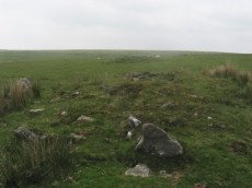
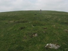
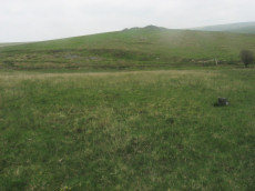
Eastern Tor Settlement
OS Map: SX 585 664
HER: MDV4023
Megalithic Portal: 19399
ShortName: ST:EasternTor
Nearby sites: SX 585 664
Distance: 1.10km
Giant's Basin Cairn
Prehistoric Dartmoor Walks: Dartmoor Site: Drizzlecombe Ceremonial Complex (Photos 1)
OS Map: SX 59202 66945
HER: MDV3372
Megalithic Portal: 538
Alternate name: Giant's Basin Cairn
ShortName: CN GiantsBasin
Butler map: 49.19.5
DPD page: 40
Grinsell: SHE 33
Notes: The Giant's Basin is an impressive but heavily disturbed cairn lying adjacent to the Drizzlecombe Stone Rows. It measures approximately 22 metres in diameter, a maximum of 3 metres high and is partially turf-covered. An approximately 2.5 metre wide reed-covered slight depression around its circumference suggests a silted ditch. Much of the central part of the cairn has been removed to a depth of 1.65m and most of excavated material in the form of fist-sized stones and small boulders has been deposited around the rim of the mound.
Nearby sites: SX 59202 66945
Distance: 1.53km
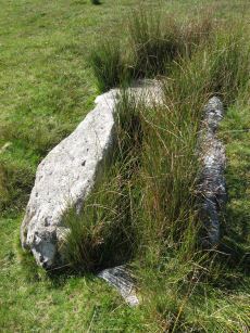
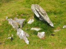
Giants Basin (near) Cist
OS Map: SX 59181 66953
HER: MDV3373
Megalithic Portal: 18464
PMD: Giants Basin Foot
Alternate name: Drizzlecombe 6 Cist
ShortName: CT GiantsBasin
Butler map: 49.19.6
Grinsell: SHE 33d
Barrow Report: 12
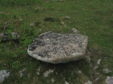
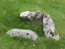
Notes: "The structure comprises a flat slab measuring 1.2m by 0.76m which rests at a slight angle on three upright slabs. These slabs, up to 0.4m high, form a 'z' shape on plan in what appears to be a slight hollow. This feature has been classified by some authorities as a cist although others reject this interpretation for either positional or structural reasons. The historical and archaeological tradition for the existence of a cist here is by no means certain. Known cists in the locality have invariably had their coverstones removed and are open. It is a scheduled ancient monument." The arrangement in the photo could well be natural.
Nearby sites: SX 59181 66953
Distance: 1.51km
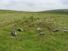
Giants Hill Enclosed Settlement
OS Map: SX 59534 66798
HER: MDV20052
ShortName: ES:GiantsHill
Notes: HER: A number of irregular enclosures containing three hut circles, four probable hut circles, three cairns and a possible military structure on the western flank of Giant's Hill above Mill Corner. The enclosures are bounded by broad stony banks up to 2.0m wide and 0.6m high. There are no identifiable entrances to these features. The hut circles are very poorly preserved and have been mutilated by later activities and had surface stone dumped on their walls and interiors. Several features described as huts by previous authorities are now simply stony patches within the enclosures and one appears to be of fairly recent (?military) origin. Only one of the identifiable huts possesses an obvious entrance while most display traces of level interiors. The cairns are generally well preserved though none present any evidence to suggest the presence of cists or kerbs.
Nearby sites: SX 59534 66798
Distance: 1.89km
Giants Hill E Cist
OS Map: SX 59587 66717
HER: MDV70333
Megalithic Portal: 45812
ShortName: CT GiantsHillE
DPD page: 48
Notes: "A little further to the east on giant's hill another cist was photographed in 2004. A large flat stone c0.9m x c0.9m partly covered by vegetation is the capstone of a small square cist c0.56m x 0.56m. One of the side stones is missing. (lethbridge)." Lethbridge p.48 Giant's Hill unscheduled Cist diagram p.47.
Nearby sites: SX 59587 66717
Distance: 1.95km
Giants Hill W Cist
OS Map: SX 59444 66753
HER: MDV55396
Megalithic Portal: 45813
PMD: Giants Hill
ShortName: CT GiantsHillW
DPD page: 48
Notes: "The cist is situated at the wsw end of the cairn, is 1.4m by 0.7m by 0.3m deep and is orientated ne-sw". Lethbridge p.48 Giant's Hill scheduled Cist diagram p.47.
Nearby sites: SX 59444 66753
Distance: 1.81km

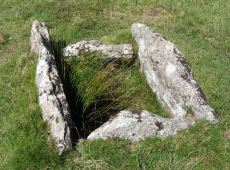
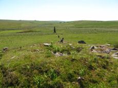
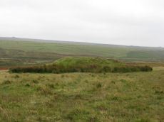
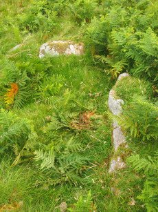
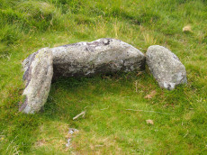
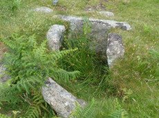
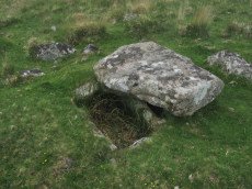
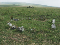
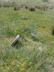
Gutter Tor N. Platform Cairn Circle and Cist
OS Map: SX 57676 67137
HER: MDV4015
Megalithic Portal: 17511
PMD: Gutter Tor N.
Alternate name: Gutter Tor 3 Platform Cairn Circle and Cist
ShortName: CT GutterTor 3
Butler map: 49.5.3
DPD page: 33
Grinsell: SHE 9
Turner: E38
Barrow Report: 59
Notes: "A cairn with cist and a double circle of stones situated on the north-facing slope of Gutter Tor at about 305m OD. The end-stones and side-stones of the cist are in situ but the coverstone is missing." Lethbridge p.32-33 Cist A. Duplicated by HER 4045.Note Garmin NGR. (Previously listed as Gutter Tor No.2)Butler Gutter Tor 3 - Vol. 3. Map 49.5 (diagram p.118 "North cairn and cist").
Nearby sites: SX 57676 67137
Distance: 0.00km
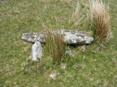
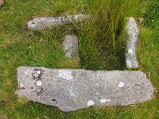
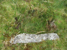
Gutter Tor S. Cist
OS Map: SX 57603 66818
HER: MDV3991
Megalithic Portal: 45650
PMD: Gutter Tor summit
Alternate name: Gutter Tor 2 Cist
ShortName: CT GutterTor 2
Butler map: 49.5.2
DPD page: 32
Grinsell: SHE 15
Barrow Report: 19
Notes: "situated on the flat top of Gutter Tor at about 345m OD just on the north side of the crest of the hill. Two end stones and a side stone remain upright". Lethbridge p.32 Cist A. (Previously listed as Gutter Tor No. 1) Butler Gutter Tor 2 - Vol. 3. Map 49.5 (diagram p.118 "Summit cist").Excavated by Worth in 1900.
Nearby sites: SX 57603 66818
Distance: 0.33km
Hentor Farm Platform Cairn Circle and Cist
Prehistoric Dartmoor Walks: Dartmoor Site: Guide to the Hentor & Shavercombe Brook Cists
OS Map: SX 59089 65792
HER: MDV12744
Megalithic Portal: 45774
PMD: Hen Tor Meadow
ShortName: CT Hentor Farm
Grinsell: SHA 48
Turner: E45
Notes: "A slight cairn with retaining circle, enclosing a cist aligned SSE-NNW, near the junction of Shavercombe Lake and River Plym." Turner has "central cist". Not listed by Butler (relevant map Vol. 3. Map 49.22).
Nearby sites: SX 59089 65792
Distance: 1.95km
Lee Moor (Willings Walls) Cist
OS Map: SX 58278 65339
HER: MDV4022
Megalithic Portal: 45651
PMD: Willings Walls Warren
Alternate name: Willings Walls 3 Cist
ShortName: CT Willings 3
Butler map: 51.6.3
DPD page: 52
Grinsell: SHA 24
Barrow Report: 19
Notes: "A cairn immediately adjacent to and west of Willings Walls Reave. The cairn mound measures 9 metres in diameter and up to 0.5 metres high. It contains a central cist with one end slab and two side slabs in place". Lethbridge p.52-3 Willingswalls Cist 1 (W of Reave) - diagram p52. Butler Willings Walls 3 (Cairn & Cist 3) - Vol. 3. Map 51.6 (diagram p.166).
Nearby sites: SX 58278 65339
Distance: 1.90km
Leeden Cist
OS Map: SX 58695 67845
HER: MDV3341
Megalithic Portal: 45710
PMD: Eylesburrow W.
Alternate name: Eylesbarrow S.W. Cist
ShortName: CT Leeden
Butler map: 47.11
DPD page: 30
Grinsell: SHE 7
Barrow Report: 48
Notes: Butler Eylesbarrow S.W - Vol. 3. Map 47.11 (diagram p.70).
Nearby sites: SX 58695 67845
Distance: 1.24km
Legis Lake Platform Cairn Circle and Cist
OS Map: SX 56595 65762
HER: MDV4030
Megalithic Portal: 34131
PMD: Legis Lake
Alternate name: Ringmoor Down 2 Platform Cairn Circle and Cist
ShortName: CT Ringmoor 2
Butler map: 49.21.2
DPD page: 36
Grinsell: SHE 20
Turner: E32
Barrow Report: 29
Notes: Lethbridge Brisworthy Cist p.34-36. Diagram p.34 site 5. Butler Ringmoor Down 2 - Vol. 3. Map 49.21 (diagram p.145).
Nearby sites: SX 56595 65762
Distance: 1.75km
Legis Lake Encircled Cairn
OS Map: SX 56563 65513
HER: MDV3360
Megalithic Portal: 34135
Alternate name: Ringmoor Down 1 Encircled Cairn
ShortName: EC Ringmoor 1
Butler map: 49.21.1
Grinsell: SHE 21
Turner: F15
Barrow Report: 29 35
Notes: "cairn with retaining circle of which 5 stones protrude and there are indications of others. Diameter 8.2m, height 0.2m. Excavated by r. H. Worth: just n of centre, a pit containing charcoal mixed with earth."
Nearby sites: SX 56563 65513
Distance: 1.97km
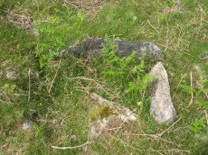
Legis Tor Ossuary
OS Map: SX 57573 65470
Megalithic Portal: 45857
ShortName: OS Legis Tor
DPD page: 37
Notes: An intriguing structure consisting of two very large parallel slabs on Legis Tor. Site discovered by Lethbridge who suggests it might be an ossuary. This is quite clearly a man made structure. The two very large parallel slabs look very much like they are an artificial construction rather than natural. One end has a clearly built up wall to form a structure. There is one larger end slab, very small in comparison to the side slabs - but it rests on a bunch of other slabs that look very much like they have been artificially placed. This is undoubtedly a prehistoric construction - a large cist or "ossuary" (receptacle for burials or cremations - a sort of tomb). No entries in HER or NMR. see Lethbridge p.37 diagram and photo.
Nearby sites: SX 57573 65470
Distance: 1.67km
Legis Tor, East Platform Cairn Circle and Cist
OS Map: SX 57474 65542
HER: MDV3424
Megalithic Portal: 45857
PMD: Legis Tor E.
Alternate name: Legis Tor E.1 Platform Cairn Circle and Cist
ShortName: CT LegisTor E1
Butler map: 49.2.1
DPD page: 38
Grinsell: SHE 23
Turner: E42
Barrow Report: 51
Notes: Butler Legis Tor E - Vol. 3. Map 49.2.1 (diagram p.113). Lethbridge p.37-38 Diagram p.37 Cist B.
Nearby sites: SX 57474 65542
Distance: 1.61km
Legis Tor, West Platform Cairn Circle and Cist
OS Map: SX 57394 65481
HER: MDV3365
Megalithic Portal: 34130
PMD: Legis Tor W.
Alternate name: Legis Tor E.2 Platform Cairn Circle and Cist
ShortName: CT LegisTor E2
Butler map: 49.2.2
DPD page: 37
Grinsell: SHE 22
Turner: E43
Barrow Report: 12 20 51
Notes: Lethbridge p.37 Cist A. The photo is thought to be the capstone of this cist. Butler Legis Tor E. 2 - Vol. 3. Map 49.2 (diagram p.114).
Nearby sites: SX 57394 65481
Distance: 1.68km
Outholme Newtake Cist
Prehistoric Dartmoor Walks: Dartmoor Walk: Yellowmead and Drizzlecombe
OS Map: SX 57993 68278
HER: MDV4024
Megalithic Portal: 45730
PMD: Outcombe
ShortName: CT OutholmeNew
Butler map: 47.10
DPD page: 30
Grinsell: SHE 2
Barrow Report: 52
Notes: "Located in an isolated pocket of closely cropped grass and surounded by tinners pits. Only three slabs survive in place surrounding a hollow and forming the sides of the cist. The fourth side is missing as is the capstone and any trace of a mound." Lethbridge Outcombe (note different spelling) Cist p.30. Butler Vol. 3. Map 47.10 (diagram p.70).
Nearby sites: SX 57993 68278
Distance: 1.18km
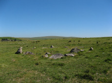
Ringmoor Down Cairn Circle
OS Map: SX 56157 65947
HER: MDV4029
Megalithic Portal: 22947
Alternate name: Ringmoor Down 3 Cairn Circle
ShortName: CC Ringmoor 3
Butler map: 49.21.3
DPD page: 36
Grinsell: SHE 18
Turner: G29
Barrow Report: 63
Notes: Located about 230m NW of the cairn circle that terminates the Ringmoor Down stone row. "An 11ft 2ins diameter cairn circle composed of fourteen stones of which four have fallen over. Stones of quartz-schorl, not granite." "This feature has the semblance of having been recently created. The stones are mostly loose and irregularly spaced. As a monument type it appears to be unique on Dartmoor. It should not be considered of great antiquity." For a photo, see: Stone-Circles.org.uk: Ringmoor Cairn. Lethbridge kerb circle p.34-36. Diagram 34 site 4.
Nearby sites: SX 56157 65947
Distance: 1.93km
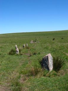
Ringmoor Down Stone Row
Prehistoric Dartmoor Walks: Dartmoor Site: Ringmoor Stone Row & Cairn Circle
OS Map: SX 56330 65808
HER: MDV3986
Megalithic Portal: 2102
The Stone Rows of GB: Ringmoor Down
PMD: Ringmoor Down Stone Row
ShortName: SR Ringmoor
Butler map: 49.20
DPD page: 34
Notes: "A stone row, 1740 feet long, mainly single but double in parts. At its southern end is a cairn circle with a diameter of 40ft. 6ins. In 1909 the circle was restored and five of the present stones were introduced from elsewhere. Prior to restoration one stone was standing, four had fallen and the presumed sites of six other stones were represented by pits. A 4ft long fallen stone terminated the stone row at its northern end". Lethbridge p.34-36, diagram p.34 site 3. See also: Sea Views at Ringmoor Down`
Nearby sites: SX 56330 65808
Distance: 1.90km
Ringmoor Down Encircled Cairn
OS Map: SX 56334 65807
HER: MDV3987
Megalithic Portal: 1233
PMD: Ringmoor Down Stone Row
Alternate name: Ringmoor Down stone row Encircled Cairn
ShortName: EC Ringmoor S
Butler map: 49.20
DPD page: 35
Grinsell: SHE 19
Turner: F5
Notes: "The cairn circle measures approximately 12.6m. in diameter and has eleven stones averaging 0.7m. high. The disturbed central cairn is 9.5m. in diameter and 0.4m. in height." "1909 the circle was restored and five of the present stones were introduced from elsewhere. Prior to restoration one stone was standing, four had fallen and the presumed sites of six other stones were represented by pits." Lethbridge Brisworthy cairn circle p.34-35. Diagram p. 34 site 2.
Nearby sites: SX 56334 65807
Distance: 1.89km
Ringmoor Down Stone Ring Cairn Circle
OS Map: SX 56113 65922
HER: MDV19760
Megalithic Portal: 34142
Alternate name: Ringmoor Down 4 Stone Ring Cairn Circle
ShortName: CC Ringmoor 4
Butler map: 49.21.4
Turner: A2
Notes: HER: A low, disturbed circular earthwork on the upper ridge of Ringmoor Down is a probable ring cairn. The bank is low and spread being up to 4.6m wide by 0.1m high and forms a slightly irregular circle with an internal diameter of between 28 and 30m and overall diameter of 37m. Two lines of tin prospecting pits which traverse the monument, of probable medieval or post medieval date, have caused some damage on the southern arc of the bank and its interior.
Nearby sites: SX 56113 65922
Distance: 1.98km
Shavercombe Enclosed Settlement
OS Map: SX 59366 66297
HER: MDV3344
Megalithic Portal: 45576
ShortName: ES:Shavercombe
Notes: "Shavercombe pound is not circular. There is no hut circle within the pound. It is one of two main enclosures in a scheduled area which also includes three isolated hut circles. The fence or wall consisted of granite with large stones in the bottom courses. There are many long stones like broad gateposts laid lengthwise along both faces of the wall and filled between in the centre with small stones. The upper part was probably similarly faced with smaller blocks."
Nearby sites: SX 59366 66297
Distance: 1.89km
Whittenknowles Rocks Enclosed Settlement
OS Map: SX 5855 6705
HER: MDV3995
Megalithic Portal: 19400
ShortName: ES Whittenknow
Nearby sites: SX 5855 6705
Distance: 0.87km
Willings Walls (North) Enclosed Settlement
OS Map: SX 57934 65795
HER: MDV3343
ShortName: ES:WillingsN
Notes: HER: Settlement consisting of at least seven irregular enclosures containing the remains of at least twelve hut circles and a later longhouse, lying at the end of the short ridge between Spanish Lake and Hentor Brook.
Nearby sites: SX 57934 65795
Distance: 1.37km
Willings Walls Warren Platform Cairn Circle and Cist
OS Map: SX 58279 65240
HER: MDV4021
Megalithic Portal: 45711
PMD: Willings Walls Warren S.
Alternate name: Willings Walls 2 Platform Cairn Circle and Cist
ShortName: CT Willings 2
Butler map: 51.6.2
DPD page: 53
Grinsell: SHA 25
Turner: E36
Barrow Report: 51
Notes: "Remains of a kerbed cairn with cist On a slight NW slope near a reave. The cairn is 4.6m in diameter and 0.6m high. Within the outer ring of stones is a second ring of boulders not shown on Worth's plan but which may represent an inner kerb. The cist is 1.8m by 0.9m and 0.5m deep with an adjacent coverstone." Lethbridge p.52-3 Willingswalls Cist 2 (E of Reave) - diagram p52, photo p.53. Butler Willings Walls 2 - Vol. 3. Map 51.6 (diagram p.165).
Nearby sites: SX 58279 65240
Distance: 1.99km
Yellowmead Stone Row
Prehistoric Dartmoor Walks: Dartmoor Site: Yellowmead 4-fold Cairn Circle
OS Map: SX 57482 67842
HER: MDV80769
Megalithic Portal: 2202
The Stone Rows of GB: Yellowmead Down
PMD: Yellowmead Stone Row
Alternate name: Yellowmead Down Stone Row
ShortName: SR Yellowmead
Butler map: 47.14
DPD page: 31
Barrow Report: 41 56
Notes: "A group of four concentric stone circles of which the innermost one is considered to be a cairn circle. Three stones were standing in 1921 when all the fallen stones were raised during restoration. There also appears to have been a stone row leading away from the stone circles." and "The double row as planned by Worth except that one stone is now missing. It is 6.9m long with mostly small line slabs, set on edge. They are about 0.3m long and 0.3m high, the intervals between stones and between the rows being 0.8m". Breton, see Megalithic circles on Yellowmead Down, Sheepstor (Heart of Dartmoor pp.89-91).
Nearby sites: SX 57482 67842
Distance: 0.73km
Yellowmead Down Encircled Cairn
Prehistoric Dartmoor Walks: Dartmoor Site: Yellowmead 4-fold Cairn Circle
OS Map: SX 57535 67861
HER: MDV4025
Megalithic Portal: 31040
Alternate name: Yellowmead Down 1 Encircled Cairn
ShortName: EC Yellowmd 1
Butler map: 47.14.1
DPD page: 31
Grinsell: SHE 5
Turner: F21
Barrow Report: 41
Notes: Cairn around 50 meters north-east of the Yellowmead stone circles, consisting of an earth and stone mound approximately 4 meters in diameter and up to 0.3 meters high. Four stones of a retaining kerb on its west and south sides. Turner F21.
Nearby sites: SX 57535 67861
Distance: 0.74km

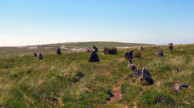
Yellowmead Fourfold Cairn Circle
Prehistoric Dartmoor Walks: Dartmoor Site: Yellowmead 4-fold Cairn Circle
OS Map: SX 57488 67846
HER: MDV3338
Megalithic Portal: 1371
PMD: Yellowmead Stone Circles
Alternate name: Yellowmead fourfold circle Cairn Circle
ShortName: CC Fourfold
Butler map: 47.14
DPD page: 31
Grinsell: SHE 4
Turner: G30
Barrow Report: 41 56
Notes: "A group of four concentric stone circles of which the innermost one is considered to be a cairn circle. Three stones were standing in 1921 when all the fallen stones were raised during restoration. There also appears to have been a stone row leading away from the stone circles." See also, Legendary Dartmoor: Yellowmead Stone Circle. Breton, see Megalithic circles on Yellowmead Down, Sheepstor (Heart of Dartmoor pp.89-91).
Nearby sites: SX 57488 67846
Distance: 0.73km