
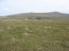
Prehistoric sites within 3km of SX 53500 74950
Guidance for walkers: The monuments featured in this database are archaeological treasures and need to be protected and preserved - please do not disturb any sites. Please check access and firing times before visiting sites, not all sites listed are on open access land. Firing ranges and boundaries of open access areas are marked on the OL28 OS Dartmoor Explorer map. Please stick to the country code and consider giving support to the numerous agencies that help to keep Dartmoor a fabulous natural and historic environment!
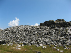
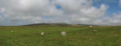
About the database listings: In all listings clicking on the photo or the site name will open a page for the site with a larger photo and further details from the database. The database now has over 6680 records covering nearly all publicly listed sites on Dartmoor including around 4800 round houses. This level of detail is of interest to archaeologists but tends to swamp listings of sites more likely to be of interest for walkers. For this reason, the listings default to around 550 core sites only. These are the stone circles, stone rows and the ring cairns listed by Turner. The default search radius is 2 km. The controls below the map can be used to start a new search by entering a 6- or 8-digit reference (without the prefix "SX"). The search radius can be specified and you can add incremental Display layers of detail on top of the core sites. If using a more detailed layer you will need to decrease the search radius to avoid getting hundreds of search results.
- Core sites Default listing of core sites consisting of stone circles & rows and some of the major ring cairns.
- Plus cairns adds approx. 1000 cairns and other minor sites not included in the core listings but excluding round houses.
- Plus round houses adds approx. 4800 round houses.
- Plus non-sites adds in the records for sites that no longer exist or are not prehistoric sites.
- Plus duplicates adds records excluded as duplicates. Those maybe duplicate records in external listings (e.g. the Historic Environment Records). For example, some sites have been identified as cairns in some listings and interpreted as round houses in other listings and both records appear.
These listings have incorporated, matched up and merged all of the records from all of the major archaeological listings including: Worth, Grinsell, Turner, Butler, Bill Radcliffe, Sandy Gerrard, Megalithic Portal, the National Monument Records and the Historic Environment Records. The author would like to thank Bill, Sandy, the lovely people both at Megalithic Portal (especially Anne Tate who did an amazing job to link listings) and at ACE Archaeology for collaborative work over the years to synchronise and correct listings across the various websites which now interlink. A culmination of years of work the final merger of cairn records took 3 months of cross referencing in 2017 the result being a snapshot of the records at that time. This data has in turn been refined since by field work and research. The round house data was supplied by Sandy Gerrard. Grid references are in order of accuracy: from Google Earth satellite, if visible and found, from a Garmin GPS reading, if visited by the author and from the literature otherwise. Individual site pages will state the source of the grid reference and provide satellite imagery. If a site listing lacks a photo it has not yet been visited by the author in which case the grid reference is from the literature.
Currently the database only includes sites which can be represented by a grid reference. Reaves are not included as they require GIS shape technology which is beyond the current capability of this system. To see the sources for the records, look at the tables on the resources menu. The database listings can also be viewed on a Google map and downloaded as GPS datasets for Garmin devices.
Corrections, or any feedback or suggestions are very welcome, email: info@dartmoorwalks.org.uk.
NOTE: Clicking on the icons for each monument in the map will give the name of the site. You can zoom in and out and drag the map around.
List of sites within 3km of SX 53500 74950
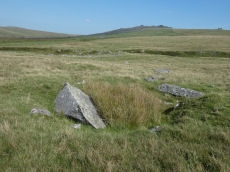
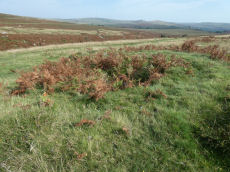
Whitchurch Common S. Reported Cairn
OS Map: SX 53032 74954
HER: MDV48865
ShortName: CN?Whitchurch6
Grinsell: WHI 1
Turner: A19
Barrow Report: 39
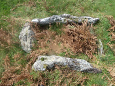
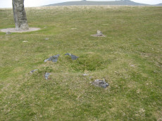
Notes: Hut Circle or ring cairn? This is probably the cairn referred to by Worth in Barrow Report 39 (not the cist on the southern slope of barn Hill).
It has been difficult to match up these three sites. The listings on this website can be matched in a coherent fashion to those on the HER and there is no doubt on those matches. However, matching records to the actual features is proving difficult. On 09/09/23 I took photos of 3 features and for the purpose of these listings I will refer to them as "northern", "western" and "southern". That clearly defines what i recorded and photographed. However, I'm not certain I have the right records matched and it may take a further site visit to unentangle this.
1. "northern" provisionally matched to SiteID=541 HER record: 4115
2. "western" provisionally matched to SiteID=2509 HER record: 48866
3. "southern" provisionally matched to SiteID=2563 HER record: 48865
NB. This site is identified as "southern" and grid reference and photo reflect this
Nearby sites: SX 53032 74954
Distance: 0.47km
Yellowmeade Round House
OS Map: SX 56370 74588
HER: MDV3756
ShortName: HT:Yellowmea4
Nearby sites: SX 56370 74588
Distance: 2.89km
Merrivale reave cairns 14 Reported Cairn
OS Map: SX 55633 74716
HER: MDV28497
ShortName: CN-Merrivale14
Butler map: 44.8.14
Nearby sites: SX 55633 74716
Distance: 2.15km
Merrivale reave cairns 15 Reported Cairn
OS Map: SX 55641 74697
HER: MDV53412
ShortName: CN-Merrivale15
Butler map: 44.8.15
Nearby sites: SX 55641 74697
Distance: 2.16km
Wedlake Farm Cairn
OS Map: SX 53893 77408
HER: MDV33612
ShortName: CN WedlakeFarm
Notes: "Small turf covered cairn, 5m diameter, 0.5m high, near centre of field". HER grid reference is 6 digit so location could be more that 100 metres out. UPDATE: The author walked along the bridal path near Wedlake Farm on 14/07/19 and a cairn was seen some distance from the HER grid reference SX 538 774 at SX 53893 77408. It seems very likely that this is the site - see photo. This record now uses the new grid reference. Now listed as "cairn" rather than "reported cairn".
Nearby sites: SX 53893 77408
Distance: 2.49km
Yellowmeade Round House
OS Map: SX 56413 74264
HER: MDV3787
ShortName: HT:Yellowmea8
Nearby sites: SX 56413 74264
Distance: 2.99km
Merrivale reave cairns 16 Reported Cairn
OS Map: SX 55647 74689
HER: MDV53413
ShortName: CN-Merrivale16
Butler map: 44.8.16
Nearby sites: SX 55647 74689
Distance: 2.16km
Merrivale reave cairns 17 Reported Cairn
OS Map: SX 55661 74675
HER: MDV28492
ShortName: CN-Merrivale17
Butler map: 44.8.17
Nearby sites: SX 55661 74675
Distance: 2.18km
Yellowmeade Round House
OS Map: SX 5632 7456
HER: MDV3756
ShortName: HT:Yellowmea10
Nearby sites: SX 5632 7456
Distance: 2.85km
Roos Tor cairn cemetery 2 Reported Cairn
OS Map: SX 5405 7717
HER: MDV48248
ShortName: CN?Roos Tor 10
Nearby sites: SX 5405 7717
Distance: 2.29km
Roos Tor cairn cemetery 3 Reported Cairn
OS Map: SX 5406 7715
HER: MDV48249
ShortName: CN?Roos Tor 11
Nearby sites: SX 5406 7715
Distance: 2.27km
Roos Tor cairn cemetery 4 Reported Cairn
OS Map: SX 5406 7713
HER: MDV48250
ShortName: CN?Roos Tor 12
Nearby sites: SX 5406 7713
Distance: 2.25km
Roos Tor cairn cemetery 5 Reported Cairn
OS Map: SX 5407 7711
HER: MDV48251
ShortName: CN?Roos Tor 13
Nearby sites: SX 5407 7711
Distance: 2.23km
Roos Tor cairn cemetery 6 Reported Cairn
OS Map: SX 5408 7711
HER: MDV48252
ShortName: CN?Roos Tor 14
Nearby sites: SX 5408 7711
Distance: 2.24km
Roos Tor cairn cemetery 7 Reported Cairn
OS Map: SX 5412 7716
HER: MDV48253
ShortName: CN?Roos Tor 15
Nearby sites: SX 5412 7716
Distance: 2.30km
Roos Tor cairn cemetery 8 Reported Cairn
OS Map: SX 5411 7717
HER: MDV48254
ShortName: CN?Roos Tor 16
Nearby sites: SX 5411 7717
Distance: 2.30km
Roos Tor cairn cemetery 9 Reported Cairn
OS Map: SX 5412 7720
HER: MDV48255
ShortName: CN?Roos Tor 17
Nearby sites: SX 5412 7720
Distance: 2.33km
Roos Tor cairn cemetery 10 Reported Cairn
OS Map: SX 5411 7720
HER: MDV48256
ShortName: CN?Roos Tor 2
Nearby sites: SX 5411 7720
Distance: 2.33km
Roos Tor cairn cemetery 11 Reported Cairn
OS Map: SX 5412 7718
HER: MDV48257
ShortName: CN?Roos Tor 3
Nearby sites: SX 5412 7718
Distance: 2.31km
Cox Tor S.E.10 Clearance Cairn
OS Map: SX 531 761
HER: MDV49831
ShortName: CN?Cox Tor 10
Notes: Clearance cairn? "clearance cairn defining ne corner of enclosure. Diam 5.5m, height 0.8m. May have been used as initial marking out point, or may have been built over the corner of an existing enclosure (mpp)." The author could find nothing at SX 531 761 but as it is a 6 digit grid reference it could be over 100 metres out.No sign of enclosure walls at the grid reference - maybe this is some distance to the south.
Nearby sites: SX 531 761
Distance: 1.22km
Merrivale (claimed cist) Reported Cist
OS Map: SX 55549 74810
HER: MDV29078
PMD: Wood & Pennys Cist at Merrivale
ShortName: CNxMerrivale24
Grinsell: WAL 6a
Notes: Wood and Penny assert that a cairn containing a cist lies at SX55577470, at end of stone row. Grinsell suggests this is a natural feature.
Nearby sites: SX 55549 74810
Distance: 2.05km
Roos Tor cairn cemetery 12 Reported Cairn
OS Map: SX 5409 7721
HER: MDV48258
ShortName: CN?Roos Tor 4
Nearby sites: SX 5409 7721
Distance: 2.34km
Roos Tor cairn cemetery 13 Reported Cairn
OS Map: SX 5414 7720
HER: MDV48259
ShortName: CN?Roos Tor 5
Nearby sites: SX 5414 7720
Distance: 2.34km
Roos Tor cairn cemetery 14 Reported Cairn
OS Map: SX 5411 7711
HER: MDV48260
ShortName: CN?Roos Tor 6
Nearby sites: SX 5411 7711
Distance: 2.24km
Roos Tor cairn cemetery 15 Reported Cairn
OS Map: SX 5411 7719
HER: MDV48262
ShortName: CN?Roos Tor 7
Nearby sites: SX 5411 7719
Distance: 2.32km
Merrivale Round House
OS Map: SX 55586 75107
HER: MDV4897
ShortName: HT:Mrrival1
Nearby sites: SX 55586 75107
Distance: 2.09km
Roos Tor cairn cemetery 16 Reported Cairn
OS Map: SX 5413 7719
HER: MDV48263
ShortName: CN?Roos Tor 8
Nearby sites: SX 5413 7719
Distance: 2.33km
Merrivale Round House
OS Map: SX 55540 75004
HER: MDV4897
ShortName: HT:Mrrival2
Nearby sites: SX 55540 75004
Distance: 2.04km
Roos Tor cairn cemetery 17 Reported Cairn
OS Map: SX 5410 7721
HER: MDV48264
ShortName: CN?Roos Tor 9
Nearby sites: SX 5410 7721
Distance: 2.34km
Merrivale Round House
OS Map: SX 55545 74950
HER: MDV4897
ShortName: HT Merrivale3
Nearby sites: SX 55545 74950
Distance: 2.04km
Merrivale Round House
OS Map: SX 55546 74907
HER: MDV4897
ShortName: HT:Mrrival4
Nearby sites: SX 55546 74907
Distance: 2.05km
Merrivale Round House
OS Map: SX 55557 75218
HER: MDV4609
ShortName: HT:Mrrival5
Nearby sites: SX 55557 75218
Distance: 2.07km
Merrivale Round House
OS Map: SX 55590 75163
HER: MDV4606
ShortName: HT:Mrrival6
Nearby sites: SX 55590 75163
Distance: 2.10km
Merrivale Round House
OS Map: SX 55542 75197
HER: MDV4608
ShortName: HT:Mrrival7
Nearby sites: SX 55542 75197
Distance: 2.06km
Cox Tor Round House
OS Map: SX 5290 7581
HER: MDV26283
ShortName: HT:Cox Tor1
Nearby sites: SX 5290 7581
Distance: 1.05km
Merrivale Round House
OS Map: SX 55578 74906
HER: MDV4897
ShortName: HT Merrivale8
Nearby sites: SX 55578 74906
Distance: 2.08km
Cox Tor Round House
OS Map: SX 52875 75828
HER: MDV103658
ShortName: HT:Cox Tor2
Nearby sites: SX 52875 75828
Distance: 1.08km
Merrivale Round House
OS Map: SX 55516 74931
HER: MDV4897
ShortName: HT:Mrrival9
Nearby sites: SX 55516 74931
Distance: 2.02km
Cox Tor Round House
OS Map: SX 53330 76089
ShortName: HT:Cox Tor3
Nearby sites: SX 53330 76089
Distance: 1.15km
Merrivale Round House
OS Map: SX 55526 75060
HER: MDV4897
ShortName: HT:Mrrival10
Nearby sites: SX 55526 75060
Distance: 2.03km
Cox Tor Round House
OS Map: SX 53273 76118
ShortName: HT:Cox Tor4
Nearby sites: SX 53273 76118
Distance: 1.19km
Merrivale Round House
OS Map: SX 55523 74870
HER: MDV4897
ShortName: HT:Mrrival11
Nearby sites: SX 55523 74870
Distance: 2.02km
Cox Tor Round House
OS Map: SX 5322 7607
HER: MDV53078
ShortName: HT:Cox Tor5
Nearby sites: SX 5322 7607
Distance: 1.15km
Merrivale Round House
OS Map: SX 55524 74903
HER: MDV4897
ShortName: HT:Mrrival12
Nearby sites: SX 55524 74903
Distance: 2.02km
Cox Tor Round House
OS Map: SX 5264 7625
HER: MDV28513
ShortName: HT:Cox Tor6
Nearby sites: SX 5264 7625
Distance: 1.56km
Merrivale Round House
OS Map: SX 55565 75196
HER: MDV4607
ShortName: HT:Mrrival13
Nearby sites: SX 55565 75196
Distance: 2.08km
Cox Tor Round House
OS Map: SX 5373 7603
HER: MDV4110
ShortName: HT:Cox Tor7
Nearby sites: SX 5373 7603
Distance: 1.10km
Merrivale Round House
OS Map: SX 55572 75107
HER: MDV4897
ShortName: HT:Mrrival14
Nearby sites: SX 55572 75107
Distance: 2.08km
Cox Tor Round House
OS Map: SX 5282 7590
HER: MDV4131
ShortName: HT:Cox Tor8
Nearby sites: SX 5282 7590
Distance: 1.17km
Merrivale Round House
OS Map: SX 55568 74989
HER: MDV4897
ShortName: HT:Mrrival15
Nearby sites: SX 55568 74989
Distance: 2.07km
Cox Tor Round House
OS Map: SX 531 761
HER: MDV49711
ShortName: HT:Cox Tor9
Nearby sites: SX 531 761
Distance: 1.22km
Merrivale Round House
OS Map: SX 55528 74981
HER: MDV4897
ShortName: HT:Mrrival16
Nearby sites: SX 55528 74981
Distance: 2.03km
Cox Tor Round House
OS Map: SX 5308 7597
HER: MDV28511
ShortName: HT:Cox Tor10
Nearby sites: SX 5308 7597
Distance: 1.10km
Merrivale Round House
OS Map: SX 55570 75077
HER: MDV4897
ShortName: HT:Mrrival17
Nearby sites: SX 55570 75077
Distance: 2.07km
Cox Tor Round House
OS Map: SX 5284 7599
HER: MDV49833
ShortName: HT:Cox Tor11
Nearby sites: SX 5284 7599
Distance: 1.23km
Merrivale Round House
OS Map: SX 55555 74937
HER: MDV4897
ShortName: HT:Mrrival18
Nearby sites: SX 55555 74937
Distance: 2.06km
Cox Tor NE Round House
OS Map: SX 53624 76462
HER: MDV4105
ShortName: HT:Cox Tor N1
Nearby sites: SX 53624 76462
Distance: 1.52km
Merrivale Round House
OS Map: SX 5566 7513
HER: MDV4897
ShortName: HT:Mrrival19
Nearby sites: SX 5566 7513
Distance: 2.17km
Cox Tor NE Round House
OS Map: SX 53530 76389
HER: MDV4105
ShortName: HT:Cox Tor N2
Nearby sites: SX 53530 76389
Distance: 1.44km
Merrivale Round House
OS Map: SX 55657 75022
HER: MDV4897
ShortName: HT:Mrrival20
Nearby sites: SX 55657 75022
Distance: 2.16km
Cox Tor NE Round House
OS Map: SX 53497 76810
HER: MDV4124
ShortName: HT:Cox Tor N3
Nearby sites: SX 53497 76810
Distance: 1.86km
Merrivale Round House
OS Map: SX 55611 74983
HER: MDV4897
ShortName: HT:Mrrival21
Nearby sites: SX 55611 74983
Distance: 2.11km
Cox Tor NE Round House
OS Map: SX 53563 76486
HER: MDV4105
ShortName: HT:Cox Tor N4
Nearby sites: SX 53563 76486
Distance: 1.54km
Merrivale Round House
OS Map: SX 55474 74945
HER: MDV4897
ShortName: HT:Mrrival22
Nearby sites: SX 55474 74945
Distance: 1.97km
Cox Tor NE Round House
OS Map: SX 53537 76363
HER: MDV4105
ShortName: HT:Cox Tor N5
Nearby sites: SX 53537 76363
Distance: 1.41km
Merrivale Round House
OS Map: SX 55616 74886
HER: MDV4897
ShortName: HT:Mrrival23
Nearby sites: SX 55616 74886
Distance: 2.12km
Cox Tor NE Round House
OS Map: SX 5351 7673
HER: MDV4124
ShortName: HT:Cox Tor N6
Nearby sites: SX 5351 7673
Distance: 1.78km
Cox Tor NE Round House
OS Map: SX 53515 76843
HER: MDV4124
ShortName: HT:Cox Tor N7
Nearby sites: SX 53515 76843
Distance: 1.89km
Merrivale Round House
OS Map: SX 55468 75043
HER: MDV4897
ShortName: HT:Mrrival25
Nearby sites: SX 55468 75043
Distance: 1.97km
Cox Tor NE Round House
OS Map: SX 53580 76543
HER: MDV4105
ShortName: HT:Cox Tor N8
Nearby sites: SX 53580 76543
Distance: 1.60km
Merrivale Round House
OS Map: SX 55468 75077
HER: MDV4897
ShortName: HT:Mrrival26
Nearby sites: SX 55468 75077
Distance: 1.97km
Cox Tor NE Round House
OS Map: SX 53528 76430
HER: MDV4105
ShortName: HT:Cox Tor N9
Nearby sites: SX 53528 76430
Distance: 1.48km
Merrivale Round House
OS Map: SX 55650 74978
HER: MDV4897
ShortName: HT:Mrrival27
Nearby sites: SX 55650 74978
Distance: 2.15km
Cox Tor NE Round House
OS Map: SX 53589 76605
HER: MDV4105
ShortName: HT:Cox Tor N10
Nearby sites: SX 53589 76605
Distance: 1.66km
Merrivale Round House
OS Map: SX 55608 74965
HER: MDV4897
ShortName: HT:Mrrival28
Nearby sites: SX 55608 74965
Distance: 2.11km
Cox Tor NE Round House
OS Map: SX 53603 76436
HER: MDV4105
ShortName: HT:Cox Tor N11
Nearby sites: SX 53603 76436
Distance: 1.49km
Merrivale Round House
OS Map: SX 55658 75074
HER: MDV4897
ShortName: HT:Mrrival29
Nearby sites: SX 55658 75074
Distance: 2.16km
Cox Tor NE Round House
OS Map: SX 53540 76791
HER: MDV4124
ShortName: HT:Cox Tor N12
Nearby sites: SX 53540 76791
Distance: 1.84km
Merrivale Round House
OS Map: SX 55487 75039
HER: MDV4897
ShortName: HT:Mrrival30
Nearby sites: SX 55487 75039
Distance: 1.99km
Cox Tor 11 (PET 37b) Reported Cairn
OS Map: SX 530 761
HER: MDV4108
ShortName: CN?Cox Tor 11
Grinsell: PET 37b
Notes: Mentioned by Breton 1912. NMR refers to clearance cairns SE of Cox Tor and cites Grinsell who is referring back to Baring-Gould. "Cox tor. On southern slope of tor is a cluster of cairns, sepulchral. Five definitely cairns and a number of other doubtful mounds. Two examined. Originally circular, composed of earth and stones. Nothing found.(baring-gould)." This very much sounds like a description of cairns 8 & 9 which are to the SE of cox tor and were excavated by the Dartmoor Exploration Committee. This grid reference is comparatively to the west and is probably wrong. This record is being marked as a duplicate for this reason, see Cox Tor 8 and Cox Tor 9.
Nearby sites: SX 530 761
Distance: 1.25km
Cox Tor NE Round House
OS Map: SX 53602 76457
HER: MDV4105
ShortName: HT:Cox Tor N13
Nearby sites: SX 53602 76457
Distance: 1.51km
Merrivale Round House
OS Map: SX 55674 75123
HER: MDV4897
ShortName: HT:Mrrival31
Nearby sites: SX 55674 75123
Distance: 2.18km
Cox Tor NE Round House
OS Map: SX 53602 76624
HER: MDV4105
ShortName: HT:Cox Tor N14
Nearby sites: SX 53602 76624
Distance: 1.68km
Merrivale Round House
OS Map: SX 55674 74997
HER: MDV4897
ShortName: HT:Mrrival32
Nearby sites: SX 55674 74997
Distance: 2.17km
Cox Tor NE Round House
OS Map: SX 5353 7683
HER: MDV4124
ShortName: HT:Cox Tor N15
Nearby sites: SX 5353 7683
Distance: 1.88km
Merrivale Round House
OS Map: SX 55694 74604
HER: MDV12832
ShortName: HT:Mrrival33
Nearby sites: SX 55694 74604
Distance: 2.22km
Cox Tor NE Round House
OS Map: SX 53578 76456
HER: MDV4105
ShortName: HT:Cox Tor N16
Nearby sites: SX 53578 76456
Distance: 1.51km
Merrivale Round House
OS Map: SX 55699 74619
HER: MDV53399
ShortName: HT:Mrrival34
Nearby sites: SX 55699 74619
Distance: 2.22km
Merrivale Bridge E.2 Reported Cairn
OS Map: SX 55964 75448
HER: MDV56739
ShortName: CN-Merrivale26
Notes: Dubious. Visited 09/09/23. There are nearby mounds with lots of activity of stone cutters. The appearance of this site is modern and the HER suggests " military training pit". Either way, it is not prehistoric. Entry altered to reflect it is not a cairn.
Nearby sites: SX 55964 75448
Distance: 2.51km
Cox Tor NE Round House
OS Map: SX 5353 7678
HER: MDV4124
ShortName: HT:Cox Tor N17
Nearby sites: SX 5353 7678
Distance: 1.83km
Merrivale Round House
OS Map: SX 55725 74565
HER: MDV53401
ShortName: HT:Mrrival35
Nearby sites: SX 55725 74565
Distance: 2.26km
Cox Tor NE Round House
OS Map: SX 5361 7650
HER: MDV4105
ShortName: HT:Cox Tor N18
Nearby sites: SX 5361 7650
Distance: 1.55km
Merrivale Round House
OS Map: SX 55814 74773
HER: MDV12830
ShortName: HT:Mrrival36
Nearby sites: SX 55814 74773
Distance: 2.32km
Cox Tor NE Round House
OS Map: SX 5354 7656
HER: MDV4105
ShortName: HT:Cox Tor N19
Nearby sites: SX 5354 7656
Distance: 1.61km
Merrivale Round House
OS Map: SX 55922 74737
HER: MDV12829
ShortName: HT:Mrrival37
Nearby sites: SX 55922 74737
Distance: 2.43km
Cox Tor NE Round House
OS Map: SX 53613 76411
HER: MDV4105
ShortName: HT:Cox Tor N20
Nearby sites: SX 53613 76411
Distance: 1.47km
Merrivale Round House
OS Map: SX 55619 75057
HER: MDV4897
ShortName: HT:Mrrival38
Nearby sites: SX 55619 75057
Distance: 2.12km
Cox Tor NE Round House
OS Map: SX 53545 76379
HER: MDV4105
ShortName: HT:Cox Tor N21
Nearby sites: SX 53545 76379
Distance: 1.43km
Merrivale Round House
OS Map: SX 55464 74967
HER: MDV4897
ShortName: HT:Mrrival39
Nearby sites: SX 55464 74967
Distance: 1.96km
Cox Tor NE Round House
OS Map: SX 5350 7677
HER: MDV4124
ShortName: HT:Cox Tor N22
Nearby sites: SX 5350 7677
Distance: 1.82km
Merrivale Round House
OS Map: SX 55507 74989
HER: MDV4897
ShortName: HT:Mrrival40
Nearby sites: SX 55507 74989
Distance: 2.01km
Cox Tor NE Round House
OS Map: SX 53507 76688
HER: MDV48242
ShortName: HT:Cox Tor N23
Nearby sites: SX 53507 76688
Distance: 1.74km
Merrivale Round House
OS Map: SX 55588 74967
HER: MDV4897
ShortName: HT:Mrrival41
Nearby sites: SX 55588 74967
Distance: 2.09km
Cox Tor NE Round House
OS Map: SX 53475 76825
HER: MDV4124
ShortName: HT:Cox Tor N24
Nearby sites: SX 53475 76825
Distance: 1.88km
Merrivale Round House
OS Map: SX 55596 75102
HER: MDV4897
ShortName: HT:Mrrival42
Nearby sites: SX 55596 75102
Distance: 2.10km
Merrivale Round House
OS Map: SX 55505 74901
HER: MDV4897
ShortName: HT:Mrrival43
Nearby sites: SX 55505 74901
Distance: 2.01km
Merrivale Round House
OS Map: SX 55508 75068
HER: MDV4897
ShortName: HT:Mrrival45
Nearby sites: SX 55508 75068
Distance: 2.01km
Merrivale Round House
OS Map: SX 55609 75023
HER: MDV4897
ShortName: HT:Mrrival46
Nearby sites: SX 55609 75023
Distance: 2.11km
Merrivale Round House
OS Map: SX 55502 75172
HER: MDV55594
ShortName: HT:Mrrival47
Nearby sites: SX 55502 75172
Distance: 2.01km
Merrivale Newtake Round House
OS Map: SX 55526 76390
HER: MDV4611
ShortName: HT:Mrrival48
Nearby sites: SX 55526 76390
Distance: 2.49km
Merrivale Newtake Round House
OS Map: SX 55442 75997
HER: MDV28502
ShortName: HT:Mrrival49
Nearby sites: SX 55442 75997
Distance: 2.21km
Merrivale Newtake Round House
OS Map: SX 55402 75458
HER: MDV55005
ShortName: HT:Mrrival50
Nearby sites: SX 55402 75458
Distance: 1.97km
Merrivale Newtake Round House
OS Map: SX 55577 76373
HER: MDV4611
ShortName: HT:Mrrival51
Nearby sites: SX 55577 76373
Distance: 2.52km
Merrivale Newtake Round House
OS Map: SX 55548 76390
HER: MDV4611
ShortName: HT:Mrrival52
Nearby sites: SX 55548 76390
Distance: 2.50km
Pew Tor South Round House
OS Map: SX 5284 7295
HER: MDV64701
ShortName: HT:Pew Tor 1
Nearby sites: SX 5284 7295
Distance: 2.11km
Merrivale Newtake Round House
OS Map: SX 55456 75998
HER: MDV28502
ShortName: HT:Mrrival53
Nearby sites: SX 55456 75998
Distance: 2.22km
Merrivale Newtake Round House
OS Map: SX 55394 75466
HER: MDV55005
ShortName: HT:Mrrival54
Nearby sites: SX 55394 75466
Distance: 1.96km
Merrivale Newtake Round House
OS Map: SX 55568 76344
HER: MDV4611
ShortName: HT:Mrrival55
Nearby sites: SX 55568 76344
Distance: 2.49km
Merrivale Newtake Round House
OS Map: SX 55553 76384
HER: MDV4611
ShortName: HT:Mrrival56
Nearby sites: SX 55553 76384
Distance: 2.50km
Merrivale Newtake Round House
OS Map: SX 5541 7541
HER: MDV55006
ShortName: HT:Mrrival57
Nearby sites: SX 5541 7541
Distance: 1.96km
Merrivale Newtake Round House
OS Map: SX 55562 76371
HER: MDV4611
ShortName: HT:Mrrival58
Nearby sites: SX 55562 76371
Distance: 2.50km
Merrivale row 4 Reported Cairn
OS Map: SX 5535 7458
ShortName: CN?Merrivale4
Butler map: 44.8.4
Notes: Cairn recored by Rowe at the head of Merrivale row 4. Not recorded by Lukis or worth. Not trabeable now.
Nearby sites: SX 5535 7458
Distance: 1.89km
Merrivale Newtake Round House
OS Map: SX 55532 76356
HER: MDV4611
ShortName: HT:Mrrival59
Nearby sites: SX 55532 76356
Distance: 2.47km
Spence Bate's Reported Cist
OS Map: SX 553 745
ShortName: CN?Merrivale25
Butler map: 44.8.5
Notes: Butler: "Nor is there much surviving from the circle of slabs around the menhir depicted in Bray's plan and recorded by Spence Bate in 1871, or the nearby cist which he excavated"
Nearby sites: SX 553 745
Distance: 1.86km
Merrivale Newtake Round House
OS Map: SX 55556 76380
HER: MDV4611
ShortName: HT:Mrrival60
Nearby sites: SX 55556 76380
Distance: 2.50km
Merrivale Newtake Round House
OS Map: SX 5528 7523
HER: MDV61974
ShortName: HT:Mrrival61
Nearby sites: SX 5528 7523
Distance: 1.80km
Merrivale Newtake Round House
OS Map: SX 55539 76354
HER: MDV4611
ShortName: HT:Mrrival62
Nearby sites: SX 55539 76354
Distance: 2.48km
Merrivale Bridge E. Reported Cairn
OS Map: SX 557 752
HER: MDV61740
ShortName: CN:Merrivale21
Nearby sites: SX 557 752
Distance: 2.21km
Merrivale Newtake Round House
OS Map: SX 5531 7517
HER: MDV61976
ShortName: HT:Mrrival63
Nearby sites: SX 5531 7517
Distance: 1.82km
Merrivale Newtake Round House
OS Map: SX 5531 7525
HER: MDV61973
ShortName: HT:Mrrival64
Nearby sites: SX 5531 7525
Distance: 1.83km
Merrivale Newtake Round House
OS Map: SX 55556 76483
HER: MDV57393
ShortName: HT:Mrrival65
Nearby sites: SX 55556 76483
Distance: 2.56km
Merrivale 11 Reported Cairn
OS Map: SX 5580 7494
ShortName: CN:Merrivale11
Butler map: 44.8.11
Notes: Butler: "A total casualty, C11, is the cairn on the north side of the road shown in the plan accompanying the Exploration Committee's report. It was apparently large about the size of C8, but had completely disappeared by 1895"
Nearby sites: SX 5580 7494
Distance: 2.30km
Merrivale Newtake Round House
OS Map: SX 55538 76392
HER: MDV4611
ShortName: HT:Mrrival66
Nearby sites: SX 55538 76392
Distance: 2.50km
Merrivale 12 Cairn
OS Map: SX 55640 74870
HER: MDV28493
ShortName: CN Merrivale12
Butler map: 44.8.12
Nearby sites: SX 55640 74870
Distance: 2.14km
Merrivale Newtake Round House
OS Map: SX 5541 7614
HER: MDV27087
ShortName: HT:Mrrival67
Nearby sites: SX 5541 7614
Distance: 2.25km
Merrivale reave cairns 13 Reported Cairn
OS Map: SX 55605 74758
HER: MDV4961
ShortName: CN-Merrivale13
Butler map: 44.8.13
Notes: Their form and positioning does not suggest either a prehistoric origin nor a sepulchral use. [N.B. This Butler entry Merrivale reave cairns 13 (1-5) has been separated into individual sites.]
Nearby sites: SX 55605 74758
Distance: 2.11km
Merrivale Newtake Round House
OS Map: SX 55879 76133
HER: MDV4227
ShortName: HT:Mrrival68
Nearby sites: SX 55879 76133
Distance: 2.66km
Merrivale Newtake Round House
OS Map: SX 55635 76364
HER: MDV4611
ShortName: HT:Mrrival69
Nearby sites: SX 55635 76364
Distance: 2.56km
Merrivale Newtake Round House
OS Map: SX 55752 76362
HER: MDV57399
ShortName: HT:Mrrival70
Nearby sites: SX 55752 76362
Distance: 2.66km
Merrivale Newtake Round House
OS Map: SX 55746 76370
HER: MDV57399
ShortName: HT:Mrrival71
Nearby sites: SX 55746 76370
Distance: 2.66km
Merrivale Newtake Round House
OS Map: SX 55652 76386
HER: MDV4611
ShortName: HT:Mrrival72
Nearby sites: SX 55652 76386
Distance: 2.59km
Vixen Tor 2 Cairn
OS Map: SX 54115 74445
HER: MDV35898
ShortName: CN Vixen Tor1
Butler map: 44.10.2
Notes: The HER grid reference is SX 54130 74460
Nearby sites: SX 54115 74445
Distance: 0.80km
Merrivale Newtake Round House
OS Map: SX 55736 76137
HER: MDV4227
ShortName: HT:Mrrival73
Nearby sites: SX 55736 76137
Distance: 2.53km
Merrivale Newtake Round House
OS Map: SX 55736 76147
HER: MDV4227
ShortName: HT:Mrrival74
Nearby sites: SX 55736 76147
Distance: 2.54km
Barn Hill N.E. Cairn
OS Map: SX 53442 75013
HER: MDV63573
ShortName: CN Barn Hill1
Butler map: 44.10.4
Notes: Possibly NMR 1359050. "Despoiled prehistoric barrow on the east side of barn hill just to the west of the streamwork. The top of the monument has recently been dug into "
Nearby sites: SX 53442 75013
Distance: 0.09km
Merrivale Newtake Round House
OS Map: SX 55734 76379
HER: MDV57399
ShortName: HT:Mrrival75
Nearby sites: SX 55734 76379
Distance: 2.65km
Whitchurch Common E. Cairn
OS Map: SX 54141 74887
HER: MDV64833
ShortName: CN:Whitchurch2
Butler map: 44.10.5
Notes: "Diam 6m, height 0.9m. A number of large stones protrude through the surface of the mound, which appears to be intact having escaped antiquarian investigation. Lies within extensive coaxial field system which is the subject of separate schedulings"
Nearby sites: SX 54141 74887
Distance: 0.64km
Merrivale Newtake Round House
OS Map: SX 55726 76152
HER: MDV4227
ShortName: HT Merrivale76
Nearby sites: SX 55726 76152
Distance: 2.53km
Merrivale Newtake Round House
OS Map: SX 55720 76048
HER: MDV4227
ShortName: HT:Mrrival77
Nearby sites: SX 55720 76048
Distance: 2.48km
Roos Tor E Round House
OS Map: SX 54765 76748
HER: MDV56596
ShortName: HT:Roos Tor 1
Nearby sites: SX 54765 76748
Distance: 2.20km
Merrivale Newtake Round House
OS Map: SX 55728 76382
HER: MDV57399
ShortName: HT:Mrrival78
Nearby sites: SX 55728 76382
Distance: 2.65km
Roos Tor E Round House
OS Map: SX 54808 76776
HER: MDV56596
ShortName: HT:Roos Tor 2
Nearby sites: SX 54808 76776
Distance: 2.25km
Merrivale Newtake Round House
OS Map: SX 55723 76387
HER: MDV57399
ShortName: HT:Mrrival79
Nearby sites: SX 55723 76387
Distance: 2.65km
Roos Tor NW Round House
OS Map: SX 53877 77001
HER: MDV47620
ShortName: HT:Roos Tor 3
Nearby sites: SX 53877 77001
Distance: 2.09km
Merrivale Newtake Round House
OS Map: SX 55637 76455
HER: MDV4611
ShortName: HT:Mrrival80
Nearby sites: SX 55637 76455
Distance: 2.61km
Roos Tor NW Round House
OS Map: SX 54048 77278
HER: MDV4104
ShortName: HT:Roos Tor 4
Nearby sites: SX 54048 77278
Distance: 2.39km
Merrivale Newtake Round House
OS Map: SX 55713 76424
HER: MDV4611
ShortName: HT:Mrrival81
Nearby sites: SX 55713 76424
Distance: 2.66km
Roos Tor NW Round House
OS Map: SX 54059 77262
HER: MDV4104
ShortName: HT:Roos Tor 5
Nearby sites: SX 54059 77262
Distance: 2.38km
Merrivale Newtake Round House
OS Map: SX 55745 76262
HER: MDV57384
ShortName: HT:Mrrival82
Nearby sites: SX 55745 76262
Distance: 2.60km
Roos Tor NW Round House
OS Map: SX 53948 76958
HER: MDV47620
ShortName: HT:Roos Tor 6
Nearby sites: SX 53948 76958
Distance: 2.06km
Merrivale Newtake Round House
OS Map: SX 55577 76345
HER: MDV57393
ShortName: HT:Mrrival83
Nearby sites: SX 55577 76345
Distance: 2.50km
Roos Tor NW Round House
OS Map: SX 54059 77231
HER: MDV4104
ShortName: HT:Roos Tor 7
Nearby sites: SX 54059 77231
Distance: 2.35km
Merrivale Newtake Round House
OS Map: SX 55638 76343
HER: MDV4611
ShortName: HT:Mrrival84
Nearby sites: SX 55638 76343
Distance: 2.55km
Roos Tor NW Round House
OS Map: SX 53999 77198
HER: MDV4104
ShortName: HT:Roos Tor 8
Nearby sites: SX 53999 77198
Distance: 2.30km
Merrivale Newtake Round House
OS Map: SX 55701 76396
HER: MDV57399
ShortName: HT:Mrrival85
Nearby sites: SX 55701 76396
Distance: 2.63km
Roos Tor NW Round House
OS Map: SX 54176 77340
HER: MDV4104
ShortName: HT:Roos Tor 9
Nearby sites: SX 54176 77340
Distance: 2.48km
Merrivale Newtake Round House
OS Map: SX 55885 76121
HER: MDV4227
ShortName: HT:Mrrival86
Nearby sites: SX 55885 76121
Distance: 2.66km
Roos Tor NW Round House
OS Map: SX 54069 77306
HER: MDV4104
ShortName: HT:Roos Tor 10
Nearby sites: SX 54069 77306
Distance: 2.42km
Merrivale Newtake Round House
OS Map: SX 55681 76184
HER: MDV4227
ShortName: HT:Mrrival87
Nearby sites: SX 55681 76184
Distance: 2.51km
Roos Tor NW Round House
OS Map: SX 54070 77321
HER: MDV4104
ShortName: HT:Roos Tor 11
Nearby sites: SX 54070 77321
Distance: 2.44km
Merrivale Newtake Round House
OS Map: SX 55824 76154
HER: MDV4227
ShortName: HT:Mrrival88
Nearby sites: SX 55824 76154
Distance: 2.62km
Roos Tor NW Round House
OS Map: SX 54072 77349
HER: MDV4104
ShortName: HT:Roos Tor 12
Nearby sites: SX 54072 77349
Distance: 2.47km
Merrivale Newtake Round House
OS Map: SX 55681 76407
HER: MDV4611
ShortName: HT:Mrrival89
Nearby sites: SX 55681 76407
Distance: 2.62km
Roos Tor NW Round House
OS Map: SX 54075 77332
HER: MDV4104
ShortName: HT:Roos Tor 13
Nearby sites: SX 54075 77332
Distance: 2.45km
Merrivale Newtake Round House
OS Map: SX 55674 76383
HER: MDV4611
ShortName: HT:Mrrival90
Nearby sites: SX 55674 76383
Distance: 2.60km
Roos Tor NW Round House
OS Map: SX 53930 77147
HER: MDV4104
ShortName: HT:Roos Tor 14
Nearby sites: SX 53930 77147
Distance: 2.24km
Merrivale Newtake Round House
OS Map: SX 55671 76409
HER: MDV4611
ShortName: HT:Mrrival91
Nearby sites: SX 55671 76409
Distance: 2.62km
Roos Tor NW Round House
OS Map: SX 53984 76979
HER: MDV47620
ShortName: HT:Roos Tor 15
Nearby sites: SX 53984 76979
Distance: 2.09km
Merrivale Newtake Round House
OS Map: SX 55664 76346
HER: MDV57398
ShortName: HT:Mrrival92
Nearby sites: SX 55664 76346
Distance: 2.58km
Roos Tor NW Round House
OS Map: SX 53946 77207
HER: MDV4104
ShortName: HT:Roos Tor 16
Nearby sites: SX 53946 77207
Distance: 2.30km
Merrivale Newtake Round House
OS Map: SX 55658 76392
HER: MDV4611
ShortName: HT:Mrrival93
Nearby sites: SX 55658 76392
Distance: 2.60km
Roos Tor NW Round House
OS Map: SX 53875 77129
HER: MDV4104
ShortName: HT:Roos Tor 17
Nearby sites: SX 53875 77129
Distance: 2.21km
Merrivale Newtake Round House
OS Map: SX 55651 76397
HER: MDV4611
ShortName: HT:Mrrival94
Nearby sites: SX 55651 76397
Distance: 2.59km
Roos Tor NW Round House
OS Map: SX 54086 77326
HER: MDV4104
ShortName: HT:Roos Tor 18
Nearby sites: SX 54086 77326
Distance: 2.45km
Merrivale Newtake Round House
OS Map: SX 55713 76078
HER: MDV4227
ShortName: HT:Mrrival95
Nearby sites: SX 55713 76078
Distance: 2.48km
Roos Tor NW Round House
OS Map: SX 53983 76940
HER: MDV47620
ShortName: HT:Roos Tor 19
Nearby sites: SX 53983 76940
Distance: 2.05km
Merrivale Newtake Round House
OS Map: SX 55817 76213
HER: MDV57388
ShortName: HT:Mrrival96
Nearby sites: SX 55817 76213
Distance: 2.64km
Roos Tor NW Round House
OS Map: SX 54044 77336
HER: MDV4104
ShortName: HT:Roos Tor 20
Nearby sites: SX 54044 77336
Distance: 2.45km
Merrivale Newtake Round House
OS Map: SX 55588 76364
HER: MDV4611
ShortName: HT:Mrrival97
Nearby sites: SX 55588 76364
Distance: 2.52km
Roos Tor NW Round House
OS Map: SX 53938 77304
HER: MDV4104
ShortName: HT:Roos Tor 21
Nearby sites: SX 53938 77304
Distance: 2.39km
Merrivale Newtake Round House
OS Map: SX 55583 76367
HER: MDV4611
ShortName: HT:Mrrival98
Nearby sites: SX 55583 76367
Distance: 2.52km
Roos Tor NW Round House
OS Map: SX 53972 77209
HER: MDV4104
ShortName: HT:Roos Tor 22
Nearby sites: SX 53972 77209
Distance: 2.31km
Merrivale Bridge N. Reported Cairn
OS Map: SX 55256 75145
HER: MDV28518
ShortName: CN Merrivale7
Butler map: 30.7
Notes: Cairn or hut? "Recorded by Ordnance Survey (1979) as a hut, but Gerrard (1999) suggests it is a cairn. Feature measures 5.7 metres in diameter, height 0.6 metres. Kerb visible in places. Large numbers of rocks with quartz in them. Cairn lies 6 metres from field wall, which appears to kink around it." Visited 09/09/23 - a bit of a jumble of stones covered in vegetation. Identification of correct site not 100% certain but fits with mutilated cairn.
Nearby sites: SX 55256 75145
Distance: 1.77km
Merrivale Newtake Round House
OS Map: SX 55610 76361
HER: MDV4611
ShortName: HT:Mrrival99
Nearby sites: SX 55610 76361
Distance: 2.54km
Roos Tor NW Round House
OS Map: SX 5408 7715
HER: MDV4104
ShortName: HT:Roos Tor 23
Nearby sites: SX 5408 7715
Distance: 2.28km
Merrivale Newtake Round House
OS Map: SX 55607 76263
HER: MDV4611
ShortName: HT:Mrrival100
Nearby sites: SX 55607 76263
Distance: 2.48km
Roos Tor NW Round House
OS Map: SX 53865 77289
HER: MDV4104
ShortName: HT:Roos Tor 24
Nearby sites: SX 53865 77289
Distance: 2.37km
Merrivale Newtake Round House
OS Map: SX 55611 76459
HER: MDV4611
ShortName: HT:Mrrival101
Nearby sites: SX 55611 76459
Distance: 2.59km
Roos Tor NW Round House
OS Map: SX 53983 77006
HER: MDV47620
ShortName: HT:Roos Tor 25
Nearby sites: SX 53983 77006
Distance: 2.11km
Merrivale Newtake Round House
OS Map: SX 55768 76265
HER: MDV57385
ShortName: HT:Mrrival102
Nearby sites: SX 55768 76265
Distance: 2.62km
Roos Tor NW Round House
OS Map: SX 53882 77210
HER: MDV4104
ShortName: HT:Roos Tor 26
Nearby sites: SX 53882 77210
Distance: 2.29km
Merrivale Newtake Round House
OS Map: SX 55814 76175
HER: MDV4227
ShortName: HT:Mrrival103
Nearby sites: SX 55814 76175
Distance: 2.62km
Roos Tor NW Round House
OS Map: SX 53865 77161
HER: MDV4104
ShortName: HT:Roos Tor 27
Nearby sites: SX 53865 77161
Distance: 2.24km
Merrivale Newtake Round House
OS Map: SX 55616 76454
HER: MDV4611
ShortName: HT:Mrrival104
Nearby sites: SX 55616 76454
Distance: 2.60km
Roos Tor NW Round House
OS Map: SX 53874 77007
HER: MDV47620
ShortName: HT:Roos Tor 28
Nearby sites: SX 53874 77007
Distance: 2.09km
Merrivale 18 Cairn
OS Map: SX 55280 74742
HER: MDV103582
ShortName: CN Merrivale18
Nearby sites: SX 55280 74742
Distance: 1.79km
Merrivale Newtake Round House
OS Map: SX 55817 76129
HER: MDV4227
ShortName: HT:Mrrival105
Nearby sites: SX 55817 76129
Distance: 2.60km
Roos Tor NW Round House
OS Map: SX 5395 7719
HER: MDV4104
ShortName: HT:Roos Tor 29
Nearby sites: SX 5395 7719
Distance: 2.28km
Merrivale 19 Cairn
OS Map: SX 55294 74727
HER: MDV103583
ShortName: CN Merrivale19
Nearby sites: SX 55294 74727
Distance: 1.81km
Merrivale Newtake Round House
OS Map: SX 55819 76109
HER: MDV4227
ShortName: HT:Mrrival106
Nearby sites: SX 55819 76109
Distance: 2.59km
Roos Tor NW Round House
OS Map: SX 53872 77011
HER: MDV47620
ShortName: HT:Roos Tor 30
Nearby sites: SX 53872 77011
Distance: 2.09km
Merrivale Newtake Round House
OS Map: SX 55599 76442
HER: MDV4611
ShortName: HT:Mrrival107
Nearby sites: SX 55599 76442
Distance: 2.58km
Roos Tor NW Round House
OS Map: SX 53879 77024
HER: MDV47620
ShortName: HT:Roos Tor 31
Nearby sites: SX 53879 77024
Distance: 2.11km
Merrivale Newtake Round House
OS Map: SX 55595 76479
HER: MDV4611
ShortName: HT:Mrrival108
Nearby sites: SX 55595 76479
Distance: 2.59km
Roos Tor NW Round House
OS Map: SX 54077 77271
HER: MDV4104
ShortName: HT:Roos Tor 32
Nearby sites: SX 54077 77271
Distance: 2.39km
Merrivale Newtake Round House
OS Map: SX 55589 76293
HER: MDV4611
ShortName: HT:Mrrival109
Nearby sites: SX 55589 76293
Distance: 2.48km
Roos Tor NW Round House
OS Map: SX 53966 76936
HER: MDV47620
ShortName: HT:Roos Tor 33
Nearby sites: SX 53966 76936
Distance: 2.04km
Merrivale Newtake Round House
OS Map: SX 55590 76346
HER: MDV4611
ShortName: HT:Mrrival110
Nearby sites: SX 55590 76346
Distance: 2.51km
Roos Tor NW Round House
OS Map: SX 53914 77121
HER: MDV47620
ShortName: HT:Roos Tor 34
Nearby sites: SX 53914 77121
Distance: 2.21km
Merrivale Newtake Round House
OS Map: SX 55606 76309
HER: MDV4611
ShortName: HT:Mrrival111
Nearby sites: SX 55606 76309
Distance: 2.51km
Roos Tor NW Round House
OS Map: SX 54031 76988
HER: MDV47620
ShortName: HT:Roos Tor 35
Nearby sites: SX 54031 76988
Distance: 2.11km
Merrivale Newtake Round House
OS Map: SX 55807 76184
HER: MDV4227
ShortName: HT:Mrrival112
Nearby sites: SX 55807 76184
Distance: 2.62km
Roos Tor NW Round House
OS Map: SX 54012 77240
HER: MDV4104
ShortName: HT:Roos Tor 36
Nearby sites: SX 54012 77240
Distance: 2.35km
Merrivale Newtake Round House
OS Map: SX 55635 76425
HER: MDV4611
ShortName: HT:Mrrival113
Nearby sites: SX 55635 76425
Distance: 2.59km
Roos Tor NW Round House
OS Map: SX 54035 77308
HER: MDV4104
ShortName: HT:Roos Tor 37
Nearby sites: SX 54035 77308
Distance: 2.42km
Merrivale Newtake Round House
OS Map: SX 55629 76373
HER: MDV4611
ShortName: HT:Mrrival114
Nearby sites: SX 55629 76373
Distance: 2.56km
Roos Tor NW Round House
OS Map: SX 53958 77150
HER: MDV4104
ShortName: HT:Roos Tor 38
Nearby sites: SX 53958 77150
Distance: 2.25km
Cox Tor N.4 Cairn
OS Map: SX 53032 76347
HER: MDV4191
ShortName: CN Cox Tor N4
Butler map: 31.1.4
Grinsell: PET 37
Nearby sites: SX 53032 76347
Distance: 1.47km
Merrivale Newtake Round House
OS Map: SX 55630 76441
HER: MDV4611
ShortName: HT:Mrrival115
Nearby sites: SX 55630 76441
Distance: 2.60km
Roos Tor NW Round House
OS Map: SX 54078 77343
HER: MDV4104
ShortName: HT:Roos Tor 39
Nearby sites: SX 54078 77343
Distance: 2.46km
Merrivale Newtake Round House
OS Map: SX 55779 76247
HER: MDV57386
ShortName: HT:Mrrival116
Nearby sites: SX 55779 76247
Distance: 2.62km
Roos Tor NW Round House
OS Map: SX 53970 77301
HER: MDV4104
ShortName: HT:Roos Tor 40
Nearby sites: SX 53970 77301
Distance: 2.40km
Merrivale Newtake Round House
OS Map: SX 55781 76154
HER: MDV4227
ShortName: HT:Mrrival117
Nearby sites: SX 55781 76154
Distance: 2.58km
Roos Tor NW Round House
OS Map: SX 5392 7728
HER: MDV4104
ShortName: HT:Roos Tor 41
Nearby sites: SX 5392 7728
Distance: 2.37km
Cox Tor N.7 Cairn
OS Map: SX 53053 76495
HER: MDV49710
ShortName: CN Cox Tor N7
Butler map: 31.1.7
Nearby sites: SX 53053 76495
Distance: 1.61km
Merrivale Newtake Round House
OS Map: SX 55800 76143
HER: MDV4227
ShortName: HT:Mrrival118
Nearby sites: SX 55800 76143
Distance: 2.59km
Roos Tor NW Round House
OS Map: SX 53918 77193
HER: MDV4104
ShortName: HT:Roos Tor 42
Nearby sites: SX 53918 77193
Distance: 2.28km
Cox Tor S.E.8 Cairn
OS Map: SX 53206 76138
HER: MDV28512
ShortName: CN Cox Tor SE8
Butler map: 31.1.8
Notes: Butler lists a pair of two small cairns south of the tor; cairn 8 at SX 5316 7613 and cairn 9 at SX 5318 7614. The author visited this area and found two possible cairns that could match the pair are located around 30-40 metres to the north-east. These match very closely to the NGR given by the the HER for SX 53210 76180 (HER 28512) and SX 53203 76131 (56607). It is impossible to say whether these are the cairns mentioned by Butler or not but these two records assume that is the case and use the grid references of the sites photographed. Butler writes: "The [Dartmoor Exploration] Committee then dug into two small cairns 60 m south of the tor, in neither of which was anything found. These were part of a small cairnfield with five to seven members but only two are easily identifiable south-east of the to, 8 and 9." This area is covered in periglacial mounds which adds to the confusing picture of this area and the author was unable to find anything else that looked man-made. NB. Grinsell's PET 37b probably relates to these two cairns.
Nearby sites: SX 53206 76138
Distance: 1.22km
Merrivale Newtake Round House
OS Map: SX 55807 76236
HER: MDV57387
ShortName: HT:Mrrival119
Nearby sites: SX 55807 76236
Distance: 2.64km
Roos Tor NW Round House
OS Map: SX 53918 77162
HER: MDV4104
ShortName: HT:Roos Tor 43
Nearby sites: SX 53918 77162
Distance: 2.25km
Cox Tor S.E.9 Cairn
OS Map: SX 53228 76174
ShortName: CN Cox Tor SE9
Butler map: 31.1.9
Notes: Butler lists a pair of two small cairns south of the tor; cairn 8 at SX 5316 7613 and cairn 9 at SX 5318 7614. The author visited this area and found two possible cairns that could match the pair are located around 30-40 metres to the north-east. These match very closely to the NGR given by the the HER for SX 53210 76180 (HER 28512) and SX 53203 76131 (56607). It is impossible to say whether these are the cairns mentioned by Butler or not but these two records assume that is the case and use the grid references of the sites photographed. Butler writes: "The [Dartmoor Exploration] Committee then dug into two small cairns 60 m south of the tor, in neither of which was anything found. These were part of a small cairnfield with five to seven members but only two are easily identifiable south-east of the to, 8 and 9." This area is covered in periglacial mounds which adds to the confusing picture of this area and the author was unable to find anything else that looked man-made. NB. Grinsell's PET 37b probably relates to these two cairns.
UPDATE 31/12/2022. The HER record MDV56607 that this used to link to has been deleted. The record originates with Butler and has possibly located so this record will be retained (see photo).
Nearby sites: SX 53228 76174
Distance: 1.25km
Merrivale Newtake Round House
OS Map: SX 55617 76313
HER: MDV4611
ShortName: HT:Mrrival120
Nearby sites: SX 55617 76313
Distance: 2.52km
Roos Tor NW Round House
OS Map: SX 53926 77259
HER: MDV4104
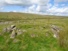
ShortName: HT:Roos Tor 44
Nearby sites: SX 53926 77259
Distance: 2.35km
Roos Tor cairn cemetery (c.20) 1 Reported Cairn
OS Map: SX 5406 7711
HER: MDV48247
ShortName: CN:Roos Tor 1
Butler map: 31.7
Notes: Cairn cemetry - see individual records for cairns. This master record is marked as a duplicate.
Nearby sites: SX 5406 7711
Distance: 2.23km
Merrivale Newtake Round House
OS Map: SX 55810 76146
HER: MDV4227
ShortName: HT:Mrrival121
Nearby sites: SX 55810 76146
Distance: 2.60km
Roos Tor NW Round House
OS Map: SX 54031 77241
HER: MDV4104
ShortName: HT:Roos Tor 45
Nearby sites: SX 54031 77241
Distance: 2.35km
Cox Tor Summit (duplicate) Reported Cairn
OS Map: SX 5305 7618
HER: MDV4151
ShortName: CN:Cox Tor S5
Butler map: 31.1.3
Notes: Duplicate of NMR 439836
Nearby sites: SX 5305 7618
Distance: 1.31km
Merrivale Newtake Round House
OS Map: SX 55614 76268
HER: MDV4611
ShortName: HT:Mrrival122
Nearby sites: SX 55614 76268
Distance: 2.49km
Roos Tor NW Round House
OS Map: SX 54032 77293
HER: MDV4104
ShortName: HT:Roos Tor 46
Nearby sites: SX 54032 77293
Distance: 2.40km
Merrivale Newtake Round House
OS Map: SX 55615 76348
HER: MDV4611
ShortName: HT:Mrrival123
Nearby sites: SX 55615 76348
Distance: 2.54km
Roos Tor NW Round House
OS Map: SX 54011 77202
HER: MDV4104
ShortName: HT:Roos Tor 47
Nearby sites: SX 54011 77202
Distance: 2.31km
Roos Tor NW Round House
OS Map: SX 53925 77029
HER: MDV4104
ShortName: HT:Roos Tor 48
Nearby sites: SX 53925 77029
Distance: 2.12km
Roos Tor NW Round House
OS Map: SX 53881 76996
HER: MDV47620
ShortName: HT:Roos Tor 49
Nearby sites: SX 53881 76996
Distance: 2.08km
Roos Tor NW Round House
OS Map: SX 54081 77322
HER: MDV4104
ShortName: HT:Roos Tor 50
Nearby sites: SX 54081 77322
Distance: 2.44km
Wedlake E.1 Cairn
OS Map: SX 54288 77561
HER: MDV4183
ShortName: CN:Wedlake E1
Butler map: 31.18.1
Grinsell: PET 34b
Notes: Probable cairn now bisected by newtake wall.
Nearby sites: SX 54288 77561
Distance: 2.73km
Roos Tor NW Round House
OS Map: SX 53886 76992
HER: MDV47620
ShortName: HT:Roos Tor 51
Nearby sites: SX 53886 76992
Distance: 2.08km
Wedlake E.2 Cairn
OS Map: SX 54448 77684
HER: MDV4184
ShortName: CN:Wedlake E2
Butler map: 31.18.2
Grinsell: PET 34a
Notes: The remains of what must have been an impressive large cairn lie on a fairly steep north-west facing hillslope in virtually clitter-free open moorland. It measures 17.0m in overall diameter, 0.5m in height and is apparently composed entirely of small stones.
Nearby sites: SX 54448 77684
Distance: 2.89km
Roos Tor NW Round House
OS Map: SX 54013 77156
HER: MDV4104
ShortName: HT:Roos Tor 52
Nearby sites: SX 54013 77156
Distance: 2.26km
Merrivale 23 Reported Cairn
OS Map: SX 550 750
HER: MDV4198
ShortName: CN?Merrivale23
Nearby sites: SX 550 750
Distance: 1.50km
Roos Tor NW Round House
OS Map: SX 53896 77156
HER: MDV4104
ShortName: HT:Roos Tor 53
Nearby sites: SX 53896 77156
Distance: 2.24km
Roos Tor NW Round House
OS Map: SX 53910 77107
HER: MDV4104
ShortName: HT:Roos Tor 54
Nearby sites: SX 53910 77107
Distance: 2.20km
Roos Tor NW Round House
OS Map: SX 53960 77301
HER: MDV4104
ShortName: HT:Roos Tor 55
Nearby sites: SX 53960 77301
Distance: 2.40km
Roos Tor NW Round House
OS Map: SX 54063 76860
HER: MDV47620
ShortName: HT:Roos Tor 56
Nearby sites: SX 54063 76860
Distance: 1.99km
Roos Tor NW Round House
OS Map: SX 53928 77305
HER: MDV4104
ShortName: HT:Roos Tor 57
Nearby sites: SX 53928 77305
Distance: 2.39km
Roos Tor NW Round House
OS Map: SX 53897 77138
HER: MDV4104
ShortName: HT:Roos Tor 58
Nearby sites: SX 53897 77138
Distance: 2.22km
Roos Tor NW Round House
OS Map: SX 53895 77035
HER: MDV47620
ShortName: HT:Roos Tor 59
Nearby sites: SX 53895 77035
Distance: 2.12km
Roos Tor NW Round House
OS Map: SX 53910 77311
HER: MDV4104
ShortName: HT:Roos Tor 60
Nearby sites: SX 53910 77311
Distance: 2.40km
Roos Tor NW Round House
OS Map: SX 53908 77231
HER: MDV4104
ShortName: HT:Roos Tor 61
Nearby sites: SX 53908 77231
Distance: 2.32km
Roos Tor NW Round House
OS Map: SX 53965 77019
HER: MDV47620
ShortName: HT:Roos Tor 62
Nearby sites: SX 53965 77019
Distance: 2.12km
Roos Tor NW Round House
OS Map: SX 54076 77301
HER: MDV4104
ShortName: HT:Roos Tor 63
Nearby sites: SX 54076 77301
Distance: 2.42km
Roos Tor NW Round House
OS Map: SX 53986 77141
HER: MDV4104
ShortName: HT:Roos Tor 64
Nearby sites: SX 53986 77141
Distance: 2.24km
Wedlake Round House
OS Map: SX 53997 77765
HER: MDV4106
ShortName: HT:Wedlake1
Nearby sites: SX 53997 77765
Distance: 2.86km
Roos Tor NW Round House
OS Map: SX 53972 76969
HER: MDV47620
ShortName: HT:Roos Tor 65
Nearby sites: SX 53972 76969
Distance: 2.07km
Wedlake Round House
OS Map: SX 54039 77816
HER: MDV4106
ShortName: HT:Wedlake2
Nearby sites: SX 54039 77816
Distance: 2.92km
Roos Tor NW Round House
OS Map: SX 53924 77172
HER: MDV4104
ShortName: HT:Roos Tor 66
Nearby sites: SX 53924 77172
Distance: 2.26km
Wedlake Round House
OS Map: SX 53992 77782
HER: MDV4106
ShortName: HT:Wedlake3
Nearby sites: SX 53992 77782
Distance: 2.87km
Roos Tor NW Round House
OS Map: SX 53981 77299
HER: MDV4104
ShortName: HT:Roos Tor 67
Nearby sites: SX 53981 77299
Distance: 2.40km
Wedlake Round House
OS Map: SX 54005 77726
HER: MDV4106
ShortName: HT:Wedlake4
Nearby sites: SX 54005 77726
Distance: 2.82km
Roos Tor NW Round House
OS Map: SX 53978 77170
HER: MDV4104
ShortName: HT:Roos Tor 68
Nearby sites: SX 53978 77170
Distance: 2.27km
Wedlake Round House
OS Map: SX 5405 7756
HER: MDV29177
ShortName: HT:Wedlake5
Nearby sites: SX 5405 7756
Distance: 2.67km
Roos Tor NW Round House
OS Map: SX 54210 77327
HER: MDV4104
ShortName: HT:Roos Tor 69
Nearby sites: SX 54210 77327
Distance: 2.48km
Wedlake Round House
OS Map: SX 54005 77794
HER: MDV4106
ShortName: HT:Wedlake6
Nearby sites: SX 54005 77794
Distance: 2.89km
Middle Staple Tor Round House
OS Map: SX 54044 75631
HER: MDV28509
ShortName: HT:Middle St1
Nearby sites: SX 54044 75631
Distance: 0.87km
Roos Tor NW Round House
OS Map: SX 5410 7717
HER: MDV4104
ShortName: HT:Roos Tor 70
Nearby sites: SX 5410 7717
Distance: 2.30km
Wedlake Round House
OS Map: SX 54005 77722
HER: MDV4106
ShortName: HT:Wedlake7
Nearby sites: SX 54005 77722
Distance: 2.82km
Whitchurch Common 4 Cairn
OS Map: SX 5370 7493
HER: MDV63574
ShortName: CN:Whitchurch4
Notes: Ring cairn c18m diameter surviving as a circular earthwork bank c30cm high on the hillside to the east of the streamwork. Part of the bank has been disturbed by a rectangular hollow which may be the remains of a later building (newman).
Nearby sites: SX 5370 7493
Distance: 0.20km
Roos Tor NW Round House
OS Map: SX 5409 7716
HER: MDV4104
ShortName: HT:Roos Tor 71
Nearby sites: SX 5409 7716
Distance: 2.29km
Wedlake Round House
OS Map: SX 54025 77790
HER: MDV4106
ShortName: HT:Wedlake8
Nearby sites: SX 54025 77790
Distance: 2.89km
Whitchurch Common 5 Reported Cairn
OS Map: SX 53496 75192
HER: MDV56594
ShortName: CN Whitchurch5
Notes: This record originates as a cairn reported in the old NMR listings. It is very likely a round house. The HER entry 56594 relates to round houses and the entry lists 3 items but also includes an NGR (SX 5349 7518) which matches this feature. In these listings we also have a round house listed as SiteID=5112 (HER=56594). The HER entry includes round houses which are apparently over 100m away from this feature and for that reason we will not treat that entry as a duplicate as it represents different unique features.
Nearby sites: SX 53496 75192
Distance: 0.24km
Roos Tor NW Round House
OS Map: SX 54100 77303
HER: MDV4104
ShortName: HT:Roos Tor 72
Nearby sites: SX 54100 77303
Distance: 2.43km
Wedlake Round House
OS Map: SX 53991 77821
HER: MDV4106
ShortName: HT:Wedlake9
Nearby sites: SX 53991 77821
Distance: 2.91km
Roos Tor NW Round House
OS Map: SX 54108 77105
HER: MDV4104
ShortName: HT:Roos Tor 73
Nearby sites: SX 54108 77105
Distance: 2.24km
Wedlake Round House
OS Map: SX 54026 77804
HER: MDV4106
ShortName: HT:Wedlake10
Nearby sites: SX 54026 77804
Distance: 2.90km
Merrivale Newtake Cist
OS Map: SX 55518 75832
HER: MDV102721
PMD: Merrivale Newtake
ShortName: CT Merrivale20
Notes: Greeves 2006 Very probable prehistoric cist set in a small cairn, with a discrete set slab on east side of cairn mound. The author visited 09/09/23 and while no cist stones were visible (could be covered) the site does look like a possible cist.
Nearby sites: SX 55518 75832
Distance: 2.20km
Roos Tor NW Round House
OS Map: SX 54198 77333
HER: MDV4104
ShortName: HT:Roos Tor 74
Nearby sites: SX 54198 77333
Distance: 2.48km
Wedlake Round House
OS Map: SX 54015 77780
HER: MDV4106
ShortName: HT:Wedlake11
Nearby sites: SX 54015 77780
Distance: 2.88km
Roos Tor NW Round House
OS Map: SX 54156 77282
HER: MDV4104
ShortName: HT:Roos Tor 75
Nearby sites: SX 54156 77282
Distance: 2.42km
Wedlake Round House
OS Map: SX 53988 77734
HER: MDV4106
ShortName: HT:Wedlake12
Nearby sites: SX 53988 77734
Distance: 2.83km
Roos Tor NW Round House
OS Map: SX 54172 77309
HER: MDV4104
ShortName: HT:Roos Tor 76
Nearby sites: SX 54172 77309
Distance: 2.45km
Wedlake Round House
OS Map: SX 53984 77820
HER: MDV4106
ShortName: HT:Wedlake13
Nearby sites: SX 53984 77820
Distance: 2.91km
Roos Tor NW Round House
OS Map: SX 53973 77189
HER: MDV4104
ShortName: HT:Roos Tor 77
Nearby sites: SX 53973 77189
Distance: 2.29km
Roos Tor NW Round House
OS Map: SX 54199 77334
HER: MDV4104
ShortName: HT:Roos Tor 78
Nearby sites: SX 54199 77334
Distance: 2.48km
Wedlake Round House
OS Map: SX 53957 77842
HER: MDV4106
ShortName: HT:Wedlake15
Nearby sites: SX 53957 77842
Distance: 2.93km
Roos Tor NW Round House
OS Map: SX 53929 77132
HER: MDV4104
ShortName: HT:Roos Tor 79
Nearby sites: SX 53929 77132
Distance: 2.22km
Wedlake Round House
OS Map: SX 53963 77835
HER: MDV4106
ShortName: HT:Wedlake16
Nearby sites: SX 53963 77835
Distance: 2.92km
Roos Tor NW Round House
OS Map: SX 54090 76864
HER: MDV47620
ShortName: HT:Roos Tor 80
Nearby sites: SX 54090 76864
Distance: 2.00km
Wedlake Round House
OS Map: SX 53991 77752
HER: MDV4106
ShortName: HT:Wedlake17
Nearby sites: SX 53991 77752
Distance: 2.84km
Roos Tor NW Round House
OS Map: SX 53928 77219
HER: MDV4104
ShortName: HT:Roos Tor 81
Nearby sites: SX 53928 77219
Distance: 2.31km
Roos Tor NW Round House
OS Map: SX 54091 77284
HER: MDV4104
ShortName: HT:Roos Tor 82
Nearby sites: SX 54091 77284
Distance: 2.41km
Roos Tor NW Round House
OS Map: SX 5400 7694
HER: MDV47620
ShortName: HT:Roos Tor 83
Nearby sites: SX 5400 7694
Distance: 2.05km
Roos Tor NW Round House
OS Map: SX 54341 77344
HER: MDV4104
ShortName: HT:Roos Tor 84
Nearby sites: SX 54341 77344
Distance: 2.54km
Roos Tor NW Round House
OS Map: SX 54087 77335
HER: MDV4104
ShortName: HT:Roos Tor 85
Nearby sites: SX 54087 77335
Distance: 2.46km
Roos Tor NW Round House
OS Map: SX 54142 77352
HER: MDV4104
ShortName: HT:Roos Tor 86
Nearby sites: SX 54142 77352
Distance: 2.49km
Roos Tor NW Round House
OS Map: SX 53927 77241
HER: MDV4104
ShortName: HT:Roos Tor 87
Nearby sites: SX 53927 77241
Distance: 2.33km
Roos Tor NW Round House
OS Map: SX 54148 77300
HER: MDV4104
ShortName: HT:Roos Tor 88
Nearby sites: SX 54148 77300
Distance: 2.44km
Roos Tor NW Round House
OS Map: SX 53968 76963
HER: MDV47620
ShortName: HT:Roos Tor 89
Nearby sites: SX 53968 76963
Distance: 2.07km
Roos Tor NW Round House
OS Map: SX 54087 77358
HER: MDV4104
ShortName: HT:Roos Tor 90
Nearby sites: SX 54087 77358
Distance: 2.48km
Roos Tor NW Round House
OS Map: SX 54148 77261
HER: MDV4104
ShortName: HT:Roos Tor 91
Nearby sites: SX 54148 77261
Distance: 2.40km
Roos Tor NW Round House
OS Map: SX 53927 77169
HER: MDV4104
ShortName: HT:Roos Tor 92
Nearby sites: SX 53927 77169
Distance: 2.26km
Roos Tor NW Round House
OS Map: SX 54089 77278
HER: MDV4104
ShortName: HT:Roos Tor 93
Nearby sites: SX 54089 77278
Distance: 2.40km
Whitchurch Common 3 Cairn
OS Map: SX 53004 74984
HER: MDV48866
ShortName: CN Whitchurch3
Turner: B10
Notes: "A 2m wide rubble bank containing a large number of edge set stones. Bank is up to 0.6m high, surrounding an area of 6.6m diam. A 3m wide, 0.1m deep ditch surrounds the bank. Lies within extensive coaxial field system".
Nearby sites: SX 53004 74984
Distance: 0.50km
Roos Tor NW Round House
OS Map: SX 54160 77293
HER: MDV4104
ShortName: HT:Roos Tor 94
Nearby sites: SX 54160 77293
Distance: 2.43km
Roos Tor SE Round House
OS Map: SX 54715 76446
HER: MDV20562
ShortName: HT:Roos Tor 95
Nearby sites: SX 54715 76446
Distance: 1.93km
Roos Tor SE Round House
OS Map: SX 54878 76369
HER: MDV50592
ShortName: HT:Roos Tor 96
Nearby sites: SX 54878 76369
Distance: 1.98km
Roos Tor SE Round House
OS Map: SX 55083 76373
HER: MDV49706
ShortName: HT:Roos Tor 97
Nearby sites: SX 55083 76373
Distance: 2.13km
Roos Tor SE Round House
OS Map: SX 54983 76463
HER: MDV4136
ShortName: HT:Roos Tor 98
Nearby sites: SX 54983 76463
Distance: 2.12km
Roos Tor SE Round House
OS Map: SX 54895 76361
HER: MDV56392
ShortName: HT:Roos Tor 99
Nearby sites: SX 54895 76361
Distance: 1.98km
Whitchurch Common Round House
OS Map: SX 52885 74615
HER: MDV12822
ShortName: HT:Whitchurc1
Nearby sites: SX 52885 74615
Distance: 0.70km
Roos Tor SE Round House
OS Map: SX 54863 76370
HER: MDV4150
ShortName: HT:Roos Tor100
Nearby sites: SX 54863 76370
Distance: 1.97km
Whitchurch Common Round House
OS Map: SX 52875 74565
HER: MDV25921
ShortName: HT:Whitchurc2
Nearby sites: SX 52875 74565
Distance: 0.73km
Roos Tor SE Round House
OS Map: SX 54872 76376
HER: MDV4150
ShortName: HT:Roos Tor101
Nearby sites: SX 54872 76376
Distance: 1.98km
Whitchurch Common Round House
OS Map: SX 52855 74655
HER: MDV12822
ShortName: HT:Whitchurc3
Nearby sites: SX 52855 74655
Distance: 0.71km
Whitchurch Common Round House
OS Map: SX 52895 74615
HER: MDV12822
ShortName: HT:Whitchurc4
Nearby sites: SX 52895 74615
Distance: 0.69km
Whitchurch Common Round House
OS Map: SX 52915 74765
HER: MDV25916
ShortName: HT:Whitchurc5
Nearby sites: SX 52915 74765
Distance: 0.61km
Whitchurch Common Round House
OS Map: SX 52895 74585
HER: MDV12822
ShortName: HT:Whitchurc6
Nearby sites: SX 52895 74585
Distance: 0.71km
Whitchurch Common Round House
OS Map: SX 5291 7499
HER: MDV25918
ShortName: HT:Whitchurc7
Nearby sites: SX 5291 7499
Distance: 0.59km
Pew Tor Reported Cist
OS Map: SX 5325 7292
HER: MDV64700
PMD: Pew Tor
ShortName: CT?Pew Tor1
Notes: Pit to the north of the standing stone is a possible cist. The rectangular pit c2.5m x 1m x 0.3m deep has three vertical sides + the remains of a possible capstone standing on edge within it. Banks adjacent to the pit suggest the remains of a mound which could have been 11m x 6m oriented north-south + covered the cist
Nearby sites: SX 5325 7292
Distance: 2.05km
Beckamoor Combe Round House
OS Map: SX 5359 7520
HER: MDV56594
ShortName: HT:Beckamoor1
Notes: See SiteID=4279 which also relates to the HER=56594. This entry is not a duplicate as the HER entry includes round houses a 100 metres away from teh feature at SiteID=4279.
Nearby sites: SX 5359 7520
Distance: 0.27km
Beckamoor Combe Round House
OS Map: SX 5345 7554
HER: MDV26286
ShortName: HT:Beckamoor2
Nearby sites: SX 5345 7554
Distance: 0.59km
Barn Hill Cist
OS Map: SX 53318 74558
HER: MDV14685
Megalithic Portal: 45785
PMD: Barn Hill
Alternate name: Barn Hill S. Cist
ShortName: CT Barn Hill
Butler map: 44.10.3
DPD page: 15
Grinsell: WHI 3
Notes: "The cairn mound measures 5.7 metres in diameter and stands up to 0.2 metres high. The cist lies slightly south of the cairn's centre and survives as a 0.98 metre long by 0.6 metre wide and 0.3 metre deep stone-lined pit". Possibly described in Barrow report 39 although refers to somethign on the norterhen side of barn Hill and this is on the southern. Butler Barn Hill S. - Vol. 3. Map 44.10.3. (diagram p.34). Previously listed with an inaccurate grid reference. Now found at SX 53318 74558. The photo was taken in the heatwave of Sept 2023 unfortunately I got sunblock on the lens - a better photo will be uploaded when i next visit. The grid reference is now accurate.
Nearby sites: SX 53318 74558
Distance: 0.43km
Cox Tor Stone Ring Cairn Circle
OS Map: SX 53060 76190
HER: MDV4151
Megalithic Portal: 32104
Alternate name: Cox Tor Summit Stone Ring Cairn Circle
ShortName: RC Cox Tor
Butler map: 31.1.3
Grinsell: PET 37a
Turner: A59
Notes: "Cox tor, ring cairn. The outcrop of granite on the summit is surrounded by an ancient wall, enclosing a space of about 21m in diameter, built of small stones. Pillaged and part used in erection of the cairn for the 1887 jubilee."
Nearby sites: SX 53060 76190
Distance: 1.32km
Cox Tor Ancient Pool
OS Map: SX 53635 76205
HER: MDV26281
ShortName: PO:Cox Tor
Notes: "Previously recorded from aerial photographs as a possible quarry. Marked as 'pond' on modern mapping and is one of the examples suggested by Greeves (2019) to potentially have Prehistoric origins."
Nearby sites: SX 53635 76205
Distance: 1.26km
Cox Tor Stone Row
OS Map: SX 5307 7618
HER: MDV12802
Megalithic Portal: 1840
PMD: Cox Tor
Alternate name: Cocks Tor Stone Row
ShortName: SRxCoxTor
Butler map: 31.1
Notes: Stone row reported by R.N. Worth in 1894 and referred to by R.H. Worth in 1953. The row is no longer visible. The NMR states: "R.N. Worth mentions, like Crossing, one stone row, while R.H.Worth notes one or more rows. These cannot be traced, and the depth of peat on the grassy plateau is so little that if the row/rows were obvious with slight shrinkage they should still be reasonably visible. Spaced stones abound, particularly towards the northern end and numerous fictitious rows of four of five stones can be deduced but nothing acceptable from any of the cairns."
Nearby sites: SX 5307 7618
Distance: 1.30km
Cox Tor (NE) Stone Ring Cairn Circle
OS Map: SX 53047 76430
HER: MDV4127
Megalithic Portal: 32104
Alternate name: Cox Tor N.6 Stone Ring Cairn Circle
ShortName: RC Cox Tor NE
Butler map: 31.1.6
Grinsell: PET 36
Turner: A51
Notes: "Narrow ridge of north-south outcropping rock measuring 10 metres in diameter, surrounded by circular stoney bank 4 metres wide, 0.8 metres high. 1890 excavation showed it to consist of an outer bank with central infill of loose stones and earth. No trace of burials or artefacts." "Cox Tor. Smaller of two adjacent cairns. Lies 12.5 metres south-east of larger one (see related record). Similar in shape, though smaller; diameter 8.23 metres. Construction of centre was loose, much earth being mingled with the stone. Nothing found and no pit in the "calm"." (Baring-Gould - fifth report of the DEC)
Nearby sites: SX 53047 76430
Distance: 1.55km
Cox Tor (NW) Stone Ring Cairn Circle
OS Map: SX 53024 76424
HER: MDV4128
Megalithic Portal: 32104
Alternate name: Cox Tor N.5 Stone Ring Cairn Circle
ShortName: RC Cox Tor NW
Butler map: 31.1.5
Grinsell: PET 35
Turner: A48
Notes: Possibly HER 4128.
Nearby sites: SX 53024 76424
Distance: 1.55km
Cox Tor N.E. Settlement
OS Map: SX 536 765
HER: MDV4105
Megalithic Portal: 17508
ShortName: ST:CoxTorNE
Notes: Details via Megalithic Portal.
Nearby sites: SX 536 765
Distance: 1.55km
Merivale (S) Encircled Cairn
OS Map: SX 55368 74602
HER: MDV3759
Megalithic Portal: 52014
The Stone Rows of GB: Merrivale 4
PMD: Merrivale Menhir
Alternate name: Merrivale 6 (near standing stone) Encircled Cairn
ShortName: EC Merivale S
Butler map: 44.8.6
Grinsell: WAL 6
Turner: F19
Notes: The cairn now turf-covered with an excavation pit in the centre, has a diameter of 2.4m. and a height of 0.1m. The excavation pit can be seen in the photo. A very irregular "circle" of stones can be seen around this cairn. Turner F19.
Nearby sites: SX 55368 74602
Distance: 1.90km
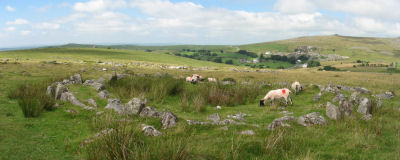
Merrivale Stone Circle
Prehistoric Dartmoor Walks: Dartmoor Site: Merrivale Ceremonial Complex [Photo Set 2]
OS Map: SX 55361 74641
HER: MDV4998
Megalithic Portal: 116
PMD: Merrivale Stone Circle
ShortName: SC Merrivale
DPD page: 17
Turner: G14
Notes: "A stone circle with a diameter of 20.0m. measured from northeast to southwest and 18.0m from northwest to southeast. It is formed by eleven stones spaced between 2.7m and 6.7m. apart and from 0.3m. to 0.5m. high. Three of the stones are of post type and eight are upright slabs. An additional stone, 7.5m. from the northeast side and 0.3m high, is angled towards the circle and may be quite unassociated". See also Legendary Dartmoor: Merrivale Ceremonial Complex. Lethbridge pp.16-18, diagram 16.
Nearby sites: SX 55361 74641
Distance: 1.89km
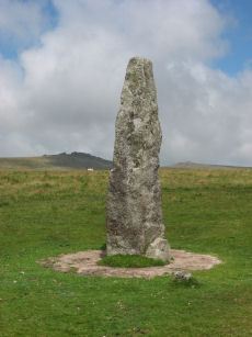
Merrivale Standing Stone
Prehistoric Dartmoor Walks: Dartmoor Site: Merrivale Ceremonial Complex [Photo Set 2]
OS Map: SX 55359 74599
HER: MDV53395
Megalithic Portal: 115
PMD: Merrivale Standing Stone
ShortName: SS Merrivale
Butler map: 44.8.4
DPD page: 17
Notes: "Two Bronze Age standing stones with a disturbed cairn and a number of small earth fast stones. Located in open generally clitter-free moorland. Only one of the two stones still stands; it is 3.2 metres high and tapers from the base which is 0.7 by 0.5 metres in section. Whether the stone was once the focus or terminus of a stone rows is uncertain. The second stone is now fallen, it is 2.2 metres long, up to 0.4 metres wide and 0.3 metres thick. An adjacent 0.3 metre deep pit may be its socket hole. "
Nearby sites: SX 55359 74599
Distance: 1.89km
Merrivale Round House
OS Map: SX 55628 74923
HER: MDV4897
ShortName: HT:Mrrival24
Nearby sites: SX 55628 74923
Distance: 2.13km
Merrivale Settlement
Prehistoric Dartmoor Walks: Dartmoor Site: Merrivale Ceremonial Complex [Photo Set 2]
OS Map: SX 555 749
HER: MDV4897
Megalithic Portal: 1520
ShortName: ST Merrivale
DPD page: 18
Notes: Merrivale Prehistoric Settlement is a partially enclosed stone hut circle settlement, including at least thirty six hut circles and four separate enclosures. Lethbridge pp.16-18, diagram p.16.
Nearby sites: SX 555 749
Distance: 2.00km
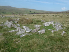
Merrivale Round House
OS Map: SX 55594 74895
HER: MDV4897
ShortName: HT Merrivale44
Nearby sites: SX 55594 74895
Distance: 2.09km
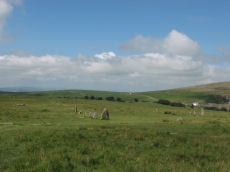
Merrivale Ceremonial Complex
Prehistoric Dartmoor Walks: Dartmoor Site: Merrivale Ceremonial Complex [Photo Set 2]
OS Map: SX 5545 7479
HER: MDV14795
Megalithic Portal: 2046
PMD: Merrivale
ShortName: CX Merrivale
DPD page: 16
Notes: The Merrivale Ceremonial Complex consists of a stone circle a large menhir and two double stone rows and burial cairns. See also: Legendary Dartmoor: Merrivale Ceremonial Complex. Lethbridge pp.16-18, diagram p.16.
Nearby sites: SX 5545 7479
Distance: 1.96km
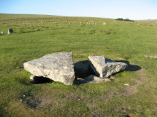
Merrivale Cist
Prehistoric Dartmoor Walks: Dartmoor Walk: Merrivale Complex
OS Map: SX 55490 74770
HER: MDV3738
Megalithic Portal: 10465
PMD: Merrivale
Alternate name: Merrivale 7 Cist
ShortName: CT Merrivale
Butler map: 44.8.7
DPD page: 18
Grinsell: WAL 5
Notes: "A very fine Bronze Age cist which measures internally 2.2 metres long by 0.9 metres wide and up to 0.8 metres deep. The triangular-shaped slab which forms the massive cover stone is up to 2.1metres wide and averages 0.4 metres thick; a central part has been removed by stone cutters revealing the water-filled cist and a broken fragment of the coverslab." See also, Legendary Dartmoor: The Merrivale Kist. Lethbridge pp.16-18, diagram p.16. Butler Vol. 3. Map 44.8.7 (diagram of location in ceremonial complex p.24, diagram of cist p.31).
Nearby sites: SX 55490 74770
Distance: 2.00km
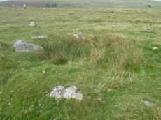
Merrivale Embanked Cairn Circle and Cist
OS Map: SX 55360 74747
HER: MDV4997
Megalithic Portal: 10503
PMD: Merrivale SW.
Alternate name: Merrivale 8 Embanked Cairn Circle and Cist
ShortName: CT MerrivaleSW
Butler map: 44.8.8
Grinsell: WAL 1
Turner: B2
Notes: "The excavation of 1851 seems to have been thorough, completely destroying structural remains of both the cairn and the 'cist or inner circle',. There is now a circular turf covered area, 18.0m. in diameter, with random stones protruding through the surface. Off centre there is a hollow, 7.0m. by 4.0m. and 0.5m. deep." Butler Merrivale Vol. 3. Map 44.8.8 (pp.30-1).
Nearby sites: SX 55360 74747
Distance: 1.87km
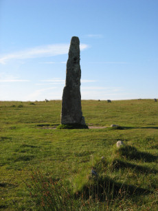
Merrivale (Menhir 1) Stone Row
Prehistoric Dartmoor Walks: Dartmoor Site: Merrivale Ceremonial Complex [Photo Set 1]
OS Map: SX 55361 74592
HER: MDV53397
Megalithic Portal: 3388
The Stone Rows of GB: Merrivale 4
PMD: Merrivale Menhir I Stone Row
Alternate name: Merrivale 4 Stone Row
ShortName: SR Mer Menhir
Butler map: 44.8.4
DPD page: 17
Notes: Butler Row 4. Prehistoric Monuments of Dartmoor website Menhir 1. "Stone row 4 is now a trivial affair [Butler] of 3 small slabs aligned towards a squarish block near the base of the standing stone. This area has suffered some damage over the past century. There were 5 stones in 1895, the missing one presumably accounted for by the pit which has appeared between the upper stones. This may well be the site of the cairn, C4, at the head of the rows recorded by Rowe but not included in the plans of Lukis or Worth. Nor is there much surviving from the circle of slabs around the menhir depicted in Bray's plan and recorded by Spence Bate in 1871, or the nearby cist which he excavated, C5. The Exploration Committee excavated at both ends of the row but no more socket holes were found and they concluded that this short alignment was complete." Lethbridge pp.16-18, diagram p.16.
Nearby sites: SX 55361 74592
Distance: 1.90km
Merrivale 5 Stone Row
OS Map: SX 55354 74592
HER: MDV53398
The Stone Rows of GB: Merrivale 5
PMD: Merrivale Menhir II
ShortName: SR:Merrivale 5
Butler map: 44.8
Nearby sites: SX 55354 74592
Distance: 1.89km
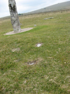
Merrivale 6 Stone Row
OS Map: SX 55344 74590
The Stone Rows of GB: Merrivale 6
ShortName: SR Merrivale 6
Butler map: 44.8
Nearby sites: SX 55344 74590
Distance: 1.88km
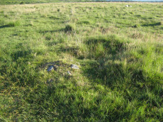
Merrivale 9 Cairn
OS Map: SX 55353 74725
HER: MDV28496
ShortName: CN Merrivale22
Butler map: 44.8.9
Grinsell: WAL 3
Notes: "Cairn measuring 4.0 meters in diameter and standing 0.6 meters high, with a pit 1.3 meters in diameter by 0.4 meters deep in the centre of the mound."
Nearby sites: SX 55353 74725
Distance: 1.87km
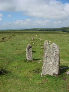
Merrivale A Stone Row
Prehistoric Dartmoor Walks: Dartmoor Site: Merrivale Ceremonial Complex [Photo Set 1]
OS Map: SX 55541 74809
HER: MDV14797
Megalithic Portal: 2044
The Stone Rows of GB: Merrivale 1
PMD: Merrivale A Stone Row
Alternate name: Merrivale 1 Stone Row
ShortName: SR MerrivaleA
Butler map: 44.8.1
DPD page: 16
Notes: Worth Merrivale A. Butler Merrivale 1. "Two Bronze Age double stone rows and associated cairns are located on open moorland. The rows are oriented roughly east to west and are almost parallel, being 25 metres between centres at their eastern ends increasing to 32 metres at the west. A leat still used to convey water to Hillside Stables separates the two monuments and flows to within 2 metres of the northern row. A single row (see SX 57 SE 115) runs roughly south-west from a small cairn at SX 55397476, some 4.75 metres south of the south row." Lethbridge pp.16-18, diagram p.16.
Nearby sites: SX 55541 74809
Distance: 2.05km
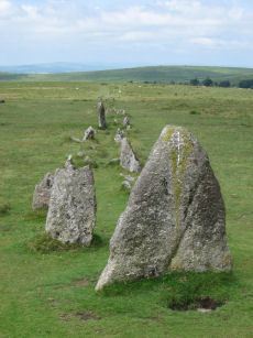
Merrivale B Stone Row
Prehistoric Dartmoor Walks: Dartmoor Site: Merrivale Ceremonial Complex [Photo Set 1]
OS Map: SX 55567 74788
HER: MDV14795
Megalithic Portal: 117
The Stone Rows of GB: Merrivale 2
PMD: Merrivale B Stone Row
Alternate name: Merrivale 2 Stone Row
ShortName: SR MerrivaleB
Butler map: 44.8.2
DPD page: 16
Notes: Butler Merrivale 2. Worth Merrivale B. For description see Merrivale A. Lethbridge pp.16-18, diagram p.16.
Nearby sites: SX 55567 74788
Distance: 2.07km
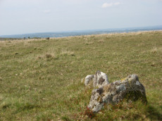
Merrivale C Stone Row
Prehistoric Dartmoor Walks: Dartmoor Site: Merrivale Ceremonial Complex [Photo Set 1]
OS Map: SX 55394 74761
HER: MDV5001
Megalithic Portal: 3391
The Stone Rows of GB: Merrivale 3
PMD: Merrivale C Stone Row
Alternate name: Merrivale 3 Stone Row
ShortName: SR MerrivaleC
Butler map: 44.8.3
DPD page: 17
Notes: Butler Merrivale 3. Worth Merrivale C. "A stone row and a small cairn lie to the south of the double stone rows in close-cropped moorland turf. The cairn located at the northern end and slightly off-centre to the row, measures 3.2m across and up to 0.5m high. An 0.3m deep central pit opens out on the southern side. There is no obvious kerb or cist but a transverse slab, the terminal slab of the row, is set within the south side of the mound. The existence of this slab suggest that the row pre-dates the mound. The stone row extends for 41.7m in a southerly direction to an upright stone (SX553774720). However, during the English Heritage 1999 survey a further stone was located on the same alignment beyond this stone indicating an overall length for the row of at least 60m. The new partially buried stone at SX55337484 is visible as a rounded stone 0.15m across; it is similar to others in the row. A total of six upright stones, six stones protruding through the turf and about ten slight depressions, now indicate this 60m long alignment. The transverse stone within the cairn is 0.5m by 0.4 and 0.15m thick. The two adjacent in line slabs are 0.6m 0.3m by 0.15m and 0.3 by 0.2 and 0.2m thick respectively. The other large stone (SX55377472) is 0.5 by 0.4 and up to 0.4m thick. The other stones are up to 0.15m high." Lethbridge pp.16-18 Row C, diagram p.16.
Nearby sites: SX 55394 74761
Distance: 1.90km
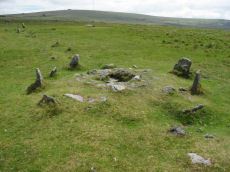
Merrivale double row B (centre) Encircled Cairn and Cist
Prehistoric Dartmoor Walks: Dartmoor Walk: Merrivale Complex
OS Map: SX 55442 74779
HER: MDV14796
Megalithic Portal: 3389
PMD: Merrivale S row
Alternate name: Merrivale double row 2 centre Encircled Cairn and Cist
ShortName: CT MerrivaleB
Butler map: 44.8.2
DPD page: 17
Grinsell: WAL 4
Turner: F20
Notes: Butler Merrivale double row 2, (centre) - Vol. 3. Map 44.8.1 (diagram p.27). Lethbridge pp.16-18, diagram p.16.
Nearby sites: SX 55442 74779
Distance: 1.95km
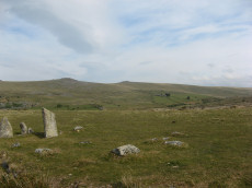
Merrivale NE Cairn Circle
Prehistoric Dartmoor Walks: Dartmoor Site: Merrivale Ceremonial Complex [Photo Set 1]
OS Map: SX 55548 74817
HER: MDV14797
Megalithic Portal: 3390
The Stone Rows of GB: Merrivale 1
PMD: Merrivale A Stone Row
Alternate name: Merrivale double row 1 (east end) Cairn Circle
ShortName: CC MerrivaleNE
Butler map: 44.8.1
Notes: At the eastern end of the northern double stone row is the remains of a cairn and its surrounding stone circle.
Nearby sites: SX 55548 74817
Distance: 2.05km
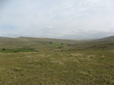
Merrivale North Embanked Cairn Circle
OS Map: SX 55340 74845
HER: MDV3757
Megalithic Portal: 10502
Alternate name: Merrivale 10 Embanked Cairn Circle
ShortName: CC Merrivale10
Butler map: 44.8.10
Turner: B8
Notes: "Turner describes this site as an embanked stone circle; an annular bank of earth and/or stones with an inner edge of orthostats. Internal diameter is 8.0 meters with a bank 0.8 meters wide and 0.3 meters high. Much disturbed." Turner B8.
Nearby sites: SX 55340 74845
Distance: 1.84km
Merrivale Recumbent Slab Standing Stone
Prehistoric Dartmoor Walks: Dartmoor Site: Merrivale Ceremonial Complex [Photo Set 2]
OS Map: SX 55371 74596
HER: MDV53396
ShortName: SS-Merrivale2
Butler map: 44.8.4
DPD page: 17
Notes: "The second stone is now fallen, it is 2.2 metres long, up to 0.4 metres wide and 0.3 metres thick. An adjacent 0.3 metre deep pit may be its socket hole." According to Butler it was "erected in 1895 in the pit alongside, toppling again a few years later".
Nearby sites: SX 55371 74596
Distance: 1.90km
Merrivale row 3 Cairn
OS Map: SX 55399 74770
HER: MDV5000
PMD: Merrivale Short Stone Row
ShortName: CN Merrivale3
Butler map: 44.8.3
Grinsell: WAL 2
Notes: Cairn located at the north-eastern end of the short single stone row, immediately south of the southern double stone row. It is of small stone construction, and is now turf-covered. "A small cairn that coontianed a ruined kistvaen" (Baring-Gould DEC Report No.2 1895)
Nearby sites: SX 55399 74770
Distance: 1.91km
Pew Tor (N side) Ancient Pool
OS Map: SX 53354 73597
HER: MDV127216
ShortName: PO:Pew Tor
Notes: "A pool measuring 28 by 14m. One of over 40 such 'sacred' pools identified on Dartmoor that are thought to have potentially been designed during the prehistoric period."
Nearby sites: SX 53354 73597
Distance: 1.36km
Roos Tor N.W. Settlement
OS Map: SX 539 772
HER: MDV4104
Megalithic Portal: 17509
ShortName: ST:RoosTorNW
Notes: Details via Megalithic Portal.
Nearby sites: SX 539 772
Distance: 2.29km
Vixen Tor Cist
OS Map: SX 54240 74391
HER: MDV3596
Megalithic Portal: 29932
PMD: Vixen Tor
Alternate name: Vixen Tor 1 Cist
ShortName: CT Vixen Tor
Butler map: 44.10.1
DPD page: 15
Grinsell: WHI 2
Barrow Report: 39
Notes: "Cist and possible remains of a barrow. The east and south sides of the cist lean inwards and the north end is slightly defective. The cover stone seems to have been in two parts and it leans against the south corner of the cist. There appears to be traces of a retaining circle of barrows, three stones only, in radius of 3.0m from the centre of the cist. The condition is good. The original dimensions would, however, appear to have been 1.219m x 533mm. One side stone is 1.524m in length, and the other is over 1.372m in length. The present depth below the top of the side stones is 330mm, but excavation would probably prove this to be at least twice this." Vixen Tor has been fenced off by the current landowner. Butler Vol. 3. Map 44.10.1 (diagram p.34). See also: Legendary Dartmooor: Vixen Tor and Vixen Tor Forbidden
Nearby sites: SX 54240 74391
Distance: 0.93km
Wedlake E.3 Reported Cairn
OS Map: SX 54527 77396
ShortName: CN-Wedlake E3
Notes: In June 2019 the author was checking through old photos and found this poor quality photo from May 2016. It appears to be of a cairn and the GPS location is some distance from any known recorded cairns - although Wedlake E1 and Wedlake E2 are not far. This is being listed as a reported cairn and only another site visit will throw more light on this. The photo has been enhanced to improve quality.
Nearby sites: SX 54527 77396
Distance: 2.65km
Whitchurch Common (N) Stone Ring Cairn Circle
OS Map: SX 53020 75005
HER: MDV4115
Megalithic Portal: 3535
Alternate name: Whitchurch Common N. Stone Ring Cairn Circle
ShortName: RC Whitchurch1
Turner: A41
Notes: Hut Circle or ring cairn? "Ring cairn with entrance. Stone ring 5.5m internal diam, with bank 1.5m wide and 0.4m high.2.5m wide entrance on ssw side" " A hut with an internal diam of 5.8m and walling 1.5m wide and 0.4m high; there is an entrance gap in the sw. This is evidently grinsell's cairn and worth's barrow.(broadly it is on the n slope of barn hill as stated by worth, but locally on the sw slope). While the structure might in isolation be construed as a cairn, the lack of any internal stone, the consistently smooth angle of the inner face of the wall and the presence of other huts and a field system militate against the worth and grinsell classifications"
Nearby sites: SX 53020 75005
Distance: 0.48km
Whitchurch Down (Warrens Cross) Ancient Pool
OS Map: SX 51153 73688
HER: MDV127230
ShortName: PO:Whitchurch
Notes: "A pool measuring 38 by 18m. One of over 40 such 'sacred' pools identified on Dartmoor that are thought to have potentially been designed during the prehistoric period."
Nearby sites: SX 51153 73688
Distance: 2.66km
Yellowmeade Round House
OS Map: SX 56322 74563
HER: MDV3756
ShortName: HT Yellowmea2
Nearby sites: SX 56322 74563
Distance: 2.85km
Yellowmeade Round House
OS Map: SX 56365 74563
HER: MDV3756
ShortName: HT Yellowmea3
Nearby sites: SX 56365 74563
Distance: 2.89km
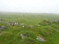
Yellowmeade Round House
OS Map: SX 56408 74548
HER: MDV3756
ShortName: HT Yellowmea5
Nearby sites: SX 56408 74548
Distance: 2.94km
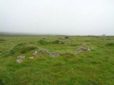
Yellowmeade Round House
OS Map: SX 56410 74443
HER: MDV3756
ShortName: HT Yellowmea6
Nearby sites: SX 56410 74443
Distance: 2.95km
Yellowmeade Round House
OS Map: SX 56446 74518
HER: MDV3756
ShortName: HT:Yellowmea11
Nearby sites: SX 56446 74518
Distance: 2.98km
Yellowmeade Round House
OS Map: SX 56416 74507
HER: MDV3756
ShortName: HT:Yellowmea12
Nearby sites: SX 56416 74507
Distance: 2.95km
Yellowmeade Round House
OS Map: SX 56456 74498
HER: MDV3756
ShortName: HT:Yellowmea13
Nearby sites: SX 56456 74498
Distance: 2.99km
Yellowmeade Round House
OS Map: SX 56458 74534
HER: MDV3756
ShortName: HT:Yellowmea14
Nearby sites: SX 56458 74534
Distance: 2.99km
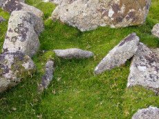
Yellowmeade Farm Cist
OS Map: SX 56350 74465
HER: MDV5002
Megalithic Portal: 45778
PMD: Yellowmeade Farm NW.
Alternate name: Yellowmeade 1 Cist
ShortName: CT Yellowm Fm1
Butler map: 44.1.1
DPD page: 18
Grinsell: WAL 7
Barrow Report: 67
Notes: Butler Yellowmeade 1 - Vol. 3. Map 44.1 (diagram p.17).
Nearby sites: SX 56350 74465
Distance: 2.89km