
Merrivale Embanked Cairn Circle and Cist
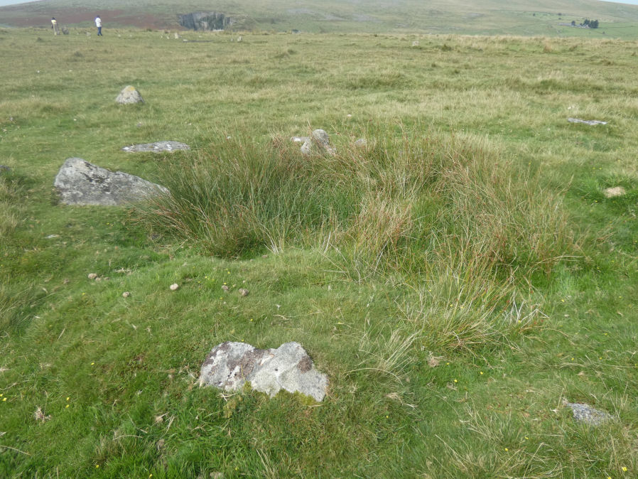
Photo taken on 09-09-2023
Database entries
OS Map: SX 55360 74747
OS Source: Garmin
Butler OS: SX55367474
HER: MDV4997
Megalithic Portal: 10503
PMD: Merrivale SW.
Alternate name: Merrivale 8
Short Name: CT Merrivale 8
Butler map: 44.8.8
Dixon Cist #: 139
Grinsell: WALKHAMPTON 1
Turner: B2
Exist: Yes
Record: Unique
Record Source: Butler
Hut Class: No
Cist Class: Yes
Cairn Class: Yes
Dimensions (m): c.20.0
Lidar: SX 55360 74747
Guide Map: 33
Nearest Bus Stop: Merrivale Dartmoor Inn (0.8 km) [Route: 98,171(20/07/26 to 19/09/26)]
Nearby sites: SX 55360 74747
Notes
"The excavation of 1851 seems to have been thorough, completely destroying structural remains of both the cairn and the 'cist or inner circle',. There is now a circular turf covered area, 18.0m. in diameter, with random stones protruding through the surface. Off centre there is a hollow, 7.0m. by 4.0m. and 0.5m. deep." Butler Merrivale Vol. 3. Map 44.8.8 (pp.30-1).References
These are selected references with an emphasis on out of copyright sources linked as PDFs. For more detailed references try any linked HER or PMD record above.
- Baring-Gould, Sabine, Second Report of the Dartmoor Exploration Committee, T.D.A. Vol.27 pp.81-92 (1895)
- Bate, C Spence, On the Prehistoric Antiquities of Dartmoor, T.D.A. Vol.4 pp.491-516 (1871)
- Bray, Anna Eliza, The Borders of the Tamar and the Tavy, vol.1, (1836)
- Butler, Jeremy, Dartmoor Atlas of Antiquities, vol.3: The South-West, (1994)
- Grinsell, L.V., Dartmoor Barrows, Devon Archaeological Society Proceedings No.36 (1978)
- Kempe, Account of some Monuments conjectured to be British, still existing upon Dartmoor, Archaeologia 22 pp.429-35 (1829)
- Page, John Lloyd Warden, An Exploration of Dartmoor and its Antiquities, with some account of its borders, (1889)
- Rowe, Samuel, A Perambulation of Dartmoor (3rd Edition), (1896)
- Turner, J.R., Ring Cairns, stone circles and related monuments on Dartmoor, D.A.S.P. No.48 pp.27-86 (1990)