
Prehistoric sites within 2km of SX 62352 63670
Guidance for walkers: The monuments featured in this database are archaeological treasures and need to be protected and preserved - please do not disturb any sites. Please check access and firing times before visiting sites, not all sites listed are on open access land. Firing ranges and boundaries of open access areas are marked on the OL28 OS Dartmoor Explorer map. Please stick to the country code and consider giving support to the numerous agencies that help to keep Dartmoor a fabulous natural and historic environment!
About the database listings: In all listings clicking on the photo or the site name will open a page for the site with a larger photo and further details from the database. The database now has over 6680 records covering nearly all publicly listed sites on Dartmoor including around 4800 round houses. This level of detail is of interest to archaeologists but tends to swamp listings of sites more likely to be of interest for walkers. For this reason, the listings default to around 550 core sites only. These are the stone circles, stone rows and the ring cairns listed by Turner. The default search radius is 2 km. The controls below the map can be used to start a new search by entering a 6- or 8-digit reference (without the prefix "SX"). The search radius can be specified and you can add incremental Display layers of detail on top of the core sites. If using a more detailed layer you will need to decrease the search radius to avoid getting hundreds of search results.
- Core sites Default listing of core sites consisting of stone circles & rows and some of the major ring cairns.
- Plus cairns adds approx. 1000 cairns and other minor sites not included in the core listings but excluding round houses.
- Plus round houses adds approx. 4800 round houses.
- Plus non-sites adds in the records for sites that no longer exist or are not prehistoric sites.
- Plus duplicates adds records excluded as duplicates. Those maybe duplicate records in external listings (e.g. the Historic Environment Records). For example, some sites have been identified as cairns in some listings and interpreted as round houses in other listings and both records appear.
These listings have incorporated, matched up and merged all of the records from all of the major archaeological listings including: Worth, Grinsell, Turner, Butler, Bill Radcliffe, Sandy Gerrard, Megalithic Portal, the National Monument Records and the Historic Environment Records. The author would like to thank Bill, Sandy, the lovely people both at Megalithic Portal (especially Anne Tate who did an amazing job to link listings) and at ACE Archaeology for collaborative work over the years to synchronise and correct listings across the various websites which now interlink. A culmination of years of work the final merger of cairn records took 3 months of cross referencing in 2017 the result being a snapshot of the records at that time. This data has in turn been refined since by field work and research. The round house data was supplied by Sandy Gerrard. Grid references are in order of accuracy: from Google Earth satellite, if visible and found, from a Garmin GPS reading, if visited by the author and from the literature otherwise. Individual site pages will state the source of the grid reference and provide satellite imagery. If a site listing lacks a photo it has not yet been visited by the author in which case the grid reference is from the literature.
Currently the database only includes sites which can be represented by a grid reference. Reaves are not included as they require GIS shape technology which is beyond the current capability of this system. To see the sources for the records, look at the tables on the resources menu. The database listings can also be viewed on a Google map and downloaded as GPS datasets for Garmin devices.
Corrections, or any feedback or suggestions are very welcome, email: info@dartmoorwalks.org.uk.
NOTE: Clicking on the icons for each monument in the map will give the name of the site. You can zoom in and out and drag the map around.
List of sites within 2km of SX 62352 63670
Hook Lake S Round House
OS Map: SX 63820 64709
HER: MDV4319
ShortName: HT:Hook Lake13
Nearby sites: SX 63820 64709
Distance: 1.80km
Ranny Brook Round House
OS Map: SX 62077 63579
HER: MDV4273
ShortName: HT:Ranny Bro57
Nearby sites: SX 62077 63579
Distance: 0.29km
Hook Lake S Round House
OS Map: SX 63826 64786
HER: MDV4242
ShortName: HT:Hook Lake14
Nearby sites: SX 63826 64786
Distance: 1.85km
Ranny Brook Round House
OS Map: SX 62081 63657
HER: MDV4273
ShortName: HT:Ranny Bro58
Nearby sites: SX 62081 63657
Distance: 0.27km
Hook Lake S Round House
OS Map: SX 63845 64700
HER: MDV4320
ShortName: HT:Hook Lake15
Nearby sites: SX 63845 64700
Distance: 1.81km
Ranny Brook Round House
OS Map: SX 62076 63599
HER: MDV4273
ShortName: HT:Ranny Bro59
Nearby sites: SX 62076 63599
Distance: 0.28km
Hook Lake S Round House
OS Map: SX 63819 64719
HER: MDV4318
ShortName: HT:Hook Lake16
Nearby sites: SX 63819 64719
Distance: 1.80km
Ranny Brook Round House
OS Map: SX 62085 63733
HER: MDV50915
ShortName: HT:Ranny Bro60
Nearby sites: SX 62085 63733
Distance: 0.27km
Hook Lake S Round House
OS Map: SX 63844 64792
HER: MDV4242
ShortName: HT:Hook Lake17
Nearby sites: SX 63844 64792
Distance: 1.87km
Ranny Brook Round House
OS Map: SX 62074 63388
HER: MDV43762
ShortName: HT:Ranny Bro61
Nearby sites: SX 62074 63388
Distance: 0.40km
Hook Lake S Round House
OS Map: SX 63883 64746
HER: MDV4317
ShortName: HT:Hook Lake18
Nearby sites: SX 63883 64746
Distance: 1.87km
Dry Lake N Round House
OS Map: SX 63924 63772
HER: MDV4291
ShortName: HT:Dry Lake 1
Nearby sites: SX 63924 63772
Distance: 1.58km
Dry Lake N Round House
OS Map: SX 63879 63809
HER: MDV79069
ShortName: HT:Dry Lake 2
Nearby sites: SX 63879 63809
Distance: 1.53km
Dry Lake N Round House
OS Map: SX 6388 6384
HER: MDV4292
ShortName: HT:Dry Lake 3
Nearby sites: SX 6388 6384
Distance: 1.54km
Dry Lake N Round House
OS Map: SX 63884 63754
HER: MDV79068
ShortName: HT:Dry Lake 4
Nearby sites: SX 63884 63754
Distance: 1.53km
Dry Lake N Round House
OS Map: SX 63892 63775
HER: MDV79067
ShortName: HT:Dry Lake 5
Nearby sites: SX 63892 63775
Distance: 1.54km
Dry Lake N Round House
OS Map: SX 63895 63852
HER: MDV4293
ShortName: HT:Dry Lake 6
Nearby sites: SX 63895 63852
Distance: 1.55km
Dry Lake N Round House
OS Map: SX 6390 6394
HER: MDV28112
ShortName: HT:Dry Lake 7
Nearby sites: SX 6390 6394
Distance: 1.57km
Dry Lake N Round House
OS Map: SX 63906 63631
HER: MDV4295
ShortName: HT:Dry Lake 8
Nearby sites: SX 63906 63631
Distance: 1.55km
Dry Lake N Round House
OS Map: SX 63926 63570
HER: MDV4294
ShortName: HT:Dry Lake 9
Nearby sites: SX 63926 63570
Distance: 1.58km
Dry Lake N Round House
OS Map: SX 63935 63795
HER: MDV79066
ShortName: HT:Dry Lake 10
Nearby sites: SX 63935 63795
Distance: 1.59km
Dry Lake N Round House
OS Map: SX 63938 63626
HER: MDV79062
ShortName: HT:Dry Lake 11
Nearby sites: SX 63938 63626
Distance: 1.59km
Dry Lake N Round House
OS Map: SX 63957 63711
HER: MDV79063
ShortName: HT:Dry Lake 12
Nearby sites: SX 63957 63711
Distance: 1.61km
Dry Lake N Round House
OS Map: SX 63980 63734
HER: MDV79065
ShortName: HT:Dry Lake 13
Nearby sites: SX 63980 63734
Distance: 1.63km
Dry Lake N Round House
OS Map: SX 63994 63732
HER: MDV79065
ShortName: HT:Dry Lake 14
Nearby sites: SX 63994 63732
Distance: 1.64km
Ranny Brook 22 Cairn
OS Map: SX 6193 6343
ShortName: CN-Ranny Bro2
Butler map: 52.9
Notes: A mound at SX 61940 63452 (Garmin GPS) is possibly the Ranny Brook 22 Cairn that Butler Map 52.9 refers to as a hut having been converted into a cairn. Butler gives SX 6193 6343 as the location - there are many huts in very close proximity in this area so certain identification is a bit tricky. The closest hut in the HER is 43759 which is thought to be located at SX 61956 63442 which is 19 metres from this mound. The site in the HER is supposedly 7.5 metres in diameter. So in terms of location this would almost be close enough to touch this mound - so maybe the grid references are slightly out and they are the same site. However, currently it would require a further visit to be certain. For now PDW sites 1590 and 7904 are being kept as separate unique records with their original OS grid references. If and when they are confirmed as the same site 1590 will be marked as a duplicate of 7904 and the details merged.
Nearby sites: SX 6193 6343
Distance: 0.49km
Ranny Brook N.1 Clearance Cairn
OS Map: SX 6204 6343
HER: MDV50926
ShortName: CN?Ranny Bro3
Butler map: 52.9.1
Notes: Hut or cairn?
Nearby sites: SX 6204 6343
Distance: 0.39km
Ranny Brook N.2 Reported Cairn
OS Map: SX 6217 6343
ShortName: CN?Ranny Bro4
Butler map: 52.9.2
Barrow Report: 58
Notes: Hut or cairn?
Nearby sites: SX 6217 6343
Distance: 0.30km
Coombe Brook E. Reported Cairn
OS Map: SX 6255 6251
ShortName: CN:Coombe Br1
Butler map: 52.11
Notes: Butler: "A common feature associated with the hut groups particularly on this part of the moor is a solitary cairn sited some distance uphill, usually just within sight, a too frequent occurrence for it to be coincidental".
Nearby sites: SX 6255 6251
Distance: 1.18km
Harrowthorn Plantation N. Reported Cist
OS Map: SX 62404 62223
HER: MDV4267
PMD: Harrowthorn Reave
ShortName: CN:Harrowtho1
Butler map: 52.12
Grinsell: COR 16
Barrow Report: 64
Notes: This small round cairn, 4.7m in diameter and 0.6m high, lies on a gentle west facing slope at 305m above OD. It is constructed of small boulders, with a large slab, 160m by 115m., lying on the northeast side accompanied by a hollowed centre, 0.3m deep, suggesting a cist.
Nearby sites: SX 62404 62223
Distance: 1.45km
Watercombe Gate Reported Cairn
OS Map: SX 6251 6186
ShortName: CN?Watercomb1
Butler map: 52.13
Notes: Butler: "Further downhill in the same direction a small oval cairn ... lies a short distance from the newtake wall". Not listed on NMR or HER.
Nearby sites: SX 6251 6186
Distance: 1.82km
Watercombe Gate Round House
OS Map: SX 62648 62028
HER: MDV19979
ShortName: HT:Watercomb1
Nearby sites: SX 62648 62028
Distance: 1.67km
Watercombe Gate Round House
OS Map: SX 62655 62035
HER: MDV19979
ShortName: HT:Watercomb3
Nearby sites: SX 62655 62035
Distance: 1.66km
Watercombe Gate Round House
OS Map: SX 62616 61949
HER: MDV19979
ShortName: HT:Watercomb4
Nearby sites: SX 62616 61949
Distance: 1.74km
Watercombe Gate Round House
OS Map: SX 62836 61777
HER: MDV19980
ShortName: HT:Watercomb5
Nearby sites: SX 62836 61777
Distance: 1.95km
Watercombe Gate Round House
OS Map: SX 62598 61979
HER: MDV19979
ShortName: HT:Watercomb6
Nearby sites: SX 62598 61979
Distance: 1.71km
Dendles Waste N. Reported Cairn
OS Map: SX 615 629
ShortName: CN?Dendles 2
Butler map: 52.15
Notes: Reported by Worth, probably destroyed in 1950s by afforestation.
Nearby sites: SX 615 629
Distance: 1.15km
Stalldown NE Round House
OS Map: SX 63844 63051
HER: MDV4332
ShortName: HT:Stalldown2
Nearby sites: SX 63844 63051
Distance: 1.62km
Stalldown NE Round House
OS Map: SX 63845 63018
HER: MDV4332
ShortName: HT:Stalldown3
Nearby sites: SX 63845 63018
Distance: 1.63km
Stalldown NE Round House
OS Map: SX 63861 63074
HER: MDV4332
ShortName: HT:Stalldown4
Nearby sites: SX 63861 63074
Distance: 1.62km
Stalldown NE Round House
OS Map: SX 63839 63236
HER: MDV4332
ShortName: HT:Stalldown5
Nearby sites: SX 63839 63236
Distance: 1.55km
Stalldown NE Round House
OS Map: SX 63864 63027
HER: MDV4332
ShortName: HT:Stalldown6
Nearby sites: SX 63864 63027
Distance: 1.64km
Blatchford Bottom Round House
OS Map: SX 63485 64046
HER: MDV4321
ShortName: HT:Blatchfor1
Nearby sites: SX 63485 64046
Distance: 1.19km
Stalldown NE Round House
OS Map: SX 63866 63018
HER: MDV4332
ShortName: HT:Stalldown7
Nearby sites: SX 63866 63018
Distance: 1.65km
Blatchford Bottom Round House
OS Map: SX 6350 6412
HER: MDV4321
ShortName: HT:Blatchfor2
Nearby sites: SX 6350 6412
Distance: 1.23km
Stalldown NE Round House
OS Map: SX 63807 63148
HER: MDV4332
ShortName: HT:Stalldown8
Nearby sites: SX 63807 63148
Distance: 1.55km
Blatchford Bottom Round House
OS Map: SX 63492 64102
HER: MDV4321
ShortName: HT:Blatchfor3
Nearby sites: SX 63492 64102
Distance: 1.22km
Stalldown NE Round House
OS Map: SX 63736 63114
HER: MDV4332
ShortName: HT:Stalldown9
Nearby sites: SX 63736 63114
Distance: 1.49km
Blatchford Bottom Round House
OS Map: SX 63451 63999
HER: MDV27894
ShortName: HT:Blatchfor4
Nearby sites: SX 63451 63999
Distance: 1.15km
Stalldown NE Round House
OS Map: SX 63784 63245
HER: MDV4332
ShortName: HT:Stalldown10
Nearby sites: SX 63784 63245
Distance: 1.49km
Blatchford Bottom Round House
OS Map: SX 63446 63980
HER: MDV27894
ShortName: HT:Blatchfor5
Nearby sites: SX 63446 63980
Distance: 1.14km
Stalldown NE Round House
OS Map: SX 63828 63081
HER: MDV4332
ShortName: HT:Stalldown11
Nearby sites: SX 63828 63081
Distance: 1.59km
Blatchford Bottom Round House
OS Map: SX 63445 63990
HER: MDV27894
ShortName: HT:Blatchfor6
Nearby sites: SX 63445 63990
Distance: 1.14km
Stalldown NE Round House
OS Map: SX 63747 63186
HER: MDV4332
ShortName: HT:Stalldown12
Nearby sites: SX 63747 63186
Distance: 1.48km
Blatchford Bottom Round House
OS Map: SX 63426 63912
HER: MDV27894
ShortName: HT:Blatchfor7
Nearby sites: SX 63426 63912
Distance: 1.10km
Quickbeam Hill W Round House
OS Map: SX 63774 64127
HER: MDV4329
ShortName: HT:Quickbeam1
Nearby sites: SX 63774 64127
Distance: 1.49km
Stalldown NE Round House
OS Map: SX 63747 63196
HER: MDV4332
ShortName: HT:Stalldown13
Nearby sites: SX 63747 63196
Distance: 1.47km
Blatchford Bottom Round House
OS Map: SX 63426 63970
HER: MDV27894
ShortName: HT:Blatchfor8
Nearby sites: SX 63426 63970
Distance: 1.12km
Quickbeam Hill W Round House
OS Map: SX 63766 64100
HER: MDV4324
ShortName: HT:Quickbeam2
Nearby sites: SX 63766 64100
Distance: 1.48km
Stalldown NE Round House
OS Map: SX 63804 63078
HER: MDV4332
ShortName: HT:Stalldown14
Nearby sites: SX 63804 63078
Distance: 1.57km
Blatchford Bottom Round House
OS Map: SX 63423 63948
HER: MDV27894
ShortName: HT:Blatchfor9
Nearby sites: SX 63423 63948
Distance: 1.11km
Quickbeam Hill W Round House
OS Map: SX 63895 64168
HER: MDV79059
ShortName: HT:Quickbeam3
Nearby sites: SX 63895 64168
Distance: 1.62km
Stalldown NE Round House
OS Map: SX 63685 63216
HER: MDV4332
ShortName: HT:Stalldown15
Nearby sites: SX 63685 63216
Distance: 1.41km
Blatchford Bottom Foot Round House
OS Map: SX 63559 63831
HER: MDV4247
ShortName: HT:Blatchfor10
Nearby sites: SX 63559 63831
Distance: 1.22km
Quickbeam Hill W Round House
OS Map: SX 63820 64076
HER: MDV4324
ShortName: HT:Quickbeam4
Nearby sites: SX 63820 64076
Distance: 1.52km
Stalldown NE Round House
OS Map: SX 63691 63187
HER: MDV4332
ShortName: HT:Stalldown16
Nearby sites: SX 63691 63187
Distance: 1.42km
Blatchford Bottom Foot Round House
OS Map: SX 63534 63780
HER: MDV4247
ShortName: HT:Blatchfor11
Nearby sites: SX 63534 63780
Distance: 1.19km
Quickbeam Hill W Round House
OS Map: SX 63873 64164
HER: MDV4325
ShortName: HT:Quickbeam5
Nearby sites: SX 63873 64164
Distance: 1.60km
Blatchford Bottom Foot Round House
OS Map: SX 63534 63777
HER: MDV4247
ShortName: HT:Blatchfor12
Nearby sites: SX 63534 63777
Distance: 1.19km
Quickbeam Hill W Round House
OS Map: SX 63853 64117
HER: MDV4327
ShortName: HT:Quickbeam6
Nearby sites: SX 63853 64117
Distance: 1.57km
Blatchford Bottom Foot Round House
OS Map: SX 63539 63843
HER: MDV4247
ShortName: HT:Blatchfor13
Nearby sites: SX 63539 63843
Distance: 1.20km
Quickbeam Hill W Round House
OS Map: SX 63849 64137
HER: MDV4326
ShortName: HT:Quickbeam7
Nearby sites: SX 63849 64137
Distance: 1.57km
Blatchford Bottom Foot Round House
OS Map: SX 63522 63796
HER: MDV4247
ShortName: HT:Blatchfor14
Nearby sites: SX 63522 63796
Distance: 1.18km
Quickbeam Hill W Round House
OS Map: SX 63812 64138
HER: MDV19972
ShortName: HT:Quickbeam8
Nearby sites: SX 63812 64138
Distance: 1.53km
Blatchford Bottom Foot Round House
OS Map: SX 63581 63838
HER: MDV4247
ShortName: HT:Blatchfor15
Nearby sites: SX 63581 63838
Distance: 1.24km
Blatchford Bottom Foot Round House
OS Map: SX 63590 63835
HER: MDV4247
ShortName: HT:Blatchfor16
Nearby sites: SX 63590 63835
Distance: 1.25km
Blatchford Bottom Foot Round House
OS Map: SX 63592 63829
HER: MDV4247
ShortName: HT:Blatchfor17
Nearby sites: SX 63592 63829
Distance: 1.25km
Erme Plains S Round House
OS Map: SX 63635 64281
HER: MDV4243
ShortName: HT:Erme Plai1
Nearby sites: SX 63635 64281
Distance: 1.42km
Blatchford Bottom Foot Round House
OS Map: SX 63594 63823
HER: MDV4247
ShortName: HT:Blatchfor18
Nearby sites: SX 63594 63823
Distance: 1.25km
Erme Plains S Round House
OS Map: SX 63565 64316
HER: MDV4243
ShortName: HT:Erme Plai2
Nearby sites: SX 63565 64316
Distance: 1.37km
Blatchford Bottom Foot Round House
OS Map: SX 63596 63816
HER: MDV4247
ShortName: HT:Blatchfor19
Nearby sites: SX 63596 63816
Distance: 1.25km
Erme Plains S Round House
OS Map: SX 63561 64313
HER: MDV4243
ShortName: HT:Erme Plai3
Nearby sites: SX 63561 64313
Distance: 1.37km
Knackersmill Gulf C, wall cairn 10 (55.3) Reported Cairn
OS Map: SX 637 650
HER: MDV-1
ShortName: CN?Knackersm1
Butler Vol 5: p.102 & Fig.60
Notes: Estimated grid ref from Butler. This is a structure embedded into a settlemnt enclosure wall. Could be a hut circle that has been filled in or converted to a cairn.
Nearby sites: SX 637 650
Distance: 1.89km
Blatchford Bottom Foot Round House
OS Map: SX 63609 63811
HER: MDV4247
ShortName: HT:Blatchfor20
Nearby sites: SX 63609 63811
Distance: 1.26km
Erme Plains S Round House
OS Map: SX 63700 64459
HER: MDV28105
ShortName: HT:Erme Plai4
Nearby sites: SX 63700 64459
Distance: 1.56km
Blatchford Bottom Foot Round House
OS Map: SX 6364 6390
HER: MDV28113
ShortName: HT:Blatchfor21
Nearby sites: SX 6364 6390
Distance: 1.31km
Erme Plains S Round House
OS Map: SX 63558 64273
HER: MDV4243
ShortName: HT:Erme Plai5
Nearby sites: SX 63558 64273
Distance: 1.35km
Erme Plains S Round House
OS Map: SX 63692 64418
HER: MDV28105
ShortName: HT:Erme Plai6
Nearby sites: SX 63692 64418
Distance: 1.53km
Erme Plains S Round House
OS Map: SX 63678 64415
HER: MDV28105
ShortName: HT:Erme Plai7
Nearby sites: SX 63678 64415
Distance: 1.52km
Erme Plains S Round House
OS Map: SX 63639 64288
HER: MDV4243
ShortName: HT:Erme Plai8
Nearby sites: SX 63639 64288
Distance: 1.43km
Erme Plains S Round House
OS Map: SX 63554 64263
HER: MDV4243
ShortName: HT:Erme Plai9
Nearby sites: SX 63554 64263
Distance: 1.34km
Erme Plains S Round House
OS Map: SX 63643 64353
HER: MDV28105
ShortName: HT:Erme Plai10
Nearby sites: SX 63643 64353
Distance: 1.46km
Erme Plains S Round House
OS Map: SX 63565 64867
HER: MDV4331
ShortName: HT:Erme Plai11
Nearby sites: SX 63565 64867
Distance: 1.70km
Erme Plains S Round House
OS Map: SX 63667 64403
HER: MDV28105
ShortName: HT:Erme Plai12
Nearby sites: SX 63667 64403
Distance: 1.51km
Erme Plains S Round House
OS Map: SX 63544 64274
HER: MDV4243
ShortName: HT:Erme Plai13
Nearby sites: SX 63544 64274
Distance: 1.34km
Erme Plains S Round House
OS Map: SX 63539 64278
HER: MDV4243
ShortName: HT:Erme Plai14
Nearby sites: SX 63539 64278
Distance: 1.33km
Erme Plains S Round House
OS Map: SX 63579 64326
HER: MDV4243
ShortName: HT:Erme Plai15
Nearby sites: SX 63579 64326
Distance: 1.39km
Erme Plains S Round House
OS Map: SX 63658 64356
HER: MDV28105
ShortName: HT:Erme Plai16
Nearby sites: SX 63658 64356
Distance: 1.48km
Erme Plains S Round House
OS Map: SX 63548 64270
HER: MDV4243
ShortName: HT:Erme Plai17
Nearby sites: SX 63548 64270
Distance: 1.34km
Erme Plains S Round House
OS Map: SX 63556 64270
HER: MDV4243
ShortName: HT:Erme Plai18
Nearby sites: SX 63556 64270
Distance: 1.35km
Erme Plains S Round House
OS Map: SX 63622 64373
HER: MDV28105
ShortName: HT:Erme Plai19
Nearby sites: SX 63622 64373
Distance: 1.45km
Erme Plains S Round House
OS Map: SX 6359 6473
HER: MDV28119
ShortName: HT:Erme Plai20
Nearby sites: SX 6359 6473
Distance: 1.63km
Erme Plains S Round House
OS Map: SX 63606 64317
HER: MDV4243
ShortName: HT:Erme Plai21
Nearby sites: SX 63606 64317
Distance: 1.41km
Erme Plains S Round House
OS Map: SX 63596 64312
HER: MDV4243
ShortName: HT:Erme Plai22
Nearby sites: SX 63596 64312
Distance: 1.40km
Erme Plains S Round House
OS Map: SX 63626 64282
HER: MDV4243
ShortName: HT:Erme Plai23
Nearby sites: SX 63626 64282
Distance: 1.41km
Erme Plains S Round House
OS Map: SX 6362 6457
HER: MDV28118
ShortName: HT:Erme Plai24
Nearby sites: SX 6362 6457
Distance: 1.55km
Erme Plains S Round House
OS Map: SX 63613 64334
HER: MDV4243
ShortName: HT:Erme Plai25
Nearby sites: SX 63613 64334
Distance: 1.43km
Erme Plains S Round House
OS Map: SX 63614 64322
HER: MDV4243
ShortName: HT:Erme Plai26
Nearby sites: SX 63614 64322
Distance: 1.42km
Erme Plains S Round House
OS Map: SX 63617 64319
HER: MDV4243
ShortName: HT:Erme Plai27
Nearby sites: SX 63617 64319
Distance: 1.42km
Erme Plains S Round House
OS Map: SX 63593 64310
HER: MDV4243
ShortName: HT:Erme Plai28
Nearby sites: SX 63593 64310
Distance: 1.40km
Erme Plains S Round House
OS Map: SX 63590 64306
HER: MDV4243
ShortName: HT:Erme Plai29
Nearby sites: SX 63590 64306
Distance: 1.39km
Erme Plains S Round House
OS Map: SX 63619 64333
HER: MDV4243
ShortName: HT:Erme Plai30
Nearby sites: SX 63619 64333
Distance: 1.43km
Broadall Lake E Round House
OS Map: SX 61291 63215
HER: MDV4360
ShortName: HT:Broadall 1
Nearby sites: SX 61291 63215
Distance: 1.15km
Broadall Lake E Round House
OS Map: SX 61210 63131
ShortName: HT:Broadall 2
Nearby sites: SX 61210 63131
Distance: 1.26km
Broadall Lake E Round House
OS Map: SX 61301 63229
HER: MDV4360
ShortName: HT:Broadall 3
Nearby sites: SX 61301 63229
Distance: 1.14km
Broadall Lake E Round House
OS Map: SX 61303 63260
HER: MDV4360
ShortName: HT:Broadall 4
Nearby sites: SX 61303 63260
Distance: 1.13km
Broadall Lake E Round House
OS Map: SX 61308 63215
HER: MDV4360
ShortName: HT:Broadall 5
Nearby sites: SX 61308 63215
Distance: 1.14km
Broadall Lake E Round House
OS Map: SX 6132 6318
HER: MDV4360
ShortName: HT:Broadall 6
Nearby sites: SX 6132 6318
Distance: 1.14km
Broadall Lake E Round House
OS Map: SX 61269 63181
HER: MDV4360
ShortName: HT:Broadall 7
Nearby sites: SX 61269 63181
Distance: 1.19km
Broadall Lake E Round House
OS Map: SX 61272 63250
HER: MDV4360
ShortName: HT:Broadall 8
Nearby sites: SX 61272 63250
Distance: 1.16km
Knackersmill Gulf Round House
OS Map: SX 6365 6502
HER: MDV13172
ShortName: HT:Knackersm1
Nearby sites: SX 6365 6502
Distance: 1.87km
Broadall Lake E Round House
OS Map: SX 61248 63239
HER: MDV4360
ShortName: HT:Broadall 9
Nearby sites: SX 61248 63239
Distance: 1.19km
Knackersmill Gulf Round House
OS Map: SX 63579 64979
HER: MDV4236
ShortName: HT:Knackersm2
Nearby sites: SX 63579 64979
Distance: 1.79km
Dendles Waste (pos duplicate) 3 Reported Cairn
OS Map: SX 624 622
HER: MDV4268
ShortName: CN:Dendles 3
Nearby sites: SX 624 622
Distance: 1.67km
Broadall Lake E Round House
OS Map: SX 61331 63191
HER: MDV4360
ShortName: HT:Broadall 10
Nearby sites: SX 61331 63191
Distance: 1.13km
Knackersmill Gulf Round House
OS Map: SX 63632 64947
HER: MDV4236
ShortName: HT:Knackersm3
Nearby sites: SX 63632 64947
Distance: 1.81km
Broadall Lake E Round House
OS Map: SX 61295 63190
HER: MDV4360
ShortName: HT:Broadall 11
Nearby sites: SX 61295 63190
Distance: 1.16km
Knackersmill Gulf Round House
OS Map: SX 63746 65077
HER: MDV13172
ShortName: HT:Knackersm4
Nearby sites: SX 63746 65077
Distance: 1.98km
Dendles Waste (pos duplicate) 4 Reported Cairn
OS Map: SX 6162 6197
HER: MDV4279
ShortName: CN:Dendles 4
Nearby sites: SX 6162 6197
Distance: 1.85km
Broadall Lake E Round House
OS Map: SX 61359 63199
HER: MDV4360
ShortName: HT:Broadall 12
Nearby sites: SX 61359 63199
Distance: 1.10km
Knackersmill Gulf Round House
OS Map: SX 63585 64958
HER: MDV4236
ShortName: HT:Knackersm5
Nearby sites: SX 63585 64958
Distance: 1.78km
Dendles Waste 6 Reported Cairn
OS Map: SX 6164 6198
HER: MDV4280
ShortName: CNxDendles 6
Nearby sites: SX 6164 6198
Distance: 1.83km
Broadall Lake E Round House
OS Map: SX 61312 63232
HER: MDV4360
ShortName: HT:Broadall 13
Nearby sites: SX 61312 63232
Distance: 1.13km
Knackersmill Gulf Round House
OS Map: SX 63584 64991
HER: MDV4236
ShortName: HT:Knackersm6
Nearby sites: SX 63584 64991
Distance: 1.81km
Broadall Lake E Round House
OS Map: SX 61359 63187
HER: MDV4360
ShortName: HT:Broadall 14
Nearby sites: SX 61359 63187
Distance: 1.10km
Knackersmill Gulf Round House
OS Map: SX 63692 65010
HER: MDV13172
ShortName: HT:Knackersm7
Nearby sites: SX 63692 65010
Distance: 1.90km
Broadall Lake E Round House
OS Map: SX 61216 63225
HER: MDV4360
ShortName: HT:Broadall 15
Nearby sites: SX 61216 63225
Distance: 1.22km
Knackersmill Gulf Round House
OS Map: SX 63629 65080
HER: MDV13172
ShortName: HT:Knackersm8
Nearby sites: SX 63629 65080
Distance: 1.90km
Broadall Lake W Round House
OS Map: SX 61019 63113
HER: MDV4284
ShortName: HT:Broadall 16
Nearby sites: SX 61019 63113
Distance: 1.44km
Knackersmill Gulf Round House
OS Map: SX 63630 65076
HER: MDV13172
ShortName: HT:Knackersm9
Nearby sites: SX 63630 65076
Distance: 1.90km
Broadall Lake W Round House
OS Map: SX 61012 63136
HER: MDV4284
ShortName: HT:Broadall 17
Nearby sites: SX 61012 63136
Distance: 1.44km
Knackersmill Gulf Round House
OS Map: SX 63696 65011
HER: MDV13172
ShortName: HT:Knackersm10
Nearby sites: SX 63696 65011
Distance: 1.90km
Broadall Lake W Round House
OS Map: SX 61025 63164
HER: MDV4284
ShortName: HT:Broadall 18
Nearby sites: SX 61025 63164
Distance: 1.42km
Coombe Brook Round House
OS Map: SX 62284 62520
HER: MDV4345
ShortName: HT:Coombe Br1
Nearby sites: SX 62284 62520
Distance: 1.15km
Knackersmill Gulf Round House
OS Map: SX 63699 65011
HER: MDV13172
ShortName: HT:Knackersm11
Nearby sites: SX 63699 65011
Distance: 1.90km
Broadall Lake W Round House
OS Map: SX 61030 63112
HER: MDV4284
ShortName: HT:Broadall 19
Nearby sites: SX 61030 63112
Distance: 1.43km
Coombe Brook Round House
OS Map: SX 62251 62504
HER: MDV4345
ShortName: HT:Coombe Br2
Nearby sites: SX 62251 62504
Distance: 1.17km
Broadall Lake W Round House
OS Map: SX 61047 63120
HER: MDV4284
ShortName: HT:Broadall 20
Nearby sites: SX 61047 63120
Distance: 1.42km
Coombe Brook Round House
OS Map: SX 62257 62517
HER: MDV4345
ShortName: HT:Coombe Br3
Nearby sites: SX 62257 62517
Distance: 1.16km
Broadall Lake W Round House
OS Map: SX 60993 63097
HER: MDV4284
ShortName: HT:Broadall 21
Nearby sites: SX 60993 63097
Distance: 1.47km
Coombe Brook Round House
OS Map: SX 62258 62408
HER: MDV4345
ShortName: HT:Coombe Br4
Nearby sites: SX 62258 62408
Distance: 1.27km
Broadall Lake W Round House
OS Map: SX 61007 63103
HER: MDV4284
ShortName: HT:Broadall 22
Nearby sites: SX 61007 63103
Distance: 1.46km
Coombe Brook Round House
OS Map: SX 62266 62523
HER: MDV4345
ShortName: HT:Coombe Br5
Nearby sites: SX 62266 62523
Distance: 1.15km
Broadall Lake W Round House
OS Map: SX 60996 63109
HER: MDV4284
ShortName: HT:Broadall 23
Nearby sites: SX 60996 63109
Distance: 1.47km
Coombe Brook Round House
OS Map: SX 62267 62497
HER: MDV4345
ShortName: HT:Coombe Br6
Nearby sites: SX 62267 62497
Distance: 1.18km
Broadall Lake W Round House
OS Map: SX 61017 63069
HER: MDV4284
ShortName: HT:Broadall 24
Nearby sites: SX 61017 63069
Distance: 1.46km
Coombe Brook Round House
OS Map: SX 62274 62419
HER: MDV4345
ShortName: HT:Coombe Br7
Nearby sites: SX 62274 62419
Distance: 1.25km
Coombe Brook Round House
OS Map: SX 62277 62529
HER: MDV4345
ShortName: HT:Coombe Br8
Nearby sites: SX 62277 62529
Distance: 1.14km
Coombe Brook Round House
OS Map: SX 62277 62517
HER: MDV4345
ShortName: HT:Coombe Br9
Nearby sites: SX 62277 62517
Distance: 1.16km
Stalldown Summit 4 Cairn
OS Map: SX 63281 62458
HER: MDV4299
ShortName: CN Stalldown11
Butler map: 54.18.4
Grinsell: COR 20
Nearby sites: SX 63281 62458
Distance: 1.53km
Coombe Brook Round House
OS Map: SX 62247 62517
HER: MDV4345
ShortName: HT:Coombe Br10
Nearby sites: SX 62247 62517
Distance: 1.16km
Stalldown Summit 5 Cairn
OS Map: SX 635 623
HER: MDV13239
ShortName: CN:Stalldown12
Butler map: 54.18.5
Nearby sites: SX 635 623
Distance: 1.79km
Yealm Steps Reported Cist
OS Map: SX 617 637
HER: MDV4367
PMD: Yealm Steps
ShortName: CT?Yealm Ste2
Notes: The County Sites and Monument Record notes a cist at Ranny Brook. This may be an outlier of the Ranny Brook settlement,
Nearby sites: SX 617 637
Distance: 0.65km
Coombe Brook Round House
OS Map: SX 62281 62504
HER: MDV4345
ShortName: HT:Coombe Br11
Nearby sites: SX 62281 62504
Distance: 1.17km
Coombe Brook Round House
OS Map: SX 62266 62475
HER: MDV4345
ShortName: HT:Coombe Br12
Nearby sites: SX 62266 62475
Distance: 1.20km
Coombe Brook Round House
OS Map: SX 62296 62379
HER: MDV4345
ShortName: HT:Coombe Br13
Nearby sites: SX 62296 62379
Distance: 1.29km
Stalldown N.8 Reported Cist
OS Map: SX 63150 62872
HER: MDV13235
PMD: Stall Moor NW.
ShortName: CN:Stalldown3
Butler map: 54.18.8
Grinsell: COR 18
Notes: Cairn with possible cist. The top is flat, 6.0m in diameter, and in the centre is an overgrown granite slab, 1.1m by 1.9m, probably the cover-stone of a cist.
Nearby sites: SX 63150 62872
Distance: 1.13km
Coombe Brook Round House
OS Map: SX 62300 62456
HER: MDV4345
ShortName: HT:Coombe Br14
Nearby sites: SX 62300 62456
Distance: 1.22km
Coombe Brook Round House
OS Map: SX 62319 62460
HER: MDV4345
ShortName: HT:Coombe Br15
Nearby sites: SX 62319 62460
Distance: 1.21km
Stalldown N.10 Reported Cairn
OS Map: SX 6347 6356
HER: MDV-1
ShortName: CN:Stalldown2
Butler map: 54.18.10
Notes: Butler: "about thirty metres from the streamworks along a minor tributary of the Erme is a good bowl-shaped cairn with a shallow-pited top". Not listed on NMR or HER.
Nearby sites: SX 6347 6356
Distance: 1.12km
Coombe Brook Round House
OS Map: SX 62321 62471
HER: MDV4345
ShortName: HT:Coombe Br16
Nearby sites: SX 62321 62471
Distance: 1.20km
Coombe Brook Round House
OS Map: SX 62326 62466
HER: MDV4345
ShortName: HT:Coombe Br17
Nearby sites: SX 62326 62466
Distance: 1.20km
Coombe Brook Round House
OS Map: SX 62335 62516
HER: MDV4345
ShortName: HT:Coombe Br18
Nearby sites: SX 62335 62516
Distance: 1.15km
Coombe Brook Round House
OS Map: SX 62359 62474
HER: MDV4345
ShortName: HT:Coombe Br19
Nearby sites: SX 62359 62474
Distance: 1.20km
Coombe Brook Round House
OS Map: SX 62360 62436
HER: MDV4345
ShortName: HT:Coombe Br20
Nearby sites: SX 62360 62436
Distance: 1.23km
Coombe Brook Round House
OS Map: SX 62278 62407
HER: MDV4345
ShortName: HT:Coombe Br21
Nearby sites: SX 62278 62407
Distance: 1.27km
Ranny Brook Round House
OS Map: SX 62003 63608
HER: MDV4273
ShortName: HT:Ranny Bro1
Nearby sites: SX 62003 63608
Distance: 0.35km
Ranny Brook Round House
OS Map: SX 62053 63596
HER: MDV4273
ShortName: HT:Ranny Bro2
Nearby sites: SX 62053 63596
Distance: 0.31km
Ranny Brook Round House
OS Map: SX 62045 63436
HER: MDV50930
ShortName: HT:Ranny Bro3
Nearby sites: SX 62045 63436
Distance: 0.39km
Ranny Brook Round House
OS Map: SX 62048 63571
HER: MDV4273
ShortName: HT:Ranny Bro4
Nearby sites: SX 62048 63571
Distance: 0.32km
Ranny Brook Round House
OS Map: SX 62043 63571
HER: MDV4273
ShortName: HT:Ranny Bro5
Nearby sites: SX 62043 63571
Distance: 0.32km
Ranny Brook Round House
OS Map: SX 62044 63619
HER: MDV4273
ShortName: HT:Ranny Bro6
Nearby sites: SX 62044 63619
Distance: 0.31km
Left Lake Round House
OS Map: SX 64214 63326
HER: MDV4251
ShortName: HT:Left Lake1
Nearby sites: SX 64214 63326
Distance: 1.89km
Ranny Brook Round House
OS Map: SX 62044 63630
HER: MDV4273
ShortName: HT Ranny Bro7
Nearby sites: SX 62044 63630
Distance: 0.31km
Left Lake Round House
OS Map: SX 64214 63352
HER: MDV4251
ShortName: HT:Left Lake2
Nearby sites: SX 64214 63352
Distance: 1.89km
Ranny Brook Round House
OS Map: SX 62034 63538
HER: MDV4273
ShortName: HT:Ranny Bro8
Nearby sites: SX 62034 63538
Distance: 0.34km
Left Lake Round House
OS Map: SX 64204 63295
HER: MDV4251
ShortName: HT:Left Lake3
Nearby sites: SX 64204 63295
Distance: 1.89km
Ranny Brook Round House
OS Map: SX 62037 63727
HER: MDV43752
ShortName: HT:Ranny Bro9
Nearby sites: SX 62037 63727
Distance: 0.32km
Left Lake Round House
OS Map: SX 64213 63310
HER: MDV4251
ShortName: HT:Left Lake4
Nearby sites: SX 64213 63310
Distance: 1.90km
Ranny Brook Round House
OS Map: SX 62021 63479
HER: MDV43756
ShortName: HT:Ranny Bro10
Nearby sites: SX 62021 63479
Distance: 0.38km
Left Lake Round House
OS Map: SX 64194 63251
HER: MDV4251
ShortName: HT:Left Lake5
Nearby sites: SX 64194 63251
Distance: 1.89km
Ranny Brook Round House
OS Map: SX 62010 63423
HER: MDV50929
ShortName: HT:Ranny Bro11
Nearby sites: SX 62010 63423
Distance: 0.42km
Left Lake Round House
OS Map: SX 6417 6330
HER: MDV4251
ShortName: HT:Left Lake6
Nearby sites: SX 6417 6330
Distance: 1.86km
Ranny Brook Round House
OS Map: SX 62011 63584
HER: MDV4273
ShortName: HT:Ranny Bro12
Nearby sites: SX 62011 63584
Distance: 0.35km
Left Lake Round House
OS Map: SX 64204 63340
HER: MDV4251
ShortName: HT:Left Lake7
Nearby sites: SX 64204 63340
Distance: 1.88km
Ranny Brook Round House
OS Map: SX 62011 63589
HER: MDV4273
ShortName: HT:Ranny Bro13
Nearby sites: SX 62011 63589
Distance: 0.35km
Left Lake Round House
OS Map: SX 64194 63272
HER: MDV4251
ShortName: HT:Left Lake8
Nearby sites: SX 64194 63272
Distance: 1.88km
Ranny Brook Round House
OS Map: SX 62057 63659
HER: MDV4273
ShortName: HT:Ranny Bro14
Nearby sites: SX 62057 63659
Distance: 0.30km
Ranny Brook Round House
OS Map: SX 62005 63589
HER: MDV4273
ShortName: HT:Ranny Bro15
Nearby sites: SX 62005 63589
Distance: 0.36km
Ranny Brook Round House
OS Map: SX 62022 63432
HER: MDV43749
ShortName: HT:Ranny Bro16
Nearby sites: SX 62022 63432
Distance: 0.41km
Ranny Brook Round House
OS Map: SX 61998 63582
HER: MDV4273
ShortName: HT:Ranny Bro17
Nearby sites: SX 61998 63582
Distance: 0.36km
Ranny Brook Round House
OS Map: SX 61993 63423
HER: MDV50927
ShortName: HT:Ranny Bro18
Nearby sites: SX 61993 63423
Distance: 0.44km
Ranny Brook Round House
OS Map: SX 61997 63577
HER: MDV4273
ShortName: HT:Ranny Bro19
Nearby sites: SX 61997 63577
Distance: 0.37km
Ranny Brook Round House
OS Map: SX 61984 63540
HER: MDV4273
ShortName: HT:Ranny Bro20
Nearby sites: SX 61984 63540
Distance: 0.39km
Ranny Brook Round House
OS Map: SX 61981 63538
HER: MDV4273
ShortName: HT:Ranny Bro21
Nearby sites: SX 61981 63538
Distance: 0.39km
Ranny Brook Round House
OS Map: SX 61972 63443
HER: MDV50925
ShortName: HT:Ranny Bro22
Nearby sites: SX 61972 63443
Distance: 0.44km
Ranny Brook Round House
OS Map: SX 61965 63487
HER: MDV43758
ShortName: HT:Ranny Bro23
Nearby sites: SX 61965 63487
Distance: 0.43km
Ranny Brook Round House
OS Map: SX 61963 63624
HER: MDV4273
ShortName: HT:Ranny Bro24
Nearby sites: SX 61963 63624
Distance: 0.39km
Ranny Brook Round House
OS Map: SX 61956 63442
HER: MDV43759
ShortName: HT:Ranny Bro25
Notes: A mound at SX 61940 63452 (Garmin GPS) is possibly the Ranny Brook 22 Cairn that Butler Map 52.9 refers to as a hut having been converted into a cairn. Butler gives SX 6193 6343 as the location - there are many huts in very close proximity in this area so certain identification is a bit tricky. The closest hut in the HER is 43759 which is thought to be located at SX 61956 63442 which is 19 metres from this mound. The site in the HER is supposedly 7.5 metres in diameter. So in terms of location this would almost be close enough to touch this mound - so maybe the grid references are slightly out and they are the same site. However, currently it would require a further visit to be certain. For now PDW sites 1590 and 7904 are being kept as separate unique records with their original OS grid references. If and when they are confirmed as the same site 1590 will be marked as a duplicate of 7904 and the details merged.
Nearby sites: SX 61956 63442
Distance: 0.46km
Ranny Brook Round House
OS Map: SX 61947 63624
HER: MDV4273
ShortName: HT:Ranny Bro26
Nearby sites: SX 61947 63624
Distance: 0.41km
Ranny Brook Round House
OS Map: SX 61940 63445
HER: MDV43760
ShortName: HT Ranny Bro27
Nearby sites: SX 61940 63445
Distance: 0.47km
Ranny Brook Round House
OS Map: SX 61940 63624
HER: MDV4273
ShortName: HT:Ranny Bro28
Nearby sites: SX 61940 63624
Distance: 0.41km
Ranny Brook Round House
OS Map: SX 61937 63628
HER: MDV4273
ShortName: HT:Ranny Bro29
Nearby sites: SX 61937 63628
Distance: 0.42km
Ranny Brook Round House
OS Map: SX 62012 63724
HER: MDV43753
ShortName: HT:Ranny Bro30
Nearby sites: SX 62012 63724
Distance: 0.34km
Ranny Brook Round House
OS Map: SX 62182 63457
HER: MDV50919
ShortName: HT:Ranny Bro31
Nearby sites: SX 62182 63457
Distance: 0.27km
Ranny Brook Round House
OS Map: SX 62088 63598
HER: MDV4273
ShortName: HT:Ranny Bro32
Nearby sites: SX 62088 63598
Distance: 0.27km
Ranny Brook Round House
OS Map: SX 62086 63370
ShortName: HT:Ranny Bro33
Nearby sites: SX 62086 63370
Distance: 0.40km
Ranny Brook Round House
OS Map: SX 62099 63645
HER: MDV4273
ShortName: HT:Ranny Bro34
Nearby sites: SX 62099 63645
Distance: 0.25km
Ranny Brook Round House
OS Map: SX 62103 63599
HER: MDV4273
ShortName: HT:Ranny Bro35
Nearby sites: SX 62103 63599
Distance: 0.26km
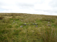
Ranny Brook, N (COR 11a) Reported Cairn
OS Map: SX 6223 6345
HER: MDV4271
ShortName: CNxRanny Bro6
Grinsell: COR 11a
Barrow Report: 58
Notes: This retaining circle appears to be the possible remains of a hut circle. Vis=30/6/1976 (grinsell). Retaining circle or hut. Diameter 5m, height of stones 0.3m. Grinsell states that worth describes another circle of 6 stones adjoining the se of this circle. Vis=5/8/1977 (os). The remains of two hut circles at sx62186342 and sx62196343, both in poor condition.
Nearby sites: SX 6223 6345
Distance: 0.25km
Ranny Brook Round House
OS Map: SX 62109 63646
HER: MDV4273
ShortName: HT:Ranny Bro36
Nearby sites: SX 62109 63646
Distance: 0.24km
Ranny Brook, N (COR 11b) Reported Cairn
OS Map: SX 6224 6343
HER: MDV4271
ShortName: CNxRanny Bro7
Grinsell: COR 11b
Notes: This retaining circle appears to be the possible remains of a hut circle. Vis=30/6/1976 (grinsell). Retaining circle or hut. Diameter 5m, height of stones 0.3m. Grinsell states that worth describes another circle of 6 stones adjoining the se of this circle. Vis=5/8/1977 (os). The remains of two hut circles at sx62186342 and sx62196343, both in poor condition.
Nearby sites: SX 6224 6343
Distance: 0.26km
Ranny Brook Round House
OS Map: SX 62104 63409
HER: MDV43761
ShortName: HT:Ranny Bro37
Nearby sites: SX 62104 63409
Distance: 0.36km
Harrowhorn, N of (site of) Reported Cist
OS Map: SX 6243 6224
HER: MDV-1
ShortName: CN?Harrowhor1
Grinsell: COR 17
Barrow Report: 64
Notes: Reported by RHW - not located by Grinsell. A turf covered cairn. Large slab of granite lies on north east side suggesting possible displaced capstone of cist.
Nearby sites: SX 6243 6224
Distance: 1.43km
Ranny Brook Round House
OS Map: SX 62089 63717
HER: MDV50916
ShortName: HT:Ranny Bro38
Nearby sites: SX 62089 63717
Distance: 0.27km
Ranny Brook Round House
OS Map: SX 62056 63558
HER: MDV4273
ShortName: HT:Ranny Bro39
Nearby sites: SX 62056 63558
Distance: 0.32km
Ranny Brook Round House
OS Map: SX 62117 63637
HER: MDV4273
ShortName: HT:Ranny Bro40
Nearby sites: SX 62117 63637
Distance: 0.24km
Ranny Brook Round House
OS Map: SX 62024 63624
HER: MDV4273
ShortName: HT:Ranny Bro41
Nearby sites: SX 62024 63624
Distance: 0.33km
Ranny Brook Round House
OS Map: SX 62182 63443
HER: MDV4271
ShortName: HT:Ranny Bro42
Nearby sites: SX 62182 63443
Distance: 0.28km
Ranny Brook Round House
OS Map: SX 62187 63460
HER: MDV50918
ShortName: HT:Ranny Bro43
Nearby sites: SX 62187 63460
Distance: 0.27km
Ranny Brook Round House
OS Map: SX 62012 63492
HER: MDV43757
ShortName: HT:Ranny Bro44
Nearby sites: SX 62012 63492
Distance: 0.38km
Ranny Brook Round House
OS Map: SX 62193 63463
HER: MDV43609
ShortName: HT:Ranny Bro45
Nearby sites: SX 62193 63463
Distance: 0.26km
Ranny Brook Round House
OS Map: SX 62193 63447
HER: MDV50920
ShortName: HT:Ranny Bro46
Nearby sites: SX 62193 63447
Distance: 0.27km
Ranny Brook Round House
OS Map: SX 62112 63578
HER: MDV4273
ShortName: HT:Ranny Bro47
Nearby sites: SX 62112 63578
Distance: 0.26km
Ranny Brook Round House
OS Map: SX 62060 63499
HER: MDV50932
ShortName: HT:Ranny Bro48
Nearby sites: SX 62060 63499
Distance: 0.34km
Hawns Round House
OS Map: SX 6135 6260
HER: MDV20529
ShortName: HT:Hawns1
Nearby sites: SX 6135 6260
Distance: 1.47km
Ranny Brook Round House
OS Map: SX 62057 63591
HER: MDV4273
ShortName: HT:Ranny Bro49
Nearby sites: SX 62057 63591
Distance: 0.31km
Ranny Brook Round House
OS Map: SX 62056 63552
HER: MDV4273
ShortName: HT:Ranny Bro50
Nearby sites: SX 62056 63552
Distance: 0.32km
Ranny Brook Round House
OS Map: SX 62064 63653
HER: MDV4273
ShortName: HT:Ranny Bro51
Nearby sites: SX 62064 63653
Distance: 0.29km
Ranny Brook Round House
OS Map: SX 62085 63606
HER: MDV4273
ShortName: HT:Ranny Bro52
Nearby sites: SX 62085 63606
Distance: 0.27km
Ranny Brook Round House
OS Map: SX 62069 63714
HER: MDV43754
ShortName: HT:Ranny Bro53
Nearby sites: SX 62069 63714
Distance: 0.29km
Ranny Brook Round House
OS Map: SX 62064 63343
HER: MDV27900
ShortName: HT:Ranny Bro54
Nearby sites: SX 62064 63343
Distance: 0.44km
Ranny Brook Round House
OS Map: SX 62067 63442
HER: MDV50931
ShortName: HT:Ranny Bro55
Nearby sites: SX 62067 63442
Distance: 0.36km
Ranny Brook Round House
OS Map: SX 62082 63625
HER: MDV4273
ShortName: HT:Ranny Bro56
Nearby sites: SX 62082 63625
Distance: 0.27km
Blatchford Brook Foot Enclosed Settlement
OS Map: SX 63551 63821
HER: MDV27894
Megalithic Portal: 14935
ShortName: ES:Blatchford
Nearby sites: SX 63551 63821
Distance: 1.21km
Dendles Waste Ring Setting Cairn and Cist
OS Map: SX 61535 62804
HER: MDV4276
Megalithic Portal: 45691
PMD: Dendles Waste
Alternate name: Dendles Waste S. Ring Setting Cairn and Cist
ShortName: CT Dendles 1
Butler map: 52.15
DPD page: 64
Grinsell: COR 14
Turner: D19
Barrow Report: 43
Notes: "The circle, consists of eight flat slabs, set on edge and has an internal diameter of approximately 3.4m. Some of the stones from the western quadrant of the circle are missing; a single earthfast stone is all that survives. The rectangular cist lies roughly centrally within the circle and is oriented E to W. It measures 1.2m long by 0.6m and 0.5m deep with slabs still in place both sides". Lethbridge diagram p.63, photo p.64. Butler Dendles Waste S. - Vol. 3. Map 52.15 (diagram p.194).
Nearby sites: SX 61535 62804
Distance: 1.19km
Dry Lake North Enclosed Settlement
OS Map: SX 63922 63602
HER: MDV4294
Megalithic Portal: 14934
ShortName: ES:DryLakeN
Nearby sites: SX 63922 63602
Distance: 1.57km
Erme Cairn Circle
Prehistoric Dartmoor Walks: Dartmoor Site: Upper Erme Stone Row & Cairn Circle
OS Map: SX 63517 64442
HER: MDV4310
Megalithic Portal: 533
Alternate name: Upper Erme stone row Cairn Circle
ShortName: CC The Dancers
Butler map: 55.7.1
DPD page: 71
Grinsell: COR 10
Turner: G16
Notes: An impressive cairn circle (often referred to as a stone circle) on Stall Moor which is also known as The Dancers, Kiss in the Ring or Stall Moor Circle. "Round barrow with retaining circle at south end of longest Dartmoor stone row. Diameter 16m, height of mound 0.3m." Lethbridge pp.70-71, diagram p.71
Nearby sites: SX 63517 64442
Distance: 1.40km
Harrowthorn (North of) Cist
OS Map: SX 62446 62645
HER: MDV4269
Megalithic Portal: 45746
PMD: Harrowthorn Plantation
Alternate name: Coombe Brook N.E. Cist
ShortName: CT Harrowthorn
Butler map: 52.11
DPD page: 66
Grinsell: COR 15
Barrow Report: 58
Notes: "A cist lies 700 yards north of Harrowthorn Plantation and a few feet west of the track from Watercombe Moorgate to Ranny Brook. Only the two side stones and the eastern end stone remain. The structure is unusual in that the southern side stone is an earth fast boulder, an approximately vertical face of which forms a side of the cist." Lethbridge p.66. diagram p.65 Ranny Brook Cist 3. Butler Coombe Brook N.E. - Vol. 3. Map 52.11. Located 200m due east up hill of the Coome Brook enclosure.
Nearby sites: SX 62446 62645
Distance: 1.03km
Hillson's House Cairn
Prehistoric Dartmoor Walks: Dartmoor Site: Stalldown Stone Row [Photo Set 2]
OS Map: SX 63668 62292
HER: MDV4302
Megalithic Portal: 45592
ShortName: CN Hillson Hse
Butler map: 54.18.7
DPD page: 69
Grinsell: COR 22
Notes: Butler Cairn 7 (Vol 3 54.18). On the summit of Stalldown barrow is a large flat-toped cairn around 17.5m across. The cairn has been damaged by the construction of shelters within it - hence it is known as Hillson's House.
Nearby sites: SX 63668 62292
Distance: 1.91km
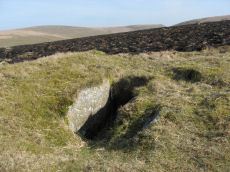
Ranny Brook Cist
OS Map: SX 62616 63543
HER: MDV4270
Megalithic Portal: 14987
PMD: Ranny Brook Head
Alternate name: Ranny Brookhead Cist
ShortName: CT Ranny Brook
Butler map: 52.10
DPD page: 66
Grinsell: COR 12
Barrow Report: 64 68 69 71
Notes: "Three sides of the grave are still in place; the third has been turned back and lies parallel to its original position. To the south of the cist, and about a foot away from the nearest point of the buried side-stone, lies the displaced coverstone. This stone has a greatest length of four feet and a greatest width of two feet six inches". Sides of cist sunken below surface. Lethbridge p.66. diagram p.65 Cist 2.Butler Ranny Brook Head - Vol. 3. Map 52.10 (diagram p.186).
Nearby sites: SX 62616 63543
Distance: 0.29km
Ranny Brook (North of) Cist
OS Map: SX 62154 63547
HER: MDV4272
Megalithic Portal: 45747
PMD: Ranny Brook settlement
Alternate name: Ranny Brook N.3 Cist
ShortName: CT Ranny Brk N
Butler map: 52.9.3
DPD page: 65
Grinsell: COR 11
Barrow Report: 58
Notes: "The northern end-stone and the western side-stone survive, whilst smaller stones may represent the other sides. This agrees with Worth's survey, but in his report he has transposed north and south." Lethbridge diagram p.65 Cist 1. Butler Ranny Brook N. 3 (Cist 3) - Vol. 3. Map 52.9. (pp.184-7 general plan of Ranny Brook settlements and cairns p.184, diagram of cists p.186).
Nearby sites: SX 62154 63547
Distance: 0.23km
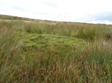
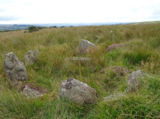
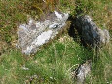
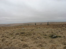
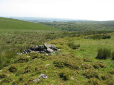
Ranny Brook (Yealm) Enclosed Settlement
OS Map: SX 62352 63670
HER: MDV43608
Megalithic Portal: 45574
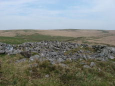
ShortName: ES:Ranny Brook
Notes: An enclosure of earth and stone walling 0.5m wide by 0.4m high encompasses an oval area 18.0m by 16.0m. It lies on the South facing slope to the North of Ranny Brook. Scheduled: Devon 10853.
Nearby sites: SX 62352 63670
Distance: 0.00km
Staldon Row Ancient Pool
OS Map: SX 63293 62442
HER: MDV127226
ShortName: PO:Staldon Row
Notes: "A pool measuring around 6.5 metres. One of over 40 such 'sacred' pools identified on Dartmoor that are thought to have potentially been designed during the prehistoric period. Lies to the north of a stone row."
Nearby sites: SX 63293 62442
Distance: 1.55km
Stall Moor Reported Stone Circle
OS Map: SX 63231 62759
HER: MDV12421
ShortName: SC:Stall Moor
Notes: "An irregular circuit of small, earthfast stones 200 metres to the north of the Stall Down stone row, may represent the remains of an alleged stone circle, which was recorded 64 metres to the northwest of this location, though it is not circular. The internal distance across the stones is 11.5 metres maximum with a minimum of 9 metres. None of the stones exceed 0.4 metres in heightThis site is on the local list of Nationally Important Dartmoor sites."
Nearby sites: SX 63231 62759
Distance: 1.27km
Stalldown Cairn Circle
Prehistoric Dartmoor Walks: Dartmoor Site: Stalldown Stone Row
OS Map: SX 63244 62423
HER: MDV4300
Megalithic Portal: 3474
PMD: Staldon Stone Row
Alternate name: Stalldown stone row Cairn Circle
ShortName: CC Stalldown
Butler map: 54.18.1
DPD page: 68
Grinsell: COR 21
Turner: D26
Notes: Cairn in middle of length of stone row. "The northern part of the row is aligned precisely in the centre of the cairn circle, both of which would therefore seem part of the original design. The cairn is not visible from the south end of the southern extension of the row. This extension consists of four general alignments more of which focus on the cairn circle, and the northern end of the extension is tangential to the west side of the circle. These factors, and the larger size of the stones in the northern extension of the row, suggest two phases of construction." Butler Cairn 1 (Vol 3 54.18). Turner Type Diii 'Ring Setting with Central reduced to subsoil level or paved'.
Nearby sites: SX 63244 62423
Distance: 1.53km
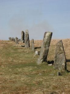
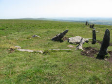
Stalldown Stone Row
Prehistoric Dartmoor Walks: Dartmoor Site: Stalldown Stone Row
OS Map: SX 63223 62558
HER: MDV4277
Megalithic Portal: 531
The Stone Rows of GB: Stalldown
PMD: Staldon Stone Row
Alternate name: Stalldon Row Stone Row
ShortName: SR Stalldown
Butler map: 54.18
Butler Vol 5: p.20 & Fig.2
DPD page: 67
Notes: "Bronze Age stone row and cairn circle on stall down. The stone row runs north -south for about 850m ow which 500m has been restored. It is associated with three cairns (one either side) and a cairn circle. The stones are mostly 1m to 1.5m high with four over 2m". Lethbridge pp.67-68
Nearby sites: SX 63223 62558
Distance: 1.41km
Stalldown Encircled Cairn
Prehistoric Dartmoor Walks: Dartmoor Site: Stalldown Stone Row [Photo Set 2]
OS Map: SX 63208 62489
HER: MDV4298
Megalithic Portal: 531
Alternate name: Stalldown Summit 3 Encircled Cairn
ShortName: EC Stalldown
Butler map: 54.18.3
Grinsell: COR 19
Turner: F22
Notes: Cairn with double or multiple ring. Butler Cairn 3 just to the west of the stone row, Butler Cairn 4 is just to the east. A flat topped turf-covered cairn 9.0m in diameter and 0.7m high, in good condition. Settings of Stones in and around the structure suggests a complex cairn circle. The author counted 17 stones in the circle around this cairn. This is difficult to see in the photo as most are concealed under vegetatio, the stone row can be seen in the background. Also visible towards the centre of the circle is a rectangular pit which is probably evidence of excavation. Turner F22, Type Fii
Nearby sites: SX 63208 62489
Distance: 1.46km
Stalldown Stone Ring Cairn Circle
Prehistoric Dartmoor Walks: Dartmoor Site: Stalldown Stone Row [Photo Set 2]
OS Map: SX 63529 62310
HER: MDV4301
Megalithic Portal: 45819
Alternate name: Stalldown Summit 6 Stone Ring Cairn Circle
ShortName: RC Stalldown
Butler map: 54.18.6
Turner: A4
Notes: A circular turf-covered stone ring on the summit of Stalldown Barrow hill. It is 25.5m in diameter, comprising a bank of small stones, 2.0m to 3.0m wide and 0.2m to 0.7m high. There is a 5.0m gap in the south-west but no evidence of disturbance to the interior or of a surrounding ditch. Not far to the east is Hillson's House. Butler Cairn 6 (Vol 3 54.18).
Nearby sites: SX 63529 62310
Distance: 1.80km
Stalldown (N) Platform Cairn Circle and Cist
Prehistoric Dartmoor Walks: Dartmoor Site: Stalldown Stone Row
OS Map: SX 63274 63239
HER: MDV4296
Megalithic Portal: 45688
PMD: Stall Moor N.
Alternate name: Stalldown N.9 Platform Cairn Circle and Cist
ShortName: CT Stalldown N
Butler map: 54.18.9
DPD page: 69
Grinsell: COR 13
Turner: E17
Barrow Report: 14 37 62
Notes: "A cist measuring 2 feet 3 inches wide at the south end, 1 foot 7 1/2 inches wide at the north and probably originally 3 feet 6 inches long. Both the coverstone and the north end stone are missing. The cist stands in a barrow which has a retaining circle, five stones of which are still erect, and one fallen. The largest stone is 3 feet 4 inches wide by 2 feet 7 inches high. The diameter of the retaining circle varies from 20 to 22 feet". Lethbridge p.69. diagram p.65 Cist 5. Butler Stalldown N. (Cairn 9) - Vol. 4. Map 54.18.9 (diagram p.62).
Nearby sites: SX 63274 63239
Distance: 1.02km
Stalldown (W) Platform Cairn Circle and Cist
Prehistoric Dartmoor Walks: Dartmoor Site: Stalldown Stone Row
OS Map: SX 62833 62327
HER: MDV13234
Megalithic Portal: 45791
PMD: Stall Moor W.
Alternate name: Stalldown W.11 Platform Cairn Circle and Cist
ShortName: CT Stalldown W
Butler map: 54.18.11
DPD page: 67
Grinsell: COR 11c
Turner: E30
Notes: "This small round cairn, diameter 5.7 to 6.4m, height 0.5m, is built of small boulders ... It contains a cist, the south side stone, 1.2m long, both end stones, 0.4m long ...On the south side of the cairn 3 large stones, 0.8m to 1.0m long and set on edge are the probable remains of a kerb". Lethbridge pp.65-67. diagram p.65 Cist 4, photo p.67. Butler Stalldown W. (Cairn 11) - Vol. 4. Map 54.18.11 (p.61-2 diagram p.62).
Nearby sites: SX 62833 62327
Distance: 1.43km
Upper Erme Cairn
OS Map: SX 63522 64958
HER: MDV4366
Megalithic Portal: 15210
Alternate name: Erme Plains Cairn
ShortName: CN Upper Erme
Butler map: 55.7.2
Grinsell: COR 9
Notes: "A round cairn, measuring 13.8 to 14.6m diameter and 1.0m high. It lies on a false crest, adjacent to a stone row, SX 66 NW 20, and just above the River Erme, at 380m above OD, is constructed of small boulders, and has a central hollow, 0.7m deep. In fair condition, though a small shelter has been built on its north side." The photo used here was taken in 2011 and attached to this record retrospectively in 2020 - identification is most probable but not 100% certain.
Nearby sites: SX 63522 64958
Distance: 1.74km
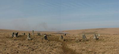
Yealm Steps Enclosed Settlement
OS Map: SX 62065 63607
HER: MDV4273
Megalithic Portal: 45575
ShortName: ES Yealm Steps
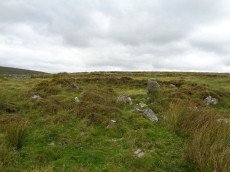
Notes: "A fine example of enclosure and hut circles. Extensive prehistoric settlement area. Two villages contiguous, the larger pound a development of the smaller. Pound walls and those of huts consist of stone and turf. At least 22 huts within the enclosure. To the north and south of the pounds are scatters of isolated huts generally much larger than the enclosed huts. On the south there are remains of fields or paddocks. Rough moorland."
Nearby sites: SX 62065 63607
Distance: 0.29km