
Stalldown (N) Platform Cairn Circle and Cist
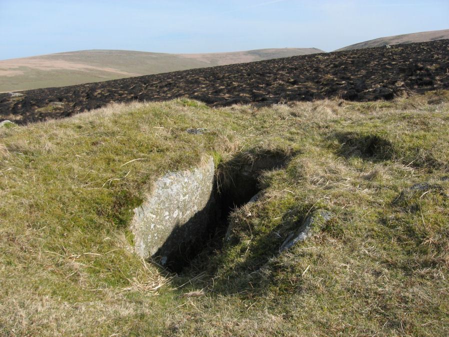
Photo taken on 19-03-2011
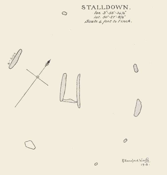
Plan by RHW. Barrow Report 37. TDA Vol.50 1918
Database entries
PDW coverage: Dartmoor Site: Stalldown Stone Row
OS Map: SX 63274 63239
OS Source: Google
Butler OS: SX63276323
HER: MDV4296
Megalithic Portal: 45688
PMD: Stall Moor N.
Alternate name: Stalldown N.9
Short Name: CT Staldon 9
Butler map: 54.18.9
Dixon Cist #: 39
Grinsell: CORNWOOD 13
Turner: E17
DPD page: 69
Exist: Yes
Record: Unique
Record Source: Butler
Hut Class: No
Cist Class: Yes
Cairn Class: Yes
Barrow Report: 14 37 62
Dimensions (m): 11.5 x 0.5 C
Lidar: SX 63274 63239
Guide Map: 56
Nearest Bus Stop: Cornwood Crossways (6.0 km) [Route: 59]
Nearby sites: SX 63274 63239
Notes
"A cist measuring 2 feet 3 inches wide at the south end, 1 foot 7 1/2 inches wide at the north and probably originally 3 feet 6 inches long. Both the coverstone and the north end stone are missing. The cist stands in a barrow which has a retaining circle, five stones of which are still erect, and one fallen. The largest stone is 3 feet 4 inches wide by 2 feet 7 inches high. The diameter of the retaining circle varies from 20 to 22 feet". Lethbridge p.69. diagram p.65 Cist 5. Butler Stalldown N. (Cairn 9) - Vol. 4. Map 54.18.9 (diagram p.62).References
These are selected references with an emphasis on out of copyright sources linked as PDFs. For more detailed references try any linked HER or PMD record above.
- Butler, Jeremy, Dartmoor Atlas of Antiquities, vol.4: The South-East, (1993)
- Davidson, C. & Seabrook, R., Stone rings on south-east Dartmoor, D.A.S.P. No.31 (1973)
- Gerrard, Sandy, English Heritage Book of Dartmoor: Landscapes Through Time, (1997)
- Grinsell, L.V., Dartmoor Barrows, Devon Archaeological Society Proceedings No.36 (1978)
- Lethbridge, William D., Discover Preshistoric Dartmoor, (2015)
- Newman, Phil, The Upper Erme Valley Dartmoor National Park Devon An Archaeological Survey, Southwest Landscape Investigations (2018)
- Turner, J.R., Ring Cairns, stone circles and related monuments on Dartmoor, D.A.S.P. No.48 pp.27-86 (1990)
- Worth, R. Hansford, The Erme, Yealm and Torry part 1, T.P.I. Vol.11 part 1 pp.173-183 (1892)
- Worth, R. Hansford, Barrow Report 21, T.D.A. Vol.34 pp.104- 146 (1902)
- Worth, R. Hansford, Barrow Report 37, T.D.A. Vol.50 pp.186-7 (1918)
- Worth, R. Hansford, Barrow Report 62, T.D.A. Vol.75 pp.53-55 (1943)
- Worth, R.N., Barrow Report 14, T.D.A. Vol.24 (1892)