
Ranny Brook Cist
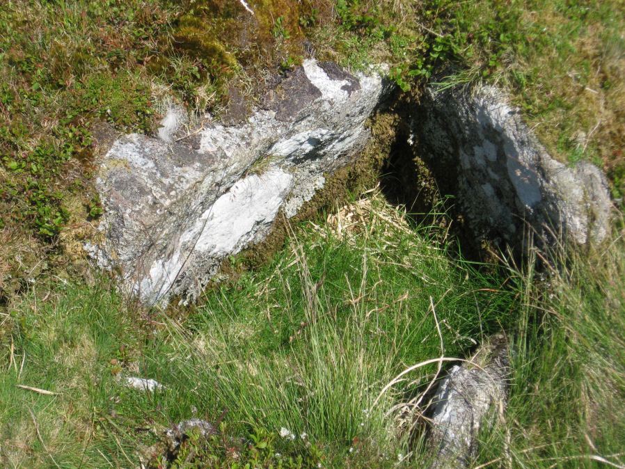
Photo taken on 30-06-2015
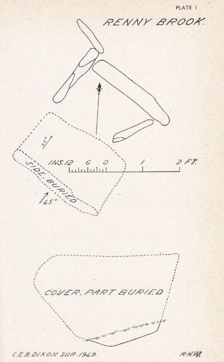
Plan by RHW. Barrow Report 69. TDA Vol.82 1950
Database entries
OS Map: SX 62616 63543
OS Source: Garmin
Butler OS: SX62616353
HER: MDV4270
Megalithic Portal: 14987
PMD: Ranny Brook Head
Alternate name: Ranny Brookhead
Short Name: CT Ranny Brook
Butler map: 52.10
Dixon Cist #: 90
Grinsell: CORNWOOD 12
DPD page: 66
Exist: Yes
Record: Unique
Record Source: Butler
Hut Class: No
Cist Class: Yes
Cairn Class: Yes
Barrow Report: 64 68 69 71
Dimensions (m): 1.0 x 0.7 C
Lidar: SX 62616 63543
Guide Map: 55
Nearest Bus Stop: Cornwood Crossways (5.9 km) [Route: 59]
Nearby sites: SX 62616 63543
Notes
"Three sides of the grave are still in place; the third has been turned back and lies parallel to its original position. To the south of the cist, and about a foot away from the nearest point of the buried side-stone, lies the displaced coverstone. This stone has a greatest length of four feet and a greatest width of two feet six inches". Sides of cist sunken below surface. Lethbridge p.66. diagram p.65 Cist 2.Butler Ranny Brook Head - Vol. 3. Map 52.10 (diagram p.186).References
These are selected references with an emphasis on out of copyright sources linked as PDFs. For more detailed references try any linked HER or PMD record above.
- Butler, Jeremy, Dartmoor Atlas of Antiquities, vol.3: The South-West, (1994)
- Dixon, C.E.B., Barrow Report 70, T.D.A. Vol.84 pp.249-253 (1952)
- Grinsell, L.V., Dartmoor Barrows, Devon Archaeological Society Proceedings No.36 (1978)
- Lethbridge, William D., Discover Preshistoric Dartmoor, (2015)
- Worth, R. Hansford, Barrow Report 64, T.D.A. Vol.77 p.55 (1945)
- Worth, R. Hansford, Barrow Report 68, T.D.A. Vol.81 pp.53-55 (1949)
- Worth, R. Hansford, Barrow Report 69, T.D.A. Vol.82 pp.45-48 (1950)