
Prehistoric sites within 2km of SX 59110 63780
Guidance for walkers: The monuments featured in this database are archaeological treasures and need to be protected and preserved - please do not disturb any sites. Please check access and firing times before visiting sites, not all sites listed are on open access land. Firing ranges and boundaries of open access areas are marked on the OL28 OS Dartmoor Explorer map. Please stick to the country code and consider giving support to the numerous agencies that help to keep Dartmoor a fabulous natural and historic environment!
About the database listings: In all listings clicking on the photo or the site name will open a page for the site with a larger photo and further details from the database. The database now has over 6680 records covering nearly all publicly listed sites on Dartmoor including around 4800 round houses. This level of detail is of interest to archaeologists but tends to swamp listings of sites more likely to be of interest for walkers. For this reason, the listings default to around 550 core sites only. These are the stone circles, stone rows and the ring cairns listed by Turner. The default search radius is 2 km. The controls below the map can be used to start a new search by entering a 6- or 8-digit reference (without the prefix "SX"). The search radius can be specified and you can add incremental Display layers of detail on top of the core sites. If using a more detailed layer you will need to decrease the search radius to avoid getting hundreds of search results.
- Core sites Default listing of core sites consisting of stone circles & rows and some of the major ring cairns.
- Plus cairns adds approx. 1000 cairns and other minor sites not included in the core listings but excluding round houses.
- Plus round houses adds approx. 4800 round houses.
- Plus non-sites adds in the records for sites that no longer exist or are not prehistoric sites.
- Plus duplicates adds records excluded as duplicates. Those maybe duplicate records in external listings (e.g. the Historic Environment Records). For example, some sites have been identified as cairns in some listings and interpreted as round houses in other listings and both records appear.
These listings have incorporated, matched up and merged all of the records from all of the major archaeological listings including: Worth, Grinsell, Turner, Butler, Bill Radcliffe, Sandy Gerrard, Megalithic Portal, the National Monument Records and the Historic Environment Records. The author would like to thank Bill, Sandy, the lovely people both at Megalithic Portal (especially Anne Tate who did an amazing job to link listings) and at ACE Archaeology for collaborative work over the years to synchronise and correct listings across the various websites which now interlink. A culmination of years of work the final merger of cairn records took 3 months of cross referencing in 2017 the result being a snapshot of the records at that time. This data has in turn been refined since by field work and research. The round house data was supplied by Sandy Gerrard. Grid references are in order of accuracy: from Google Earth satellite, if visible and found, from a Garmin GPS reading, if visited by the author and from the literature otherwise. Individual site pages will state the source of the grid reference and provide satellite imagery. If a site listing lacks a photo it has not yet been visited by the author in which case the grid reference is from the literature.
Currently the database only includes sites which can be represented by a grid reference. Reaves are not included as they require GIS shape technology which is beyond the current capability of this system. To see the sources for the records, look at the tables on the resources menu. The database listings can also be viewed on a Google map and downloaded as GPS datasets for Garmin devices.
Corrections, or any feedback or suggestions are very welcome, email: info@dartmoorwalks.org.uk.
NOTE: Clicking on the icons for each monument in the map will give the name of the site. You can zoom in and out and drag the map around.
List of sites within 2km of SX 59110 63780
Upper Hentor Brook Round House
OS Map: SX 58986 65391
HER: MDV3482
ShortName: HT:Upper Hen35
Nearby sites: SX 58986 65391
Distance: 1.62km
Upper Hentor Brook Round House
OS Map: SX 58984 65264
HER: MDV48950
ShortName: HT:Upper Hen36
Nearby sites: SX 58984 65264
Distance: 1.49km
Upper Hentor Brook Round House
OS Map: SX 58987 65376
HER: MDV3482
ShortName: HT:Upper Hen37
Nearby sites: SX 58987 65376
Distance: 1.60km
Upper Hentor Brook Round House
OS Map: SX 58989 65260
HER: MDV48951
ShortName: HT:Upper Hen38
Nearby sites: SX 58989 65260
Distance: 1.48km
Upper Hentor Brook Round House
OS Map: SX 58987 65173
HER: MDV48947
ShortName: HT:Upper Hen39
Nearby sites: SX 58987 65173
Distance: 1.40km
Upper Hentor Brook Round House
OS Map: SX 58998 65358
HER: MDV3482
ShortName: HT:Upper Hen40
Nearby sites: SX 58998 65358
Distance: 1.58km
Upper Hentor Brook Round House
OS Map: SX 5908 6517
HER: MDV48949
ShortName: HT:Upper Hen41
Nearby sites: SX 5908 6517
Distance: 1.39km
Shavercombe Head (9+ cairns) Reported Cairn
OS Map: SX 6065 6490
ShortName: CNxShavercom2
Butler map: 50.3
Notes: Nine circular mounds on high ground at Shavercombe Head. Each of these mounds looks like a barrow, but each is composed solely of peat and there are many other mounds in the vicinity suggesting that there is some form of natural or other agency causing this phenomena.
Nearby sites: SX 6065 6490
Distance: 1.90km
Parkland Round House
OS Map: SX 59582 62037
HER: MDV2562
ShortName: HT:Parkland1
Nearby sites: SX 59582 62037
Distance: 1.81km
Parkland Round House
OS Map: SX 59602 61886
HER: MDV5540
ShortName: HT:Parkland2
Nearby sites: SX 59602 61886
Distance: 1.96km
Parkland Round House
OS Map: SX 59602 62016
HER: MDV2562
ShortName: HT:Parkland3
Nearby sites: SX 59602 62016
Distance: 1.83km
Parkland Round House
OS Map: SX 59593 61971
HER: MDV2562
ShortName: HT:Parkland4
Nearby sites: SX 59593 61971
Distance: 1.87km
Parkland Round House
OS Map: SX 59592 62023
HER: MDV2562
ShortName: HT:Parkland5
Nearby sites: SX 59592 62023
Distance: 1.82km
Shell Top W.1 Cairn
OS Map: SX 5911 6378
HER: MDV56855
ShortName: CN:ShellTopW1
Butler map: 51.4.1
Notes: Round cairn. Mound measures 8.5 metres north-south by 7 metres east-west and stands up to 1.1 metres high. Two separate hollows dug into the mound suggest partial early excavation or robbing. A post medieval boundary stone lies at the west-south-west foot of the mound and may have once stood upright on the cairn.
Nearby sites: SX 5911 6378
Distance: 0.00km
Parkland Round House
OS Map: SX 59591 61899
HER: MDV5540
ShortName: HT:Parkland6
Nearby sites: SX 59591 61899
Distance: 1.94km
Shell Top W.2 Reported Cairn
OS Map: SX 5897 6379
HER: MDV56856
ShortName: CN:ShellTopW2
Butler map: 51.4.2
Butler Vol 5: p.24 & Fig.5
Notes: Cairn or hut circle?
Nearby sites: SX 5897 6379
Distance: 0.14km
Parkland Round House
OS Map: SX 59605 61942
HER: MDV2562
ShortName: HT:Parkland7
Nearby sites: SX 59605 61942
Distance: 1.90km
Shell Top W.3 Cairn
OS Map: SX 58615 63978
HER: MDV2517
ShortName: CN:ShellTopW3
Butler map: 51.4.3
Grinsell: SHA 37
Nearby sites: SX 58615 63978
Distance: 0.53km
Parkland Round House
OS Map: SX 59384 62162
HER: MDV2563
ShortName: HT:Parkland8
Nearby sites: SX 59384 62162
Distance: 1.64km
Shell Top W.4 Cairn
OS Map: SX 5849 6400
HER: MDV2516
ShortName: CN:ShellTopW4
Butler map: 51.4.4
Grinsell: SHA 36
Nearby sites: SX 5849 6400
Distance: 0.66km
Parkland Round House
OS Map: SX 59615 61942
HER: MDV2562
ShortName: HT:Parkland9
Nearby sites: SX 59615 61942
Distance: 1.91km
Shell Top W.5 Cairn
OS Map: SX 5845 6373
HER: MDV56849
ShortName: CN:ShellTopW5
Butler map: 51.4.5
Nearby sites: SX 5845 6373
Distance: 0.66km
Parkland Round House
OS Map: SX 59076 62223
HER: MDV79185
ShortName: HT:Parkland10
Nearby sites: SX 59076 62223
Distance: 1.56km
Parkland Round House
OS Map: SX 59076 62262
HER: MDV79185
ShortName: HT:Parkland11
Nearby sites: SX 59076 62262
Distance: 1.52km
Parkland Round House
OS Map: SX 59044 62221
HER: MDV79185
ShortName: HT:Parkland12
Nearby sites: SX 59044 62221
Distance: 1.56km
Parkland Round House
OS Map: SX 59069 62231
HER: MDV79185
ShortName: HT:Parkland13
Nearby sites: SX 59069 62231
Distance: 1.55km
Parkland Round House
OS Map: SX 59064 62221
HER: MDV79185
ShortName: HT:Parkland14
Nearby sites: SX 59064 62221
Distance: 1.56km
Upper Spanish Lake 5 Reported Cist
OS Map: SX 5857 6449
HER: MDV12786
PMD: Lee Moor E.
ShortName: CN:Upper Spa5
Butler map: 51.5.5
Grinsell: SHA 33
Notes: Alledged cairn found Sept 1975. Possibly natural feature. Radcliffe lists as possible cist noting comment from Butler: "The rather smaller upper cairn may also have held a cistas the edge of a narrow slab is visible near the centre" Vol 3 p.163
Nearby sites: SX 5857 6449
Distance: 0.89km
Parkland Round House
OS Map: SX 59054 62226
HER: MDV79185
ShortName: HT:Parkland15
Nearby sites: SX 59054 62226
Distance: 1.56km
Spanish Lake E Cairn
OS Map: SX 5821 6520
HER: MDV56777
ShortName: CN:Spanish L1
Butler map: 51.6
Notes: A small cairn on the ridge crest between Spanish Lake and Hen Tor Brook. Apparently undisturbed, it measures 4.0m in diameter and 0.3m high. There is no evidence to suggest the presence of a cist or retaining kerb though some stones do protrude through the turf covering of the mound.
Nearby sites: SX 5821 6520
Distance: 1.68km
Parkland Round House
OS Map: SX 59055 62262
HER: MDV79185
ShortName: HT:Parkland16
Nearby sites: SX 59055 62262
Distance: 1.52km
Parkland Round House
OS Map: SX 59233 62294
HER: MDV79185
ShortName: HT:Parkland17
Nearby sites: SX 59233 62294
Distance: 1.49km
Parkland Round House
OS Map: SX 59378 62165
HER: MDV2563
ShortName: HT:Parkland18
Nearby sites: SX 59378 62165
Distance: 1.64km
Parkland Round House
OS Map: SX 59382 62142
HER: MDV2563
ShortName: HT:Parkland19
Nearby sites: SX 59382 62142
Distance: 1.66km
Willings Walls 4 Cairn
OS Map: SX 5830 6535
HER: MDV131161
ShortName: CN:Willings 4
Butler map: 51.6.4
Grinsell: SHA 24b
Notes: SHA 24a & SHA 24b: NMR record mentions one cairn. The entry for the reave mentions two.
Nearby sites: SX 5830 6535
Distance: 1.77km
Parkland Round House
OS Map: SX 59526 62101
HER: MDV2562
ShortName: HT:Parkland20
Nearby sites: SX 59526 62101
Distance: 1.73km
Tory Brookhead 1 Cairn
OS Map: SX 5888 6304
HER: MDV12938
ShortName: CN?ToryBrook1
Butler map: 51.7.1
Notes: A hut circle converted to a cairn accordig o Butler.
Nearby sites: SX 5888 6304
Distance: 0.77km
Parkland Round House
OS Map: SX 59016 62369
HER: MDV79185
ShortName: HT:Parkland21
Nearby sites: SX 59016 62369
Distance: 1.41km
Tory Brookhead 2 Cairn
OS Map: SX 58337 63413
HER: MDV5633
ShortName: CN:ToryBrook2
Butler map: 51.7.2
Grinsell: SHA 38
Nearby sites: SX 58337 63413
Distance: 0.86km
Parkland Round House
OS Map: SX 59473 62135
HER: MDV2563
ShortName: HT:Parkland22
Nearby sites: SX 59473 62135
Distance: 1.68km
Parkland Round House
OS Map: SX 5961 6193
HER: MDV2562
ShortName: HT:Parkland23
Nearby sites: SX 5961 6193
Distance: 1.92km
Tory Brookhead 4 Cairn
OS Map: SX 58689 63544
HER: MDV20149
ShortName: CN:ToryBrook4
Butler map: 51.7.4
Grinsell: SHA 39a
Nearby sites: SX 58689 63544
Distance: 0.48km
Parkland Round House
OS Map: SX 59409 62126
HER: MDV2563
ShortName: HT:Parkland24
Nearby sites: SX 59409 62126
Distance: 1.68km
Parkland Round House
OS Map: SX 59374 62167
HER: MDV2563
ShortName: HT:Parkland25
Nearby sites: SX 59374 62167
Distance: 1.63km
Parkland Round House
OS Map: SX 59389 62160
HER: MDV2563
ShortName: HT:Parkland26
Nearby sites: SX 59389 62160
Distance: 1.64km
Shell Top S.W. stone row Cairn
OS Map: SX 5946 6315
HER: MDV48897
ShortName: CN:ShellTop SR
Butler map: 51.9
Nearby sites: SX 5946 6315
Distance: 0.72km
Parkland Round House
OS Map: SX 59515 62115
HER: MDV2562
ShortName: HT:Parkland27
Nearby sites: SX 59515 62115
Distance: 1.71km
Parkland Round House
OS Map: SX 59504 62098
HER: MDV2562
ShortName: HT:Parkland28
Nearby sites: SX 59504 62098
Distance: 1.73km
Shell Top Summit 2 Platform Cairn Circle
OS Map: SX 59902 63740
HER: MDV12791
ShortName: CN:ShellTopSu2
Butler map: 51.10.2
Butler Vol 5: p.194 & Fig.138
Grinsell: COR 1b
Turner: E55
Nearby sites: SX 59902 63740
Distance: 0.79km
Parkland Round House
OS Map: SX 59026 62277
HER: MDV79185
ShortName: HT:Parkland29
Nearby sites: SX 59026 62277
Distance: 1.51km
Parkland Round House
OS Map: SX 59097 62175
HER: MDV79185
ShortName: HT:Parkland30
Nearby sites: SX 59097 62175
Distance: 1.61km
Tory Brookhead 5 Cairn
OS Map: SX 58678 63525
HER: MDV53393
ShortName: CN:ToryBrook5
Nearby sites: SX 58678 63525
Distance: 0.50km
Parkland Round House
OS Map: SX 59538 62074
HER: MDV2562
ShortName: HT:Parkland31
Nearby sites: SX 59538 62074
Distance: 1.76km
Parkland Round House
OS Map: SX 59554 62065
HER: MDV2562
ShortName: HT:Parkland32
Nearby sites: SX 59554 62065
Distance: 1.77km
Parkland Round House
OS Map: SX 59561 61945
HER: MDV2562
ShortName: HT:Parkland33
Nearby sites: SX 59561 61945
Distance: 1.89km
Parkland Round House
OS Map: SX 59564 62050
HER: MDV2562
ShortName: HT:Parkland34
Nearby sites: SX 59564 62050
Distance: 1.79km
Penn Beacon (SW) Cairn
OS Map: SX 5958 6242
HER: MDV48899
ShortName: CN:Penn Beac1
Turner: A56
Notes: Stone ring encircling natural rock.24m in diameter with bank 1m wide and 0.3m high. Only a few boulders remain.
Nearby sites: SX 5958 6242
Distance: 1.44km
Tory Brookhead Round House
OS Map: SX 58618 63334
HER: MDV2425
ShortName: HT:Tory Broo1
Nearby sites: SX 58618 63334
Distance: 0.66km
Tory Brookhead Round House
OS Map: SX 58628 63336
HER: MDV2425
ShortName: HT:Tory Broo2
Nearby sites: SX 58628 63336
Distance: 0.66km
Hentor Brook 2 Cairn
OS Map: SX 5841 6558
HER: MDV55407
ShortName: CN:Hentor Br2
Nearby sites: SX 5841 6558
Distance: 1.93km
Tory Brookhead Round House
OS Map: SX 58499 63388
HER: MDV53383
ShortName: HT:Tory Broo3
Nearby sites: SX 58499 63388
Distance: 0.73km
Penn Beacon S.3 Reported Cairn
OS Map: SX 5983 6226
ShortName: CN:Penn Beac6
Butler map: 52.14.3
Nearby sites: SX 5983 6226
Distance: 1.68km
Penn Beacon Round House
OS Map: SX 59774 62852
HER: MDV43437
ShortName: HT:Penn Beac1
Nearby sites: SX 59774 62852
Distance: 1.14km
Tory Brookhead Round House
OS Map: SX 58499 63395
HER: MDV53383
ShortName: HT:Tory Broo4
Nearby sites: SX 58499 63395
Distance: 0.72km
Penn Beacon S.4 Cairn
OS Map: SX 59797 62319
HER: MDV12913
ShortName: CN:Penn Beac7
Butler map: 52.14.4
Nearby sites: SX 59797 62319
Distance: 1.61km
Penn Beacon Round House
OS Map: SX 5968 6269
ShortName: HT:Penn Beac2
Nearby sites: SX 5968 6269
Distance: 1.23km
Tory Brookhead Round House
OS Map: SX 58624 63304
HER: MDV2432
ShortName: HT:Tory Broo5
Nearby sites: SX 58624 63304
Distance: 0.68km
Penn Beacon S.W.5 Cairn
OS Map: SX 5959 6247
PMD: Penn Beacon 5
ShortName: CN:Penn Beac11
Butler map: 52.14.5
Butler Vol 5: p.25 & Fig.6
Notes: Radcliffe corrects Butler's listing: The plan in Butler V p26 (Fig 7) refers to Penn Beacon 10. The plan for this site is Fig 6, p25, for which no cist is suggested. n.b. Following Radcliffe this has been corrected in this listing.
Nearby sites: SX 5959 6247
Distance: 1.40km
Penn Beacon Round House
OS Map: SX 59684 62699
ShortName: HT:Penn Beac3
Nearby sites: SX 59684 62699
Distance: 1.22km
Tory Brookhead Round House
OS Map: SX 58526 63338
HER: MDV2427
ShortName: HT:Tory Broo6
Nearby sites: SX 58526 63338
Distance: 0.73km
Penn Beacon S.W.6 Cairn
OS Map: SX 59491 62658
HER: MDV45312
ShortName: CN:Penn Beac12
Butler map: 52.14.6
Notes: ?
Nearby sites: SX 59491 62658
Distance: 1.18km
Penn Beacon Round House
OS Map: SX 59760 62779
HER: MDV2401
ShortName: HT:Penn Beac4
Nearby sites: SX 59760 62779
Distance: 1.19km
Tory Brookhead Round House
OS Map: SX 58612 63330
HER: MDV2425
ShortName: HT:Tory Broo7
Nearby sites: SX 58612 63330
Distance: 0.67km
Penn Beacon S.W.7 Reported Cairn
OS Map: SX 5948 6257
ShortName: CN:Penn Beac13
Butler map: 52.14.7
Notes: ?
Nearby sites: SX 5948 6257
Distance: 1.27km
Penn Beacon Round House
OS Map: SX 59965 62824
HER: MDV2403
ShortName: HT:Penn Beac5
Nearby sites: SX 59965 62824
Distance: 1.28km
Tory Brookhead Round House
OS Map: SX 58619 63328
HER: MDV2425
ShortName: HT:Tory Broo8
Nearby sites: SX 58619 63328
Distance: 0.67km
Penn Beacon S.W.8 Cairn
OS Map: SX 5949 6258
HER: MDV12915
ShortName: CN:Penn Beac14
Butler map: 52.14.8
Nearby sites: SX 5949 6258
Distance: 1.26km
Penn Beacon Round House
OS Map: SX 59951 62816
HER: MDV2403
ShortName: HT:Penn Beac6
Nearby sites: SX 59951 62816
Distance: 1.28km
Tory Brookhead Round House
OS Map: SX 58606 63373
HER: MDV2425
ShortName: HT:Tory Broo9
Nearby sites: SX 58606 63373
Distance: 0.65km
Penn Beacon S.W.9 Reported Cairn
OS Map: SX 5941 6258
ShortName: CN:Penn Beac15
Butler map: 52.14.9
Nearby sites: SX 5941 6258
Distance: 1.24km
Shell Top W.7 Cairn
OS Map: SX 58684 63695
HER: MDV56852
ShortName: CN:ShellTopW7
Nearby sites: SX 58684 63695
Distance: 0.43km
Penn Beacon Round House
OS Map: SX 59771 62770
HER: MDV2401
ShortName: HT:Penn Beac7
Nearby sites: SX 59771 62770
Distance: 1.21km
Tory Brookhead Round House
OS Map: SX 58629 63348
HER: MDV2425
ShortName: HT:Tory Broo10
Nearby sites: SX 58629 63348
Distance: 0.65km
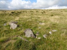
Penn Beacon S.W.10 Reported Cist
OS Map: SX 59431 62663
HER: MDV12914
PMD: Penn Beacon 10
ShortName: CN Penn Beac8
Butler map: 52.14.10
Butler Vol 5: p.26 & Fig.7
Notes: Cairn 10 survives as a ring of stones only, ten small slabs, several of them overgrown, arranged in a circle about 3.0m across. The upper edge of a narrow slab protruding through the turf near the centre is in the correct position for the end stone of a cist. (Butler Vol. 3 p.193) n.b. Radcliffe points out that Butler incorrectly lists Vol 5 Fig 6, p25 for this cairn, it has been corrected in this listing to Fig 7. p26
Nearby sites: SX 59431 62663
Distance: 1.16km
Penn Beacon Round House
OS Map: SX 59775 62859
HER: MDV43437
ShortName: HT:Penn Beac8
Nearby sites: SX 59775 62859
Distance: 1.14km
Tory Brookhead Round House
OS Map: SX 58616 63361
HER: MDV2425
ShortName: HT:Tory Broo11
Nearby sites: SX 58616 63361
Distance: 0.65km
Penn Beacon S.W.11 Reported Cairn
OS Map: SX 5934 6274
ShortName: CN:Penn Beac9
Butler map: 52.14.11
Nearby sites: SX 5934 6274
Distance: 1.07km
Penn Beacon E Round House
OS Map: SX 60277 62891
HER: MDV4358
ShortName: HT:Penn Beac9
Nearby sites: SX 60277 62891
Distance: 1.47km
Tory Brookhead Round House
OS Map: SX 58614 63355
HER: MDV2425
ShortName: HT:Tory Broo12
Nearby sites: SX 58614 63355
Distance: 0.65km
Penn Beacon S.W.12 Reported Cairn
OS Map: SX 5936 6274
ShortName: CN:Penn Beac10
Butler map: 52.14.12
Notes: Butler: one of a pair (with cairn 11), "the companion mound a few metres uphill has been reduced to an oval shape by the removal of half of it's structure, the arc of stones foooting the upper part alone remaining".
Nearby sites: SX 5936 6274
Distance: 1.07km
Penn Beacon E Round House
OS Map: SX 60276 62878
HER: MDV4358
ShortName: HT:Penn Beac10
Nearby sites: SX 60276 62878
Distance: 1.47km
Tory Brookhead Round House
OS Map: SX 58495 63392
HER: MDV53383
ShortName: HT:Tory Broo13
Nearby sites: SX 58495 63392
Distance: 0.73km
Penn Beacon W.13 Reported Cairn
OS Map: SX 5930 6287
ShortName: CN:Penn Beac18
Butler map: 52.14.13
Nearby sites: SX 5930 6287
Distance: 0.93km
Penn Beacon E Round House
OS Map: SX 60279 62907
HER: MDV4358
ShortName: HT:Penn Beac11
Nearby sites: SX 60279 62907
Distance: 1.46km
Tory Brookhead Round House
OS Map: SX 58755 63324
HER: MDV53394
ShortName: HT:Tory Broo14
Nearby sites: SX 58755 63324
Distance: 0.58km
Penn Beacon W.14 Reported Cairn
OS Map: SX 5927 6294
ShortName: CN:Penn Beac19
Butler map: 52.14.14
Nearby sites: SX 5927 6294
Distance: 0.86km
Penn Beacon E Round House
OS Map: SX 60256 62898
HER: MDV4358
ShortName: HT:Penn Beac12
Nearby sites: SX 60256 62898
Distance: 1.45km
Tory Brookhead Round House
OS Map: SX 58494 63388
HER: MDV53383
ShortName: HT:Tory Broo15
Nearby sites: SX 58494 63388
Distance: 0.73km
Penn Beacon W.15 Cairn
OS Map: SX 5921 6303
HER: MDV12911
ShortName: CN:Penn Beac20
Butler map: 52.14.15
Notes: ?
Nearby sites: SX 5921 6303
Distance: 0.76km
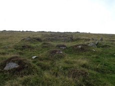
Penn Beacon E Round House
OS Map: SX 60346 62908
HER: MDV15069
ShortName: HT Penn Beac13
Notes: The Penn Moor Reave East incorporates this hut circle.
Nearby sites: SX 60346 62908
Distance: 1.51km
Tory Brookhead Round House
OS Map: SX 58478 63375
HER: MDV2426
ShortName: HT:Tory Broo16
Nearby sites: SX 58478 63375
Distance: 0.75km
Penn Beacon W.16 Reported Cairn
OS Map: SX 5926 6301
ShortName: CN:Penn Beac21
Butler map: 52.14.16
Nearby sites: SX 5926 6301
Distance: 0.78km
Penn Beacon E Round House
OS Map: SX 60302 62849
HER: MDV45129
ShortName: HT:Penn Beac14
Nearby sites: SX 60302 62849
Distance: 1.51km
Tory Brookhead Round House
OS Map: SX 58476 63352
HER: MDV53392
ShortName: HT:Tory Broo17
Nearby sites: SX 58476 63352
Distance: 0.76km
Penn Beacon W.17 Cairn
OS Map: SX 592 629
HER: MDV12910
ShortName: CN:Penn Beac22
Butler map: 52.14.17
Notes: Many of the Butler Penn Beacon cairns could match HER 12910 - this one is closer!
Nearby sites: SX 592 629
Distance: 0.88km
Penn Beacon E Round House
OS Map: SX 60256 62885
HER: MDV4358
ShortName: HT:Penn Beac15
Nearby sites: SX 60256 62885
Distance: 1.45km
Tory Brookhead Round House
OS Map: SX 58630 63369
HER: MDV2425
ShortName: HT:Tory Broo18
Nearby sites: SX 58630 63369
Distance: 0.63km
Penn Beacon E Round House
OS Map: SX 60267 62915
HER: MDV4358
ShortName: HT:Penn Beac16
Nearby sites: SX 60267 62915
Distance: 1.44km
Tory Brookhead Round House
OS Map: SX 58556 63335
HER: MDV2428
ShortName: HT:Tory Broo19
Nearby sites: SX 58556 63335
Distance: 0.71km
Penn Beacon E Round House
OS Map: SX 60268 62881
HER: MDV4358
ShortName: HT:Penn Beac17
Nearby sites: SX 60268 62881
Distance: 1.47km
Tory Brookhead Round House
OS Map: SX 58451 63413
HER: MDV63334
ShortName: HT:Tory Broo20
Nearby sites: SX 58451 63413
Distance: 0.75km
Penn Beacon E Round House
OS Map: SX 60335 62907
HER: MDV15069
ShortName: HT:Penn Beac18
Nearby sites: SX 60335 62907
Distance: 1.50km
Tory Brookhead Round House
OS Map: SX 58549 63333
HER: MDV2428
ShortName: HT:Tory Broo21
Nearby sites: SX 58549 63333
Distance: 0.72km
Penn Beacon E Round House
OS Map: SX 60289 62911
HER: MDV4358
ShortName: HT:Penn Beac19
Nearby sites: SX 60289 62911
Distance: 1.46km
Tory Brookhead Round House
OS Map: SX 58627 63325
HER: MDV2425
ShortName: HT:Tory Broo22
Nearby sites: SX 58627 63325
Distance: 0.66km
Tory Brookhead Round House
OS Map: SX 58609 63316
HER: MDV2431
ShortName: HT:Tory Broo23
Nearby sites: SX 58609 63316
Distance: 0.68km
Tory Brookhead Round House
OS Map: SX 58578 63341
HER: MDV53390
ShortName: HT:Tory Broo24
Nearby sites: SX 58578 63341
Distance: 0.69km
Tory Brookhead Round House
OS Map: SX 58609 63378
HER: MDV2425
ShortName: HT:Tory Broo25
Nearby sites: SX 58609 63378
Distance: 0.64km
Tory Brookhead Round House
OS Map: SX 58635 63346
HER: MDV2425
ShortName: HT:Tory Broo26
Nearby sites: SX 58635 63346
Distance: 0.64km
Tory Brookhead Round House
OS Map: SX 58670 63348
HER: MDV2425
ShortName: HT:Tory Broo27
Nearby sites: SX 58670 63348
Distance: 0.62km
Tory Brookhead Round House
OS Map: SX 58638 63355
HER: MDV2425
ShortName: HT:Tory Broo28
Nearby sites: SX 58638 63355
Distance: 0.64km
Tory Brookhead Round House
OS Map: SX 58627 63352
HER: MDV2425
ShortName: HT:Tory Broo29
Nearby sites: SX 58627 63352
Distance: 0.65km
Tory Brookhead Round House
OS Map: SX 58647 63366
HER: MDV2425
ShortName: HT:Tory Broo30
Nearby sites: SX 58647 63366
Distance: 0.62km
Lee Moor Round House
OS Map: SX 58626 64360
HER: MDV2424
ShortName: HT:Lee Moor1
Nearby sites: SX 58626 64360
Distance: 0.76km
Lee Moor Round House
OS Map: SX 58520 64576
HER: MDV2546
ShortName: HT:Lee Moor2
Nearby sites: SX 58520 64576
Distance: 0.99km
Lee Moor Round House
OS Map: SX 58525 64639
HER: MDV2419
ShortName: HT:Lee Moor3
Nearby sites: SX 58525 64639
Distance: 1.04km
Lee Moor Round House
OS Map: SX 58529 64618
HER: MDV2419
ShortName: HT:Lee Moor4
Nearby sites: SX 58529 64618
Distance: 1.02km
Lee Moor Round House
OS Map: SX 58531 64621
HER: MDV2419
ShortName: HT:Lee Moor5
Nearby sites: SX 58531 64621
Distance: 1.02km
Lee Moor Round House
OS Map: SX 58532 64643
HER: MDV2419
ShortName: HT:Lee Moor6
Nearby sites: SX 58532 64643
Distance: 1.04km
Trowlesworthy Round House
OS Map: SX 57603 64778
ShortName: HT:Trowles2
Nearby sites: SX 57603 64778
Distance: 1.81km
Lee Moor Round House
OS Map: SX 58535 64598
HER: MDV2546
ShortName: HT:Lee Moor7
Nearby sites: SX 58535 64598
Distance: 1.00km
Lee Moor Round House
OS Map: SX 58548 64592
HER: MDV2546
ShortName: HT:Lee Moor8
Nearby sites: SX 58548 64592
Distance: 0.99km
Trowlesworthy Round House
OS Map: SX 57216 64332
ShortName: HT:Trowles4
Nearby sites: SX 57216 64332
Distance: 1.97km
Lee Moor Round House
OS Map: SX 58558 64636
HER: MDV2419
ShortName: HT:Lee Moor9
Nearby sites: SX 58558 64636
Distance: 1.02km
Trowlesworthy Round House
OS Map: SX 57473 64776
HER: MDV15289
ShortName: HT:Trowles5
Nearby sites: SX 57473 64776
Distance: 1.92km
Lee Moor Round House
OS Map: SX 58518 64637
HER: MDV2419
ShortName: HT:Lee Moor10
Nearby sites: SX 58518 64637
Distance: 1.04km
Trowlesworthy Round House
OS Map: SX 57449 64536
HER: MDV2530
ShortName: HT:Trowles6
Nearby sites: SX 57449 64536
Distance: 1.82km
Lee Moor Round House
OS Map: SX 5858 6462
HER: MDV2419
ShortName: HT:Lee Moor11
Nearby sites: SX 5858 6462
Distance: 0.99km
Trowlesworthy Round House
OS Map: SX 57601 64253
HER: MDV15290
ShortName: HT:Trowles7
Nearby sites: SX 57601 64253
Distance: 1.58km
Lee Moor Round House
OS Map: SX 58485 64595
HER: MDV2546
ShortName: HT:Lee Moor12
Nearby sites: SX 58485 64595
Distance: 1.03km
Lee Moor Round House
OS Map: SX 58637 64344
HER: MDV2424
ShortName: HT:Lee Moor13
Nearby sites: SX 58637 64344
Distance: 0.74km
Trowlesworthy Round House
OS Map: SX 5758 6384
HER: MDV32086
ShortName: HT:Trowles9
Nearby sites: SX 5758 6384
Distance: 1.53km
Lee Moor Round House
OS Map: SX 58991 63778
HER: MDV56856
ShortName: HT:Lee Moor14
Nearby sites: SX 58991 63778
Distance: 0.12km
Trowlesworthy Round House
OS Map: SX 5765 6422
HER: MDV15290
ShortName: HT:Trowles10
Nearby sites: SX 5765 6422
Distance: 1.52km
Lee Moor Round House
OS Map: SX 58579 64642
HER: MDV2419
ShortName: HT:Lee Moor15
Nearby sites: SX 58579 64642
Distance: 1.01km
Lee Moor Round House
OS Map: SX 58512 64532
HER: MDV28535
ShortName: HT:Lee Moor16
Nearby sites: SX 58512 64532
Distance: 0.96km
Trowlesworthy Round House
OS Map: SX 57254 64491
ShortName: HT:Trowles12
Nearby sites: SX 57254 64491
Distance: 1.99km
Lee Moor Round House
OS Map: SX 58991 63916
HER: MDV2555
ShortName: HT:Lee Moor17
Nearby sites: SX 58991 63916
Distance: 0.18km
Lee Moor Round House
OS Map: SX 58501 64588
HER: MDV2546
ShortName: HT:Lee Moor18
Nearby sites: SX 58501 64588
Distance: 1.01km
Lee Moor Round House
OS Map: SX 58475 64844
HER: MDV29984
ShortName: HT:Lee Moor19
Nearby sites: SX 58475 64844
Distance: 1.24km
Lee Moor Round House
OS Map: SX 58476 64825
HER: MDV29984
ShortName: HT:Lee Moor20
Nearby sites: SX 58476 64825
Distance: 1.22km
Lee Moor Round House
OS Map: SX 58474 64830
HER: MDV29984
ShortName: HT:Lee Moor21
Nearby sites: SX 58474 64830
Distance: 1.23km
Trowlesworthy Round House
OS Map: SX 57479 64445
HER: MDV15288
ShortName: HT:Trowles17
Nearby sites: SX 57479 64445
Distance: 1.76km
Lee Moor Round House
OS Map: SX 58462 64774
HER: MDV29984
ShortName: HT:Lee Moor22
Nearby sites: SX 58462 64774
Distance: 1.19km
Trowlesworthy Round House
OS Map: SX 57526 64399
HER: MDV56771
ShortName: HT:Trowles18
Nearby sites: SX 57526 64399
Distance: 1.70km
Lee Moor Round House
OS Map: SX 58459 64814
HER: MDV29984
ShortName: HT:Lee Moor23
Nearby sites: SX 58459 64814
Distance: 1.22km
Lee Moor Round House
OS Map: SX 58457 64774
HER: MDV29984
ShortName: HT:Lee Moor24
Nearby sites: SX 58457 64774
Distance: 1.19km
Lee Moor Round House
OS Map: SX 58450 64817
HER: MDV29984
ShortName: HT:Lee Moor25
Nearby sites: SX 58450 64817
Distance: 1.23km
Trowlesworthy Round House
OS Map: SX 57448 64249
HER: MDV49040
ShortName: HT:Trowles21
Nearby sites: SX 57448 64249
Distance: 1.73km
Lee Moor Round House
OS Map: SX 58449 64837
HER: MDV29984
ShortName: HT:Lee Moor26
Nearby sites: SX 58449 64837
Distance: 1.25km
Trowlesworthy Round House
OS Map: SX 57490 64442
HER: MDV15288
ShortName: HT:Trowles22
Nearby sites: SX 57490 64442
Distance: 1.75km
Lee Moor Round House
OS Map: SX 58441 64807
HER: MDV29984
ShortName: HT:Lee Moor27
Nearby sites: SX 58441 64807
Distance: 1.23km
Trowlesworthy Round House
OS Map: SX 57602 64221
HER: MDV15290
ShortName: HT:Trowles23
Nearby sites: SX 57602 64221
Distance: 1.57km
Lee Moor Round House
OS Map: SX 58432 64851
HER: MDV29984
ShortName: HT:Lee Moor28
Nearby sites: SX 58432 64851
Distance: 1.27km
Trowlesworthy Round House
OS Map: SX 57433 64557
HER: MDV2530
ShortName: HT:Trowles24
Nearby sites: SX 57433 64557
Distance: 1.85km
Lee Moor Round House
OS Map: SX 58414 64868
HER: MDV29984
ShortName: HT:Lee Moor29
Nearby sites: SX 58414 64868
Distance: 1.29km
Trowlesworthy Round House
OS Map: SX 57636 64717
HER: MDV56881
ShortName: HT:Trowles25
Nearby sites: SX 57636 64717
Distance: 1.75km
Lee Moor Round House
OS Map: SX 58510 64574
HER: MDV2546
ShortName: HT:Lee Moor30
Nearby sites: SX 58510 64574
Distance: 1.00km
Lee Moor Round House
OS Map: SX 58962 63936
HER: MDV2555
ShortName: HT:Lee Moor31
Nearby sites: SX 58962 63936
Distance: 0.22km
Trowlesworthy Round House
OS Map: SX 57655 64215
HER: MDV15290
ShortName: HT:Trowles27
Nearby sites: SX 57655 64215
Distance: 1.52km
Lee Moor Round House
OS Map: SX 58987 63911
HER: MDV2555
ShortName: HT:Lee Moor32
Nearby sites: SX 58987 63911
Distance: 0.18km
Trowlesworthy Round House
OS Map: SX 57601 64215
HER: MDV15290
ShortName: HT:Trowles28
Nearby sites: SX 57601 64215
Distance: 1.57km
Trowlesworthy Round House
OS Map: SX 57448 64257
HER: MDV49040
ShortName: HT:Trowles29
Nearby sites: SX 57448 64257
Distance: 1.73km
Trowlesworthy Round House
OS Map: SX 57219 64418
ShortName: HT:Trowles33
Nearby sites: SX 57219 64418
Distance: 2.00km
Trowlesworthy Round House
OS Map: SX 57430 63944
HER: MDV28568
ShortName: HT:Trowles34
Nearby sites: SX 57430 63944
Distance: 1.69km
Trowlesworthy Round House
OS Map: SX 57221 64326
ShortName: HT:Trowles36
Nearby sites: SX 57221 64326
Distance: 1.97km
Trowlesworthy Round House
OS Map: SX 57427 64323
HER: MDV2507
ShortName: HT:Trowles38
Nearby sites: SX 57427 64323
Distance: 1.77km
Trowlesworthy Round House
OS Map: SX 57461 64511
HER: MDV2530
ShortName: HT:Trowles39
Nearby sites: SX 57461 64511
Distance: 1.80km
Willings Walls 7 Cairn
OS Map: SX 58086 65357
HER: MDV103578
ShortName: CN:Willings 7
Nearby sites: SX 58086 65357
Distance: 1.88km
Shell Top W.6 Cairn
OS Map: SX 58639 63720
HER: MDV103579
ShortName: CN:ShellTopW6
Nearby sites: SX 58639 63720
Distance: 0.47km
Trowlesworthy Round House
OS Map: SX 5720 6433
ShortName: HT:Trowles42
Nearby sites: SX 5720 6433
Distance: 1.99km
Trowlesworthy Round House
OS Map: SX 57503 64176
HER: MDV56764
ShortName: HT:Trowles43
Nearby sites: SX 57503 64176
Distance: 1.66km
Trowlesworthy Round House
OS Map: SX 57415 64529
HER: MDV49042
ShortName: HT:Trowles44
Nearby sites: SX 57415 64529
Distance: 1.85km
Trowlesworthy Round House
OS Map: SX 57408 64539
HER: MDV49043
ShortName: HT:Trowles46
Nearby sites: SX 57408 64539
Distance: 1.86km
Trowlesworthy Round House
OS Map: SX 57402 64599
HER: MDV49048
ShortName: HT:Trowles47
Nearby sites: SX 57402 64599
Distance: 1.89km
Trowlesworthy Round House
OS Map: SX 57634 64232
HER: MDV15290
ShortName: HT:Trowles48
Nearby sites: SX 57634 64232
Distance: 1.54km
Trowlesworthy Round House
OS Map: SX 57431 64287
HER: MDV2507
ShortName: HT:Trowles49
Nearby sites: SX 57431 64287
Distance: 1.75km
Trowlesworthy Round House
OS Map: SX 57389 64606
HER: MDV49047
ShortName: HT:Trowles50
Nearby sites: SX 57389 64606
Distance: 1.91km
Trowlesworthy Round House
OS Map: SX 57512 64416
HER: MDV15288
ShortName: HT:Trowles56
Nearby sites: SX 57512 64416
Distance: 1.72km
Trowlesworthy Round House
OS Map: SX 57515 64464
HER: MDV15288
ShortName: HT:Trowles57
Nearby sites: SX 57515 64464
Distance: 1.74km
Tory Brookhead 2 (duplicate) Reported Cairn
OS Map: SX 5833 6340
HER: MDV28541
ShortName: CN:ToryBrook6
Butler map: 51.7.2
Nearby sites: SX 5833 6340
Distance: 0.87km
Penn Beacon 1 stone row (duplicate) Reported Cist
OS Map: SX 59528 62475
HER: MDV2407
ShortName: CT:Penn Beac3
Butler map: 52.14.1
Notes: Duplicate of HER 12909
Nearby sites: SX 59528 62475
Distance: 1.37km
Trowlesworthy Round House
OS Map: SX 57364 64541
HER: MDV2532
ShortName: HT:Trowles60
Nearby sites: SX 57364 64541
Distance: 1.90km
Trowlesworthy Round House
OS Map: SX 57500 64371
HER: MDV56772
ShortName: HT:Trowles61
Nearby sites: SX 57500 64371
Distance: 1.72km
Trowlesworthy Round House
OS Map: SX 57401 64567
ShortName: HT:Trowles64
Nearby sites: SX 57401 64567
Distance: 1.88km
Trowlesworthy Round House
OS Map: SX 57635 64157
HER: MDV15290
ShortName: HT:Trowles67
Nearby sites: SX 57635 64157
Distance: 1.52km
Trowlesworthy Round House
OS Map: SX 57381 64551
HER: MDV2532
ShortName: HT:Trowles72
Nearby sites: SX 57381 64551
Distance: 1.89km
Trowlesworthy Round House
OS Map: SX 57502 64435
HER: MDV15288
ShortName: HT:Trowles74
Nearby sites: SX 57502 64435
Distance: 1.74km
Trowlesworthy Round House
OS Map: SX 57970 64225
HER: MDV28539
ShortName: HT:Trowles76
Nearby sites: SX 57970 64225
Distance: 1.22km
Willings Walls Warren Round House
OS Map: SX 58214 64948
HER: MDV2413
ShortName: HT:Willings 1
Nearby sites: SX 58214 64948
Distance: 1.47km
Trowlesworthy Round House
OS Map: SX 57426 64590
HER: MDV49044
ShortName: HT:Trowles77
Nearby sites: SX 57426 64590
Distance: 1.87km
Trowlesworthy Round House
OS Map: SX 57446 64505
HER: MDV2530
ShortName: HT:Trowles78
Nearby sites: SX 57446 64505
Distance: 1.82km
Trowlesworthy Round House
OS Map: SX 57357 64547
HER: MDV2532
ShortName: HT:Trowles80
Nearby sites: SX 57357 64547
Distance: 1.91km
Trowlesworthy Round House
OS Map: SX 57583 64329
HER: MDV43435
ShortName: HT:Trowles81
Nearby sites: SX 57583 64329
Distance: 1.62km
Trowlesworthy Round House
OS Map: SX 57494 64421
HER: MDV15288
ShortName: HT:Trowles83
Nearby sites: SX 57494 64421
Distance: 1.74km
Trowlesworthy Round House
OS Map: SX 57423 64286
HER: MDV2507
ShortName: HT:Trowles84
Nearby sites: SX 57423 64286
Distance: 1.76km
Trowelsworthy (NMR 439396) Reported Cairn
OS Map: SX 5743 6395
HER: MDV28568
ShortName: CNxTrowelswo1
Notes: Hut circle. NMR suggests ring cairn.
Nearby sites: SX 5743 6395
Distance: 1.69km
Trowlesworthy Round House
OS Map: SX 57446 64511
HER: MDV2530
ShortName: HT:Trowles85
Nearby sites: SX 57446 64511
Distance: 1.82km
Trowlesworthy Round House
OS Map: SX 57436 64307
HER: MDV2507
ShortName: HT:Trowles86
Nearby sites: SX 57436 64307
Distance: 1.75km
Trowlesworthy Round House
OS Map: SX 57414 64322
HER: MDV2507
ShortName: HT:Trowles88
Nearby sites: SX 57414 64322
Distance: 1.78km
Trowlesworthy Round House
OS Map: SX 57442 64549
HER: MDV2530
ShortName: HT:Trowles89
Nearby sites: SX 57442 64549
Distance: 1.84km
Trowlesworthy Round House
OS Map: SX 57341 64535
ShortName: HT:Trowles90
Nearby sites: SX 57341 64535
Distance: 1.92km
Trowlesworthy Round House
OS Map: SX 5735 6446
HER: MDV29979
ShortName: HT:Trowles91
Nearby sites: SX 5735 6446
Distance: 1.89km
Hentor Meadow (alleged) Reported Cist
OS Map: SX 585 656
HER: MDV22770
ShortName: CT?Hentor Me1
Notes: SX 58 65 An isolated cist can be found with great difficulty "in the valley of the wallabrook, opposite hentor meadow". The sides have fallen in and the coverstone moved a few feet away (os citing worth)... The cist may be on the west side possibly sx56ne/25. The cist may exist at about sx585656
Nearby sites: SX 585 656
Distance: 1.92km
Trowlesworthy Round House
OS Map: SX 57437 64520
HER: MDV2530
ShortName: HT:Trowles92
Nearby sites: SX 57437 64520
Distance: 1.83km
Trowlesworthy Round House
OS Map: SX 57508 64175
HER: MDV56764
ShortName: HT:Trowles93
Nearby sites: SX 57508 64175
Distance: 1.65km
Trowlesworthy Round House
OS Map: SX 57562 64241
HER: MDV15290
ShortName: HT:Trowles94
Nearby sites: SX 57562 64241
Distance: 1.62km
Hentor Brook (100 yds to W) Reported Cist
OS Map: SX 58393 65488
HER: MDV3480
ShortName: CT?Hentor Br4
Notes: A cist was alleged at this location but could not be found during field investigation. NOTE: NMR gives NGR of SX58156559, but SX 58393 65488 matches description much better.
Nearby sites: SX 58393 65488
Distance: 1.85km
Trowlesworthy Round House
OS Map: SX 57491 64787
HER: MDV15289
ShortName: HT:Trowles95
Nearby sites: SX 57491 64787
Distance: 1.91km
Trowlesworthy Round House
OS Map: SX 5738 6380
HER: MDV32114
ShortName: HT:Trowles96
Nearby sites: SX 5738 6380
Distance: 1.73km
Trowlesworthy Round House
OS Map: SX 57371 64557
HER: MDV2532
ShortName: HT:Trowles97
Nearby sites: SX 57371 64557
Distance: 1.90km
Lower Hentor Brook Round House
OS Map: SX 5851 6563
HER: MDV53369
ShortName: HT:Lower Hen16
Nearby sites: SX 5851 6563
Distance: 1.94km
Willings Walls 8 Reported Cairn
OS Map: SX 5833 6517
HER: MDV131248
ShortName: CN?Willings 8
Notes: "Two possible stone circles depicted and described by Robertson (1991). Survey in 2002 confirmed that these appear to be natural features. They exist a stony patches on an otherwise stone free north-west facing hillside."
Nearby sites: SX 5833 6517
Distance: 1.59km
Willings Walls 6 Cairn
OS Map: SX 5830 6529
ShortName: CN:Willings 6
Grinsell: SHA 24a
Notes: Cairns within the reave. SHA 24a & SHA 24b: NMR record mentions one cairn. The entry for the reave mentions two. UPDATE 01/01/2023 This record used to link to the now deleted HER record MDV56774. The HER entry MDV131336 has a similiar description of cairns on the reave but located quite some distance away at SX 58536541. If the grid reference is wrong, it could actually refer to this earlier record from Grinsell. NB. Grinsell refers to a paper by Fleming in 1973.
Nearby sites: SX 5830 6529
Distance: 1.71km
Upper Ford Brook Round House
OS Map: SX 60480 62702
HER: MDV45133
ShortName: HT:Upper For1
Nearby sites: SX 60480 62702
Distance: 1.74km
Upper Ford Brook Round House
OS Map: SX 60443 62703
HER: MDV50909
ShortName: HT:Upper For2
Nearby sites: SX 60443 62703
Distance: 1.71km
Upper Ford Brook Round House
OS Map: SX 60457 62697
HER: MDV50908
ShortName: HT:Upper For3
Nearby sites: SX 60457 62697
Distance: 1.73km
Upper Ford Brook Round House
OS Map: SX 60459 62714
HER: MDV45132
ShortName: HT:Upper For4
Nearby sites: SX 60459 62714
Distance: 1.72km
Upper Ford Brook Round House
OS Map: SX 60554 62555
HER: MDV4281
ShortName: HT:Upper For5
Nearby sites: SX 60554 62555
Distance: 1.89km
Upper Ford Brook Round House
OS Map: SX 60476 62671
HER: MDV4282
ShortName: HT:Upper For6
Nearby sites: SX 60476 62671
Distance: 1.76km
Upper Ford Brook Round House
OS Map: SX 6032 6265
HER: MDV50906
ShortName: HT:Upper For7
Nearby sites: SX 6032 6265
Distance: 1.66km
Hentor Brook 1 Reported Cairn
OS Map: SX 5894 6517
HER: MDV48946
ShortName: CNxHentor Br1
Butler map: 49.7
Notes: Hut circle
Nearby sites: SX 5894 6517
Distance: 1.40km
Upper Ford Brook Round House
OS Map: SX 60477 62644
HER: MDV50913
ShortName: HT:Upper For8
Nearby sites: SX 60477 62644
Distance: 1.78km
Upper Ford Brook Round House
OS Map: SX 60492 62658
HER: MDV45140
ShortName: HT:Upper For9
Nearby sites: SX 60492 62658
Distance: 1.78km
Upper Ford Brook Round House
OS Map: SX 60510 62734
HER: MDV27921
ShortName: HT:Upper For10
Nearby sites: SX 60510 62734
Distance: 1.75km
Upper Ford Brook Round House
OS Map: SX 60518 62750
HER: MDV27921
ShortName: HT:Upper For11
Nearby sites: SX 60518 62750
Distance: 1.74km
Upper Ford Brook Round House
OS Map: SX 60544 62768
HER: MDV45130
ShortName: HT:Upper For12
Nearby sites: SX 60544 62768
Distance: 1.76km
Upper Ford Brook Round House
OS Map: SX 60548 62637
HER: MDV45134
ShortName: HT:Upper For13
Nearby sites: SX 60548 62637
Distance: 1.84km
Upper Hentor Brook Round House
OS Map: SX 59055 65135
HER: MDV3353
ShortName: HT:Upper Hen1
Nearby sites: SX 59055 65135
Distance: 1.36km
Upper Hentor Brook Round House
OS Map: SX 58996 65104
HER: MDV48955
ShortName: HT:Upper Hen2
Nearby sites: SX 58996 65104
Distance: 1.33km
Upper Hentor Brook Round House
OS Map: SX 59066 65450
ShortName: HT:Upper Hen3
Nearby sites: SX 59066 65450
Distance: 1.67km
Upper Hentor Brook Round House
OS Map: SX 59007 65375
HER: MDV3482
ShortName: HT:Upper Hen4
Nearby sites: SX 59007 65375
Distance: 1.60km
Upper Hentor Brook Round House
OS Map: SX 59079 65186
HER: MDV48953
ShortName: HT:Upper Hen5
Nearby sites: SX 59079 65186
Distance: 1.41km
Upper Hentor Brook Round House
OS Map: SX 59106 65462
HER: MDV55450
ShortName: HT:Upper Hen6
Nearby sites: SX 59106 65462
Distance: 1.68km
Shell Top SW Round House
OS Map: SX 59393 63455
HER: MDV2435
ShortName: HT:Shell Top1
Nearby sites: SX 59393 63455
Distance: 0.43km
Upper Hentor Brook Round House
OS Map: SX 59081 65454
HER: MDV55448
ShortName: HT:Upper Hen7
Nearby sites: SX 59081 65454
Distance: 1.67km
Shell Top SW Round House
OS Map: SX 59410 63444
HER: MDV2435
ShortName: HT:Shell Top2
Nearby sites: SX 59410 63444
Distance: 0.45km
Upper Hentor Brook Round House
OS Map: SX 59000 65097
HER: MDV48955
ShortName: HT:Upper Hen8
Nearby sites: SX 59000 65097
Distance: 1.32km
Shell Top SW Round House
OS Map: SX 59406 63502
HER: MDV2435
ShortName: HT:Shell Top3
Nearby sites: SX 59406 63502
Distance: 0.41km
Upper Hentor Brook Round House
OS Map: SX 59132 65335
HER: MDV55454
ShortName: HT:Upper Hen9
Nearby sites: SX 59132 65335
Distance: 1.56km
Shell Top SW Round House
OS Map: SX 59401 63390
HER: MDV2435
ShortName: HT:Shell Top4
Nearby sites: SX 59401 63390
Distance: 0.49km
Upper Hentor Brook Round House
OS Map: SX 59106 65386
HER: MDV55451
ShortName: HT:Upper Hen10
Nearby sites: SX 59106 65386
Distance: 1.61km
Shell Top SW Round House
OS Map: SX 59414 63499
HER: MDV2435
ShortName: HT:Shell Top5
Nearby sites: SX 59414 63499
Distance: 0.41km
Upper Hentor Brook Round House
OS Map: SX 59007 65097
HER: MDV48955
ShortName: HT:Upper Hen11
Nearby sites: SX 59007 65097
Distance: 1.32km
Shell Top SW Round House
OS Map: SX 59368 63438
HER: MDV2435
ShortName: HT:Shell Top6
Nearby sites: SX 59368 63438
Distance: 0.43km
Upper Hentor Brook Round House
OS Map: SX 59024 65374
HER: MDV3482
ShortName: HT:Upper Hen12
Nearby sites: SX 59024 65374
Distance: 1.60km
Shell Top SW Round House
OS Map: SX 59401 63450
HER: MDV2435
ShortName: HT:Shell Top7
Nearby sites: SX 59401 63450
Distance: 0.44km
Upper Hentor Brook Round House
OS Map: SX 59064 65528
HER: MDV3488
ShortName: HT:Upper Hen13
Nearby sites: SX 59064 65528
Distance: 1.75km
Shell Top SW Round House
OS Map: SX 59417 63486
HER: MDV2435
ShortName: HT:Shell Top8
Nearby sites: SX 59417 63486
Distance: 0.43km
Upper Hentor Brook Round House
OS Map: SX 59065 65569
HER: MDV55497
ShortName: HT:Upper Hen14
Nearby sites: SX 59065 65569
Distance: 1.79km
Shell Top SW Round House
OS Map: SX 59422 63445
HER: MDV2435
ShortName: HT:Shell Top9
Nearby sites: SX 59422 63445
Distance: 0.46km
Upper Hentor Brook Round House
OS Map: SX 5906 6543
HER: MDV55449
ShortName: HT:Upper Hen15
Nearby sites: SX 5906 6543
Distance: 1.65km
Shell Top SW Round House
OS Map: SX 59423 63479
HER: MDV2435
ShortName: HT:Shell Top10
Nearby sites: SX 59423 63479
Distance: 0.43km
Upper Hentor Brook Round House
OS Map: SX 59046 65131
HER: MDV3353
ShortName: HT:Upper Hen16
Nearby sites: SX 59046 65131
Distance: 1.35km
Shell Top SW Round House
OS Map: SX 59386 63438
HER: MDV2435
ShortName: HT:Shell Top11
Nearby sites: SX 59386 63438
Distance: 0.44km
Upper Hentor Brook Round House
OS Map: SX 59056 65484
HER: MDV55447
ShortName: HT:Upper Hen17
Nearby sites: SX 59056 65484
Distance: 1.70km
Shell Top SW Round House
OS Map: SX 59380 63465
HER: MDV2435
ShortName: HT:Shell Top12
Nearby sites: SX 59380 63465
Distance: 0.41km
Upper Hentor Brook Round House
OS Map: SX 59139 65341
HER: MDV55454
ShortName: HT:Upper Hen18
Nearby sites: SX 59139 65341
Distance: 1.56km
Shell Top SW Round House
OS Map: SX 59373 63437
HER: MDV2435
ShortName: HT:Shell Top13
Nearby sites: SX 59373 63437
Distance: 0.43km
Upper Hentor Brook Round House
OS Map: SX 58997 65249
HER: MDV48954
ShortName: HT:Upper Hen19
Nearby sites: SX 58997 65249
Distance: 1.47km
Shell Top SW Round House
OS Map: SX 59373 63465
HER: MDV2435
ShortName: HT:Shell Top14
Nearby sites: SX 59373 63465
Distance: 0.41km
Upper Hentor Brook Round House
OS Map: SX 59059 65530
HER: MDV3488
ShortName: HT:Upper Hen20
Nearby sites: SX 59059 65530
Distance: 1.75km
Shell Top SW Round House
OS Map: SX 59318 63476
HER: MDV2435
ShortName: HT:Shell Top15
Nearby sites: SX 59318 63476
Distance: 0.37km
Upper Hentor Brook Round House
OS Map: SX 59116 65315
HER: MDV3486
ShortName: HT:Upper Hen21
Nearby sites: SX 59116 65315
Distance: 1.54km
Hentor Brook 3 Reported Cist
OS Map: SX 5848 6557
HER: MDV-1
ShortName: CT?Hentor Br3
DPD page: 52
Notes: Lethbridge reports a possible cist near Willings Walls Reave. There are no entries in the NMR or HER. The NGR is approx SX 5848 6557 - see diagram Discover Prehistoric Dartmoor p.52 (Lethbridge 2015)
Nearby sites: SX 5848 6557
Distance: 1.90km
Shell Top SW Round House
OS Map: SX 59350 63492
HER: MDV2435
ShortName: HT:Shell Top16
Nearby sites: SX 59350 63492
Distance: 0.37km
Upper Hentor Brook Round House
OS Map: SX 59060 65498
HER: MDV55446
ShortName: HT:Upper Hen22
Nearby sites: SX 59060 65498
Distance: 1.72km
Shell Top SW Round House
OS Map: SX 59409 63482
HER: MDV2435
ShortName: HT:Shell Top17
Nearby sites: SX 59409 63482
Distance: 0.42km
Upper Hentor Brook Round House
OS Map: SX 59123 65311
HER: MDV3486
ShortName: HT:Upper Hen23
Nearby sites: SX 59123 65311
Distance: 1.53km
Shell Top SW Round House
OS Map: SX 59355 63398
HER: MDV2435
ShortName: HT:Shell Top18
Nearby sites: SX 59355 63398
Distance: 0.45km
Upper Hentor Brook Round House
OS Map: SX 5906 6516
HER: MDV3505
ShortName: HT:Upper Hen24
Nearby sites: SX 5906 6516
Distance: 1.38km
Shell Top SW Round House
OS Map: SX 59360 63496
HER: MDV2435
ShortName: HT:Shell Top19
Nearby sites: SX 59360 63496
Distance: 0.38km
Upper Hentor Brook Round House
OS Map: SX 5906 6516
HER: MDV3353
ShortName: HT:Upper Hen25
Nearby sites: SX 5906 6516
Distance: 1.38km
Shell Top SW Round House
OS Map: SX 59363 63388
HER: MDV2435
ShortName: HT:Shell Top20
Nearby sites: SX 59363 63388
Distance: 0.47km
Upper Hentor Brook Round House
OS Map: SX 5906 6544
HER: MDV3484
ShortName: HT:Upper Hen26
Nearby sites: SX 5906 6544
Distance: 1.66km
Shell Top SW Round House
OS Map: SX 59396 63450
HER: MDV2435
ShortName: HT:Shell Top21
Nearby sites: SX 59396 63450
Distance: 0.44km
Upper Hentor Brook Round House
OS Map: SX 59037 65139
HER: MDV3353
ShortName: HT:Upper Hen27
Nearby sites: SX 59037 65139
Distance: 1.36km
Shell Top W Round House
OS Map: SX 59141 63709
HER: MDV56857
ShortName: HT:Shell Top22
Nearby sites: SX 59141 63709
Distance: 0.08km
Upper Hentor Brook Round House
OS Map: SX 59103 65380
HER: MDV55452
ShortName: HT:Upper Hen28
Nearby sites: SX 59103 65380
Distance: 1.60km
Shell Top W Round House
OS Map: SX 59243 63634
HER: MDV56859
ShortName: HT:Shell Top23
Nearby sites: SX 59243 63634
Distance: 0.20km
Upper Hentor Brook Round House
OS Map: SX 58977 65379
HER: MDV3482
ShortName: HT:Upper Hen29
Nearby sites: SX 58977 65379
Distance: 1.60km
Shell Top W Round House
OS Map: SX 59154 63710
HER: MDV56857
ShortName: HT:Shell Top24
Nearby sites: SX 59154 63710
Distance: 0.08km
Upper Hentor Brook Round House
OS Map: SX 5897 6519
HER: MDV48945
ShortName: HT:Upper Hen30
Nearby sites: SX 5897 6519
Distance: 1.42km
Upper Hentor Brook Round House
OS Map: SX 5895 6516
HER: MDV48946
ShortName: HT:Upper Hen31
Nearby sites: SX 5895 6516
Distance: 1.39km
Upper Hentor Brook Round House
OS Map: SX 58945 65170
HER: MDV48952
ShortName: HT:Upper Hen32
Nearby sites: SX 58945 65170
Distance: 1.40km
Upper Hentor Brook Round House
OS Map: SX 59102 65373
HER: MDV55453
ShortName: HT:Upper Hen33
Nearby sites: SX 59102 65373
Distance: 1.59km
Upper Hentor Brook Round House
OS Map: SX 5898 6535
HER: MDV3482
ShortName: HT:Upper Hen34
Nearby sites: SX 5898 6535
Distance: 1.58km
Cholwich Town Stone Row
OS Map: SX 585 623
HER: MDV2438
Megalithic Portal: 1824
The Stone Rows of GB: Cholwichtown
PMD: Cholwich Town Stone Row
Alternate name: Cholwichtown stone row Stone Row
ShortName: SRxCholwich
Butler map: 48.7
Notes: "This ring and stone row is now covered by china clay waste. A stone row and circle on top of a low ridge, between Tory Brook and a tributary of the Yealm, near Cholwich Town. The row, extending over 700ft, consisted of uprights 2-3ft. high and 3ft. apart, the circle, at the northern end of the row, was 15ft. in diameter with seven upright stones. The site was excavated in 1961, and the sockets of many missing stones were found, also a pit 8ft. in diameter in the centre of the circle." Pollen analysis suggested the row was originally in a clearing of a wooded area.
Nearby sites: SX 585 623
Distance: 1.60km
Cholwich Town (site of) Cairn Circle
OS Map: SX 5846 6225
HER: MDV49508
Megalithic Portal: 770
PMD: Cholwich Town Stone Row
Alternate name: Cholwichtown stone row Cairn Circle
ShortName: CCxCholwich
Butler map: 48.
Grinsell: COR 5
Turner: G27
Notes: Site of former cairn circle. "the row, extending over 700ft, consisted of uprights 2-3ft. high and 3ft. apart, the circle, at the northern end of the row, was 15ft. in diameter with seven upright stones. The site was excavated in 1961, and the sockets of many missing stones were found, also a pit 8ft. in diameter in the centre of the circle. "
Nearby sites: SX 5846 6225
Distance: 1.66km
Cholwichtown Contour Reave Enclosed Settlement
OS Map: SX 59383 63449
HER: MDV2435
ShortName: ST:Cholwich
Notes: Enclosure with hut circles on Cholwich Town contour reave.
Nearby sites: SX 59383 63449
Distance: 0.43km
Great Trowlesworthy Cairn Circle
OS Map: SX 5839 6459
HER: MDV28533
ShortName: CC:Trowles
Butler map: 51.5
Notes: "An incomplete circle of largely recumbent granite boulders on the gently sloping W flank of Lee Moor. The ring measures 9.9m north-south by 9.4m with a gap in the eastern side. The interior lies at the same level as the surrounding ground surface." See Butler Volume 3 pp.162-3, Map 51, Figure 51.6 'Ring of stones' shown to the west of Settlement 'B' at 'Upper Spanish Lake'. Not listed in Butler's cairn listing.
Nearby sites: SX 5839 6459
Distance: 1.08km
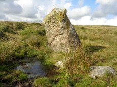
Hanging Stone Standing Stone
OS Map: SX 58372 63688
HER: MDV2423
Megalithic Portal: 45568
The Stone Rows of GB: Lee Moor South
PMD: The Hanging Stone
Alternate name: The Hanging Stone Standing Stone
ShortName: SS Hanging
Butler Vol 5: p.53
DPD page: 59
Notes: Located on Lee Moor. "The 'Hanging Stone' or 'Leaning Rock', 7ft 9ins in length, but because of the stone being 38o out of the vertical, its vertical height is only 6ft 9ins. It measures 3ft 7ins by 1ft 10ins at the base, and is incised on one face with the letters "CB" showing that at one time it was used as a bound-post. It is believed to be prehistoric." TDA Vol. 72 1940 pp. 192-3 (R Hansford Worth). See also, Legendary Dartmoor: The Hanging Stone.
Nearby sites: SX 58372 63688
Distance: 0.74km
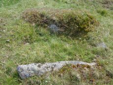
Hentor Cist
Prehistoric Dartmoor Walks: Dartmoor Site: Guide to the Hentor & Shavercombe Brook Cists
OS Map: SX 59252 65720
HER: MDV55317
Megalithic Portal: 45790
PMD: Hen Tor Warren 1
Alternate name: Hen Tor N.1 Cist
ShortName: CT Hen Tor N1
Butler map: 49.22.1
DPD page: 51
Notes: Butler Hen Tor 1 (Cairn 1) - Vol. 3. Map 49.22 (general plan of Hen Tor with diagram of cists pp.146-7). "A low earthen barrow or cairn with cist. The barrow is 4m by 3.5m and 0.6m high. The centrally placed cist is 1.2m by 0.75m. internally and 0.2m deep. Three side stones visible, with the cist aligned north-east/south-west, but no coverstone. The overall condition is fair". Lethbridge p.50-51 Shavercombe Cist F - diagram p.49.
Nearby sites: SX 59252 65720
Distance: 1.95km
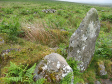
Hentor Warren Reported Cist
Prehistoric Dartmoor Walks: Dartmoor Site: Guide to the Hentor & Shavercombe Brook Cists
OS Map: SX 59003 65604
ShortName: CT-Hen Tor N9
Butler map: 49.22
Notes: Possible cist reported by Sam Goodwin. This site is close to the ruins of Hentor Warren House. The structure has the appearance of being a Bronze Age site but it is situated in close proximity to a jumble of remains from the historic period including buildings and walls. Site visited by the author and Sam on 16/06/2018.
Nearby sites: SX 59003 65604
Distance: 1.83km
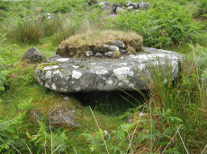
Hentor Warren Reported Cist
OS Map: SX 59023 65597
ShortName: CT-Hen Tor N10
Butler map: 49.22
Notes: Possible cist reported by Sam Goodwin. This site is close to the ruins of Hentor Warren House. The structure has the appearance of being a Bronze Age site but it is situated in close proximity to a jumble of remains from the historic period including buildings and walls. Site visited by the author and Sam on 16/06/2018. This particular slab has a cavity below it which is large enough for a dog to shelter in. On top of the slab is a thick layer which could represent remains of a cairn.
UPDATE 16/01/2019. This site is described as a "cooler" in Eric Hemery's High Dartmoor on p.21 photo 19. "A cupboard recess or chamber used for cool-storage of foodstuffs" (p.33). See also p.39 photo 39 and p.200 for "Mother Nicholl's Book -place" - another cupboard recess within the walls of Hentor Warren House.
Nearby sites: SX 59023 65597
Distance: 1.82km
High-house Waste Enclosed Settlement
OS Map: SX 605 627
HER: MDV4362
Megalithic Portal: 45579
ShortName: ES:HighHouse
DPD page: 63
Notes: "Scattered settlement of at least 12 circular huts, some of them being very large. Possibly Romano-British as opposed to the Bronze Age/Iron Age settlements nearby. Later rectangular house on south edge of area". Lethbridge p.63-64 Hut Circle with largest door jambs (over 4 foot tall) on Dartmoor.
Nearby sites: SX 605 627
Distance: 1.76km
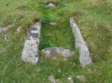
Lee Moor (Upper Spanish Lake) Cist
OS Map: SX 58549 64450
HER: MDV2495
Megalithic Portal: 45753
PMD: Lee Moor
Alternate name: Upper Spanish Lake 3 Cist
ShortName: CT SpanishLake
Butler map: 51.5.3
DPD page: 54
Grinsell: SHA 31
Barrow Report: 63
Notes: Part of a group of cairns very close together, see also NMR record SX56 SE4. "A small round cairn, 5.0m. diameter and 0.5m. high, on a gentle, well drained, clitter strewn, west facing slope at 355m. above OD. It is built of small boulders, now turf covered, and a cist lies within the cairn on the south-east side. The cist comprises the side and end stones, measures internally 0.7m. by 0.6m. wide, and is aligned on a grid bearing of 130o. The cover-stone is missing". Lethbridge p.54 Spanish Lake Cist. Butler Upper Spanish Lake 3 (Cairn 3) - Vol. 3. Map 51.5 (pp.162-4 general plan of Upper Spanish Lake huts and cairns p.163, diagram of cist p.164).
Nearby sites: SX 58549 64450
Distance: 0.87km
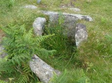
Lee Moor (Willings Walls) Cist
OS Map: SX 58278 65339
HER: MDV4022
Megalithic Portal: 45651
PMD: Willings Walls Warren
Alternate name: Willings Walls 3 Cist
ShortName: CT Lee Moor
Butler map: 51.6.3
DPD page: 52
Grinsell: SHA 24
Barrow Report: 19
Notes: "A cairn immediately adjacent to and west of Willings Walls Reave. The cairn mound measures 9 metres in diameter and up to 0.5 metres high. It contains a central cist with one end slab and two side slabs in place". Lethbridge p.52-3 Willingswalls Cist 1 (W of Reave) - diagram p52. Butler Willings Walls 3 (Cairn & Cist 3) - Vol. 3. Map 51.6 (diagram p.166).
Nearby sites: SX 58278 65339
Distance: 1.77km
Penn Beacon Platform Cairn Circle
OS Map: SX 59827 62268
HER: MDV2402
Megalithic Portal: 45617
PMD: Penn Beacon 2
Alternate name: Penn Beacon S.2 Platform Cairn Circle
ShortName: PC:Penn Beacon
Butler map: 52.14.2
Grinsell: COR 4
Turner: E7
Notes: A tumulus with a retaining circle, in poor condition. Diameter 12m, height 0.5m. "A cairn, about forty feet in diameter, from which almost all the stones have been removed and the central cist destroyed. It was surrounded by a circle of upright stones from one to three feet high, and to the west a row of two pairs of stones."
Nearby sites: SX 59827 62268
Distance: 1.67km
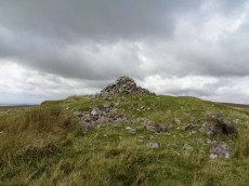
Penn Beacon Cairn
OS Map: SX 59924 62928
HER: MDV2404
Megalithic Portal: 45853
Alternate name: Penn Beacon Summit Cairn
ShortName: CN PennBeacon
Butler map: 52.14
Butler Vol 5: p.157 & Fig.96
Grinsell: COR 2
Barrow Report: 14
Notes: "A round cairn, 22 metres in diameter and 1.7 metres high, lies on the summit of Penn Beacon, at 430 metres above O.D. It is of small boulders and has been much disturbed, with a central hollow, 8 metres in diameter and 0.8 metres deep, and a modern marker cairn, 1 metre high, on the south side". Lethbridge p.62-3 suggests possible ruins of chambered cairn (diagram p.59).
Nearby sites: SX 59924 62928
Distance: 1.18km
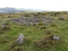
Penn Beacon 1 Cairn Circle & Cist
OS Map: SX 59532 62482
HER: MDV12909
PMD: Penn Beacon 1
Alternate name: Penn Beacon 1 stone row Cairn Circle & Cist
ShortName: CT Penn Beac2
Butler map: 52.14.1
DPD page: 61
Grinsell: COR 3
Notes: A cairn on the lower slope of Penn Beacon, close to stone row (sx56se/2). Opened in 1872 by Spence Bate and Oliver: a fine cist was found, a stone implement and many pot fragments, one quite substantial. The cairn stands at the north end of a double stone row which extends for 7.0m. The cist is not visible. See also: Bate's 1872 Report
Nearby sites: SX 59532 62482
Distance: 1.36km
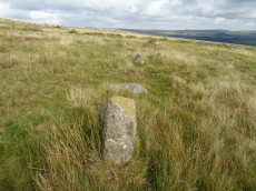
Penn Beacon S. Stone Row
OS Map: SX 59947 62553
HER: MDV2400
Megalithic Portal: 2076
The Stone Rows of GB: Penn Beacon South
PMD: Penn Beacon Stone Row
Alternate name: Penn Beacon S Stone Row
ShortName: SR Penn Beac S
Butler map: 52.14
DPD page: 62
Notes: "A single stone row, sixty-six feet long, the largest stone being about 2 1/2 feet high. This row is no more than a remnant". Lethbridge p.62 Penn stone row - diagram p.59.
Nearby sites: SX 59947 62553
Distance: 1.49km

Penn Beacon S.W. Stone Row
OS Map: SX 59523 62471
HER: MDV2399
Megalithic Portal: 2077
The Stone Rows of GB: Penn Beacon South West
PMD: Penn Beacon Cairn Stone Row
Alternate name: Penn Beacon SW Stone Row
ShortName: SR PennBeac SW
Butler map: 52.14.1
DPD page: 61
Notes: "A short double stone row 24ft. long and nearly 2ft. wide consisting of two pairs of stones on the southern slope of Penn Beacon. To the north end of the row there is a cairn approximately 52 feet in diameter and 6 foot high. It was excavated in 1872, a cist was discovered, though the capstone had collapsed at one end. Fragments of a wide mouthed jar were found and a slate implement, thought to be used for fashioning clay vessels". Lethbridge p.61 Penn Moor south double stone row and cairn - diagram p.59. See also: Bate's 1872 Report
Nearby sites: SX 59523 62471
Distance: 1.37km
Shell Top Stone Ring Cairn Circle
OS Map: SX 59835 63835
HER: MDV12790
Megalithic Portal: 1250
Alternate name: Shell Top Summit 3 Stone Ring Cairn Circle
ShortName: RC:ShellTopSu3
Butler map: 51.10.3
Grinsell: COR 1a
Turner: A44
Notes: "A stone ring 20.5m overall diameter, comprising small, heather covered stones, 0.8m wide and 0.2m high. It lies on the broad level summit of shell top at 475m above sea level. There is a wide 3m wide gap on the north side and the interior is slightly domed, about 0.4m high, possibly a natural rise since it is off-centre. The term 'stone circle' is rather a mis-nomer since only half a dozen stones protrude from the turf and in appearance it is simply a low circular bank."
Nearby sites: SX 59835 63835
Distance: 0.73km
Shell Top Platform Cairn Circle
OS Map: SX 59766 63805
HER: MDV12905
Megalithic Portal: 45646
PMD: Shell Top
Alternate name: Shell Top Summit 1 Platform Cairn Circle
ShortName: PC:ShellTopSu1
Butler map: 51.10.1
Grinsell: COR 1
Turner: E53
Notes: Cairn 9.5m in diameter with boulder of tor. Butler Vol 3 map 51.10 p.174.
Nearby sites: SX 59766 63805
Distance: 0.66km
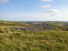
Shell Top Chambered Cairn
OS Map: SX 58690 63517
HER: MDV2411
Megalithic Portal: 45852
Alternate name: Tory Brookhead 3 Chambered Cairn
ShortName: CN ToryBrook3
Butler map: 51.7.3
DPD page: 59
Grinsell: SHA 39
Notes: "A Bronze Age round cairn on a well drained south west facing slope. The cairn mound measures 26 metres by 24 metres and stands up to 1.2 metres high. The centre is much disturbed, with many hollows, up to 1m deep, which have been interpreted as chambers, but are most probably modern windbreak shelters. Two small satellite cairns lie immediately to the north west." Lethbridge suggests a chambered cairn, see photos Lethbridge p.59-60 Chambered Cairn - diagram p.59
Nearby sites: SX 58690 63517
Distance: 0.50km
Shell Top S.W. Stone Row
OS Map: SX 59473 63142
HER: MDV48897
Megalithic Portal: 36955
The Stone Rows of GB: Shell Top South West
PMD: Shell Top Stone Row
Alternate name: Shell Top SW Stone Row
ShortName: SR:ShellTop SW
Butler map: 51.9
DPD page: 60
Notes: Not listed in NMR. Discovered by Lethbridge in 1992. Butler Vol. 3 Map 51.9. Oval cairn at the higher end. Orientated just west of north and 73.5 m from the cairn is a massive fallen longstone 2.7 m long which is probably the terminal stone of the row. There are 31 of 47 original stones visible in the row, all but a few either flat or leaning. Lethbridge p.59-61 diagram p.59, 61.
Nearby sites: SX 59473 63142
Distance: 0.73km
South-west of Penn Beacon Enclosed Settlement
OS Map: SX 59763 62760
HER: MDV2401
ShortName: ST:SWPennBeac
Notes: Enclosure with hut circles on Cholwich Town contour reave.
Nearby sites: SX 59763 62760
Distance: 1.21km
Trowlesworthy Enclosed Settlement
Prehistoric Dartmoor Walks: Dartmoor Site: Trowlesworthy, Settlements, Stone Row & Cairn Circle
OS Map: SX 57459 64536
HER: MDV2530
Megalithic Portal: 34064
ShortName: ES:Trowles N
Notes: "Two adjoining enclosures containing four hut circles and two other contemporary structures on the W flank of Lee Moor some 300m W of Little Trowelsworthy Tor. The enclosures measure 24m N to S by 34m and 63m N to S by 46m. Both are bounded by substantial stony banks up to 2.5m wide and 0.9m high."
Nearby sites: SX 57459 64536
Distance: 1.82km
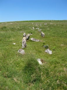
Trowlesworthy E. Stone Row
Prehistoric Dartmoor Walks: Dartmoor Site: Trowlesworthy, Settlements, Stone Row & Cairn Circle
OS Map: SX 57646 63972
HER: MDV2421
Megalithic Portal: 3516
The Stone Rows of GB: Trowlesworthy 1
PMD: Trowlesworthy E Stone Row
Alternate name: Trowlesworthy 1 Stone Row
ShortName: SR Trowles E
Butler map: 51.8.1
Butler Vol 5: p.229 & Fig.163
DPD page: 57
Notes: Butler Trowlesworthy 1. "A Bronze Age stone alignment comprising a double stone row consisting of 99 upright and 8 recumbent stones running south-south-west from a possible stone circle near the foot of the south flank of Little Trowlesworthy Tor. The surviving length of the row is about 129 metres, it is bisected by a leat. The better preserved element of the row is down the slope from the leat. The circle comprises 8 main orthostat stones in a "kidney-shaped" plan. The south-west orthostat in the ring is surrounded by a number of smaller stones". Lethbridge p.57-8, diagram p.58. See also, Legendary Dartmoor: The Pulpit and Sea Views at Trowlesworthy 1
Nearby sites: SX 57646 63972
Distance: 1.48km
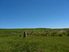
Trowlesworthy W. Stone Row
Prehistoric Dartmoor Walks: Dartmoor Site: Trowlesworthy, Settlements, Stone Row & Cairn Circle
OS Map: SX 57536 63978
HER: MDV2415
Megalithic Portal: 2176
The Stone Rows of GB: Trowlesworthy 2
PMD: Trowlesworthy W Stone Row
Alternate name: Trowlesworthy 2 Stone Row
ShortName: SR Trowles W
Butler map: 51.8.2
DPD page: 58
Notes: Butler Trowlesworthy 2. "A single stone row consisting of 35 upright and 13 recumbent stones running in an E to W line from the site of a possible ring cairn at the foot of the SW flank of Little Trowlesworthy Tor. The cairn at the head of the row is marked by a circle containing one upright and eight fallen small slabs and boulders. Within these is a slightly raised area, perhaps the remains of a cairn." Lethbridge p.57-8, diagram p.58.
Nearby sites: SX 57536 63978
Distance: 1.59km
Trowlesworthy Warren Enclosed Settlement
Prehistoric Dartmoor Walks: Dartmoor Site: Trowlesworthy, Settlements, Stone Row & Cairn Circle
OS Map: SX 57499 64442
HER: MDV2507
Megalithic Portal: 34075
ShortName: ES:Trowles S
Notes: "A sub-circular enclosure about 150 paces in diameter situated on the western slope of Trowlesworthy Tor, the wall unbroken except for entrances on the north and south sides. Inside the southern entrance is a hut circle. The structures at the two entrances are vermin traps, these and the square chamber having been built by warreners"
Nearby sites: SX 57499 64442
Distance: 1.74km
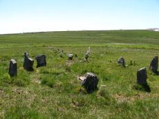
Trowlesworthy Warren (E) Cairn Circle
Prehistoric Dartmoor Walks: Dartmoor Site: Trowlesworthy, Settlements, Stone Row & Cairn Circle
OS Map: SX 57651 63983
HER: MDV49511
Megalithic Portal: 529
PMD: Trowlesworthy E Stone Row
Alternate name: Trowlesworthy stone row 1 Cairn Circle
ShortName: CC Trowles E
Butler map: 51.8.1
Butler Vol 5: p.229 & Fig.163
DPD page: 58
Grinsell: SHA 44
Turner: G25
Notes: Cairn circle at head of stone row. "The circle 6.5m. in diameter comprises eight orthostats from 0.7m. to 1.5m. high. In some cases the 'trig' stones are visible." "The alleged cairn at the head of the row comprises a ring of eight stones a maximum of 1.2m high with no evidence of a cist and very little to suggest the former presence of a cairn. It would seem more likely to represent the remains of a small stone circle albeit only 6.0 to 6.5m in diameter." See also, Legendary Dartmoor: The Pulpit. Lethbridge p.57-8, diagram p.58.
Nearby sites: SX 57651 63983
Distance: 1.47km
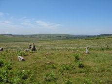
Trowlesworthy Warren (W) Cairn Circle
Prehistoric Dartmoor Walks: Dartmoor Site: Trowlesworthy, Settlements, Stone Row & Cairn Circle
OS Map: SX 57544 63986
HER: MDV49509
Megalithic Portal: 3517
PMD: Trowlesworthy W Stone Row
Alternate name: Trowlesworthy stone row 2 Cairn Circle
ShortName: CC Trowles W
Butler map: 51.8.2
Grinsell: SHA 43
Turner: G26
Notes: This is a cairn circle at the east end of the Trowlesworthy Warren (W) stone row. "At the east is a 4.5m. diameter circle of 10 stones; average height 0.4m. There is no visible cairn or cist in the centre. Two upright stones immediately to the north west of the circle are probably associated. "
Nearby sites: SX 57544 63986
Distance: 1.58km
Upper Spanish Lake 1 Reported Cist
OS Map: SX 58626 64360
HER: MDV42216
PMD: Lee Moor S1
ShortName: CT:Upper Spa1
Butler map: 51.5.1
Grinsell: SHA 35
Notes: Cairn mound, measuring approximately 3 metres in diameter and standing 0.5 metres high. The end and side slabs of the cist are in situ but the coverstone is missing. There are traces of a possible retaining kerb. Scheduled.
Nearby sites: SX 58626 64360
Distance: 0.76km
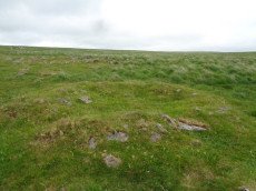
Upper Spanish Lake 2 Reported Cist
OS Map: SX 58586 64351
HER: MDV2418
PMD: Lee Moor S2
ShortName: CT Upper Spa2
Butler map: 51.5.2
Grinsell: SHA 34
Notes: Cairn, measuring roughly 3 metres in diameter and 0.3 metres high. The end and side slabs of the cist survive but the coverstone is missing.
Nearby sites: SX 58586 64351
Distance: 0.77km
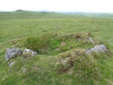
Upper Spanish Lake 4 Cairn Circle
OS Map: SX 58553 64459
HER: MDV42010
ShortName: CN Upper Spa4
Butler map: 51.5.4
Grinsell: SHA 32
Barrow Report: 63
Notes: A hollowed-out cairn measuring 6.5m N to S by 6.4m and 0.9m high. There are no traces of a cist though some protruding stones on the E side may indicate the presence of a former kerb. A stone-lined hollow 2.5m in diameter and 0.6m deep lies in the centre of the mound and probably represents its reuse as a military training feature.
Nearby sites: SX 58553 64459
Distance: 0.88km
Willings Walls Reave Stone Ring Cairn Circle
OS Map: SX 5822 6520
HER: MDV48896
Megalithic Portal: 45834
Alternate name: Willings Walls 1 Stone Ring Cairn Circle
ShortName: RC:Willings 1
Butler map: 51.6.1
Turner: A23
Notes: "Ring cairn willings walls reave. Stone ring with internal diam 6.8m, bank 1.5m wide and 0.5m high. Just outside a break in the reave"
Nearby sites: SX 5822 6520
Distance: 1.68km
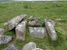
Willings Walls Warren Platform Cairn Circle and Cist
OS Map: SX 58279 65240
HER: MDV4021
Megalithic Portal: 45711
PMD: Willings Walls Warren S.
Alternate name: Willings Walls 2 Platform Cairn Circle and Cist
ShortName: CT Willings 2
Butler map: 51.6.2
DPD page: 53
Grinsell: SHA 25
Turner: E36
Barrow Report: 51
Notes: "Remains of a kerbed cairn with cist On a slight NW slope near a reave. The cairn is 4.6m in diameter and 0.6m high. Within the outer ring of stones is a second ring of boulders not shown on Worth's plan but which may represent an inner kerb. The cist is 1.8m by 0.9m and 0.5m deep with an adjacent coverstone." Lethbridge p.52-3 Willingswalls Cist 2 (E of Reave) - diagram p52, photo p.53. Butler Willings Walls 2 - Vol. 3. Map 51.6 (diagram p.165).
Nearby sites: SX 58279 65240
Distance: 1.68km
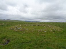
Willings Walls Warren Round House
OS Map: SX 58205 64953
HER: MDV48896
ShortName: HT Willings 2
Nearby sites: SX 58205 64953
Distance: 1.48km
Willings Walls Warren Stone Ring Cairn Circle
OS Map: SX 5818 6517
HER: MDV3438
Megalithic Portal: 1358
PMD: Willings Walls Warren Stone Circle
Alternate name: Willings Walls 5 Stone Ring Cairn Circle
ShortName: RC:Willings 5
Turner: A1
Notes: "Willings walls warren, lee moor. Unusual stone circle. Two kists nearby. Plan. A reave interferes with the circumference of the circle. Four groups of stones are in the circle. No trace of barrow within the circle; and no evidence to show that the stones were ever cists (worth)." A 40m diameter circle consisting of 5 groups of stones. It touches and is incorporated into the Willings Walls Reave. Lethbridge p.52-3 Willingswalls Stone Circle - diagram p52.
Nearby sites: SX 5818 6517
Distance: 1.67km