
Guide to the Monuments on Corn Ridge and Sourton Tor

Table of Ritual and Burial Monuments on Corn Ridge and Sourton Tor
The following table lists the records currently in this Guide Map. For an explantion of the Guide Maps and a table of all 62 Guide Maps, follow this link: Guide List Table. Introductory text will be added to each guide list in 2025. Notes on duplication and omissions will appear below the table once checks have been finalised.
Notes on possible duplications and omissions
Branscombe's Loaf Tor Cairns There are two HER entries for this feature.1) HER record MDV48863 (SiteID=557) is duplicated by MDV50574 (SiteID=4130) and both refer to Turner tor cairn A57. Both entries refer to "a bank of small to medium sized stones surrounding a large rock-outcrop known as Branscombe's Loaf". MDV50574 includes notes saying it is a duplicate. NB. The HER entry MDV134915 also refers to *two* tor cairns. There are more than one rock outcrops at Branscombe but there is only one Branscombe's loaf.
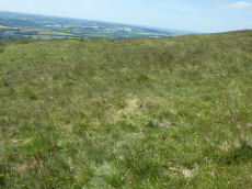
Corn Ridge W and NW and Sourton cairns The Butler listings for the Corn Ridge West cairns are a little confusing being separated in to two groups (West 1,2,3 and North-West 4.1 and 4.2) with some intermingled with cairns and features designated as Sourton. In the past these listings extended the Butler numbering to add two more cairns listed on the HER as 4.3 and 4.4. This may have added to the confusion by making it look like Butler had four "site 4" cairns when he only listed two. With the benefit of hindsight this may have been a mistake but trying to list these as just cairns 1 to 7 seems to make matters worse so reluctantly we have maintained this "after Butler" numbering.
The notes on SiteID=1358 state: NGR is 6-digit from HER. This looks like a duplicate entry maybe of W4.1. Are there 4 or 5 of these cairns? The descriptions on the HER suggest 4 but there are 5 records. Duplication is more likely as this is a rare case where the underlying Butler records are a bit confusing. The size of the feature in tis record seems to originate with an accoutn from Gerrard at 3.0 x 0.6 - W4.1 is reported as a small cairn at 3.0 x 0.3 - that is very similiar.
PS. These notes are to assist untangling complicated records and are neither permanent nor a criticism of the HER who do a fantastic job! The author finds it easier to systematically work through these records (2000+ of them) and add these notes, which are then to be communicated with the HER, if appropriate, it is a pragmatic way of dealing with lots of data without continually stopping and starting.
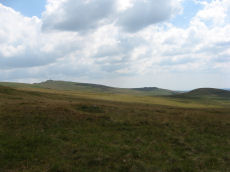
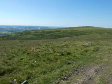
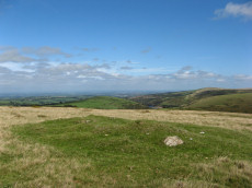
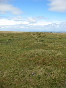
Corn Ridge and Sourton Tor Guide Map
Guidance for walkers: The monuments featured in this database are archaeological treasures and need to be protected and preserved - please do not disturb any sites. Please check access and firing times before visiting sites, not all sites listed are on open access land. Firing ranges and boundaries of open access areas are marked on the OL28 OS Dartmoor Explorer map. Please stick to the country code and consider giving support to the numerous agencies that help to keep Dartmoor a fabulous natural and historic environment!
List of Ritual and Burial Monuments on Corn Ridge and Sourton Tor
Sourton Common Stone Ring Cairn Circle
OS Map: SX 54418 88858
HER record: MDV4674
Megalithic Portal: 10023
Alternate name: Corn Ridge W.1 Stone Ring Cairn Circle
ShortName: RC CornRg W1
Butler map: 43.8.1
Grinsell: BRI 3
Turner: A33
Notes: "Ring cairn surviving as a circular bank 4m wide and 0.7m high surrounding an internal area measuring 12m in diam. Four small hollows in the ring bank suggest partial early excavation or robbing" NMR B.
Nearby sites: SX54428886
Corn Ridge W.2 Cairn
OS Map: SX 54434 88904
HER record: MDV4673
ShortName: CN CornRg W2
Butler map: 43.8.2
Grinsell: BRI 4
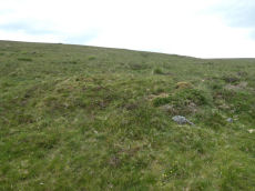
Notes: This monument includes a round cairn and stone hut circle situated on a narrow natural terrace on a steep west-facing slope overlooking west Devon. The cairn mound measures 16m in diameter and stands up to 0.8m high. A hollow in the centre of the mound suggests partial early excavation or robbing. Resembles ring cairn. The stone hut circle lies 7.5m ENE of the cairn and survives as a 1m-wide and 0.3m-high rubble bank surrounding an internal area measuring 3.2m long by 2.3m wide.
Nearby sites: SX54438890
Corn Ridge W.3 Cairn
OS Map: SX 54468 89125
HER record: MDV12846
ShortName: CN CornRg W3
Butler map: 43.9
Grinsell: BRI 2
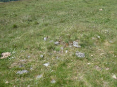
Notes: Cairn mound measures 9.3 metres in diameter and stands up to 0.7 metres high. A shallow hollow in the centre of the mound, measuring 1.5 metres long, 1.3 metres wide and 0.2 metres deep, and another on the western edge, measuring 2.0 metres square and 0.4 metres deep, suggest partial early excavation or robbing.
Nearby sites: SX54478913
Corn Ridge W.4.1 Clearance Cairn
OS Map: SX 54604 89120
HER record: MDV52422
ShortName: CN CornRg W4.1
Butler map: 43.4.1
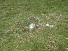
Notes: Butler:" A miniature cairn (3.0 x 0.2 m) a few metres from the hut (SiteID=6900) may be the site of a burial" (gerrard) diam 3.6m, height 0.6m - clearance cairn
Nearby sites: SX54608912
Corn Ridge W.4.2 Cairn
OS Map: SX 54565 89205
HER record: MDV52423
ShortName: CN CornRg W4.2
Butler map: 43.4.2
Notes: (gerrard) largest of 4 cairns.6m by 4m by 0.7m high. May represent a partly damaged funerary cairn, which was incorporated into the later field system. NMR A. NB. Visited by author on 20/06/22 and again on 22/06/22 when it was noted that walling traces in and out of this site which is consistent with other accounts of this site (relevance being many sites in close proximity leading to confusing records).
Nearby sites: SX54578921
Corn Ridge W.4.3 Clearance Cairn
OS Map: SX 54600 89130
HER record: MDV52424
ShortName: CN CornRg W4.3
Notes: "Vis=30/4/1993 (gerrard) oblong mound.4m by 3.3m by 0.6m high"
Nearby sites: SX54608913
Corn Ridge W.4.4 Clearance Cairn
OS Map: SX 54607 89146
HER record: MDV52426
ShortName: CN CornRg W4.4
Notes: "Vis=30/4/1993 (gerrard) diam 3.8m, height 0.8m"
Nearby sites: SX54618915
Corn Ridge W.4 (duplicate) Clearance Cairn
OS Map: SX 54600 89100
HER record: MDV52425
ShortName: CN:CornRgW4Dup
Notes: NGR is 6-digit from HER. This looks like a duplicate entry maybe of W4.1. Are there 4 or 5 of these cairns. The descriptions on the HER suggest 4 but there are 5 records? Duplication is more likely as this is a rare case where the underlying Butler records are a bit confusing. The size of the feature in tis record seems to originate with an accoutn from Gerrard at 3.0 x 0.6 - W4.1 is reported as a small cairn at 3.0 x 0.3 - that is very similiar.
Nearby sites: SX54608910
Sourton Tors 1 Cairn
OS Map: SX 54813 90021
HER record: MDV50577
ShortName: CN:Sourton 1
Nearby sites: SX54819002
Sourton Tors 2 Cairn
OS Map: SX 54811 90021
HER record: MDV16574
ShortName: CN:Sourton 2
Nearby sites: SX54819002
Corn Ridge N.W.1 Cairn
OS Map: SX 54603 89454
HER record: MDV4627
Megalithic Portal: 10022
ShortName: CN CornRg NW1
Butler map: 43.10.1
Grinsell: BRI 1
Notes: Butler Corn Ridge NW1. Southern most of pair of cairns near stone circle. "The remains of a cairn, SX 54608942, which has been disturbed in the past - now heather covered. Diameter 10.5m, height 0.5m. One or two stones of the retaining circle are still visible but there is no trace of a cist to be seen." Previously listed as Sourton Tors S.E. - changed to the Butler name as less confusing given part of a pair of cairns
Nearby sites: SX54608945
Corn Ridge N.W.2 Cairn
OS Map: SX 54610 89480
HER record: MDV55327
ShortName: CN CornRg NW2
Butler map: 43.10.2
Notes: Butler Corn Ridge NW2. Northern most of pair of cairns near stone circle. This was previously matched to the southern terminal of the cairn row but it looks likely they are two separate cairns. This being around 5o-60 metres north of the southern one of the pair (site 10) mentioned by Butler. The southern terminal of the cairn row should be another 30 metres or so to the north and is now a seprate entry with photo and accurate grid reference. The grid reference for this record is that originally published by Butler. Field work is required to clarify this actually relates to a real feature and is nota duplicate of the terminal cairn.
Nearby sites: SX54618948
Sourton Row N Cairn
OS Map: SX 54746 89834
HER record: MDV4628
ShortName: CN SourtonRow
Butler map: 43.11
Grinsell: OKE 3
Notes: This cairn is the northern terminal cairn associated with the cairn row at Sourton. Round cairn, scheduled with two other prehistoric features; another round cairn and a stone circle. The top is uneven with stones showing; kerb stone visible. A series of small cairns form a line from this cairn heading southwards passing the stone circle.
Nearby sites: SX54758983

Sourton Row S Cairn
OS Map: SX 54623 89529
HER record: MDV134910
ShortName: CN SourtonRowS
Notes: HER: Cairn at the southern end of the cairn alignment to the south-east of Sourton Tors of 10 metres diameter by 0.4 metres high. A number of shallow hollows in the surface of the mound suggest partial early excavation or robbing
Nearby sites: SX54628953
Sourton Common Cairn Alignment
OS Map: SX 54623 89529
HER record: MDV50568
ShortName: CR Sourton Row
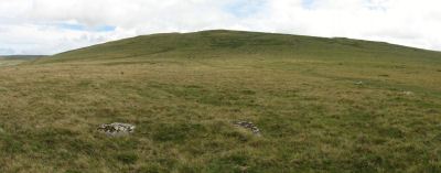
Notes: Cairn alignment crossing a ridge forming a saddle between Sourton Tor to w and corn ridge to e. It is 344.5m long, running n-s. The author visited and logged the location of the individual cairns on 09/09/2018 and again on 22/06/2022.
Nearby sites: SX54628953
Sourton Tors Stone Circle
OS Map: SX 54683 89587
HER record: MDV4626
Megalithic Portal: 3472
PMD: Sourton (Corn Ridge) Stone Circle
ShortName: SC Sourton Tor
Butler map: 43.6
Turner: G3
Notes: "A stone circle, diameter about 110 ft and appearing to have comprised 32 stones of which all but six remain where they have fallen, has been discovered between Sourton Tors and Cornridge. In size it compares with the circles of the Grey Wethers and Scorhill". For a photo of this site, see: Megalithic Portal: Sourton Tors Stone Circle
Nearby sites: SX54688959
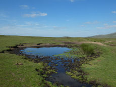
Sourton Tors Ancient Pool
OS Map: SX 54596 89607
HER record: MDV127223
ShortName: PO Sourton Tor
Notes: Pool measures 12 by 10.5m. One of over 40 such 'sacred' pools identified on Dartmoor that are thought to have potentially been designed during the prehistoric period, and may have been used to deposit votive items, although these Dartmoor examples may have alternative significance as designed prehistoric elements in the landscape. Many are located on ridge tops and in conjunction with cairns, stone rows and other prehistoric features. Further research may well reveal more about these interesting features.
Nearby sites: SX54608961
Branscombes Loaf (C.6) Cairnfield Master
OS Map: SX 55200 89100
HER record: MDV134915
ShortName: CN:Branscomb M
Notes: This is the master record for a cairn cemetry and as such set as a duplicate record. See individual entries.
Nearby sites: SX55208910
Corn Ridge Encircled Cairn
OS Map: SX 55175 89119
HER record: MDV3171
Megalithic Portal: 3158
Alternate name: Branscombe's Loaf 1 Encircled Cairn
ShortName: EC Branscomb 1
Butler map: 43.12.1
Grinsell: BRI 9
Turner: F2
Notes: One of 4 cairns on Corn Ridge - see Turner "Ring Cairns, Stone Circles and Related Monuments on Dartmoor" DASP No. 48 p59 for diagram of the 4 cairns.
Nearby sites: SX55188912
Corn Ridge Stone Ring Cairn Circle
OS Map: SX 55138 89153
HER record: MDV3172
Megalithic Portal: 52276
Alternate name: Branscombe's Loaf 2 Stone Ring Cairn Circle
ShortName: RC Branscomb 2
Butler map: 43.12.2
Grinsell: BRI 10
Turner: A14
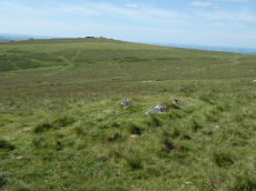
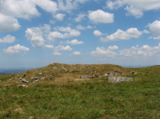
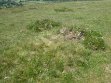
Notes: This ring cairn can just about be seen in the photograph that accompanies this record, it is a bit difficult to capture in a photograph. It is a bit of an indistinct circular bank. It is perhaps easier to see in the Google Earth satellite imagery - which can help to then make sense of the photograph. One of 4 cairns on Corn Ridge - see Turner "Ring Cairns, Stone Circles and Related Monuments on Dartmoor" DASP No. 48 p59 for diagram of the 4 cairns.
Nearby sites: SX55148915
Corn Ridge Rock Stone Ring Cairn Circle
OS Map: SX 55219 89145
HER record: MDV48864
Megalithic Portal: 45850
Alternate name: Branscombe's Loaf 3 Stone Ring Cairn Circle
ShortName: RC Branscomb 3
Butler map: 43.12.3
Turner: A66
Notes: "Tor cairn on summit of Corn Ridge. Two banks of small to medium stones associated with large outcrop. Outer bank survives as 12 metres long, 1.2 metres wide, 0.3 metres high curving rubble spread following s + w edges of the outcrop. Inner ring measures 1.3m wide, 0.3m high and corresponds with the n edge of the outcrop, but also extends over the rock itself, which stands 3m high. Area enclosed by ring banks measures 15m ns by 12m ew" One of 4 cairns on Corn Ridge - see Turner "Ring Cairns, Stone Circles and Related Monuments on Dartmoor" DASP No. 48 p59 for diagram of the 4 cairns.
Nearby sites: SX55228915
Branscombe's Loaf 4 Cairn
OS Map: SX 55194 89076
HER record: MDV50575
Alternate name: Branscombe's Loaf 4 Cairn
ShortName: CN:Branscomb 4
Nearby sites: SX55198908
Branscombe's Loaf 5 Cairn
OS Map: SX 55250 89090
HER record: MDV50576
Alternate name: Branscombe's Loaf 5 Cairn
ShortName: CN:Branscomb 5
Nearby sites: SX55258909
Branscombe's Loaf Stone Ring Cairn Circle
OS Map: SX 55305 89126
HER record: MDV48863
Megalithic Portal: 45843
Alternate name: Branscombe's Loaf Stone Ring Cairn Circle
ShortName: RC Branscomb 6
Turner: A57
Notes: One of 4 cairns on Corn Ridge - see Turner "Ring Cairns, Stone Circles and Related Monuments on Dartmoor" DASP No. 48 p59 for diagram of the 4 cairns. This one is a "tor cairn" - a circular bank enclosing a rocky outcrop. The circle can be seen clearly on Google Earth satellite imagery.
Nearby sites: SX55318913
Branscombe's Loaf (duplicate) Reported Cairn
OS Map: SX 55200 89000
HER record: MDV50574
Alternate name: Branscombe's Loaf (duplicate) Reported Cairn
ShortName: CN:Brans 6 dup
Notes: Duplicate of HER 48863
Nearby sites: SX55208900
Lake Down (c.12) Cairnfield Master
OS Map: SX 54200 88800
HER record: MDV12848
ShortName: CN:LakeDown M
Butler map: 43.8
Notes: This is the master record for a cairn cemetery and as such set as a duplicate record. See individual entries. A cairnfield comprising a total 12 cairns, one outlier and a group of 11.
Nearby sites: SX54208880
Lake Down 1 Clearance Cairn
OS Map: SX 54130 88817
HER record: MDV50578
ShortName: CN LakeDown 1
Notes: "Sub-circular in shape, measures 6m in diameter and stands up to 1.2m high. May contain burials, but it is also part of the nearby cairnfield which represents stone clearance connected with cultivation of the area" . The HER entries MDV61981 (now deleted) and MDV50578 refer to the same site. Lake Down 14 (SiteID=3218) which originally had same grid reference has now beenmarked as a duplicate record.
Nearby sites: SX54138882
Lake Down 2 Clearance Cairn
OS Map: SX 54185 88722
HER record: MDV50945
ShortName: CN LakeDown 2
Notes: There are 12 recorded cairns in this cairnfield, 1 outlier (cairn 1) and group of 11 cairns clustered together making 12 in total. It is impossible to match the HER entries from the descriptions provided due to lack of precision grid references on the HER for this group. For this reason the distinct cairns identified in the field and appearing in the photos have been arbitrarily allocated to one of the HER entries. The grid reference is that of the feature in the photo and is not the grid reference of the arbitrary HER entry allocated to this entry. The group was visited on 17/06/22 and 10 of the 12 cairns were recorded. Two of them, Cairn 9 and Cairn 12, were located on a follow up visit on 20/06/22. Cairn 10 and cairn 11 are oval shaped and allocated to the two HER entries that state oval shaped. Cairn 2 clearly has a central pit and cairn 12 is small - these can be matched to an HER entry.
Nearby sites: SX54198872
Lake Down 3 Clearance Cairn
OS Map: SX 54189 88747
HER record: MDV50946
ShortName: CN LakeDown 3
Notes: There are 12 recorded cairns in this cairnfield, 1 outlier (cairn 1) and group of 11 cairns clustered together making 12 in total. It is impossible to match the HER entries from the descriptions provided due to lack of precision grid references on the HER for this group. For this reason the distinct cairns identified in the field and appearing in the photos have been arbitrarily allocated to one of the HER entries. The grid reference is that of the feature in the photo and is not the grid reference of the arbitrary HER entry allocated to this entry. The group was visited on 17/06/22 and 10 of the 12 cairns were recorded. Two of them, Cairn 9 and Cairn 12, were located on a follow up visit on 20/06/22. Cairn 10 and cairn 11 are oval shaped and allocated to the two HER entries that state oval shaped. Cairn 2 clearly has a central pit and cairn 12 is small - these can be matched to an HER entry.
Nearby sites: SX54198875
Lake Down 4 Clearance Cairn
OS Map: SX 54180 88745
HER record: MDV50948
ShortName: CN LakeDown 4
Notes: There are 12 recorded cairns in this cairnfield, 1 outlier (cairn 1) and group of 11 cairns clustered together making 12 in total. It is impossible to match the HER entries from the descriptions provided due to lack of precision grid references on the HER for this group. For this reason the distinct cairns identified in the field and appearing in the photos have been arbitrarily allocated to one of the HER entries. The grid reference is that of the feature in the photo and is not the grid reference of the arbitrary HER entry allocated to this entry. The group was visited on 17/06/22 and 10 of the 12 cairns were recorded. Two of them, Cairn 9 and Cairn 12, were located on a follow up visit on 20/06/22. Cairn 10 and cairn 11 are oval shaped and allocated to the two HER entries that state oval shaped. Cairn 2 clearly has a central pit and cairn 12 is small - these can be matched to an HER entry.
Nearby sites: SX54188875
Lake Down 5 Clearance Cairn
OS Map: SX 54171 88747
HER record: MDV50949
ShortName: CN LakeDown 5
Notes: There are 12 recorded cairns in this cairnfield, 1 outlier (cairn 1) and group of 11 cairns clustered together making 12 in total. It is impossible to match the HER entries from the descriptions provided due to lack of precision grid references on the HER for this group. For this reason the distinct cairns identified in the field and appearing in the photos have been arbitrarily allocated to one of the HER entries. The grid reference is that of the feature in the photo and is not the grid reference of the arbitrary HER entry allocated to this entry. The group was visited on 17/06/22 and 10 of the 12 cairns were recorded. Two of them, Cairn 9 and Cairn 12, were located on a follow up visit on 20/06/22. Cairn 10 and cairn 11 are oval shaped and allocated to the two HER entries that state oval shaped. Cairn 2 clearly has a central pit and cairn 12 is small - these can be matched to an HER entry.
Nearby sites: SX54178875
Lake Down 6 Clearance Cairn
OS Map: SX 54179 88759
HER record: MDV50950
ShortName: CN LakeDown 6
Notes: There are 12 recorded cairns in this cairnfield, 1 outlier (cairn 1) and group of 11 cairns clustered together making 12 in total. It is impossible to match the HER entries from the descriptions provided due to lack of precision grid references on the HER for this group. For this reason the distinct cairns identified in the field and appearing in the photos have been arbitrarily allocated to one of the HER entries. The grid reference is that of the feature in the photo and is not the grid reference of the arbitrary HER entry allocated to this entry. The group was visited on 17/06/22 and 10 of the 12 cairns were recorded. Two of them, Cairn 9 and Cairn 12, were located on a follow up visit on 20/06/22. Cairn 10 and cairn 11 are oval shaped and allocated to the two HER entries that state oval shaped. Cairn 2 clearly has a central pit and cairn 12 is small - these can be matched to an HER entry.
Nearby sites: SX54188876
Lake Down 7 Clearance Cairn
OS Map: SX 54169 88758
HER record: MDV50951
ShortName: CN LakeDown 7
Notes: There are 12 recorded cairns in this cairnfield, 1 outlier (cairn 1) and group of 11 cairns clustered together making 12 in total. It is impossible to match the HER entries from the descriptions provided due to lack of precision grid references on the HER for this group. For this reason the distinct cairns identified in the field and appearing in the photos have been arbitrarily allocated to one of the HER entries. The grid reference is that of the feature in the photo and is not the grid reference of the arbitrary HER entry allocated to this entry. The group was visited on 17/06/22 and 10 of the 12 cairns were recorded. Two of them, Cairn 9 and Cairn 12, were located on a follow up visit on 20/06/22. Cairn 10 and cairn 11 are oval shaped and allocated to the two HER entries that state oval shaped. Cairn 2 clearly has a central pit and cairn 12 is small - these can be matched to an HER entry.
Nearby sites: SX54178876
Lake Down 8 Clearance Cairn
OS Map: SX 54170 88765
HER record: MDV50952
ShortName: CN LakeDown 8
Notes: There are 12 recorded cairns in this cairnfield, 1 outlier (cairn 1) and group of 11 cairns clustered together making 12 in total. It is impossible to match the HER entries from the descriptions provided due to lack of precision grid references on the HER for this group. For this reason the distinct cairns identified in the field and appearing in the photos have been arbitrarily allocated to one of the HER entries. The grid reference is that of the feature in the photo and is not the grid reference of the arbitrary HER entry allocated to this entry. The group was visited on 17/06/22 and 10 of the 12 cairns were recorded. Two of them, Cairn 9 and Cairn 12, were located on a follow up visit on 20/06/22. Cairn 10 and cairn 11 are oval shaped and allocated to the two HER entries that state oval shaped. Cairn 2 clearly has a central pit and cairn 12 is small - these can be matched to an HER entry.
Nearby sites: SX54178877
Lake Down 9 Clearance Cairn
OS Map: SX 54192 88729
HER record: MDV50953
ShortName: CN LakeDown 9
Notes: There are 12 recorded cairns in this cairnfield, 1 outlier (cairn 1) and group of 11 cairns clustered together making 12 in total. It is impossible to match the HER entries from the descriptions provided due to lack of precision grid references on the HER for this group. For this reason the distinct cairns identified in the field and appearing in the photos have been arbitrarily allocated to one of the HER entries. The grid reference is that of the feature in the photo and is not the grid reference of the arbitrary HER entry allocated to this entry. The group was visited on 17/06/22 and 10 of the 12 cairns were recorded. Two of them, Cairn 9 and Cairn 12, were located on a follow up visit on 20/06/22. Cairn 10 and cairn 11 are oval shaped and allocated to the two HER entries that state oval shaped. Cairn 2 clearly has a central pit and cairn 12 is small - these can be matched to an HER entry.
Nearby sites: SX54198873
Lake Down 10 Clearance Cairn
OS Map: SX 54151 88763
HER record: MDV50954
ShortName: CN LakeDown10
Notes: There are 12 recorded cairns in this cairnfield, 1 outlier (cairn 1) and group of 11 cairns clustered together making 12 in total. It is impossible to match the HER entries from the descriptions provided due to lack of precision grid references on the HER for this group. For this reason the distinct cairns identified in the field and appearing in the photos have been arbitrarily allocated to one of the HER entries. The grid reference is that of the feature in the photo and is not the grid reference of the arbitrary HER entry allocated to this entry. The group was visited on 17/06/22 and 10 of the 12 cairns were recorded. Two of them, Cairn 9 and Cairn 12, were located on a follow up visit on 20/06/22. Cairn 10 and cairn 11 are oval shaped and allocated to the two HER entries that state oval shaped. Cairn 2 clearly has a central pit and cairn 12 is small - these can be matched to an HER entry.
Nearby sites: SX54158876
Lake Down 11 Clearance Cairn
OS Map: SX 54151 88769
HER record: MDV50955
ShortName: CN LakeDown11
Notes: There are 12 recorded cairns in this cairnfield, 1 outlier (cairn 1) and group of 11 cairns clustered together making 12 in total. It is impossible to match the HER entries from the descriptions provided due to lack of precision grid references on the HER for this group. For this reason the distinct cairns identified in the field and appearing in the photos have been arbitrarily allocated to one of the HER entries. The grid reference is that of the feature in the photo and is not the grid reference of the arbitrary HER entry allocated to this entry. The group was visited on 17/06/22 and 10 of the 12 cairns were recorded. Two of them, Cairn 9 and Cairn 12, were located on a follow up visit on 20/06/22. Cairn 10 and cairn 11 are oval shaped and allocated to the two HER entries that state oval shaped. Cairn 2 clearly has a central pit and cairn 12 is small - these can be matched to an HER entry.
Nearby sites: SX54158877
Lake Down 12 Clearance Cairn
OS Map: SX 54158 88764
HER record: MDV50956
ShortName: CN LakeDown12
Notes: There are 12 recorded cairns in this cairnfield, 1 outlier (cairn 1) and group of 11 cairns clustered together making 12 in total. It is impossible to match the HER entries from the descriptions provided due to lack of precision grid references on the HER for this group. For this reason the distinct cairns identified in the field and appearing in the photos have been arbitrarily allocated to one of the HER entries. The grid reference is that of the feature in the photo and is not the grid reference of the arbitrary HER entry allocated to this entry. The group was visited on 17/06/22 and 10 of the 12 cairns were recorded. Two of them, Cairn 9 and Cairn 12, were located on a follow up visit on 20/06/22. Cairn 10 and cairn 11 are oval shaped and allocated to the two HER entries that state oval shaped. Cairn 2 clearly has a central pit and cairn 12 is small - these can be matched to an HER entry.
Nearby sites: SX54168876
Page last updated 10/12/24