
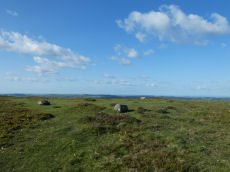
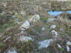
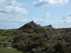
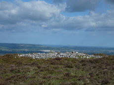
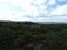
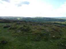
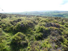
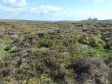
Prehistoric sites within 3km of SX 74900 78180
Guidance for walkers: The monuments featured in this database are archaeological treasures and need to be protected and preserved - please do not disturb any sites. Please check access and firing times before visiting sites, not all sites listed are on open access land. Firing ranges and boundaries of open access areas are marked on the OL28 OS Dartmoor Explorer map. Please stick to the country code and consider giving support to the numerous agencies that help to keep Dartmoor a fabulous natural and historic environment!
About the database listings: In all listings clicking on the photo or the site name will open a page for the site with a larger photo and further details from the database. The database now has over 6680 records covering nearly all publicly listed sites on Dartmoor including around 4800 round houses. This level of detail is of interest to archaeologists but tends to swamp listings of sites more likely to be of interest for walkers. For this reason, the listings default to around 550 core sites only. These are the stone circles, stone rows and the ring cairns listed by Turner. The default search radius is 2 km. The controls below the map can be used to start a new search by entering a 6- or 8-digit reference (without the prefix "SX"). The search radius can be specified and you can add incremental Display layers of detail on top of the core sites. If using a more detailed layer you will need to decrease the search radius to avoid getting hundreds of search results.
- Core sites Default listing of core sites consisting of stone circles & rows and some of the major ring cairns.
- Plus cairns adds approx. 1000 cairns and other minor sites not included in the core listings but excluding round houses.
- Plus round houses adds approx. 4800 round houses.
- Plus non-sites adds in the records for sites that no longer exist or are not prehistoric sites.
- Plus duplicates adds records excluded as duplicates. Those maybe duplicate records in external listings (e.g. the Historic Environment Records). For example, some sites have been identified as cairns in some listings and interpreted as round houses in other listings and both records appear.
These listings have incorporated, matched up and merged all of the records from all of the major archaeological listings including: Worth, Grinsell, Turner, Butler, Bill Radcliffe, Sandy Gerrard, Megalithic Portal, the National Monument Records and the Historic Environment Records. The author would like to thank Bill, Sandy, the lovely people both at Megalithic Portal (especially Anne Tate who did an amazing job to link listings) and at ACE Archaeology for collaborative work over the years to synchronise and correct listings across the various websites which now interlink. A culmination of years of work the final merger of cairn records took 3 months of cross referencing in 2017 the result being a snapshot of the records at that time. This data has in turn been refined since by field work and research. The round house data was supplied by Sandy Gerrard. Grid references are in order of accuracy: from Google Earth satellite, if visible and found, from a Garmin GPS reading, if visited by the author and from the literature otherwise. Individual site pages will state the source of the grid reference and provide satellite imagery. If a site listing lacks a photo it has not yet been visited by the author in which case the grid reference is from the literature.
Currently the database only includes sites which can be represented by a grid reference. Reaves are not included as they require GIS shape technology which is beyond the current capability of this system. To see the sources for the records, look at the tables on the resources menu. The database listings can also be viewed on a Google map and downloaded as GPS datasets for Garmin devices.
Corrections, or any feedback or suggestions are very welcome, email: info@dartmoorwalks.org.uk.
NOTE: Clicking on the icons for each monument in the map will give the name of the site. You can zoom in and out and drag the map around.
List of sites within 3km of SX 74900 78180
Rippon Tor 3 Reported Cist
OS Map: SX 74698 75537
HER: MDV7434
PMD: Rippon Tor Summit
ShortName: CN Rippon To3
Butler map: 5.5.3
Grinsell: ILS 2
Turner: A62
Notes: NMR Cairn 'B' at SX 7474 7547 has been considerably mutilated in the eastern quadrant where it is barely 0.5m. high; otherwise it is up to 3.0m. high. Butler states "Composed of small stones except for a large slab lying at the edge, this is probably the site of the cist referred to by Crossing as almost covered by turf, though he makes no mention of the cairn.
Nearby sites: SX 74698 75537
Distance: 2.65km
Hayne Down Round House
OS Map: SX 7449 8040
HER: MDV26986
ShortName: HT:Hayne Dow8
Nearby sites: SX 7449 8040
Distance: 2.26km
Rippon Tor 4 Cairn
OS Map: SX 74724 75501
HER: MDV13721
ShortName: CN Rippon To4
Butler map: 5.5.4
Grinsell: ILS 3
Notes: NMR B?
Nearby sites: SX 74724 75501
Distance: 2.68km
Hayne Down Round House
OS Map: SX 73973 80583
HER: MDV8815
ShortName: HT:Hayne Dow9
Nearby sites: SX 73973 80583
Distance: 2.58km
Rippon Tor 5 Cairn
OS Map: SX 74750 75479
HER: MDV7433
ShortName: CN Rippon To5
Butler map: 5.5.5
Grinsell: ILS 4
Notes: NMR A? "One of a pair of large cairns south-east of Rippon Tor. It is located on a reave but probably predates it. A much spread and turf-covered cairn of up to 25 metres diameter, 87 metres south-east of Rippon Tor outcrop".
Nearby sites: SX 74750 75479
Distance: 2.71km
Hayne Down Round House
OS Map: SX 74627 80019
HER: MDV26987
ShortName: HT:Hayne Dow10
Nearby sites: SX 74627 80019
Distance: 1.86km
Hayne Down Round House
OS Map: SX 74432 80338
ShortName: HT:Hayne Dow11
Nearby sites: SX 74432 80338
Distance: 2.21km
Haytor Down Round House
OS Map: SX 76655 78425
HER: MDV26624
ShortName: HT:Haytor Do1
Nearby sites: SX 76655 78425
Distance: 1.77km
Halsanger Clearance Cairn
OS Map: SX 7445 7522
HER: MDV7548
ShortName: CN:Halsanger1
Butler map: 5.7
Grinsell: ASH 1
Nearby sites: SX 7445 7522
Distance: 2.99km
Haytor Down Round House
OS Map: SX 76705 78495
HER: MDV26624
ShortName: HT:Haytor Do2
Nearby sites: SX 76705 78495
Distance: 1.83km
Haytor Rocks Round House
OS Map: SX 75605 76985
HER: MDV26556
ShortName: HT:Haytor Ro1
Nearby sites: SX 75605 76985
Distance: 1.39km
Haytor Rocks Round House
OS Map: SX 7568 7719
HER: MDV26539
ShortName: HT:Haytor Ro2
Nearby sites: SX 7568 7719
Distance: 1.26km
Chinkwell Tor Cairn
OS Map: SX 7293 7825
HER: MDV20168
ShortName: CN:Chinkwell1
Butler map: 7.3
Grinsell: WID 10
Turner: A63
Nearby sites: SX 7293 7825
Distance: 1.97km
Haytor Rocks Round House
OS Map: SX 75525 76985
HER: MDV26556
ShortName: HT:Haytor Ro3
Nearby sites: SX 75525 76985
Distance: 1.35km
Haytor Rocks Round House
OS Map: SX 75635 76995
HER: MDV26556
ShortName: HT:Haytor Ro4
Nearby sites: SX 75635 76995
Distance: 1.39km
Haytor Rocks NE Round House
OS Map: SX 7612 7748
HER: MDV26574
ShortName: HT:Haytor Ro5
Nearby sites: SX 7612 7748
Distance: 1.41km
Top Tor 2 Cairn
OS Map: SX 73545 76555
HER: MDV7457
ShortName: CN:Top Tor 21
Butler map: 9.7.2
Grinsell: WID 12
Notes: NMR A
Nearby sites: SX 73545 76555
Distance: 2.12km
Haytor Rocks NE Round House
OS Map: SX 7603 7733
HER: MDV26538
ShortName: HT:Haytor Ro6
Nearby sites: SX 7603 7733
Distance: 1.41km
Top Tor 3 Cairn Circle
OS Map: SX 73657 76472
HER: MDV7456
ShortName: CN:Top Tor 31
Butler map: 9.7.3
Butler Vol 5: p.46 & Fig.25
Barrow Report: 53
Notes: NMR B "One of a group of three, recognisable mainly by four large in situ boulders which represent the remains of a substantial retaining circle. However, much of the fabric has been removed leaving only a faint, roughly circular earthwork of 9.5 metres diameter."
Nearby sites: SX 73657 76472
Distance: 2.11km
Saddle Tor Crop Mark
OS Map: SX 751 765
HER: MDV28309
ShortName: CNxSaddleTor2
Notes: Aerial Photograph
Nearby sites: SX 751 765
Distance: 1.69km
Gratnor Round House
OS Map: SX 7407 7968
HER: MDV7549
ShortName: HT:Gratnor1
Nearby sites: SX 7407 7968
Distance: 1.71km
Great Houndtor Round House
OS Map: SX 74262 79803
HER: MDV7429
ShortName: HT:Great Hou1
Nearby sites: SX 74262 79803
Distance: 1.74km
Great Houndtor Round House
OS Map: SX 74248 79798
HER: MDV7431
ShortName: HT:Great Hou2
Nearby sites: SX 74248 79798
Distance: 1.74km
Great Houndtor Round House
OS Map: SX 74273 79790
HER: MDV7432
ShortName: HT:Great Hou3
Nearby sites: SX 74273 79790
Distance: 1.73km
Horridge Common Round House
OS Map: SX 75156 75261
HER: MDV62326
ShortName: HT:Horridge 14
Nearby sites: SX 75156 75261
Distance: 2.93km
Hedge Down Round House
OS Map: SX 73109 78576
HER: MDV7518
ShortName: HT:Hedge Dow1
Nearby sites: SX 73109 78576
Distance: 1.83km
Hedge Down Round House
OS Map: SX 73087 78554
HER: MDV7517
ShortName: HT:Hedge Dow2
Nearby sites: SX 73087 78554
Distance: 1.85km
Houndtor Down Round House
OS Map: SX 74375 79154
HER: MDV58418
ShortName: HT:Houndtor 1
Nearby sites: SX 74375 79154
Distance: 1.11km
Houndtor Down Round House
OS Map: SX 74363 79163
HER: MDV58418
ShortName: HT:Houndtor 2
Nearby sites: SX 74363 79163
Distance: 1.12km
Greator Round House
OS Map: SX 74911 78427
HER: MDV7505
ShortName: HT:Greator1
Nearby sites: SX 74911 78427
Distance: 0.25km
Houndtor Down Round House
OS Map: SX 74504 79107
HER: MDV58418
ShortName: HT:Houndtor 3
Nearby sites: SX 74504 79107
Distance: 1.01km
Greator Round House
OS Map: SX 74901 78426
HER: MDV7505
ShortName: HT:Greator2
Nearby sites: SX 74901 78426
Distance: 0.25km
Houndtor Down Round House
OS Map: SX 74391 79155
HER: MDV58418
ShortName: HT:Houndtor 4
Nearby sites: SX 74391 79155
Distance: 1.10km
Greator Round House
OS Map: SX 74824 78394
HER: MDV7505
ShortName: HT:Greator 1
Nearby sites: SX 74824 78394
Distance: 0.23km
Houndtor Down Round House
OS Map: SX 74743 78750
HER: MDV58424
ShortName: HT:Houndtor 5
Nearby sites: SX 74743 78750
Distance: 0.59km
Greator Rocks Round House
OS Map: SX 74686 78550
HER: MDV26802
ShortName: HT:Greator R1
Nearby sites: SX 74686 78550
Distance: 0.43km
Houndtor Down Round House
OS Map: SX 74354 79169
HER: MDV58418
ShortName: HT:Houndtor 6
Nearby sites: SX 74354 79169
Distance: 1.13km
Houndtor Down Round House
OS Map: SX 74469 79148
HER: MDV58423
ShortName: HT:Houndtor 7
Nearby sites: SX 74469 79148
Distance: 1.06km
Houndtor Down Round House
OS Map: SX 74504 79121
HER: MDV58418
ShortName: HT:Houndtor 8
Nearby sites: SX 74504 79121
Distance: 1.02km
Houndtor Down Round House
OS Map: SX 74473 79082
HER: MDV58418
ShortName: HT:Houndtor 9
Nearby sites: SX 74473 79082
Distance: 1.00km
RipponTor E of Summit Reported Cairn
OS Map: SX 7468 7553
HER: MDV-1
PMD: Rippon Tor E.
ShortName: CT?RipponTor1
Notes: PMD: Probable dupl;icate of HER 7434 "Stone setting round a possible central cist. 2.3m x 3.5m N-S. Very slight retaining bank 6.5m dia. Ring bank now under reave. Probably the same as SX 7468 7553."
Nearby sites: SX 7468 7553
Distance: 2.66km
Saddle Tor E Round House
OS Map: SX 75573 76337
HER: MDV115985
ShortName: HT:Saddle To1
Nearby sites: SX 75573 76337
Distance: 1.96km
Saddle Tor E Round House
OS Map: SX 75565 76325
HER: MDV115987
ShortName: HT:Saddle To2
Nearby sites: SX 75565 76325
Distance: 1.97km
Saddle Tor E Round House
OS Map: SX 75698 76382
HER: MDV8097
ShortName: HT:Saddle To3
Nearby sites: SX 75698 76382
Distance: 1.97km
Saddle Tor E Round House
OS Map: SX 75711 76399
HER: MDV8098
ShortName: HT:Saddle To4
Nearby sites: SX 75711 76399
Distance: 1.96km
Smallacombe Rocks Round House
OS Map: SX 75663 78292
HER: MDV72895
ShortName: HT:Smallacom1
Nearby sites: SX 75663 78292
Distance: 0.77km
Smallacombe Rocks Round House
OS Map: SX 75695 78172
HER: MDV72898
ShortName: HT:Smallacom2
Nearby sites: SX 75695 78172
Distance: 0.80km
Smallacombe Rocks Round House
OS Map: SX 75716 78268
HER: MDV72896
ShortName: HT:Smallacom3
Nearby sites: SX 75716 78268
Distance: 0.82km
Smallacombe Rocks Round House
OS Map: SX 75654 78244
HER: MDV72897
ShortName: HT:Smallacom4
Nearby sites: SX 75654 78244
Distance: 0.76km
Hayne Down summit Reported Cist
OS Map: SX 744 802
PMD: Hayne Down
ShortName: CT?Hayne Dow1
Butler map: 21.
Grinsell: MAN 3a
Notes: No HER or NMR rcords. Grinsell: LVG and GMS have searched in vain for cist near reave connecting Bowerman's Nose with tor to SE, mentioned by Crossing 1912/1965, 294
Nearby sites: SX 744 802
Distance: 2.08km
Cripdon Down Round House
OS Map: SX 7327 8057
HER: MDV29201
ShortName: HT:Cripdon D1
Nearby sites: SX 7327 8057
Distance: 2.89km
Cripdon Down Round House
OS Map: SX 7345 8031
HER: MDV26683
ShortName: HT:Cripdon D2
Nearby sites: SX 7345 8031
Distance: 2.58km
Cripdon Down Round House
OS Map: SX 73526 80384
HER: MDV26682
ShortName: HT:Cripdon D3
Nearby sites: SX 73526 80384
Distance: 2.60km
Rippon Tor N Round House
OS Map: SX 74846 75809
HER: MDV7555
ShortName: HT:Rippon To1
Nearby sites: SX 74846 75809
Distance: 2.37km
Rippon Tor N Round House
OS Map: SX 74900 75745
HER: MDV7555
ShortName: HT:Rippon To2
Nearby sites: SX 74900 75745
Distance: 2.44km
Rippon Tor N Round House
OS Map: SX 74887 75798
HER: MDV7555
ShortName: HT:Rippon To3
Nearby sites: SX 74887 75798
Distance: 2.38km
Rippon Tor N Round House
OS Map: SX 74693 75727
HER: MDV62356
ShortName: HT:Rippon To4
Nearby sites: SX 74693 75727
Distance: 2.46km
Rippon Tor N Round House
OS Map: SX 74902 75769
HER: MDV7555
ShortName: HT:Rippon To5
Nearby sites: SX 74902 75769
Distance: 2.41km
Rippon Tor N Round House
OS Map: SX 74697 75747
HER: MDV62355
ShortName: HT:Rippon To6
Nearby sites: SX 74697 75747
Distance: 2.44km
Rippon Tor W Round House
OS Map: SX 74429 75587
HER: MDV62354
ShortName: HT:Rippon To7
Nearby sites: SX 74429 75587
Distance: 2.64km
Rippon Tor W Round House
OS Map: SX 74411 75587
HER: MDV62353
ShortName: HT:Rippon To8
Nearby sites: SX 74411 75587
Distance: 2.64km
Trendlebere Down Round House
OS Map: SX 7673 7933
HER: MDV26579
ShortName: HT:Trendlebe1
Nearby sites: SX 7673 7933
Distance: 2.16km
Pinchaford Round House
OS Map: SX 76855 76285
HER: MDV26625
ShortName: HT:Pinchafor1
Nearby sites: SX 76855 76285
Distance: 2.72km
Pinchaford Round House
OS Map: SX 76835 76375
HER: MDV26625
ShortName: HT:Pinchafor2
Nearby sites: SX 76835 76375
Distance: 2.65km
Pitton Round House
OS Map: SX 72375 78695
HER: MDV7422
ShortName: HT:Pitton1
Nearby sites: SX 72375 78695
Distance: 2.58km
Pitton Round House
OS Map: SX 72365 78675
HER: MDV7421
ShortName: HT:Pitton2
Nearby sites: SX 72365 78675
Distance: 2.58km
Emsworthy Round House
OS Map: SX 7466 7656
HER: MDV26838
ShortName: HT:Emsworthy1
Nearby sites: SX 7466 7656
Distance: 1.64km
Emsworthy Round House
OS Map: SX 7478 7680
HER: MDV26842
ShortName: HT:Emsworthy2
Nearby sites: SX 7478 7680
Distance: 1.39km
Blissmoor Round House
OS Map: SX 73659 80705
HER: MDV8802
ShortName: HT:Blissmoor1
Nearby sites: SX 73659 80705
Distance: 2.81km
Blissmoor Round House
OS Map: SX 73680 80756
HER: MDV8763
ShortName: HT:Blissmoor2
Nearby sites: SX 73680 80756
Distance: 2.85km
Haytor Down N.3 Reported Cairn
OS Map: SX 76599 78154
HER: MDV8105
ShortName: CN-Haytor N3
Butler map: 2.6.3
Butler Vol 5: p.191 & Fig.134
Notes: One of group of 4 cairns - see Butler for diagram in Vol 1 and 5. Maybe medieval ditch. "Sited at SX76597814 on a gently sloping northern summit of the Haytor Down spur, is a circular ditch with a level interior and slight external bank. The well-defined ditch has a V profile and a diameter of 24m. It is 1.9m wide and survives to a depth of 0.6m. The external bank, where visible is approximately 1.5m wide. The southern quadrant has been overlain by a modern footpath. The unsilted appearance of the ditch suggests this is not a prehistoric feature."
Nearby sites: SX 76599 78154
Distance: 1.70km
Haytor Down N.4 Cairn
OS Map: SX 76545 78161
HER: MDV79704
ShortName: CN Haytor N4
Butler map: 2.6.4
Butler Vol 5: p.191 & Fig.135
Notes: One of group of 4 cairns - see Butler for diagram in Vol 1 and 5. "One of three cairns forming a linear group in the centre of the ridge to the east of Smallacombe Rocks. A large 17 metre diameter flat turfed mound with two orthostats on the circumference."
Nearby sites: SX 76545 78161
Distance: 1.65km
Bonehill Down Round House
OS Map: SX 73124 77019
HER: MDV7554
ShortName: HT:Bonehill 1
Nearby sites: SX 73124 77019
Distance: 2.12km
Bonehill Down Round House
OS Map: SX 73147 77005
HER: MDV26955
ShortName: HT:Bonehill 2
Nearby sites: SX 73147 77005
Distance: 2.11km
Hollow Tor N Round House
OS Map: SX 72977 76696
HER: MDV7424
ShortName: HT:Hollow To1
Nearby sites: SX 72977 76696
Distance: 2.43km
Hollow Tor N Round House
OS Map: SX 73185 76435
HER: MDV113193
ShortName: HT:Hollow To2
Nearby sites: SX 73185 76435
Distance: 2.45km
Hollow Tor N Round House
OS Map: SX 73193 76428
HER: MDV113193
ShortName: HT:Hollow To3
Nearby sites: SX 73193 76428
Distance: 2.45km
Hollow Tor N Round House
OS Map: SX 72995 76689
HER: MDV7424
ShortName: HT:Hollow To4
Nearby sites: SX 72995 76689
Distance: 2.42km
Hollow Tor N Round House
OS Map: SX 73042 76500
ShortName: HT:Hollow To5
Nearby sites: SX 73042 76500
Distance: 2.50km
Hollow Tor W Round House
OS Map: SX 72960 76194
HER: MDV26826
ShortName: HT:Hollow To6
Nearby sites: SX 72960 76194
Distance: 2.78km
Hay Tor S.E.4 Cairn
OS Map: SX 76030 76598
HER: MDV103589
ShortName: CN:Hay Tor 4
Notes: A badly robbed out cairn on the southern ridge of Haytor Down - one of a group of four.
Nearby sites: SX 76030 76598
Distance: 1.94km
Hollow Tor W Round House
OS Map: SX 73028 76261
HER: MDV26826
ShortName: HT:Hollow To7
Nearby sites: SX 73028 76261
Distance: 2.68km
Hay Tor S.E.3 Cairn
OS Map: SX 76098 76550
HER: MDV103590
ShortName: CN:Hay Tor 3
Notes: "A badly disturbed Prehistoric cairn on the southern ridge of Haytor Down - one of a group of four."
Nearby sites: SX 76098 76550
Distance: 2.02km
Hay Tor S.E.2 Cairn
OS Map: SX 76181 76543
HER: MDV103591
ShortName: CN:Hay Tor 2
Notes: Prehistoric cairn which has been badly disturbed and robbed lies on the southern ridge of Haytor Down - one of a group of four
Nearby sites: SX 76181 76543
Distance: 2.08km
Chinkwell Tor NE Round House
OS Map: SX 7303 7834
HER: MDV7436
ShortName: HT:Chinkwell1
Nearby sites: SX 7303 7834
Distance: 1.88km
Chinkwell Tor NW Round House
OS Map: SX 72592 78458
HER: MDV7440
ShortName: HT:Chinkwell2
Nearby sites: SX 72592 78458
Distance: 2.32km
Hemsworthy Gate (E of ) Reported Cairn
OS Map: SX 7457 7612
HER: MDV26840
ShortName: CN?Hemsworthy
Grinsell: B:ILS 4a
Notes: Shaft of C19 tin mine, on some maps as cairn. T. Greeves
Nearby sites: SX 7457 7612
Distance: 2.09km
Owlacombe Burrow Reported Cairn
OS Map: SX 7764 7763
HER: MDV8111
ShortName: CN?Owlacombe
Grinsell: B:ILS 6a
Notes: LVG 5/10/1975 name of boundary stone on outcrop.
Nearby sites: SX 7764 7763
Distance: 2.79km
Yarner Wells Clearance Cairn
OS Map: SX 7662 7935
HER: MDV-1
ShortName: CN?YarnerWells
Grinsell: B:MAN 14a
Notes: 'cairn' at lower ed of stone row 48, thought to be an 'island' left by turf cutters. Worth 1953, 227
Nearby sites: SX 7662 7935
Distance: 2.08km
Foale's Arrishes Round House
OS Map: SX 73790 75856
HER: MDV7417
ShortName: HT:Foale's A1
Nearby sites: SX 73790 75856
Distance: 2.58km
Foale's Arrishes Round House
OS Map: SX 73578 75802
HER: MDV21488
ShortName: HT:Foale's A2
Nearby sites: SX 73578 75802
Distance: 2.72km
Foale's Arrishes Round House
OS Map: SX 73581 75785
HER: MDV21493
ShortName: HT:Foale's A3
Nearby sites: SX 73581 75785
Distance: 2.73km
Foale's Arrishes Round House
OS Map: SX 73750 75858
HER: MDV7416
ShortName: HT:Foale's A4
Nearby sites: SX 73750 75858
Distance: 2.59km
Foale's Arrishes Round House
OS Map: SX 73763 76108
HER: MDV21491
ShortName: HT:Foale's A5
Nearby sites: SX 73763 76108
Distance: 2.36km
Foale's Arrishes Round House
OS Map: SX 73790 76028
HER: MDV21489
ShortName: HT:Foale's A6
Nearby sites: SX 73790 76028
Distance: 2.42km
Foale's Arrishes Round House
OS Map: SX 73803 75995
HER: MDV21490
ShortName: HT:Foale's A7
Nearby sites: SX 73803 75995
Distance: 2.44km
Foale's Arrishes Round House
OS Map: SX 73758 75951
HER: MDV7419
ShortName: HT:Foale's A8
Nearby sites: SX 73758 75951
Distance: 2.50km
Foale's Arrishes Round House
OS Map: SX 73762 75956
HER: MDV7419
ShortName: HT:Foale's A9
Nearby sites: SX 73762 75956
Distance: 2.50km
Bagpark Round House
OS Map: SX 721 785
HER: MDV28889
ShortName: HT:Bagpark1
Nearby sites: SX 721 785
Distance: 2.82km
Bagtor Round House
OS Map: SX 76005 75395
HER: MDV62351
ShortName: HT:Bagtor1
Nearby sites: SX 76005 75395
Distance: 3.00km
Tunhill Rocks Round House
OS Map: SX 73190 75806
HER: MDV43229
ShortName: HT:Tunhill R1
Nearby sites: SX 73190 75806
Distance: 2.93km
Tunhill Rocks Round House
OS Map: SX 73197 75795
HER: MDV43228
ShortName: HT:Tunhill R2
Nearby sites: SX 73197 75795
Distance: 2.93km
Bagtor Down Round House
OS Map: SX 75181 75734
HER: MDV8052
ShortName: HT:Bagtor Do1
Nearby sites: SX 75181 75734
Distance: 2.46km
Bagtor Down Round House
OS Map: SX 74973 75882
ShortName: HT:Bagtor Do2
Nearby sites: SX 74973 75882
Distance: 2.30km
Bagtor Down Round House
OS Map: SX 74968 75880
ShortName: HT:Bagtor Do3
Nearby sites: SX 74968 75880
Distance: 2.30km
Bagtor Down Round House
OS Map: SX 75191 75716
HER: MDV8052
ShortName: HT:Bagtor Do4
Nearby sites: SX 75191 75716
Distance: 2.48km
Holwell Round House
OS Map: SX 7404 7708
HER: MDV7532
ShortName: HT:Holwell1
Nearby sites: SX 7404 7708
Distance: 1.40km
Holwell E Round House
OS Map: SX 74714 77054
HER: MDV7530
ShortName: HT:Holwell E1
Nearby sites: SX 74714 77054
Distance: 1.14km
Holwell E Round House
OS Map: SX 74745 77118
HER: MDV116220
ShortName: HT:Holwell E2
Nearby sites: SX 74745 77118
Distance: 1.07km
Holwell E Round House
OS Map: SX 74849 77489
HER: MDV7402
ShortName: HT:Holwell E3
Nearby sites: SX 74849 77489
Distance: 0.69km
Holwell E Round House
OS Map: SX 74719 77074
HER: MDV7531
ShortName: HT:Holwell E4
Nearby sites: SX 74719 77074
Distance: 1.12km
Holwell E Round House
OS Map: SX 74879 77441
HER: MDV7403
ShortName: HT:Holwell E5
Nearby sites: SX 74879 77441
Distance: 0.74km
Hay Tor S.E.5 Cairn
OS Map: SX 76861 75925
HER: MDV19471
ShortName: CN:Hay Tor 5
Nearby sites: SX 76861 75925
Distance: 2.99km
Holwell E Round House
OS Map: SX 74834 77571
HER: MDV26944
ShortName: HT:Holwell E6
Nearby sites: SX 74834 77571
Distance: 0.61km
Holwell E Round House
OS Map: SX 74851 77526
HER: MDV7401
ShortName: HT:Holwell E7
Nearby sites: SX 74851 77526
Distance: 0.66km
Holwell E Round House
OS Map: SX 74751 77100
HER: MDV116217
ShortName: HT:Holwell E8
Nearby sites: SX 74751 77100
Distance: 1.09km
Hayter S. Cairn
OS Map: SX 75631 76810
HER: MDV40740
ShortName: CN:Hayter S.1
Butler map: 1.8
Nearby sites: SX 75631 76810
Distance: 1.55km
Holwell E Round House
OS Map: SX 74719 77182
HER: MDV116223
ShortName: HT:Holwell E9
Nearby sites: SX 74719 77182
Distance: 1.01km
Emsworthy Rocks E.1 Cairn
OS Map: SX 7528 7682
HER: MDV78669
ShortName: CN:Emsworthy1
Butler map: 1.9.1
Notes: HER refers to two cairns
Nearby sites: SX 7528 7682
Distance: 1.41km
Holwell Lawn Round House
OS Map: SX 7404 7800
HER: MDV7533
ShortName: HT:Holwell L1
Nearby sites: SX 7404 7800
Distance: 0.88km
Emsworthy Rocks E.2 Cairn
OS Map: SX 7533 7684
HER: MDV78669
ShortName: CN:Emsworthy2
Butler map: 1.9.2
Notes: HER refers to two cairns
Nearby sites: SX 7533 7684
Distance: 1.41km
Holwell Tor Round House
OS Map: SX 753 775
ShortName: HT:Holwell T1
Nearby sites: SX 753 775
Distance: 0.79km
West Emsworthy Quarry Cairn
OS Map: SX 75784 77745
HER: MDV78602
ShortName: CN:West Emsw1
Butler map: 1.10
Nearby sites: SX 75784 77745
Distance: 0.99km
Holwell Tor Round House
OS Map: SX 75399 77609
HER: MDV8091
ShortName: HT:Holwell T2
Nearby sites: SX 75399 77609
Distance: 0.76km
Haytor Chambered Tomb
OS Map: SX 75766 76409
HER: MDV61778
ShortName: CN Haytor Ch1
Butler map: 1.f
Butler Vol 5: p.158 & Fig.97
Notes: Haytor chambered tomb to the west of the Haytor track. Circular mound circa 4 metres diameter surrounds a rectangular chamber, circa 3 metres by 1.4 metres, tapering slightly towards one end, partially filled with soil. One of pair of larger slabs at entrance on downhill edge of mound has collapsed inwards, the other stands c irca 1 metre above interior. Most of slabs forming sides of chamber appear in place but capstones have been removed. Entrance oriented south of east.
Nearby sites: SX 75766 76409
Distance: 1.97km
Holwell Tor N Round House
OS Map: SX 75332 77834
HER: MDV8089
ShortName: HT:Holwell T3
Nearby sites: SX 75332 77834
Distance: 0.55km
Black Hill 1 Cairn
OS Map: SX 76213 78605
HER: MDV8044
ShortName: CN BlackHill1
Butler map: 2.5.1
Grinsell: MAN 19
Notes: Butler refers to around twelve cairns at this location, most of which are quite insignificant. The four largest are still well defined and measure approximately 16.5 meters in diameter.
Nearby sites: SX 76213 78605
Distance: 1.38km
Holwell Tor N Round House
OS Map: SX 75284 77805
HER: MDV115871
ShortName: HT:Holwell T4
Nearby sites: SX 75284 77805
Distance: 0.54km
Black Hill 2 Cairn
OS Map: SX 76169 78687
HER: MDV8042
ShortName: CN BlackHill2
Butler map: 2.5.2
Grinsell: MAN 18
Notes: Butler refers to around twelve cairns at this location, most of which are quite insignificant. The four largest are still well defined and measure approximately 16.5 meters in diameter.
Nearby sites: SX 76169 78687
Distance: 1.37km
Holwell Tor N Round House
OS Map: SX 75408 77757
HER: MDV8090
ShortName: HT:Holwell T5
Nearby sites: SX 75408 77757
Distance: 0.66km
Black Hill 3 Cairn
OS Map: SX 76153 78735
HER: MDV8043
ShortName: CN BlackHill3
Butler map: 2.5.3
Grinsell: MAN 17
Notes: Butler refers to around twelve cairns at this location, most of which are quite insignificant. The four largest are still well defined and measure approximately 16.5 meters in diameter.
Nearby sites: SX 76153 78735
Distance: 1.37km
Black Hill 5 Cairn
OS Map: SX 76285 78989
HER: MDV8046
ShortName: CN BlackHill5
Butler map: 2.5.5
Grinsell: MAN 15
Notes: "A cairn at SX76297898 (note slight variation) with a maximum height at the rim of 0.5 meters with a probable retaining stone in the west. The centre of the cairn has been dug out. Other details: Plan."
Nearby sites: SX 76285 78989
Distance: 1.60km
Black Hill 6 Reported Cairn
OS Map: SX 76175 78642
ShortName: CN:BlackHill6
Butler map: 2.5.6
Notes: The HER lists Black Hill 1-5. Butler lists several more, see fig. 2.2 Vol 1 p.28
Nearby sites: SX 76175 78642
Distance: 1.36km
Black Hill 7 Reported Cairn
OS Map: SX 7619 7896
ShortName: CN:BlackHill7
Butler map: 2.5.7
Notes: The HER lists Black Hill 1-5. Butler lists several more, see fig. 2.2 Vol 1 p.28
Nearby sites: SX 7619 7896
Distance: 1.51km
Black Hill 8 Reported Cairn
OS Map: SX 7617 7895
ShortName: CN BlackHill8
Butler map: 2.5.8
Notes: The HER lists Black Hill 1-5. Butler lists several more, see fig. 2.2 Vol 1 p.28
Nearby sites: SX 7617 7895
Distance: 1.49km
Black Hill 9 Reported Cairn
OS Map: SX 7615 7866
ShortName: CN:BlackHill9
Butler map: 2.5.9
Notes: The HER lists Black Hill 1-5. Butler lists several more, see fig. 2.2 Vol 1 p.28. Grid reference is estimated on Google Earth by comparison to Butler's diagram.
Nearby sites: SX 7615 7866
Distance: 1.34km
Black Hill 10 Reported Cairn
OS Map: SX 76102 78655
ShortName: CN BlackHill10
Butler map: 2.5.10
Notes: The HER lists Black Hill 1-5. Butler lists several more, see fig. 2.2 Vol 1 p.28. Grid reference is estimated on Google Earth by comparison to Butler's diagram.
Nearby sites: SX 76102 78655
Distance: 1.29km
Black Hill 11 Reported Cairn
OS Map: SX 76167 78646
HER: MDV26562
ShortName: CN:BlackHill11
Butler map: 2.5.11
Notes: The HER lists Black Hill 1-5. Butler lists several more, see fig. 2.2 Vol 1 p.28. Grid reference is estimated on Google Earth by comparison to Butler's diagram.
Nearby sites: SX 76167 78646
Distance: 1.35km
Black Hill 12 Reported Cairn
OS Map: SX 76167 78676
ShortName: CN:BlackHill12
Butler map: 2.5.12
Notes: The HER lists Black Hill 1-5. Butler lists several more, see fig. 2.2 Vol 1 p.28. Grid reference is estimated on Google Earth by comparison to Butler's diagram.
Nearby sites: SX 76167 78676
Distance: 1.36km
Hayne Down Round House
OS Map: SX 73964 80578
HER: MDV8815
ShortName: HT:Hayne Dow1
Nearby sites: SX 73964 80578
Distance: 2.57km
Haytor Down N.2 Cairn
OS Map: SX 76626 78145
HER: MDV8106
ShortName: CN Haytor N2
Butler map: 2.6.2
Butler Vol 5: p.191 & Fig.133
Grinsell: ILS 6
Notes: One of group of 4 cairns - see Butler for diagram in Vol 1 and 5.
Nearby sites: SX 76626 78145
Distance: 1.73km
Hayne Down Round House
OS Map: SX 73998 80606
HER: MDV8815
ShortName: HT:Hayne Dow2
Nearby sites: SX 73998 80606
Distance: 2.59km
Bell Tor Round House
OS Map: SX 73115 77960
ShortName: HT:Bell Tor1
Nearby sites: SX 73115 77960
Distance: 1.80km
Hayne Down Round House
OS Map: SX 74118 79936
ShortName: HT:Hayne Dow3
Nearby sites: SX 74118 79936
Distance: 1.92km
Bell Tor Round House
OS Map: SX 73129 77987
HER: MDV26811
ShortName: HT:Bell Tor2
Nearby sites: SX 73129 77987
Distance: 1.78km
Hayne Down Round House
OS Map: SX 7417 8018
HER: MDV26984
ShortName: HT:Hayne Dow4
Nearby sites: SX 7417 8018
Distance: 2.13km
Hay Tor S.E.1 Cairn
OS Map: SX 76265 76521
HER: MDV103592
ShortName: CN:Hay Tor 1
Butler map: 4.4
Notes: A once substantial cairn of 22 metres diameter. The fabric has been heavily robbed though traces of a kerb survive.
Nearby sites: SX 76265 76521
Distance: 2.15km
Haytor Down Cairn
OS Map: SX 76337 78318
HER: MDV8104
ShortName: CN:Haytor Do1
Grinsell: ILS 5
Notes: "A very flat and ruinous cairn sited near the Three Parishes Stone at SX76347831. Its position coincides with a reave which occupies the parish boundary and seems to respect the position of the cairn."
Nearby sites: SX 76337 78318
Distance: 1.44km
Bell Tor Round House
OS Map: SX 7320 7805
HER: MDV26808
ShortName: HT:Bell Tor3
Nearby sites: SX 7320 7805
Distance: 1.70km
Hayne Down Round House
OS Map: SX 74209 80138
ShortName: HT:Hayne Dow5
Nearby sites: SX 74209 80138
Distance: 2.08km
Hayne Down Round House
OS Map: SX 7430 8031
HER: MDV26985
ShortName: HT:Hayne Dow6
Nearby sites: SX 7430 8031
Distance: 2.21km
Rippon Tor 2 Cairn
OS Map: SX 74685 75577
HER: MDV51161
ShortName: CN:Rippon To2
Butler map: 5.5.2
Notes: NMR C "Small cairn south of Rippon Tor cairn and immediately contiguous to scatter from it. Diam 4.0 metres, height 0.45 metres." Grid reference given here is to a small structure circa 6 metres in diameter visible in Google Earth - this might be this cairn but it is not certain.
Nearby sites: SX 74685 75577
Distance: 2.61km
Hayne Down Round House
OS Map: SX 74411 80326
ShortName: HT:Hayne Dow7
Nearby sites: SX 74411 80326
Distance: 2.20km
Black Hill 4 Cairn
OS Map: SX 76281 78963
HER: MDV8045
Megalithic Portal: 26733
ShortName: CN:BlackHill4
Butler map: 2.5.4
Grinsell: MAN 16
Notes: "One of five cairns on Black Hill, all in a damaged condition." "Cairn with modern stoneheap at north end. Diameter 17.0 meters, height 0.7 meters."
Nearby sites: SX 76281 78963
Distance: 1.59km
Black Hill A (Manaton) Ancient Pool
OS Map: SX 76188 78885
HER: MDV127184
ShortName: PO:BlackHillA
Notes: "The pool at Black Hill measures 10-11m. One of over 40 such 'sacred' pools identified on Dartmoor that are thought to have potentially been designed during the prehistoric period."
Nearby sites: SX 76188 78885
Distance: 1.47km
Black Hill B (Manaton) Ancient Pool
OS Map: SX 76171 78465
HER: MDV127185
ShortName: PO:BlackHillB
Notes: "The second pool at Black Hill (B) is interesting as it possesses a double ring bank enclosing a distinct sunken hollow. Externally the feature is about 20 metres in diameter, and the pool hollow about 10 metres. Compared with the King’s Stables pool and earthwork at Navan, County Armagh which is about 25 metres in diameter x 3.5 metres deep, dating to around 1000 BC (although this feature has a shallower form). One of over 40 such 'sacred' pools identified on Dartmoor that are thought to have potentially been designed during the prehistoric period, and may have been used to deposit votive items, although these Dartmoor examples may have alternative significance as designed prehistoric elements in the landscape. Many are located on ridge tops and in conjunction with cairns, stone rows and other prehistoric features. Further research may well reveal more about these interesting features."
Nearby sites: SX 76171 78465
Distance: 1.30km
Bonehill Down Ancient Pool
OS Map: SX 73282 77812
HER: MDV127194
ShortName: PO:BonehillDn
Notes: "The pool on Bonehill Down measures 12 by 6m. One of over 40 such 'sacred' pools identified on Dartmoor that are thought to have potentially been designed during the prehistoric period."
Nearby sites: SX 73282 77812
Distance: 1.66km
Cripdon Ancient Pool
OS Map: SX 73345 80335
HER: MDV127204
ShortName: PO:Cripdon
Notes: "The pool at Cripdon measures 24 by 14m One of over 40 such 'sacred' pools identified on Dartmoor that are thought to have potentially been designed during the prehistoric period"
Nearby sites: SX 73345 80335
Distance: 2.66km
Foales Arrishes Settlement
OS Map: SX 737 758
HER: MDV7415
Megalithic Portal: 4623
ShortName: ST:FoalesArris
Nearby sites: SX 737 758
Distance: 2.67km
Haytor Down Stone Ring Cairn Circle
OS Map: SX 7670 7811
HER: MDV48849
Megalithic Portal: 45820
Alternate name: Haytor Down N.1 Stone Ring Cairn Circle
ShortName: RC:Haytor Down
Butler map: 2.6.1
Butler Vol 5: p.190 & Fig.132
Turner: A7
Notes: "Ring cairn on Haytor Down. Stone ring 21.0 meters internal diameter, with bank 1.5 meters wide and 0.4 meters high. Modern entrance." One of group of 4 cairns - see Butler for diagram in Vol 1 and 5.
Nearby sites: SX 7670 7811
Distance: 1.80km
Haytor Down North A Ancient Pool
OS Map: SX 76269 78331
HER: MDV127210
ShortName: PO:HaytorDownA
Notes: "A pool measuring 18 by 14m. One of over 40 such 'sacred' pools identified on Dartmoor that are thought to have potentially been designed during the prehistoric period. Lies near a prehistoric reave and cairn."
Nearby sites: SX 76269 78331
Distance: 1.38km
Haytor Down North B Ancient Pool
OS Map: SX 76493 78182
HER: MDV127211
ShortName: PO:HaytorDownB
Notes: "A pool measuring around 5m. One of over 40 such 'sacred' pools identified on Dartmoor that are thought to have potentially been designed during the prehistoric period. Lies near a prehistoric cairn and enclosure."
Nearby sites: SX 76493 78182
Distance: 1.59km
Houndtor Down Ancient Pool
OS Map: SX 74193 78601
HER: MDV127214
ShortName: PO:Houndtor
Notes: "A pool measuring around 50 by 17m. One of over 40 such 'sacred' pools identified on Dartmoor that are thought to have potentially been designed during the prehistoric period. Lies south of a prehistoric cairn."
Nearby sites: SX 74193 78601
Distance: 0.82km
Houndtor Down Ring Setting Cairn and Cist
OS Map: SX 74106 78772
HER: MDV7398
Megalithic Portal: 24187
PMD: Hound Tor
ShortName: CT Houndtor
Butler map: 8.6
Butler Vol 5: p.179 & Fig.121
DPD page: 151
Grinsell: MAN 13
Turner: D8
Barrow Report: 53 56
Notes: "A ring cairn surviving as a mound 6.5 metres in diameter and 0.15 metres high. It is defined, except on the west side, by a ring of at least 19 close set granite stones. In the centre of the cairn is a north to south orientated cist, with both end stones and the western side stone remaining visible.". Butler Vol. 1. Map 8.6 (diagram Vol. 5. p.179).
Nearby sites: SX 74106 78772
Distance: 0.99km
Rippon Tor Stone Ring Cairn Circle
OS Map: SX 74664 75581
HER: MDV7539
Megalithic Portal: 17833
PMD: Rippon Tor Summit
Alternate name: Rippon Tor 1 Stone Ring Cairn Circle
ShortName: RC Rippon Tor
Butler map: 5.5.1
Grinsell: ILS 1
Notes: "Cairn built around tor. Diameter 25 metres, height 4.0 metres." "Ring cairn, internal diameter 4.5 metres, with bank 1.0 metre wide and 0.4 metres high. In the centre is a boulder 3.0 metres wide, 2.0 metres thick, 2.5 metres high." NMR D
Nearby sites: SX 74664 75581
Distance: 2.61km
Saddle Tor Reported Cairn
OS Map: SX 75154 76343
ShortName: CN?SaddleTor1
Notes: This site was asked about by Max Piper on a Dartmoor Facebook group on 20 Nov 2020. Max observed: "atop Saddle Tor's eastern mass at SX 75154 76343, and at the very, very top. It appears to have utilised bedrock and is almost a ring cairn on the western side where broken rocks have been piled up." In the discussion that followed the consensus was that there had once been a flag pole sited here and that is the origin of this man-made mound. It is being added here as a "reported cairn" to help others trying to make sense of it. Thanks to Max for the grid reference and details. There are no entries on the HER for this feature.
Nearby sites: SX 75154 76343
Distance: 1.85km
Saddle Tor A Ancient Pool
OS Map: SX 75135 76534
HER: MDV127219
ShortName: PO:SaddleTorA
Notes: "A pool measuring 20m. One of over 40 such 'sacred' pools identified on Dartmoor that are thought to have potentially been designed during the prehistoric period. One of a group of three pools north-east of saddle Tor."
Nearby sites: SX 75135 76534
Distance: 1.66km
Saddle Tor B Ancient Pool
OS Map: SX 75172 76553
HER: MDV127220
ShortName: PO:SaddleTorB
Notes: "A pool measuring 16.5 by 14.5m. One of over 40 such 'sacred' pools identified on Dartmoor that are thought to have potentially been designed during the prehistoric period. One of a group of three pools north-east of saddle Tor."
Nearby sites: SX 75172 76553
Distance: 1.65km
Saddle Tor C Ancient Pool
OS Map: SX 75273 76526
HER: MDV127222
ShortName: PO:SaddleTorC
Notes: "A pool measuring 14 by 10m. One of over 40 such 'sacred' pools identified on Dartmoor that are thought to have potentially been designed during the prehistoric period. One of a group of three pools north-east of saddle Tor."
Nearby sites: SX 75273 76526
Distance: 1.70km
Seven Lords' Lands Encircled Cairn
OS Map: SX 74127 76237
HER: MDV7396
Megalithic Portal: 3454
PMD: Seven Lord's Lands
Alternate name: Sevon Lords Lands Encircled Cairn
ShortName: EC 7LordsLands
Butler map: 9.10
Butler Vol 5: p.51 & Fig.29
Grinsell: WID 13
Turner: F1
Barrow Report: 53
Notes: A cairn from 0.8m. to 1.2m. high, with a minor central excavation 0.5m. deep. The kerb retaining circle extends round the west and north quadrants.
Nearby sites: SX 74127 76237
Distance: 2.09km
Smallacombe Rocks Settlement
OS Map: SX 757 782
HER: MDV8055
Megalithic Portal: 31843
ShortName: ST:Smallacombe
Nearby sites: SX 757 782
Distance: 0.80km
Top Tor Cairn
OS Map: SX 73574 76472
HER: MDV7455
Megalithic Portal: 32049
Alternate name: Top Tor 1 Cairn
ShortName: CN:Top Tor
Butler map: 9.7.1
Grinsell: WID 11
Notes: NMR C. "Cairns on Top Tor. Two inconspicuous cairns lie about 80 metres apart beside the track which follows the crest of the ridge on the north side of Top Tor. The cairn to the south is smaller at circa 7.5 metres diameter by 0.2 metres high and has a circle of ten slabs showing above the turf around the edge. This cairn has been reported to have a stone row running downhill to the north but the few earthfast slabs in this direction are no more numerous than elsewhere on the hillside and this seems unconvincing. Nearly 100 metres east of the southern cairn is an arc of three standing and two flat slabs representing about a quarter of a circle. The interior is quite flat except for a shallow trench but possibly the stones originally surrounded a cairn which has been completely removed. Other details: Map 9, Site 7."
Nearby sites: SX 73574 76472
Distance: 2.16km
Trendlebere Down Stone Row
OS Map: SX 76600 79239
HER: MDV8076
Megalithic Portal: 2171
The Stone Rows of GB: Trendlebere Down
PMD: Trendlebeare Down Stone Row
ShortName: SR Trendlebere
Butler map: 2.7
DPD page: 151
Notes: "A stone row 100ft. to the north of the Haytor-Manaton road." 18 stones of the stone row can be identified of which 9 are fallen and 9 upright stones. The fallen stones vary in length between 3'4" and 4'6"; the upright ones between 6" and 2'4".
Nearby sites: SX 76600 79239
Distance: 2.00km
Trendlebere Row S. Cairn
OS Map: SX 7662 7923
HER: MDV8077
Megalithic Portal: 4625
Alternate name: Trendlebere Down Stone Row Cairn
ShortName: CN Trendlebere
Butler map: 2.7
Grinsell: MAN 14
Notes: "Cairn at south end of stone row on trendlebere down ne slope of black hill ... (worth) a ruined cairn some 50ft in diam but now reduced to a ring cairn... perimeter can be traced on the ground but only a grass covered crescent of stones survives in the eastern half ... (Grinsell). Cairn, truncated, from west margin of which double stone row descends. Diameter 14.5m, height 0.6m."
Nearby sites: SX 7662 7923
Distance: 2.02km
Tunhill Rocks Settlement
OS Map: SX 732 758
HER: MDV7438
Megalithic Portal: 31984
ShortName: ST:TunhillRock
Nearby sites: SX 732 758
Distance: 2.92km