
Houndtor Down Ring Setting Cairn and Cist
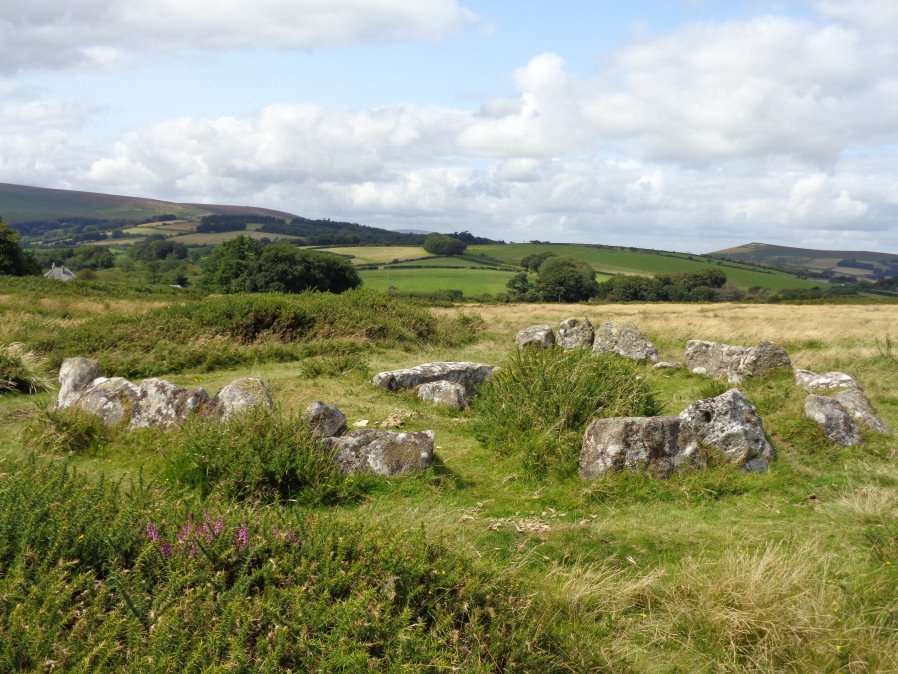
Photo taken on 19-08-2017
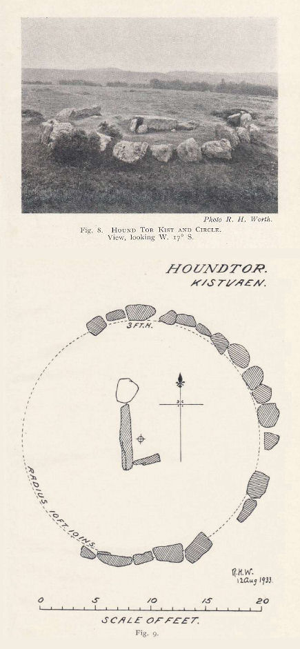
Plan by RHW. Barrow Report 53. TDA Vol.66 1934
Database entries
OS Map: SX 74106 78772
OS Source: Google
Butler OS: SX74107876
HER: MDV7398
Megalithic Portal: 24187
PMD: Hound Tor
Alternate name: Houndtor Down
Short Name: CT Houndtor
Butler map: 8.6
Butler Vol 5: p.179 & Fig.121
Dixon Cist #: 58
Grinsell: MANATON 13
Turner: D8
DPD page: 151
Exist: Yes
Record: Unique
Record Source: Butler
Hut Class: No
Cist Class: Yes
Cairn Class: Yes
Barrow Report: 53 56
Dimensions (m): 6.5 x 0.3 C
Lidar: SX 74106 78772
Guide Map: 31
Nearest Bus Stop (Minor): Swallerton Gate (0.5 km) [Route: 271]
Nearest Bus Stop (Major): Lustleigh Bishops Stone (5.3 km) [Route: 178]
Nearby sites: SX 74106 78772
Notes
"A ring cairn surviving as a mound 6.5 metres in diameter and 0.15 metres high. It is defined, except on the west side, by a ring of at least 19 close set granite stones. In the centre of the cairn is a north to south orientated cist, with both end stones and the western side stone remaining visible.". Butler Vol. 1. Map 8.6 (diagram Vol. 5. p.179).References
These are selected references with an emphasis on out of copyright sources linked as PDFs. For more detailed references try any linked HER or PMD record above.
- Burnard, Robert, Dartmoor Pictorial Records, (1986)
- Butler, Jeremy, Dartmoor Atlas of Antiquities, vol.1: The East, (1991)
- Butler, Jeremy, Dartmoor Atlas of Antiquities, vol.5: The Second Millennium B.C., (1997)
- Grinsell, L.V., Dartmoor Barrows, Devon Archaeological Society Proceedings No.36 (1978)
- Lethbridge, William D., Discover Preshistoric Dartmoor, (2015)
- Rowe, Samuel, A Perambulation of Dartmoor (3rd Edition), (1896)
- Turner, J.R., Ring Cairns, stone circles and related monuments on Dartmoor, D.A.S.P. No.48 pp.27-86 (1990)
- Worth, R. Hansford, Barrow Report 53, T.D.A. Vol.66 pp.39-42 (1934)
- Worth, R. Hansford, Barrow Report 56, T.D.A. Vol.69 pp.75-109 (1937)
- Worth, R.N., Barrow Report 7, T.D.A. Vol.17 (1885)