
Owlacombe Burrow Reported Cairn
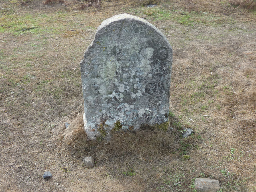
Photo taken on 17-09-2026
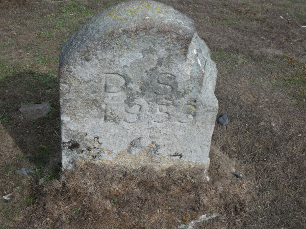
Photo of other side of boundary stone DS 1853 17/09/2026
Database entries
OS Map: SX 77649 77661
OS Source: Garmin
HER: MDV8111
Alternate name: Owlacombe Burrow
Short Name: CN?Owlacombe
Grinsell: List B ILSINGTON 6a
Exist: Yes
Record: Unique
Record Source: Grinsell
Hut Class: No
Lidar: SX 77649 77661
Guide Map: 31
Nearest Bus Stop (Minor): Rock Inn (0.9 km) [Route: 193]
Nearest Bus Stop (Major): Bovey Tracey Dolphin Square (3.7 km) [Route: 171(20/07/26 to 19/09/26)]
Nearby sites: SX 77649 77661
Notes
LVG 5/10/1975 name of boundary stone on outcrop which is inscribed with "OWLACOMBE BURROW".HER: Boundary stone inscribed 'Owlacombe Burrow' on the boundary between Bovey Tracey and Ilsington parishes. No trace of any cairn or barrow remain.
There is a good digitally enhanced photo by Peter Brooks of this boundary stone on Dartefacts, see:
Dartefacts: Ilsington/ Bovey Tracey – BS Owlacombe Burrow No.04
There was a barrow marked on nineteenth century OS mapping at this location but it is now thought to be just the natural outcrop. The Duke of Somerset erected a number of boundary stones in 1853 including those along Hamel Down marking the site of Single Barrow and Two barrows and so on. This stone was put in place at the same time. See also:
Tors Of Dartmoor: Owlacombe Burrow Rock
References
These are selected references with an emphasis on out of copyright sources linked as PDFs. For more detailed references try any linked HER or PMD record above.
- Brewer, Dave, A Field Guide to the Boundary Markers on and around Dartmoor, (1986)
- Grinsell, L.V., Dartmoor Barrows, Devon Archaeological Society Proceedings No.36 (1978)
- Page, William, The Victoria History of the County of Devon: v. 1, (1906)
- Wall, J. Charles, Ancient Earthworks, The Victoria History of the County of Devon: v. 1 pp.573-630 (1906)