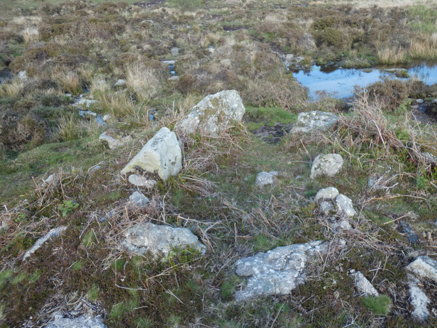
Haytor Chambered Tomb

Photo taken on 26-05-2021
Database entries
OS Map: SX 75766 76409
OS Source: Garmin
Butler OS: SX75767640
HER: MDV61778
Alternate name: Haytor
Short Name: CN HaytorTomb
Butler map: 1.f
Butler Vol 5: p.158 & Fig.97
Exist: Yes
Record: Unique
Record Source: Butler
Hut Class: No
Cairn Class: Yes
Dimensions (m): c.3.0 x 1.4 wide
Lidar: SX 75766 76409
Guide Map: 37
Nearest Bus Stop (Minor): Haytor Vale Moorlands House (1.7 km) [Route: 193,271]
Nearest Bus Stop (Major): Lemonford Caravan Park (5.3 km) [Route: 38,193]
Nearby sites: SX 75766 76409
Notes
Haytor chambered tomb to the west of the Haytor track. Circular mound circa 4 metres diameter surrounds a rectangular chamber, circa 3 metres by 1.4 metres, tapering slightly towards one end, partially filled with soil. One of pair of larger slabs at entrance on downhill edge of mound has collapsed inwards, the other stands c irca 1 metre above interior. Most of slabs forming sides of chamber appear in place but capstones have been removed. Entrance oriented south of east.References
These are selected references with an emphasis on out of copyright sources linked as PDFs. For more detailed references try any linked HER or PMD record above.
- Butler, Jeremy, Dartmoor Atlas of Antiquities, vol.1: The East, (1991)
- Butler, Jeremy, Dartmoor Atlas of Antiquities, vol.5: The Second Millennium B.C., (1997)
- Fleming, Andrew, The prehistoric landscape of Dartmoor Part 1: South Dartmoor , Proceedings of the Prehistoric Society , Volume 44 , pp. 97 - 12 (1978)
- Fleming, Andrew, The Prehistoric Landscape of Dartmoor Part 2: North and East Dartmoor , Proceedings of the Prehistoric Society , Volume 49 , Issue 1 , pp. 195 - 241 (1983)
- Gerrard, Sandy, English Heritage Book of Dartmoor: Landscapes Through Time, (1997)