
Rippon Tor 2 Stone Ring Cairn Circle
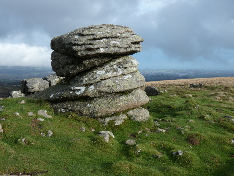
Photo taken on 01-11-2025
Database entries
OS Map: SX 74677 75563
OS Source: Google
Butler OS: SX74697553
HER: MDV51162
Alternate name: Rippon Tor 2
Short Name: RC RipponTor 2
Butler map: 5.5.2
Turner: A62
Exist: Yes
Record: Unique
Record Source: Butler
Hut Class: No
Cairn Class: Yes
Dimensions (m): 7.2 x 0.5
Lidar: SX 74677 75563
Guide Map: 37
Nearest Bus Stop (Minor): Haytor Vale Moorlands House (3.5 km) [Route: 193,271]
Nearest Bus Stop (Major): Poundsgate Tavistock Inn (5.4 km) [Route: 172]
Nearby sites: SX 74677 75563
Notes
HER: A small cairn close to the tor which appears to have been a ring cairn surrounding a small free-standing granite outcrop. Butler: a small natural rock pillar about 2m high and 10m from C1, surrounded at the base by a ring of small stones (7.2 x 0.5 m) and, perhaps significantly, in line with the cairns.NB. this record had got confused in these listings previously with the record now added as Rippon Tor 6 (SiteID=1033). This was an error now corrected.
References
These are selected references with an emphasis on out of copyright sources linked as PDFs. For more detailed references try any linked HER or PMD record above.
- Butler, Jeremy, Dartmoor Atlas of Antiquities, vol.1: The East, (1991)
- Newman, Phil, Rippon Tor Premier Archaeological Landscape, Dartmoor National Park, Devon, Southwest Landscape Investigations (2015)
- Turner, J.R., Ring Cairns, stone circles and related monuments on Dartmoor, D.A.S.P. No.48 pp.27-86 (1990)