
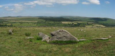
Prehistoric sites within 3km of SX 62900 71750
Guidance for walkers: The monuments featured in this database are archaeological treasures and need to be protected and preserved - please do not disturb any sites. Please check access and firing times before visiting sites, not all sites listed are on open access land. Firing ranges and boundaries of open access areas are marked on the OL28 OS Dartmoor Explorer map. Please stick to the country code and consider giving support to the numerous agencies that help to keep Dartmoor a fabulous natural and historic environment!
About the database listings: In all listings clicking on the photo or the site name will open a page for the site with a larger photo and further details from the database. The database now has over 6680 records covering nearly all publicly listed sites on Dartmoor including around 4800 round houses. This level of detail is of interest to archaeologists but tends to swamp listings of sites more likely to be of interest for walkers. For this reason, the listings default to around 550 core sites only. These are the stone circles, stone rows and the ring cairns listed by Turner. The default search radius is 2 km. The controls below the map can be used to start a new search by entering a 6- or 8-digit reference (without the prefix "SX"). The search radius can be specified and you can add incremental Display layers of detail on top of the core sites. If using a more detailed layer you will need to decrease the search radius to avoid getting hundreds of search results.
- Core sites Default listing of core sites consisting of stone circles & rows and some of the major ring cairns.
- Plus cairns adds approx. 1000 cairns and other minor sites not included in the core listings but excluding round houses.
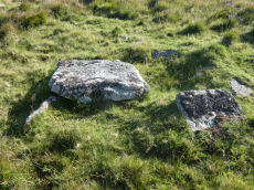
- Plus round houses adds approx. 4800 round houses.
- Plus non-sites adds in the records for sites that no longer exist or are not prehistoric sites.
- Plus duplicates adds records excluded as duplicates. Those maybe duplicate records in external listings (e.g. the Historic Environment Records). For example, some sites have been identified as cairns in some listings and interpreted as round houses in other listings and both records appear.
These listings have incorporated, matched up and merged all of the records from all of the major archaeological listings including: Worth, Grinsell, Turner, Butler, Bill Radcliffe, Sandy Gerrard, Megalithic Portal, the National Monument Records and the Historic Environment Records. The author would like to thank Bill, Sandy, the lovely people both at Megalithic Portal (especially Anne Tate who did an amazing job to link listings) and at ACE Archaeology for collaborative work over the years to synchronise and correct listings across the various websites which now interlink. A culmination of years of work the final merger of cairn records took 3 months of cross referencing in 2017 the result being a snapshot of the records at that time. This data has in turn been refined since by field work and research. The round house data was supplied by Sandy Gerrard. Grid references are in order of accuracy: from Google Earth satellite, if visible and found, from a Garmin GPS reading, if visited by the author and from the literature otherwise. Individual site pages will state the source of the grid reference and provide satellite imagery. If a site listing lacks a photo it has not yet been visited by the author in which case the grid reference is from the literature.
Currently the database only includes sites which can be represented by a grid reference. Reaves are not included as they require GIS shape technology which is beyond the current capability of this system. To see the sources for the records, look at the tables on the resources menu. The database listings can also be viewed on a Google map and downloaded as GPS datasets for Garmin devices.
Corrections, or any feedback or suggestions are very welcome, email: info@dartmoorwalks.org.uk.
NOTE: Clicking on the icons for each monument in the map will give the name of the site. You can zoom in and out and drag the map around.
List of sites within 3km of SX 62900 71750
Ter Hill N Round House
OS Map: SX 63941 71999
HER: MDV26141
ShortName: HT:Ter Hill 26
Nearby sites: SX 63941 71999
Distance: 1.07km
Ter Hill N Round House
OS Map: SX 63555 72118
HER: MDV26081
ShortName: HT:Ter Hill 27
Nearby sites: SX 63555 72118
Distance: 0.75km
Ter Hill N Round House
OS Map: SX 63935 71997
HER: MDV26141
ShortName: HT:Ter Hill 28
Nearby sites: SX 63935 71997
Distance: 1.06km
Ter Hill N Round House
OS Map: SX 63747 72098
HER: MDV6293
ShortName: HT:Ter Hill 29
Nearby sites: SX 63747 72098
Distance: 0.92km
Blakey Tor Cairn
OS Map: SX 6115 7373
HER: MDV18419
PMD: Blakey Tor
ShortName: CN:Blakey To1
Notes: Radcliffe, doubtful cist: Possibly the cairn referred to in an English Heritage Report and by Fletcher and Dunn in "Patterns of the Past", at SX 6115 7373, as a cairn having a "shallow depression in its top".
Nearby sites: SX 6115 7373
Distance: 2.64km
Ter Hill N Round House
OS Map: SX 63553 72080
HER: MDV26081
ShortName: HT:Ter Hill 30
Nearby sites: SX 63553 72080
Distance: 0.73km
Ter Hill N Round House
OS Map: SX 63733 72111
HER: MDV6293
ShortName: HT:Ter Hill 31
Nearby sites: SX 63733 72111
Distance: 0.91km
Ter Hill N Round House
OS Map: SX 63586 72056
HER: MDV26081
ShortName: HT:Ter Hill 32
Nearby sites: SX 63586 72056
Distance: 0.75km
Ter Hill N Round House
OS Map: SX 63600 72135
HER: MDV26081
ShortName: HT:Ter Hill 33
Nearby sites: SX 63600 72135
Distance: 0.80km
Ter Hill N Round House
OS Map: SX 63546 72123
HER: MDV26081
ShortName: HT:Ter Hill 34
Nearby sites: SX 63546 72123
Distance: 0.75km
Royal Hill E Round House
OS Map: SX 63046 71957
HER: MDV54416
ShortName: HT:Royal Hil1
Nearby sites: SX 63046 71957
Distance: 0.25km
Ter Hill N Round House
OS Map: SX 63552 72176
HER: MDV26081
ShortName: HT:Ter Hill 35
Nearby sites: SX 63552 72176
Distance: 0.78km
Royal Hill E Round House
OS Map: SX 63042 71941
HER: MDV54418
ShortName: HT:Royal Hil2
Nearby sites: SX 63042 71941
Distance: 0.24km
Ter Hill N Round House
OS Map: SX 63551 72129
HER: MDV26081
ShortName: HT:Ter Hill 36
Nearby sites: SX 63551 72129
Distance: 0.75km
Royal Hill E Round House
OS Map: SX 63059 71922
HER: MDV54417
ShortName: HT:Royal Hil3
Nearby sites: SX 63059 71922
Distance: 0.23km
Ter Hill N Round House
OS Map: SX 63588 72124
HER: MDV26081
ShortName: HT:Ter Hill 37
Nearby sites: SX 63588 72124
Distance: 0.78km
Royal Hill E Round House
OS Map: SX 6327 7244
HER: MDV26089
ShortName: HT:Royal Hil4
Nearby sites: SX 6327 7244
Distance: 0.78km
Ter Hill N Round House
OS Map: SX 63605 72141
HER: MDV26081
ShortName: HT:Ter Hill 38
Nearby sites: SX 63605 72141
Distance: 0.81km
Royal Hill S Round House
OS Map: SX 62397 71304
HER: MDV12965
ShortName: HT:Royal Hil5
Nearby sites: SX 62397 71304
Distance: 0.67km
Ter Hill N Round House
OS Map: SX 63605 72130
HER: MDV26081
ShortName: HT:Ter Hill 39
Nearby sites: SX 63605 72130
Distance: 0.80km
Royal Hill S Round House
OS Map: SX 62406 71341
HER: MDV12965
ShortName: HT:Royal Hil6
Nearby sites: SX 62406 71341
Distance: 0.64km
Ter Hill N Round House
OS Map: SX 63609 72148
HER: MDV26081
ShortName: HT:Ter Hill 40
Nearby sites: SX 63609 72148
Distance: 0.81km
Royal Hill S Round House
OS Map: SX 62412 71293
HER: MDV12965
ShortName: HT:Royal Hil7
Nearby sites: SX 62412 71293
Distance: 0.67km
Ter Hill NW Round House
OS Map: SX 63248 71624
HER: MDV6370
ShortName: HT:Ter Hill 41
Nearby sites: SX 63248 71624
Distance: 0.37km
Royal Hill S Round House
OS Map: SX 62426 71344
HER: MDV12965
ShortName: HT:Royal Hil8
Nearby sites: SX 62426 71344
Distance: 0.62km
Ter Hill NW Round House
OS Map: SX 63284 71640
HER: MDV6370
ShortName: HT:Ter Hill 42
Nearby sites: SX 63284 71640
Distance: 0.40km
Royal Hill S Round House
OS Map: SX 62428 71312
HER: MDV12965
ShortName: HT:Royal Hil9
Nearby sites: SX 62428 71312
Distance: 0.64km
Ter Hill NW Round House
OS Map: SX 63293 71633
HER: MDV6370
ShortName: HT:Ter Hill 43
Nearby sites: SX 63293 71633
Distance: 0.41km
Royal Hill S Round House
OS Map: SX 62449 71356
HER: MDV12965
ShortName: HT:Royal Hil10
Nearby sites: SX 62449 71356
Distance: 0.60km
Royal Hill S Round House
OS Map: SX 62473 71325
HER: MDV12965
ShortName: HT:Royal Hil11
Nearby sites: SX 62473 71325
Distance: 0.60km
Royal Hill S Round House
OS Map: SX 62473 71315
HER: MDV12965
ShortName: HT:Royal Hil12
Nearby sites: SX 62473 71315
Distance: 0.61km
Royal Hill S Round House
OS Map: SX 62468 71363
HER: MDV12965
ShortName: HT:Royal Hil13
Nearby sites: SX 62468 71363
Distance: 0.58km
Royal Hill SE Round House
OS Map: SX 6294 7167
HER: MDV26071
ShortName: HT:Royal Hil14
Nearby sites: SX 6294 7167
Distance: 0.09km
Fox Tor Mire Cairn
OS Map: SX 618 701
HER: MDV12968
ShortName: CN:Fox Tor M1
Grinsell: LYD 95a
Notes: On a gentle N slope is a peaty mound 3.5m in diameter and 0.3m high. On its W perimeter are two large earthfast stone 0.6m high. Several smaller ones protude through the peat near the centre indicating a stone content.
Nearby sites: SX 618 701
Distance: 1.98km
Ter Hill N.W.3 Reported Cairn
OS Map: SX 6289 7109
HER: MDV12969
ShortName: CN:Ter Hill 3
Grinsell: LYD 98a
Notes: A low turf-covered mound situated at SX 62887108 is probably the feature noted by both Fox and Grinsell. It lies in tall cotton grass on a south-west facing peat-covered hiislope in an area covered by low swellings, gullies and a marked accumulation of surface peat.
Nearby sites: SX 6289 7109
Distance: 0.66km
Weal Emma Leat (S) Reported Cairn
OS Map: SX 6388 7199
HER: MDV12970
ShortName: CN?S of Weal1
Grinsell: LYD 99
Notes: Hut circle
Nearby sites: SX 6388 7199
Distance: 1.01km
Dunnabridge Plantation Round House
OS Map: SX 6354 7407
HER: MDV26105
ShortName: HT:Dunnabrid4
Nearby sites: SX 6354 7407
Distance: 2.41km
Dunnabridge Pound Round House
OS Map: SX 6418 7302
HER: MDV26086
ShortName: HT:Dunnabrid7
Nearby sites: SX 6418 7302
Distance: 1.80km
Joan Ford's Newtake N.1 Cairn
OS Map: SX 62970 72264
HER: MDV18389
ShortName: CN Joan Ford3
Butler map: 63.3
Nearby sites: SX 62970 72264
Distance: 0.52km
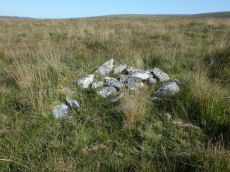
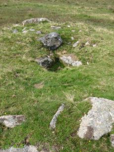
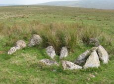
Joan Ford's Newtake N.2 Cairn Circle
OS Map: SX 63002 72332
HER: MDV54460
ShortName: CN Joan Ford4
Butler map: 63.3
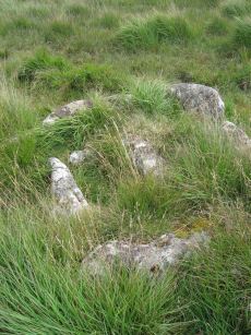
Notes: "A probable ring cairn situated on a slight NW slope. At least eight tin pits occur immediately to the E and S, and modern small stone clearance heaps are visible everywhere. The circular turf-covered stony bank is 12.2m in overall diameter, 2.0m wide and on average 0.4m high; a few stones protrude through the turf but there is no obvious trace of a kerb, slabs or boulders. Two or three modern clearance heaps lie on the bank and a gap on the N side with an adjacent corresponding pile of spoil is probably a recent mutilation" The photo shows one of the heaps on the bank which can just be seen.
Nearby sites: SX 63002 72332
Distance: 0.59km
Joan Ford's Newtake N.4 Clearance Cairn
OS Map: SX 62911 72319
HER: MDV18390
ShortName: CN Joan Ford6
Butler map: 63.3
Nearby sites: SX 62911 72319
Distance: 0.57km
Swincombe Ford Newtake 2 Reported Cairn
OS Map: SX 6331 7307
HER: MDV-1
ShortName: CN?Swincombe3
Butler map: 63.5.2
Notes: Butler: "A short distance to the north is a smaller oval mound ... possibly a second burial cairn". Not listed on NMR or HER.
Nearby sites: SX 6331 7307
Distance: 1.38km
Joan Ford's Newtake N.5 Clearance Cairn
OS Map: SX 63050 72366
ShortName: CN Joan Ford7
Notes: An oval shaped mound of stones that has the appearance of a modern clearance cairn. Added as record Joan Ford's Newtake N.5 to add to the Butler cairns N.1-N.4.
Nearby sites: SX 63050 72366
Distance: 0.63km
Cholake Head Cairn
OS Map: SX 61460 73070
HER: MDV6307
ShortName: CN:Cholake H1
Butler map: 65.2
Grinsell: LYD 87
Barrow Report: 27
Nearby sites: SX 61460 73070
Distance: 1.95km
Ter Hill N.W.4 Cairn
OS Map: SX 6382 7079
HER: MDV58864
ShortName: CN:Ter Hill 4
Nearby sites: SX 6382 7079
Distance: 1.33km
Crock of Gold Round House
OS Map: SX 61406 73073
HER: MDV54419
ShortName: HT:Crock of 1
Nearby sites: SX 61406 73073
Distance: 2.00km
Royal Hill E.2 Reported Cairn
OS Map: SX 6179 7195
HER: MDV-1
ShortName: CN?RoyalHill 2
Butler map: 65.5.2
Notes: Butler: "A tiny satellite cairn inconspicuous some 30 m to the west has been exposed by turf cuters in the old ties across teh summit". Not listed on NMR or HER.
Nearby sites: SX 6179 7195
Distance: 1.13km
Royal Hill E.6 Cairn
OS Map: SX 6208 7257
HER: MDV28603
ShortName: CN:RoyalHill 6
Butler map: 65.5.6
Nearby sites: SX 6208 7257
Distance: 1.16km
Dartmoor Training Centre Round House
OS Map: SX 6277 7394
HER: MDV6373
ShortName: HT:Dartmoor 1
Nearby sites: SX 6277 7394
Distance: 2.19km
Hexworthy (near) Reported Cist
OS Map: SX 655 725
HER: MDV13004
PMD: Hexworthy
ShortName: CT?Hexworthy1
Grinsell: LYD 109
Notes: Destroyed for road building, report by Burnard
Nearby sites: SX 655 725
Distance: 2.71km
Royal Hill E.8 Cairn
OS Map: SX 6227 7130
HER: MDV78792
ShortName: CN?RoyalHill 8
Nearby sites: SX 6227 7130
Distance: 0.77km
Deep Swincombe Round House
OS Map: SX 64631 72255
HER: MDV107506
ShortName: HT:Deep Swin1
Nearby sites: SX 64631 72255
Distance: 1.80km
Deep Swincombe Round House
OS Map: SX 64634 72246
HER: MDV107506
ShortName: HT:Deep Swin2
Nearby sites: SX 64634 72246
Distance: 1.80km
Deep Swincombe Round House
OS Map: SX 64310 71925
ShortName: HT:Deep Swin3
Nearby sites: SX 64310 71925
Distance: 1.42km
Deep Swincombe Round House
OS Map: SX 64648 72247
HER: MDV107506
ShortName: HT:Deep Swin4
Nearby sites: SX 64648 72247
Distance: 1.82km
Deep Swincombe Round House
OS Map: SX 64617 72222
HER: MDV107506
ShortName: HT:Deep Swin5
Nearby sites: SX 64617 72222
Distance: 1.78km
Deep Swincombe Round House
OS Map: SX 64684 72286
HER: MDV107506
ShortName: HT:Deep Swin6
Nearby sites: SX 64684 72286
Distance: 1.86km
Deep Swincombe Round House
OS Map: SX 64304 72080
HER: MDV26140
ShortName: HT:Deep Swin7
Nearby sites: SX 64304 72080
Distance: 1.44km
Deep Swincombe Round House
OS Map: SX 64283 72035
ShortName: HT:Deep Swin8
Nearby sites: SX 64283 72035
Distance: 1.41km
Deep Swincombe Round House
OS Map: SX 64644 72231
HER: MDV107506
ShortName: HT:Deep Swin9
Nearby sites: SX 64644 72231
Distance: 1.81km
Deep Swincombe Round House
OS Map: SX 64321 71899
ShortName: HT:Deep Swin10
Nearby sites: SX 64321 71899
Distance: 1.43km
Deep Swincombe Round House
OS Map: SX 64755 72325
HER: MDV107506
ShortName: HT:Deep Swin11
Nearby sites: SX 64755 72325
Distance: 1.94km
Deep Swincombe Round House
OS Map: SX 64749 72307
HER: MDV107506
ShortName: HT:Deep Swin12
Nearby sites: SX 64749 72307
Distance: 1.93km
Hooten Wheals Mine Cairn
OS Map: SX 65603 71063
HER: MDV103597
ShortName: CN:Hooten Wh1
Notes: " A robbed cairn 50m SW of the ruinous former Hooten Wheals Mine offices on the S flank of Down Ridge. The turf covered stony mound is circular with a diameter of 8.0m and stands 0.75m high. A square hollow 1.6m wide, probably the result of an unrecorded excavation, lies centrally in the mound with a spoil heap on its NW margin."
Nearby sites: SX 65603 71063
Distance: 2.79km
Deep Swincombe Round House
OS Map: SX 64519 72459
HER: MDV6345
ShortName: HT:Deep Swin13
Nearby sites: SX 64519 72459
Distance: 1.77km
Deep Swincombe Round House
OS Map: SX 64576 72298
HER: MDV107506
ShortName: HT:Deep Swin14
Nearby sites: SX 64576 72298
Distance: 1.76km
Down Ridge Clearance Cairn
OS Map: SX 65775 71734
HER: MDV103601
ShortName: CN?Down Ridg2
Notes: "A low circular turf covered mound measuring 5.0 metres in diameter and standing to a maximum of 0.6 metres high. There is no evidence to suggest the presence of a kerb or cist. Its definite interpretation as a cairn is marred by some small scale tinners diggings immediately to the NW and its unusual position on the slope."
Nearby sites: SX 65775 71734
Distance: 2.88km
Cholake Round House
OS Map: SX 6170 7352
HER: MDV18418
ShortName: HT:Cholake1
Nearby sites: SX 6170 7352
Distance: 2.14km
Deep Swincombe Round House
OS Map: SX 64579 72272
HER: MDV107506
ShortName: HT:Deep Swin15
Nearby sites: SX 64579 72272
Distance: 1.76km
Deep Swincombe Round House
OS Map: SX 64629 72311
HER: MDV107506
ShortName: HT:Deep Swin16
Nearby sites: SX 64629 72311
Distance: 1.82km
Deep Swincombe Round House
OS Map: SX 64590 72227
HER: MDV107506
ShortName: HT:Deep Swin17
Nearby sites: SX 64590 72227
Distance: 1.76km
Swincombe Ford Newtake 1 (duplicate) Reported Cist
OS Map: SX 6345 7285
HER: MDV59551
ShortName: CT:Swincombe2
Notes: Most likely a duplicate of HER 54431
Nearby sites: SX 6345 7285
Distance: 1.23km
Fox Tor Girt Reported Cairn
OS Map: SX 63204 69910
HER: MDV103605
ShortName: CN?FoxTor Girt
Notes: A small cairn 130 metres east of Fox Tor Girt. It measures 2.6 metres in diameter and 0.6 metres high and is comprised of loose boulders roughly piled on large earthfast blocks.
Nearby sites: SX 63204 69910
Distance: 1.86km
Deep Swincombe Round House
OS Map: SX 64312 71905
ShortName: HT:Deep Swin18
Nearby sites: SX 64312 71905
Distance: 1.42km
Deep Swincombe Round House
OS Map: SX 64597 72244
HER: MDV107506
ShortName: HT:Deep Swin19
Nearby sites: SX 64597 72244
Distance: 1.77km
Deep Swincombe Round House
OS Map: SX 64336 72483
HER: MDV6344
ShortName: HT:Deep Swin20
Nearby sites: SX 64336 72483
Distance: 1.61km
Deep Swincombe Round House
OS Map: SX 64616 72238
HER: MDV107506
ShortName: HT:Deep Swin21
Nearby sites: SX 64616 72238
Distance: 1.78km
Deep Swincombe Round House
OS Map: SX 64626 72268
HER: MDV107506
ShortName: HT:Deep Swin22
Nearby sites: SX 64626 72268
Distance: 1.80km
Deep Swincombe Round House
OS Map: SX 64406 72301
HER: MDV26134
ShortName: HT:Deep Swin23
Nearby sites: SX 64406 72301
Distance: 1.60km
Deep Swincombe Round House
OS Map: SX 64632 72317
HER: MDV107506
ShortName: HT:Deep Swin24
Nearby sites: SX 64632 72317
Distance: 1.82km
Deep Swincombe Round House
OS Map: SX 64329 71905
ShortName: HT:Deep Swin25
Nearby sites: SX 64329 71905
Distance: 1.44km
Deep Swincombe Round House
OS Map: SX 64763 72268
HER: MDV107506
ShortName: HT:Deep Swin26
Nearby sites: SX 64763 72268
Distance: 1.93km
Deep Swincombe Round House
OS Map: SX 64742 72243
HER: MDV107506
ShortName: HT:Deep Swin27
Nearby sites: SX 64742 72243
Distance: 1.91km
Round Hill (LYD 79b) Clearance Cairn
OS Map: SX 6155 7421
HER: MDV6239
ShortName: CN?Round79b
Grinsell: B:LYD 79b
Notes: Ditched mounds believed to be pillow mounds of rabbit warren c 18/19
Nearby sites: SX 6155 7421
Distance: 2.81km
Deep Swincombe Round House
OS Map: SX 64765 72272
HER: MDV107506
ShortName: HT:Deep Swin28
Nearby sites: SX 64765 72272
Distance: 1.94km
Round Hill (LYD 79c) Clearance Cairn
OS Map: SX 6171 7420
HER: MDV6240
ShortName: CN?Round79c
Grinsell: B:LYD 79c
Notes: Ditched mounds believed to be pillow mounds of rabbit warren c 18/19
Nearby sites: SX 6171 7420
Distance: 2.72km
Deep Swincombe Round House
OS Map: SX 64765 72252
HER: MDV107506
ShortName: HT:Deep Swin29
Nearby sites: SX 64765 72252
Distance: 1.93km
Deep Swincombe Round House
OS Map: SX 64787 72277
HER: MDV107506
ShortName: HT:Deep Swin30
Nearby sites: SX 64787 72277
Distance: 1.96km
Deep Swincombe Round House
OS Map: SX 64807 72323
HER: MDV107506
ShortName: HT:Deep Swin31
Nearby sites: SX 64807 72323
Distance: 1.99km
Round Hill E. Reported Cairn
OS Map: SX 617 742
HER: MDV6240
ShortName: CNxRoundhil1 E
Nearby sites: SX 617 742
Distance: 2.73km
Moorlands Farm Round House
OS Map: SX 62991 73727
HER: MDV6215
ShortName: HT:Moorlands1
Nearby sites: SX 62991 73727
Distance: 1.98km
Moorlands Farm Round House
OS Map: SX 62981 73715
HER: MDV6215
ShortName: HT:Moorlands2
Nearby sites: SX 62981 73715
Distance: 1.97km
Moorlands Farm Round House
OS Map: SX 6296 7366
HER: MDV6215
ShortName: HT:Moorlands3
Nearby sites: SX 6296 7366
Distance: 1.91km
Moorlands Farm Round House
OS Map: SX 62617 73652
HER: MDV6255
ShortName: HT:Moorlands4
Nearby sites: SX 62617 73652
Distance: 1.92km
Moorlands Farm Round House
OS Map: SX 62933 73725
HER: MDV6215
ShortName: HT:Moorlands5
Nearby sites: SX 62933 73725
Distance: 1.98km
Moorlands Farm Round House
OS Map: SX 6292 7378
HER: MDV6215
ShortName: HT:Moorlands6
Nearby sites: SX 6292 7378
Distance: 2.03km
Moorlands Farm Round House
OS Map: SX 62899 73711
HER: MDV6215
ShortName: HT:Moorlands7
Nearby sites: SX 62899 73711
Distance: 1.96km
Goldsmith's Cross E.3 (duplicate) Reported Cairn
OS Map: SX 61709 70209
HER: MDV12964
ShortName: CN:Goldsmith4
Notes: Duplicate of 6343
Nearby sites: SX 61709 70209
Distance: 1.95km
Fox Tor Farm Round House
OS Map: SX 62729 71292
HER: MDV25568
ShortName: HT:Fox Tor F1
Nearby sites: SX 62729 71292
Distance: 0.49km
Fox Tor Farm Round House
OS Map: SX 62732 71332
HER: MDV25568
ShortName: HT:Fox Tor F2
Nearby sites: SX 62732 71332
Distance: 0.45km
Fox Tor Farm Round House
OS Map: SX 62734 71349
HER: MDV25568
ShortName: HT:Fox Tor F3
Nearby sites: SX 62734 71349
Distance: 0.43km
Royal Hill, wall Reported Cist
OS Map: SX 62646 72246
HER: MDV18403
PMD: Swincombe
ShortName: CT-RoyalHill 9
Notes: The suggested cist, beside a length of bank and with numerous earthfast stones in visibility. The primary feature is a rectilinear slab 1.5 metres long, 1.2 metres wide and 0.1 metres thick. Its north-east corner rests upon a thin embedded stone, about 0.8 metres long and 0.1 metres high, and the slab is thus raised from the surface ... The impression gained is that, being similar to a coverstone, the large slab has been moved in the false expectation of a cist beneath.
Nearby sites: SX 62646 72246
Distance: 0.58km
Royal Hill E. Cairn Cemetry A Clearance Cairn
OS Map: SX 6265 7227
HER: MDV18401
ShortName: CN:RoyalHill11
Notes: "Cairn A. The most northerly is crest-sited as you approach uphill from the south, with concave centre. Approximately 4.0 metres in diameter, Maximum height of 0.4 metres with a 2.0 metre length of wall attached to the south-west." Part of cairn cemetry consisting of 8 reported 8 cairns, see master record SiteID 4068 (MDV18401)
Nearby sites: SX 6265 7227
Distance: 0.58km
Royal Hill E. Cairn Cemetry B Clearance Cairn
OS Map: SX 6259 7223
HER: MDV18401
ShortName: CN:RoyalHill12
Notes: Cairn B. 1st of line of cairns B-B2-B3-C. Part of cairn cemetry consisting of 8 reported 8 cairns, see master record SiteID 4068 (MDV18401) "The second cairn 33 metres to the south-west of A is 2.0 metres in diameter."
Nearby sites: SX 6259 7223
Distance: 0.57km
Royal Hill E. Cairn Cemetry B2 Clearance Cairn
OS Map: SX 62588 72218
HER: MDV18401
ShortName: CN:RoyalHill13
Notes: Cairn B2. 2nd of line of cairns B-B2-B3-C. Part of cairn cemetry consisting of 8 reported 8 cairns, see master record SiteID 4068 (MDV18401)
Nearby sites: SX 62588 72218
Distance: 0.56km
Royal Hill E. Cairn Cemetry B3 Clearance Cairn
OS Map: SX 62584 72204
HER: MDV18401
ShortName: CN:RoyalHill14
Notes: Cairn B3. 3rd of line of cairns B-B2-B3-C. Part of cairn cemetry consisting of 8 reported 8 cairns, see master record SiteID 4068 (MDV18401)
Nearby sites: SX 62584 72204
Distance: 0.55km
Royal Hill E. Cairn Cemetry C Clearance Cairn
OS Map: SX 6258 7219
HER: MDV18401
ShortName: CN:RoyalHill15
Notes: Cairn C. 4th of line of cairns B-B2-B3-C. Part of cairn cemetry consisting of 8 reported 8 cairns, see master record SiteID 4068 (MDV18401)
Nearby sites: SX 6258 7219
Distance: 0.54km
Royal Hill E. Cairn Cemetry D Clearance Cairn
OS Map: SX 6264 7221
HER: MDV18401
ShortName: CN:RoyalHill16
Notes: Cairn D. 1st of line of cairns D-E-F. Part of cairn cemetry consisting of 8 reported 8 cairns, see master record SiteID 4068 (MDV18401)
Nearby sites: SX 6264 7221
Distance: 0.53km
Royal Hill E. Cairn Cemetry E Clearance Cairn
OS Map: SX 62653 72215
HER: MDV18401
ShortName: CN:RoyalHill17
Notes: Cairn E. 2nd of line of cairns D-E-F. Part of cairn cemetry consisting of 8 reported 8 cairns, see master record SiteID 4068 (MDV18401)
Nearby sites: SX 62653 72215
Distance: 0.53km
Royal Hill E. Cairn Cemetry F Clearance Cairn
OS Map: SX 6267 7222
HER: MDV18401
ShortName: CN:RoyalHill18
Notes: Cairn F. 3rd of line of cairns D-E-F. Part of cairn cemetry consisting of 8 reported 8 cairns, see master record SiteID 4068 (MDV18401)
Nearby sites: SX 6267 7222
Distance: 0.52km
Down Ridge N Round House
OS Map: SX 65656 72319
HER: MDV26351
ShortName: HT:Down Ridg2
Nearby sites: SX 65656 72319
Distance: 2.81km
Foxtor Cross N.E. of Cairn
OS Map: SX 6193 6988
HER: MDV5095
PMD: Fox Tor Mires S.
ShortName: CT?Foxtor Cr1
Notes: [Presumably Foxtor not Foxton] Cist 54.9 meters south east of white stone in the wall. Area was over grown with high heather in 1917-1918, but the heather was burnt in 1920 and the cist was quite plain with capstone by north east side. The south west stone had gone.No trace of this antiquity could be found in 1950.
Nearby sites: SX 6193 6988
Distance: 2.11km
Down Ridge N Round House
OS Map: SX 65681 72077
ShortName: HT:Down Ridg3
Nearby sites: SX 65681 72077
Distance: 2.80km
Roundhill Round House
OS Map: SX 61592 74206
HER: MDV6241
ShortName: HT:Roundhill1
Nearby sites: SX 61592 74206
Distance: 2.78km
Down Ridge N Round House
OS Map: SX 65603 72108
ShortName: HT:Down Ridg4
Nearby sites: SX 65603 72108
Distance: 2.73km
Down Ridge N Round House
OS Map: SX 6493 7218
HER: MDV26144
ShortName: HT:Down Ridg5
Nearby sites: SX 6493 7218
Distance: 2.08km
Roundhill Round House
OS Map: SX 61600 74313
HER: MDV54380
ShortName: HT:Roundhill3
Nearby sites: SX 61600 74313
Distance: 2.87km
Down Ridge N Round House
OS Map: SX 6494 7220
HER: MDV26144
ShortName: HT:Down Ridg6
Nearby sites: SX 6494 7220
Distance: 2.09km
Down Ridge N Round House
OS Map: SX 65575 72123
ShortName: HT:Down Ridg7
Nearby sites: SX 65575 72123
Distance: 2.70km
Roundhill Round House
OS Map: SX 61596 74218
HER: MDV6243
ShortName: HT:Roundhill5
Nearby sites: SX 61596 74218
Distance: 2.79km
Down Ridge N Round House
OS Map: SX 65432 72360
HER: MDV27268
ShortName: HT:Down Ridg8
Nearby sites: SX 65432 72360
Distance: 2.60km
Roundhill Round House
OS Map: SX 61395 74181
HER: MDV6235
ShortName: HT:Roundhill6
Nearby sites: SX 61395 74181
Distance: 2.86km
Down Ridge N Round House
OS Map: SX 653 723
HER: MDV54387
ShortName: HT:Down Ridg9
Nearby sites: SX 653 723
Distance: 2.46km
Roundhill Round House
OS Map: SX 61325 74260
HER: MDV6221
ShortName: HT:Roundhill9
Nearby sites: SX 61325 74260
Distance: 2.96km
Royal Hill E. Cairn Cemetry (master record - duplicate) Clearance Cairn
OS Map: SX 6265 7227
HER: MDV18401
ShortName: CN:RoyalHill10
Notes: "Centred at SX62657227. Group of prehistoric cairns in a row running approx south-west to north-east.
Cairn A. The most northerly is crest-sited as you approach uphill from the south, with concave centre. Approximately 4.0 metres in diameter, Maximum height of 0.4 metres with a 2.0 metre length of wall attached to the south-west. Cairn B. The second cairn 33 metres to the south-west of A is 2.0 metres in diameter. Cairn C. 46 metres south-west of B is positioned against a natural boulder and measures 4.0 metres maximum diameter. Cairn D is located approximately 77 metres south-east of C. Oval, measuring 3.0 by 2.0 metres. Cairn E is 18 metres south-east of Cairn D and is 2.5 metres in diameter. Cairn F is 13 metres south-east of E and measures 3.0 metres in diameter."
"Centred SX 62597223. Eight scattered small turf-covered cairns lie on a SE hillslope at 360m OD on moorland pasture in an area cleared of surface stone except for large earthfast boulders. Mostly oval-shaped and rather ragged they are of compacted stones with some built against large earthfast boulders. There are no traces of formal construction.
The largest cairn, at SX 62607226, is 4.6m by 3.8m and 0.4m high with a disturbed centre and stone spill. The line of four cairns between SX 62597223 and SX 62587219 vary from 2.6m by 2.2m and 0.3m high to 3.5m in diameter and 0.5m high. The row of three cairns between.
SX 62647221 and SX 62677222 are from 2.5m by 2.0m and 0.3m high to 3.5m by 2.5m and 0.45m high.
They are almost certainly clearance cairns possibly of prehistoric origin as suggested by Greeves"
NB. SiteID=3021 MDV18403, reported cist with wall connected to it - this is very close to this group of 8 and could perhaps be one of them. However, the Probert & M. J. Fletcher (Report - Survey) SDV350839 tends to suggest it is a 9th separate feature.
Nearby sites: SX 6265 7227
Distance: 0.58km
Roundhill Round House
OS Map: SX 6143 7408
HER: MDV54377
ShortName: HT:Roundhill10
Nearby sites: SX 6143 7408
Distance: 2.75km
Roundhill Round House
OS Map: SX 61357 74303
HER: MDV6221
ShortName: HT:Roundhill11
Nearby sites: SX 61357 74303
Distance: 2.98km
Roundhill Round House
OS Map: SX 61259 74233
HER: MDV6221
ShortName: HT:Roundhill12
Nearby sites: SX 61259 74233
Distance: 2.98km
Roundhill Round House
OS Map: SX 6164 7393
HER: MDV18233
ShortName: HT:Roundhill13
Nearby sites: SX 6164 7393
Distance: 2.52km
Ter Hill N Round House
OS Map: SX 63574 72122
HER: MDV26081
ShortName: HT:Ter Hill 1
Nearby sites: SX 63574 72122
Distance: 0.77km
Roundhill Round House
OS Map: SX 61638 74214
HER: MDV54378
ShortName: HT:Roundhill14
Nearby sites: SX 61638 74214
Distance: 2.77km
Ter Hill N Round House
OS Map: SX 63480 71893
HER: MDV12966
ShortName: HT:Ter Hill 2
Nearby sites: SX 63480 71893
Distance: 0.60km
Roundhill Round House
OS Map: SX 61636 74257
HER: MDV54379
ShortName: HT:Roundhill15
Nearby sites: SX 61636 74257
Distance: 2.81km
Ter Hill N Round House
OS Map: SX 63544 72100
HER: MDV26081
ShortName: HT:Ter Hill 3
Nearby sites: SX 63544 72100
Distance: 0.73km
Roundhill Round House
OS Map: SX 61610 74218
ShortName: HT:Roundhill16
Nearby sites: SX 61610 74218
Distance: 2.78km
Ter Hill N Round House
OS Map: SX 63523 72150
HER: MDV26081
ShortName: HT:Ter Hill 4
Nearby sites: SX 63523 72150
Distance: 0.74km
Roundhill Round House
OS Map: SX 61677 74192
HER: MDV54382
ShortName: HT:Roundhill17
Nearby sites: SX 61677 74192
Distance: 2.73km
Ter Hill N Round House
OS Map: SX 63544 72147
HER: MDV26081
ShortName: HT:Ter Hill 5
Nearby sites: SX 63544 72147
Distance: 0.76km
Roundhill Round House
OS Map: SX 61349 74237
HER: MDV6221
ShortName: HT:Roundhill18
Nearby sites: SX 61349 74237
Distance: 2.93km
Ter Hill N Round House
OS Map: SX 63568 72102
HER: MDV26081
ShortName: HT:Ter Hill 6
Nearby sites: SX 63568 72102
Distance: 0.76km
Roundhill Round House
OS Map: SX 61298 74268
HER: MDV6221
ShortName: HT:Roundhill19
Nearby sites: SX 61298 74268
Distance: 2.98km
Ter Hill N Round House
OS Map: SX 63541 72146
HER: MDV26081
ShortName: HT:Ter Hill 7
Nearby sites: SX 63541 72146
Distance: 0.75km
Roundhill Round House
OS Map: SX 61312 74279
HER: MDV6221
ShortName: HT:Roundhill20
Nearby sites: SX 61312 74279
Distance: 2.99km
Ter Hill N Round House
OS Map: SX 63537 72149
HER: MDV26081
ShortName: HT:Ter Hill 8
Nearby sites: SX 63537 72149
Distance: 0.75km
Roundhill Round House
OS Map: SX 61352 74244
HER: MDV6221
ShortName: HT:Roundhill21
Nearby sites: SX 61352 74244
Distance: 2.94km
Ter Hill N Round House
OS Map: SX 63564 72140
HER: MDV26081
ShortName: HT:Ter Hill 9
Nearby sites: SX 63564 72140
Distance: 0.77km
Roundhill Round House
OS Map: SX 61276 74250
HER: MDV6221
ShortName: HT:Roundhill22
Nearby sites: SX 61276 74250
Distance: 2.98km
Ter Hill N Round House
OS Map: SX 63969 72145
HER: MDV26140
ShortName: HT:Ter Hill 10
Nearby sites: SX 63969 72145
Distance: 1.14km
Roundhill Round House
OS Map: SX 61323 74247
HER: MDV6221
ShortName: HT:Roundhill23
Nearby sites: SX 61323 74247
Distance: 2.95km
Ter Hill N Round House
OS Map: SX 63573 72135
HER: MDV26081
ShortName: HT:Ter Hill 11
Nearby sites: SX 63573 72135
Distance: 0.78km
Roundhill Round House
OS Map: SX 6161 7441
HER: MDV18229
ShortName: HT:Roundhill24
Nearby sites: SX 6161 7441
Distance: 2.96km
Ter Hill N Round House
OS Map: SX 63568 72171
HER: MDV26081
ShortName: HT:Ter Hill 12
Nearby sites: SX 63568 72171
Distance: 0.79km
Roundhill Round House
OS Map: SX 61330 74221
HER: MDV6221
ShortName: HT:Roundhill25
Nearby sites: SX 61330 74221
Distance: 2.93km
Ter Hill N Round House
OS Map: SX 63814 72057
HER: MDV6293
ShortName: HT:Ter Hill 13
Nearby sites: SX 63814 72057
Distance: 0.96km
Roundhill Round House
OS Map: SX 61348 74249
HER: MDV6221
ShortName: HT:Roundhill26
Nearby sites: SX 61348 74249
Distance: 2.94km
Ter Hill N Round House
OS Map: SX 63480 71918
HER: MDV12966
ShortName: HT:Ter Hill 14
Nearby sites: SX 63480 71918
Distance: 0.60km
Roundhill Round House
OS Map: SX 61336 74306
HER: MDV6221
ShortName: HT:Roundhill27
Nearby sites: SX 61336 74306
Distance: 3.00km
Ter Hill N Round House
OS Map: SX 63695 72071
HER: MDV6293
ShortName: HT:Ter Hill 15
Nearby sites: SX 63695 72071
Distance: 0.86km
Roundhill Round House
OS Map: SX 61352 74240
HER: MDV6221
ShortName: HT:Roundhill28
Nearby sites: SX 61352 74240
Distance: 2.93km
Ter Hill N Round House
OS Map: SX 63491 71960
HER: MDV12966
ShortName: HT:Ter Hill 16
Nearby sites: SX 63491 71960
Distance: 0.63km
Roundhill Round House
OS Map: SX 61335 74214
HER: MDV6221
ShortName: HT:Roundhill29
Nearby sites: SX 61335 74214
Distance: 2.92km
Ter Hill N Round House
OS Map: SX 63567 72109
HER: MDV26081
ShortName: HT:Ter Hill 17
Nearby sites: SX 63567 72109
Distance: 0.76km
Ter Hill N Round House
OS Map: SX 63581 72139
HER: MDV26081
ShortName: HT:Ter Hill 18
Nearby sites: SX 63581 72139
Distance: 0.78km
Ter Hill N Round House
OS Map: SX 64038 72118
HER: MDV26140
ShortName: HT:Ter Hill 19
Nearby sites: SX 64038 72118
Distance: 1.20km
Roundhill Round House
OS Map: SX 61261 74243
HER: MDV6221
ShortName: HT:Roundhill32
Nearby sites: SX 61261 74243
Distance: 2.98km
Ter Hill N Round House
OS Map: SX 63785 72072
HER: MDV6293
ShortName: HT:Ter Hill 20
Nearby sites: SX 63785 72072
Distance: 0.94km
Ter Hill N Round House
OS Map: SX 64052 71826
ShortName: HT:Ter Hill 21
Nearby sites: SX 64052 71826
Distance: 1.15km
Sherberton Round House
OS Map: SX 6399 7371
HER: MDV54479
ShortName: HT:Sherberto1
Nearby sites: SX 6399 7371
Distance: 2.24km
Ter Hill N Round House
OS Map: SX 63557 72134
HER: MDV26081
ShortName: HT:Ter Hill 22
Nearby sites: SX 63557 72134
Distance: 0.76km
Sherberton S Round House
OS Map: SX 6457 7288
HER: MDV54407
ShortName: HT:Sherberto2
Nearby sites: SX 6457 7288
Distance: 2.02km
Ter Hill N Round House
OS Map: SX 63563 72158
HER: MDV26081
ShortName: HT:Ter Hill 23
Nearby sites: SX 63563 72158
Distance: 0.78km
Sherberton SW Round House
OS Map: SX 64224 72317
HER: MDV78793
ShortName: HT:Sherberto3
Nearby sites: SX 64224 72317
Distance: 1.44km
Ter Hill N Round House
OS Map: SX 63757 72062
HER: MDV6293
ShortName: HT:Ter Hill 24
Nearby sites: SX 63757 72062
Distance: 0.91km
Ter Hill N Round House
OS Map: SX 64042 72154
HER: MDV26140
ShortName: HT:Ter Hill 25
Nearby sites: SX 64042 72154
Distance: 1.21km
Blakey Tor (E) Cist
OS Map: SX 61312 73558
HER: MDV6245
Megalithic Portal: 28869
PMD: Blakey Tor E.
Alternate name: Blakey Tor E. Cist
ShortName: CT BlakeyTor E
Butler map: 65.4
DPD page: 102
Grinsell: LYD 85
Barrow Report: 31 47
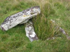
Notes: "A reed-filled cist is set well into the cairn on a NNW-SSE axis. The intact chamber measures internally 0.95m long, a maximum 0.65m wide and 0.45m deep; the longest side slab is 1.4m by 0.3m by 0.45m and largest end slab 0.55m by 0.2m by 0.4m. The coverstone against the NW side of the cist is roughly oval in shape and measures 1.7m by 1.3m and a maximum 0.25m thick." Lethbridge diagram p.102 Cist(B), photo p.102. Butler Vol. 4. Map 65.4 (diagram p.232).
Nearby sites: SX 61312 73558
Distance: 2.41km
Blakey Tor (W) Cist
OS Map: SX 61240 73551
HER: MDV6244
Megalithic Portal: 45772
PMD: Blakey Tor W.
Alternate name: Blakey Tor W. Cist
ShortName: CT BlakeyTor W
Butler map: 65.4
DPD page: 103
Grinsell: LYD 84
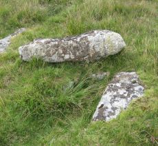
Notes: "The incomplete cist is oriented NW-SE. It measures about 0.85m long, 0.4m to 0.55m wide and 0.25m deep internally. The upright W side slab is 0.9m by 0.2m by 0.25m and the surviving end slab is 0.4m by 0.2m by 0.25m. The E side is formed by a flat-sided boulder which is c. 1.1m long, at least 0.6m thick and 0.25m high. The SE side is open. The coverstone is 1.7m by 0.7m by 0.4m and leans against the W side of the cist." Lethbridge diagram p.102 Cist(A), photo top p.103. Butler Blakey Tor W. - Vol. 4. Map 65.4 (diagram p.232).
Nearby sites: SX 61240 73551
Distance: 2.45km
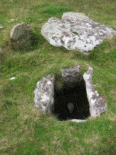
Childes Tomb Platform Cairn Circle and Cist
OS Map: SX 62577 70299
HER: MDV48907
Megalithic Portal: 15211
PMD: Childe's Tomb
ShortName: CT ChildesTomb
Butler map: 64.4
DPD page: 94
Grinsell: LYD 96
Turner: E33
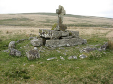
Notes: "A much disturbed cairn, 9m in diameter and 0.3m high with a modern 'kerb' of blocks and slabs, 5.8m in diameter and 0.5m high, set upon the mound. At the centre is a well built cist 1.4m long, 0.5m wide and 0.6m deep. Over this is a two tier pedestal of eight well trimmed blocks, of three different lengths; a further half buried block lies S of the monument. Upon this is a replacement socket stone and cross, cut at Holne in 1885". Lethbridge diagram p.93, photo p.94. Butler Vol. 4. Map 64.4 (diagram p.220).
Nearby sites: SX 62577 70299
Distance: 1.49km
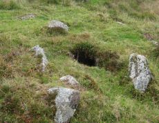
Crock of Gold Ring Setting Cairn and Cist
OS Map: SX 61286 73076
HER: MDV6308
Megalithic Portal: 14960
PMD: The Crock of Gold
ShortName: CT CrockofGold
Butler map: 65.2
DPD page: 101
Grinsell: LYD 86
Turner: D17
Barrow Report: 27 47 56
Notes: "The cairn, 7m in overall diameter and 0.3m high, has a flattish top with a retaining circle set 1m to 1.5m within the perimeter. This consists of six earthfast boulders, about 0.4m across and protruding a similar height above the cairn ... A central cist is oriented NW to SE. Internally it is 0.8m long, 0.4m wide at the NW end, 0.5m at the SE, and 0.7m deep. The side slabs are 1m long and respectively 0.15m and 0.25m thick; the end slabs, 0.5m long and 0.1m thick. The capstone, moved to the W, is 1.3m long, 1.1m wide and 0.15m thick and now rests against the kerb." Lethbridge diagram p.102 Cist(C), photo p.101. Butler Vol. 4. Map 65.2 (diagram p.229).
Nearby sites: SX 61286 73076
Distance: 2.09km
Down Ridge Stone Circle
OS Map: SX 65516 72084
HER: MDV6400
Megalithic Portal: 863
PMD: Down Ridge Stone Circle
ShortName: SC DownRidge
DPD page: 92
Turner: G9
Notes: Also known as Hexworthy Circle. "situated on a gentle north facing slope overlooking the valley of the River Dart. The stone circle measures 25 meters in diameter and is denoted by five upright granite slabs, standing up to 1.45 meters high, which are confined to its south western sector. A further six recumbent stones lie where they have fallen. The stone circle was partially excavated in 1904 by the Dartmoor Exploration Committee and their work revealed the original ground surface covered with charcoal. An associated outlying standing stone is located 85 meters south-east of the stone circle and survives as a triangular shaped block up to 0.86 meters high." [HER MDV6400]. For photos of this site, see: Megalithic Portal: Down Ridge - Stone Circle
Nearby sites: SX 65516 72084
Distance: 2.64km
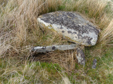
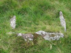
Fox Tor Newtake, North Cist
OS Map: SX 62861 71177
HER: MDV6303
Megalithic Portal: 45677
PMD: Ter Hill N.
Alternate name: Ter Hill N.W.1 Cist
ShortName: CT FoxTorNew N
Butler map: 64.3.1
DPD page: 93
Grinsell: LYD 97
Barrow Report: 24 56
Notes: "The cist is 0.6m deep and 1.2m long, the NW end is 0.4m wide and SE end 0.6m wide; the NW end-slab, said by Burnard (1905)to be wedged in the bottom cannot be seen. The coverstone, resting on the NE side, is 1.6m by 1.3m at its extremeties". Lethbridge diagram (Cist A) and photo p.93. Butler Ter Hill N.W. 1 - Vol. 4. Map 64.3 (diagram p. 219).
Nearby sites: SX 62861 71177
Distance: 0.57km
Fox Tor Newtake, South Cist
OS Map: SX 62864 70964
HER: MDV6279
Megalithic Portal: 45678
PMD: Ter Hill S.
Alternate name: Ter Hill N.W.2 Cist
ShortName: CT FoxTorNew S
Butler map: 64.3.2
DPD page: 94
Grinsell: LYD 98
Barrow Report: 24 56
Notes: "The turf-covered cairn is, at maximum, 3.9m in diameter and 0.3m in height. The cist, oriented NW/SE, is approximately 1.3m by 0.55m, and 0.75m deep, and now almost hidden by the SW side stone which has fallen inwards. The NE end stone is not evident but an 0.7m high upright granite post retains part of the mound on this NE side. There is no trace of the coverstone". Lethbridge diagram p.93 (Cist B), top photos p.94. Butler Ter Hill N.W. 2 - Vol. 4. Map 64.3 (diagram p.219).
Nearby sites: SX 62864 70964
Distance: 0.79km
Foxtor Mires W. Platform Cairn Circle and Cist
OS Map: SX 60780 70484
HER: MDV12967
Megalithic Portal: 24008
PMD: Whiteworks
ShortName: CT FoxtorMireW
Butler map: 64.6
DPD page: 97
Turner: E19
Notes: "Seven large orthostats of the retaining circle remain in situ on the south and south-east side (see plan). The cist is entirely below ground level to a depth of 0.7m and measures 1.0m by 0.6m. The two endstones and two sidestones are visible; a stone which may be the coverstone lies on the ground to one side". Lethbridge diagram p.93, photos bottom p.97. Butler Foxtor Mires W. - Vol. 4. Map 64.6 (diagram p.222). Cairn with kerb circle, visible on N, E & W sides, with a central cist.
Nearby sites: SX 60780 70484
Distance: 2.47km
Goldsmith's Cross E.2. Ring Setting Cairn and Cist
OS Map: SX 61804 70321
HER: MDV6342
Megalithic Portal: 42707
PMD: Fox Tor Mires cairn
Alternate name: Goldsmith's Cross E.2 Ring Setting Cairn and Cist
ShortName: CT GoldsmithE2
Butler map: 64.5.2
DPD page: 95
Grinsell: LYD 95
Turner: D23
Notes: "West end stone of cist leans slightly inwards, otherwise a perfect cist measuring 0.75m NW-SE by 0.5m wide by 0.4m deep. Retaining circle of 7 stones averaging 0.4m high. No coverstone or barrow". Lethbridge diagram p.93, photo bottom right p.95 and on p.96. Turner D23 (Fox Tor Mire) - Proc Devon Arch Soc 48 (diagram p.45). Butler Goldsmith's Cross E. 2 - Vol. 4. Map 64.5 (Cairn 2 - diagram p.221).
Nearby sites: SX 61804 70321
Distance: 1.80km
Goldsmith's Cross S. Cist
OS Map: SX 61684 69872
HER: MDV5081
Megalithic Portal: 42708
PMD: Fox Tor Mires S 5
ShortName: CT Goldsmith S
Butler map: 64.5
DPD page: 97
Grinsell: LYD 100
Barrow Report: 46 56
Notes: "The remains of a cist lie some 80m E of the Whealam streamworks at SX 61666985, on gently sloping ground 50m S of the newtake wall. The remains consist of four granite slabs set into the ground, forming three sides of a trapezoidal structure. It measures 1.2m long and a maximum of 0.85m wide. The long side, unusually formed of two granite slabs, is oriented NW to SE. The maximum height which the stones protrude above the ground is 0.2m. The SW side of the structure is missing; there are no traces of a capstone or cairn". Lethbridge diagram p.93, text p.96, photo top p.97. Butler Goldsmith's Cross S. - Vol. 4. Map 64.5. (Cairn 4 - diagram p.221).
Nearby sites: SX 61684 69872
Distance: 2.24km
Goldsmiths Cross E.1. Cist
OS Map: SX 61871 70395
HER: MDV61775
Megalithic Portal: 45806
PMD: Fox Tor Mires E.
Alternate name: Goldsmiths Cross E.1 Cist
ShortName: CT:GoldsmithE1
Butler map: 64.5.1
Notes: "Clear remains of cairn with cist. One side and one end stone of cist are in place. The western side stone may be beneath the turf, but the southern end stone and cover stone are missing. The internal dimensions of the cist are approximately 0.53 x 0.58 x 0.45 meters (1 foot 9 inches x 1 foot 11 inches x 1 foot 6 inches). Immediately around cist there was a backing of comparatively large flat stones.". Butler Goldsmith's Cross E. 1. Vol. 4. Map 64.5 (Cairn 1 - diagram p.221). There is no NMR for this site. There is an HER entry MDV61775 which matches precisely with the OS reference given by Butler. Butler describes: "The mound 0.1m high at best surrounds a slightly wedge-shaped cist of which only the sides, one composed of two stones, and an end are visible. The missing slab is probably buried in place".
Nearby sites: SX 61871 70395
Distance: 1.70km
Goldsmiths Cross E.3. Cist
OS Map: SX 61741 70204
HER: MDV6343
Megalithic Portal: 45748
PMD: Goldsmith's Cross
Alternate name: Goldsmiths Cross E.3 Cist
ShortName: CT:GoldsmithE3
Butler map: 64.5.3
DPD page: 95
Grinsell: LYD 94
Barrow Report: 58
Notes: "The NW sidestone, 0.8m long by 0.2m wide and the NE endstone 0.6m long, 0.15m wide are the only recognisable cist stones though it is possible that the SW side was formed by the two small slabs still visible and depicted by Worth. There is no coverstone". Lethbridge diagram p.93, photo bottom left p.95. Butler Goldsmith's Cross E.3. - Vol. 4. Map 64.5 (Cairn 3 - diagram p.221).
Nearby sites: SX 61741 70204
Distance: 1.93km
Joan Ford's Newtake Cairn Circle
OS Map: SX 63033 72172
HER: MDV6261
Megalithic Portal: 3296
Alternate name: Joan Ford's Newtake 2 Cairn Circle
ShortName: CC Joan Fords
Butler map: 63.3.2
Grinsell: LYD 91
Turner: G22
Barrow Report: 30
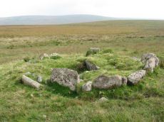
Notes: "A stone circle with six identifiable erect or leaning stones. One forms the E post of the gateway, the west post, 7ft high, stands outside the circumference. It is because of its small diameter, without doubt a retaining circle; any internal features such as a central hollow or possible kistvean have been obliterated by the wall builders." Turner Stone Circle G22. Bar Rep 30.
Nearby sites: SX 63033 72172
Distance: 0.54km
Joan Ford's Newtake Embanked Cairn Circle and Cist
OS Map: SX 63143 72168
HER: MDV6260
Megalithic Portal: 3295
PMD: Joan Ford's Newtake
Alternate name: Joan Ford's Newtake 1 Embanked Cairn Circle and Cist
ShortName: CT Joan Fords
Butler map: 63.3.1
DPD page: 99
Grinsell: LYD 92
Turner: B7
Barrow Report: 30 56
Notes: "A low kerb within the disturbed fringes of the mound is 8.7m in diameter with more or less continuous upright slabs and boulders 0.3m to 0.6m high. A dry stone newtake wall crosses the N side and overlies part of the kerb. A well-preserved cist, oriented NW-SE, is internally 1.0m long, 0.5m to 0.65m wide and up to 0.7m deep. The coverstone leans against the SE side of the cist and measures 1.35m by 1.0m by 0.2." Lethbridge diagram p.99, photo bottom p.99. Butler Joan Ford's Newtake 1 - Vol. 4. Map 63.3 (diagram p.214).
Nearby sites: SX 63143 72168
Distance: 0.48km
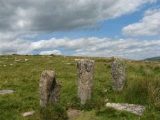
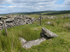
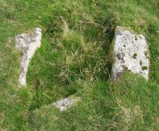
Joan Ford's Newtake Stone Row
OS Map: SX 63183 71987
HER: MDV6375
Megalithic Portal: 1985
The Stone Rows of GB: Joan Fords Newtake
PMD: Joan Ford's Newtake
ShortName: SR Joan Fords
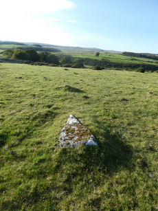
Notes: Stone Rows of great Britain states: "A probable single stone row measuring 7.27m long, including at least three large-sized upright orthostats and two recumbent slabs situated on a gentle south east facing slope. The stones stand up to between 1.55m and 1.23m high, arranged in height order with the tallest at the east. The row is orientated ENE to NSW and has restricted views of several skyline cairns and surrounding landscape."
Nearby sites: SX 63183 71987
Distance: 0.37km
Royal Hill Cairn
OS Map: SX 61817 71957
HER: MDV6310
Megalithic Portal: 34957
Alternate name: Royal Hill E.1 Cairn
ShortName: CN:RoyalHill 1
Butler map: 65.5.1
Grinsell: LYD 93
Notes: "This impressive disturbed turf-covered cairn on the summit area of Royal Hill at 394m OD. It measures 16.4m (N-S) by 15.6m (E-W) with a maximum height of 1.8m. The flattish top has an off-centre pit 4.5m by 2.4m and 0.8m deep with some upcast material dumped around the top edge. Damage to the perimeter, reported in 1982 (8), has mostly been reinstated. The cairn is variously named Broken Barrow, Broken Barrows and Brokenborough"
Nearby sites: SX 61817 71957
Distance: 1.10km
Royal Hill Summit Cist
OS Map: SX 61295 72792
HER: MDV18391
Megalithic Portal: 45798
PMD: Royal Hill Summit
ShortName: CT RoyalHill 7
Butler map: 65.5.7
Butler Vol 5: p.185 & Fig.128
DPD page: 102
Notes: Butler Royal Hill Summit Vol. 4. Map 65.2 (diagram Vol. 5. p.185). "The cairn 7.4m E to W, and 6.5m N to S, and about 0.5m high. It is turf covered, but the tops of three stones of an inner retaining circle are exposed to a height of 0.3m. The largest is 1.1m long and 0.2m thick ... The cist, oriented E to W is largely infilled; internally it measures 0.8m by 0.6m, and is 0.2m deep. The coverstone is missing as is the stone at the E end. The others take the form of irregular boulders rather than slabs". Lethbridge diagram p.102 Cist(D), photo p.102.
Nearby sites: SX 61295 72792
Distance: 1.91km
Royal Hill, Central Platform Cairn Circle and Cist
OS Map: SX 62082 72334
HER: MDV6304
Megalithic Portal: 34960
PMD: Royal Hill E.
Alternate name: Royal Hill E.4 Platform Cairn Circle and Cist
ShortName: CT RoyalHill 4
Butler map: 65.5.4
DPD page: 98
Grinsell: LYD 89
Turner: E21
Barrow Report: 27 47
Notes: "The cairn has an overall diameter of about 7.5m in diameter, and 0.6m high, with a flattish top. There are traces of an inner kerb 4.5m in diameter, and an outer one 5.7m across comprising boulders and slabs, the largest 1.5m long, 0.6m high, and 0.2m thick. The interior of the central cist is about 0.8m square with four stones up to 0.25m thick and 0.6m deep but the southern one overlaps the sides, is 1m long, and gives the cist its NW to SE alignment. This and the two end stones incline inwards; the northern one inclines slightly outwards. There is no cover stone." Lethbridge diagram p.97 Cist B, photo p.98. Turner E21 - listed as Royal Hill (N) [n.b. we have a south, central & north - N being a different cist]. Butler Royal Hill E. 4 (Cairn 4 - diagram p.233) - Vol. 4. Map 65.5.
Nearby sites: SX 62082 72334
Distance: 1.01km
Royal Hill, North Ring Setting Cairn and Cist
OS Map: SX 62108 72434
HER: MDV6305
Megalithic Portal: 34959
PMD: Royal Hill NE.
Alternate name: Royal Hill E.5 Ring Setting Cairn and Cist
ShortName: CT RoyalHill 5
Butler map: 65.5.5
DPD page: 98
Grinsell: LYD 90
Turner: D21
Barrow Report: 27 47
Notes: "The circle is 3.1m in overall diameter, comprising nine contiguous thick slabs, up to 0.9m long and from 0.3m to 0.7m high... There is virtually no cairn material but the interior has been levelled up to a height of 0.1m on the E, downhill side. A central cist oriented WNW to ESE is represented by two side stones which protrude 0.15m above ground. They are 1.2m and 0.9m long and both about 0.2m thick and 0.4m deep. The longer, northern one leans inwards and touches the other at the W end; at the E the stones are 0.8m apart separated by two flat (packing ?) stones each about 0.35m across. An overgrown and embedded slab against the circle W if the cist may have been an end stone." Lethbridge diagram p.97 Cist C, photo p.98. Butler Royal Hill E. 5 (Cairn 5 - diagram p.233)- Vol. 4. Map 65.5. Central cist.
Nearby sites: SX 62108 72434
Distance: 1.05km
Royal Hill, South Platform Cairn Circle and Cist
OS Map: SX 62020 72091
HER: MDV6309
Megalithic Portal: 34958
PMD: Royal Hill SE.
Alternate name: Royal Hill E.3 Platform Cairn Circle and Cist
ShortName: CT RoyalHill 3
Butler map: 65.5.3
DPD page: 98
Grinsell: LYD 88
Turner: E31
Barrow Report: 27 47
Notes: "The cairn is 4.9m in diameter and 0.4m high with a flattish, platform, top. It is retained by a kerb of almost contiguous orthostats, the largest 1.1m long, 0.2m thick, and 0.6m high. A few are fallen or displaced. The central cist is oriented WNW to ESE, lacking both coverstone and N side slab. Internally it measures 1.35m by 0.75m by 0.55m deep." Lethbridge diagram p.97 Cist A, photo p.98. Butler Royal Hill E. 3 - Vol. 4. Map 65.5 (Cairn 3 - diagram p.233).
Nearby sites: SX 62020 72091
Distance: 0.94km
Sherberton Stone Row
OS Map: SX 63948 73349
HER: MDV6426
Megalithic Portal: 6333470
The Stone Rows of GB: Sherberton Row
PMD: Sherberton Stone Row
Alternate name: Sherberton Row Stone Row
ShortName: SR Sherberton
Butler Vol 5: p.211 & Fig.148
DPD page: 100
Notes: The Sherberton double row was discovered in 1997. It is an unimpressive double row of small stones a short distance north-west of the Sherberton Circle. For a plan see Butler Vol. 5 p. 210-12. Lethbridge pp.99-100, diagram p.99 and p.100.
Nearby sites: SX 63948 73349
Distance: 1.91km
Sherberton Stone Circle
OS Map: SX 63946 73187
HER: MDV6290
Megalithic Portal: 1252
PMD: Sherberton Stone Circle
ShortName: SC Sherberton
DPD page: 101
Turner: G5
Notes: Remains of a 97 ft diameter stone circle with a stone wall passing through its western side. "Nine of the original stones are still standing, plus one larger stone which is incorporated in the remains of the old wall which bisects the western extremity of the circle. This stone appears to have been removed from the original circumference, and its height is 1.4m. The remaining nine stones range in height from 0.3m to 0.75m. The original circle appears to have been c. 30m across, although no stones appear to the west of the old wall. The length of the 2 fallen stones at the southern end is 2.6m and 2.4m". For a photo of this site, see: Megalithic Portal: Sherberton circle. Lethbridge p.101, diagram p.99 and p.100.
Nearby sites: SX 63946 73187
Distance: 1.78km
Skir Hill (Henroost) Ring Setting Cairn and Cist
OS Map: SX 65104 70686
HER: MDV6507
Megalithic Portal: 45676
PMD: Skir Hill
Alternate name: Skir Hill Ring Setting Cairn and Cist
ShortName: CT Skir Hill
Butler map: 61.8
DPD page: 92
Grinsell: LYD 102
Turner: D18
Barrow Report: 24 56
Notes: DM reports it is actually located at SX 65092 70684. The author has found this site at SX 65104 70691 on 28/06/18 assisted by the grid reference given by Dave Martin (DM). "A Bronze Age cairn containing a cist located on the north east facing slope of Skir Hill 590 metres south of Skir Ford. The cairn survives as a 4.1 diameter ring of edge set slabs up to 0.5 metres high. The cist is situated slightly west of the cairns centre and survives as a 0.82 metres long by 0.52 metres wide and 0.82 metres deep stone lined pit." Formerly listed as being at SX 6517 7075 (as per literature). Butler Vol. 4. Map 61.8 (diagram p.203).
Nearby sites: SX 65104 70686
Distance: 2.45km
Swincombe Ford Newtake 1 Cist
OS Map: SX 63330 72988
HER: MDV54431
Megalithic Portal: 42665
PMD: Swincombe Ford Newtake
ShortName: CT Swincombe 1
Butler map: 63.5.1
DPD page: 99
Notes: Butler Vol. 4. Map 63.5 (diagram p.215). "A robbed cist within a cairn on a gently sloping NE-facing moorland hillside. A stoney cairn 6.0m N-S by 5.5m E-W and 0.3m high contains the cist, approximately 0.8m wide, 0.3m deep and of indeterminate length and orientation. The capstone, 1.4m by 1.3m largely obscures the cist, with only the ?NE end stone being visible." Lethbridge diagram p.99 photo top of p.99.
Nearby sites: SX 63330 72988
Distance: 1.31km
Tor Royal (newtake) Stone Ring Cairn Circle
OS Map: SX 62974 72262
HER: MDV18388
Megalithic Portal: 45831
Alternate name: Joan Ford's Newtake N.3 Stone Ring Cairn Circle
ShortName: RC Tor Royal
Butler map: 63.3
Turner: A18
Notes: "Disturbed ring cairn consisting of a stone ring 8.0 meters in diameter internally with bank 1.0 meter wide and 0.2 meters high." This feature was previously listed here at SX 62939 72246 but that is the location of the nearby cairn to the east of this ring cairn. This record has been updated with SX 62974 72262 from a visit on 04/09/23.
Nearby sites: SX 62974 72262
Distance: 0.52km