
Royal Hill Cairn
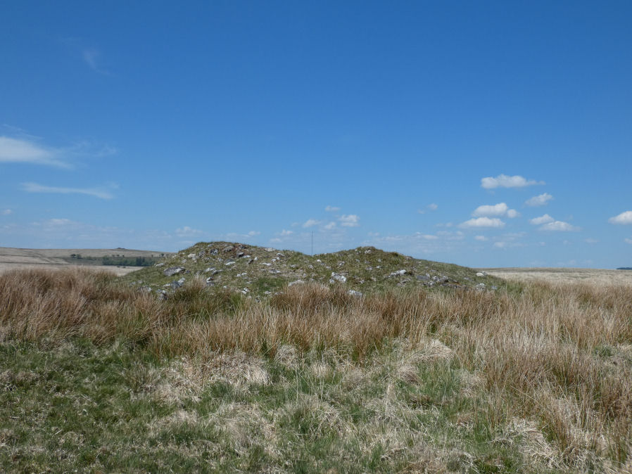
Photo taken on 10-05-2025
Database entries
OS Map: SX 61817 71957
OS Source: Google
Butler OS: SX61817194
HER: MDV6310
Megalithic Portal: 34957
Alternate name: Royal Hill E.1
Short Name: CN RoyalHill 1
Butler map: 65.5.1
Grinsell: LYDFORD 93
Exist: Yes
Record: Unique
Record Source: Butler
Hut Class: No
Cairn Class: Yes
Dimensions (m): 15.5 x 2.0
Lidar: SX 61817 71957
Guide Map: 39
Nearest Bus Stop: Princetown Dartmoor Visitor Centre (4.2 km) [Route: 98,171(20/07/26 to 19/09/26)]
Nearby sites: SX 61817 71957
Notes
"This impressive disturbed turf-covered cairn on the summit area of Royal Hill at 394m OD. It measures 16.4m (N-S) by 15.6m (E-W) with a maximum height of 1.8m. The flattish top has an off-centre pit 4.5m by 2.4m and 0.8m deep with some upcast material dumped around the top edge. Damage to the perimeter, reported in 1982 (8), has mostly been reinstated. The cairn is variously named Broken Barrow, Broken Barrows and Brokenborough"References
These are selected references with an emphasis on out of copyright sources linked as PDFs. For more detailed references try any linked HER or PMD record above.
- Burnard, Robert, Notes on Dartmoor Kistvaens, T.D.A. Vol.22 pp.200-207 (1890)
- Butler, Jeremy, Dartmoor Atlas of Antiquities, vol.4: The South-East, (1993)
- Grinsell, L.V., Dartmoor Barrows, Devon Archaeological Society Proceedings No.36 (1978)