
Prehistoric sites within 3km of SX 67150 71750
Guidance for walkers: The monuments featured in this database are archaeological treasures and need to be protected and preserved - please do not disturb any sites. Please check access and firing times before visiting sites, not all sites listed are on open access land. Firing ranges and boundaries of open access areas are marked on the OL28 OS Dartmoor Explorer map. Please stick to the country code and consider giving support to the numerous agencies that help to keep Dartmoor a fabulous natural and historic environment!
About the database listings: In all listings clicking on the photo or the site name will open a page for the site with a larger photo and further details from the database. The database now has over 6680 records covering nearly all publicly listed sites on Dartmoor including around 4800 round houses. This level of detail is of interest to archaeologists but tends to swamp listings of sites more likely to be of interest for walkers. For this reason, the listings default to around 550 core sites only. These are the stone circles, stone rows and the ring cairns listed by Turner. The default search radius is 2 km. The controls below the map can be used to start a new search by entering a 6- or 8-digit reference (without the prefix "SX"). The search radius can be specified and you can add incremental Display layers of detail on top of the core sites. If using a more detailed layer you will need to decrease the search radius to avoid getting hundreds of search results.
- Core sites Default listing of core sites consisting of stone circles & rows and some of the major ring cairns.
- Plus cairns adds approx. 1000 cairns and other minor sites not included in the core listings but excluding round houses.
- Plus round houses adds approx. 4800 round houses.
- Plus non-sites adds in the records for sites that no longer exist or are not prehistoric sites.
- Plus duplicates adds records excluded as duplicates. Those maybe duplicate records in external listings (e.g. the Historic Environment Records). For example, some sites have been identified as cairns in some listings and interpreted as round houses in other listings and both records appear.
These listings have incorporated, matched up and merged all of the records from all of the major archaeological listings including: Worth, Grinsell, Turner, Butler, Bill Radcliffe, Sandy Gerrard, Megalithic Portal, the National Monument Records and the Historic Environment Records. The author would like to thank Bill, Sandy, the lovely people both at Megalithic Portal (especially Anne Tate who did an amazing job to link listings) and at ACE Archaeology for collaborative work over the years to synchronise and correct listings across the various websites which now interlink. A culmination of years of work the final merger of cairn records took 3 months of cross referencing in 2017 the result being a snapshot of the records at that time. This data has in turn been refined since by field work and research. The round house data was supplied by Sandy Gerrard. Grid references are in order of accuracy: from Google Earth satellite, if visible and found, from a Garmin GPS reading, if visited by the author and from the literature otherwise. Individual site pages will state the source of the grid reference and provide satellite imagery. If a site listing lacks a photo it has not yet been visited by the author in which case the grid reference is from the literature.
Currently the database only includes sites which can be represented by a grid reference. Reaves are not included as they require GIS shape technology which is beyond the current capability of this system. To see the sources for the records, look at the tables on the resources menu. The database listings can also be viewed on a Google map and downloaded as GPS datasets for Garmin devices.
Corrections, or any feedback or suggestions are very welcome, email: info@dartmoorwalks.org.uk.
NOTE: Clicking on the icons for each monument in the map will give the name of the site. You can zoom in and out and drag the map around.
List of sites within 3km of SX 67150 71750
Bench Tor Round House
OS Map: SX 69081 71484
HER: MDV6447
ShortName: HT:Bench Tor1
Nearby sites: SX 69081 71484
Distance: 1.95km
Bench Tor Round House
OS Map: SX 68957 71430
HER: MDV6447
ShortName: HT:Bench Tor2
Nearby sites: SX 68957 71430
Distance: 1.84km
Bench Tor Round House
OS Map: SX 69015 71451
HER: MDV6447
ShortName: HT:Bench Tor3
Nearby sites: SX 69015 71451
Distance: 1.89km
Bench Tor Round House
OS Map: SX 68986 71564
HER: MDV6447
ShortName: HT:Bench Tor4
Nearby sites: SX 68986 71564
Distance: 1.85km
Bench Tor Round House
OS Map: SX 68947 71446
HER: MDV6447
ShortName: HT:Bench Tor5
Nearby sites: SX 68947 71446
Distance: 1.82km
Bench Tor Round House
OS Map: SX 68991 71537
HER: MDV6447
ShortName: HT:Bench Tor6
Nearby sites: SX 68991 71537
Distance: 1.85km
Bench Tor Round House
OS Map: SX 68977 71301
HER: MDV12990
ShortName: HT:Bench Tor7
Nearby sites: SX 68977 71301
Distance: 1.88km
Bench Tor Round House
OS Map: SX 69015 71451
HER: MDV6447
ShortName: HT:Bench Tor8
Nearby sites: SX 69015 71451
Distance: 1.89km
Combestone Round House
OS Map: SX 67083 72083
HER: MDV6485
ShortName: HT:Combeston1
Nearby sites: SX 67083 72083
Distance: 0.34km
Combestone Round House
OS Map: SX 66953 72205
HER: MDV43763
ShortName: HT:Combeston2
Nearby sites: SX 66953 72205
Distance: 0.50km
Combestone Round House
OS Map: SX 66982 72295
HER: MDV6512
ShortName: HT:Combeston3
Nearby sites: SX 66982 72295
Distance: 0.57km
Combestone Round House
OS Map: SX 66945 72322
HER: MDV43764
ShortName: HT:Combeston4
Nearby sites: SX 66945 72322
Distance: 0.61km
Combestone Tor Round House
OS Map: SX 6697 7208
HER: MDV26237
ShortName: HT:Combeston5
Nearby sites: SX 6697 7208
Distance: 0.38km
Combestone Tor Round House
OS Map: SX 66929 71929
ShortName: HT:Combeston6
Nearby sites: SX 66929 71929
Distance: 0.28km
Corndon Down Round House
OS Map: SX 68448 73809
HER: MDV79744
ShortName: HT:Corndon D17
Nearby sites: SX 68448 73809
Distance: 2.43km
Corndon Down S Round House
OS Map: SX 68775 73773
HER: MDV79741
ShortName: HT:Corndon D22
Nearby sites: SX 68775 73773
Distance: 2.59km
Corndon Down S Round House
OS Map: SX 68699 73785
HER: MDV79742
ShortName: HT:Corndon D23
Nearby sites: SX 68699 73785
Distance: 2.56km
Corndon Down S Round House
OS Map: SX 68899 73740
HER: MDV16719
ShortName: HT:Corndon D24
Nearby sites: SX 68899 73740
Distance: 2.65km
Corndon Down S Round House
OS Map: SX 68784 73794
HER: MDV16720
ShortName: HT:Corndon D25
Nearby sites: SX 68784 73794
Distance: 2.62km
Deep Swincombe Round House
OS Map: SX 64631 72255
HER: MDV107506
ShortName: HT:Deep Swin1
Nearby sites: SX 64631 72255
Distance: 2.57km
Deep Swincombe Round House
OS Map: SX 64634 72246
HER: MDV107506
ShortName: HT:Deep Swin2
Nearby sites: SX 64634 72246
Distance: 2.56km
Deep Swincombe Round House
OS Map: SX 64310 71925
ShortName: HT:Deep Swin3
Nearby sites: SX 64310 71925
Distance: 2.85km
Deep Swincombe Round House
OS Map: SX 64648 72247
HER: MDV107506
ShortName: HT:Deep Swin4
Nearby sites: SX 64648 72247
Distance: 2.55km
Deep Swincombe Round House
OS Map: SX 64617 72222
HER: MDV107506
ShortName: HT:Deep Swin5
Nearby sites: SX 64617 72222
Distance: 2.58km
Deep Swincombe Round House
OS Map: SX 64684 72286
HER: MDV107506
ShortName: HT:Deep Swin6
Nearby sites: SX 64684 72286
Distance: 2.52km
Deep Swincombe Round House
OS Map: SX 64304 72080
HER: MDV26140
ShortName: HT:Deep Swin7
Nearby sites: SX 64304 72080
Distance: 2.87km
Deep Swincombe Round House
OS Map: SX 64283 72035
ShortName: HT:Deep Swin8
Nearby sites: SX 64283 72035
Distance: 2.88km
Deep Swincombe Round House
OS Map: SX 64644 72231
HER: MDV107506
ShortName: HT:Deep Swin9
Nearby sites: SX 64644 72231
Distance: 2.55km
Deep Swincombe Round House
OS Map: SX 64321 71899
ShortName: HT:Deep Swin10
Nearby sites: SX 64321 71899
Distance: 2.83km
Deep Swincombe Round House
OS Map: SX 64755 72325
HER: MDV107506
ShortName: HT:Deep Swin11
Nearby sites: SX 64755 72325
Distance: 2.46km
Deep Swincombe Round House
OS Map: SX 64749 72307
HER: MDV107506
ShortName: HT:Deep Swin12
Nearby sites: SX 64749 72307
Distance: 2.46km
Deep Swincombe Round House
OS Map: SX 64519 72459
HER: MDV6345
ShortName: HT:Deep Swin13
Nearby sites: SX 64519 72459
Distance: 2.72km
Deep Swincombe Round House
OS Map: SX 64576 72298
HER: MDV107506
ShortName: HT:Deep Swin14
Nearby sites: SX 64576 72298
Distance: 2.63km
Deep Swincombe Round House
OS Map: SX 64579 72272
HER: MDV107506
ShortName: HT:Deep Swin15
Nearby sites: SX 64579 72272
Distance: 2.62km
Deep Swincombe Round House
OS Map: SX 64629 72311
HER: MDV107506
ShortName: HT:Deep Swin16
Nearby sites: SX 64629 72311
Distance: 2.58km
Deep Swincombe Round House
OS Map: SX 64590 72227
HER: MDV107506
ShortName: HT:Deep Swin17
Nearby sites: SX 64590 72227
Distance: 2.60km
Deep Swincombe Round House
OS Map: SX 64312 71905
ShortName: HT:Deep Swin18
Nearby sites: SX 64312 71905
Distance: 2.84km
Deep Swincombe Round House
OS Map: SX 64597 72244
HER: MDV107506
ShortName: HT:Deep Swin19
Nearby sites: SX 64597 72244
Distance: 2.60km
Deep Swincombe Round House
OS Map: SX 64336 72483
HER: MDV6344
ShortName: HT:Deep Swin20
Nearby sites: SX 64336 72483
Distance: 2.91km
Deep Swincombe Round House
OS Map: SX 64616 72238
HER: MDV107506
ShortName: HT:Deep Swin21
Nearby sites: SX 64616 72238
Distance: 2.58km
Deep Swincombe Round House
OS Map: SX 64626 72268
HER: MDV107506
ShortName: HT:Deep Swin22
Nearby sites: SX 64626 72268
Distance: 2.58km
Deep Swincombe Round House
OS Map: SX 64406 72301
HER: MDV26134
ShortName: HT:Deep Swin23
Nearby sites: SX 64406 72301
Distance: 2.80km
Deep Swincombe Round House
OS Map: SX 64632 72317
HER: MDV107506
ShortName: HT:Deep Swin24
Nearby sites: SX 64632 72317
Distance: 2.58km
Deep Swincombe Round House
OS Map: SX 64329 71905
ShortName: HT:Deep Swin25
Nearby sites: SX 64329 71905
Distance: 2.83km
Deep Swincombe Round House
OS Map: SX 64763 72268
HER: MDV107506
ShortName: HT:Deep Swin26
Nearby sites: SX 64763 72268
Distance: 2.44km
Deep Swincombe Round House
OS Map: SX 64742 72243
HER: MDV107506
ShortName: HT:Deep Swin27
Nearby sites: SX 64742 72243
Distance: 2.46km
Deep Swincombe Round House
OS Map: SX 64765 72272
HER: MDV107506
ShortName: HT:Deep Swin28
Nearby sites: SX 64765 72272
Distance: 2.44km
Deep Swincombe Round House
OS Map: SX 64765 72252
HER: MDV107506
ShortName: HT:Deep Swin29
Nearby sites: SX 64765 72252
Distance: 2.44km
Deep Swincombe Round House
OS Map: SX 64787 72277
HER: MDV107506
ShortName: HT:Deep Swin30
Nearby sites: SX 64787 72277
Distance: 2.42km
Deep Swincombe Round House
OS Map: SX 64807 72323
HER: MDV107506
ShortName: HT:Deep Swin31
Nearby sites: SX 64807 72323
Distance: 2.41km
Down Ridge E Round House
OS Map: SX 6609 7163
HER: MDV61308
ShortName: HT:Down Ridg1
Nearby sites: SX 6609 7163
Distance: 1.07km
Down Ridge N Round House
OS Map: SX 65656 72319
HER: MDV26351
ShortName: HT:Down Ridg2
Nearby sites: SX 65656 72319
Distance: 1.60km
Down Ridge N Round House
OS Map: SX 65681 72077
ShortName: HT:Down Ridg3
Nearby sites: SX 65681 72077
Distance: 1.50km
Down Ridge N Round House
OS Map: SX 65603 72108
ShortName: HT:Down Ridg4
Nearby sites: SX 65603 72108
Distance: 1.59km
Down Ridge N Round House
OS Map: SX 6493 7218
HER: MDV26144
ShortName: HT:Down Ridg5
Nearby sites: SX 6493 7218
Distance: 2.26km
Down Ridge N Round House
OS Map: SX 6494 7220
HER: MDV26144
ShortName: HT:Down Ridg6
Nearby sites: SX 6494 7220
Distance: 2.26km
Down Ridge N Round House
OS Map: SX 65575 72123
ShortName: HT:Down Ridg7
Nearby sites: SX 65575 72123
Distance: 1.62km
Down Ridge N Round House
OS Map: SX 65432 72360
HER: MDV27268
ShortName: HT:Down Ridg8
Nearby sites: SX 65432 72360
Distance: 1.82km
Down Ridge N Round House
OS Map: SX 653 723
HER: MDV54387
ShortName: HT:Down Ridg9
Nearby sites: SX 653 723
Distance: 1.93km
Holne Moor Round House
OS Map: SX 67409 70660
ShortName: HT:Holne Moo1
Nearby sites: SX 67409 70660
Distance: 1.12km
Holne Moor Round House
OS Map: SX 67126 71508
HER: MDV26337
ShortName: HT:Holne Moo2
Nearby sites: SX 67126 71508
Distance: 0.24km
Holne Moor Round House
OS Map: SX 67814 70964
HER: MDV104469
ShortName: HT:Holne Moo3
Nearby sites: SX 67814 70964
Distance: 1.03km
Holne Moor Round House
OS Map: SX 67640 71397
HER: MDV6395
ShortName: HT:Holne Moo4
Nearby sites: SX 67640 71397
Distance: 0.60km
Holne Moor Round House
OS Map: SX 67425 71399
ShortName: HT:Holne Moo5
Nearby sites: SX 67425 71399
Distance: 0.45km
Holne Moor Round House
OS Map: SX 68662 70552
HER: MDV6381
ShortName: HT:Holne Moo6
Nearby sites: SX 68662 70552
Distance: 1.93km
Holne Moor Round House
OS Map: SX 67672 71410
HER: MDV6394
ShortName: HT:Holne Moo7
Nearby sites: SX 67672 71410
Distance: 0.62km
Holne Moor Round House
OS Map: SX 68507 70577
HER: MDV6382
ShortName: HT:Holne Moo8
Nearby sites: SX 68507 70577
Distance: 1.79km
Holne Moor Round House
OS Map: SX 67448 71443
ShortName: HT:Holne Moo9
Nearby sites: SX 67448 71443
Distance: 0.43km
Holne Moor Round House
OS Map: SX 67039 71279
HER: MDV12993
ShortName: HT:Holne Moo10
Nearby sites: SX 67039 71279
Distance: 0.48km
Holne Moor Round House
OS Map: SX 67119 71254
HER: MDV6478
ShortName: HT:Holne Moo11
Nearby sites: SX 67119 71254
Distance: 0.50km
Holne Moor Round House
OS Map: SX 67634 71835
HER: MDV6480
ShortName: HT:Holne Moo12
Nearby sites: SX 67634 71835
Distance: 0.49km
Holne Moor Round House
OS Map: SX 67378 71227
HER: MDV26363
ShortName: HT:Holne Moo13
Nearby sites: SX 67378 71227
Distance: 0.57km
Holne Moor Round House
OS Map: SX 67420 71354
HER: MDV26264
ShortName: HT:Holne Moo14
Nearby sites: SX 67420 71354
Distance: 0.48km
Holne Moor Round House
OS Map: SX 67623 71784
HER: MDV6482
ShortName: HT:Holne Moo15
Nearby sites: SX 67623 71784
Distance: 0.47km
Holne Moor Round House
OS Map: SX 67419 71331
HER: MDV26265
ShortName: HT:Holne Moo16
Nearby sites: SX 67419 71331
Distance: 0.50km
Holne Moor Round House
OS Map: SX 67770 70474
ShortName: HT:Holne Moo17
Nearby sites: SX 67770 70474
Distance: 1.42km
Holne Moor Round House
OS Map: SX 68106 70434
HER: MDV64119
ShortName: HT:Holne Moo18
Nearby sites: SX 68106 70434
Distance: 1.63km
Holne Moor Round House
OS Map: SX 67418 71359
HER: MDV26264
ShortName: HT:Holne Moo19
Nearby sites: SX 67418 71359
Distance: 0.47km
Holne Moor Round House
OS Map: SX 68527 70456
HER: MDV6382
ShortName: HT:Holne Moo20
Nearby sites: SX 68527 70456
Distance: 1.89km
Holne Moor Round House
OS Map: SX 68232 71068
HER: MDV26358
ShortName: HT:Holne Moo21
Nearby sites: SX 68232 71068
Distance: 1.28km
Holne Moor Round House
OS Map: SX 68914 70468
HER: MDV6382
ShortName: HT:Holne Moo22
Nearby sites: SX 68914 70468
Distance: 2.18km
Holne Moor Round House
OS Map: SX 68003 70612
HER: MDV27271
ShortName: HT:Holne Moo23
Nearby sites: SX 68003 70612
Distance: 1.42km
Holne Moor Round House
OS Map: SX 67437 71285
HER: MDV26369
ShortName: HT:Holne Moo24
Nearby sites: SX 67437 71285
Distance: 0.55km
Holne Moor Round House
OS Map: SX 68660 70547
HER: MDV6381
ShortName: HT:Holne Moo25
Nearby sites: SX 68660 70547
Distance: 1.93km
Holne Moor Round House
OS Map: SX 68101 70434
HER: MDV64119
ShortName: HT:Holne Moo26
Nearby sites: SX 68101 70434
Distance: 1.62km
Holne Moor Round House
OS Map: SX 67305 70701
ShortName: HT:Holne Moo27
Nearby sites: SX 67305 70701
Distance: 1.06km
Holne Moor Round House
OS Map: SX 67371 70688
ShortName: HT:Holne Moo28
Nearby sites: SX 67371 70688
Distance: 1.08km
Holne Moor Round House
OS Map: SX 6868 7175
HER: MDV20674
ShortName: HT:Holne Moo29
Nearby sites: SX 6868 7175
Distance: 1.53km
Holne Moor Round House
OS Map: SX 66713 71413
HER: MDV12991
ShortName: HT:Holne Moo30
Nearby sites: SX 66713 71413
Distance: 0.55km
Holne Moor Round House
OS Map: SX 68065 70547
HER: MDV6379
ShortName: HT:Holne Moo31
Nearby sites: SX 68065 70547
Distance: 1.51km
Holne Moor Round House
OS Map: SX 6742 7070
ShortName: HT:Holne Moo32
Nearby sites: SX 6742 7070
Distance: 1.08km
Holne Moor Round House
OS Map: SX 67141 71227
ShortName: HT:Holne Moo33
Nearby sites: SX 67141 71227
Distance: 0.52km
Holne Moor Round House
OS Map: SX 67229 71373
HER: MDV26732
ShortName: HT:Holne Moo34
Nearby sites: SX 67229 71373
Distance: 0.39km
Holne Moor Round House
OS Map: SX 68170 70979
HER: MDV6388
ShortName: HT:Holne Moo35
Nearby sites: SX 68170 70979
Distance: 1.28km
Holne Moor Round House
OS Map: SX 67224 71363
HER: MDV26732
ShortName: HT:Holne Moo36
Nearby sites: SX 67224 71363
Distance: 0.39km
Holne Moor Round House
OS Map: SX 68170 70993
HER: MDV6388
ShortName: HT:Holne Moo37
Nearby sites: SX 68170 70993
Distance: 1.27km
Holne Moor Round House
OS Map: SX 68842 70446
HER: MDV6382
ShortName: HT:Holne Moo38
Nearby sites: SX 68842 70446
Distance: 2.14km
Holne Moor Round House
OS Map: SX 67821 70980
HER: MDV26733
ShortName: HT:Holne Moo39
Nearby sites: SX 67821 70980
Distance: 1.02km
Holne Moor Round House
OS Map: SX 68032 71812
HER: MDV6483
ShortName: HT:Holne Moo40
Nearby sites: SX 68032 71812
Distance: 0.88km
Holne Moor Round House
OS Map: SX 67051 71429
HER: MDV12994
ShortName: HT:Holne Moo41
Nearby sites: SX 67051 71429
Distance: 0.34km
Holne Moor Round House
OS Map: SX 67121 71577
ShortName: HT:Holne Moo42
Nearby sites: SX 67121 71577
Distance: 0.18km
Holne Moor Round House
OS Map: SX 68007 70893
ShortName: HT:Holne Moo43
Nearby sites: SX 68007 70893
Distance: 1.21km
Holne Moor Round House
OS Map: SX 66967 71635
HER: MDV26339
ShortName: HT:Holne Moo44
Nearby sites: SX 66967 71635
Distance: 0.22km
Holne Moor Round House
OS Map: SX 67130 71501
HER: MDV26337
ShortName: HT:Holne Moo45
Nearby sites: SX 67130 71501
Distance: 0.25km
Holne Moor Round House
OS Map: SX 67752 70467
ShortName: HT:Holne Moo46
Nearby sites: SX 67752 70467
Distance: 1.42km
Holne Moor Round House
OS Map: SX 67648 70497
HER: MDV26362
ShortName: HT:Holne Moo47
Nearby sites: SX 67648 70497
Distance: 1.35km
Holne Moor Round House
OS Map: SX 6776 7170
HER: MDV6398
ShortName: HT:Holne Moo48
Nearby sites: SX 6776 7170
Distance: 0.61km
Holne Moor Round House
OS Map: SX 67721 71698
ShortName: HT:Holne Moo49
Nearby sites: SX 67721 71698
Distance: 0.57km
Holne Moor Round House
OS Map: SX 67153 71334
HER: MDV26732
ShortName: HT:Holne Moo50
Nearby sites: SX 67153 71334
Distance: 0.42km
Holne Moor Round House
OS Map: SX 67814 70829
ShortName: HT:Holne Moo51
Nearby sites: SX 67814 70829
Distance: 1.14km
Holne Moor Round House
OS Map: SX 67402 71330
HER: MDV26265
ShortName: HT:Holne Moo52
Nearby sites: SX 67402 71330
Distance: 0.49km
Holne Moor Round House
OS Map: SX 67104 71535
HER: MDV26337
ShortName: HT:Holne Moo53
Nearby sites: SX 67104 71535
Distance: 0.22km
Holne Moor Round House
OS Map: SX 68258 70428
HER: MDV113635
ShortName: HT:Holne Moo54
Nearby sites: SX 68258 70428
Distance: 1.72km
Holne Moor Round House
OS Map: SX 67390 71226
HER: MDV26363
ShortName: HT:Holne Moo55
Nearby sites: SX 67390 71226
Distance: 0.58km
Holne Moor Round House
OS Map: SX 67269 70677
ShortName: HT:Holne Moo56
Nearby sites: SX 67269 70677
Distance: 1.08km
Holne Moor Round House
OS Map: SX 67483 71379
ShortName: HT:Holne Moo57
Nearby sites: SX 67483 71379
Distance: 0.50km
Holne Moor Round House
OS Map: SX 68117 71602
HER: MDV12976
ShortName: HT:Holne Moo58
Nearby sites: SX 68117 71602
Distance: 0.98km
Holne Moor Round House
OS Map: SX 68068 70433
HER: MDV64119
ShortName: HT:Holne Moo59
Nearby sites: SX 68068 70433
Distance: 1.61km
Holne Moor Round House
OS Map: SX 68455 70435
HER: MDV6470
ShortName: HT:Holne Moo60
Nearby sites: SX 68455 70435
Distance: 1.85km
Holne Moor Round House
OS Map: SX 68270 71547
HER: MDV12979
ShortName: HT:Holne Moo61
Nearby sites: SX 68270 71547
Distance: 1.14km
Holne Moor Round House
OS Map: SX 679 709
HER: MDV20247
ShortName: HT:Holne Moo62
Nearby sites: SX 679 709
Distance: 1.13km
Holne Moor Round House
OS Map: SX 68277 70829
HER: MDV6451
ShortName: HT:Holne Moo63
Nearby sites: SX 68277 70829
Distance: 1.46km
Holne Moor Round House
OS Map: SX 68947 70461
HER: MDV6471
ShortName: HT:Holne Moo64
Nearby sites: SX 68947 70461
Distance: 2.21km
Holne Moor Round House
OS Map: SX 66856 71404
HER: MDV12992
ShortName: HT:Holne Moo65
Nearby sites: SX 66856 71404
Distance: 0.45km
Holne Moor Round House
OS Map: SX 68674 70593
HER: MDV6382
ShortName: HT:Holne Moo66
Nearby sites: SX 68674 70593
Distance: 1.91km
Holne Moor Round House
OS Map: SX 68424 70439
HER: MDV6468
ShortName: HT:Holne Moo67
Nearby sites: SX 68424 70439
Distance: 1.83km
Holne Moor Round House
OS Map: SX 68640 70613
HER: MDV6382
ShortName: HT:Holne Moo68
Nearby sites: SX 68640 70613
Distance: 1.87km
Holne Moor Round House
OS Map: SX 68068 70558
HER: MDV6379
ShortName: HT:Holne Moo69
Nearby sites: SX 68068 70558
Distance: 1.50km
Holne Moor Round House
OS Map: SX 6875 7161
HER: MDV26269
ShortName: HT:Holne Moo70
Nearby sites: SX 6875 7161
Distance: 1.61km
Holne Moor Round House
OS Map: SX 68072 70639
HER: MDV12985
ShortName: HT:Holne Moo71
Nearby sites: SX 68072 70639
Distance: 1.44km
Holne Moor Round House
OS Map: SX 68428 70460
HER: MDV6469
ShortName: HT:Holne Moo72
Nearby sites: SX 68428 70460
Distance: 1.82km
Holne Moor Round House
OS Map: SX 66657 71427
HER: MDV26336
ShortName: HT:Holne Moo73
Nearby sites: SX 66657 71427
Distance: 0.59km
Holne Moor Round House
OS Map: SX 67119 71297
HER: MDV6479
ShortName: HT:Holne Moo74
Nearby sites: SX 67119 71297
Distance: 0.45km
Holne Moor Round House
OS Map: SX 68175 71626
HER: MDV12978
ShortName: HT:Holne Moo75
Nearby sites: SX 68175 71626
Distance: 1.03km
Holne Moor Round House
OS Map: SX 68102 71630
HER: MDV12977
ShortName: HT:Holne Moo76
Nearby sites: SX 68102 71630
Distance: 0.96km
Holne Moor Round House
OS Map: SX 68816 70463
HER: MDV12984
ShortName: HT:Holne Moo77
Nearby sites: SX 68816 70463
Distance: 2.11km
Holne Moor Round House
OS Map: SX 67265 71378
ShortName: HT:Holne Moo78
Nearby sites: SX 67265 71378
Distance: 0.39km
Holne Moor Round House
OS Map: SX 68098 70628
HER: MDV26361
ShortName: HT:Holne Moo79
Nearby sites: SX 68098 70628
Distance: 1.47km
Holne Moor Round House
OS Map: SX 68236 70801
ShortName: HT:Holne Moo80
Nearby sites: SX 68236 70801
Distance: 1.44km
Huccaby Round House
OS Map: SX 6557 7368
HER: MDV14435
ShortName: HT:Huccaby1
Nearby sites: SX 6557 7368
Distance: 2.49km
Huccaby Round House
OS Map: SX 65366 73851
HER: MDV6442
ShortName: HT:Huccaby2
Nearby sites: SX 65366 73851
Distance: 2.76km
Huccaby Round House
OS Map: SX 6547 7375
HER: MDV6441
ShortName: HT:Huccaby3
Nearby sites: SX 6547 7375
Distance: 2.61km
Huccaby Ring E Round House
OS Map: SX 6601 7380
HER: MDV26278
ShortName: HT:Huccaby R1
Nearby sites: SX 6601 7380
Distance: 2.35km
Mel Tor Round House
OS Map: SX 69524 72537
HER: MDV6453
ShortName: HT Mel Tor1
Nearby sites: SX 69524 72537
Distance: 2.50km
Mel Tor Round House
OS Map: SX 6943 7263
HER: MDV26252
ShortName: HT:Mel Tor2
Nearby sites: SX 6943 7263
Distance: 2.44km
Mel Tor Round House
OS Map: SX 69105 71451
HER: MDV6447
ShortName: HT:Mel Tor3
Nearby sites: SX 69105 71451
Distance: 1.98km
O Brook E Round House
OS Map: SX 6663 7134
HER: MDV61461
ShortName: HT:O Brook E1
Nearby sites: SX 6663 7134
Distance: 0.66km
O Brook E Round House
OS Map: SX 6668 7122
HER: MDV61474
ShortName: HT:O Brook E2
Nearby sites: SX 6668 7122
Distance: 0.71km
O Brook E Round House
OS Map: SX 6666 7125
HER: MDV61470
ShortName: HT:O Brook E3
Nearby sites: SX 6666 7125
Distance: 0.70km
O Brook E Round House
OS Map: SX 6668 7125
HER: MDV61471
ShortName: HT:O Brook E4
Nearby sites: SX 6668 7125
Distance: 0.69km
O Brook E Round House
OS Map: SX 6669 7128
HER: MDV61472
ShortName: HT:O Brook E5
Nearby sites: SX 6669 7128
Distance: 0.66km
O Brook E Round House
OS Map: SX 6670 7125
HER: MDV61475
ShortName: HT:O Brook E6
Nearby sites: SX 6670 7125
Distance: 0.67km
O Brook E Round House
OS Map: SX 6667 7121
HER: MDV61473
ShortName: HT:O Brook E7
Nearby sites: SX 6667 7121
Distance: 0.72km
O Brook E Round House
OS Map: SX 6659 7120
HER: MDV61465
ShortName: HT:O Brook E8
Nearby sites: SX 6659 7120
Distance: 0.78km
O Brook E Round House
OS Map: SX 6655 7110
HER: MDV61480
ShortName: HT:O Brook E9
Nearby sites: SX 6655 7110
Distance: 0.88km
O Brook E Round House
OS Map: SX 6655 7105
HER: MDV61481
ShortName: HT:O Brook E10
Nearby sites: SX 6655 7105
Distance: 0.92km
O Brook E Round House
OS Map: SX 6654 7122
HER: MDV61463
ShortName: HT:O Brook E11
Nearby sites: SX 6654 7122
Distance: 0.81km
O Brook E Round House
OS Map: SX 6659 7125
HER: MDV61467
ShortName: HT:O Brook E12
Nearby sites: SX 6659 7125
Distance: 0.75km
O Brook E Round House
OS Map: SX 6654 7125
HER: MDV61462
ShortName: HT:O Brook E13
Nearby sites: SX 6654 7125
Distance: 0.79km
O Brook E Round House
OS Map: SX 6656 7128
HER: MDV61464
ShortName: HT:O Brook E14
Nearby sites: SX 6656 7128
Distance: 0.75km
O Brook E Round House
OS Map: SX 6662 7120
HER: MDV61468
ShortName: HT:O Brook E15
Nearby sites: SX 6662 7120
Distance: 0.76km
O Brook E Round House
OS Map: SX 6673 7125
HER: MDV61476
ShortName: HT:O Brook E16
Nearby sites: SX 6673 7125
Distance: 0.65km
O Brook E Round House
OS Map: SX 6660 7122
HER: MDV61466
ShortName: HT:O Brook E17
Nearby sites: SX 6660 7122
Distance: 0.76km
O Brook E Round House
OS Map: SX 6660 7129
HER: MDV61469
ShortName: HT:O Brook E18
Nearby sites: SX 6660 7129
Distance: 0.72km
O Brook S Round House
OS Map: SX 6636 7105
HER: MDV61486
ShortName: HT:O Brook S1
Nearby sites: SX 6636 7105
Distance: 1.06km
O Brook S Round House
OS Map: SX 6638 7103
HER: MDV61484
ShortName: HT:O Brook S2
Nearby sites: SX 6638 7103
Distance: 1.05km
O Brook S Round House
OS Map: SX 6638 7105
HER: MDV61485
ShortName: HT:O Brook S3
Nearby sites: SX 6638 7105
Distance: 1.04km
O Brook S Round House
OS Map: SX 6642 7095
HER: MDV61488
ShortName: HT:O Brook S4
Nearby sites: SX 6642 7095
Distance: 1.08km
O Brook SE Round House
OS Map: SX 66736 70818
HER: MDV12989
ShortName: HT:O Brook S5
Nearby sites: SX 66736 70818
Distance: 1.02km
O Brook SE Round House
OS Map: SX 66744 70873
HER: MDV26270
ShortName: HT:O Brook S6
Nearby sites: SX 66744 70873
Distance: 0.97km
O Brook SE Round House
OS Map: SX 66729 70876
HER: MDV26270
ShortName: HT:O Brook S7
Nearby sites: SX 66729 70876
Distance: 0.97km
Saddle Bridge Round House
OS Map: SX 66409 71740
HER: MDV6503
ShortName: HT:Saddle Br1
Nearby sites: SX 66409 71740
Distance: 0.74km
Saddle Bridge Round House
OS Map: SX 66427 71800
ShortName: HT:Saddle Br2
Nearby sites: SX 66427 71800
Distance: 0.72km
Saddle Bridge Round House
OS Map: SX 65953 71789
ShortName: HT:Saddle Br3
Nearby sites: SX 65953 71789
Distance: 1.20km
Saddle Bridge Round House
OS Map: SX 66640 71842
HER: MDV6499
ShortName: HT:Saddle Br4
Nearby sites: SX 66640 71842
Distance: 0.52km
Saddle Bridge Round House
OS Map: SX 66603 71860
HER: MDV6498
ShortName: HT:Saddle Br5
Nearby sites: SX 66603 71860
Distance: 0.56km
Saddle Bridge Round House
OS Map: SX 6654 7183
HER: MDV12974
ShortName: HT:Saddle Br6
Nearby sites: SX 6654 7183
Distance: 0.62km
Saddle Bridge Round House
OS Map: SX 66445 71636
HER: MDV6501
ShortName: HT:Saddle Br7
Nearby sites: SX 66445 71636
Distance: 0.71km
Saddle Bridge Round House
OS Map: SX 66396 71860
HER: MDV6494
ShortName: HT:Saddle Br8
Nearby sites: SX 66396 71860
Distance: 0.76km
Saddle Bridge Round House
OS Map: SX 66380 71706
HER: MDV6504
ShortName: HT:Saddle Br9
Nearby sites: SX 66380 71706
Distance: 0.77km
Saddle Bridge Round House
OS Map: SX 66376 71834
HER: MDV6493
ShortName: HT:Saddle Br10
Nearby sites: SX 66376 71834
Distance: 0.78km
Saddle Bridge Round House
OS Map: SX 6614 7176
HER: MDV26340
ShortName: HT:Saddle Br11
Nearby sites: SX 6614 7176
Distance: 1.01km
Saddle Bridge Round House
OS Map: SX 66057 71782
ShortName: HT:Saddle Br12
Nearby sites: SX 66057 71782
Distance: 1.09km
Saddle Bridge Round House
OS Map: SX 66457 71755
ShortName: HT:Saddle Br13
Nearby sites: SX 66457 71755
Distance: 0.69km
Saddle Bridge Round House
OS Map: SX 66110 71829
ShortName: HT:Saddle Br14
Nearby sites: SX 66110 71829
Distance: 1.04km
Saddle Bridge Round House
OS Map: SX 66368 71576
HER: MDV6505
ShortName: HT:Saddle Br15
Nearby sites: SX 66368 71576
Distance: 0.80km
Saddle Bridge Round House
OS Map: SX 66149 71777
ShortName: HT:Saddle Br16
Nearby sites: SX 66149 71777
Distance: 1.00km
Saddle Bridge Round House
OS Map: SX 66333 71833
HER: MDV6495
ShortName: HT:Saddle Br17
Nearby sites: SX 66333 71833
Distance: 0.82km
Saddle Bridge Round House
OS Map: SX 66341 71863
ShortName: HT:Saddle Br18
Nearby sites: SX 66341 71863
Distance: 0.82km
Saddle Bridge Round House
OS Map: SX 66351 71765
ShortName: HT:Saddle Br19
Nearby sites: SX 66351 71765
Distance: 0.80km
Saddle Bridge Round House
OS Map: SX 66352 71552
ShortName: HT:Saddle Br20
Nearby sites: SX 66352 71552
Distance: 0.82km
Saddle Bridge Round House
OS Map: SX 66367 71541
ShortName: HT:Saddle Br21
Nearby sites: SX 66367 71541
Distance: 0.81km
Sharp Tor E Round House
OS Map: SX 68903 72933
HER: MDV28606
ShortName: HT:Sharp Tor13
Nearby sites: SX 68903 72933
Distance: 2.11km
Sharp Tor N Round House
OS Map: SX 68361 73327
ShortName: HT:Sharp Tor14
Nearby sites: SX 68361 73327
Distance: 1.99km
Sharp Tor N Round House
OS Map: SX 68498 73282
HER: MDV6444
ShortName: HT:Sharp Tor15
Nearby sites: SX 68498 73282
Distance: 2.04km
Sharp Tor N Round House
OS Map: SX 68472 73288
HER: MDV6444
ShortName: HT:Sharp Tor16
Nearby sites: SX 68472 73288
Distance: 2.03km
Sherberton S Round House
OS Map: SX 6457 7288
HER: MDV54407
ShortName: HT:Sherberto2
Nearby sites: SX 6457 7288
Distance: 2.82km
Sherberton SW Round House
OS Map: SX 64224 72317
HER: MDV78793
ShortName: HT:Sherberto3
Nearby sites: SX 64224 72317
Distance: 2.98km
Sherwell Round House
OS Map: SX 68224 74465
HER: MDV6457
ShortName: HT:Sherwell7
Nearby sites: SX 68224 74465
Distance: 2.92km
Sherwell Round House
OS Map: SX 68047 74409
ShortName: HT:Sherwell9
Nearby sites: SX 68047 74409
Distance: 2.81km
Week Ford Round House
OS Map: SX 66231 72157
HER: MDV6491
ShortName: HT:Week Ford1
Nearby sites: SX 66231 72157
Distance: 1.01km
Week Ford Round House
OS Map: SX 66332 72562
ShortName: HT:Week Ford2
Nearby sites: SX 66332 72562
Distance: 1.15km
West Shallowford Round House
OS Map: SX 6955 7263
HER: MDV26251
ShortName: HT:West Shal2
Nearby sites: SX 6955 7263
Distance: 2.56km
Yar Tor Round House
OS Map: SX 67693 73946
HER: MDV26475
ShortName: HT:Yar Tor 1
Nearby sites: SX 67693 73946
Distance: 2.26km
Yar Tor E Round House
OS Map: SX 68174 74154
HER: MDV6458
ShortName: HT Yar Tor E1
Notes: See also SiteID=2606
Nearby sites: SX 68174 74154
Distance: 2.61km
Yar Tor E Round House
OS Map: SX 6819 7400
HER: MDV16726
ShortName: HT:Yar Tor E2
Nearby sites: SX 6819 7400
Distance: 2.48km
Yar Tor N Round House
OS Map: SX 6781 7442
HER: MDV6384
ShortName: HT:Yar Tor N1
Nearby sites: SX 6781 7442
Distance: 2.75km
Yar Tor N Round House
OS Map: SX 67670 74512
HER: MDV6384
ShortName: HT:Yar Tor N2
Nearby sites: SX 67670 74512
Distance: 2.81km
Yar Tor N Round House
OS Map: SX 67725 74522
HER: MDV6384
ShortName: HT:Yar Tor N3
Nearby sites: SX 67725 74522
Distance: 2.83km
Yar Tor N Round House
OS Map: SX 67754 74511
HER: MDV6384
ShortName: HT:Yar Tor N4
Nearby sites: SX 67754 74511
Distance: 2.83km
Yar Tor S Round House
OS Map: SX 6783 7359
ShortName: HT:Yar Tor S1
Nearby sites: SX 6783 7359
Distance: 1.96km
Yar Tor S Round House
OS Map: SX 6788 7361
HER: MDV16724
ShortName: HT:Yar Tor S2
Nearby sites: SX 6788 7361
Distance: 2.00km
Yar Tor S Round House
OS Map: SX 6800 7331
HER: MDV6443
ShortName: HT:Yar Tor S3
Nearby sites: SX 6800 7331
Distance: 1.78km
Yar Tor S Round House
OS Map: SX 6773 7369
HER: MDV26343
ShortName: HT:Yar Tor S4
Nearby sites: SX 6773 7369
Distance: 2.02km
Yar Tor S Round House
OS Map: SX 6770 7362
HER: MDV16723
ShortName: HT:Yar Tor S5
Nearby sites: SX 6770 7362
Distance: 1.95km
Yar Tor SE Round House
OS Map: SX 68197 73677
HER: MDV6465
ShortName: HT:Yar Tor S6
Nearby sites: SX 68197 73677
Distance: 2.19km
Yar Tor SE Round House
OS Map: SX 6826 7359
HER: MDV6461
ShortName: HT:Yar Tor S7
Nearby sites: SX 6826 7359
Distance: 2.15km
Yar Tor SE Round House
OS Map: SX 68448 73509
HER: MDV6463
ShortName: HT:Yar Tor S8
Nearby sites: SX 68448 73509
Distance: 2.19km
Yar Tor SE Round House
OS Map: SX 68276 73616
HER: MDV79797
ShortName: HT:Yar Tor S9
Nearby sites: SX 68276 73616
Distance: 2.18km
Yar Tor SE Round House
OS Map: SX 68284 73618
HER: MDV79797
ShortName: HT:Yar Tor S10
Nearby sites: SX 68284 73618
Distance: 2.19km
Yar Tor SE Round House
OS Map: SX 68142 73635
HER: MDV79794
ShortName: HT:Yar Tor S11
Nearby sites: SX 68142 73635
Distance: 2.13km
Yar Tor SE Round House
OS Map: SX 68183 73691
HER: MDV6464
ShortName: HT:Yar Tor S12
Nearby sites: SX 68183 73691
Distance: 2.20km
Yar Tor SW Round House
OS Map: SX 67459 73576
HER: MDV6435
ShortName: HT:Yar Tor S13
Nearby sites: SX 67459 73576
Distance: 1.85km
Yar Tor SW Round House
OS Map: SX 6762 7377
HER: MDV26343
ShortName: HT:Yar Tor S14
Nearby sites: SX 6762 7377
Distance: 2.07km
Yar Tor SW Round House
OS Map: SX 67676 73452
HER: MDV79772
ShortName: HT:Yar Tor S15
Nearby sites: SX 67676 73452
Distance: 1.78km
Yar Tor SW Round House
OS Map: SX 67625 73436
HER: MDV79771
ShortName: HT:Yar Tor S16
Nearby sites: SX 67625 73436
Distance: 1.75km
Yar Tor SW Round House
OS Map: SX 67442 73575
HER: MDV6435
ShortName: HT:Yar Tor S17
Nearby sites: SX 67442 73575
Distance: 1.85km
Yar Tor SW Round House
OS Map: SX 67515 73719
HER: MDV26249
ShortName: HT:Yar Tor S18
Nearby sites: SX 67515 73719
Distance: 2.00km
Yar Tor W Round House
OS Map: SX 67555 74056
HER: MDV6489
ShortName: HT:Yar Tor W1
Nearby sites: SX 67555 74056
Distance: 2.34km
Yar Tor W Round House
OS Map: SX 67490 74099
HER: MDV6489
ShortName: HT:Yar Tor W2
Nearby sites: SX 67490 74099
Distance: 2.37km
Yar Tor W Round House
OS Map: SX 67476 74085
HER: MDV6489
ShortName: HT:Yar Tor W3
Nearby sites: SX 67476 74085
Distance: 2.36km
Yartor Down Round House
OS Map: SX 68237 73376
HER: MDV6462
ShortName: HT:Yartor Do1
Nearby sites: SX 68237 73376
Distance: 1.96km
Yartor Down Round House
OS Map: SX 67831 72617
HER: MDV79816
ShortName: HT:Yartor Do2
Nearby sites: SX 67831 72617
Distance: 1.10km
Yartor Down Round House
OS Map: SX 67898 72626
HER: MDV6486
ShortName: HT:Yartor Do3
Nearby sites: SX 67898 72626
Distance: 1.15km
Yartor Down Round House
OS Map: SX 67368 73109
ShortName: HT:Yartor Do4
Nearby sites: SX 67368 73109
Distance: 1.38km
Yartor Down Round House
OS Map: SX 67891 72612
HER: MDV79818
ShortName: HT:Yartor Do5
Nearby sites: SX 67891 72612
Distance: 1.14km
Yartor Down Round House
OS Map: SX 67810 72663
HER: MDV79815
ShortName: HT:Yartor Do6
Nearby sites: SX 67810 72663
Distance: 1.13km
Yartor Down Round House
OS Map: SX 67449 72672
HER: MDV6487
ShortName: HT:Yartor Do7
Nearby sites: SX 67449 72672
Distance: 0.97km
Yartor Down Round House
OS Map: SX 67688 72644
HER: MDV79814
ShortName: HT:Yartor Do8
Nearby sites: SX 67688 72644
Distance: 1.04km
Yartor Down Round House
OS Map: SX 67524 72979
HER: MDV26250
ShortName: HT:Yartor Do9
Nearby sites: SX 67524 72979
Distance: 1.28km
Yartor Down Round House
OS Map: SX 67523 72698
HER: MDV6487
ShortName: HT:Yartor Do10
Nearby sites: SX 67523 72698
Distance: 1.02km
Yartor Down Round House
OS Map: SX 67525 72690
HER: MDV6487
ShortName: HT:Yartor Do11
Nearby sites: SX 67525 72690
Distance: 1.01km
Yartor Down Round House
OS Map: SX 67539 72926
HER: MDV16717
ShortName: HT:Yartor Do12
Nearby sites: SX 67539 72926
Distance: 1.24km
Yartor Down Round House
OS Map: SX 67566 73039
ShortName: HT:Yartor Do13
Nearby sites: SX 67566 73039
Distance: 1.35km
Yartor Down Round House
OS Map: SX 68162 72596
HER: MDV26477
ShortName: HT:Yartor Do14
Nearby sites: SX 68162 72596
Distance: 1.32km
Yartor Down Round House
OS Map: SX 67793 72671
HER: MDV79821
ShortName: HT:Yartor Do15
Nearby sites: SX 67793 72671
Distance: 1.12km
Yartor Down Round House
OS Map: SX 68134 72703
HER: MDV79750
ShortName: HT:Yartor Do16
Nearby sites: SX 68134 72703
Distance: 1.37km
Yartor Down Round House
OS Map: SX 67672 72728
HER: MDV79813
ShortName: HT:Yartor Do17
Nearby sites: SX 67672 72728
Distance: 1.11km
Yartor Down Round House
OS Map: SX 67462 73020
ShortName: HT:Yartor Do18
Nearby sites: SX 67462 73020
Distance: 1.31km
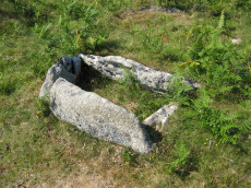
Aller Brook E. (duplicate) Cist
OS Map: SX 67813 71682
HER: MDV20166
Megalithic Portal: 45799
PMD: Aller Brook E.
ShortName: CT Aller BrkE2
Butler map: 60.11
DPD page: 90
Notes: Butler Vol. 4. Map 60.11 (diagram p.181). only the four sides of the cist remain (1.0 x 0.5m), orientated WNW. Around it are two or three flat slabs of the retaining circle but the cover stone has gone as have all traces of the mound Lethbridge diagram and photo bottom left p.90
NB. The HER entry MDV126409 is duplicated with MDV20166 - see also SiteID=444
Nearby sites: SX 67813 71682
Distance: 0.67km
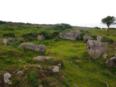
Holne Ridge N.11 Cairn Circle
OS Map: SX 66698 70020
HER: MDV61447
ShortName: CN:HolneRidg11
Butler map: 60.26.11
Notes: Ring cairn
Nearby sites: SX 66698 70020
Distance: 1.79km
Venford Reservoir E. Embanked Cairn Circle
OS Map: SX 69033 70678
HER: MDV63936
ShortName: CC:VenfordResE
Notes: HER: A ring cairn sited 6m east of the Holne to Hexworthy road and on the crest of the ridge which extends between Bench Tor and Holne Lee. The cairn consists of a low (0.2m) circular earthwork with a diameter of approximately 20m, and a central mound. Much of the circle has been effaced, possibly by road builders and a pair of tinners' pits have destroyed part of the western sector. The best preserved section is on the northern side where a low, curved bank survives with a spread of approximately 2m. The eastern side is currently occupied by a car park, delineated by a row of large, loose boulders. The section of the circle within the car park has become badly eroded and the stony cairn material is exposed. The central mound is roughly elliptical measuring 9m by 7m.
Nearby sites: SX 69033 70678
Distance: 2.17km
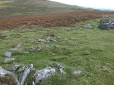
Holne Ridge N.2 stone row Cairn
OS Map: SX 66732 71089
HER: MDV61452
ShortName: CN:HolneRidg 2
Butler map: 60.26.2
Grinsell: HOL 6b
Notes: Cairn associated with stone alignment and a second cairn to the east. This cairn stands a short distance north of the alignment and survives as a 3.8 metre diameter mound standing up to 0.4 metres high.
Nearby sites: SX 66732 71089
Distance: 0.78km

Corndon Tor 1 Cairn
OS Map: SX 68588 74227
HER: MDV6387
Megalithic Portal: 22982
ShortName: CN CorndonTor
Butler map: 15.4.1
Barrow Report: 56 62
Notes: HER: Cairn on the summit of Corndon Tor, to the north of the main outcrop, comprising a large stony mound, constructed from moorstone with a truncated cone profile and no turf cover. Remains of a possible second cairn are located to the south on the outcrop.
Nearby sites: SX 68588 74227
Distance: 2.86km

Yar Tor N.E.1 Cairn
OS Map: SX 68014 74182
HER: MDV14377
ShortName: CN Yar Tor N 1
Butler map: 14.11
Grinsell: WID 19
Notes: HER: Barrow north-east of Yar Tor on Corndon Down; located at the northern end of the stone row. Within area of Dartmeet parallel reave system and later prehistoric fields / enclosures. The north cairn comprises vegetation covered mound of earth, slightly ovoid in shape, 6 metres by 6.3 metres by 1 metres high.
Nearby sites: SX 68014 74182
Distance: 2.58km

Corndon Tor 2 Cairn
OS Map: SX 68601 74158
HER: MDV16727
ShortName: CN CorndonTor2
Butler map: 15.4.2
Grinsell: WID 18
Barrow Report: 56 62
Notes: HER: On the main outcrop of Corndon Tor is a possible tor cairn (south of MDV6387). Stones piled around the base of the outcrop may be remains of cairn which has been much disturbed and is now very spread and fragmentary The cairn overlies a reave which runs up to the tor, a shelter has been built against the tor very recently using stone from the cairn. Maximum diameter 27.2m.
The Google satellite imagery shows that this feature has the clear appearance of a tor cairn.
Nearby sites: SX 68601 74158
Distance: 2.81km
Holne Lee 1 Cairn
OS Map: SX 67847 69575
HER: MDV5200
ShortName: CN:Holne Lee 1
Butler map: 58.11.1
Grinsell: HOL 9
Notes: HER: A round cairn, overall diameter 22.5 metres with a central platform, 7 metres diameter and 0.6 metres high, surrounded by a rim, 7.8 metres average width and 0.9 metres high. Butler: deformed by a saucer shaped depression in the surface now turfed over and comparatively smooth, the product of some ancient excavation.
Nearby sites: SX 67847 69575
Distance: 2.28km
Holne Lee 3 Cairn
OS Map: SX 67921 69599
HER: MDV5201
ShortName: CN:Holne Lee 3
Butler map: 58.11.3
Grinsell: HOL 11
Notes: HER: Round cairn, overall diameter 19.8m, is of similar form to A. having a central platform 8.7m diameter and 0.6m high, surrounded by a rim, 5.5m average width and 1.0m high. Gerrard: One of 5 cairns on Holne Lee situated 2 kilometres south-west of Fore Stoke. Round cairn. Diameter 21m, height 1.3m. Central pit 6m by 6m by 0.3m deep. Robbing pit is slightly east of the mound centre. Old animal burrows within the pit. Rushes in the pit, grass, gorse, bilberry and heather elsewhere.
Nearby sites: SX 67921 69599
Distance: 2.29km
Holne Lee 5 Cairn
OS Map: SX 68495 69805
HER: MDV5198
ShortName: CN:Holne Lee 5
Butler map: 58.11.5
Grinsell: HOL 16
Notes: HER: One of two cairns of probable Bronze Age date on Holne Lee. Cairn has an overall diameter of 18.5m and is constructed of small boulders and comprises a central mound, 12.8m diameter, 0.9m high, which has been extensively disturbed. It is immediately surrounded by a ring, 2.9m thick and 0.5m high resulting in a cairn of embankment bowl type.
Nearby sites: SX 68495 69805
Distance: 2.36km
Holne Lee 8 Cairn
OS Map: SX 6869 6993
HER: MDV13198
ShortName: CN:Holne Lee 8
Butler map: 58.11.8
Grinsell: HOL 18
Notes: HER: A disturbed cairn 9.0 metres in diameter lies on the northern tip of Holne Lee overlooking Venford reservoir. Now standing 0.4 metres high this feature has suffered severe disturbance to its centre.
Nearby sites: SX 6869 6993
Distance: 2.38km
Holne Lee 2 Cairn
OS Map: SX 67884 69583
HER: MDV13208
ShortName: CN:Holne Lee 2
Butler map: 58.11.2
Grinsell: HOL 10
Notes: HER: Grinsell (1978) described an additional cairn 'D' here, 10.0m. in diameter and 0.6m. high with a hollow in or near the centre. The Royal Commission Holne survey (1997) records this possible feature as 'somewhat enigmatic'; while from some aspects it resembles a cairn, it is probably the debris from a prospecting pit allied to the nearby extensive tinworking remains. Gerrard: One of 5 cairns on Holne Lee situated 2 kilometres south-west of Fore Stoke. Round cairn. Measures 9.5m by 7.8m. Central pit 4.4m by 2.9m. The mound is orientated at 340 degrees. The structure now looks like a rectangular building rather than a cairn. On balance, however, given its location it is more likely to represent a cairn. Butler: trenched and hollowed out to ground level.
Nearby sites: SX 67884 69583
Distance: 2.29km
Holne Lee 4 Cairn
OS Map: SX 67992 69641
HER: MDV5202
ShortName: CN:Holne Lee 4
Butler map: 58.11.4
Grinsell: HOL 12
Notes: HER: Oval cairn, 12 metres by 11 metres overall and 0.9 metres high with a regular central depression, 6 metres diameter and 0.9 metres deep. The surround is noticeably dipped to the east-south-east on the long axis, where it is only 0.6 metres high. The even turf cover of the stones and the regular profile suggest that this cairn has not been disturbed and maintains its original form as a hollow top cairn.
Nearby sites: SX 67992 69641
Distance: 2.27km
Holne Lee 6 Cairn
OS Map: SX 6849 6982
HER: MDV13209
ShortName: CN:Holne Lee 6
Butler map: 58.11.6
Grinsell: HOL 16a
Notes: HER: Oval cairn, 16 metres by 14 metres and 0.6 metres high. The central area (11 metres to 13 metres diameter) is very disturbed, with a small, off centre mound 0.6 metres high. The cairn has a rim 1.5 metres wide and 0.5 metres high, with a south-west facing gap, 2 metres wide. There is a single orthostat set into the rim on its east arc. Butler: Originally an outer bank seems to have surrounded a raised interior but this has become badly disordered and further damage has been caused to the edges by the well worn tracks approaching uphill from the ford across the Mardle
Nearby sites: SX 6849 6982
Distance: 2.35km
Mardle Valley 2 Cairn
OS Map: SX 6761 6922
HER: MDV5203
ShortName: CN:Mardle 2
Butler map: 58.12.2
Grinsell: HOL 13
Notes: HER quoting Gerrard: Round cairn. Diameter 8m, height 0.4m. A small trench leading in from the north-west is 1.5m long by 1m wide and 0.2m deep.
This cairn has been cleared of vegetation by the DPA in September 2025 and the author visited shortly afterwards on 02/10/2025. Of the 4 cairns cleared this one I was unable to locate with certainty but I was lacking time for a thorough search. I had probably located it but was uncertain I had correctly identified it. It maybe more obvious when the bracken has died back.
Nearby sites: SX 6761 6922
Distance: 2.57km

Mardle Valley 3 Cairn
OS Map: SX 67727 69038
HER: MDV5204
ShortName: CN Mardle 3
Butler map: 58.12.3
Grinsell: HOL 14
Notes: HER: Round cairn measures 8.5m diameter and 0.5m high. It has a rectangular trench, 2.3m by 1.6m and 0.3m deep dug into its centre.
This cairn has been cleared of vegetation by the DPA in September 2025 and the author visited shortly afterwards on 02/10/2025. Photos added and grid references updated.
Nearby sites: SX 67727 69038
Distance: 2.77km

Mardle Valley 4 Cairn
OS Map: SX 67627 68957
HER: MDV24792
ShortName: CN Mardle 4
Butler map: 58.12.4
Grinsell: HOL 15
Notes: HER quoting Gerrard: Round cairn. Diameter 9.8m, height 0.7m. A flat topped stoney mound with several hollows. A small number of edge set stones around the periphery may represent the remnants of a kerb.
This cairn has been cleared of vegetation by the DPA in September 2025 and the author visited shortly afterwards on 02/10/2025. Photos added and grid references updated.
Nearby sites: SX 67627 68957
Distance: 2.83km
Mardle Valley 5 Cairn
OS Map: SX 6779 6889
HER: MDV62034
ShortName: CN:Mardle 5
Butler map: 58.12.5
Notes: HER: Ovoid feature measuring 4.5 metres north to south by 5.2 metres and stands 1.1 metres high. An amorphous hollow roughly 1.0 metres in diameter is situated in the centre of the mound.
Visit by author 02/10/2025 to look for this site. Unable to locate cairns 5-8 due to dense vegetation cover. This site might be easier to locate when the bracken has died back more in the winter or early spring.
Nearby sites: SX 6779 6889
Distance: 2.93km
Ryders Hill Cairn
OS Map: SX 65982 69068
HER: MDV5223
ShortName: CN:Ryders Hill
Butler map: 58.13
Butler Vol 5: p.162 & Fig.101
Grinsell: HOL 8
Notes: HER: Large platform cairn, 30.5 m diameter and on average 1.0 m high is turf covered and in good condition, except for the erection of Petre's Bound Stone, a modern boundary stone, and an Ordnance Survey triangulation pillar upon it. It lies on the broad level summit of Ryder's Hill.
Nearby sites: SX 65982 69068
Distance: 2.93km
Holne Lee N. Cairn
OS Map: SX 6884 7032
HER: MDV6472
ShortName: CN:HolneLee N
Butler map: 59.1
Grinsell: HOL 7
Notes: HER: A cairn situated within the field system at SX68847032 survives as a 9.7 metre diameter flat-topped mound standing up to 0.8 metres high. A small hollow in the centre of the cairn suggests that it has been partially excavated or robbed.. Possibly visible at around 20m to the east of Butler's grid reference at SX 68864 70324 on Google satellite. This record will revert to Butler's NGR until location confirmed.
NB. record duplicated on HER as MDV129703 see SiteID=1841.
Nearby sites: SX 6884 7032
Distance: 2.21km
Venford Brook W.1 Cairn
OS Map: SX 6822 7154
HER: MDV13003
ShortName: CN:Venford W1
Butler map: 60.8.1
Notes: HER: One of four small clearance cairns within the medieval and later field system west of Venford Reservoir. The Ordnance Survey (1977) suggested these as Prehistoric cairns, but 1996 Royal Commission field survey (1996) reclassified as Medieval or later clearance mounds. It measures 4.0m in diameter and 0.4m high with a stone content, now turf and heather covered, but no particular features. It is within a reave system and 3.0m from a north to south lynchet
Nearby sites: SX 6822 7154
Distance: 1.09km
Venford Reservoir S.3 Cairn
OS Map: SX 6811 7050
HER: MDV64120
ShortName: CN:VenfordRes3
Butler map: 60.20.3
Notes: HER: Bronze Age cairn measures 6.7 metres diameter and 0.8 metres high and there is a small hollow in the centre of the mound from possible past excavation or robbing.
Nearby sites: SX 6811 7050
Distance: 1.58km
Holne Lee N. (Duplicate) Cairn
OS Map: SX 6884 7032
HER: MDV129703
ShortName: CN:HolneLeDup
Butler map: 59.1
Grinsell: HOL 7
Notes: This is record MDV129703 on the HER which is a duplicate of MDV6472 both referring to the cairn 59.1 Holne Lee N Butler grid reference SX 6884 7032. See also SiteID=1830.
Nearby sites: SX 6884 7032
Distance: 2.21km
Holne Ridge N.4 Cairn
OS Map: SX 6692 7119
HER: MDV12998
ShortName: CN:HolneRidg 4
Butler map: 60.26.4
Grinsell: HOL 1
Nearby sites: SX 6692 7119
Distance: 0.61km
Holne Ridge N.7 Cairn
OS Map: SX 6692 7104
HER: MDV6411
ShortName: CN:HolneRidg 7
Butler map: 60.26.7
Grinsell: HOL 4
Barrow Report: 24
Notes: One of eight cairns forming part of a cairn cemetery on Holne Ridge. Cairn near horn's cross. It has been excavated; there is a trench through the centre. A hole was sunk in 'calm', and contained charcoal and bones.
Nearby sites: SX 6692 7104
Distance: 0.75km
Holne Ridge N.8 Cairn
OS Map: SX 6691 7099
HER: MDV61451
ShortName: CN:HolneRidg 8
Butler map: 60.26.8
Notes: ? NMR B
Nearby sites: SX 6691 7099
Distance: 0.80km
Holne Ridge N.10 Cairn
OS Map: SX 66904 70672
HER: MDV6473
ShortName: CN:HolneRidg10
Butler map: 60.26.10
Grinsell: HOL 6
Nearby sites: SX 66904 70672
Distance: 1.11km
Yar Tor Summit (duplicate) Cairn
OS Map: SX 67868 73945
HER: MDV6434
ShortName: CN:Yar Tor Dup
Grinsell: WID 20a
Barrow Report: 56
Notes: Grinsell refers to a mention by RHW of a summit cairn built around natural rocks on Yar Tor. See: Barrow Report 56 p.81. This is clearly a duplicate of WID 20 (Yar Tor Summit Cairn). NB. This record is being retained for the sake of completeness in terms of the Grinsell listings.
Nearby sites: SX 67868 73945
Distance: 2.31km
Holne Ridge N.15 Cairn
OS Map: SX 6694 7013
HER: MDV6476
ShortName: CN:HolneRidg15
Nearby sites: SX 6694 7013
Distance: 1.63km
Holne Ridge N.16 Cairn
OS Map: SX 6681 7109
HER: MDV6506
ShortName: CN:HolneRidg16
Nearby sites: SX 6681 7109
Distance: 0.74km
O Brook 4 Cairn
OS Map: SX 6653 7136
HER: MDV12760
ShortName: CN?O Brook 4
Notes: "a cairn 2.5m diameter, 0.4m high, in moorland. About half the circumference is kerbed, and the centre incorporates a modicum of stone, now turf-covered. Either a sepulchral feature or a solitary clearance cairn."
Nearby sites: SX 6653 7136
Distance: 0.73km
Holne Ridge N.12 Cairn
OS Map: SX 66740 71078
HER: MDV12981
ShortName: CN:HolneRidg12
Nearby sites: SX 66740 71078
Distance: 0.79km
Holne Lee 9 Cairn
OS Map: SX 67767 69497
HER: MDV61446
ShortName: CN:Holne Lee 9
Notes: HER: A small stoney cairn lies on the summit of Two Barrows Hill some 60m SW of three large skyline cairns. Some small stones protrude through the turf-covered mound which measures 4.8m N to S by 4.1m. It stands a maximum of 0.3m high. There is no trace of a cist or kerb. NB. Formerly listed as Holne Lee 11 but changed to 9.
Nearby sites: SX 67767 69497
Distance: 2.34km
Holne Ridge N.13 Cairn
OS Map: SX 66990 70457
HER: MDV61448
ShortName: CN:HolneRidg13
Notes: Cairn forms part of a cairn cemetery on Holne Ridge. Diameter 7.6 metres, height 1.0 metre. Central pit 1.1 metres wide, 0.6 metres deep. At the south-east end is a large slab which may represent a stone from a displaced cist.
Nearby sites: SX 66990 70457
Distance: 1.30km
O Brook East Hut 8 Cairn
OS Map: SX 6671 7126
HER: MDV61477
ShortName: CN:O Brook 6
Butler map: 60.22.8
Notes: "cairn partly overlying a hut circle within a partially enclosed hut settlement 430m nw of horn's cross"
Nearby sites: SX 6671 7126
Distance: 0.66km
Holne Ridge N.14 Cairn
OS Map: SX 6672 7082
HER: MDV61456
ShortName: CN:HolneRidg14
Notes: Cairn built upon an earlier stone hut circle situated within an agglomerated enclosure 330m sw of horn's cross
Nearby sites: SX 6672 7082
Distance: 1.02km
Hooten Wheals Mine Cairn
OS Map: SX 65603 71063
HER: MDV103597
ShortName: CN:HootenWheal
Notes: " A robbed cairn 50m SW of the ruinous former Hooten Wheals Mine offices on the S flank of Down Ridge. The turf covered stony mound is circular with a diameter of 8.0m and stands 0.75m high. A square hollow 1.6m wide, probably the result of an unrecorded excavation, lies centrally in the mound with a spoil heap on its NW margin."
Nearby sites: SX 65603 71063
Distance: 1.69km
O Brook 2 Cairn
OS Map: SX 66418 71767
HER: MDV103602
ShortName: CN:O Brook 2
Notes: HER Ruinous cairn lies within a settlement complex containing nine hut circles and several irregular enclosures on the gentle north-east facing slope of Slade Newtake immediately south of Saddle Bridge. NB. Described as a possible bury, or pillow mound by Butler.
Nearby sites: SX 66418 71767
Distance: 0.73km
O Brook 3 Cairn
OS Map: SX 66199 71321
HER: MDV103603
ShortName: CN:O Brook 3
Notes: "A small, circular heather-covered stony mound lies on a slope above the valley of the O'Brook. The mound measures 4.4m N-S, 4,5m E-W and is approximately 0.8m high. It is probably a burial cairn, and may well be associated with the Bronze Age settlement in the immediate area"
Nearby sites: SX 66199 71321
Distance: 1.04km
Yar Tor E.1 Clearance Cairn
OS Map: SX 6815 7384
HER: MDV21514
ShortName: CN?Yar Tor E 1
Butler map: 14.11.1
Grinsell: WID 21a
Notes: HER 21514 includes two possibe cairs, maybe clearance cairns. WID 21a and WID 21b
Nearby sites: SX 6815 7384
Distance: 2.32km
Yar Tor E.2 Clearance Cairn
OS Map: SX 6815 7383
HER: MDV21514
ShortName: CN?Yar Tor E 2
Butler map: 14.11.2
Grinsell: WID 21b
Notes: HER 21514 includes two possibe cairs, maybe clearance cairns. WID 21a and WID 21b
Nearby sites: SX 6815 7383
Distance: 2.31km
O Brook 1 Cairn
OS Map: SX 66317 71481
HER: MDV103600
ShortName: CN:O Brook 1
Notes: HER: Centred SX 66327148. Three small cairns lie in open moorland on the crest of the steep valley side above the left bank of the O Brook immediately south of the current limit of cultivation.
Nearby sites: SX 66317 71481
Distance: 0.88km
Venford Brook S.2 Clearance Cairn
OS Map: SX 6764 7046
HER: MDV128837
ShortName: CN?Venford S2
Butler map: 60.8.4
Notes: HER: Two cairns or disturbed hut circles overlain by later clearance material lie at the foot of a steep north-facing slope above the right bank of the western tributary of the Venford Brook. These features have been Scheduled as cairns. The huts are largely infilled with small boulders and rocks and measure 6.5m and 5.5m in external diameter respectively. Both possess off-centre hollows roughly 0.5m deep and neither displays evidence of a former entrance. The fact that these features appear to be terraced into the slope would preclude their interpretation as burial cairns as suggested by Butler
Nearby sites: SX 6764 7046
Distance: 1.38km
Venford Reservoir S.1 Clearance Cairn
OS Map: SX 6827 7050
HER: MDV113643
ShortName: CNxVenfordRes1
Butler map: 60.20.1
Notes: Northern cairn of pair. HER: The two features depicted as prehistoric cairns by Butler are the product of medieval or later clearance. The northern feature, at SX 68277050, measures 3.0 metres in diameter and is 0.6 metres high while the southern mound measures 1.7 metres in diameter and stands 0.5 metres high. Neither possesses traces of cist or kerb and both are undisturbed. They lie in an area which has been subject to medieval or later agrarian activity which has effaced most of the prehistoric monuments in the immediate area.
Nearby sites: SX 6827 7050
Distance: 1.68km
Venford Reservoir S.2 Clearance Cairn
OS Map: SX 6826 7046
HER: MDV113643
ShortName: CNxVenfordRes2
Butler map: 60.20.2
Notes: Southern cairn of pair. HER: The two features depicted as prehistoric cairns by Butler are the product of medieval or later clearance. The northern feature, at SX 68277050, measures 3.0 metres in diameter and is 0.6 metres high while the southern mound measures 1.7 metres in diameter and stands 0.5 metres high. Neither possesses traces of cist or kerb and both are undisturbed. They lie in an area which has been subject to medieval or later agrarian activity which has effaced most of the prehistoric monuments in the immediate area.
Nearby sites: SX 6826 7046
Distance: 1.70km
Venford Reservoir Clearance Cairn
OS Map: SX 686 708
HER: MDV47780
ShortName: CNxVenfordRes
Notes: HER: Several clearance cairns observed on e and w sides of venford reservoir. Max height 0.5m, but most are less than 0.3m.(greeves)
Nearby sites: SX 686 708
Distance: 1.73km
Yar Tor (SE of) Clearance Cairn
OS Map: SX 6815 7381
HER: MDV21514
ShortName: CN?Yar Tor SE
Grinsell: WID 21c
Nearby sites: SX 6815 7381
Distance: 2.29km
Venford 2 Clearance Cairn
OS Map: SX 6794 7100
HER: MDV12987
ShortName: CN:Venford 2
Notes: HER: Several small clearance cairns lie on the moderate SE facing slope W of Venford reservoir. There is no evidence to suggest that these features which lie in an area of intensive medieval and later cultivation are prehistoric in origin.
Nearby sites: SX 6794 7100
Distance: 1.09km
Venford 3 Clearance Cairn
OS Map: SX 6797 7101
HER: MDV12988
ShortName: CN:Venford 3
Notes: HER: Several small clearance cairns lie on the moderate SE facing slope W of Venford reservoir. There is no evidence to suggest that these features which lie in an area of intensive medieval and later cultivation are prehistoric in origin.
Nearby sites: SX 6797 7101
Distance: 1.10km
Venford 4 Clearance Cairn
OS Map: SX 6820 7117
HER: MDV13000
ShortName: CN:Venford 4
Notes: HER: One of a group of three cairns on Holne Moor. The Ordnance Survey (1977) suggested these as Prehistoric cairns, but 1996 Royal Commission field survey (1996) reclassified as Medieval or later clearance mounds. This feature is turf covered and measures 2.7m diameter and 0.3m high, and is constructed of small boulders.
Nearby sites: SX 6820 7117
Distance: 1.20km
Venford 5 Clearance Cairn
OS Map: SX 6820 7116
HER: MDV13001
ShortName: CN:Venford 5
Notes: HER: One of a group of three cairns on Holne Moor. The Ordnance Survey (1977) suggested these as Prehistoric cairns, but 1996 Royal Commission field survey (1996) reclassified as Medieval or later clearance mounds. This feature measures 2.8m diameter and 0.6m high and is linked with MDV13002 by a slight scarp.
Nearby sites: SX 6820 7116
Distance: 1.20km
Venford 6 Clearance Cairn
OS Map: SX 6819 7116
HER: MDV13002
ShortName: CN:Venford 6
Notes: HER: One of a group of three cairns on Holne Moor. The Ordnance Survey (1977) suggested these as Prehistoric cairns, but 1996 Royal Commission field survey (1996) reclassified as Medieval or later clearance mounds. This feature measures 2.4m diameter and 0.3m high and partly turf covered.
Nearby sites: SX 6819 7116
Distance: 1.20km
Down Ridge Clearance Cairn
OS Map: SX 65775 71734
HER: MDV103601
ShortName: CN?DownRidg 2
Notes: "A low circular turf covered mound measuring 5.0 metres in diameter and standing to a maximum of 0.6 metres high. There is no evidence to suggest the presence of a kerb or cist. Its definite interpretation as a cairn is marred by some small scale tinners diggings immediately to the NW and its unusual position on the slope."
Nearby sites: SX 65775 71734
Distance: 1.38km
Sherberton Common Stone Row Reported Cist
OS Map: SX 691 732
HER: MDV6426
PMD: Sherberton Common Stone Row
ShortName: CT?SherberCom
Butler map: 11.6
Grinsell: WID 22
Notes: NGR taken from NMR. Grinsell gives location SX 691739. Destroyed by 1897 but see entry for the stone row which is in fact a passageway to a round house.
Nearby sites: SX 691 732
Distance: 2.43km
Hexworthy (near) Reported Cist
OS Map: SX 655 725
HER: MDV13004
PMD: Hexworthy
ShortName: CT?Hexworthy
Grinsell: LYD 109
Notes: Destroyed for road building, report by Burnard
Nearby sites: SX 655 725
Distance: 1.81km
Yartor Down S.E. (site of) Reported Cist
OS Map: SX 6828 7329
HER: MDV6422
PMD: Ollsbrim
ShortName: CT?YartorDown
Notes: A cist was alleged at this location but there is no ground evidence to substantiate this. (Worth 1948)
Nearby sites: SX 6828 7329
Distance: 1.91km
Venford Reported Cist
OS Map: SX 68432 70973
HER: MDV47779
PMD: Venford
ShortName: CT?Venford 1
Notes: Radcliffe: "TAPG report while reservoir low. Walls, clearance cairn and cairn, with flint flakes. Cairn 4m dia with possible cist slab 1m by 0.5m by 0.2m. Probably at 6843 7097, found 29/9/03."
Nearby sites: SX 68432 70973
Distance: 1.50km
Yar Tor S. Reported Cairn
OS Map: SX 6795 7358
HER: MDV16724
ShortName: CNxYar Tor S
Butler map: 14.9
Notes: Butler refers to this as a hut circle but lists as a cairn. It is clearly a hut circle. HER 16724
Nearby sites: SX 6795 7358
Distance: 2.00km
Corndon Tor S. Reported Cairn
OS Map: SX 6847 7393
ShortName: CN?CorndonTorS
Butler map: 15.4.3
Notes: Crossing mentions this cairn. Not traceable.
Nearby sites: SX 6847 7393
Distance: 2.55km
Bench Tor S. Reported Cairn
OS Map: SX 6916 7140
HER: MDV130253
ShortName: CN?Bench Tor
Butler map: 59.2
Notes: Butler: in the field system "a small mound near the north end was probably a cairn".
Nearby sites: SX 6916 7140
Distance: 2.04km
Venford Brook W.2 Reported Cairn
OS Map: SX 6813 7146
HER: MDV130254
ShortName: CNxVenford W2
Butler map: 60.8.2
Notes: HER: Four clearance cairns of medieval or later date, one previously recorded as SX 67 SE 113, lie on the crest of the ridge overlooking the W side of Venford Reservoir. All these features have diameters of around 2.5m and remain up to 0.8m high. They lie within an area of the former Dartmeet parallel reave system (SX 67 SE 95) which was heavily disturbed by agrarian activity in the historic period. There is no evidence in the form of cists or kerbs to suggest that these were once prehistoric sepulchral monuments.
Nearby sites: SX 6813 7146
Distance: 1.02km
Venford Brook S.1 Reported Cairn
OS Map: SX 6763 7047
HER: MDV128837
ShortName: CN?Venford S1
Butler map: 60.8.3
Notes: HER: Two cairns or disturbed hut circles overlain by later clearance material lie at the foot of a steep north-facing slope above the right bank of the western tributary of the Venford Brook. These features have been Scheduled as cairns. The huts are largely infilled with small boulders and rocks and measure 6.5m and 5.5m in external diameter respectively. Both possess off-centre hollows roughly 0.5m deep and neither displays evidence of a former entrance. The fact that these features appear to be terraced into the slope would preclude their interpretation as burial cairns as suggested by Butler
Nearby sites: SX 6763 7047
Distance: 1.37km
Holne Ridge N.1 Reported Cairn
OS Map: SX 6700 7175
HER: MDV6445
ShortName: CN?HolneRidg 1
Butler map: 60.26.1
Grinsell: HOL 6a
Barrow Report: 24
Notes: Possibly destroyed. Butler: Holne Ridge N. '1' at SX67007175 was a fine cairn until 1878 when Crossing witnessed it 'gradually disappear under the hammer of the stone breaker'. Its remains are a disorganised rim of stone and earth which lie close to one of the parallel reaves about 25 metres from the road opposite the car park
See also SiteID=4033 which also references the Butler entry but the NGR is around 300 metres away?
Nearby sites: SX 6700 7175
Distance: 0.15km
Holne Ridge Reported Cairn
OS Map: SX 66 69
HER: MDV5251
ShortName: CN:HolneRidge
Notes: HER: Holne Ridge, tumulus indicated by Ordnance Survey, while making the 6 inch map. NB. This description is so vague as to be of no use. For this reason this record is being marked as a duplicate to exclude it from most listings. It is only included for completeness of HER records.
Nearby sites: SX 66 69
Distance: 2.98km
O Brook 5 Reported Cairn
OS Map: SX 665 719
HER: MDV6410
ShortName: CN?O Brook 5
Notes: 1902 (burnard) holne moor above saddle bridge; two cairns destroyed.
Nearby sites: SX 665 719
Distance: 0.67km
Huccaby Newtake Reported Cairn
OS Map: SX 6563 7421
HER: MDV25457
ShortName: CN?Huccaby New
Nearby sites: SX 6563 7421
Distance: 2.89km

Yar Tor S.W. Reported Cairn
OS Map: SX 67584 73729
HER: MDV26338
ShortName: CN?Yar Tor SW
Nearby sites: SX 67584 73729
Distance: 2.03km
Holne Ridge N.17 Reported Cairn
OS Map: SX 66559 70716
HER: MDV103596
ShortName: CN?HolneRidg17
Notes: A cluster of five small cairns on the slope above the left bank of Yonder Dry Lake. With one exception the cairns are all slightly ovoid with diameters in the range 3.5 metres to 7.0 metres and stand an average of 0.7m high. The two northernmost cairns have been heavily disturbed. None of these features display evidence of cists or kerbs.
Nearby sites: SX 66559 70716
Distance: 1.19km
Holne Moor Reported Cairn
OS Map: SX 6799 7145
HER: MDV6446
ShortName: CN?Holne Moo1
Grinsell: HOL 19
Notes: Grinsell: A possible cairn with a hollow centre found at SX 6798 7140. Diameter 4.0 metres, height 0.1 metre. HER quoting OS division (1980): It is uncertain what Grinsell (1978) is referring to. At SX 6798 7140 there is an earthen ring 1.2 metres wide and 0.1 metres high, enclosing an area 2.4 metres in diameter with a military 'foxhole' trench in the northern half and traces of an infilled one on the south (See ground photograph). These occupy virtually the whole of the interior.
Nearby sites: SX 6799 7145
Distance: 0.89km

Yar Tor N.E.2 Reported Cairn
OS Map: SX 6817 7414
HER: MDV6458
ShortName: CNxYar Tor N 2
Grinsell: WID 25
Notes: The remains of a despoiled hut circle on the saddle of ground between Yar Tor and Corndon Tor. Grinsell: possibly a cairn despoiled for material for the road to E; shown on 6 inch OS sheet as hut circle
Nearby sites: SX 6817 7414
Distance: 2.60km
Yar Tor Tor Enclosure
OS Map: SX 67849 74046
HER: MDV128748
ShortName: EN Yar Tor
Butler map: 14.8
Notes: HER quoting Newman: A Tor enclosure of uncertain date on the northern outcrop of Yar Tor. This enclosure is situated in a natural avenue between two outcrops with vertical faces on the north and south sides which has been blocked off at the western and eastern ends by artificial stone walls.
Nearby sites: SX 67849 74046
Distance: 2.40km
Aller Brook E Cist
OS Map: SX 67813 71682
HER: MDV126409
Megalithic Portal: 45799
PMD: Aller Brook E.
Alternate name: Aller Brook E. Cist
ShortName: CT Aller Brk E
Butler map: 60.11
DPD page: 90
Notes: Butler Vol. 4. Map 60.11 (diagram p.181). only the four sides of the cist remain (1.0 x 0.5m), orientated WNW. Around it are two or three flat slabs of the retaining circle but the cover stone has gone as have all traces of the mound Lethbridge diagram and photo bottom left p.90.
NB. The HER entry MDV126409 is duplicated with MDV20166 - see also SiteID=1842
Nearby sites: SX 67813 71682
Distance: 0.67km
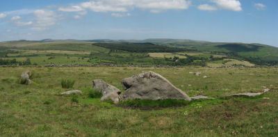
Down Ridge Stone Circle
OS Map: SX 65516 72084
HER: MDV6400
Megalithic Portal: 863
PMD: Down Ridge Stone Circle
ShortName: SC DownRidge
DPD page: 92
Turner: G9
Notes: Also known as Hexworthy Circle. "situated on a gentle north facing slope overlooking the valley of the River Dart. The stone circle measures 25 meters in diameter and is denoted by five upright granite slabs, standing up to 1.45 meters high, which are confined to its south western sector. A further six recumbent stones lie where they have fallen. The stone circle was partially excavated in 1904 by the Dartmoor Exploration Committee and their work revealed the original ground surface covered with charcoal. An associated outlying standing stone is located 85 meters south-east of the stone circle and survives as a triangular shaped block up to 0.86 meters high." [HER MDV6400]. For photos of this site, see: Megalithic Portal: Down Ridge - Stone Circle
Nearby sites: SX 65516 72084
Distance: 1.67km
Holne Lee Stone Ring Cairn Circle
OS Map: SX 68656 69919
HER: MDV5199
Megalithic Portal: 45836
Alternate name: Holne Lee 7 Stone Ring Cairn Circle
ShortName: RC Holne Lee 7
Butler map: 58.11.7
Grinsell: HOL 17
Turner: A32
Notes: HER: One of two cairns of probable Bronze Age date on Holne Lee. Cairn is 21 metres in diameter and is constructed of small boulders, and consists of a platform 14 metres diameter and about 0.2m high, with a perimeter rim average thickness 3.5m and 0.5m high. There is a gap, 4.3m wide, facing north north-east.
Nearby sites: SX 68656 69919
Distance: 2.37km
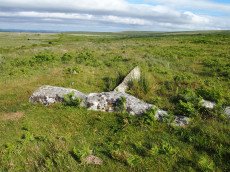
Holne Moor Stone Row
OS Map: SX 67431 71042
HER: MDV12983
Megalithic Portal: 1981
The Stone Rows of GB: Holne Moor
PMD: Holne Moor Stone Row
ShortName: SR Holne Moor
Butler map: 60.25
DPD page: 90
Notes: "A standing stone and triple stone row lying in a secluded position, across the head of a shallow, north facing valley. It measures 147 metres long with rows on average 1.5 m apart. The stones, fifty three of which were located, have a maximum height of 0.2 m and are spaced about 1.1 m apart, each opposite the stone of the adjacent row. There is also a possible former standing stone which is now recumbent." See also MDV129985
Nearby sites: SX 67431 71042
Distance: 0.76km
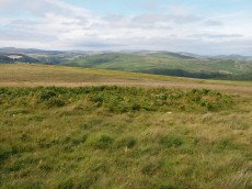
Holne Moor Stone Ring Cairn Circle
OS Map: SX 66919 70785
HER: MDV6474
Megalithic Portal: 27342
Alternate name: Holne Ridge N.9 Stone Ring Cairn Circle
ShortName: RC HolneRidg 9
Butler map: 60.26.9
Grinsell: HOL 5
Turner: A12
Notes: "One of four cairns 310 metres south of Horn's Cross forming part of a cairn cemetery on Holne Ridge. Ring cairn measuring 19.9 metres in diameter, height 0.9 metres. Has a 4 metre wide bank standing up to 0.9 metres high surrounding an 11.9 metre diameter internal area. A stone on the inner face of the east side of the cairn has been cut by tear and feather."
Nearby sites: SX 66919 70785
Distance: 0.99km
Holne Moor (N) Stone Ring Cairn Circle
OS Map: SX 6809 7162
HER: MDV26266
Megalithic Portal: 45830
ShortName: RC:HolneMoor N
Turner: A16
Notes: "Possible cairn in corner of a field." "Stone ring 9.5m diam internally, with bank 1.2m wide and 0.4m high. Joined on w side by reave (turner)." No NMR record.
Nearby sites: SX 6809 7162
Distance: 0.95km
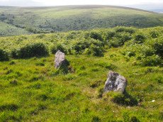
Holne Ridge Stone Row
OS Map: SX 66741 71080
HER: MDV61453
Megalithic Portal: 27341
The Stone Rows of GB: Holne Ridge
PMD: Holne Ridge Stone Row
Alternate name: Holne Ridge North Stone Row
ShortName: SR Holne Ridge
Butler map: 60.26
DPD page: 90
Notes: "One or two cairns and a short probably unfinished stone row lie in the north west facing hollow above Horse Ford on the O Brook. The cairn described by Authority 2 lies at the south end of the site with the surviving stones of the stone row to the north. As so few stones survive the exact form and extent of the rows is impossible to determine but there may have been as many as three parallel rows approximately 1.0 metre apart. Overlying or abutting the east row at SX 6672 7109 is a low turf covered mound 3.0 metes in diameter and 0.4 metres high. It is not clear whether this feature forms part of the monument or if it is associated with the shallow turf cuttings to the east."
Nearby sites: SX 66741 71080
Distance: 0.78km
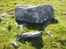
Holne Ridge N. Cist
OS Map: SX 66641 71138
HER: MDV12997
Megalithic Portal: 45800
PMD: Holne Ridge N.
Alternate name: Holne Ridge N.3 Cist
ShortName: CT HolneRidg 3
Butler map: 60.26.3
DPD page: 91
Notes: Butler Cist 3 Vol. 4. Map 60.26 (diagram p.195). "A probable but unusual cist is on steep well drained, NW facing slope. It utilizes the south east side of a massive slab, 1.6m long, 0.4m thick and 0.7m high, with smaller slabs 0.6m to 0.9m long and 0.2m thick, which barely project above ground level". NW of of Holne Ridge stone row. Lethbridge p.90-91, diagram p.90, photo bottom p.91
Nearby sites: SX 66641 71138
Distance: 0.80km
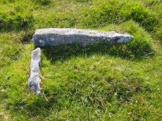
Holne Ridge N. (nr Stone Row) Reported Cist
OS Map: SX 66732 71089
Megalithic Portal: 45800
ShortName: CT HolneRidgSR
DPD page: 91
Notes: Located near to cairn heading fragmentary remains of Holne Ridge stone row. Lethbridge photo top of p.90-91, diagram p.90. Not listed in the HER or by Butler. Whilst this certainly looks like a genuine cist as can be seen in the photo it is almost certainly fallen stones from the stone row that are loose on the ground and happen to be arranged to give the appearance of a cist.
Nearby sites: SX 66732 71089
Distance: 0.78km
Horns Cross Stone Ring Cairn Circle
OS Map: SX 66921 71125
HER: MDV6475
Megalithic Portal: 27342
Alternate name: Holne Ridge N.6 Stone Ring Cairn Circle
ShortName: RC:HolneRidg 6
Butler map: 60.26.6
DPD page: 90
Grinsell: HOL 3
Turner: A35
Notes: "Remains of cairn; one of eight cairns forming part of a cairn cemetery on Holne Ridge. Truncated cairn, or ring cairn, gap in north-east. Diameter 14 metres, height 0.3 metres."
Nearby sites: SX 66921 71125
Distance: 0.67km
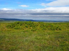
Horns Cross N. Cairn
OS Map: SX 66941 71187
HER: MDV26276
Megalithic Portal: 27342
Alternate name: Holne Ridge N.5 Cairn
ShortName: CN HolneRidg 5
Butler map: 60.26.5
Grinsell: HOL 2
Notes: "A turf and bracken covered Bronze Age cairn forming part of a cairn cemetery on Holne Ridge. The mound measures 14 metres by 14.4 metres in diameter and standing to a height of 1.4 metres. " Butler cairn 5 map 60.15. UPDATE 03/01/2023 This record formerly linked with MDV12975 which has been deleted.
It is unclear but this record now realte to MDV26276 which is a "tin-working spoil dump".
Nearby sites: SX 66941 71187
Distance: 0.60km
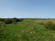
Huccaby Rings Inner Enclosed Settlement
OS Map: SX 6582 7381
HER: MDV6405
Megalithic Portal: 4616
ShortName: ES HuccabyInn
Notes: "Huccaby Ring a circular banked enclosure south-east of Huccaby Tor; smaller than Outer Huccaby Ring that lies to the north-west of the Tor. A Bronze Age enclosure visible as a turf covered stoney bank measuring 3.5 metres wide and stading to a maximum height of 0.7 metres. There is no obvious sign of an entrance."
Nearby sites: SX 6582 7381
Distance: 2.45km
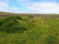
Mardle Embanked Cairn Circle
OS Map: SX 67526 69359
HER: MDV5308
Megalithic Portal: 3374
Alternate name: Mardle Valley 1 Embanked Cairn Circle
ShortName: CC Mardle 1
Butler map: 58.12.1
Turner: B11
Notes: Turner: Embanked stone circle; an annular bank of earth and/or stone with an inner edge of orthostats. Much disturbed. Internal diam 6.5m with bank 1.2m wide and 0.4m high. This cairn has a very interesting structure appearing to be multiple circles of stones similar to the cairns at Corringdon Ball. This structure is difficult to capture in a photograph as the stones are small and the site much disturbed.
Nearby sites: SX 67526 69359
Distance: 2.42km
Sherberton Common Reported Stone Row
OS Map: SX 69148 73346
HER: MDV6426
The Stone Rows of GB: Sherberton Common
PMD: Sherberton Common
ShortName: SR:SherberCom
Butler map: 11.6
Butler Vol 5: p.214
Notes: Sandy Gerrard (see link to SRGB): According R.N. Worth this is a double stone row that measured 68.6m long situated on a gently sloping south facing slope. According to him the row was destroyed in 1897 shortly after its discovery. The rows were described as being between 8 and 9 feet apart and included some contiguous stones. Jeremy Butler suggested that it was a passage similar to one surviving at Fernworthy Reservoir but he was unable to identify the site of the feature described by Worth (Butler, J., 1997, 214). Fresh fieldwork has identified the structure, which survives comparatively well and is clearly a passageway leading to a robbed roundhouse from a length of prehistoric rubble walling. The structure has only been partly robbed and several stones remain together with the original 1897 stone robbing pits.
Nearby sites: SX 69148 73346
Distance: 2.56km
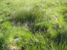
Skir Hill (Henroost) Ring Setting Cairn and Cist
OS Map: SX 65104 70686
HER: MDV6507
Megalithic Portal: 45676
PMD: Skir Hill
Alternate name: Skir Hill Ring Setting Cairn and Cist
ShortName: CT Skir Hill
Butler map: 61.8
DPD page: 92
Grinsell: LYD 102
Turner: D18
Barrow Report: 24 56
Notes: DM reports it is actually located at SX 65092 70684. The author has found this site at SX 65104 70691 on 28/06/18 assisted by the grid reference given by Dave Martin (DM). "A Bronze Age cairn containing a cist located on the north east facing slope of Skir Hill 590 metres south of Skir Ford. The cairn survives as a 4.1 diameter ring of edge set slabs up to 0.5 metres high. The cist is situated slightly west of the cairns centre and survives as a 0.82 metres long by 0.52 metres wide and 0.82 metres deep stone lined pit." Formerly listed as being at SX 6517 7075 (as per literature). Butler Vol. 4. Map 61.8 (diagram p.203).
Nearby sites: SX 65104 70686
Distance: 2.31km
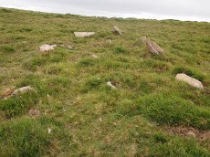
Yar Tor Stone Row
OS Map: SX 68177 73857
HER: MDV6459
Megalithic Portal: 2199
The Stone Rows of GB: Yar Tor
PMD: Yar Tor Stone Row
ShortName: SR Yar Tor
Butler map: 14.11
DPD page: 122
Barrow Report: 56
Notes: "The remains of a probable triple stone row with a cairn and cist at its south end and a barrow at its north. The row comprises stones set 2m apart and standing to a height of 0.3m. Some are concealed beneath the turf. The cairn measures 11m in diameter and 0.3m high with a central cist surrounded by a kerb. The barrow is 6m in diameter and 1m high".
Nearby sites: SX 68177 73857
Distance: 2.34km

Yar Tor (Money Pit) Platform Cairn Circle and Cist
OS Map: SX 68181 73865
HER: MDV6460
Megalithic Portal: 1369
PMD: Money Pit
Alternate name: Money Pit Platform Cairn Circle and Cist
ShortName: CT Money Pit
Butler map: 14.11
Butler Vol 5: p.23 & Fig.4
DPD page: 122
Grinsell: WID 21
Turner: E51
Barrow Report: 56 62
Notes: "The south cairn is a very spread and slight earthwork with a centrally placed cist. Only the north and west side slabs of the cist remain in situ though a misplaced slab lies to one side of the chamber. Eleven slabs forming a kerb of approximately 3m surrounding the cist remain in situ. Several additional stones survive, protruding just above the surface of the flattened cairn, which are likely to be evidence of an outer circle with a diameter of approximately 11m". Lethbridge diagram p.122 and photo bottom p.122. Butler Money Pit - Vol. 1. Map 14.11 (photo on p.92, diagram pp.125-6).
Nearby sites: SX 68181 73865
Distance: 2.35km
Yar Tor Prehistoric Homestead Round House
OS Map: SX 674 734
HER: MDV26473
Megalithic Portal: 22983
ShortName: HC:YarTor
Notes: HER: Two incomplete conjoined enclosures on the south-west slope of Yar Tor, near Dartmeet, of probable Medieval date.
Nearby sites: SX 674 734
Distance: 1.67km

Yar Tor Summit Cairn
OS Map: SX 67865 73943
HER: MDV6434
Megalithic Portal: 11065
Alternate name: Yar Tor summit Cairn
ShortName: CN Yar Tor Sum
Butler map: 14.8
Grinsell: WID 20
Barrow Report: 56
Notes: "Large cairn (approximately 18.0 metres) built on the summit of Yar Tor; the stones have been rearranged to form a shelter. This cairn is aligned with a reave; part of the Dartmeet parallel reave system."
Nearby sites: SX 67865 73943
Distance: 2.31km