
Holne Ridge N. Cist
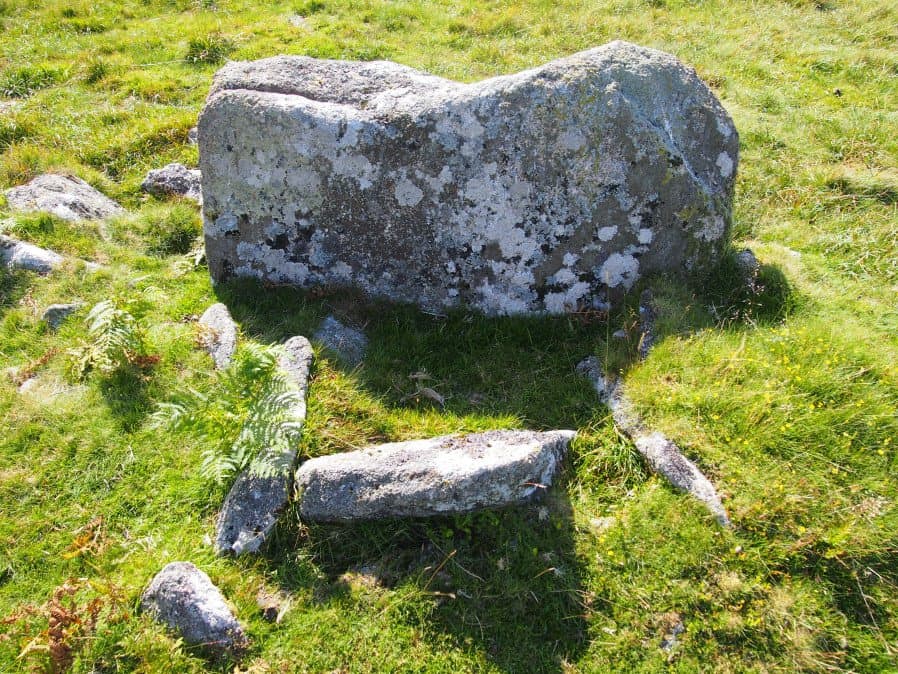
Photo taken on 15-07-2016
Database entries
OS Map: SX 66641 71138
OS Source: Garmin
Butler OS: SX66637112
HER: MDV12997
Megalithic Portal: 45800
PMD: Holne Ridge N.
Alternate name: Holne Ridge N.3
Short Name: CT HolneRidg 3
Butler map: 60.26.3
Dixon Cist #: 145
DPD page: 91
Exist: Yes
Record: Unique
Record Source: Butler
Hut Class: No
Cist Class: Yes
Cairn Class: Yes
Dimensions (m): 1.6 x 0.9 C
Lidar: SX 66641 71138
Guide Map: 40
Nearest Bus Stop: Postbridge Bellever (8.2 km) [Route: 98]
Nearby sites: SX 66641 71138
Notes
Butler Cist 3 Vol. 4. Map 60.26 (diagram p.195). "A probable but unusual cist is on steep well drained, NW facing slope. It utilizes the south east side of a massive slab, 1.6m long, 0.4m thick and 0.7m high, with smaller slabs 0.6m to 0.9m long and 0.2m thick, which barely project above ground level". NW of of Holne Ridge stone row. Lethbridge p.90-91, diagram p.90, photo bottom p.91References
These are selected references with an emphasis on out of copyright sources linked as PDFs. For more detailed references try any linked HER or PMD record above.
- Butler, Jeremy, Dartmoor Atlas of Antiquities, vol.4: The South-East, (1993)
- Lethbridge, William D., Discover Preshistoric Dartmoor, (2015)