
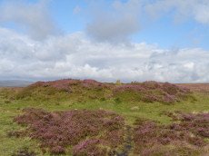
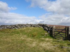
Prehistoric sites within 3km of SX 70400 79600
Guidance for walkers: The monuments featured in this database are archaeological treasures and need to be protected and preserved - please do not disturb any sites. Please check access and firing times before visiting sites, not all sites listed are on open access land. Firing ranges and boundaries of open access areas are marked on the OL28 OS Dartmoor Explorer map. Please stick to the country code and consider giving support to the numerous agencies that help to keep Dartmoor a fabulous natural and historic environment!
About the database listings: In all listings clicking on the photo or the site name will open a page for the site with a larger photo and further details from the database. The database now has over 6680 records covering nearly all publicly listed sites on Dartmoor including around 4800 round houses. This level of detail is of interest to archaeologists but tends to swamp listings of sites more likely to be of interest for walkers. For this reason, the listings default to around 550 core sites only. These are the stone circles, stone rows and the ring cairns listed by Turner. The default search radius is 2 km. The controls below the map can be used to start a new search by entering a 6- or 8-digit reference (without the prefix "SX"). The search radius can be specified and you can add incremental Display layers of detail on top of the core sites. If using a more detailed layer you will need to decrease the search radius to avoid getting hundreds of search results.
- Core sites Default listing of core sites consisting of stone circles & rows and some of the major ring cairns.
- Plus cairns adds approx. 1000 cairns and other minor sites not included in the core listings but excluding round houses.
- Plus round houses adds approx. 4800 round houses.
- Plus non-sites adds in the records for sites that no longer exist or are not prehistoric sites.
- Plus duplicates adds records excluded as duplicates. Those maybe duplicate records in external listings (e.g. the Historic Environment Records). For example, some sites have been identified as cairns in some listings and interpreted as round houses in other listings and both records appear.
These listings have incorporated, matched up and merged all of the records from all of the major archaeological listings including: Worth, Grinsell, Turner, Butler, Bill Radcliffe, Sandy Gerrard, Megalithic Portal, the National Monument Records and the Historic Environment Records. The author would like to thank Bill, Sandy, the lovely people both at Megalithic Portal (especially Anne Tate who did an amazing job to link listings) and at ACE Archaeology for collaborative work over the years to synchronise and correct listings across the various websites which now interlink. A culmination of years of work the final merger of cairn records took 3 months of cross referencing in 2017 the result being a snapshot of the records at that time. This data has in turn been refined since by field work and research. The round house data was supplied by Sandy Gerrard. Grid references are in order of accuracy: from Google Earth satellite, if visible and found, from a Garmin GPS reading, if visited by the author and from the literature otherwise. Individual site pages will state the source of the grid reference and provide satellite imagery. If a site listing lacks a photo it has not yet been visited by the author in which case the grid reference is from the literature.
Currently the database only includes sites which can be represented by a grid reference. Reaves are not included as they require GIS shape technology which is beyond the current capability of this system. To see the sources for the records, look at the tables on the resources menu. The database listings can also be viewed on a Google map and downloaded as GPS datasets for Garmin devices.
Corrections, or any feedback or suggestions are very welcome, email: info@dartmoorwalks.org.uk.
NOTE: Clicking on the icons for each monument in the map will give the name of the site. You can zoom in and out and drag the map around.
List of sites within 3km of SX 70400 79600
Hookney Tor NW Round House
OS Map: SX 69762 81404
HER: MDV103609
ShortName: HT:Hookney T1
Nearby sites: SX 69762 81404
Distance: 1.91km
Hookney Tor NW Round House
OS Map: SX 69758 81401
HER: MDV103609
ShortName: HT:Hookney T2
Nearby sites: SX 69758 81401
Distance: 1.91km
Vogwell Round House
OS Map: SX 72292 81494
HER: MDV27871
ShortName: HT:Vogwell 1
Nearby sites: SX 72292 81494
Distance: 2.68km
Chinkwell Tor Cairn
OS Map: SX 7293 7825
HER: MDV20168
ShortName: CN:Chinkwell1
Butler map: 7.3
Grinsell: WID 10
Turner: A63
Nearby sites: SX 7293 7825
Distance: 2.87km
Hookney Tor S Round House
OS Map: SX 69930 81144
HER: MDV6604
ShortName: HT:Hookney T3
Nearby sites: SX 69930 81144
Distance: 1.61km
Vogwell Down Round House
OS Map: SX 7222 8138
HER: MDV8719
ShortName: HT:Vogwell D1
Nearby sites: SX 7222 8138
Distance: 2.55km
Hookney Tor S Round House
OS Map: SX 69929 81150
HER: MDV6604
ShortName: HT:Hookney T4
Nearby sites: SX 69929 81150
Distance: 1.62km
Vogwell Down Round House
OS Map: SX 7220 8136
HER: MDV8718
ShortName: HT:Vogwell D2
Nearby sites: SX 7220 8136
Distance: 2.52km
Hookney Tor S Round House
OS Map: SX 69938 81145
HER: MDV6604
ShortName: HT:Hookney T5
Nearby sites: SX 69938 81145
Distance: 1.61km
Vogwell Down Round House
OS Map: SX 7219 8134
HER: MDV8720
ShortName: HT:Vogwell D3
Nearby sites: SX 7219 8134
Distance: 2.50km
Heatree Down Round House
OS Map: SX 72230 80712
HER: MDV8721
ShortName: HT:Heatree D1
Nearby sites: SX 72230 80712
Distance: 2.14km
Heatree Down Round House
OS Map: SX 72244 80708
HER: MDV8721
ShortName: HT:Heatree D2
Nearby sites: SX 72244 80708
Distance: 2.15km
Heatree Down Round House
OS Map: SX 72227 80741
HER: MDV8721
ShortName: HT:Heatree D3
Nearby sites: SX 72227 80741
Distance: 2.15km
Heatree Down Round House
OS Map: SX 72220 80788
HER: MDV8721
ShortName: HT:Heatree D4
Nearby sites: SX 72220 80788
Distance: 2.17km
Heatree Down Round House
OS Map: SX 72214 80552
HER: MDV55528
ShortName: HT:Heatree D5
Nearby sites: SX 72214 80552
Distance: 2.05km
Heatree Down Round House
OS Map: SX 7222 8057
HER: MDV55529
ShortName: HT:Heatree D6
Nearby sites: SX 7222 8057
Distance: 2.06km
Heatree Down Round House
OS Map: SX 72214 80770
HER: MDV8721
ShortName: HT:Heatree D7
Nearby sites: SX 72214 80770
Distance: 2.16km
Heatree Down Round House
OS Map: SX 72212 80699
HER: MDV8721
ShortName: HT:Heatree D8
Nearby sites: SX 72212 80699
Distance: 2.12km
Heatree Down Round House
OS Map: SX 72202 80600
HER: MDV55531
ShortName: HT:Heatree D9
Nearby sites: SX 72202 80600
Distance: 2.06km
Heatree Down Round House
OS Map: SX 72236 80585
HER: MDV55530
ShortName: HT:Heatree D10
Nearby sites: SX 72236 80585
Distance: 2.08km
Heatree Down Round House
OS Map: SX 72201 80738
HER: MDV8721
ShortName: HT:Heatree D11
Nearby sites: SX 72201 80738
Distance: 2.13km
Heatree Down Round House
OS Map: SX 72244 80727
HER: MDV8721
ShortName: HT:Heatree D12
Nearby sites: SX 72244 80727
Distance: 2.16km
Heatree Down Round House
OS Map: SX 72226 80691
HER: MDV8721
ShortName: HT:Heatree D13
Nearby sites: SX 72226 80691
Distance: 2.13km
Hedge Down Round House
OS Map: SX 73109 78576
HER: MDV7518
ShortName: HT:Hedge Dow1
Nearby sites: SX 73109 78576
Distance: 2.90km
Hedge Down Round House
OS Map: SX 73087 78554
HER: MDV7517
ShortName: HT:Hedge Dow2
Nearby sites: SX 73087 78554
Distance: 2.88km
Berry Pound Round House
OS Map: SX 7152 8017
HER: MDV26661
ShortName: HT:Berry Pou1
Nearby sites: SX 7152 8017
Distance: 1.26km
Dunstone Down Round House
OS Map: SX 7062 7728
HER: MDV26861
ShortName: HT:Dunstone 2
Nearby sites: SX 7062 7728
Distance: 2.33km
Hill W of Grendon Farm Cairn Circle
OS Map: SX 6805 7835
HER: MDV6008
ShortName: CN:Hill W of1
Grinsell: WID 1a
Notes: The remains of a ring cairn are visible as overgrown small stones.
Nearby sites: SX 6805 7835
Distance: 2.66km
Grimspound Round House
OS Map: SX 70075 80928
HER: MDV43898
ShortName: HT:Grimspoun1
Nearby sites: SX 70075 80928
Distance: 1.37km
Grimspound Round House
OS Map: SX 70121 80881
HER: MDV43911
ShortName: HT:Grimspoun2
Nearby sites: SX 70121 80881
Distance: 1.31km
Grimspound Round House
OS Map: SX 70112 80868
HER: MDV43909
ShortName: HT:Grimspoun3
Nearby sites: SX 70112 80868
Distance: 1.30km
Grimspound Round House
OS Map: SX 70065 80833
HER: MDV43903
ShortName: HT:Grimspoun4
Nearby sites: SX 70065 80833
Distance: 1.28km
Grimspound Round House
OS Map: SX 70077 80884
HER: MDV43899
ShortName: HT:Grimspoun5
Nearby sites: SX 70077 80884
Distance: 1.32km
Grimspound Round House
OS Map: SX 70112 80873
HER: MDV43910
ShortName: HT:Grimspoun6
Nearby sites: SX 70112 80873
Distance: 1.31km
Grimspound Round House
OS Map: SX 70098 80862
HER: MDV43906
ShortName: HT:Grimspoun7
Nearby sites: SX 70098 80862
Distance: 1.30km
Grimspound Round House
OS Map: SX 70044 80870
HER: MDV43914
ShortName: HT:Grimspoun8
Nearby sites: SX 70044 80870
Distance: 1.32km
Grimspound Round House
OS Map: SX 70042 80904
HER: MDV43917
ShortName: HT:Grimspoun9
Nearby sites: SX 70042 80904
Distance: 1.35km
Grimspound Round House
OS Map: SX 70107 80859
HER: MDV43908
ShortName: HT:Grimspoun10
Nearby sites: SX 70107 80859
Distance: 1.29km
Grimspound Round House
OS Map: SX 70040 80889
HER: MDV8778
ShortName: HT:Grimspoun11
Nearby sites: SX 70040 80889
Distance: 1.34km
Grimspound Round House
OS Map: SX 70102 80865
HER: MDV43906
ShortName: HT:Grimspoun12
Nearby sites: SX 70102 80865
Distance: 1.30km
Grimspound Round House
OS Map: SX 70037 80903
HER: MDV43916
ShortName: HT:Grimspoun13
Nearby sites: SX 70037 80903
Distance: 1.35km
Grimspound Round House
OS Map: SX 70060 80902
HER: MDV43901
ShortName: HT:Grimspoun14
Nearby sites: SX 70060 80902
Distance: 1.35km
Grimspound Round House
OS Map: SX 70089 80840
HER: MDV8778
ShortName: HT:Grimspoun15
Nearby sites: SX 70089 80840
Distance: 1.28km
Langworthy Reported Cairn
OS Map: SX 70668 77189
HER: MDV26861
ShortName: CN Langworth1
Butler map: 19.3
Notes: Listed by Butler but no cairn listed in HER or NMR. Maybe hut circle HER 26861. Visited by the author 15/09/19 as can be seen in the photo there is clearly a cairn here although it is in a very dilapidated state.
Nearby sites: SX 70668 77189
Distance: 2.43km
East Bovey Head Round House
OS Map: SX 69411 82202
HER: MDV6551
ShortName: HT:East Bove1
Nearby sites: SX 69411 82202
Distance: 2.78km
Grimspound Round House
OS Map: SX 70088 80874
HER: MDV43912
ShortName: HT:Grimspoun16
Nearby sites: SX 70088 80874
Distance: 1.31km
East Bovey Head Round House
OS Map: SX 69391 82215
HER: MDV6551
ShortName: HT:East Bove2
Nearby sites: SX 69391 82215
Distance: 2.80km
Grimspound Round House
OS Map: SX 70087 80833
HER: MDV43904
ShortName: HT:Grimspoun17
Nearby sites: SX 70087 80833
Distance: 1.27km
Kings Barrow Cairn
OS Map: SX 70927 81449
HER: MDV8743
ShortName: CN:Kings Bar1
Butler map: 20.6
Grinsell: N.BOV 4
Notes: Large circular cairn. Largely grassed over but head-sized granite boulders visible. No remains of kerb visible, but there is a slight trace of an encircling ditch. The centre of the barrow has been robbed.
Nearby sites: SX 70927 81449
Distance: 1.92km
East Bovey Head Round House
OS Map: SX 69517 82369
HER: MDV6550
ShortName: HT:East Bove3
Nearby sites: SX 69517 82369
Distance: 2.91km
Grimspound Round House
OS Map: SX 70087 80883
HER: MDV8778
ShortName: HT:Grimspoun18
Nearby sites: SX 70087 80883
Distance: 1.32km
East Bovey Head Round House
OS Map: SX 69396 82210
HER: MDV6551
ShortName: HT:East Bove4
Nearby sites: SX 69396 82210
Distance: 2.80km
Grimspound Round House
OS Map: SX 70081 80863
HER: MDV8778
ShortName: HT:Grimspoun19
Nearby sites: SX 70081 80863
Distance: 1.30km
East Bovey Head Round House
OS Map: SX 69400 82206
HER: MDV6551
ShortName: HT:East Bove5
Nearby sites: SX 69400 82206
Distance: 2.79km
Grimspound Round House
OS Map: SX 70081 80911
HER: MDV43919
ShortName: HT:Grimspoun20
Nearby sites: SX 70081 80911
Distance: 1.35km
East Bovey Head Round House
OS Map: SX 69439 82044
HER: MDV64121
ShortName: HT:East Bove6
Nearby sites: SX 69439 82044
Distance: 2.63km
Grimspound Round House
OS Map: SX 7008 8092
HER: MDV43918
ShortName: HT:Grimspoun21
Nearby sites: SX 7008 8092
Distance: 1.36km
East Bovey Head Round House
OS Map: SX 69518 82402
HER: MDV6550
ShortName: HT:East Bove7
Nearby sites: SX 69518 82402
Distance: 2.94km
Grimspound Round House
OS Map: SX 70077 80905
HER: MDV43920
ShortName: HT:Grimspoun22
Nearby sites: SX 70077 80905
Distance: 1.34km
East Bovey Head Round House
OS Map: SX 69449 82203
HER: MDV6551
ShortName: HT:East Bove8
Nearby sites: SX 69449 82203
Distance: 2.77km
Grimspound Round House
OS Map: SX 70040 80869
HER: MDV43915
ShortName: HT:Grimspoun23
Nearby sites: SX 70040 80869
Distance: 1.32km
East Bovey Head Round House
OS Map: SX 69405 82204
HER: MDV6551
ShortName: HT:East Bove9
Nearby sites: SX 69405 82204
Distance: 2.79km
Grimspound S Round House
OS Map: SX 7009 8076
HER: MDV55284
ShortName: HT:Grimspoun24
Nearby sites: SX 7009 8076
Distance: 1.20km
East Bovey Head Round House
OS Map: SX 69422 82133
HER: MDV64121
ShortName: HT:East Bove10
Nearby sites: SX 69422 82133
Distance: 2.72km
Grimspound S Round House
OS Map: SX 7005 8071
HER: MDV55281
ShortName: HT:Grimspoun25
Nearby sites: SX 7005 8071
Distance: 1.16km
East Bovey Head Round House
OS Map: SX 69530 82357
HER: MDV6550
ShortName: HT:East Bove11
Nearby sites: SX 69530 82357
Distance: 2.89km
Grimspound S Round House
OS Map: SX 7008 8075
HER: MDV55282
ShortName: HT:Grimspoun26
Nearby sites: SX 7008 8075
Distance: 1.19km
East Bovey Head Round House
OS Map: SX 69437 82060
HER: MDV64121
ShortName: HT:East Bove12
Nearby sites: SX 69437 82060
Distance: 2.64km
Grimspound S Round House
OS Map: SX 7010 8077
HER: MDV55285
ShortName: HT:Grimspoun27
Nearby sites: SX 7010 8077
Distance: 1.21km
Hamel Down S.E.1 Cairn
OS Map: SX 71455 78665
HER: MDV7520
ShortName: CN Hamel Dow3
Butler map: 20.14.1
Grinsell: WID 8
Notes: NMR A. "Heather and gorse covered cairn. Mutilation in top and south face shows a construction of stones. No trace of ditch. On top of the mound is a modern boundary stone inscribed 'DS 1854 Old House'".
Nearby sites: SX 71455 78665
Distance: 1.41km
East Bovey Head Round House
OS Map: SX 69441 82215
HER: MDV6551
ShortName: HT:East Bove13
Nearby sites: SX 69441 82215
Distance: 2.79km
Grimspound S Round House
OS Map: SX 7010 8075
HER: MDV55283
ShortName: HT:Grimspoun28
Nearby sites: SX 7010 8075
Distance: 1.19km
Hamel Down S.E.2 Cairn
OS Map: SX 71474 78507
HER: MDV7522
ShortName: CN Hamel Dow4
Butler map: 20.14.2
Grinsell: WID 9
Notes: NMR B "Cairn on Hamel Down with diameter 10 metres by 0.3 metres high in poor condition with a trench driven across the centre." Some stones exposed or heaped on one side of the cairn.
Nearby sites: SX 71474 78507
Distance: 1.53km
East Bovey Head Round House
OS Map: SX 69430 82034
HER: MDV64121
ShortName: HT:East Bove14
Nearby sites: SX 69430 82034
Distance: 2.62km
Grimspound S Round House
OS Map: SX 7013 8078
HER: MDV55286
ShortName: HT:Grimspoun29
Nearby sites: SX 7013 8078
Distance: 1.21km
Grimspound S Round House
OS Map: SX 7012 8078
HER: MDV55287
ShortName: HT:Grimspoun30
Nearby sites: SX 7012 8078
Distance: 1.21km
Grimspound S Round House
OS Map: SX 7011 8079
ShortName: HT:Grimspoun31
Nearby sites: SX 7011 8079
Distance: 1.22km
Hamel Down W. Cairn
OS Map: SX 6997 7904
HER: MDV5991
ShortName: CN:Hamel Dow5
Butler map: 20.
Nearby sites: SX 6997 7904
Distance: 0.71km
Grimspound S Round House
OS Map: SX 70108 80785
HER: MDV55288
ShortName: HT:Grimspoun32
Nearby sites: SX 70108 80785
Distance: 1.22km
Blackaton Ball E. Reported Cairn
OS Map: SX 69467 78786
HER: MDV5988
ShortName: CNxBlackaton1
Butler map: 20.18.1
Notes: Hut circle
Nearby sites: SX 69467 78786
Distance: 1.24km
Grimspound W Round House
OS Map: SX 6985 8084
HER: MDV54579
ShortName: HT:Grimspoun33
Nearby sites: SX 6985 8084
Distance: 1.36km
Blackaton Ball W. Reported Cairn
OS Map: SX 69435 78788
HER: MDV5988
ShortName: CNxBlackaton2
Butler map: 20.18.2
Notes: Hut circle
Nearby sites: SX 69435 78788
Distance: 1.26km
Heatree Down Cairn
OS Map: SX 72435 80255
HER: MDV8764
ShortName: CN:Heatree D1
Butler map: 20.19
Grinsell: MAN 3
Notes: Cairn on Heatree Down, measuring 14.5 meters in diameter, and 0.6 meters high. The cairn itself has been disturbed by looting and is bumpy.
Nearby sites: SX 72435 80255
Distance: 2.14km
Red Barrows 2 Cairn
OS Map: SX 67709 79666
HER: MDV6006
ShortName: CN Red Barro2
Butler map: 24.2.2
Grinsell: MAN 6
Barrow Report: 56
Nearby sites: SX 67709 79666
Distance: 2.69km
Red Barrows 3 Cairn
OS Map: SX 67694 79690
HER: MDV6005
ShortName: CN Red Barro3
Butler map: 24.2.3
Grinsell: MAN 7
Nearby sites: SX 67694 79690
Distance: 2.71km
Red Barrows 4 Cairn
OS Map: SX 67695 79705
HER: MDV6004
ShortName: CN Red Barro4
Butler map: 24.2.4
Grinsell: MAN 8
Nearby sites: SX 67695 79705
Distance: 2.71km
Soussons Plantation N.1 Cairn
OS Map: SX 67673 79963
HER: MDV6015
ShortName: CN:Soussons N1
Butler map: 24.2.5
Butler Vol 5: p.38 & Fig.15
Grinsell: MAN 4
Nearby sites: SX 67673 79963
Distance: 2.75km
Shapley Tor SE Round House
OS Map: SX 70119 81787
HER: MDV8739
ShortName: HT:Shapley T4
Nearby sites: SX 70119 81787
Distance: 2.20km
Shapley Tor SE Round House
OS Map: SX 70424 81983
HER: MDV8730
ShortName: HT:Shapley T5
Nearby sites: SX 70424 81983
Distance: 2.38km
Shapley Tor SE Round House
OS Map: SX 70026 81770
HER: MDV8724
ShortName: HT:Shapley T6
Nearby sites: SX 70026 81770
Distance: 2.20km
Shapley Tor SE Round House
OS Map: SX 70029 81723
HER: MDV8724
ShortName: HT:Shapley T7
Nearby sites: SX 70029 81723
Distance: 2.16km
Shapley Tor SE Round House
OS Map: SX 70036 81773
HER: MDV8724
ShortName: HT:Shapley T8
Nearby sites: SX 70036 81773
Distance: 2.20km
Shapley Tor SE Round House
OS Map: SX 70147 81656
HER: MDV8724
ShortName: HT:Shapley T9
Nearby sites: SX 70147 81656
Distance: 2.07km
Shapley Tor SE Round House
OS Map: SX 70118 81718
HER: MDV55156
ShortName: HT:Shapley T10
Nearby sites: SX 70118 81718
Distance: 2.14km
Shapley Tor SE Round House
OS Map: SX 7029 8159
HER: MDV26662
ShortName: HT:Shapley T11
Nearby sites: SX 7029 8159
Distance: 1.99km
Shapley Tor SE Round House
OS Map: SX 70186 81733
HER: MDV55156
ShortName: HT:Shapley T12
Nearby sites: SX 70186 81733
Distance: 2.14km
Blackaton Round House
OS Map: SX 6927 7852
HER: MDV26232
ShortName: HT:Blackaton1
Nearby sites: SX 6927 7852
Distance: 1.56km
Shapley Tor SE Round House
OS Map: SX 70174 81720
HER: MDV55156
ShortName: HT:Shapley T13
Nearby sites: SX 70174 81720
Distance: 2.13km
Blackaton Round House
OS Map: SX 69434 78788
HER: MDV5988
ShortName: HT:Blackaton2
Nearby sites: SX 69434 78788
Distance: 1.26km
Shapley Tor SE Round House
OS Map: SX 70155 81705
HER: MDV55156
ShortName: HT:Shapley T14
Nearby sites: SX 70155 81705
Distance: 2.12km
Shapley Tor SE Round House
OS Map: SX 7035 8161
HER: MDV26659
ShortName: HT:Shapley T15
Nearby sites: SX 7035 8161
Distance: 2.01km
Shapley Tor SE Round House
OS Map: SX 70158 81785
HER: MDV55153
ShortName: HT:Shapley T16
Nearby sites: SX 70158 81785
Distance: 2.20km
Pitton Round House
OS Map: SX 72375 78695
HER: MDV7422
ShortName: HT:Pitton1
Nearby sites: SX 72375 78695
Distance: 2.17km
Pitton Round House
OS Map: SX 72365 78675
HER: MDV7421
ShortName: HT:Pitton2
Nearby sites: SX 72365 78675
Distance: 2.17km
Hameldown Round House
OS Map: SX 7125 7925
HER: MDV26878
ShortName: HT:Hameldown1
Nearby sites: SX 7125 7925
Distance: 0.92km
Hameldown Round House
OS Map: SX 7100 7933
HER: MDV26880
ShortName: HT:Hameldown2
Nearby sites: SX 7100 7933
Distance: 0.66km
Hameldown Round House
OS Map: SX 7004 8030
ShortName: HT:Hameldown3
Nearby sites: SX 7004 8030
Distance: 0.79km
Hameldown Round House
OS Map: SX 7064 8072
HER: MDV26693
ShortName: HT:Hameldown4
Nearby sites: SX 7064 8072
Distance: 1.15km
Hameldown Round House
OS Map: SX 7118 7932
HER: MDV26879
ShortName: HT:Hameldown5
Nearby sites: SX 7118 7932
Distance: 0.83km
Challacombe Round House
OS Map: SX 69686 79232
ShortName: HT:Challacom1
Nearby sites: SX 69686 79232
Distance: 0.80km
Hameldown SE Round House
OS Map: SX 7125 7791
HER: MDV54718
ShortName: HT:Hameldown6
Nearby sites: SX 7125 7791
Distance: 1.89km
Challacombe Round House
OS Map: SX 69665 79217
ShortName: HT:Challacom2
Nearby sites: SX 69665 79217
Distance: 0.83km
Hameldown SE Round House
OS Map: SX 71575 77988
HER: MDV103663
ShortName: HT:Hameldown7
Nearby sites: SX 71575 77988
Distance: 1.99km
Challacombe Round House
OS Map: SX 69467 78786
HER: MDV5988
ShortName: HT:Challacom3
Nearby sites: SX 69467 78786
Distance: 1.24km
Hameldown SE Round House
OS Map: SX 71724 78111
ShortName: HT:Hameldown8
Nearby sites: SX 71724 78111
Distance: 1.99km
Challacombe Round House
OS Map: SX 69664 79903
HER: MDV5990
ShortName: HT:Challacom4
Nearby sites: SX 69664 79903
Distance: 0.80km
Challacombe Round House
OS Map: SX 69649 79889
HER: MDV5990
ShortName: HT:Challacom5
Nearby sites: SX 69649 79889
Distance: 0.80km
Challacombe Round House
OS Map: SX 69613 80096
HER: MDV54571
ShortName: HT:Challacom6
Nearby sites: SX 69613 80096
Distance: 0.93km
Challacombe Down Round House
OS Map: SX 6862 8040
HER: MDV6700
ShortName: HT:Challacom12
Nearby sites: SX 6862 8040
Distance: 1.95km
Challacombe Down Round House
OS Map: SX 68593 80233
HER: MDV6700
ShortName: HT:Challacom13
Nearby sites: SX 68593 80233
Distance: 1.91km
Challacombe Down Round House
OS Map: SX 68588 80273
HER: MDV6700
ShortName: HT:Challacom14
Nearby sites: SX 68588 80273
Distance: 1.93km
Challacombe Down Round House
OS Map: SX 68614 80233
HER: MDV6700
ShortName: HT:Challacom15
Nearby sites: SX 68614 80233
Distance: 1.89km
Headland Warren 1 Cairn
OS Map: SX 69445 81588
HER: MDV103580
ShortName: CN:Headland 1
Nearby sites: SX 69445 81588
Distance: 2.21km
Challacombe Down Round House
OS Map: SX 6846 8056
HER: MDV6659
ShortName: HT:Challacom16
Nearby sites: SX 6846 8056
Distance: 2.16km
Headland Warren 2 Cairn
OS Map: SX 69359 81735
HER: MDV103581
ShortName: CN:Headland 2
Nearby sites: SX 69359 81735
Distance: 2.38km
Challacombe Down Round House
OS Map: SX 68525 80524
HER: MDV6664
ShortName: HT:Challacom17
Nearby sites: SX 68525 80524
Distance: 2.09km
Challacombe Down Round House
OS Map: SX 68485 80533
HER: MDV6662
ShortName: HT:Challacom18
Nearby sites: SX 68485 80533
Distance: 2.13km
Challacombe Down Round House
OS Map: SX 68492 80512
HER: MDV54550
ShortName: HT:Challacom19
Nearby sites: SX 68492 80512
Distance: 2.11km
Challacombe Down Round House
OS Map: SX 68515 80479
HER: MDV6665
ShortName: HT:Challacom20
Nearby sites: SX 68515 80479
Distance: 2.08km
Challacombe Down Round House
OS Map: SX 6850 8058
HER: MDV6663
ShortName: HT:Challacom21
Nearby sites: SX 6850 8058
Distance: 2.14km
Challacombe Down Round House
OS Map: SX 68475 80517
HER: MDV6661
ShortName: HT:Challacom22
Nearby sites: SX 68475 80517
Distance: 2.13km
Chinkwell Tor NE Round House
OS Map: SX 7303 7834
HER: MDV7436
ShortName: HT:Chinkwell1
Nearby sites: SX 7303 7834
Distance: 2.92km
Chinkwell Tor NW Round House
OS Map: SX 72592 78458
HER: MDV7440
ShortName: HT:Chinkwell2
Nearby sites: SX 72592 78458
Distance: 2.47km
Headland Warren 2(duplicate) Reported Cairn
OS Map: SX 69359 81735
HER: MDV103581
ShortName: CN:Headland 3
Notes: Duplicate of NMR 1327521
Nearby sites: SX 69359 81735
Distance: 2.38km
Soussons Plantation N.2 Reported Cairn
OS Map: SX 6791 7982
HER: MDV6086
ShortName: CNxSoussons N2
Nearby sites: SX 6791 7982
Distance: 2.50km
Shapley Common 3 Cairn
OS Map: SX 6984 8175
HER: MDV6648
ShortName: CN?Shapley C3
Nearby sites: SX 6984 8175
Distance: 2.22km
Shapley Common 4 Reported Cist
OS Map: SX 7041 8144
HER: MDV8755
ShortName: CT:Shapley C4
Notes: The cist is set in a definite cairn with a retaining kerb within the cairn. May have been confused with cairn to the south; MDV8744.
Nearby sites: SX 7041 8144
Distance: 1.84km
Corndon Down Round House
OS Map: SX 68455 80649
HER: MDV6660
ShortName: HT:Corndon D6
Nearby sites: SX 68455 80649
Distance: 2.21km
Bagpark Round House
OS Map: SX 721 785
HER: MDV28889
ShortName: HT:Bagpark1
Nearby sites: SX 721 785
Distance: 2.02km
Hameldown 1 Reported Cairn
OS Map: SX 7039 8069
HER: MDV26692
ShortName: CN?Hameldown1
Nearby sites: SX 7039 8069
Distance: 1.09km
Berry Pound
OS Map: SX 71325 80349
HER: MDV8754
ShortName: PD:Berry
Notes: Berry Pound a Prehistoric enclosure on Hamel Down
Nearby sites: SX 71325 80349
Distance: 1.19km
Birch Tor Ancient Pool
OS Map: SX 68686 81656
HER: MDV127183
ShortName: PO:Birch Tor
Notes: "The pool at Birch Tor measures around 15.5m. One of over 40 such 'sacred' pools identified on Dartmoor that are thought to have potentially been designed during the prehistoric period."
Nearby sites: SX 68686 81656
Distance: 2.68km
Birch Tor Cairn
OS Map: SX 68686 81654
HER: MDV6673
Megalithic Portal: 34981
Alternate name: Birch Tor Summit Cairn
ShortName: CN:Birch Tor
Butler map: 24.4
Grinsell: N.BOV 1
Barrow Report: 56
Notes: "The heavily disturbed remains of a large, flat-topped cairn lie on the ridge crest 230 metres north of Birch Tor. The centre and south margin of this feature have apparently suffered from an unrecorded excavation with spoil dumped to the south and on the east fringe of the mound. Two large upright slabs are embedded in the unexcavated interior of the cairn and may have previously been interpreted as elements of a kerb even though they lie several metres in from the actual edge of the feature. 10m to the north-west of the cairn is a warren boundary stone inscribed with the letters`WB'on its eastern side."
Nearby sites: SX 68686 81654
Distance: 2.68km
Blackaton Down N. Cairn
OS Map: SX 70683 79094
HER: MDV7413
Megalithic Portal: 16633
ShortName: CN Blackaton N
Butler map: 20.12.1
Butler Vol 5: p.193 & Fig.137
Grinsell: WID 4
Notes: The earthwork remains of two Bronze Age cairns. 'B' is a cairn 42 feet in diameter and 3 feet high. Cairn with small hollow towards centre. Butler Volume 1 Map 20.12.
Nearby sites: SX 70683 79094
Distance: 0.58km
Blackaton Down S. Cairn
OS Map: SX 70732 79047
HER: MDV7412
Megalithic Portal: 16634
ShortName: CN:Blackaton S
Butler map: 20.12.2
Butler Vol 5: p.192 & Fig.136
Grinsell: WID 5
Notes: ['A' SX 7073 7904]. Tumuli on saddle, 'A' is 40 feet in diameter with a rim 1 ft. high. One of pair of cairns, this one is concave or "saucer" shaped. Butler Volume 1 Map 20.12.
Nearby sites: SX 70732 79047
Distance: 0.65km
Blackaton Newtake (Hameldown) Ancient Pool
OS Map: SX 70785 78973
HER: MDV7527
ShortName: PO:Hameldown
Notes: Previously recorded as a possible cairn (was listed here as Hameldown 2 Reported Cairn), although identification noted later as 'doubtful' - water filled depression with a few surface stones. Identified as one of the 40+ 'sacred pool' sites on the moor, possibly dating from the Prehistoric period.
Nearby sites: SX 70785 78973
Distance: 0.74km

Broad Barrow Stone Ring Cairn Circle
OS Map: SX 70577 79908
HER: MDV20787
Megalithic Portal: 16630
Alternate name: Broad Burrow Stone Ring Cairn Circle
ShortName: RC BroadBarrow
Butler map: 20.9
Butler Vol 5: p.166 & Fig.106
Grinsell: MAN 10
Turner: A46
Notes: "Infilled ring cairn. Stone ring 14 metres diameter internally with bank 2.5 metres wide and 0.4 metres high. Infilled to 0.25 metres below bank top." Butler Volume 1 Map 20.9.
Nearby sites: SX 70577 79908
Distance: 0.36km

Challacombe Down Cairn Circle
Prehistoric Dartmoor Walks: Dartmoor Site: Challacombe Down Triple Stone Row
OS Map: SX 6898 8084
HER: MDV49462
Megalithic Portal: 1819
PMD: Challacombe Down Stone Row
ShortName: CC Challacombe
Butler map: 24.3
Butler Vol 5: p.239 & Fig.169
Turner: G20
Notes: Dubious site - the current arrangement relates to stones placed during restoration of the stone row. See Worth (1953) p. 226 on how "nothing coherent" came of attempts to re-erect stones scattered to the west of the north end of the row which gave the appearance of a stone circle.
Nearby sites: SX 6898 8084
Distance: 1.89km
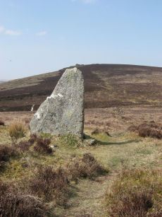
Challacombe Down Standing Stone
Prehistoric Dartmoor Walks: Dartmoor Site: Challacombe Down Triple Stone Row
OS Map: SX 69021 80723
HER: MDV6600
Megalithic Portal: 10092
PMD: Challacombe Stone Row
ShortName: SS Challacombe
Butler map: 24.3
DPD page: 126
Notes: The largest and most prominent blocking stone of the Dartmoor rows is to be found at the Challacombe triple row. Worth states that it is over 5 feet in width at the base and over 6 feet in height. Butler (Vol. 2) states that the terminal pillar is today 0.5m shorter than when it was measured in 1893.
Nearby sites: SX 69021 80723
Distance: 1.78km
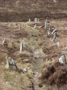
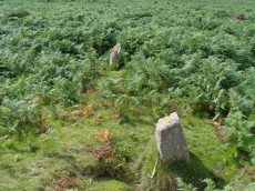
Challacombe Down Stone Row
Prehistoric Dartmoor Walks: Dartmoor Site: Challacombe Down Triple Stone Row
OS Map: SX 69016 80718
HER: MDV6600
Megalithic Portal: 1819
The Stone Rows of GB: Challacombe Down
PMD: Challacombe Stone Row
ShortName: SR Challacombe
Butler map: 24.3
Butler Vol 5: p.239 & Fig.169
DPD page: 126
Notes: "Bronze Age triple stone row well marked and wider apart at the north, drawing nearer to the south where they meet a blocking stone of unusual size. The stones have suffered little in their restoration except that a stone in the middle row was turned to form a blocking stone for that row. The loose stones scattered to the west of the north end have been suggested to form a stone circle and additional rows but may be stones excavated from the north end of the stone row."
Nearby sites: SX 69016 80718
Distance: 1.78km
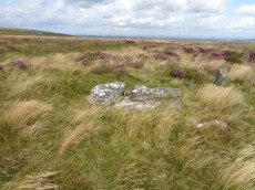
Grimslake Platform Cairn Circle and Cist
OS Map: SX 70418 81165
HER: MDV8744
Megalithic Portal: 44533
The Stone Rows of GB: Grimslake Cist
PMD: Hookney Down
Alternate name: Grimslake Mire Platform Cairn Circle and Cist
ShortName: CT Grimslake
Butler map: 20.16
Butler Vol 5: p.219 & Fig.153
DPD page: 128
Grinsell: N.BOV 3
Turner: E18
Notes: Cairn with kerb circle and central cist. Lethbridge diagram p.127 and photo top p.128. Butler Grimslake Mire - Vol. 1. Map 20.16 (diagram p.147).
Nearby sites: SX 70418 81165
Distance: 1.57km
Grimslake Cist Stone Row
OS Map: SX 70412 81154
HER: MDV8744
The Stone Rows of GB: Grimslake Cist
PMD: Grimslake Cist Stone Row
ShortName: SR:Grimslake
Butler map: 20.16
Nearby sites: SX 70412 81154
Distance: 1.55km
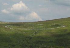
Grimspound Enclosed Settlement
Prehistoric Dartmoor Walks: Dartmoor Site: Grimspound Enclosed Settlement
OS Map: SX 70073 80909
HER: MDV8778
Megalithic Portal: 1344141065
ShortName: ES Grimspound
DPD page: 127
Notes: Probabaly the best known enclosed settlement on Dartmoor, within walking distance of Warren House Inn. "Prehistoric enclosed settlement with a substantial granite surrounding wall, containing 24 hut circles, as well as several 'pens' built into the enclosure wall, positioned in a valley between Hookney Tor and Hameldon. First planned by A. C. Shillibeer in 1829, this site was excavated by the Dartmoor Exploration Committee in 1894-5. Within the guardianship area managed by Dartmoor National Park Authority". Extensive notes in the NMR record, see also coverage on Wikipedia and Legendary Dartmoor.
Nearby sites: SX 70073 80909
Distance: 1.35km
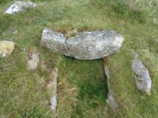
Hameldon Cist
OS Map: SX 71008 78345
HER: MDV7519
Megalithic Portal: 16636
PMD: Hamel Down S.
Alternate name: Hamel Down S. Cist
ShortName: CT Hameldon
Butler map: 20.15
Butler Vol 5: p.178 & Fig.120
DPD page: 129
Grinsell: WID 7
Barrow Report: 54
Notes: Precise location originally unsurveyed but given approximately by Worth as SX 71257908. This may explain the large discrepancy between the NMR position and that given by Butler and in the HER. Three sides of the cist are visible with the fourth having sunken below the earth. The capstone is incomplete and only partly covers the cavity. Lethbridge diagram p129 and photo top p.129. Butler Hamel Down 15 (S) - Vol. 1. Map 20.15 (Cairn 15 p.149, diagram Vol 5. p.178).
Nearby sites: SX 71008 78345
Distance: 1.39km
Hameldown Beacon Cairn
OS Map: SX 70830 78922
HER: MDV7435
Megalithic Portal: 16635
ShortName: CN HamelBeacon
Butler map: 20.13
Butler Vol 5: p.166 & Fig.106
Grinsell: WID 6
Notes: A grass covered cairn which was alleged to have been used as a beacon in medieval period. Butler Volume 1 Map 20.13
Nearby sites: SX 70830 78922
Distance: 0.80km
Hameldown N.E. Stone Row
OS Map: SX 71481 80095
HER: MDV18865
Megalithic Portal: 6333472
The Stone Rows of GB: Hameldown
PMD: Berry Pound Stone Row
Alternate name: Hamel Down Stone Row
ShortName: SR Hamel NE
Butler map: 20.3
Notes: No NMR listing. HER record MDV18865. Described in Butler Volume 1 Map 20.3. To the south of Berry Pound is a small longhouse. "Within the abandoned field 250m south of the longhouse are the probable remains of a single row first recorded in 1983. Five or six stones remain in line up to 206m apart, the rest having been removed or buried when the field was ploughed."
Nearby sites: SX 71481 80095
Distance: 1.19km
Hameldown Tor Cairn
OS Map: SX 70318 80574
HER: MDV8768
Megalithic Portal: 16628
ShortName: CN HameldonTor
Butler map: 20.8
Butler Vol 5: p.166 & Fig.106
Grinsell: MAN 2
Turner: E54
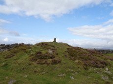
Notes: Cairn on hameldown tor.(diam 14m. Heig 700mm)a denuded cairn with kerb of large stones on northern half only. Pillar and conical mound of small stones of evidently modern date. Remainder of kerb visible (11 stones). Remainder of cairn largely grassed over but head sized granite boulders visible (os trig. Point and recent mound of stones on top). Butler Volume 1 Map 20.8.
Nearby sites: SX 70318 80574
Distance: 0.98km
Hookney Tor Cairn
OS Map: SX 69905 81314
HER: MDV6611
Megalithic Portal: 34982
Alternate name: Hookney Tor summit Cairn
ShortName: CN:HookneyTor
Butler map: 20.7
Grinsell: N.BOV 2
Notes: Tor cairn north of Hookney Tor and resembling a barrow in shape. Enough of the topsoil has been removed to show that the mound is a natural outcrop feature covered with turf and heather, enclosed on three sides by a broken turf and stone bank. A footpath approaching the west side has probably effaced the remainder of the circuit.
Nearby sites: SX 69905 81314
Distance: 1.78km
Hookney Tor North A Ancient Pool
OS Map: SX 69843 81721
HER: MDV127212
ShortName: PO:HookneyTorA
Notes: "A pool measuring 15 by 9.5m. One of over 40 such 'sacred' pools identified on Dartmoor that are thought to have potentially been designed during the prehistoric period. Lies near a prehistoric cairn."
Nearby sites: SX 69843 81721
Distance: 2.19km
Hookney Tor North B Ancient Pool
OS Map: SX 69838 81605
HER: MDV127213
ShortName: PO:HookneyTorB
Notes: "A pool measuring 7.5m. One of over 40 such 'sacred' pools identified on Dartmoor that are thought to have potentially been designed during the prehistoric period."
Nearby sites: SX 69838 81605
Distance: 2.08km
Red Barrows Cairn
Prehistoric Dartmoor Walks: Dartmoor Site: Soussons Cairn Circle
OS Map: SX 67718 79650
HER: MDV6007
Megalithic Portal: 34986
PMD: Red Barrows
Alternate name: Red Barrows 1 Cairn
ShortName: CN RedBarrows
Butler map: 24.2.1
Grinsell: MAN 5
Notes: Four Bronze Age round barrows between 10 and 20 meters in diameter and 0.5 to 2.2 meters high. One barrow was excavated in 1902, finds included pottery and flints. See also HER records, 6004, 6005, 6006, 6007.
Nearby sites: SX 67718 79650
Distance: 2.68km
Shapley Common Standing Stone
OS Map: SX 70012 82227
PMD: Shapley Common
ShortName: SS:Shapley C1
Butler map: 23.5
Butler Vol 5: p.212
Notes: Possible standing stone, see Butler Vol V (1997) p 212.
Nearby sites: SX 70012 82227
Distance: 2.66km
Shapley Common Round House
OS Map: SX 6942 8206
HER: MDV6553
Megalithic Portal: 45859
ShortName: HC:ShapleyComm
DPD page: 128
Notes: Lethbridge p.128 Hut Circle on Shapley Common - particularly fine example.
Nearby sites: SX 6942 8206
Distance: 2.65km

Single Barrow Cairn
OS Map: SX 70576 79538
HER: MDV7487
Megalithic Portal: 16631
ShortName: CN SingleBarro
Butler map: 20.10
Butler Vol 5: p.23 & Fig.106
Grinsell: MAN 11
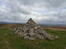
Notes: Round barrow, crowned by boundary stone dated 1854, and inscribed single burrow. Excavated 1873. Diameter 23 metres, height 1.0 metres. Butler Volume 1 Map 20.10.
Nearby sites: SX 70576 79538
Distance: 0.19km
Soussons Down (Red Barrows) Stone Row
Prehistoric Dartmoor Walks: Dartmoor Site: Soussons Cairn Circle
OS Map: SX 6767 7998
HER: MDV6015
Megalithic Portal: 2136
The Stone Rows of GB: Soussons Down
PMD: Red Barrows Stone Row
Alternate name: Soussons Down Stone Row
ShortName: SRxRed Barrows
Butler map: 24.2
Notes: Triple row destroyed in 1946 Butler Vol. 5 p38, Vol. 3 Map 24.2 p.19. The row was associated with a cairn about 300m north of the four Red Barrow cairn group (SX 67 NE 3).
Nearby sites: SX 6767 7998
Distance: 2.76km
Two Barrows Stone Ring Cairn Circle
OS Map: SX 70654 79219
HER: MDV7409
Megalithic Portal: 16632
Alternate name: Two Barrows 1 Stone Ring Cairn Circle
ShortName: RC Two Barrows
Butler map: 20.11.1
Butler Vol 5: p.23 & Fig.106
Grinsell: MAN 12
Barrow Report: 21 56
Notes: "The northern barrow was excavated in 1872. It measures 40 feet in diameter and 4 1/2 feet high. A ring of stones encircled the barrow and in the centre was a small cairn. A cremation burial was found to the SE of the centre covered by five flat stones. With the cremation was the blade of a bronze dagger and a pommel made from amber with a decoration consisting of rows of gold pins" See: Bate, C Spence, Researches into Some Antient Tumuli on Dartmoor, T.D.A. Vol. 5 pp.549-58 (1872). Relevant Butler map Vol. 1. Map 20. Butler Volume 1 Map 20.11 Two Barrows 1. [N.b. Treated as Turner type Stone Ring Cairn circle from the description].
Nearby sites: SX 70654 79219
Distance: 0.46km
Two Barrows S Cairn
OS Map: SX 70663 79203
HER: MDV7411
Megalithic Portal: 16632
Alternate name: Two Barrows 2 Cairn
ShortName: CN TwoBarrowsS
Butler map: 20.11.2
Butler Vol 5: p.23 & Fig.106
Grinsell: WID 3
Notes: Two Barrows 2. An oval, stony mound measuring 15.5m E-W and 10.5m N-S. It stands up to 1.1m high and was probably originally bowl-profiled. The N slope is spit by a narrow path and a N-S slope across the top of the barrow has caused minor damage. It appears to be unexcavated. The mounds is crossed by a maintained drystone field wall, approaching from the SE and turning W on the barrow. The wall is built over the mound and does not seem to have caused much damage. This barrow appears to have been a target point for a reave, Fleming's Hameldon South, approaching from the E and stopping 3.5m short of the mound. The reave line is continued W by the modern wall beyond the barrow. See also: Bate, C Spence, Researches into Some Antient Tumuli on Dartmoor, T.D.A. Vol. 5 pp.549-58 (1872). Butler Volume 1 Map 20.11
Nearby sites: SX 70663 79203
Distance: 0.48km